
Archer County, Texas
Encyclopedia
Archer County is a county located in the US state of Texas, and was formed in 1858 from Fannin County
. It is part of the Wichita Falls, Texas
, Metropolitan Statistical Area
. As of 2005, the population estimate is 9,095, up from 8,854 in 2000. Its county seat
is Archer City
. Archer is named for Branch Tanner Archer
, a commissioner for the Republic of Texas
. (See List of Texas county name etymologies.)
, the county has a total area of 926 square miles (2,398.3 km²), of which 910 square miles (2,356.9 km²) is land and 16 square miles (41.4 km²) (1.74%) is water.
, 0.08% Black
or African American
, 0.62% Native American
, 0.12% Asian
, 0.03% Pacific Islander
, 2.28% from other races
, and 1.32% from two or more races. 4.87% of the population were Hispanic
or Latino
of any race.
There were 3,345 households out of which 37.20% had children under the age of 18 living with them, 65.00% were married couples living together, 7.20% had a female householder with no husband present, and 24.80% were non-families. Of all unmarried parter households, 89.8% were heterosexual, 1.9% were same-sex male, and 8.3% were same-sex female.
21.90% of all households were made up of individuals and 10.20% had someone living alone who was 65 years of age or older. The average household size was 2.63 and the average family size was 3.08.
In the county, the population was spread out with 28.20% under the age of 18, 7.00% from 18 to 24, 27.40% from 25 to 44, 23.50% from 45 to 64, and 13.90% who were 65 years of age or older. The median age was 38 years. For every 100 females there were 100.20 males. For every 100 females age 18 and over, there were 96.20 males.
The median income for a household in the county was $38,514, and the median income for a family was $45,984. Males had a median income of $31,386 versus $22,119 for females. The per capita income for the county was $19,300. About 6.80% of families and 9.00% of the population were below the poverty line, including 9.90% of those under age 18 and 10.80% of those age 65 or over.
Megargel Independent School District
once served portions of Archer County, but it closed after Fall 2006.
is located north of Seymour, Texas
in Baylor County and part of Archer County. The Seymour Division consists of 34,000 acres (120 km²) which was formally known as the Cross Bar Ranch when it was owned by the Claude Cowan Sr. Trust. The ranch was purchased in January, 2005 by the Gerald Lyda
family and La Escalera Limited Partnership and is managed by partner Jo Lyda Granberg and her husband K. G. Granberg of Seymour. La Escalera Ranch
extends over much of Pecos County and portions of Reeves, Brewster, Archer and Baylor Counties. It is known for its reputation herd of Black Angus cattle and its abundant wildlife.
Fannin County, Texas
As of the census of 2000, there were 31,242 people, 11,105 households, and 7,984 families residing in the county. The population density was 35 people per square mile . There were 12,887 housing units at an average density of 14 per square mile...
. It is part of the Wichita Falls, Texas
Wichita Falls, Texas
Wichita Falls is a city in and the county seat of Wichita County, Texas, United States, United States. Wichita Falls is the principal city of the Wichita Falls Metropolitan Statistical Area, which encompasses all of Archer, Clay and Wichita counties. According to the U.S. Census estimate of 2010,...
, Metropolitan Statistical Area
Wichita Falls metropolitan area
The Wichita Falls Metropolitan Statistical Area is a metropolitan area in North Texas that covers three counties - Archer, Clay, and Wichita. As of the 2000 census, the MSA had a population of 151,524 .-Counties:*Archer*Clay*Wichita-Places with 1,000 to 25,000 people:*Archer...
. As of 2005, the population estimate is 9,095, up from 8,854 in 2000. Its county seat
County seat
A county seat is an administrative center, or seat of government, for a county or civil parish. The term is primarily used in the United States....
is Archer City
Archer City, Texas
Archer City is a city in Archer County, Texas, United States. The city lies at the junction of State Highway 79 and State Highway 25. It is the county seat of Archer County. It is located 25 miles south of Wichita Falls, Texas and is part of the Wichita Falls Metropolitan Statistical Area...
. Archer is named for Branch Tanner Archer
Branch Tanner Archer
Branch Tanner Archer was a Texan who served as Commissioner to the United States and Speaker of the House of the Republic of Texas House of Representatives and Secretary of War of the Republic of Texas.-Early life:...
, a commissioner for the Republic of Texas
Republic of Texas
The Republic of Texas was an independent nation in North America, bordering the United States and Mexico, that existed from 1836 to 1846.Formed as a break-away republic from Mexico by the Texas Revolution, the state claimed borders that encompassed an area that included all of the present U.S...
. (See List of Texas county name etymologies.)
Geography
According to the U.S. Census BureauUnited States Census Bureau
The United States Census Bureau is the government agency that is responsible for the United States Census. It also gathers other national demographic and economic data...
, the county has a total area of 926 square miles (2,398.3 km²), of which 910 square miles (2,356.9 km²) is land and 16 square miles (41.4 km²) (1.74%) is water.
Major highways

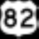
 U.S. Highway 82/U.S. Highway 277
 U.S. Highway 281
 State Highway 25
 State Highway 79
 State Highway 114
Adjacent counties
- Wichita CountyWichita County, TexasAs of the census of 2000, there were 131,664 people, 48,441 households, and 32,891 families residing in the county. The population density was 210 people per square mile . There were 53,304 housing units at an average density of 85 per square mile...
(north) - Clay CountyClay County, TexasAs of the census of 2000, there were 11,006 people, 4,323 households, and 3,181 families residing in the county. The population density was 10 people per square mile . There were 4,992 housing units at an average density of 4 per square mile...
(east) - Jack CountyJack County, Texas*Bryson*Jacksboro*Jermyn *Joplin *Perrin *Gibtown-See also:*National Register of Historic Places listings in Jack County, Texas-External links:*...
(southeast) - Young CountyYoung County, TexasAs of the census of 2000, there were 17,943 people, 7,167 households, and 5,081 families residing in the county. The population density was 20 people per square mile . There were 8,504 housing units at an average density of 9 per square mile...
(south) - Baylor CountyBaylor County, TexasAs of the census of 2000, there were 4,093 people, 1,791 households, and 1,156 families residing in the county. The population density was 5 people per square mile . There were 2,820 housing units at an average density of 3 per square mile...
(west)
Demographics
As of the census of 2000, there were 8,854 people, 3,345 households, and 2,515 families residing in the county. The population density was 10 people per square mile (4/km²). There were 3,871 housing units at an average density of 4 per square mile (2/km²). The racial makeup of the county was 95.54% WhiteRace (United States Census)
Race and ethnicity in the United States Census, as defined by the Federal Office of Management and Budget and the United States Census Bureau, are self-identification data items in which residents choose the race or races with which they most closely identify, and indicate whether or not they are...
, 0.08% Black
Race (United States Census)
Race and ethnicity in the United States Census, as defined by the Federal Office of Management and Budget and the United States Census Bureau, are self-identification data items in which residents choose the race or races with which they most closely identify, and indicate whether or not they are...
or African American
Race (United States Census)
Race and ethnicity in the United States Census, as defined by the Federal Office of Management and Budget and the United States Census Bureau, are self-identification data items in which residents choose the race or races with which they most closely identify, and indicate whether or not they are...
, 0.62% Native American
Race (United States Census)
Race and ethnicity in the United States Census, as defined by the Federal Office of Management and Budget and the United States Census Bureau, are self-identification data items in which residents choose the race or races with which they most closely identify, and indicate whether or not they are...
, 0.12% Asian
Race (United States Census)
Race and ethnicity in the United States Census, as defined by the Federal Office of Management and Budget and the United States Census Bureau, are self-identification data items in which residents choose the race or races with which they most closely identify, and indicate whether or not they are...
, 0.03% Pacific Islander
Race (United States Census)
Race and ethnicity in the United States Census, as defined by the Federal Office of Management and Budget and the United States Census Bureau, are self-identification data items in which residents choose the race or races with which they most closely identify, and indicate whether or not they are...
, 2.28% from other races
Race (United States Census)
Race and ethnicity in the United States Census, as defined by the Federal Office of Management and Budget and the United States Census Bureau, are self-identification data items in which residents choose the race or races with which they most closely identify, and indicate whether or not they are...
, and 1.32% from two or more races. 4.87% of the population were Hispanic
Race (United States Census)
Race and ethnicity in the United States Census, as defined by the Federal Office of Management and Budget and the United States Census Bureau, are self-identification data items in which residents choose the race or races with which they most closely identify, and indicate whether or not they are...
or Latino
Race (United States Census)
Race and ethnicity in the United States Census, as defined by the Federal Office of Management and Budget and the United States Census Bureau, are self-identification data items in which residents choose the race or races with which they most closely identify, and indicate whether or not they are...
of any race.
There were 3,345 households out of which 37.20% had children under the age of 18 living with them, 65.00% were married couples living together, 7.20% had a female householder with no husband present, and 24.80% were non-families. Of all unmarried parter households, 89.8% were heterosexual, 1.9% were same-sex male, and 8.3% were same-sex female.
21.90% of all households were made up of individuals and 10.20% had someone living alone who was 65 years of age or older. The average household size was 2.63 and the average family size was 3.08.
In the county, the population was spread out with 28.20% under the age of 18, 7.00% from 18 to 24, 27.40% from 25 to 44, 23.50% from 45 to 64, and 13.90% who were 65 years of age or older. The median age was 38 years. For every 100 females there were 100.20 males. For every 100 females age 18 and over, there were 96.20 males.
The median income for a household in the county was $38,514, and the median income for a family was $45,984. Males had a median income of $31,386 versus $22,119 for females. The per capita income for the county was $19,300. About 6.80% of families and 9.00% of the population were below the poverty line, including 9.90% of those under age 18 and 10.80% of those age 65 or over.
Cities
- Archer CityArcher City, TexasArcher City is a city in Archer County, Texas, United States. The city lies at the junction of State Highway 79 and State Highway 25. It is the county seat of Archer County. It is located 25 miles south of Wichita Falls, Texas and is part of the Wichita Falls Metropolitan Statistical Area...
- HollidayHolliday, TexasHolliday is a city in Archer County, Texas, United States. It is part of the Wichita Falls, Texas Metropolitan Statistical Area. The population was 1,632 at the 2000 census...
- ScotlandScotland, TexasScotland is a city in Archer County in the U.S. state of Texas. It is part of the Wichita Falls, Texas Metropolitan Statistical Area. The population was 438 at the 2000 census. The town is named for its founder, Henry J. Scott....
Towns
- Lakeside CityLakeside City, TexasLakeside City is a town in Archer County, Texas, United States. It is part of the Wichita Falls, Texas Metropolitan Statistical Area. The population was 984 at the 2000 census.-Geography:Lakeside City is located at ....
- MegargelMegargel, TexasMegargel is a town in Archer County, Texas, United States. It is part of the Wichita Falls, Texas Metropolitan Statistical Area. The population was 203 at the 2010 census. The town is named for Roy C...
- WindthorstWindthorst, TexasWindthorst is a town in Archer and Clay counties in the U.S. state of Texas. It is part of the Wichita Falls, Texas Metropolitan Statistical Area. The population was 440 at the 2000 census. The town is named for Ludwig Windthorst, a Catholic statesman in Germany.Windthorst is the home of the St...
Education
The following school districts serve Archer County:- Archer City Independent School DistrictArcher City Independent School DistrictArcher City Independent School District is a public school district based in Archer City, Texas .Archer City serves much of Archer County, including the city of Archer City and most of the city of Scotland....
- Holliday Independent School DistrictHolliday Independent School DistrictHolliday Independent School District is a public school district based in Holliday, Texas .Located in Archer County, a small portion of the district extends into Wichita County...
- Iowa Park Consolidated Independent School DistrictIowa Park Consolidated Independent School DistrictIowa Park Consolidated Independent School District is a public school district based in Iowa Park, Texas .Located in central Wichita County, the district extends into a small portion of northwestern Archer County...
(partial) - Jacksboro Independent School DistrictJacksboro Independent School DistrictJacksboro Independent School District is a public school district based in Jacksboro, Texas .Located in Jack County, small portions of the district extend into Wise and Archer counties....
(partial) - Olney Independent School DistrictOlney Independent School DistrictOlney Independent School District is a school district headquartered in Olney, Texas .The district serves portions of Young County , Archer County , Baylor County, and Throckmorton County....
(partial) - Windthorst Independent School DistrictWindthorst Independent School DistrictWindthorst Independent School District is a public school district based in Windthorst, Texas, USA.Located in Archer County, the district extends into a portion of Clay County.Windthorst High School is among the state's most dominant programs in volleyball...
Megargel Independent School District
Megargel Independent School District
Megargel Independent School District is a school district headquartered in Megargel, Texas . The district had one school called the Megargel School.The district served portions of Archer County, including the town of Megargel...
once served portions of Archer County, but it closed after Fall 2006.
Ranching industry
The Seymour Division of the sprawling 320,000 deeded acre (1400 km²) La Escalera RanchLa Escalera Ranch
La Escalera Ranch consists of approximately 260,000 acre , located south of Fort Stockton, Texas. The ranch extends over portions of Pecos County, Brewster County, Archer County, and Baylor County, with the majority of the ranch lying in Pecos County.The 100-year old ranch was acquired by building...
is located north of Seymour, Texas
Seymour, Texas
Seymour is a city in and the county seat of Baylor County, Texas, United States. The population was 2,740 as of the 2010 Census.-Geography:Seymour is located at ....
in Baylor County and part of Archer County. The Seymour Division consists of 34,000 acres (120 km²) which was formally known as the Cross Bar Ranch when it was owned by the Claude Cowan Sr. Trust. The ranch was purchased in January, 2005 by the Gerald Lyda
Gerald Lyda
Gerald Lyda ) was an American cattle rancher, contractor and developer prominent in the state of Texas....
family and La Escalera Limited Partnership and is managed by partner Jo Lyda Granberg and her husband K. G. Granberg of Seymour. La Escalera Ranch
La Escalera Ranch
La Escalera Ranch consists of approximately 260,000 acre , located south of Fort Stockton, Texas. The ranch extends over portions of Pecos County, Brewster County, Archer County, and Baylor County, with the majority of the ranch lying in Pecos County.The 100-year old ranch was acquired by building...
extends over much of Pecos County and portions of Reeves, Brewster, Archer and Baylor Counties. It is known for its reputation herd of Black Angus cattle and its abundant wildlife.
See also
- National Register of Historic Places listings in Archer County, Texas