

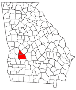
Americus micropolitan area
Encyclopedia
United States Census Bureau
The United States Census Bureau is the government agency that is responsible for the United States Census. It also gathers other national demographic and economic data...
, is an area consisting of two counties in Georgia
Georgia (U.S. state)
Georgia is a state located in the southeastern United States. It was established in 1732, the last of the original Thirteen Colonies. The state is named after King George II of Great Britain. Georgia was the fourth state to ratify the United States Constitution, on January 2, 1788...
, anchored by the city of Americus
Americus, Georgia
-Early years:Americus, Georgia was named and chartered by Sen. Lovett B. Smith in 1832.For its first two decades, Americus was a small courthouse town. The arrival of the railroad in 1854 and, three decades later, local attorney Samuel H. Hawkins' construction of the only privately financed...
.
At the 2000 census
United States Census, 2000
The Twenty-second United States Census, known as Census 2000 and conducted by the Census Bureau, determined the resident population of the United States on April 1, 2000, to be 281,421,906, an increase of 13.2% over the 248,709,873 persons enumerated during the 1990 Census...
, the μSA
United States micropolitan area
United States Micropolitan Statistical Areas , as defined by the United States Office of Management and Budget, are urban areas in the United States based around a core city or town with a population of 10,000 to 49,999. The micropolitan area designation was created in 2003...
had a population of 36,966 (though a July 1, 2009, estimate placed the population at 36,409).
Communities
- Incorporated places
- AmericusAmericus, Georgia-Early years:Americus, Georgia was named and chartered by Sen. Lovett B. Smith in 1832.For its first two decades, Americus was a small courthouse town. The arrival of the railroad in 1854 and, three decades later, local attorney Samuel H. Hawkins' construction of the only privately financed...
(Principal city) - AndersonvilleAndersonville, GeorgiaAndersonville is a city in Sumter County, Georgia, United States. The population was 331 at the 2000 census . It is located in the southwest part of the state, about southwest of Macon, Georgia on the Central of Georgia railroad...
- De SotoDe Soto, GeorgiaDe Soto is a city in Sumter County, Georgia, United States. The population was 214 at the 2000 census. It is part of the Americus Micropolitan Statistical Area.-History:...
- EllavilleEllaville, GeorgiaEllaville is a city in Schley County, Georgia, United States. The population was 1,609 at the 2000 census. The city is the county seat of Schley County.Ellaville is part of the Americus Micropolitan Statistical Area.-Geography:...
- LeslieLeslie, GeorgiaLeslie is a city in Sumter County, Georgia, United States. The population was 455 at the 2000 census. It is part of the Americus Micropolitan Statistical Area.-Geography:Leslie is located at ....
- PlainsPlains, GeorgiaPlains is a city in Sumter County, Georgia, United States. The population was 776 at the 2010 census. It is part of the Americus Micropolitan Statistical Area.-Notable people:...
- Americus
- Unincorporated places
- CobbCobb, GeorgiaCobb is an unincorporated community in Sumter County, Georgia, United States. It is the home of the largest pecan orchard in the world. Cobb is connected with the residents of Lake Blackshear and is the location of the Lake Blackshear Volunteer Fire Department....
- Murrays CrossroadsMurrays Crossroads, GeorgiaMurrays Crossroads is an unincorporated community in Schley County, Georgia, United States. It lies at the intersection of U.S. Route 19 with State Route 240, to the north of the city of Ellaville, the county seat of Schley County...
- Cobb
Demographics
At the 2000 censusCensus
A census is the procedure of systematically acquiring and recording information about the members of a given population. It is a regularly occurring and official count of a particular population. The term is used mostly in connection with national population and housing censuses; other common...
, there were 36,966 people, 13,460 households and 9,542 families residing within the μSA. The racial makeup of the μSA was 50.01% White, 47.22% African American, 0.29% Native American, 0.54% Asian, 0.03% Pacific Islander, 1.27% from other races
Race (United States Census)
Race and ethnicity in the United States Census, as defined by the Federal Office of Management and Budget and the United States Census Bureau, are self-identification data items in which residents choose the race or races with which they most closely identify, and indicate whether or not they are...
, and 0.64% from two or more races. Hispanic or Latino of any race were 2.65% of the population.
The median household income
Median household income
The median household income is commonly used to generate data about geographic areas and divides households into two equal segments with the first half of households earning less than the median household income and the other half earning more...
was $31,470 and the median family income was $35,797. Males had a median income of $28,534 versus $20,196 for females. The per capita income
Per capita income
Per capita income or income per person is a measure of mean income within an economic aggregate, such as a country or city. It is calculated by taking a measure of all sources of income in the aggregate and dividing it by the total population...
was $15,032.