
Aiguá
Encyclopedia
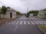
Aiguá is a city of the Maldonado Department
in Uruguay
. It is located at the north of the department, at the intersection of Route 39 with Route 109, 88 kilometres (54.7 mi) north of the capital city, Maldonado
. Its status was elevated to the category of "City" on 4 January 1956 by decree Ley No. 12.265.
Source: Instituto Nacional de Estadística de Uruguay
, and indeed, the city is situated on the east bank of the stream Arroyo de Aiguá, one of the main tributaries of Cebollatí River
.
The municipality of Aiguá has the highest point of Uruguay, the Cerro Catedral
. This point is situated at an altitude of 513.66 metres (1,685.2 ft).
Maldonado Department
The Maldonado Department , with an area of and 140,192 inhabitants, is located to the southeast of Uruguay. Its capital is Maldonado.-Geography and climate:...
in Uruguay
Uruguay
Uruguay ,officially the Oriental Republic of Uruguay,sometimes the Eastern Republic of Uruguay; ) is a country in the southeastern part of South America. It is home to some 3.5 million people, of whom 1.8 million live in the capital Montevideo and its metropolitan area...
. It is located at the north of the department, at the intersection of Route 39 with Route 109, 88 kilometres (54.7 mi) north of the capital city, Maldonado
Maldonado, Uruguay
Maldonado is the capital of Maldonado Department of Uruguay. It is located on Route 39 and shares borders with Punta del Este to the south, Pinares - Las Delicias to the south and to the east and suburb La Sonrisa to the north. Together they all for a unified metropolitan area. East of the city...
. Its status was elevated to the category of "City" on 4 January 1956 by decree Ley No. 12.265.
Population
In 2004, it had a population of 2,676.| Year | Population |
|---|---|
| 1963 | 2,715 |
| 1975 | 2,470 |
| 1985 | 2,362 |
| 1996 | 2,567 |
| 2004 | 2,676 |
Source: Instituto Nacional de Estadística de Uruguay
Geographical features
Aiguá means running water in the Guaraní languageGuaraní language
Guaraní, specifically the primary variety known as Paraguayan Guaraní , is an indigenous language of South America that belongs to the Tupí–Guaraní subfamily of the Tupian languages. It is one of the official languages of Paraguay , where it is spoken by the majority of the population, and half of...
, and indeed, the city is situated on the east bank of the stream Arroyo de Aiguá, one of the main tributaries of Cebollatí River
Cebollatí River
-References:*Rand McNally, The New International Atlas, 1993.*...
.
The municipality of Aiguá has the highest point of Uruguay, the Cerro Catedral
Cerro Catedral (Uruguay)
Cerro Catedral , also known as Cerro Cordillera, is a peak and the highest point of Uruguay, with an altitude of . It is located north of Maldonado Department, in the municipality of Aiguá, in a hill range named Sierra Carapé, which constitutes part of a larger range named Cuchilla Grande...
. This point is situated at an altitude of 513.66 metres (1,685.2 ft).