

Public transport in New Zealand
Encyclopedia
Bus
A bus is a road vehicle designed to carry passengers. Buses can have a capacity as high as 300 passengers. The most common type of bus is the single-decker bus, with larger loads carried by double-decker buses and articulated buses, and smaller loads carried by midibuses and minibuses; coaches are...
transport is the main form of public transport. Two major cities, Auckland and Wellington, also have suburban rail systems which have been gaining more patronage and new investment in recent years. Some cities also operate local ferry
Ferry
A ferry is a form of transportation, usually a boat, but sometimes a ship, used to carry primarily passengers, and sometimes vehicles and cargo as well, across a body of water. Most ferries operate on regular, frequent, return services...
services. There are no remaining tram
Tram
A tram is a passenger rail vehicle which runs on tracks along public urban streets and also sometimes on separate rights of way. It may also run between cities and/or towns , and/or partially grade separated even in the cities...
(i.e. light rail) systems active anywhere in New Zealand (except for some museum systems), though trams (and their horse-drawn pedecessors) once had a major role in New Zealand's public transport.
Usage
According to the Ministry for the Environment, overall use of public transport in New Zealand is low, with only around 2.5% of trips making use of it. This figure is for the whole of New Zealand and includes centres that may have limited public transport. New Zealand was rated only 22nd in a survey for public transport use amongst 28 countries worldwide, with only 56% always, or sometimes, using public transport to reach work. At the same time, this share was much higher than for example in the US, with only 34% usage.Considering the regions like Auckland
Auckland
The Auckland metropolitan area , in the North Island of New Zealand, is the largest and most populous urban area in the country with residents, percent of the country's population. Auckland also has the largest Polynesian population of any city in the world...
, where the overall share is about 5%, this figure is comparable to numerous North America
North America
North America is a continent wholly within the Northern Hemisphere and almost wholly within the Western Hemisphere. It is also considered a northern subcontinent of the Americas...
n and Australian cities. However, use of public transport is higher in major cities, which have more developed systems. According to the 2006 census, 17% of Wellington
Wellington
Wellington is the capital city and third most populous urban area of New Zealand, although it is likely to have surpassed Christchurch due to the exodus following the Canterbury Earthquake. It is at the southwestern tip of the North Island, between Cook Strait and the Rimutaka Range...
ians took public transport to work, as did 7% of Auckland
Auckland
The Auckland metropolitan area , in the North Island of New Zealand, is the largest and most populous urban area in the country with residents, percent of the country's population. Auckland also has the largest Polynesian population of any city in the world...
ers. Wendell Cox
Wendell Cox
Wendell Cox is an international public policy consultant. He is the principal and sole owner of Wendell Cox Consultancy/Demographia, based in the St. Louis metropolitan region and editor of three web sites, Demographia, The Public Purpose and Urban Tours by Rental Car...
, public policy consultant said in 2001 that Auckland's "public transport's downtown
Downtown
Downtown is a term primarily used in North America by English speakers to refer to a city's core or central business district ....
work trip market share is 31%" compared to Wellington
Wellington
Wellington is the capital city and third most populous urban area of New Zealand, although it is likely to have surpassed Christchurch due to the exodus following the Canterbury Earthquake. It is at the southwestern tip of the North Island, between Cook Strait and the Rimutaka Range...
's 26%. Cox further stated that no other centre in New Zealand achieved as high a market share as the Auckland city centre.
Modes
BusBus
A bus is a road vehicle designed to carry passengers. Buses can have a capacity as high as 300 passengers. The most common type of bus is the single-decker bus, with larger loads carried by double-decker buses and articulated buses, and smaller loads carried by midibuses and minibuses; coaches are...
es are the most common form of public transport in New Zealand, making up the majority of trips in every city that has public transport (and often being the only public transport mode available). They are followed by train
Train
A train is a connected series of vehicles for rail transport that move along a track to transport cargo or passengers from one place to another place. The track usually consists of two rails, but might also be a monorail or maglev guideway.Propulsion for the train is provided by a separate...
s, which are found in Wellington and Auckland. Ferries
Ferry
A ferry is a form of transportation, usually a boat, but sometimes a ship, used to carry primarily passengers, and sometimes vehicles and cargo as well, across a body of water. Most ferries operate on regular, frequent, return services...
also play a role, mainly in Auckland but also in other cities. Trams in New Zealand
Trams in New Zealand
Trams in New Zealand were a major form of transport from the 19th century into the mid 20th century. New Zealand's first tramway was established in 1862 , followed by a steam tramway in 1871 , and the first electric tramway in 1900 . The tram systems in the main centres, and in some smaller towns,...
, while once common in many cities and towns, now survive only as heritage displays. Cable car
Cable car (railway)
A cable car or cable railway is a mass transit system using rail cars that are hauled by a continuously moving cable running at a constant speed. Individual cars stop and start by releasing and gripping this cable as required...
s have also been employed; the Dunedin cable tramway system
Dunedin cable tramway system
The Dunedin cable tramway system was a group of cable tramway lines in the New Zealand city of Dunedin. It is significant as Dunedin was the second city in the world to adopt the cable car .- History :...
was both the second and second-last to operate in the world, while the Wellington Cable Car
Wellington Cable Car
The Wellington Cable Car is a funicular railway in Wellington, New Zealand between Lambton Quay, the main shopping street, and Kelburn, a suburb in the hills overlooking the central city, rising 120 m over a length of 612 m. It is widely recognised as a symbol of Wellington.-Track and stations:The...
is now a funicular
Funicular
A funicular, also known as an inclined plane or cliff railway, is a cable railway in which a cable attached to a pair of tram-like vehicles on rails moves them up and down a steep slope; the ascending and descending vehicles counterbalance each other.-Operation:The basic principle of funicular...
.
Auckland
Auckland
The Auckland metropolitan area , in the North Island of New Zealand, is the largest and most populous urban area in the country with residents, percent of the country's population. Auckland also has the largest Polynesian population of any city in the world...
is managed by the Auckland Regional Transport Authority (set up by the regional council) under the MAXX brand. It consists of buses, trains, and ferries. According to ARTA, over 50 million passenger trips are made in Auckland each year. This makes the Auckland transport system New Zealand's largest by total passenger volume, although not by trips per capita.
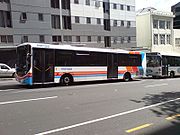
Buses are the most widely used form of public transport in Auckland. They are operated by a number of companies, including NZ Bus (operating under various brands) and Ritchies Transport. The route network is dense, covering all parts of the Auckland urban area (including Waiheke Island
Waiheke Island
Waiheke Island is an island in the Hauraki Gulf of New Zealand, located about from Auckland.The island is the second-largest in the Hauraki Gulf after Great Barrier Island. It is the most populated, with nearly 8,000 permanent residents plus another estimated 3,400 who have second or holiday homes...
).
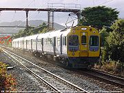
Auckland also has a commuter rail system, one of two in the country. The system uses diesel-powered trains, although planning is in motion to electrify the Auckland network
Auckland Railway electrification
The Auckland railway electrification has been proposed for several decades, but physical works only began in the late 2000s. After investment into new infrastructure and improved services created massive patronage gains on Auckland's commuter rail network in the middle 2000s, the long-discussed...
it. There are three main lines, designated Western, Southern, and Eastern (the latter two of which eventually merge). The trains are operated by Veolia's New Zealand branch
Veolia (New Zealand)
Veolia Transport Auckland, formerly Connex Auckland Ltd, is a division of Australasia's largest passenger train company, French-owned Veolia. It runs Auckland's urban passenger trains under contract from Auckland Transport under their MAXX brand, on infrastructure owned and managed by KiwiRail...
.
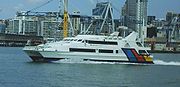
Ferries also play a significant role in Auckland's transport network — more so than in other New Zealand cities. Ferries travel between the city centre and a number of destinations, including several points on the North Shore
North Shore, New Zealand
North Shore City was the name of a city that existed in the Auckland region of New Zealand from 1989 until 2010. The city had a population of making it the fourth most populous city in New Zealand prior to November 2010...
, Half Moon Bay
Half Moon Bay, Auckland
Half Moon Bay is a coastal suburb located immediately south of Bucklands Beach in Manukau City, Auckland, New Zealand.It is well known for the Half Moon Bay Marina, home to over 500 boats...
, Waiheke Island
Waiheke Island
Waiheke Island is an island in the Hauraki Gulf of New Zealand, located about from Auckland.The island is the second-largest in the Hauraki Gulf after Great Barrier Island. It is the most populated, with nearly 8,000 permanent residents plus another estimated 3,400 who have second or holiday homes...
, Rangitoto Island
Rangitoto Island
Rangitoto Island is a volcanic island in the Hauraki Gulf near Auckland, New Zealand. The 5.5 km wide island is an iconic and widely visible landmark of Auckland with its distinctive symmetrical shield volcano cone rising 260 metres high over the Hauraki Gulf...
, and Great Barrier Island
Great Barrier Island
Great Barrier Island is a large island of New Zealand, situated to the north-east of central Auckland in the outer Hauraki Gulf. With an area of it is the fourth-largest island of New Zealand's main chain of islands, with its highest point, Mount Hobson, rising...
. The largest operator is Fullers Ferries
Fullers Ferries
Fullers Group is a ferry and tourism company in Auckland, New Zealand. It operates in the Hauraki Gulf and in 2007, transported 4.2 million passengers.- Services :Fullers run ferries from the Auckland Ferry Terminal in Quay Street, Downtown Auckland...
.
Auckland, like many others in New Zealand, previously operated trams. The first ran in 1884, and the last ran in 1956. The Museum of Transport and Technology
Museum of Transport and Technology
The Museum of Transport and Technology is a museum located in Western Springs, Auckland, New Zealand. It is located close to the Western Springs Stadium, Auckland Zoo and the Western Springs Park. The museum has large collections of civilian and military aircraft and other land transport vehicles...
subsequently constructed a 2 km heritage line linking its two sites and Auckland Zoo
Auckland Zoo
Auckland Zoo is a zoological garden in Auckland, New Zealand, situated next to Western Springs park not far from Auckland's central business district. It is run by the Auckland City Council with the Auckland Zoological Society as a supporting organisation....
.
Christchurch
The ChristchurchChristchurch
Christchurch is the largest city in the South Island of New Zealand, and the country's second-largest urban area after Auckland. It lies one third of the way down the South Island's east coast, just north of Banks Peninsula which itself, since 2006, lies within the formal limits of...
public transport system is based principally around buses, although the city also has a ferry service and a heritage tramway. The services are operated under the Metro brand, administered by the regional council, Environment Canterbury.
Buses operate to all parts of the Christchurch urban area, including Lyttelton
Lyttelton, New Zealand
Lyttelton is a port town on the north shore of Lyttelton Harbour close to Banks Peninsula, a suburb of Christchurch on the eastern coast of the South Island of New Zealand....
. There are also services to outlying towns such as Rangiora, Lincoln
Lincoln, New Zealand
Lincoln is a town in the Selwyn District of Canterbury, New Zealand. The town has a population of 2,727.-Location:It is located on the Canterbury Plains to the west of Banks Peninsula, 22 kilometres south of Christchurch.-History:...
, and Burnham
Burnham, New Zealand
Burnham, also known as Burnham Camp, is the largest army base in New Zealand's South Island. It is located 28 kilometres south of Christchurch on the Canterbury Plains, close to the town of Dunsandel.- Military :Units at Burnham:...
. There are around 40 routes in total, plus a free shuttle following a loop through the central city.
Since 12 November 2007, Christchurch has been carrying out the first New Zealand trial for bikes on buses, which amongst other things gives cyclists access through the Lyttelton road tunnel
Lyttelton Road Tunnel
The Lyttelton road tunnel links the New Zealand city of Christchurch and its seaport, Lyttelton. It opened in 1964 and carries just over 10,000 vehicles/day...
.
A ferry service operates between Lyttelton
Lyttelton, New Zealand
Lyttelton is a port town on the north shore of Lyttelton Harbour close to Banks Peninsula, a suburb of Christchurch on the eastern coast of the South Island of New Zealand....
and Diamond Harbour
Diamond Harbour, New Zealand
Diamond Harbour is a small settlement on Banks Peninsula, in Canterbury, New Zealand. It is on the peninsula's northern coast, on the southern shores of Lyttelton Harbour, and is administratively part of the city of Christchurch....
, a small settlement on the opposite side of Lyttelton Harbour
Lyttelton Harbour
Lyttelton Harbour is one of two major inlets in Banks Peninsula, on the coast of Canterbury, New Zealand. The other is Akaroa Harbour.Approximately 15 km in length from its mouth to Teddington, the harbour was formed from a series of ancient volcanic eruptions that created a caldera, the...
.
Christchurch used to operate an extensive tram network, but this service was discontinued in 1954. In 1995, a heritage tramway was re-opened in the city centre, primarily serving tourists.
Dunedin
Dunedin
Dunedin is the second-largest city in the South Island of New Zealand, and the principal city of the Otago Region. It is considered to be one of the four main urban centres of New Zealand for historic, cultural, and geographic reasons. Dunedin was the largest city by territorial land area until...
has a substantial public transport system based around buses. There are 14 routes, covering the Dunedin urban area (including Mosgiel
Mosgiel
Mosgiel is an urban satellite of Dunedin in Otago, New Zealand, fifteen kilometres west of the city's centre. Since the re-organisation of New Zealand local government in 1989 it has been inside the Dunedin City Council area, but was physically separate from the contiguous suburbs until...
and Port Chalmers
Port Chalmers
Port Chalmers is a suburb and the main port of the city of Dunedin, New Zealand, with a population of 3,000. Port Chalmers lies ten kilometres inside Otago Harbour, some 15 kilometres northeast from Dunedin's city centre....
), plus a service to Waikouaiti
Waikouaiti
Waikouaiti is a small town in East Otago, New Zealand, within the city limits of Dunedin. The town is close to the coast and the mouth of the Waikouaiti River....
and Palmerston
Palmerston, New Zealand
The town of Palmerston, in New Zealand's South Island lies 50 kilometres to the north of the city of Dunedin. It is the largest town in the Waihemo Ward of the Waitaki District with a population of 890 residents...
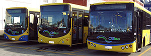
. Services are administered by the Otago Regional Council, and run mainly by Citibus (owned by the Dunedin City Council) and Passenger Transport
Passenger Transport (New Zealand)
Invercargill Passenger Transport Ltd is a bus company which operates public transport routes and school transport services in Dunedin and Invercargill and leisure and tourism transport services throughout New Zealand.-Public transport services:Passenger Transport operates almost all public...
, (a private company based in Invercargill).
The city formerly operated other forms of public transport — the Dunedin cable tramway system
Dunedin cable tramway system
The Dunedin cable tramway system was a group of cable tramway lines in the New Zealand city of Dunedin. It is significant as Dunedin was the second city in the world to adopt the cable car .- History :...
(similar to the famous San Francisco cable cars
San Francisco cable car system
The San Francisco cable car system is the world's last permanently operational manually operated cable car system, in the US sense of a tramway whose cars are pulled along by cables embedded in the street. It is an icon of San Francisco, California...
) operated between 1881 and 1957, and electric trams operated on several routes from 1900 to 1956. Commuter trains ran from the Dunedin Railway Station
Dunedin Railway Station
Possibly the best-known building in the southern half of New Zealand's South Island, Dunedin Railway Station is a jewel in the country's architectural crown. Designed by George Troup, the station is the fourth building to have served as Dunedin's railway station...
to Mosgiel and Port Chalmers until 1979 and 1982, respectively.
Hamilton
HamiltonHamilton, New Zealand
Hamilton is the centre of New Zealand's fourth largest urban area, and Hamilton City is the country's fourth largest territorial authority. Hamilton is in the Waikato Region of the North Island, approximately south of Auckland...
has a bus system covering most of its urban area, with around 25 routes. There are also bus services to (and sometimes between) other towns in the Waikato region — Taupo
Taupo
Taupo is a town on the shore of Lake Taupo in the centre of the North Island of New Zealand. It is the seat of the Taupo District Council and lies in the southern Waikato Region....
, Huntly
Huntly, New Zealand
Huntly is a town in the Waikato region of the North Island of New Zealand. It is on State Highway 1, 93 kilometres south of Auckland and 35 kilometres north of Hamilton. It is situated on the North Island Main Trunk Railway and straddles the Waikato River.Huntly was called Rahui Pokeka when...
, Coromandel
Coromandel, New Zealand
Coromandel is the name of a town and harbour on the western side of the Coromandel Peninsula, which is on the east coast of the North Island of New Zealand...
, Thames
Thames, New Zealand
Thames is a town at the southwestern end of the Coromandel Peninsula in New Zealand's North Island. It is located on the Firth of Thames close to the mouth of the Waihou River. The town is the seat of the Thames-Coromandel District Council....
, Tokoroa
Tokoroa
Tokoroa is the third-largest town in the Waikato region of the North Island of New Zealand and largest settlement in the South Waikato district. Located 30 km southwest of Rotorua, close to the foot of the Mamaku Ranges, it is mid-way between Taupo and Hamilton on State Highway One...
, Meremere
Meremere
Meremere is a small town in the northern Waikato region in the North Island of New Zealand. It is located on the east bank of the Waikato River, 50 kilometres north of Hamilton....
, Te Kauwhata
Te Kauwhata
Te Kauwhata is a small town in the north of the Waikato region of New Zealand, situated close to the western shore of Lake Waikare, some 40 km north of Hamilton...
, Cambridge
Cambridge, New Zealand
Cambridge is a town in the Waikato region of the North Island of New Zealand. Situated 24 kilometres southeast of Hamilton, on the banks of the Waikato River, Cambridge is known as "The Town of Trees & Champions".In the 1840s Cambridge had a Maori population but in the 1850's missionaries and...
, Paeroa
Paeroa
Paeroa is a small town in New Zealand, in the northern Waikato region of the Thames Valley. Located at the foot of the Coromandel Peninsula, it is close to the junction of the Waihou and Ohinemuri Rivers, 20 kilometres from the coast at the Firth of Thames...
, Raglan, Mangakino
Mangakino
Mangakino is a small town on the banks of the Waikato River in the North Island of New Zealand. It is located close to the hydroelectric power station at Lake Maraetai, southeast of Hamilton. Its population in 2001 was 1257...
, and Te Awamutu
Te Awamutu
Te Awamutu is a town in the Waikato in the North Island of New Zealand. It is the council seat of the Waipa District and serves as a service town for the farming communities which surround it...
are among the destinations.
Hamilton formerly had a commuter train to Auckland, the Waikato Connection. Proposals were floated in 2007 to re-instate the service.
Invercargill
InvercargillInvercargill
Invercargill is the southernmost and westernmost city in New Zealand, and one of the southernmost cities in the world. It is the commercial centre of the Southland region. It lies in the heart of the wide expanse of the Southland Plains on the Oreti or New River some 18 km north of Bluff,...
has a bus service with eight routes (four of which are loops that have different designations for the inbound and outbound sections). They operate from a hub in the central city, and are administered by the Invercargill City Council. Some of the routes are free, and others are free outside peak hours.
Invercargill formerly had the southernmost tram system in the world; construction began in January 1911 and the network operated from 26 March 1912 to 10 September 1952. At its greatest extent, it had four separate routes. Commuter trains also ran along the Bluff Branch
Bluff Branch
The Bluff Branch is a railway line in Southland, New Zealand that links Invercargill with the port of Bluff. One of the first railways in New Zealand, it opened in 1867 and is still operating...
railway line between Invercargill and Bluff
Bluff, New Zealand
Bluff is a town and seaport in the Southland region, on the southern coast of the South Island of New Zealand. It is the southern-most town in New Zealand and, despite Slope Point being further to the south, is colloquially used to refer to the southern extremity of the country...
from the line's opening in 1867 until the final service was cancelled in 1967. Multiple stops within Invercargill were serviced, and as late as 1950, seven trains ran each way on the average weekday.
Wellington
Wellington
Wellington is the capital city and third most populous urban area of New Zealand, although it is likely to have surpassed Christchurch due to the exodus following the Canterbury Earthquake. It is at the southwestern tip of the North Island, between Cook Strait and the Rimutaka Range...
has the highest percentage of citizens using public transport in the country. Its public transport system, organised under the Metlink brand, consists of buses (including trolleybuses), trains, ferries, and a funicular (the Wellington Cable Car
Wellington Cable Car
The Wellington Cable Car is a funicular railway in Wellington, New Zealand between Lambton Quay, the main shopping street, and Kelburn, a suburb in the hills overlooking the central city, rising 120 m over a length of 612 m. It is widely recognised as a symbol of Wellington.-Track and stations:The...
).
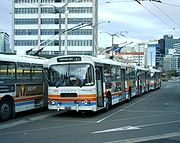
The most widely used form of public transport are buses, which are operated mainly by NZ Bus and Mana Coachlines (both using multiple brands). The network extends across the whole region, with slightly over 100 routes and around 2,800 stops. Some bus routes are served by the Wellington trolleybus system
Trolleybuses in Wellington
Trolleybuses in Wellington form part of the Wellington public transport system, with the current system having operated since 1949. Wellington's trolleybus system is the only one still operating in Oceania, and one of the few in the English-speaking world, and the world's only right-hand-drive...
, which replaced the city's historic Wellington tramway system
Wellington tramway system
The Wellington tramway system operated in Wellington, the capital of New Zealand. The tramways were originally owned by a private company, but were purchased by the city and formed a major part of the city's transport system.-Trams:...
.
The second most popular form of public transport is rail, which makes up around a third of the total. Wellington's commuter rail network carries passengers between the central city and suburban areas to the north, as well as to smaller towns in Wairarapa
Wairarapa
Wairarapa is a geographical region of New Zealand. It occupies the south-eastern corner of the North Island, east of metropolitan Wellington and south-west of the Hawke's Bay region. It is lightly populated, having several rural service towns, with Masterton being the largest...
. It is the larger of New Zealand's two commuter rail systems, with 49 stations, and is mostly electrified. The two non-electrified services are diesel trains: the Wairarapa Connection from Masterton
Masterton
Masterton is a large town and local government district in the Wellington Region of New Zealand. It is the largest town in the Wairarapa, a region separated from Wellington by the Rimutaka ranges...
and the Capital Connection from Palmerston North
Palmerston North
Palmerston North is the main city of the Manawatu-Wanganui region of the North Island of New Zealand. It is an inland city with a population of and is the country's seventh largest city and eighth largest urban area. Palmerston North is located in the eastern Manawatu Plains near the north bank...
. The latter is not run by the suburban operator, Tranz Metro
Tranz Metro
Tranz Metro, part of KiwiRail, is the operator of Metlink suburban trains owned by the Greater Wellington Regional Council in the Wellington Region of New Zealand....
, but by long distance operator Tranz Scenic
Tranz Scenic
Tranz Scenic is the long-distance passenger train brand of KiwiRail, formed from the New Zealand Railways Corporation InterCity Rail services. Tranz Scenic was renamed along with the other operating divisions of Tranz Rail in 1995...
; however, in practice, it serves as a commuter service.
The remainder of trips use either the Wellington ferry system
Ferries in Wellington
Ferries in Wellington form a part of the Wellington public transport system, carrying commuters and tourists on Wellington Harbour. Ferries operate between central Wellington and Days Bay , Petone, Seatoun, and Matiu/Somes Island. They have previously served Miramar, Karaka Bay, and Eastbourne proper...
or the Wellington Cable Car. The ferry service operates across Wellington Harbour
Wellington Harbour
Wellington Harbour is the large natural harbour at the southern tip of New Zealand's North Island. New Zealand's capital, Wellington, is on the western side of Wellington Harbour. The harbour was officially named Port Nicholson until it assumed its current name in the 1980s.In Māori the harbour is...
, connecting Eastbourne
Eastbourne, New Zealand
Eastbourne is a suburb of Lower Hutt city in the southern North Island of New Zealand. Its population is about 4,600.-Location:An outer suburb, it is situated on the eastern shore of Wellington Harbour, 5 kilometres south of the main Lower Hutt urban area, and directly across the harbour from the...
, Matiu/Somes Island
Matiu/Somes Island
Matiu/Somes Island, at , is the largest of three islands in the northern half of Wellington Harbour, New Zealand. It lies south of the suburb of Petone and the mouth of the Hutt River, and about northwest of the much smaller Makaro/Ward Island....
, and the central city. The iconic Wellington Cable Car
Wellington Cable Car
The Wellington Cable Car is a funicular railway in Wellington, New Zealand between Lambton Quay, the main shopping street, and Kelburn, a suburb in the hills overlooking the central city, rising 120 m over a length of 612 m. It is widely recognised as a symbol of Wellington.-Track and stations:The...
(strictly speaking, a funicular
Funicular
A funicular, also known as an inclined plane or cliff railway, is a cable railway in which a cable attached to a pair of tram-like vehicles on rails moves them up and down a steep slope; the ascending and descending vehicles counterbalance each other.-Operation:The basic principle of funicular...
, rather than a true cable car) travels between the central city and the suburb of Kelburn
Kelburn, New Zealand
thumb|300px|Panorama of Wellington including the Kelburn cable car.Kelburn is an inner suburb of Wellington, New Zealand. It is located on the hills to the west of the Central Business District.-Features of Kelburn:...
, and is still used as a regular means of transport.
Other areas
- BlenheimBlenheim, New ZealandBlenheim is the most populous town in the region of Marlborough, in the north east of the South Island of New Zealand, and the seat of the regional council. It has a population of The area which surrounds the town is well known as a centre of New Zealand's wine industry...
has a small bus service operating on Tuesdays and Thursdays. It has two loop routes, serving the northern and southern halves of the town from a central hub. It is operated by Ritchies Transport on behalf of the Marlborough regional council. - GisborneGisborne, New Zealand-Economy:The harbour was host to many ships in the past and had developed as a river port to provide a more secure location for shipping compared with the open roadstead of Poverty Bay which can be exposed to southerly swells. A meat works was sited beside the harbour and meat and wool was shipped...
operates a bus service covering most of the town's urban area. There are six routes. It is run by a local company on behalf of Gisborne District Council. - LevinLevin, New ZealandLevin is a town in the Manawatu-Wanganui region of New Zealand, and is the largest town in the Horowhenua district. It is 90 kilometres north of Wellington, 50 kilometres south of Palmerston North, and two kilometres to the east of Lake Horowhenua....
has an internal bus service consisting of three loop routes converging on a central hub. The buses are operated by Madge Coachlines on behalf of Horizons Regional Council. There is also a bus to Palmerston North. - MastertonMastertonMasterton is a large town and local government district in the Wellington Region of New Zealand. It is the largest town in the Wairarapa, a region separated from Wellington by the Rimutaka ranges...
has an internal bus network consisting of three routes, operated as part of the Wellington regional transport system. There are also bus connections to nearby towns. - Napier-HastingsNapier-Hastings Urban AreaThe Napier-Hastings Urban Area is a New Zealand urban area that covers the twin cities of Napier and Hastings. It is the fifth largest urban area in the country with a population of over 128,600...
has a bus service with nine routes — three in NapierNapier, New ZealandNapier is a New Zealand city with a seaport, located in Hawke's Bay on the eastern coast of the North Island. The population of Napier is about About 18 kilometres south of Napier is the inland city of Hastings. These two neighboring cities are often called "The Twin Cities" or "The Bay Cities"...
proper, three in HastingsHastings, New ZealandThe city of Hastings is a major urban settlement in the Hawke's Bay region of the North Island of New Zealand, and it is the largest settlement by population in Hawke's Bay. Hastings city is the administrative centre of the Hastings District...
proper, and routes between Hastings and Napier, between Hastings and FlaxmereFlaxmereFlaxmere is a suburb in the Hawke's Bay region of New Zealand's North Island.It is located North-west to the town of Hastings City, and is regarded as a suburb of its larger neighbor. It had a population of 10,400 according to the Hastings Council....
, and between Hastings and Havelock North. The buses are operated by Go Bus Transport Ltd. They are funded by the regional council. - NelsonNelson, New ZealandNelson is a city on the eastern shores of Tasman Bay, and is the economic and cultural centre of the Nelson-Tasman region. Established in 1841, it is the second oldest settled city in New Zealand and the oldest in the South Island....
has four bus routes within its urban area, forming loops into the city's suburbs from a hub at Wakatu Square. There is also a separate service to RichmondRichmond, New ZealandRichmond, the seat of the Tasman District Council, lies 13 km south of Nelson in the South Island of New Zealand, close to the southern extremity of Tasman Bay...
, which is outside Nelson's official boundaries but which is often considered part of the Nelson urban area. - New Plymouth has a bus service connecting the central city and the suburbs. Four loop routes cover the city's main urban area, and there are also services to WaitaraWaitara, New ZealandWaitara is the name of a town and a river in the northern part of the Taranaki Region of the North Island of New Zealand. Waitara is located just off State Highway 3, 15 km northeast of New Plymouth....
and OakuraOakuraOakura is a small township in Taranaki, in the western North Island of New Zealand. It is located on State Highway 45, 15 kilometres south-west of New Plymouth. Okato is 12 km further south-west. The Oakura River flows past the town and into the North Taranaki Bight...
, small towns not far from the city. Services are operated by Tranzit coachlines and administered by the Taranaki Regional Council. - Palmerston NorthPalmerston NorthPalmerston North is the main city of the Manawatu-Wanganui region of the North Island of New Zealand. It is an inland city with a population of and is the country's seventh largest city and eighth largest urban area. Palmerston North is located in the eastern Manawatu Plains near the north bank...
's public transport system consists of five bus routes, forming loops through the city's suburbs from a central station in the city's centre. The outward and inward portions of each loop are given distinct labels. There are also less frequent services to places outside the immediate urban area, such as AshhurstAshhurstAshhurst is a small town in the Manawatu-Wanganui region of New Zealand's North Island.-Location, features:Ashhurst is sited 14 kilometres northeast of the city of Palmerston North and is a small rural town....
, FieldingFeilding, New ZealandFeilding is a town in the Manawatu-Wanganui Region of the North Island of New Zealand. It is located on State Highway 54, 20 kilometres north of Palmerston North....
, LevinLevin, New ZealandLevin is a town in the Manawatu-Wanganui region of New Zealand, and is the largest town in the Horowhenua district. It is 90 kilometres north of Wellington, 50 kilometres south of Palmerston North, and two kilometres to the east of Lake Horowhenua....
, TaihapeTaihapeTaihape is the Northern gateway town of the Rangitikei District, located near the middle of the North Island of New Zealand. It services a large rural community and lies on State Highway 1, which runs through the centre of the North Island.- Economy :...
, and the Linton Army CampLinton Army CampLinton Army Camp is the largest New Zealand Army base and is home to the 2nd Land Force Group. It is located just south of Palmerston North.Units based at Linton:* HQ 2 Land Force Group* 16 Field Regiment...
. - PukekohePukekohePukekohe is a town in the Auckland Region of the North Island of New Zealand. Located at the southern edge of the Auckland Region, it is approximately 50 kilometres south of Auckland City, between the southern shore of the Manukau Harbour and the mouth of the Waikato River. The hills of Pukekohe...
has an internal bus loop operated as part of the Auckland transport system and limited rail services to Auckland. - QueenstownQueenstown, New ZealandQueenstown is a resort town in Otago in the south-west of New Zealand's South Island. It is built around an inlet called Queenstown Bay on Lake Wakatipu, a long thin Z-shaped lake formed by glacial processes, and has spectacular views of nearby mountains....
has a bus service with three routes, serving most of Queenstown proper, FranktonFrankton, OtagoFrankton is a settlement close to and effectively part of the town of Queenstown in the South Island of New Zealand.Frankton is located at the end of a large inlet in the northeastern shore of Lake Wakatipu known as the Frankton Arm on State Highway 6...
(including Queenstown Airport), and ArrowtownArrowtownArrowtown is a historic gold mining town in the Otago region of the South Island of New Zealand. Arrowtown is located on the banks of the Arrow River approximately 5 km from State Highway 6...
. It operates seven days a week. - RotoruaRotoruaRotorua is a city on the southern shores of the lake of the same name, in the Bay of Plenty region of the North Island of New Zealand. The city is the seat of the Rotorua District, a territorial authority encompassing the city and several other nearby towns...
has a network of ten bus routes, serving all parts of the urban area. The buses are administered by the Bay of Plenty's regional council. There are links to other towns in the area. - TaupoTaupoTaupo is a town on the shore of Lake Taupo in the centre of the North Island of New Zealand. It is the seat of the Taupo District Council and lies in the southern Waikato Region....
has a single-route bus service covering the Taupo urban area. - TaurangaTaurangaTauranga is the most populous city in the Bay of Plenty region, in the North Island of New Zealand.It was settled by Europeans in the early 19th century and was constituted as a city in 1963...
employs buses and ferries in its public transport system. Its bus system has around a dozen routes, covering all major parts of its urban area. The buses run seven days a week. There are also bus connections to other places in the Bay of PlentyBay of PlentyThe Bay of Plenty , often abbreviated to BOP, is a region in the North Island of New Zealand situated around the body of water of the same name...
region. The buses are administered by the Bay of Plenty regional council. Ferry services run between central Tauranga and Mount MaunganuiMount MaunganuiMount Maunganui is a town in the Bay of Plenty, New Zealand, located on a peninsula to the north of Tauranga. It was independent from Tauranga until the completion of the Tauranga Harbour Bridge in 1988....
. - TimaruTimaruTimaruUrban AreaPopulation:27,200Extent:Former Timaru City CouncilTerritorial AuthorityName:Timaru District CouncilPopulation:42,867 Land area:2,736.54 km² Mayor:Janie AnnearWebsite:...
's public transport network consists of four bus routes within its urban area, plus a route to nearby TemukaTemukaTemuka is a town on New Zealand's Canterbury Plains, 15 kilometres north of Timaru and 142 km south of Christchurch. It is located at the centre of a rich sheep and dairy farming region, for which it is a service town.-History:...
. The four urban routes are loops, with a hub in the city centre. - WanganuiWanganuiWhanganui , also spelled Wanganui, is an urban area and district on the west coast of the North Island of New Zealand. It is part of the Manawatu-Wanganui region....
operates buses on four loop routes, originating from a central terminus and passing through the city's suburbs. As in Palmerston North (whose service is administered by the same region), the outward and inward portions of each loop are given distinct labels. There are also buses to TaihapeTaihapeTaihape is the Northern gateway town of the Rangitikei District, located near the middle of the North Island of New Zealand. It services a large rural community and lies on State Highway 1, which runs through the centre of the North Island.- Economy :...
. - WhangareiWhangareiWhangarei, pronounced , is the northernmost city in New Zealand and the regional capital of Northland Region. Although commonly classified as a city, it is officially part of the Whangarei District, administered by the Whangarei District Council a local body created in 1989 to administer both the...
has a bus service administered by the regional council, funded by the district council and Land Transport New ZealandLand Transport New ZealandLand Transport New Zealand was a Crown entity in New Zealand, tasked with promoting safe and functional transport by land, and includes responsibilities such as driver and vehicle licensing...
, and operated by Adams Travelines (a NZBus owned company) under the name CityLink Whangarei. The system has five routes, covering most of the Whangarei urban area. It runs six days a week.
Overview table
The table below lists towns in New Zealand that have or once had public transport systems. It includes only internal services (as opposed to services between towns), and does not include services run primarily for heritage reasons.| City | Buses | Urban rail | Ferries | Funicular | Trams |
|---|---|---|---|---|---|
| Auckland Auckland The Auckland metropolitan area , in the North Island of New Zealand, is the largest and most populous urban area in the country with residents, percent of the country's population. Auckland also has the largest Polynesian population of any city in the world... |
align=center | align=center | align=center | align=center | |
| Blenheim Blenheim, New Zealand Blenheim is the most populous town in the region of Marlborough, in the north east of the South Island of New Zealand, and the seat of the regional council. It has a population of The area which surrounds the town is well known as a centre of New Zealand's wine industry... |
align=center | ||||
| Christchurch Christchurch Christchurch is the largest city in the South Island of New Zealand, and the country's second-largest urban area after Auckland. It lies one third of the way down the South Island's east coast, just north of Banks Peninsula which itself, since 2006, lies within the formal limits of... |
align=center | align=center | align=center | align=center | |
| Dunedin Dunedin Dunedin is the second-largest city in the South Island of New Zealand, and the principal city of the Otago Region. It is considered to be one of the four main urban centres of New Zealand for historic, cultural, and geographic reasons. Dunedin was the largest city by territorial land area until... |
align=center | align=center | align=center | align=center | |
| Gisborne Gisborne, New Zealand -Economy:The harbour was host to many ships in the past and had developed as a river port to provide a more secure location for shipping compared with the open roadstead of Poverty Bay which can be exposed to southerly swells. A meat works was sited beside the harbour and meat and wool was shipped... |
align=center | align=center | |||
| Hamilton Hamilton, New Zealand Hamilton is the centre of New Zealand's fourth largest urban area, and Hamilton City is the country's fourth largest territorial authority. Hamilton is in the Waikato Region of the North Island, approximately south of Auckland... |
align=center | ||||
| Invercargill Invercargill Invercargill is the southernmost and westernmost city in New Zealand, and one of the southernmost cities in the world. It is the commercial centre of the Southland region. It lies in the heart of the wide expanse of the Southland Plains on the Oreti or New River some 18 km north of Bluff,... |
align=center | align=center | align=center | ||
| Levin Levin, New Zealand Levin is a town in the Manawatu-Wanganui region of New Zealand, and is the largest town in the Horowhenua district. It is 90 kilometres north of Wellington, 50 kilometres south of Palmerston North, and two kilometres to the east of Lake Horowhenua.... |
align=center | ||||
| Masterton Masterton Masterton is a large town and local government district in the Wellington Region of New Zealand. It is the largest town in the Wairarapa, a region separated from Wellington by the Rimutaka ranges... |
align=center | ||||
| Napier-Hastings Napier-Hastings Urban Area The Napier-Hastings Urban Area is a New Zealand urban area that covers the twin cities of Napier and Hastings. It is the fifth largest urban area in the country with a population of over 128,600... |
align=center | align=center | |||
| Nelson Nelson, New Zealand Nelson is a city on the eastern shores of Tasman Bay, and is the economic and cultural centre of the Nelson-Tasman region. Established in 1841, it is the second oldest settled city in New Zealand and the oldest in the South Island.... |
align=center | align=center | |||
| New Plymouth | align=center | align=center | |||
| Palmerston North Palmerston North Palmerston North is the main city of the Manawatu-Wanganui region of the North Island of New Zealand. It is an inland city with a population of and is the country's seventh largest city and eighth largest urban area. Palmerston North is located in the eastern Manawatu Plains near the north bank... |
align=center | ||||
| Pukekohe Pukekohe Pukekohe is a town in the Auckland Region of the North Island of New Zealand. Located at the southern edge of the Auckland Region, it is approximately 50 kilometres south of Auckland City, between the southern shore of the Manukau Harbour and the mouth of the Waikato River. The hills of Pukekohe... |
align=center | ||||
| Queenstown Queenstown, New Zealand Queenstown is a resort town in Otago in the south-west of New Zealand's South Island. It is built around an inlet called Queenstown Bay on Lake Wakatipu, a long thin Z-shaped lake formed by glacial processes, and has spectacular views of nearby mountains.... |
align=center | ||||
| Rotorua Rotorua Rotorua is a city on the southern shores of the lake of the same name, in the Bay of Plenty region of the North Island of New Zealand. The city is the seat of the Rotorua District, a territorial authority encompassing the city and several other nearby towns... |
align=center | ||||
| Taupo Taupo Taupo is a town on the shore of Lake Taupo in the centre of the North Island of New Zealand. It is the seat of the Taupo District Council and lies in the southern Waikato Region.... |
align=center | ||||
| Tauranga Tauranga Tauranga is the most populous city in the Bay of Plenty region, in the North Island of New Zealand.It was settled by Europeans in the early 19th century and was constituted as a city in 1963... |
align=center | align=center | |||
| Thames Thames, New Zealand Thames is a town at the southwestern end of the Coromandel Peninsula in New Zealand's North Island. It is located on the Firth of Thames close to the mouth of the Waihou River. The town is the seat of the Thames-Coromandel District Council.... |
align=center | ||||
| Timaru Timaru TimaruUrban AreaPopulation:27,200Extent:Former Timaru City CouncilTerritorial AuthorityName:Timaru District CouncilPopulation:42,867 Land area:2,736.54 km² Mayor:Janie AnnearWebsite:... |
align=center | ||||
| Wanganui Wanganui Whanganui , also spelled Wanganui, is an urban area and district on the west coast of the North Island of New Zealand. It is part of the Manawatu-Wanganui region.... |
align=center | align=center | |||
| Wellington Wellington Wellington is the capital city and third most populous urban area of New Zealand, although it is likely to have surpassed Christchurch due to the exodus following the Canterbury Earthquake. It is at the southwestern tip of the North Island, between Cook Strait and the Rimutaka Range... |
align=center | align=center | align=center | align=center | align=center |
| Whangarei Whangarei Whangarei, pronounced , is the northernmost city in New Zealand and the regional capital of Northland Region. Although commonly classified as a city, it is officially part of the Whangarei District, administered by the Whangarei District Council a local body created in 1989 to administer both the... |
align=center |
See also
- Rail transport in New ZealandRail transport in New ZealandRail transport in New Zealand consists of a network of gauge railway lines in both the North and South Islands. Rail services are focused primarily on freight, particularly bulk freight, with limited passenger services on some lines...
- Trams in New ZealandTrams in New ZealandTrams in New Zealand were a major form of transport from the 19th century into the mid 20th century. New Zealand's first tramway was established in 1862 , followed by a steam tramway in 1871 , and the first electric tramway in 1900 . The tram systems in the main centres, and in some smaller towns,...
- Transport in New ZealandTransport in New ZealandTransport in New Zealand, with its mountainous topography and a relatively small population mostly located near its long coastline, has always faced many challenges. Before Europeans arrived, Māori either walked or used watercraft on rivers or along the coasts...
External links
- Current Issues (from the New Zealand Ministry of Transport)
- The Hub (private forum for discussion of public transport in New Zealand)