

British Columbia provincial highway 20
Encyclopedia
Highway 20, also known as the Chilcotin Highway, and officially dubbed the Alexander MacKenzie Highway, is one of the two main East-West routes in the Central Interior
of British Columbia
(the other being Highway 16 (the Yellowhead Highway)). The Chilcotin Highway runs 457 km (284 mi) from Williams Lake
westward through the Chilcotin region
to North Bentinck Arm
, an inlet from the Pacific Ocean where the town of Bella Coola
is located. As of 2006, all but 57 km (35 mi) has been paved, mostly for expediting the removal of timber from the region, which is afflicted like most of British Columbia with pine beetle infestations. Logging traffic and ranch-related traffic on the route can be expected.
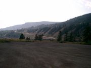
Highway 20 is famous for the portion of the westernmost stretch, between Anahim Lake and Bella Coola, known as the Hill or The Precipice. From the point where the road crosses the Coast Range
via Heckman Pass
in Tweedsmuir South Provincial Park
at an elevation of 1487 m (4879 ft) the road descends 43 km (27 mi) of steep, narrow road with sharp hairpin turns and two major switchbacks to the Bella Coola Valley. The descent includes a 9 km (5.6 mi) section with grades of up to 18% (about 1 in 6). The road is winding, in some places only wide enough for one vehicle, and in many places bordered on one side by cliffs and on the other side by a drop of hundreds of meters (many hundreds of feet) unprotected by guardrails. Tourists who have driven to Bella Coola from Williams Lake have been known to refuse to drive back and have had to be taken out by boat or float plane.
 Until 1953 Highway 20 ended at Anahim Lake, 137 km (85 mi) from Bella Coola. The province considered the terrain too difficult and refused to extend it, leaving Bella Coola inaccessible by road. The road, known at the time as the "Freedom Road", was completed by local volunteers working from opposite ends with two bulldozers and supplies bought on credit.
at Sheep Creek Bridge, from which it ascends via a series of steep switchbacks to the Chilcotin Plateau. Prior to improvements of the late 20th Century, including the Sheep Creek Bridge, it crossed the Fraser via a 1910s style suspension bridge, which was like those farther south at Gang Ranch-Dog Creek and Lillooet.
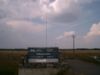
 At 36 km (22 mi) it passes the Williams Lake LORAN-C Tower, part of the maritime navigation system.
 At 52 km (32 mi) it passes through Riske Creek
(population 165) then at 94 km (58 mi) the hamlet of Hanceville
(population 68).
 Around 104 km (64 mi) it passes Anahim Reserve, a Chilcotin
community before reaching Alexis Creek
(population 317) at 114 km (71 mi). From Alexis Creek it is 122 km (76 mi) to the next town, Tatla Lake
(population 147).
 54 km (34 mi) farther West is Nimpo Lake
which serves as a float plane base for the region. Just west of Nimpo Lake the highway crosses the Dean River
before reaching Anahim Lake (population 163) and the adjacent Indian reserve at 310 km (193 mi). Past Anahim Lake the road ascends and descends through Tweedsmuir South Provincial Park via Heckman Pass to Hagensborg
and finally Bella Coola (population 2500). The entire route is scenic and very sparsely populated.
British Columbia Interior
The British Columbia Interior or BC Interior or Interior of British Columbia, usually referred to only as the Interior, is one of the three main regions of the Canadian province of British Columbia, the other two being the Lower Mainland, which comprises the overlapping areas of Greater Vancouver...
of British Columbia
British Columbia
British Columbia is the westernmost of Canada's provinces and is known for its natural beauty, as reflected in its Latin motto, Splendor sine occasu . Its name was chosen by Queen Victoria in 1858...
(the other being Highway 16 (the Yellowhead Highway)). The Chilcotin Highway runs 457 km (284 mi) from Williams Lake
Williams Lake, British Columbia
Williams Lake, is a city in the Central Interior of British Columbia, Canada. Located in the central part of a region known as the Cariboo, it is the largest urban centre between Kamloops and Prince George, with a population of 11,150 in city limits....
westward through the Chilcotin region
Chilcotin
Chilcotin, meaning "people of the red ochre river" may refer to:*The Tsilhqot'in , an Athabaskan First Nations people of British Columbia, Canada*Chilcotin language, the language spoken by the Tsilhqot’in...
to North Bentinck Arm
North Bentinck Arm
North Bentinck Arm is short inlet about in length in the Central Coast region of British Columbia, Canada. It is a sidewater of Burke Channel and is linked via that waterway and Labouchere Channel to Dean Channel, which is one of the largest inlets of the BC Coast.A spot on North Bentinck Arm is...
, an inlet from the Pacific Ocean where the town of Bella Coola
Bella Coola, British Columbia
Bella Coola is a community of approximately 600 at the western extremity of the Bella Coola Valley. Bella Coola usually refers to the entire valley, encompassing the settlements of Bella Coola proper , Lower Bella Coola, Hagensborg, Saloompt, Nusatsum, Firvale and Stuie...
is located. As of 2006, all but 57 km (35 mi) has been paved, mostly for expediting the removal of timber from the region, which is afflicted like most of British Columbia with pine beetle infestations. Logging traffic and ranch-related traffic on the route can be expected.
Highway 20 is famous for the portion of the westernmost stretch, between Anahim Lake and Bella Coola, known as the Hill or The Precipice. From the point where the road crosses the Coast Range
Coast Mountains
The Coast Mountains are a major mountain range, in the Pacific Coast Ranges, of western North America, extending from southwestern Yukon through the Alaska Panhandle and virtually all of the Coast of British Columbia. They are so-named because of their proximity to the sea coast, and are often...
via Heckman Pass
Heckman Pass
Heckman Pass is a mountain pass in the Rainbow Range of west-central British Columbia, Canada, located west of Anahim Lake on the divide between the Chilcotin Plateau and the Bella Coola Valley...
in Tweedsmuir South Provincial Park
Tweedsmuir South Provincial Park
Tweedsmuir South Provincial Park is a provincial park in British Columbia, Canada. Formerly part of Tweedsmuir Provincial Park it was formed from the southern portion of that park, the northern portion being redesignated Tweedsmuir North Provincial Park and Protected Area in order to allow...
at an elevation of 1487 m (4879 ft) the road descends 43 km (27 mi) of steep, narrow road with sharp hairpin turns and two major switchbacks to the Bella Coola Valley. The descent includes a 9 km (5.6 mi) section with grades of up to 18% (about 1 in 6). The road is winding, in some places only wide enough for one vehicle, and in many places bordered on one side by cliffs and on the other side by a drop of hundreds of meters (many hundreds of feet) unprotected by guardrails. Tourists who have driven to Bella Coola from Williams Lake have been known to refuse to drive back and have had to be taken out by boat or float plane.
Route Details
Highway 20 begins in Williams Lake at its juncture with Highway 97. It rises gradually for 23 km (14 mi) to the crossing of the Fraser RiverFraser River
The Fraser River is the longest river within British Columbia, Canada, rising at Fraser Pass near Mount Robson in the Rocky Mountains and flowing for , into the Strait of Georgia at the city of Vancouver. It is the tenth longest river in Canada...
at Sheep Creek Bridge, from which it ascends via a series of steep switchbacks to the Chilcotin Plateau. Prior to improvements of the late 20th Century, including the Sheep Creek Bridge, it crossed the Fraser via a 1910s style suspension bridge, which was like those farther south at Gang Ranch-Dog Creek and Lillooet.
Riske Creek, British Columbia
Riske Creek, originally Chilcoten and also Chilcotin, is a ranching and First Nations community located on the Fraser River just southwest of the city of Williams Lake, British Columbia, Canada. It is the location of the offices of the Toosey First Nation, a band government of Tsilhqot'in people...
(population 165) then at 94 km (58 mi) the hamlet of Hanceville
Hanceville, British Columbia
Hanceville is about 90 km west of Williams Lake in the Chilcotin District of the Central Interior of British Columbia, Canada. It is the main community the Stone First Nation. It is located southeast of Alexis Creek, on the north side of the Chilcotin River....
(population 68).
Chilcotin
Chilcotin, meaning "people of the red ochre river" may refer to:*The Tsilhqot'in , an Athabaskan First Nations people of British Columbia, Canada*Chilcotin language, the language spoken by the Tsilhqot’in...
community before reaching Alexis Creek
Alexis Creek, British Columbia
Alexis Creek, also known as Anaham, is an unincorporated community in the Chilcotin District of the western Central Interior of the Canadian province of British Columbia, on Highway 20 between Williams Lake and Bella Coola...
(population 317) at 114 km (71 mi). From Alexis Creek it is 122 km (76 mi) to the next town, Tatla Lake
Tatla Lake, British Columbia
Tatla Lake is a small unincorporated community in the west Chilcotin area of British Columbia, Canada, located at the west end of its eponymous lake...
(population 147).
Nimpo Lake
Nimpo Lake is a freshwater lake in the Chilcotin District of British Columbia, Canada. It is located 185 miles west of Williams Lake on the Chilcotin Highway and is approx. 100 miles east of Bella Coola...
which serves as a float plane base for the region. Just west of Nimpo Lake the highway crosses the Dean River
Dean River
The Dean River is one of the major rivers of the Kitimat Ranges subrange of the southern Coast Mountains in British Columbia. It begins in the volcanic-shield Ilgachuz Range on the Chilcotin Plateau and winds north around the Rainbow Range to enter Dean Channel at the now-uninhabited, remote...
before reaching Anahim Lake (population 163) and the adjacent Indian reserve at 310 km (193 mi). Past Anahim Lake the road ascends and descends through Tweedsmuir South Provincial Park via Heckman Pass to Hagensborg
Hagensborg, British Columbia
Hagensborg is a small community in the Bella Coola Valley in British Columbia, Canada. Its census population in 2006 was 248. The valley was already the ancient home to the Nuxálk people when European explorers arrived. Norwegian settlers from Minnesota and Wisconsin arrived in 1894, and the town...
and finally Bella Coola (population 2500). The entire route is scenic and very sparsely populated.
External links
- http://www.bcadventure.com/adventure/explore/cariboo/cities/hwy20.htm
- http://www.landwithoutlimits.com/?p=46