
Yoshino, Nara
Encyclopedia
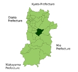
is a town
located in Yoshino District
, Nara Prefecture
, Japan
.
As of September 1, 2007, the town had an estimated population
of 9397 and a density
of 97.93 persons per km². The total area was 95.65 km².
, the majority of the town is covered by mountains. However, places along the Yoshino River
are rather flatter than the other areas, where many roads, train tracks, and houses exist.
For adherents of Shugendo
, Yoshino is the traditional beginning of the Mount Omine
pilgrimage trail; however, many hikers to begin and end their trek from the Dorogawa district of Tenkawa Village
.
Mount Yoshino is famous for its many thousands of sakura
trees. These flowering specimen trees were planted in four groves at different altitudes, in part so that the famed trees would come into bloom at different times of the spring. A 1714 account explained that, on their climb to the top, travelers would be able to enjoy the lower 1,000 cherry trees at the base, the middle 1,000 on the way, the upper 1,000 toward the top, and the 1,000 in the precincts of the inner shrine at the top.
Towns of Japan
A town is a local administrative unit in Japan. It is a local public body along with prefecture , city , and village...
located in Yoshino District
Yoshino District, Nara
Yoshino is a district located in Nara Prefecture, Japan.As of 2003, the district has an estimated population of 59,020 and a density of 26.14 persons per km²...
, Nara Prefecture
Nara Prefecture
is a prefecture in the Kansai region on Honshū Island, Japan. The capital is the city of Nara.-History:The present-day Nara Prefecture was created in 1887, making it independent of Osaka Prefecture....
, Japan
Japan
Japan is an island nation in East Asia. Located in the Pacific Ocean, it lies to the east of the Sea of Japan, China, North Korea, South Korea and Russia, stretching from the Sea of Okhotsk in the north to the East China Sea and Taiwan in the south...
.
As of September 1, 2007, the town had an estimated population
Population
A population is all the organisms that both belong to the same group or species and live in the same geographical area. The area that is used to define a sexual population is such that inter-breeding is possible between any pair within the area and more probable than cross-breeding with individuals...
of 9397 and a density
Population density
Population density is a measurement of population per unit area or unit volume. It is frequently applied to living organisms, and particularly to humans...
of 97.93 persons per km². The total area was 95.65 km².
Geography
Located in the northern portion of Yoshino DistrictYoshino District, Nara
Yoshino is a district located in Nara Prefecture, Japan.As of 2003, the district has an estimated population of 59,020 and a density of 26.14 persons per km²...
, the majority of the town is covered by mountains. However, places along the Yoshino River
Kinokawa River
The is a river in Nara and Wakayama Prefecture in Japan. It is called in Nara. It is 136 km long and has a watershed of 1,660 km².The river rises from Mount Ōdaigahara and flows to the west. It pours into the sea at Wakayama city.-Geography:...
are rather flatter than the other areas, where many roads, train tracks, and houses exist.
- Mountains: Mount YoshinoMount Yoshinois a mountain located in the town of Yoshino in Yoshino District, Nara Prefecture, Japan. In 2004, It was designated as part of a UNESCO World Heritage Site under the name Sacred Sites and Pilgrimage Routes in the Kii Mountain Range....
- Rivers: Yoshino RiverKinokawa RiverThe is a river in Nara and Wakayama Prefecture in Japan. It is called in Nara. It is 136 km long and has a watershed of 1,660 km².The river rises from Mount Ōdaigahara and flows to the west. It pours into the sea at Wakayama city.-Geography:...
- Lakes: Lake Tsuburo
For adherents of Shugendo
Shugendo
is a highly syncretic Buddhic religion or sect and mystical-spiritual tradition which originated in pre-Feudal Japan, in which enlightenment is equated with attaining oneness with the . This perception of experiential "awakening" is obtained through the understanding of the relationship between...
, Yoshino is the traditional beginning of the Mount Omine
Mount Omine
, is a sacred mountain in Nara, Japan, famous for its three tests of courage.Officially known as , it is more popularly known as Mount Ōmine due to its prominence in the Ōmine mountain range...
pilgrimage trail; however, many hikers to begin and end their trek from the Dorogawa district of Tenkawa Village
Tenkawa, Nara
is a village located in Yoshino District, Nara, Japan.As of July 2009, the village has an estimated population of 1,823 and a density of 10.38 persons per km²...
.
Mount Yoshino is famous for its many thousands of sakura
Sakura
A cherry blossom is the flower of any of several trees of genus Prunus, particularly the Japanese Cherry, Prunus serrulata, which is sometimes called sakura after the Japanese . Many of the varieties that have been cultivated for ornamental use do not produce fruit...
trees. These flowering specimen trees were planted in four groves at different altitudes, in part so that the famed trees would come into bloom at different times of the spring. A 1714 account explained that, on their climb to the top, travelers would be able to enjoy the lower 1,000 cherry trees at the base, the middle 1,000 on the way, the upper 1,000 toward the top, and the 1,000 in the precincts of the inner shrine at the top.
Surrounding municipalities
- Nara PrefectureNara Prefectureis a prefecture in the Kansai region on Honshū Island, Japan. The capital is the city of Nara.-History:The present-day Nara Prefecture was created in 1887, making it independent of Osaka Prefecture....
- AsukaAsuka, Narais a village located in Takaichi District, Nara, Japan.As of September 1, 2007, the village has an estimated population of 6,146 and a density of 255.23 persons per km². The total area is 24.08 km².Asuka is the land where ancient palaces were located...
- SakuraiSakurai, Narais a city in Nara, Japan.As of 2007, the city had an estimated population of 63,321 with a density of 630.01 persons per km². The total area is 98.92 km².The city was founded on September 1, 1956....
- HigashiyoshinoHigashiyoshino, Narais a village located in Yoshino District, Nara, Japan.As of October 1, 2007, the village has an estimated population of 2,426 and a density of 18.40 persons per km². The total area is 131.60 km².-Geography:...
- KawakamiKawakami, Narais a village located in Yoshino District, Nara, Japan.As of 2003, the village has an estimated population of 2,286 and a density of 8.49 persons per km². The total area is 269.16 km².-External links:*...
- KurotakiKurotaki, Narais a village located in Yoshino District, Nara, Japan.As of 2003, the village has an estimated population of 1,114 and a density of 23.35 persons per km²...
- ShimoichiShimoichi, Narais a town located in Yoshino District, Nara, Japan.As of September 1, 2007, the town has an estimated population of 7,404 and a density of 119.40 persons per km². The total area is 62.01 km²....
- ŌyodoOyodo, Narais a town located in Yoshino District, Nara, Japan.As of September 1, 2007, the town has an estimated population of 19,835 and a density of 521.15 persons per km²...
- UdaUda, Narais a city located in northeastern Nara, Japan.On January 1, 2006, the towns of Haibara, Ōuda and Utano, and the village of Murō, all from Uda District, were merged to form Uda City. As of December 29, 2005 the population was 38,648 people. The total area is 247.62 km².Each former town became a ward...
- Asuka
Notable places
- Yoshino-Kumano National ParkYoshino-Kumano National Parkis a national park in the Kansai region, Honshū, Japan. It was accredited on February 1, 1936.Part of it was accredited World Heritage Site in 2004.Northernmost of mountain lands in it called Yoshino is famous site of cherry blossoms.-External links:...
- Yoshino Shrine
- Miyataki (waterfallWaterfallA waterfall is a place where flowing water rapidly drops in elevation as it flows over a steep region or a cliff.-Formation:Waterfalls are commonly formed when a river is young. At these times the channel is often narrow and deep. When the river courses over resistant bedrock, erosion happens...
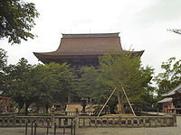
) - Kinpusen-ji
- Yoshimizu ShrineYoshimizu Shrineis a Shinto shrine located on Mount Yoshino in Yoshino district, Nara, Japan. It is dedicated to Emperor Go-Daigo, and the samurai Kusunoki Masashige....
- Sakuramotobō
- Yoshinomikumari Shrine
- Nyoirin-jiNyoirin-ji' is a Buddhist temple located in the city of Mobara in Chiba Prefecture. Nyoirin-ji is a Nichiren Buddhist temple noted for its ancient ginkgo tree. The temple is also near the remains of the Tonoyatsu Castle.- History :...
External links
- Yoshino official website
- Kansai Digital Archives...Images of Yoshino-cho
- National Archives of Japan Yoshinoyama syokeizu, illustrated scroll describing Mt. Yoshino, text by Kaibara Ekiken (circa 1714)
- Japan-guide.com Yoshino at Japan Guide