

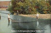
Winnipesaukee River
Encyclopedia
Lake Winnipesaukee
Lake Winnipesaukee is the largest lake in the U.S. state of New Hampshire. It is approximately long and from wide , covering — when Paugus Bay is included—with a maximum depth of ....
with the Pemigewasset
Pemigewasset River
The Pemigewasset River , known locally as "The Pemi", is a river in the state of New Hampshire, the United States. It is in length and drains approximately...
and Merrimack
Merrimack River
The Merrimack River is a river in the northeastern United States. It rises at the confluence of the Pemigewasset and Winnipesaukee rivers in Franklin, New Hampshire, flows southward into Massachusetts, and then flows northeast until it empties into the Atlantic Ocean at Newburyport...
rivers in Franklin, New Hampshire
Franklin, New Hampshire
The median income for a household in the city was $34,613, and the median income for a family was $41,698. Males had a median income of $32,318 versus $25,062 for females. The per capita income for the city was $17,155...
. The river is located in the Lakes Region
Lakes Region (New Hampshire)
The Lakes Region of New Hampshire is the mid-state region surrounding Lake Winnipesaukee, Winnisquam Lake, Squam Lake, and Newfound Lake.The area is a popular tourist destination in the summer time, with the activity peaking during the annual Motorcycle Week and races at Loudon's New Hampshire...
of central New Hampshire. The total drainage area of the river is approximately 488 square miles (1,264 km²).
There are two distinct sections of the river. The upstream section consists of a series of river courses connecting a chain of lakes, beginning with Lake Winnipesaukee. From the dam at the outlet of Lake Winnipesaukee in the Lakeport
Lakeport, New Hampshire
Lakeport is a village in the city of Laconia in Belknap County, New Hampshire, in the United States. The village is centered around a power dam on the short river channel between Paugus Bay to the north, and Opechee Bay to the south...
section of Laconia
Laconia, New Hampshire
As of the census of 2000, there were 16,411 people, 6,724 households, and 4,168 families residing in the city. The population density was 809.3 people per square mile . There were 8,554 housing units at an average density of 421.8 per square mile...
, the river almost immediately enters Opechee Bay
Opechee Bay
Opechee Bay is a lake located in Belknap County in the Lakes Region of central New Hampshire, United States, in the city of Laconia. It is located directly downstream from Paugus Bay and Lake Winnipesaukee, and it connects by a one-mile segment of the Winnipesaukee River through the center of...
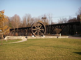
. 1 miles (1.6 km) down the lake, the river exits over a dam and drops through the center of Laconia, its banks lined by industrial buildings from the 19th century that were constructed to take advantage of the river's power. The 1 miles (1.6 km) section through Laconia ends at Winnisquam Lake
Winnisquam Lake
Winnisquam Lake is located in Belknap County in central New Hampshire, in the communities of Meredith, Laconia, Sanbornton, Belmont, and Tilton. At , it is the fourth-largest lake located entirely in New Hampshire. The lake is primarily fed by the outlet from Lake Winnipesaukee, and Winnisquam's...
, the fourth-largest lake in New Hampshire. A 5 miles (8 km) stretch across Winnisquam leads to the dam at the lake's outlet and a short descent to Silver Lake.
Belmont, New Hampshire
Belmont is a town in Belknap County, New Hampshire, United States. The population was 7,356 at the 2010 census.The primary settlement in town, where 1,301 people resided at the 2010 census, is defined by the U.S...
and Tilton, New Hampshire
Tilton, New Hampshire
Tilton is a town located on the Winnipesaukee River in Belknap County, New Hampshire, United States. The population was 3,567 at the 2010 census. It includes the village of Lochmere. Tilton is home to the Tilton School, a private preparatory school.-History:...
. The river passes through the center of the twin towns of Tilton and Northfield
Northfield, New Hampshire
Northfield is a town in Merrimack County, New Hampshire, United States. The population was 4,829 at the 2010 census.-History:The area was settled in 1760 as a part of Canterbury. In the late 1770s the residents of the "north fields" of Canterbury petitioned the State Legislature to become their...
, then descends through a narrow valley to Franklin
Franklin, New Hampshire
The median income for a household in the city was $34,613, and the median income for a family was $41,698. Males had a median income of $32,318 versus $25,062 for females. The per capita income for the city was $17,155...
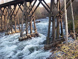
where additional small dams use the river's power. From Tilton to Franklin, the river has a drop of up to 90 ft/mi, with challenging rapids for sport boaters who put in at Cross Mill Bridge and take out at the U.S. Route 3
U.S. Route 3
U.S. Route 3 is a north–south United States highway that runs from its southern terminus in Cambridge, Massachusetts through New Hampshire to its terminus near Third Connecticut Lake at the Canadian border, where the road continues north as Quebec Route 257.In New Hampshire parts of US 3 are...
Sanborn Bridge in downtown Franklin. A USGS water gage is located in Tilton which also lists current precipitation and air temperature http://waterdata.usgs.gov/usa/nwis/uv?site_no=01081000.
The Winnipesaukee River joins the Pemigewasset River just downstream from the center of Franklin, forming the Merrimack River.