
William H. Natcher Parkway
Encyclopedia
Bowling Green, Kentucky
Bowling Green is the third-most populous city in the state of Kentucky after Louisville and Lexington, with a population of 58,067 as of the 2010 Census. It is the county seat of Warren County and the principal city of the Bowling Green, Kentucky Metropolitan Statistical Area with an estimated 2009...
to Owensboro, Kentucky
Owensboro, Kentucky
Owensboro is the fourth largest city by population in the U.S. state of Kentucky. It is the county seat of Daviess County. It is located on U.S. Route 60 about southeast of Evansville, Indiana, and is the principal city of the Owensboro, Kentucky, Metropolitan Statistical Area. The city's...
. The Natcher is one of nine highways that are part of Kentucky
Kentucky
The Commonwealth of Kentucky is a state located in the East Central United States of America. As classified by the United States Census Bureau, Kentucky is a Southern state, more specifically in the East South Central region. Kentucky is one of four U.S. states constituted as a commonwealth...
's parkway
Parkway
The term parkway has several distinct principal meanings and numerous synonyms around the world, for either a type of landscaped area or a type of road.Type of landscaped area:...
system. Conceived as the "Owensboro-Bowling Green Parkway," it was instead named the Green River Parkway when it opened on December 15, 1972. It received its current name in 1994 following the death of the late William H. Natcher, a United States Congress
United States Congress
The United States Congress is the bicameral legislature of the federal government of the United States, consisting of the Senate and the House of Representatives. The Congress meets in the United States Capitol in Washington, D.C....
man who represented the Second District of Kentucky for three decades. Natcher is best known for his record-setting string of 18,401 roll call votes, even being wheeled in on a hospital gurney to vote shortly before his death.
The Natcher Parkway was a toll road
Toll road
A toll road is a privately or publicly built road for which a driver pays a toll for use. Structures for which tolls are charged include toll bridges and toll tunnels. Non-toll roads are financed using other sources of revenue, most typically fuel tax or general tax funds...
from its opening until November 21, 2006.
In 2006, the old and new names were combined into the current name, in order to be consistent with most of the Commonwealth's other parkways, all of which had their original names changed in the same manner to honor various Kentucky politicians. However, the newly-designed marker signs that were installed on the Natcher Parkway in the summer of 2006 do not bear the words "Green River."
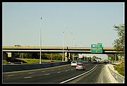
The parkway begins at an interchange with Interstate 65
Interstate 65
Interstate 65 is a major Interstate Highway in the United States. The southern terminus is located at an intersection with Interstate 10 in Mobile, Alabama, and its northern terminus is at an interchange with Interstate 90 , U.S. Route 12, and U.S...
(exit 20) just south of Bowling Green. It travels along the west side of the city in a northwesterly direction, through rolling farmlands and near coal mines, for 70.24 miles (113 km) before meeting its northern terminus at an interchange with US 60
U.S. Route 60
U.S. Route 60 is an east–west United States highway, running from the Atlantic Ocean on the east coast in Virginia to western Arizona. Despite the final "0" in its number, indicating a transcontinental designation, the 1926 route formerly ended in Springfield, Missouri, at its intersection...
at Owensboro. At Exit 41, the parkway intersects with the Wendell H. Ford Western Kentucky Parkway, the longest and oldest road in the state's parkway system. The Natcher Parkway bypasses the cities of Morgantown
Morgantown, Kentucky
Morgantown is a city in and the county seat of Butler County, Kentucky, United States. The population was 2,544 at the 2000 census. The city had a sister city in Tatsuruhama, Ishikawa, Japan, which city is now part of Nanao, Ishikawa, Japan.-History:...
, Beaver Dam
Beaver Dam, Kentucky
Beaver Dam is a city in Ohio County, Kentucky, United States. The population was 3,033 at the 2000 census. It is named for nearby Beaver Dam Creek.-Geography:Beaver Dam is located at ....
and Hartford
Hartford, Kentucky
Hartford is a city in Ohio County, Kentucky, United States. The population was 2,571 at the 2000 census. It is the county seat of Ohio County. It is believed to be named for a deer crossing on the nearby Rough River....
. The parkway carries the unsigned designation of Kentucky Route 9007 (WN 9007).
Toll removal
On November 21, 2006, toll plazas on the Natcher were removed. Prior to their removal, toll plazas were located at Exit 7/Bowling Green (through cars 50 cents), Exit 34/Morgantown (40 cents), and Exit 48/Hartford (60 cents). Motorists travelling between the I-65 exit and Exit 7 in the Bowling Green area were not charged toll.The Natcher and the nearby Audubon Parkway
Audubon Parkway
The Audubon Parkway is a four-lane controlled-access freeway connecting the cities of Henderson and Owensboro, Kentucky....
, were the last two roads in the Kentucky parkway system to have their tolls removed. Under Kentucky law, toll roads cease toll collection once their construction bonds are paid, either by collected tolls or other sources.
Interstate 66
The parkway was designated a part of the "Future Interstate 66 Corridor," a proposed four-lane Interstate utilizing the existing Cumberland and Hal Rogers Parkway, among other routes, across the southern tier of Kentucky. It cannot be signed as an Interstate until it has permanent connections to the east and west, both of which have not been determined due to the King Coal Highway in West Virginia being demoted to a corridor-standard roadway for US 52.All or part of the Natcher from the Western Kentucky Parkway interchange southward has been proposed to become part of the controversial proposed extension of Interstate 66 through Kentucky. Exactly how much of the southernmost 41 miles (66 km) of the highway will be used has not yet been decided — various plans call for the route to diverge from the Natcher somewhere north of Bowling Green and head east toward I-65, forming a northern beltine around the city; another plan would have I-66 follow the Natcher route all the way to the current I-65 interchange, then turn north and overlap I-65 to its junction with the Louie B. Nunn Cumberland Parkway.
I-69/I-65 Spur
Natcher Parkway to become an interstate spur.Jeff Moore, chief of the division of planning for the state Department of Highways, said in an interview with the Bowling Green Daily News that Kentucky is studying a new north-south corridor through the state, I-69. While the major portion of the road would be in western Kentucky, a spur for the newly designated roadway could have its terminus in Bowling Green. It would use the William H. Natcher Parkway between Bowling Green and Owensboro.
I-69 is well on its way to becoming another major north/south interstate in Kentucky as parkway upgrade studies are complete. A 55.3 mile section was established as I-69 September 30, 2011 from Madisonville west to Calvert City on I-24. I-69 red, white, and blue interstate signs will be installed on the section of freeway in October 2011. As for I-66, "Interest has been lost in the I-66 project,” Moore said
The new I-69 corridor wouldn’t necessarily funnel traffic away from I-65 and Bowling Green. Moore said it could actually bring traffic here with the interstate spur designation of the Natcher Parkway from Owensboro to Bowling Green. The Parkways that would be added to the interstate system would be studied and then brought up to interstate standards where needed. The study will consider widening shoulders, lengthening exit and entrance ramps, ensuring clearance heights under bridges for wide and tall loads and, in some instances, widening the travel lanes.
Preliminary recommendations from the studies will be sometime next year (2012). Improvements, Moore said, will be recommended in “small bites.”
Reference:
ROBYN L. MINOR, The Daily News, Tuesday, September 27, 2011 11:45 AM CDT
Link to original story: http://www.bgdailynews.com/articles/2011/09/27/news/news3.txt
Exit list
| County | Location | Mile | # Exit number An exit number is a number assigned to a road junction, usually an exit from a freeway. It is usually marked on the same sign as the destinations of the exit, as well as a sign in the gore.... |
Destinations | Notes |
|---|---|---|---|---|---|
| Warren Warren County, Kentucky Warren County is a county located in the U.S. state of Kentucky, specifically the Pennyroyal Plateau and Western Coal Fields regions. It is included in the Bowling Green, Kentucky, Metropolitan Statistical Area. The population was 113,792 in the 2010 Census. The county seat is Bowling Green... |
Bowling Green Bowling Green, Kentucky Bowling Green is the third-most populous city in the state of Kentucky after Louisville and Lexington, with a population of 58,067 as of the 2010 Census. It is the county seat of Warren County and the principal city of the Bowling Green, Kentucky Metropolitan Statistical Area with an estimated 2009... |
0.000 | 1A-B |  I-65 I-65Interstate 65 Interstate 65 is a major Interstate Highway in the United States. The southern terminus is located at an intersection with Interstate 10 in Mobile, Alabama, and its northern terminus is at an interchange with Interstate 90 , U.S. Route 12, and U.S... - Louisville Louisville, Kentucky Louisville is the largest city in the U.S. state of Kentucky, and the county seat of Jefferson County. Since 2003, the city's borders have been coterminous with those of the county because of a city-county merger. The city's population at the 2010 census was 741,096... , Nashville (TN) Nashville, Tennessee Nashville is the capital of the U.S. state of Tennessee and the county seat of Davidson County. It is located on the Cumberland River in Davidson County, in the north-central part of the state. The city is a center for the health care, publishing, banking and transportation industries, and is home... |
Southbound only. |
| 3.572 | 4 |  US 31W US 31WU.S. Route 31W U.S. Route 31W is the westernmost of two parallel routes for U.S. Route 31 from Nashville, Tennessee to Louisville, Kentucky. At one time, it split with U.S... - Bowling Green Bowling Green, Kentucky Bowling Green is the third-most populous city in the state of Kentucky after Louisville and Lexington, with a population of 58,067 as of the 2010 Census. It is the county seat of Warren County and the principal city of the Bowling Green, Kentucky Metropolitan Statistical Area with an estimated 2009... |
To Western Kentucky University Western Kentucky University Western Kentucky University is a public university in Bowling Green, Kentucky, USA. It was formally founded by the Commonwealth of Kentucky in 1906, though its roots reach back a quarter-century earlier.... . |
||
| 4.969 | 5 |   US 68 US 68U.S. Route 68 U.S. Route 68 is an east–west United States highway that runs for from northwest Ohio to western Kentucky. The highway's western terminus is at U.S. Route 62 in Reidland, Kentucky. Its eastern terminus is at Interstate 75 in Findlay, Ohio... /KY 80 - Bowling Green Bowling Green, Kentucky Bowling Green is the third-most populous city in the state of Kentucky after Louisville and Lexington, with a population of 58,067 as of the 2010 Census. It is the county seat of Warren County and the principal city of the Bowling Green, Kentucky Metropolitan Statistical Area with an estimated 2009... , Russellville Russellville, Kentucky As of the census of 2000, there were 7,149 people, 3,064 households, and 1,973 families residing in the city. The population density was 672.1 people per square mile . There were 3,458 housing units at an average density of 325.1 per square mile... |
|||
| 7.422 | 7 |  US 231 US 231U.S. Route 231 U.S. Route 231 is a parallel route of U.S. Route 31. It currently runs for 912 miles from St. John, Indiana, at U.S. Route 41 to south of U.S. Route 98 in Downtown Panama City, Florida.One of its most notable landmarks is the William H... - Bowling Green Bowling Green, Kentucky Bowling Green is the third-most populous city in the state of Kentucky after Louisville and Lexington, with a population of 58,067 as of the 2010 Census. It is the county seat of Warren County and the principal city of the Bowling Green, Kentucky Metropolitan Statistical Area with an estimated 2009... |
|||
| Butler Butler County, Kentucky Butler County is a county located in the US state of Kentucky. It was formed in 1810, becoming Kentucky's 53rd county. As of 2000, the population was 13,010. Its county seat is Morgantown, Kentucky. Butler is a prohibition or dry county.- History :... |
Morgantown Morgantown, Kentucky Morgantown is a city in and the county seat of Butler County, Kentucky, United States. The population was 2,544 at the 2000 census. The city had a sister city in Tatsuruhama, Ishikawa, Japan, which city is now part of Nanao, Ishikawa, Japan.-History:... |
26.147 | 26 |  US 231 US 231U.S. Route 231 U.S. Route 231 is a parallel route of U.S. Route 31. It currently runs for 912 miles from St. John, Indiana, at U.S. Route 41 to south of U.S. Route 98 in Downtown Panama City, Florida.One of its most notable landmarks is the William H... /KY 79 Kentucky Route 79 Kentucky Route 79 originates at a junction with US 431 in downtown Russellville in Logan County. The route continues through Morgantown, Caneyville, Short Creek, Cannons Point, Harned, and Irvington, to terminate at the Ohio River near Brandenburg in Meade County, where, after crossing the Matthew E... - Morgantown Morgantown, Kentucky Morgantown is a city in and the county seat of Butler County, Kentucky, United States. The population was 2,544 at the 2000 census. The city had a sister city in Tatsuruhama, Ishikawa, Japan, which city is now part of Nanao, Ishikawa, Japan.-History:... |
|
| 27.428 | 27 |  KY 70 KY 70Kentucky Route 70 Kentucky Route 70 is a long east-east state highway that originates at a junction with US 60 in Smithland in Livingston County, just east of the Ohio River. The route continues through the counties of Crittenden, Caldwell, Hopkins, Muhlenberg, Butler, Edmonson, Barren, Barren, Metcalfe, Green,... - Morgantown Morgantown, Kentucky Morgantown is a city in and the county seat of Butler County, Kentucky, United States. The population was 2,544 at the 2000 census. The city had a sister city in Tatsuruhama, Ishikawa, Japan, which city is now part of Nanao, Ishikawa, Japan.-History:... , Rochester Rochester, Kentucky Rochester is a city in Butler County, Kentucky, United States, at the confluence of the Green and Mud Rivers. The population was 186 at the 2000 census. It is named for Rochester, New York... |
|||
| 33.845 | 34 | US 231 U.S. Route 231 U.S. Route 231 is a parallel route of U.S. Route 31. It currently runs for 912 miles from St. John, Indiana, at U.S. Route 41 to south of U.S. Route 98 in Downtown Panama City, Florida.One of its most notable landmarks is the William H... - Cromwell, Morgantown Morgantown, Kentucky Morgantown is a city in and the county seat of Butler County, Kentucky, United States. The population was 2,544 at the 2000 census. The city had a sister city in Tatsuruhama, Ishikawa, Japan, which city is now part of Nanao, Ishikawa, Japan.-History:... |
|||
| Ohio Ohio County, Kentucky Ohio County is a county located in the U.S. state of Kentucky. As of 2000, the population was 22,916. Its county seat is Hartford. The county is named for the Ohio River, which originally formed its northern boundary. It is a dry county, which means that the sale of alcohol is restricted or... |
41.270 | 41A-B |  Western Kentucky Parkway Western Kentucky ParkwayWestern Kentucky Parkway The Wendell H. Ford Western Kentucky Parkway is a controlled-access highway running from Elizabethtown, Kentucky to near Eddyville, Kentucky. It intersects with Interstate 65 at its eastern terminus, and Interstate 24 at its western terminus. It is one of nine highways that are part of the... - Elizabethtown Elizabethtown, Kentucky Elizabethtown is a city in and the county seat of Hardin County, Kentucky, United States. The population was 28,531 at the 2010 census, making it the eleventh-largest city in the state... , Paducah Paducah, Kentucky Paducah is the largest city in Kentucky's Jackson Purchase Region and the county seat of McCracken County, Kentucky, United States. It is located at the confluence of the Tennessee River and the Ohio River, halfway between the metropolitan areas of St. Louis, Missouri, to the west and Nashville,... |
||
| Hartford Hartford, Kentucky Hartford is a city in Ohio County, Kentucky, United States. The population was 2,571 at the 2000 census. It is the county seat of Ohio County. It is believed to be named for a deer crossing on the nearby Rough River.... |
47.796 | 48 |  KY 69 - Beaver Dam KY 69 - Beaver DamBeaver Dam, Kentucky Beaver Dam is a city in Ohio County, Kentucky, United States. The population was 3,033 at the 2000 census. It is named for nearby Beaver Dam Creek.-Geography:Beaver Dam is located at .... , Hartford Hartford, Kentucky Hartford is a city in Ohio County, Kentucky, United States. The population was 2,571 at the 2000 census. It is the county seat of Ohio County. It is believed to be named for a deer crossing on the nearby Rough River.... |
||
| Daviess Daviess County, Kentucky As of the census of 2000, there were 91,545 people, 36,033 households, and 24,826 families residing in the county. The population density was . There were 38,432 housing units at an average density of... |
Owensboro Owensboro, Kentucky Owensboro is the fourth largest city by population in the U.S. state of Kentucky. It is the county seat of Daviess County. It is located on U.S. Route 60 about southeast of Evansville, Indiana, and is the principal city of the Owensboro, Kentucky, Metropolitan Statistical Area. The city's... |
70.184 | 70A-B |   US 60 BYP/US 231 US 60 BYP/US 231U.S. Route 231 U.S. Route 231 is a parallel route of U.S. Route 31. It currently runs for 912 miles from St. John, Indiana, at U.S. Route 41 to south of U.S. Route 98 in Downtown Panama City, Florida.One of its most notable landmarks is the William H... - Hawesville Hawesville, Kentucky Hawesville is a city in Hancock County, Kentucky, United States, along the Ohio River. The population was 971 at the 2000 census. It is included in the Owensboro, Kentucky Metropolitan Statistical Area... , Henderson Henderson, Kentucky Henderson is a city in Henderson County, Kentucky, United States, along the Ohio River in the western part of the state. The population was 27,952 at the 2010 census. It is part of the Evansville Metropolitan Area often referred to as "Kentuckiana", although "Tri-State Area" or "Tri-State" are more... , Owensboro Owensboro, Kentucky Owensboro is the fourth largest city by population in the U.S. state of Kentucky. It is the county seat of Daviess County. It is located on U.S. Route 60 about southeast of Evansville, Indiana, and is the principal city of the Owensboro, Kentucky, Metropolitan Statistical Area. The city's... |
Northbound only. To Ben Hawes Golf Course and Park. |
Exit Number Revision
All exit numbers on the Natcher Parkway have increased by two because of the parkway extension from I-65 to US 231 on the south side of Bowling Green. The extension will be open to traffic the 1st week of November 2011. The Natcher Parkway extension is 2.5 miles long and is at the beginning of the Parkway. This is the reason for the mileage change from Bowling Green, KY to Owensboro, KY. All the mile markers and exit signs have already been changed on the Natcher Parkway. Note: There will be a new exit between I-65 and US 231 at KY 622. I'm not sure what the exit number will be but I assume it will be exit 1 and I-65 will be exit 2 on the Natcher. I'll find out next month for sure. Below are the old exit numbers and the new exit numbers as they are now on the parkway.
Bowling Green Exit 4 US 31W is now Exit 6; Bowling Green Exit 5 US 68 KY 80 is now Exit 7; Bowling Green Exit 7 US 231 is now Exit 9
Morgantown Exit 26 US 231 KY 79 is now Exit 28; Morgantown Exit 27 KY 70 is now Exit 29; Morgantown Exit 34 US 231 is now Exit 36
Hartford Exit 41 Western Kentucky Parkway is now Exit 43; Hartford Exit 48 KY 69 is now Exit 50
Owensboro Exit 70 US 60 is now Exit 72 End of the William H. Natcher Parkway