
White Rock, New Mexico
Overview
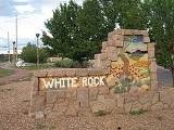
White Rock is a census-designated place
(CDP) in Los Alamos County
, New Mexico
, United States
. The population was 6,045 at the 2000 census. It is largely a bedroom community for employees of Los Alamos National Laboratory
and their families. Access to White Rock from the town of Los Alamos
and other cities and towns in New Mexico is via New Mexico State Road 4
, which forms the northwestern boundary of the community. Administratively, White Rock is a neighborhood of Los Alamos; locals refer to Los Alamos (meaning not White Rock) as "the Townsite," or "the Hill".
In 1947 the United States Atomic Energy Commission
acquired land from the United States Forest Service
to build a temporary community to house construction workers.
Census-designated place
A census-designated place is a concentration of population identified by the United States Census Bureau for statistical purposes. CDPs are delineated for each decennial census as the statistical counterparts of incorporated places such as cities, towns and villages...
(CDP) in Los Alamos County
Los Alamos County, New Mexico
-2010:Whereas according to the 2010 U.S. Census Bureau:*87.8% White*0.6% Black*0.8% Native American*6.0% Asian*0.0% Native Hawaiian or Pacific Islander*2.6% Two or more races*2.2% Other races*14.7% Hispanic or Latino -2000:...
, New Mexico
New Mexico
New Mexico is a state located in the southwest and western regions of the United States. New Mexico is also usually considered one of the Mountain States. With a population density of 16 per square mile, New Mexico is the sixth-most sparsely inhabited U.S...
, United States
United States
The United States of America is a federal constitutional republic comprising fifty states and a federal district...
. The population was 6,045 at the 2000 census. It is largely a bedroom community for employees of Los Alamos National Laboratory
Los Alamos National Laboratory
Los Alamos National Laboratory is a United States Department of Energy national laboratory, managed and operated by Los Alamos National Security , located in Los Alamos, New Mexico...
and their families. Access to White Rock from the town of Los Alamos
Los Alamos, New Mexico
Los Alamos is a townsite and census-designated place in Los Alamos County, New Mexico, United States, built upon four mesas of the Pajarito Plateau and the adjoining White Rock Canyon. The population of the CDP was 12,019 at the 2010 Census. The townsite or "the hill" is one part of town while...
and other cities and towns in New Mexico is via New Mexico State Road 4
New Mexico State Road 4
New Mexico State Road 4 is a state highway in New Mexico, United States of America. It is significant as the main access route connecting the remote town of Los Alamos, Los Alamos National Laboratory, and Bandelier National Monument to other, more major highways in New Mexico...
, which forms the northwestern boundary of the community. Administratively, White Rock is a neighborhood of Los Alamos; locals refer to Los Alamos (meaning not White Rock) as "the Townsite," or "the Hill".
In 1947 the United States Atomic Energy Commission
United States Atomic Energy Commission
The United States Atomic Energy Commission was an agency of the United States government established after World War II by Congress to foster and control the peace time development of atomic science and technology. President Harry S...
acquired land from the United States Forest Service
United States Forest Service
The United States Forest Service is an agency of the United States Department of Agriculture that administers the nation's 155 national forests and 20 national grasslands, which encompass...
to build a temporary community to house construction workers.
Unanswered Questions