
Weston County, Wyoming
Encyclopedia
Weston County is a county located in the U.S. state
of Wyoming
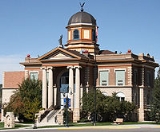
. Its county seat
is Newcastle
. The population was 7,208 at the 2010 census.
on March 12, 1890. The county was created out of a portion of Crook County.
Weston County was named for John B. Weston, who was a geologist and surveyor. In 1887, John Weston and Frank Mondell found rich coal deposits north of Newcastle
which caused a railroad to be built through the area.
In 1911, Campbell County was formed from portions of Weston County and Crook County. Since then, the boundaries of Weston County have been stable.
, the county has a total area of 2400 square miles (6,216 km²), of which 2398 square miles (6,210.8 km²) is land and 2 square miles (5.2 km²) (0.09%) is water.
National protected area
of 2000, there were 6,644 people, 2,624 households, and 1,868 families residing in the county. The population density
was 3 people per square mile (1/km²). There were 3,231 housing units at an average density of 1 per square mile (1/km²). The racial makeup of the county was 95.94% White
, 0.12% Black
or African American
, 1.26% Native American
, 0.20% Asian
, 0.02% Pacific Islander
, 0.93% from other races
, and 1.54% from two or more races. 2.06% of the population were Hispanic
or Latino
of any race. 33.0% were of German, 13.0% English
, 8.9% Irish
and 7.2% American
ancestry according to Census 2000.
There were 2,624 households out of which 31.10% had children under the age of 18 living with them, 60.40% were married couples
living together, 7.30% had a female householder with no husband present, and 28.80% were non-families. 25.00% of all households were made up of individuals and 11.50% had someone living alone who was 65 years of age or older. The average household size was 2.42 and the average family size was 2.88.
In the county the population was spread out with 24.10% under the age of 18, 7.40% from 18 to 24, 26.30% from 25 to 44, 26.70% from 45 to 64, and 15.60% who were 65 years of age or older. The median age was 41 years. For every 100 females there were 103.10 males. For every 100 females age 18 and over, there were 103.80 males.
The median income for a household in the county was $32,348, and the median income for a family was $40,472. Males had a median income of $34,321 versus $18,640 for females. The per capita income
for the county was $17,366. About 6.30% of families and 9.90% of the population were below the poverty line, including 11.30% of those under age 18 and 13.60% of those age 65 or over.
. The facility was operated by the Wyoming Board of Charities and Reform
until that agency was dissolved as a result of a state constitutional amendment passed in November 1990.
U.S. state
A U.S. state is any one of the 50 federated states of the United States of America that share sovereignty with the federal government. Because of this shared sovereignty, an American is a citizen both of the federal entity and of his or her state of domicile. Four states use the official title of...
of Wyoming
Wyoming
Wyoming is a state in the mountain region of the Western United States. The western two thirds of the state is covered mostly with the mountain ranges and rangelands in the foothills of the Eastern Rocky Mountains, while the eastern third of the state is high elevation prairie known as the High...
. Its county seat
County seat
A county seat is an administrative center, or seat of government, for a county or civil parish. The term is primarily used in the United States....
is Newcastle
Newcastle, Wyoming
Newcastle is a city in and the county seat of Weston County, Wyoming, United States. The population was 3,065 at the 2000 census.- Geography :Newcastle is located at...
. The population was 7,208 at the 2010 census.
History
Weston County was created by the legislature of the Wyoming TerritoryWyoming Territory
The Territory of Wyoming was an organized incorporated territory of the United States that existed from July 25, 1868, until July 10, 1890, when it was admitted to the Union as the State of Wyoming. Cheyenne was the territorial capital...
on March 12, 1890. The county was created out of a portion of Crook County.
Weston County was named for John B. Weston, who was a geologist and surveyor. In 1887, John Weston and Frank Mondell found rich coal deposits north of Newcastle
Newcastle, Wyoming
Newcastle is a city in and the county seat of Weston County, Wyoming, United States. The population was 3,065 at the 2000 census.- Geography :Newcastle is located at...
which caused a railroad to be built through the area.
In 1911, Campbell County was formed from portions of Weston County and Crook County. Since then, the boundaries of Weston County have been stable.
Geography
According to the U.S. Census BureauUnited States Census Bureau
The United States Census Bureau is the government agency that is responsible for the United States Census. It also gathers other national demographic and economic data...
, the county has a total area of 2400 square miles (6,216 km²), of which 2398 square miles (6,210.8 km²) is land and 2 square miles (5.2 km²) (0.09%) is water.
Adjacent counties
- Crook County (north)
- Lawrence County, South DakotaLawrence County, South DakotaAs of the census of 2000, there were 21,802 people, 8,881 households, and 5,559 families residing in the county. The population density was 27 people per square mile . There were 10,427 housing units at an average density of 13 per square mile...
(northeast) - Pennington County, South DakotaPennington County, South DakotaAs of the census of 2000, there were 88,565 people, 34,641 households, and 23,278 families residing in the county. The population density was 32 people per square mile . There were 37,249 housing units at an average density of 13 per square mile...
(east) - Custer County, South DakotaCuster County, South DakotaAs of the census of 2000, there were 7,275 people, 2,970 households, and 2,067 families residing in the county. The population density was 5 people per square mile . There were 3,624 housing units at an average density of 2 per square mile...
(southeast) - Niobrara County (south)
- Converse County (southwest)
- Campbell County (west)
Major Highways
 U.S. Highway 16
 U.S. Highway 20
 U.S. Highway 85
 Wyoming Highway 116Wyoming Highway 116Wyoming Highway 116 is a north-south Wyoming State Road located in central Weston and southern Crook counties, and travels from Wyoming Highway 450 south of Upton north to U.S. Route 14 at Sundance.-Route description:...
 Wyoming Highway 450Wyoming Highway 450Wyoming Highway 450 is a east-west Wyoming State Road in Campbell and Weston counties that provides travels between WYO 59 at Wright and U.S. Route 16 at Newcastle.-Route description:...
 Wyoming Highway 585Wyoming Highway 585Wyoming Highway 585 is a north-south Wyoming State Road located in Weston and Crook counties in northwestern Wyoming.- Route description :Wyoming Highway 585 starts it south end at US 85 in Four Corners, and from there, travels north-northwest through the northeastern corner of Weston County and...
National protected areaProtected areaProtected areas are locations which receive protection because of their recognised natural, ecological and/or cultural values. There are several kinds of protected areas, which vary by level of protection depending on the enabling laws of each country or the regulations of the international...
s
- Black Hills National ForestBlack Hills National ForestBlack Hills National Forest is located in southwestern South Dakota and northeastern Wyoming. The forest has an area of over 1.25 million acres and is managed by the Forest Service. Forest headquarters are located in Custer, South Dakota...
(part) - Thunder Basin National GrasslandThunder Basin National GrasslandThe Thunder Basin National Grassland is located in northeastern Wyoming in the Powder River Basin between the Big Horn Mountains and the Black Hills. The Grassland ranges in elevation from feet to and the climate is semi-arid. The Grassland provides opportunities for recreation, including hiking,...
(part)
Demographics
As of the censusCensus
A census is the procedure of systematically acquiring and recording information about the members of a given population. It is a regularly occurring and official count of a particular population. The term is used mostly in connection with national population and housing censuses; other common...
of 2000, there were 6,644 people, 2,624 households, and 1,868 families residing in the county. The population density
Population density
Population density is a measurement of population per unit area or unit volume. It is frequently applied to living organisms, and particularly to humans...
was 3 people per square mile (1/km²). There were 3,231 housing units at an average density of 1 per square mile (1/km²). The racial makeup of the county was 95.94% White
Race (United States Census)
Race and ethnicity in the United States Census, as defined by the Federal Office of Management and Budget and the United States Census Bureau, are self-identification data items in which residents choose the race or races with which they most closely identify, and indicate whether or not they are...
, 0.12% Black
Race (United States Census)
Race and ethnicity in the United States Census, as defined by the Federal Office of Management and Budget and the United States Census Bureau, are self-identification data items in which residents choose the race or races with which they most closely identify, and indicate whether or not they are...
or African American
Race (United States Census)
Race and ethnicity in the United States Census, as defined by the Federal Office of Management and Budget and the United States Census Bureau, are self-identification data items in which residents choose the race or races with which they most closely identify, and indicate whether or not they are...
, 1.26% Native American
Race (United States Census)
Race and ethnicity in the United States Census, as defined by the Federal Office of Management and Budget and the United States Census Bureau, are self-identification data items in which residents choose the race or races with which they most closely identify, and indicate whether or not they are...
, 0.20% Asian
Race (United States Census)
Race and ethnicity in the United States Census, as defined by the Federal Office of Management and Budget and the United States Census Bureau, are self-identification data items in which residents choose the race or races with which they most closely identify, and indicate whether or not they are...
, 0.02% Pacific Islander
Race (United States Census)
Race and ethnicity in the United States Census, as defined by the Federal Office of Management and Budget and the United States Census Bureau, are self-identification data items in which residents choose the race or races with which they most closely identify, and indicate whether or not they are...
, 0.93% from other races
Race (United States Census)
Race and ethnicity in the United States Census, as defined by the Federal Office of Management and Budget and the United States Census Bureau, are self-identification data items in which residents choose the race or races with which they most closely identify, and indicate whether or not they are...
, and 1.54% from two or more races. 2.06% of the population were Hispanic
Race (United States Census)
Race and ethnicity in the United States Census, as defined by the Federal Office of Management and Budget and the United States Census Bureau, are self-identification data items in which residents choose the race or races with which they most closely identify, and indicate whether or not they are...
or Latino
Race (United States Census)
Race and ethnicity in the United States Census, as defined by the Federal Office of Management and Budget and the United States Census Bureau, are self-identification data items in which residents choose the race or races with which they most closely identify, and indicate whether or not they are...
of any race. 33.0% were of German, 13.0% English
English people
The English are a nation and ethnic group native to England, who speak English. The English identity is of early mediaeval origin, when they were known in Old English as the Anglecynn. England is now a country of the United Kingdom, and the majority of English people in England are British Citizens...
, 8.9% Irish
Irish people
The Irish people are an ethnic group who originate in Ireland, an island in northwestern Europe. Ireland has been populated for around 9,000 years , with the Irish people's earliest ancestors recorded having legends of being descended from groups such as the Nemedians, Fomorians, Fir Bolg, Tuatha...
and 7.2% American
United States
The United States of America is a federal constitutional republic comprising fifty states and a federal district...
ancestry according to Census 2000.
There were 2,624 households out of which 31.10% had children under the age of 18 living with them, 60.40% were married couples
Marriage
Marriage is a social union or legal contract between people that creates kinship. It is an institution in which interpersonal relationships, usually intimate and sexual, are acknowledged in a variety of ways, depending on the culture or subculture in which it is found...
living together, 7.30% had a female householder with no husband present, and 28.80% were non-families. 25.00% of all households were made up of individuals and 11.50% had someone living alone who was 65 years of age or older. The average household size was 2.42 and the average family size was 2.88.
In the county the population was spread out with 24.10% under the age of 18, 7.40% from 18 to 24, 26.30% from 25 to 44, 26.70% from 45 to 64, and 15.60% who were 65 years of age or older. The median age was 41 years. For every 100 females there were 103.10 males. For every 100 females age 18 and over, there were 103.80 males.
The median income for a household in the county was $32,348, and the median income for a family was $40,472. Males had a median income of $34,321 versus $18,640 for females. The per capita income
Per capita income
Per capita income or income per person is a measure of mean income within an economic aggregate, such as a country or city. It is calculated by taking a measure of all sources of income in the aggregate and dividing it by the total population...
for the county was $17,366. About 6.30% of families and 9.90% of the population were below the poverty line, including 11.30% of those under age 18 and 13.60% of those age 65 or over.
Government and infrastructure
The Wyoming Department of Corrections Wyoming Honor Conservation Camp & Boot Camp is located in NewcastleNewcastle, Wyoming
Newcastle is a city in and the county seat of Weston County, Wyoming, United States. The population was 3,065 at the 2000 census.- Geography :Newcastle is located at...
. The facility was operated by the Wyoming Board of Charities and Reform
Wyoming Board of Charities and Reform
The Wyoming Board of Charities and Reform was a state agency of Wyoming that operated the state's charitable and penal institutions.-History:...
until that agency was dissolved as a result of a state constitutional amendment passed in November 1990.
Census-designated places
- Hill View HeightsHill View Heights, WyomingHill View Heights is a census-designated place in Weston County, Wyoming, United States. The population was 166 at the 2000 census.-Geography:Hill View Heights is located at ....
- OsageOsage, WyomingOsage is a census-designated place in Weston County, Wyoming, United States. The population was 215 at the 2000 census.-Geography:Osage is located at ....