
Western Carpathians
Encyclopedia
The Western Carpathians are a mountain range
and geomorphological
province that forms the western part of the Carpathian Mountains
.
The mountain belt stretches from the Low Beskids
range of the Eastern Carpathians along the border of Poland
with Slovakia
toward the Moravia
n region of the Czech Republic
and the Austria
n Weinviertel
. In the south the North Hungarian Mountains cover northern Hungary
. The area of the Western Carpathians comprises about 70,000 km². The highest elevation is the Gerlachovský štít (2,655m).
by the Forecarpathian Lowland and the Lesser Poland Upland
; to the west the Moravian Gate
leads over to the Sudetes. To the south the mountain chain falls away towards the Pannonian Plain, a large plain situated between the Alps
, the Dinaric Alps
, and the main mass of the Eastern Carpathians.
The boundary between the Western Carpathians and the Eastern Alps
is formed by the Vienna Basin
, the Hainburg Hills of the Little Carpathians
at Devín Gate
, and a gap
carved by the Danube
. To the east and northeast the mountains are bounded by the East Slovak and Sandomierz Basin
s, but it is less striking and passes through highland terrain that continues to the Eastern Carpathians.
 The Western Carpathians are part of the northern branch of alpine orogeny
, which was formed by the closure of the Tethys Ocean
.
The Western Carpathians are part of the Alpide belt
. To the west they longitudinally join the Alps
, but the exact boundary is hidden under the Neogene sedimentary fill of the Vienna Basin
. To the east, their boundary with the Eastern Carpathians is the valley of the Hornád
or Uzh River
. The northern boundary with the East European craton
and Bohemian Massif
is well marked by the thrust of nappe
s of the Carpathian flysch belt. The southern boundary is less clear, because later postorogenetic evolution caused formation of basins
, penetrating the mountain chain non-uniformly.
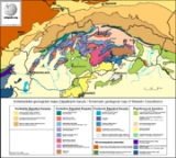
The Western Carpathians have a complicated geological structure, that has been formed since the Paleozoic
era. The oldest Paleozoic rocks
experienced the first stage of deformation during the Hercynian orogeny, but younger Alpine overprint is common. Alpine orogeny
affected the area in several stages from Jurassic
to Neogene
. During this period, parts of Tethys Ocean
were subducted under the African plate
and Western Carpathian blocks were thrust over the margin of the Eurasian plate
.
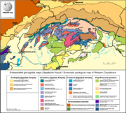
Tectonic units of the Western Carpathians are arranged in belt-like order, with the external units in the north and internal units in the south. Alpine evolution of the Western Carpathians is dominated by extension and closure of two or three oceanic domains: Triassic-Jurassic Meliata-Halstatt Ocean, Jurassic-Cretaceous Piemont-Vahic Ocean/Zone and Cretaceous-Tertiary Valais-Magura Ocean
. After a subduction of the Meliata Ocean, the Internal Western Carpathians were formed. Suturing
of Vahic domain finalized thrusting in the Central Western Carpathians, and consuming the crust of Carpathian Flysch Basins caused the formation of the External West Carpathian accretionary wedge
.
Mountain range
A mountain range is a single, large mass consisting of a succession of mountains or narrowly spaced mountain ridges, with or without peaks, closely related in position, direction, formation, and age; a component part of a mountain system or of a mountain chain...
and geomorphological
Geomorphology
Geomorphology is the scientific study of landforms and the processes that shape them...
province that forms the western part of the Carpathian Mountains
Carpathian Mountains
The Carpathian Mountains or Carpathians are a range of mountains forming an arc roughly long across Central and Eastern Europe, making them the second-longest mountain range in Europe...
.
The mountain belt stretches from the Low Beskids
Low Beskids
The ', ', Low Beskids or Lower Beskids is one of the Beskids mountain ranges in the Outer Eastern Carpathians in southeastern Poland and northeastern Slovakia...
range of the Eastern Carpathians along the border of Poland
Poland
Poland , officially the Republic of Poland , is a country in Central Europe bordered by Germany to the west; the Czech Republic and Slovakia to the south; Ukraine, Belarus and Lithuania to the east; and the Baltic Sea and Kaliningrad Oblast, a Russian exclave, to the north...
with Slovakia
Slovakia
The Slovak Republic is a landlocked state in Central Europe. It has a population of over five million and an area of about . Slovakia is bordered by the Czech Republic and Austria to the west, Poland to the north, Ukraine to the east and Hungary to the south...
toward the Moravia
Moravia
Moravia is a historical region in Central Europe in the east of the Czech Republic, and one of the former Czech lands, together with Bohemia and Silesia. It takes its name from the Morava River which rises in the northwest of the region...
n region of the Czech Republic
Czech Republic
The Czech Republic is a landlocked country in Central Europe. The country is bordered by Poland to the northeast, Slovakia to the east, Austria to the south, and Germany to the west and northwest....
and the Austria
Austria
Austria , officially the Republic of Austria , is a landlocked country of roughly 8.4 million people in Central Europe. It is bordered by the Czech Republic and Germany to the north, Slovakia and Hungary to the east, Slovenia and Italy to the south, and Switzerland and Liechtenstein to the...
n Weinviertel
Weinviertel
The Weinviertel or Viertel unter dem Manhartsberg is located in the northeast of Lower Austria....
. In the south the North Hungarian Mountains cover northern Hungary
Hungary
Hungary , officially the Republic of Hungary , is a landlocked country in Central Europe. It is situated in the Carpathian Basin and is bordered by Slovakia to the north, Ukraine and Romania to the east, Serbia and Croatia to the south, Slovenia to the southwest and Austria to the west. The...
. The area of the Western Carpathians comprises about 70,000 km². The highest elevation is the Gerlachovský štít (2,655m).
Geographical definition
Most of the perimeter of the Western Carpathians is quite sharply defined by valleys. To the northwest and north they are separated from the Bohemian MassifBohemian Massif
The Bohemian Massif; or Český masiv; is in the geology of Central Europe a large massif stretching over central Czech republic, eastern Germany, southern Poland and northern Austria...
by the Forecarpathian Lowland and the Lesser Poland Upland
Lesser Poland Upland
Lesser Polish Upland is an upland located in southern part of Poland, which stretches from the valley of the upper Vistula river between Kraków and Sandomierz to north-west in the region of Tomaszów Mazowiecki and Radomsko. Average height is between 200 and 400 metres above sea level, with the...
; to the west the Moravian Gate
Moravian Gate
The Moravian Gate is a geomorphological feature in the Moravian region of the Czech Republic. It is formed by the depression between the Carpathian Mountains in the east and the Sudetes in the west...
leads over to the Sudetes. To the south the mountain chain falls away towards the Pannonian Plain, a large plain situated between the Alps
Alps
The Alps is one of the great mountain range systems of Europe, stretching from Austria and Slovenia in the east through Italy, Switzerland, Liechtenstein and Germany to France in the west....
, the Dinaric Alps
Dinaric Alps
The Dinaric Alps or Dinarides form a mountain chain in Southern Europe, spanning areas of Slovenia, Croatia, Bosnia and Herzegovina, Serbia, Kosovo, Albania and Montenegro....
, and the main mass of the Eastern Carpathians.
The boundary between the Western Carpathians and the Eastern Alps
Eastern Alps
Eastern Alps is the name given to the eastern half of the Alps, usually defined as the area east of the Splügen Pass in eastern Switzerland. North of the Splügen Pass, the Posterior Rhine forms the border, and south of the pass, the Liro river and Lake Como form the boundary line.-Geography:The...
is formed by the Vienna Basin
Vienna Basin
The Vienna Basin is a sedimentary basin between the Alps and the Carpathian Mountains...
, the Hainburg Hills of the Little Carpathians
Little Carpathians
The Little Carpathians are a low, about 100 km long, mountain range, part of the Carpathian Mountains. The mountains are situated in Western Slovakia, covering the area from Bratislava to Nové Mesto nad Váhom, a very small part called Hundsheimer Berge is situated south of Devín Gate in...
at Devín Gate
Devín Gate
Devín Gate or Hainburger Gate is a natural gate in the Danube valley at the border of Slovakia and Austria. In a wider sense it begins below Bratislava Castle, in which case the gate is 11.5 km long and 2 to 7 km wide; in a narrower sense it begins below Devín Castle and ends near Hundsheimer Berg...
, and a gap
Water gap
A water gap is an opening or notch which flowing water has carved through a mountain range. Water gaps often offer a practical route for road and rail transport to cross mountain ridges.- Geology :...
carved by the Danube
Danube
The Danube is a river in the Central Europe and the Europe's second longest river after the Volga. It is classified as an international waterway....
. To the east and northeast the mountains are bounded by the East Slovak and Sandomierz Basin
Sandomierz Basin
Sandomierz Basin is a lowland, located in southeastern Poland, between the Lesser Poland Upland, Lublin Upland and the Western Carpathians. Its name comes from the historical city of Sandomierz and the basin has a triangular shape with the size of around It is drained by the Vistula River and its...
s, but it is less striking and passes through highland terrain that continues to the Eastern Carpathians.
Geology
Alpine orogeny
The Alpine orogeny is an orogenic phase in the Late Mesozoic and Tertiary that formed the mountain ranges of the Alpide belt...
, which was formed by the closure of the Tethys Ocean
Tethys Ocean
The Tethys Ocean was an ocean that existed between the continents of Gondwana and Laurasia during the Mesozoic era before the opening of the Indian Ocean.-Modern theory:...
.
The Western Carpathians are part of the Alpide belt
Alpide belt
The Alpide belt is a mountain range which extends along the southern margin of Eurasia. Stretching from Java to Sumatra through the Himalayas, the Mediterranean, and out into the Atlantic, it includes the Alps, the Carpathians, the mountains of Asia Minor and Iran, the Hindu Kush, the Himalayas,...
. To the west they longitudinally join the Alps
Alps
The Alps is one of the great mountain range systems of Europe, stretching from Austria and Slovenia in the east through Italy, Switzerland, Liechtenstein and Germany to France in the west....
, but the exact boundary is hidden under the Neogene sedimentary fill of the Vienna Basin
Vienna Basin
The Vienna Basin is a sedimentary basin between the Alps and the Carpathian Mountains...
. To the east, their boundary with the Eastern Carpathians is the valley of the Hornád
Hornád
Hornád or Hernád is a river in eastern Slovakia and north-eastern Hungary.It is a tributary to the river Sajó, which is itself a tributary to the river Tisza. The source of the Hornád is in the Low Tatra mountains under the Kráľova hoľa hill, southwest of Poprad...
or Uzh River
Uzh River
The Uzh is a river in Ukraine and Slovakia. Its name comes from the ancient west slavic dialect word už, meaning "Snake", ....
. The northern boundary with the East European craton
East European craton
The East European craton is the core of the Baltica proto-plate and consists of three crustal regions/segments: Fennoscandia to the northwest, Volgo-Uralia to the east, and Sarmatia to the south...
and Bohemian Massif
Bohemian Massif
The Bohemian Massif; or Český masiv; is in the geology of Central Europe a large massif stretching over central Czech republic, eastern Germany, southern Poland and northern Austria...
is well marked by the thrust of nappe
Nappe
In geology, a nappe is a large sheetlike body of rock that has been moved more than or 5 km from its original position. Nappes form during continental plate collisions, when folds are sheared so much that they fold back over on themselves and break apart. The resulting structure is a...
s of the Carpathian flysch belt. The southern boundary is less clear, because later postorogenetic evolution caused formation of basins
Sedimentary basin
The term sedimentary basin is used to refer to any geographical feature exhibiting subsidence and consequent infilling by sedimentation. As the sediments are buried, they are subjected to increasing pressure and begin the process of lithification...
, penetrating the mountain chain non-uniformly.
The Western Carpathians have a complicated geological structure, that has been formed since the Paleozoic
Paleozoic
The Paleozoic era is the earliest of three geologic eras of the Phanerozoic eon, spanning from roughly...
era. The oldest Paleozoic rocks
Rock (geology)
In geology, rock or stone is a naturally occurring solid aggregate of minerals and/or mineraloids.The Earth's outer solid layer, the lithosphere, is made of rock. In general rocks are of three types, namely, igneous, sedimentary, and metamorphic...
experienced the first stage of deformation during the Hercynian orogeny, but younger Alpine overprint is common. Alpine orogeny
Alpine orogeny
The Alpine orogeny is an orogenic phase in the Late Mesozoic and Tertiary that formed the mountain ranges of the Alpide belt...
affected the area in several stages from Jurassic
Jurassic
The Jurassic is a geologic period and system that extends from about Mya to Mya, that is, from the end of the Triassic to the beginning of the Cretaceous. The Jurassic constitutes the middle period of the Mesozoic era, also known as the age of reptiles. The start of the period is marked by...
to Neogene
Neogene
The Neogene is a geologic period and system in the International Commission on Stratigraphy Geologic Timescale starting 23.03 ± 0.05 million years ago and ending 2.588 million years ago...
. During this period, parts of Tethys Ocean
Tethys Ocean
The Tethys Ocean was an ocean that existed between the continents of Gondwana and Laurasia during the Mesozoic era before the opening of the Indian Ocean.-Modern theory:...
were subducted under the African plate
African Plate
The African Plate is a tectonic plate which includes the continent of Africa, as well as oceanic crust which lies between the continent and various surrounding ocean ridges.-Boundaries:...
and Western Carpathian blocks were thrust over the margin of the Eurasian plate
Eurasian Plate
The Eurasian Plate is a tectonic plate which includes most of the continent of Eurasia , with the notable exceptions of the Indian subcontinent, the Arabian subcontinent, and the area east of the Chersky Range in East Siberia...
.
Tectonic units of the Western Carpathians are arranged in belt-like order, with the external units in the north and internal units in the south. Alpine evolution of the Western Carpathians is dominated by extension and closure of two or three oceanic domains: Triassic-Jurassic Meliata-Halstatt Ocean, Jurassic-Cretaceous Piemont-Vahic Ocean/Zone and Cretaceous-Tertiary Valais-Magura Ocean
Valais Ocean
The Valais Ocean is a disappeared piece of oceanic crust which was situated between the continent Europe and the microcontinent Iberia or so called Briançonnais microcontinent...
. After a subduction of the Meliata Ocean, the Internal Western Carpathians were formed. Suturing
Suture (geology)
In structural geology, a suture is a major fault zone through an orogen or mountain range. Sutures separate terranes, tectonic units that have different plate tectonic, metamorphic and paleogeographic histories...
of Vahic domain finalized thrusting in the Central Western Carpathians, and consuming the crust of Carpathian Flysch Basins caused the formation of the External West Carpathian accretionary wedge
Accretionary wedge
An accretionary wedge or accretionary prism is formed from sediments that are accreted onto the non-subducting tectonic plate at a convergent plate boundary...
.