

West Gate Freeway
Encyclopedia
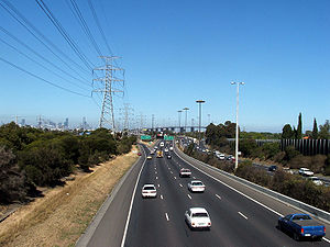
West Gate Freeway is a freeway in Melbourne
Melbourne
Melbourne is the capital and most populous city in the state of Victoria, and the second most populous city in Australia. The Melbourne City Centre is the hub of the greater metropolitan area and the Census statistical division—of which "Melbourne" is the common name. As of June 2009, the greater...
, Australia
Australia
Australia , officially the Commonwealth of Australia, is a country in the Southern Hemisphere comprising the mainland of the Australian continent, the island of Tasmania, and numerous smaller islands in the Indian and Pacific Oceans. It is the world's sixth-largest country by total area...
, linking Geelong to Melbourne CBD
Central business district
A central business district is the commercial and often geographic heart of a city. In North America this part of a city is commonly referred to as "downtown" or "city center"...
and beyond. It is also a link between Melbourne and the west and linking industrial and residential areas west of the Yarra River
Yarra River
The Yarra River, originally Birrarung, is a river in east-central Victoria, Australia. The lower stretches of the river is where the city of Melbourne was established in 1835 and today Greater Melbourne dominates and influences the landscape of its lower reaches...
with the city and port areas. The iconic West Gate Bridge
West Gate Bridge
The West Gate Bridge is a steel box girder cable-stayed bridge in Melbourne, Victoria, Australia. It spans the Yarra River, just north of its mouth into Port Phillip, and is a vital link between the inner city and Melbourne's western suburbs with the industrial suburbs in the west and with the city...
is a part of the freeway. The inner section of the freeway is currently being upgraded.
History
The freeway was originally designated in the 1969 Melbourne Transportation Plan1969 Melbourne Transportation Plan
The 1969 Melbourne Transportation Plan was a road and rail transport plan for Melbourne, the state capital of Victoria, Australia instituted by Henry Bolte's state government...
as the F9 Freeway corridor. The freeway was originally constructed in the late 1960s and was open for traffic by 1971, stretching from the intersection of the Princes Highway and Little Boundary Road in Altona North
Altona North, Victoria
Altona North is a suburb in Melbourne, Victoria, Australia, 10 km south-west from Melbourne's central business district. Its Local Government Area is the City of Hobsons Bay...
(later enlarged and named the West Gate Interchange) eastwards to Melbourne/Williamstown Roads just west of the mouth of the Yarra, initially designated with a F-82 shield. At the time, the only way to cross the Yarra west of the CBD was via a ferry crossing, which naturally saw far heavier demands once the Lower Yarra Freeway was officially opened.
The West Gate Bridge across the Yarra had started construction not too long before the opening of the freeway, and although delayed, when finally completed in 1978 allowed the freeway to extend over the river and directly into the CBD's south-western corner (via Rogers and Lorimer Streets). The freeway's name was changed to the West Gate Freeway to commemorate its opening, but the freeway also attracted tolls from anyone using the bridge (between Melbourne/Williamstown Road and Rogers Street) between 16 November 1978 and 29 November 1985. The toll plaza was located on the city side of the bridge where the service stations are now located. National Route 1 - previously designated along Geelong Road (Princes Highway West) and through the CBD via Smithfield and Flemington Roads and King Street
King Street, Melbourne
King Street is a main street in the Melbourne central business district. King Street is part of the Pacific Highway, and used to be part of National Route 1 until the city by-pass road linking the Monash Freeway with the Westgate Freeway was completed...
- was altered to use the freeway instead and rejoin Kings Way via Rogers, Lorimer and Clarendon Streets.
Due to how much extra traffic the West Gate Freeway was attracting, and also due to safety concerns having most of it filtered through connector streets in South Melbourne, the freeway was finally extended to Kings Way above the Grant Street intersection using elevated carriageways in 1987. Expansion of the original two lane freeway on the western side of the bridge to three lanes each way was carried out in 1993, and expansion to four lanes followed in 2000. With the subsequent completion of the Western Ring Road joining the West Gate Interchange to the freeway's west and CityLink
CityLink
CityLink is a system of tolled urban Highways in Melbourne, Victoria, Australia. The company Transurban was awarded the contract to augment two existing freeways and construct two new Toll roads—labelled the Western and Southern Links—directly linking a number of existing freeways to...
to the freeway's east, it also funnels traffic from northern and western suburbs around Melbourne, acting as a bypass freeway.
The entire freeway has been given an M1 designation. It gains the Tourist 2 shield at the Melbourne/Williamstown Road interchange in Spotswood, and loses it at the Montague Street interchange in Port Melbourne.
2008 Upgrade
Traffic volumes on the West Gate Freeway have grown steadily since opening, carrying up to 180,000 vehicles every day. Congestion frequently occurs at the Montague Street and Bolte Bridge interchanges due to conflicting traffic movements on and off the freeway. On 1 May 2008 the Minister for Roads and Ports Tim PallasTim Pallas
Timothy Hugh Pallas is an Australian politician. He has been an Australian Labor Party member of the Victorian Legislative Assembly since 2006, representing the electorate of Tarneit...
announced design details for the West Gate Freeway improvements.
They are:
- the addition of a new elevated road structure joining the outbound Kings Way on-ramp to the Freeway
- new traffic ramps over Montague Street
- an additional dedicated exit ramp from the Bolte Bridge to the Freeway
- widening of the freeway between Todd Road and Montague Street
- redesign of the Montague Street interchange.
To see a map of the new design, click here .
These works help reduce merging and weaving movements at key points on the freeway, leading to a smoother traffic flow and improved driver safety. As part of the works the Montague Street on-ramp city bound had been closed for approximately 18 months to enable the new one to be built.
Early works on the West Gate Freeway, including geo-technical investigations and service proving, commenced in late 2007. In early 2008 construction works started on the freeway widening, specifically in the South Melbourne area. New traffic lanes and ramps have be completed and opened in different stages with the total project scheduled for completion in late 2010.
The Freeway Upgrade was awarded the 2011 Australian Construction Achievement Award
Australian Construction Achievement Award
The Australian Construction Achievement Award is the Australian construction industry’s most prestigious award presented annually since 1997....
.
Road Conditions
The West Gate Freeway officially begins at the West Gate Interchange in Altona NorthAltona North, Victoria
Altona North is a suburb in Melbourne, Victoria, Australia, 10 km south-west from Melbourne's central business district. Its Local Government Area is the City of Hobsons Bay...
, with four lanes running in each direction. The freeway flows from the Western Ring Road
 and the Princes Freeway
Princes Freeway
The Princes Freeway is a , 2 section freeway, which links Melbourne to Geelong on the west and Morwell on the east . It continues beyond these extremities as the Princes Highway towards Adelaide to the west and Sydney to the east...
 with access to the Princes Highway (Geelong Road)
Princes Highway, Melbourne
The Princes Highway route through Melbourne, runs along former alignments with which originally Highway 1 now run on Melbourne's freeway network.-Werribee section:...
 also provided with city bound exit and Geelong bound entry ramps.
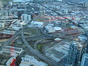
Soon after the bridge crossing, the freeway becomes elevated for its remaining length, with access ramps to Melbourne's central business district. Continuing to drive eastward on the freeway after the Power Street exit results in entering the electronically tolled CityLink
CityLink
CityLink is a system of tolled urban Highways in Melbourne, Victoria, Australia. The company Transurban was awarded the contract to augment two existing freeways and construct two new Toll roads—labelled the Western and Southern Links—directly linking a number of existing freeways to...
, and travelling through the Burnley Tunnel
Burnley Tunnel
The Burnley Tunnel is a tollway tunnel in Melbourne, in Victoria, Australia, which carries traffic eastbound from the West Gate Freeway to the Monash Freeway. It is part of the CityLink Tollway operated by Transurban. Running under the Yarra River and the inner suburbs of Richmond and Burnley, the...
.
Exits and Interchanges
West Gate Freeway  |
|||
| Westbound exits | Exit Number | Eastbound exits | |
| End West Gate Freeway continues as Princes Freeway West Princes Freeway The Princes Freeway is a , 2 section freeway, which links Melbourne to Geelong on the west and Morwell on the east . It continues beyond these extremities as the Princes Highway towards Adelaide to the west and Sydney to the east... to Geelong  |
W10 | Start West Gate Freeway from Princes Freeway West Princes Freeway The Princes Freeway is a , 2 section freeway, which links Melbourne to Geelong on the west and Morwell on the east . It continues beyond these extremities as the Princes Highway towards Adelaide to the west and Sydney to the east... |
|
| Ballarat, Adelaide Adelaide Adelaide is the capital city of South Australia and the fifth-largest city in Australia. Adelaide has an estimated population of more than 1.2 million... , Sydney Sydney Sydney is the most populous city in Australia and the state capital of New South Wales. Sydney is located on Australia's south-east coast of the Tasman Sea. As of June 2010, the greater metropolitan area had an approximate population of 4.6 million people... Western Ring Road |
|||
| Altona Altona, Victoria Altona is a suburb in Melbourne, Victoria, Australia, 13 km south-west from Melbourne's central business district. Its Local Government Area is the City of Hobsons Bay. At the 2006 Census, Altona had a population of 9685.... , Brooklyn Brooklyn, Victoria Brooklyn is a suburb in Melbourne, Victoria, Australia, 10 km west from Melbourne's central business district. Its Local Government Area are the Cities of Hobsons Bay and Brimbank. At the 2006 Census, Brooklyn had a population of 1583.-Industry:... Grieve Parade  |
W8 | no exit | |
| Altona Altona, Victoria Altona is a suburb in Melbourne, Victoria, Australia, 13 km south-west from Melbourne's central business district. Its Local Government Area is the City of Hobsons Bay. At the 2006 Census, Altona had a population of 9685.... , Sunshine Sunshine, Victoria Sunshine is a suburb of Melbourne, Victoria, Australia lying 11 to 13 km west of the CBD. Its Local Government Area is the City of Brimbank. At the 2006 Census, Sunshine had a population of 8,070.-History:... Millers Road  |
W7 | Sunshine Sunshine, Victoria Sunshine is a suburb of Melbourne, Victoria, Australia lying 11 to 13 km west of the CBD. Its Local Government Area is the City of Brimbank. At the 2006 Census, Sunshine had a population of 8,070.-History:... , Altona Altona, Victoria Altona is a suburb in Melbourne, Victoria, Australia, 13 km south-west from Melbourne's central business district. Its Local Government Area is the City of Hobsons Bay. At the 2006 Census, Altona had a population of 9685.... Millers Road |
|
| NEWPORT-SUNSHINE FREIGHT RAIL LINE | -- | NEWPORT-SUNSHINE FREIGHT RAIL LINE | |
| continues as |
W6 | Footscray Footscray, Victoria Footscray is a suburb 5 km west of Melbourne, Victoria, Australia. Its Local Government Area is the City of Maribyrnong. At the 2006 Census, Footscray had a population of 11,401.... , Williamstown Williamstown, Victoria Williamstown is a suburb in Melbourne, Victoria, Australia, 8 km south-west from Melbourne's central business district. Its Local Government Area is the City of Hobsons Bay. At the 2006 Census, Williamstown had a population of 12,733.... Williamstown Road  Melbourne Road |
|
| Williamstown Williamstown, Victoria Williamstown is a suburb in Melbourne, Victoria, Australia, 8 km south-west from Melbourne's central business district. Its Local Government Area is the City of Hobsons Bay. At the 2006 Census, Williamstown had a population of 12,733.... , Footscray Footscray, Victoria Footscray is a suburb 5 km west of Melbourne, Victoria, Australia. Its Local Government Area is the City of Maribyrnong. At the 2006 Census, Footscray had a population of 11,401.... Melbourne Road Williamstown Road |
duplexes with |
||
| WERRIBEE RAIL LINE | -- | WERRIBEE RAIL LINE | |
| WEST GATE BRIDGE West Gate Bridge The West Gate Bridge is a steel box girder cable-stayed bridge in Melbourne, Victoria, Australia. It spans the Yarra River, just north of its mouth into Port Phillip, and is a vital link between the inner city and Melbourne's western suburbs with the industrial suburbs in the west and with the city... |
-- | WEST GATE BRIDGE West Gate Bridge The West Gate Bridge is a steel box girder cable-stayed bridge in Melbourne, Victoria, Australia. It spans the Yarra River, just north of its mouth into Port Phillip, and is a vital link between the inner city and Melbourne's western suburbs with the industrial suburbs in the west and with the city... |
|
| Port Melbourne Port Melbourne, Victoria Port Melbourne is a suburb of Melbourne, Victoria, Australia, 5 km southwest of Melbourne's central business district. Its Local Government areas are the cities of Port Phillip and Melbourne. At the 2006 Census, Port Melbourne had a population of 13,293.... Todd Road |
W5 | Port Melbourne Port Melbourne, Victoria Port Melbourne is a suburb of Melbourne, Victoria, Australia, 5 km southwest of Melbourne's central business district. Its Local Government areas are the cities of Port Phillip and Melbourne. At the 2006 Census, Port Melbourne had a population of 13,293.... Todd Road |
|
| COLES EXPRESS WEST GATE SOUTH SERVICE CENTRE Coles Express Coles Express is an Australian chain of fuel and convenience stores. The business venture and corresponding fuel discount offer was launched in July 2003 in response to the similar offer by rival Woolworths Limited some years earlier, proving attractive to shoppers.Coles Myer purchased the retail... |
-- | COLES EXPRESS WEST GATE NORTH SERVICE CENTRE Coles Express Coles Express is an Australian chain of fuel and convenience stores. The business venture and corresponding fuel discount offer was launched in July 2003 in response to the similar offer by rival Woolworths Limited some years earlier, proving attractive to shoppers.Coles Myer purchased the retail... |
|
| Bendigo, Sydney Sydney Sydney is the most populous city in Australia and the state capital of New South Wales. Sydney is located on Australia's south-east coast of the Tasman Sea. As of June 2010, the greater metropolitan area had an approximate population of 4.6 million people... CityLink CityLink CityLink is a system of tolled urban Highways in Melbourne, Victoria, Australia. The company Transurban was awarded the contract to augment two existing freeways and construct two new Toll roads—labelled the Western and Southern Links—directly linking a number of existing freeways to...  |
W4 | Bendigo, Sydney Sydney Sydney is the most populous city in Australia and the state capital of New South Wales. Sydney is located on Australia's south-east coast of the Tasman Sea. As of June 2010, the greater metropolitan area had an approximate population of 4.6 million people... CityLink CityLink CityLink is a system of tolled urban Highways in Melbourne, Victoria, Australia. The company Transurban was awarded the contract to augment two existing freeways and construct two new Toll roads—labelled the Western and Southern Links—directly linking a number of existing freeways to... |
|
| duplexes with |
W3 | Docklands, South Melbourne South Melbourne, Victoria South Melbourne is an inner city suburb in Melbourne, Victoria, Australia, 2 km south from Melbourne's central business district. Its Local Government Area are the Cities of Port Phillip and Melbourne... Montague Street   |
|
| South Melbourne South Melbourne, Victoria South Melbourne is an inner city suburb in Melbourne, Victoria, Australia, 2 km south from Melbourne's central business district. Its Local Government Area are the Cities of Port Phillip and Melbourne... , Docklands Montague Street No access from Kings Way (Princes Highway) on-ramp. |
continues as |
||
| St Kilda St Kilda, Victoria St Kilda is an inner city suburb of Melbourne, Victoria, Australia, 6 km south from Melbourne's central business district. Its Local Government Area is the City of Port Phillip... , Melbourne City Centre Melbourne Melbourne is the capital and most populous city in the state of Victoria, and the second most populous city in Australia. The Melbourne City Centre is the hub of the greater metropolitan area and the Census statistical division—of which "Melbourne" is the common name. As of June 2009, the greater... Kings Way (Princes Highway) Princes Highway, Melbourne The Princes Highway route through Melbourne, runs along former alignments with which originally Highway 1 now run on Melbourne's freeway network.-Werribee section:...   |
W2 | St Kilda St Kilda, Victoria St Kilda is an inner city suburb of Melbourne, Victoria, Australia, 6 km south from Melbourne's central business district. Its Local Government Area is the City of Port Phillip... ; To Nepean Highway Nepean Highway runs south from the centre of Melbourne in Victoria, Australia to Portsea, along the eastern shore of Port Phillip. It is the primary road route to central Melbourne from Melbourne's southern suburbs.- History :...  Frankston FrankstonFrankston, Victoria Frankston is a suburb within the Greater Melbourne metropolitan area in Victoria, Australia. It is located 40 km southeast of the state capital Melbourne at the southernmost edge of Greater Melbourne, near the beginnings of the Mornington Peninsula... Kings Way (Princes Highway) Princes Highway, Melbourne The Princes Highway route through Melbourne, runs along former alignments with which originally Highway 1 now run on Melbourne's freeway network.-Werribee section:... |
|
| Southbank Southbank, Victoria Southbank is an inner city suburb of Melbourne, Victoria, Australia located direct south of the Yarra River opposite Melbourne's Hoddle Grid. The northernmost area is considered part of the Central Business District and Central Activities District of the city. Its Local Government Area are the... , Melbourne City Centre Melbourne Melbourne is the capital and most populous city in the state of Victoria, and the second most populous city in Australia. The Melbourne City Centre is the hub of the greater metropolitan area and the Census statistical division—of which "Melbourne" is the common name. As of June 2009, the greater... Power Street |
W1 | Southbank Southbank, Victoria Southbank is an inner city suburb of Melbourne, Victoria, Australia located direct south of the Yarra River opposite Melbourne's Hoddle Grid. The northernmost area is considered part of the Central Business District and Central Activities District of the city. Its Local Government Area are the... , Melbourne City Centre Melbourne Melbourne is the capital and most populous city in the state of Victoria, and the second most populous city in Australia. The Melbourne City Centre is the hub of the greater metropolitan area and the Census statistical division—of which "Melbourne" is the common name. As of June 2009, the greater... Power Street |
|
| Start West Gate Freeway continues from CityLink (Domain Tunnel) CityLink CityLink is a system of tolled urban Highways in Melbourne, Victoria, Australia. The company Transurban was awarded the contract to augment two existing freeways and construct two new Toll roads—labelled the Western and Southern Links—directly linking a number of existing freeways to... |
-- | End West Gate Freeway continues as CityLink (Burnley Tunnel) CityLink CityLink is a system of tolled urban Highways in Melbourne, Victoria, Australia. The company Transurban was awarded the contract to augment two existing freeways and construct two new Toll roads—labelled the Western and Southern Links—directly linking a number of existing freeways to... to Dandenong Dandenong, Victoria Dandenong is a suburb and major urban centre in metropolitan Melbourne, Victoria, Australia, 30 km south-east from Melbourne's central business district. Situated on Dandenong Creek and mostly flat land at the foothills of Mount Dandenong, it is the main administrative centre for the City of... / Traralgon Traralgon, Victoria Traralgon is a regional city located in the Latrobe Valley in the Gippsland region of Victoria, Australia. Traralgon is a city within the City of Latrobe.... |
|
See also
- Freeways in AustraliaFreeways in AustraliaThis is a list of freeways and motorways in Australia, sorted by states and territories and their corresponding routes. This list includes toll roads such as the CityLink freeway system in Melbourne. This list has over 70 entries...
- Freeways in Melbourne
- Road transport in Victoria
- West Gate BridgeWest Gate BridgeThe West Gate Bridge is a steel box girder cable-stayed bridge in Melbourne, Victoria, Australia. It spans the Yarra River, just north of its mouth into Port Phillip, and is a vital link between the inner city and Melbourne's western suburbs with the industrial suburbs in the west and with the city...