

Wellington Harbour
Encyclopedia
Wellington Harbour is the large natural harbour at the southern tip of New Zealand
's North Island
. New Zealand's capital, Wellington
, is on the western side of Wellington Harbour. The harbour was officially named Port Nicholson until it assumed its current name in the 1980s.
In Māori
the harbour is Te Whanganui-a-Tara
(the great harbour of Tara). A Māori name for Wellington, Pōneke is often said to be a transliteration of Port Nick, although this etymology is disputed.
, covering 70 km², with a two-km wide entrance at its southern end between Pencarrow Head and the Miramar Peninsula
.
 The harbour is of tectonic origin, and a major earthquake fault lies along its western shore. At the northern end of the harbour is the narrow triangular plain of the Hutt River
, which largely follows the line of the earthquake fault to the north-east. The city of Lower Hutt
is on this plain.
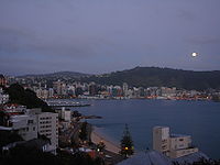
The central city suburbs spread around the hills overlooking the west and south-west of Wellington Harbour and its two large bays: Lambton Harbour and Evans Bay. Lambton Harbour is surrounded by the reclaimed land
of Wellington's central business district and contains the majority of the city's port facilities. Evans Bay is an inlet between Mt Victoria and the Miramar Peninsula on the flight path to low-lying Wellington Airport
. Another smaller bay popular for its beach and cafes is Oriental Bay
. To the east of the harbour are several small bays, most of which are populated by small coastal communities. The largest of these suburban settlements is Eastbourne
, east of the northern tip of the Miramar Peninsula.
Three small islands are in the harbour. To the south, close to Eastbourne, is Makaro/Ward Island
. Further north, close to the centre of the harbour, is the larger Matiu/Somes Island
, to the north of which is the tiny Mokopuna Island
.
The entrance to the harbour can be quite dangerous, especially since Cook Strait to the south is notoriously rough. Close to the harbour entrance lies Barrett Reef
, its rocks breaking the water's surface at low tide. It was here in 1968 that the inter-island passenger ferry Wahine
grounded during a storm, with the loss of 53 lives.
, close to the foreshore of Lower Hutt. A settlement was established there in early 1840, but the swampy land was unsuitable for development and the settlement (originally called Britannia but soon changed to Wellington) was moved to the present site of Wellington later the same year.
 Wellington Harbour is a significant port serving the lower North Island, with the Greater Wellington Regional Council-owned company Centreport
recording around 14,000 commercial shipping movements each year. The region's largest container port is in Wellington city and there is a tanker
terminal at Seaview, in Lower Hutt
. Wellington harbour ferries
began operating at the end of the 19th century and regular crossings from central Wellington to Days Bay continue today. The harbour is also used by inter-island ferries, linking Wellington to Picton
.
A project to develop a walking and cycling route around the harbour, the Great Harbour Way, has broad support from community groups and local authorities.
New Zealand
New Zealand is an island country in the south-western Pacific Ocean comprising two main landmasses and numerous smaller islands. The country is situated some east of Australia across the Tasman Sea, and roughly south of the Pacific island nations of New Caledonia, Fiji, and Tonga...
's North Island
North Island
The North Island is one of the two main islands of New Zealand, separated from the much less populous South Island by Cook Strait. The island is in area, making it the world's 14th-largest island...
. New Zealand's capital, Wellington
Wellington
Wellington is the capital city and third most populous urban area of New Zealand, although it is likely to have surpassed Christchurch due to the exodus following the Canterbury Earthquake. It is at the southwestern tip of the North Island, between Cook Strait and the Rimutaka Range...
, is on the western side of Wellington Harbour. The harbour was officially named Port Nicholson until it assumed its current name in the 1980s.
In Māori
Maori language
Māori or te reo Māori , commonly te reo , is the language of the indigenous population of New Zealand, the Māori. It has the status of an official language in New Zealand...
the harbour is Te Whanganui-a-Tara
Te Whanganui-a-Tara
Te Whanganui a Tara is a Māori name for Wellington, the capital city of New Zealand. Originally it described the actual harbour , but the term has come to be accepted as the name of the city as well...
(the great harbour of Tara). A Māori name for Wellington, Pōneke is often said to be a transliteration of Port Nick, although this etymology is disputed.
Geography
Wellington Harbour is an arm of Cook StraitCook Strait
Cook Strait is the strait between the North and South Islands of New Zealand. It connects the Tasman Sea on the west with the South Pacific Ocean on the east....
, covering 70 km², with a two-km wide entrance at its southern end between Pencarrow Head and the Miramar Peninsula
Miramar Peninsula
The Miramar Peninsula is a peninsula at the southeastern end of the city of Wellington, New Zealand.The peninsula is 800 hectares and contains the suburbs of Miramar, Maupuia, Strathmore and Seatoun...
.
Hutt River, New Zealand
thumb|300px|The Hutt River looking downstream.The Hutt River flows through the southern North Island of New Zealand...
, which largely follows the line of the earthquake fault to the north-east. The city of Lower Hutt
Lower Hutt
Lower Hutt is a city in the Wellington region of New Zealand. Its council has adopted the name Hutt City Council, but neither the New Zealand Geographic Board nor the Local Government Act recognise the name Hutt City. This alternative name can lead to confusion, as there are two cities in the...
is on this plain.
The central city suburbs spread around the hills overlooking the west and south-west of Wellington Harbour and its two large bays: Lambton Harbour and Evans Bay. Lambton Harbour is surrounded by the reclaimed land
Reclamation of Wellington Harbour
The reclamation of Wellington Harbour started in the 1850s, originally to increase the amount of usable flat land for Wellington city. Reclamations in the 1960s and 1970s were to meet the needs of container shipping and new cargo handling methods...
of Wellington's central business district and contains the majority of the city's port facilities. Evans Bay is an inlet between Mt Victoria and the Miramar Peninsula on the flight path to low-lying Wellington Airport
Wellington International Airport
Wellington International Airport is an international airport located in the suburb of Rongotai in Wellington, the capital city of New Zealand. It is a secondary hub and focus city for Air New Zealand and its subsidiaries...
. Another smaller bay popular for its beach and cafes is Oriental Bay
Oriental Bay
Oriental Bay is a suburb of Wellington, the capital city of New Zealand. Located close to the CBD on Wellington Harbour, it has the closest beach to the centre of the city and is thus a popular spot both for living and for visiting....
.
Eastbourne, New Zealand
Eastbourne is a suburb of Lower Hutt city in the southern North Island of New Zealand. Its population is about 4,600.-Location:An outer suburb, it is situated on the eastern shore of Wellington Harbour, 5 kilometres south of the main Lower Hutt urban area, and directly across the harbour from the...
, east of the northern tip of the Miramar Peninsula.
Three small islands are in the harbour. To the south, close to Eastbourne, is Makaro/Ward Island
Makaro/Ward Island
Makaro/Ward island is one of the three small islands in Wellington Harbour, at the Southern end of the North Island, New Zealand.Ward Island is on the eastern side of the harbour, about west of the town of Eastbourne. It is about long and wide, with the long axis aligned North/South...
. Further north, close to the centre of the harbour, is the larger Matiu/Somes Island
Matiu/Somes Island
Matiu/Somes Island, at , is the largest of three islands in the northern half of Wellington Harbour, New Zealand. It lies south of the suburb of Petone and the mouth of the Hutt River, and about northwest of the much smaller Makaro/Ward Island....
, to the north of which is the tiny Mokopuna Island
Mokopuna Island
Mokopuna Island is a small island in Wellington Harbour, New Zealand. It is about on its long axis and about across. It lies immediately north of the much larger Matiu/Somes Island, from which it is separated by a channel about wide....
.
The entrance to the harbour can be quite dangerous, especially since Cook Strait to the south is notoriously rough. Close to the harbour entrance lies Barrett Reef
Barrett Reef
The cluster of rocks that is Barrett Reef is one of the most treacherous reefs in New Zealand.It lies on the western side of the entrance of Wellington Harbour, on the approaches to the city of Wellington, at coordinates . The reef is named after Richard Barrett , a whaler and trader. Its Maori...
, its rocks breaking the water's surface at low tide. It was here in 1968 that the inter-island passenger ferry Wahine
Wahine disaster
The Wahine disaster occurred on 10 April 1968 when the TEV Wahine, a New Zealand inter-island ferry of the Union Company, foundered on Barrett Reef at the entrance to Wellington Harbour and capsized near Steeple Rock...
grounded during a storm, with the loss of 53 lives.
Early history
During the early years of European colonisation, Port Nicholson became a focus for settlement. The original site chosen for what is now the city of Wellington was at PetonePetone
Petone is a major suburb of the city of Lower Hutt in New Zealand. It is located at the southern end of the narrow triangular plain of the Hutt River, on the northern shore of Wellington Harbour...
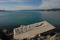
, close to the foreshore of Lower Hutt. A settlement was established there in early 1840, but the swampy land was unsuitable for development and the settlement (originally called Britannia but soon changed to Wellington) was moved to the present site of Wellington later the same year.
Transport
Centreport
Centreport may refer to:*Wellington Harbour, a large natural harbour at the southern tip of New Zealand's North Island.*CentrePort Canada, an inland port in Winnipeg and Rosser, Manitoba, Canada....
recording around 14,000 commercial shipping movements each year. The region's largest container port is in Wellington city and there is a tanker
Tanker (ship)
A tanker is a ship designed to transport liquids in bulk. Major types of tankship include the oil tanker, the chemical tanker, and the liquefied natural gas carrier.-Background:...
terminal at Seaview, in Lower Hutt
Lower Hutt
Lower Hutt is a city in the Wellington region of New Zealand. Its council has adopted the name Hutt City Council, but neither the New Zealand Geographic Board nor the Local Government Act recognise the name Hutt City. This alternative name can lead to confusion, as there are two cities in the...
. Wellington harbour ferries
Ferries in Wellington
Ferries in Wellington form a part of the Wellington public transport system, carrying commuters and tourists on Wellington Harbour. Ferries operate between central Wellington and Days Bay , Petone, Seatoun, and Matiu/Somes Island. They have previously served Miramar, Karaka Bay, and Eastbourne proper...
began operating at the end of the 19th century and regular crossings from central Wellington to Days Bay continue today. The harbour is also used by inter-island ferries, linking Wellington to Picton
Picton, New Zealand
Picton is a town in the Marlborough region of New Zealand. It is close to the head of Queen Charlotte Sound near the north-east corner of the South Island. The population was 2928 in the 2006 Census, a decrease of 72 from 2001...
.
A project to develop a walking and cycling route around the harbour, the Great Harbour Way, has broad support from community groups and local authorities.