
Valleys of the Alps
Encyclopedia
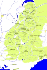
Rhine basin
High RhineHigh Rhine
The High Rhine is the name used in Germany for the part of the Rhine River that flows westbound from Lake Constance to Basel.The High Rhine begins at the outflow of the Rhine from the Untersee in Stein am Rhein and turns into the Upper Rhine in Basel...
- Aare
- LimmatLimmatThe Limmat is a river in Switzerland. It is the continuation of the Linth river, known as Limmat from the point of effluence from Lake Zurich, in the city of Zurich. From Zurich it flows in a northwesterly direction, after 35 km reaching the river Aare...
- LinthLinthThe Linth is a Swiss river starting above Linthal the mountains of Glarus near the Klausen Pass and flowing from there north through the Glarus valley passing Schwanden, where it is joined by its main tributary Sernft, Ennenda, the town of Glarus, Netstal, and Näfels, from where it is channeled to...
(GlarusGlarusGlarus is the capital of the Canton of Glarus in Switzerland. Glarus municipality since 1 January 2011 incorporates the former municipalities of Ennenda, Netstal and Riedern....
)- Lake WalenLake WalenWalensee is one of the larger lakes in Switzerland, for about 2/3 of its surface in the Canton of St. Gallen and for 1/3 in the Canton of Glarus. It is also known as Lake Walen or Lake Walenstadt, after Walenstadt. Other towns and villages at the lake include: Weesen, Quinten, Quarten, and Murg.The...
- Seez
- Klöntal
- SernftalSernftalThe Sernftal or Kleintal is an alpine valley within Glarus Süd, in the canton of Glarus, Switzerland. It is formed by the Sernf, a right tributary of the Linth. Situated in the Sernftal are the villages of Elm and Engi...
- Lake Walen
- Linth
- Reuss RiverReuss RiverThe Reuss is a river in Switzerland. With a length of and a drainage basin of , it is the fourth largest river in Switzerland...
- Lake LucerneLake LucerneLake Lucerne is a lake in central Switzerland and the fourth largest in the country.The lake has a complicated shape, with bends and arms reaching from the city of Lucerne into the mountains. It has a total area of 114 km² , an elevation of 434 m , and a maximum depth of 214 m . Its volume is 11.8...
- Sarner AaSarner AaThe Sarner Aa is a river in Switzerland. It drains the Lungerersee and is a tributary of Lake Lucerne, which is drained by the Reuss River....
(Brünig connects to the Aare basin) - MuotathalMuotathalMuotathal is a municipality in Schwyz District in the canton of Schwyz in Switzerland. The eponymous valley is formed by the Muota river, which joins Lake Lucerne at Brunnen.-Geography:...
- Sarner Aa
- Schächen, Klausen PassKlausen PassKlausen Pass is a high mountain pass in the Swiss Alps connecting the cantons of Uri and Glarus. The pass road from Altdorf leads through the Schächen Valley, the pass and Urnerboden to Linthal in Glarus....
connects to GlarusGlarusGlarus is the capital of the Canton of Glarus in Switzerland. Glarus municipality since 1 January 2011 incorporates the former municipalities of Ennenda, Netstal and Riedern.... - UrserentalUrserentalThe Urserental is the valley of the upper Reuss River in Uri, Switzerland, running southwest to northeast, from Realp to Hospental and Andermatt....
- Susten PassSusten PassSusten Pass is a mountain pass in the Swiss Alps. The pass road, built from 1938–1945, connects Innertkirchen in the canton of Bern with Wassen in the canton of Uri...
connects to the Gadmertal - Furka PassFurka PassFurka Pass is a high mountain pass in the Swiss Alps connecting Gletsch, Valais with Realp, Uri. The Furka-Oberalp-Bahn line through the Furka Tunnel bypasses the pass...
connects to the Goms
- Lake Lucerne
- Lake ThunLake ThunLake Thun is an Alpine lake in the Bernese Oberland in Switzerland. It took its name from the city of Thun, on its northern shore.Lake Thun's approximately 2,500 km² large catchment area frequently causes local flooding after heavy rainfalls...
, Bernese OberlandBernese OberlandThe Bernese Oberland is the higher part of the canton of Bern, Switzerland, in the southern end of the canton: The area around Lake Thun and Lake Brienz, and the valleys of the Bernese Alps .The flag of the Bernese Oberland consists of a black eagle in a gold field The Bernese Oberland (Bernese...
- Kander
- SimmentalSimmentalSimmental is an alpine valley in the Bernese Oberland of Switzerland. It expands from Lenk to Boltigen, in a more or less South-North direction , and from there to the valley exit at Wimmis near Spiez it takes a West-East orientation . It comprises the municipalities of Lenk, St...
- Diemtigental (Chirel, Fildrich (Narebach, Senggibach, Gurbsbach))
- Suld
- Chiene
- Engstligental
- Kandertal
- Simmental
- Lombach, HabkernHabkernHabkern is a municipality in the Interlaken-Oberhasli administrative district in the canton of Bern in Switzerland.-Origin of the name:The name Habkern comes from the Old High German word habuh and the ending -arra, indicating that something is in large numbers. Habkern is thus "the place where...
- Brienzersee, InterlakenInterlakenInterlaken is a municipality in the Interlaken-Oberhasli administrative district in the Canton of Bern in Switzerland, a well-known tourist destination in the Bernese Oberland.-History:...
- LütschineLütschineThe Lütschine is a river in the Bernese Oberland, Switzerland.It flows from Zweilütschinen, where its two tributaries join, on a length of 8.6 km through the Bödeli and into Lake Brienz at Bönigen....
- Saxettal
- Schwarze Lütschine, LütschentalLütschentalLütschental is a municipality in the Interlaken-Oberhasli administrative district in the canton of Bern in Switzerland.-History:Lütschental is first mentioned in 1238 as Liscinthal. In 1275 it was mentioned as Lyzental.-Geography:...
, GrindelwaldGrindelwaldGrindelwald is a municipality in the Interlaken-Oberhasli administrative district in the canton of Bern in Switzerland. The village is located at above sea level in the Bernese Alps.-Winter sports:...
, Grosse ScheideggGrosse ScheideggGrosse Scheidegg is a high mountain pass in the Bernese Alps in Switzerland, connecting Grindelwald and Meiringen.The road over the pass is open only to bus traffic...
connects to ReichenbachtalReichenbachtalReichenbachtal is an alpine valley in Oberhasli, Canton of Berne, Switzerland. It is situated within the municipality of Schattenhalb, connecting Meiringen with the Grosse Scheidegg pass towards Grindelwald... - Weisse Lütschine, Lauterbrunnental, LauterbrunnenLauterbrunnenLauterbrunnen is a municipality in the Interlaken-Oberhasli administrative district in the canton of Bern in Switzerland.The municipality lies in the Lauterbrunnen Valley and comprises the villages Lauterbrunnen, Wengen, Mürren, Gimmelwald, Stechelberg and Isenfluh...
- Sefinental
- Giessbach
- HaslitalHaslitalThe Hasli region is a historical Landvogtei or Talschaft in the Bernese Oberland, Switzerland, bordering on the cantons of Obwalden, Uri and Wallis...
, MeiringenMeiringen-References:...
- ReichenbachtalReichenbachtalReichenbachtal is an alpine valley in Oberhasli, Canton of Berne, Switzerland. It is situated within the municipality of Schattenhalb, connecting Meiringen with the Grosse Scheidegg pass towards Grindelwald...
(Rychenbach, Seilibach), Grosse ScheideggGrosse ScheideggGrosse Scheidegg is a high mountain pass in the Bernese Alps in Switzerland, connecting Grindelwald and Meiringen.The road over the pass is open only to bus traffic...
connects to Schwarze Lütschine - Gadmertal (Gadmerwasser, Triftwasser), Susten PassSusten PassSusten Pass is a mountain pass in the Swiss Alps. The pass road, built from 1938–1945, connects Innertkirchen in the canton of Bern with Wassen in the canton of Uri...
connects to the Reuss - Ürbachtal
- Rindertal (Ärlenbach), Bächliltal (Bächlisbach)
- Grimsel PassGrimsel PassGrimsel Pass is a Swiss high mountain pass.-Position:It connects the valley of the Rhone River in the canton of Valais and the Haslital in the canton of Bern....
connects to the Goms and the Furka PassFurka PassFurka Pass is a high mountain pass in the Swiss Alps connecting Gletsch, Valais with Realp, Uri. The Furka-Oberalp-Bahn line through the Furka Tunnel bypasses the pass...
- Reichenbachtal
- Lütschine
- Kander
- Limmat
- Tösstal
- ToggenburgToggenburgToggenburg is the name given to the upper valley of the Thur River, in the Swiss Canton of St. Gallen. Currently, it is one of the eight constituencies into which the canton is divided....
(Thur River) - Rhine ValleyRhine ValleyThe Rhine Valley is a glacial alpine valley, formed by the Alpine Rhine , i.e. the section of the Rhine River between the confluence of the Anterior Rhine and Posterior Rhine at Reichenau and its mouth at Lake Constance....
(Alpine Rhine)- IllIll (Austria)The Ill is a 72 km long tributary of the Rhine river in the western Austrian province of Vorarlberg.It flows from the northern slopes of the Silvretta mountain range and then runs north-west through Vorarlberg. The Ill passes through the Montafon and Walgau valleys and the town Feldkirch...
- Meng
- TaminaTaminaThe Tamina River in Switzerland originates near the Egghorn . First her course follows a North to South direction through the Marchtal....
- PrättigauPrättigauThe Prättigau Valley, in the canton of Graubünden , Switzerland, is home to the world famous ski resorts of Klosters and neighbouring Davos in the Landwasser Valley....
(Landquart River) - Schanfigg (PlessurPlessur (river)The Plessur is a 33 km long right tributary of the Rhine River running through the Swiss canton of Graubünden. The river source is near the municipality of Arosa in the Plessur Range...
) - posterior RhineHinterrhein (river)The Hinterrhein is one of the initial tributaries of the Rhine in the Canton of Graubünden in Switzerland, flowing from the village Hinterrhein near the San Bernardino pass through the Rheinwald valley into a gorge called Roflaschlucht...
- Albula RiverAlbula RiverAlbula is a river of Switzerland, a tributary of Hinterrhein . Length: 36 km , Basin: 950 km² ....
- Landwasser (DavosDavosDavos is a municipality in the district of Prättigau/Davos in the canton of Graubünden, Switzerland. It has a permanent population of 11,248 . Davos is located on the Landwasser River, in the Swiss Alps, between the Plessur and Albula Range...
) - Oberhalbstein (Julier PassJulier PassThe Julier Pass is a mountain pass in Switzerland, in the Albula Range of the Alps. It connects the Engadin valley with the rest of Graubünden...
connects to the Inn basin) - Albulatal, BergünBergünBergün/Bravuogn , is a municipality in the district of Albula in the canton of Graubünden in Switzerland. The double name has been the official name since 1943.-Geography:...
, PredaPredaPreda is locality within the municipality of Bergün, district of Albula, Canton Graubünden, Switzerland.-Transportation:Rhaetian Railway operates services to Preda ....
(Albula PassAlbula PassAlbula Pass is a Swiss mountain pass in the canton of Graubünden. It lies in the Albula Range of the Alps...
connects to the Inn basin)
- Landwasser (Davos
- Averstal
- Splügen PassSplügen PassThe Splügen Pass is a high mountain pass which marks the boundary between the Lepontine and Rhaetian Alps....
connects to the MeraMera RiverThe Mera is a river in Switzerland and Italy. Its source is near the Maloja Pass, in Graubünden, Switzerland. It flows west through the Val Bregaglia and crosses the Italian border near Soglio...
basin, San Bernardino PassSan Bernardino PassSan Bernardino Pass is a high mountain pass in the Swiss Alps connecting the Hinterrhein and the Mesolcina valleys between Thusis and Bellinzona . Located in the far eastern side of the Western Alps it is not to be confused with the Great St. Bernard Pass and the Little St. Bernard Pass...
to the Moesa basin
- Albula River
- anterior Rhine
- Safien valleySafien valleyThe Safien valley is an alpine valley of the Canton of Grisons, branching off the Vorderrhein valley. Part of the Surselva district, it comprises the four municipalities of Valendas, Versam, Tenna und Safien....
- Val LumneziaVal LumneziaThe Val Lumnezia is a Swiss high Alpine valley made up of the main Lumnezia valley, and a side valley, the Valser valley to the south-east. Located at , it forms also Municipality, which is composed of the communities Vella, Vignogn, Degen, Suraua, Vrin, Cumbel, Morissen, Vals and Lumbrein. Its...
(GlennerGlennerThe Glenner is a Whitewater river in Graubünden. Glenner was also the name of a district in this area, which was annexed by Surselva District in 2001....
)- Valsertal
- Surselva (Oberalppass connects to the Reuss basin, Lukmanier PassLukmanier PassLukmanier Pass is a pass in the Swiss Alps.The road from Disentis/Mustér in the canton of Graubünden leads through the Val Medel across the pass to the Blenio valley and Biasca in the canton of Ticino.The Pass is kept opened during the winter.-See also:* List of highest paved roads in Europe*...
to the Leventina)
- Safien valley
- Ill
Danube basin (Black Sea)
DanubeDanube
The Danube is a river in the Central Europe and the Europe's second longest river after the Volga. It is classified as an international waterway....
- Sava
- PlanicaPlanicaPlanica is an alpine valley in northwestern Slovenia, extending south from the border village of Rateče, not far from another well-known ski resort, Kranjska Gora. Further south, the valley extends into the Tamar Valley, a popular hiking destination in Triglav National Park.Planica is famous for...
(Julian AlpsJulian AlpsThe Julian Alps are a mountain range of the Southern Limestone Alps that stretches from northeastern Italy to Slovenia, where they rise to 2,864 m at Mount Triglav. They are named after Julius Caesar, who founded the municipium of Cividale del Friuli at the foot of the mountains...
)
- Planica
- DravaDravaDrava or Drave is a river in southern Central Europe, a tributary of the Danube. It sources in Toblach/Dobbiaco, Italy, and flows east through East Tirol and Carinthia in Austria, into Slovenia , and then southeast, passing through Croatia and forming most of the border between Croatia and...
- DravinjaDravinjaThe Dravinja River is the largest tributary of the Drava River in Slovenia. It is long. Its source is on the Pohorje Massif southwest of Mount Rogla about 1,150 m above sea level. The river passes Zreče, the town of Slovenske Konjice, the ruins of the fort at Zbelovo, Poljčane, Makole, Štatenberg...
- Gail RiverGail RiverGail is the name of a river in the Southern Limestone Alps of southern Austria, a right tributary of the Drava River.Originating in the Tyrolean municipality of Obertilliach, it flows from west to east, reaching Carinthia in Lesachtal, running through the Gail Valley parallel to the borders with...
- MežaMežaThe Meža is a long river in Carinthia, Slovenia. It has its source on the Austrian side of the state border near Mount Olševa, becomes subterranean a kilometer from its source, and reappears on the surface in Koprivna near Črna na Koroškem, Slovenia. It is the central river of the Mežica Valley...
- Gurk RiverGurk RiverThe Gurk is a river in Carinthia, Austria. It is the second longest river in that state after the Drava.A northern tributary of the river Drava, the 120 km long Gurk flows from under Nock Mountains, near the border of Austrian provinces of Styria and Carinthia. Its sources are two small lakes, the...
- Mura
- Dravinja
- Inn RiverInn RiverThe Inn is a river in Switzerland, Austria and Germany. It is a right tributary of the Danube and is approximately 500km long. The highest point of its drainage basin is the summit of Piz Bernina, at 4,049 metres.- Geography :...
- ÖtztalÖtztalThe Ötztal is a 65-kilometer long alpine valley in the Austrian state of Tyrol. The Ötztaler Ache river flows through the valley in a northern direction. The Ötztal separates the Stubai Alps in the east from the Ötztal Alps in the west. The northern end of the valley is at the confluence of the...
- ZillertalZillertalThe Zillertal is the biggest valley branching off the Inn valley in Tyrol, Austria drained by the river Ziller. It is surrounded by the strongly glaciated Zillertal Alps to the south and east, the lower grass peaks of the Kitzbühel Alps to the east and Tux Alps to the west...
- EngadinEngadinThe Engadin or Engadine is a long valley in the Swiss Alps located in the canton of Graubünden in southeast Switzerland. It follows the route of the Inn River from its headwaters at Maloja Pass running northeast until the Inn flows into Austria one hundred kilometers downstream...
- Ötztal
Rhone basin

Rhône
Rhone can refer to:* Rhone, one of the major rivers of Europe, running through Switzerland and France* Rhône Glacier, the source of the Rhone River and one of the primary contributors to Lake Geneva in the far eastern end of the canton of Valais in Switzerland...
- Durance River
- Verdon
- Drôme RiverDrôme RiverThe Drôme , a river in southeastern France, has a length of 110 km long and forms a left tributary of the Rhône River. Its source is in the western foothills of the Alps, near the village Valdrôme...
- Isère
- Drac RiverDrac RiverThe Drac is a 130 km long river in southeastern France, left tributary of the Isère. It is formed by the confluence of the Drac Noir and the Drac Blanc, that both rise in the southern part of the Massif des Écrins. It flows through several reservoirs, including the Lac de Monteynard-Avignonet....
- Drac River
- Fier River
- Arve River
- ChablaisChablaisChablais was a province of the Duchy of Savoy. Its capital was Thonon-les-Bains.This region is currently divided into three territories, the Chablais savoyard, the Chablais valaisan, and the Chablais vaudois, and is now split across two countries: France and Switzerland...
- ValaisValaisThe Valais is one of the 26 cantons of Switzerland in the southwestern part of the country, around the valley of the Rhône from its headwaters to Lake Geneva, separating the Pennine Alps from the Bernese Alps. The canton is one of the drier parts of Switzerland in its central Rhône valley...
- Dranse River
- Val de Banse
- Val d'Entremont
- Val d'HérensVal d'HérensVal d'Hérens is an alpine valley in the Valais canton of Switzerland. It was formed by the Hérens glacier, which retreated at the end of the last ice age....
, Val d'Herémece - Val d'AnniviersVal d'AnniviersThe val d'Anniviers is a Swiss alpine valley, situated in the district of Sierre in Valais, which extends south of the Rhône Valley. The valley was home to six municipalities: Ayer, Chandolin, Grimentz, Saint-Jean, Saint-Luc, Vissoie, Vercorin and Zinal. The citizens of those municipalities agreed...
- Turtmanntal
- LötschentalLötschentalThe Lötschental is the largest valley on the northern side of the Rhône valley in the canton of Valais in Switzerland. It lies in the Bernese Alps, with the river Lonza running down the length of the valley from its source within the Langgletscher....
- Vispa River
- SaastalSaastalThe Saastal or the Saas Valley is an alpine valley in the Canton of Valais, Switzerland. It is separated from the Mattertal valley by the Dom....
- MattertalMattertalThe Matter Valley is located in southwestern Switzerland, south of the Rhone valley in the canton of Valais. The village of Zermatt is the most important settlement of the valley, which is surrounded by many four-thousanders, including the Matterhorn.-Geography:Located in the Pennine Alps, the...
- Zmuttal
- Saastal
- Goms (Nufenen PassNufenen PassNufenen Pass is the highest mountain pass in the Swiss Alps. It lies between the summits of Pizzo Gallina and Nufenestock ....
to the Leventina, Grimsel PassGrimsel PassGrimsel Pass is a Swiss high mountain pass.-Position:It connects the valley of the Rhone River in the canton of Valais and the Haslital in the canton of Bern....
to the HaslitalHaslitalThe Hasli region is a historical Landvogtei or Talschaft in the Bernese Oberland, Switzerland, bordering on the cantons of Obwalden, Uri and Wallis...
, Furka PassFurka PassFurka Pass is a high mountain pass in the Swiss Alps connecting Gletsch, Valais with Realp, Uri. The Furka-Oberalp-Bahn line through the Furka Tunnel bypasses the pass...
to the Reuss)- Binntal
- Dranse River
Po basin
Po RiverPo River
The Po |Ligurian]]: Bodincus or Bodencus) is a river that flows either or – considering the length of the Maira, a right bank tributary – eastward across northern Italy, from a spring seeping from a stony hillside at Pian del Re, a flat place at the head of the Val Po under the northwest face...
- MincioMincioMincio is a river in the Lombardy region of northern Italy.Called the Sarca River before entering Lake Garda, it flows from there about 65 km past Mantua into the Po River....
- OglioOglioThe Oglio is a left-side tributary of the Po River in Lombardy, Italy. It is 280 km long....
(Lake IseoLake IseoLake Iseo or Lago d'Iseo or Sebino is the fourth largest lake in Lombardy, Italy, fed by the Oglio river.It is in the north of the country in the Val Camonica area, near the cities of Brescia and Bergamo. The lake is almost equally divided between the Provinces of Bergamo and Brescia...
)- Val CamonicaVal CamonicaVal Camonica is one of the largest valleys of the central Alps, in eastern Lombardy, about 90 km long. It starts from the Tonale Pass, at 1883 metres above sea level and ends at Corna Trentapassi, in the comune of Pisogne, near Lake Iseo...
- Val Camonica
- Adda RiverAdda RiverThe Adda is a river in North Italy, a tributary of the Po. It rises in the Alps near the border with Switzerland and flows through Lake Como. The Adda joins the Po a few kilometres upstream of Cremona. It is 313 kilometres long...
(Lake ComoLake ComoLake Como is a lake of glacial origin in Lombardy, Italy. It has an area of 146 km², making it the third largest lake in Italy, after Lake Garda and Lake Maggiore...
)- Breggia
- Val BregagliaVal BregagliaThe Val Bregaglia or Bergell Tal is an alpine valley of Switzerland and Italy at the base of which runs the river Mera River...
(Mera RiverMera RiverThe Mera is a river in Switzerland and Italy. Its source is near the Maloja Pass, in Graubünden, Switzerland. It flows west through the Val Bregaglia and crosses the Italian border near Soglio...
)- Valle SplugaValle SplugaThe Valle Spluga, also known as the Val San Giacomo, is an Alpine valley in the north Italian Province of Sondrio , which extends from the Splügen Pass, on the border with Switzerland, south to Chiavenna. It is the valley of the river Liro....
(Liro (stream - SO))
- Valle Spluga
- Val BrembanaVal BrembanaVal Brembana is a valley in Lombardy, northern Italy. It takes its name from the river crossing it, the Brembo.The Bergamo Alps form the valley's northern limits, notably the Tre Signori and Diavolo di Tenda Peaks, while at south lies the plain of Bergamo...
- ValsassinaValsassinathumb|250px|The Valsassina plateau.Valsassina is a valley in the Alps of Lombardy, northern Italy, within the province of Lecco.It is included between the Grigne range from West, and the Bergamo Prealps which, in a half-circle stretching from North to East, separate it from the valley of the area...
(PiovernaPiovernaThe Pioverna is a torrente of Lombardy in northern Italy. The stream is born in the Grigna massif and flows north and west through the Valsassina, forming a gorge at Bellano before entering Lake Como...
) - ValtellinaValtellinaValtellina or the Valtelline valley ; is a valley in the Lombardy region of northern Italy, bordering Switzerland. Today it is known for its skiing, its hot spring spas, its cheeses and its wines...
- LambroLambroFor the river in Cilento, see Lambro . For the genus, see Lambro .The Lambro is a river of Lombardy, northern Italy, a left tributary of the Po....
- TicinoTicinoCanton Ticino or Ticino is the southernmost canton of Switzerland. Named after the Ticino river, it is the only canton in which Italian is the sole official language...
- Val MesolcinaVal MesolcinaThe Misox is an alpine valley of the Grisons, Switzerland, stretching from the San Bernardino Pass to Grono where it joins the Calanca Valley...
- Valle MaggiaValle MaggiaValle Maggia is an alpine valley of the Maggia River in Ticino, the Italian canton of Switzerland.The valley is dotted with small picturesque villages with traditional stone houses, vineyards and dairy farms...
- Verzasca
- ToceToceThe Toce is a river in Piedmont, Italy, which stretches the length of the Val d'Ossola from the Swiss border to Lake Maggiore into which it debouches near Fondotoce in the Commune of Verbania. The river is c. 76 kilometres in length and is formed in the upper Val Formazza by the confluence of a...
- Val Mesolcina
- AgognaAgognaThe Agogna is a narrow long river which runs through the Italian regions of Piedmont and Lombardy. It is a left side tributary of the river Po....
- TanaroTanaro RiverThe Tanaro , known as Tanarus in ancient times, is a 276 km-long river in northwestern Italy. It rises in the Ligurian Alps, close to the border with France and is the most significant right-side tributary to the Po in terms of length, size of drainage basin and discharge.-Source:The Tanaro proper...
- SesiaSesia RiverThe Sesia is a river in north-western Italy, tributary to the Po. Its sources are the glaciers of Monte Rosa at the border with Switzerland. It flows through the Alpine valley Valsesia and the towns Varallo Sesia, Quarona, Borgosesia and Vercelli...
- Aosta Valley (Dora BalteaDora BalteaDora Baltea or Doire Baltée , is a river in northern Italy. It is a left-hand tributary of the Po River, and is about 160 km long...
) - ToceToceThe Toce is a river in Piedmont, Italy, which stretches the length of the Val d'Ossola from the Swiss border to Lake Maggiore into which it debouches near Fondotoce in the Commune of Verbania. The river is c. 76 kilometres in length and is formed in the upper Val Formazza by the confluence of a...
- OrcoOrcoThe Orco is an Italian river. It originates in the glaciers of the Piedmontese slopes of Gran Paradiso, and after about 90 km reaches the Po River near Chivasso...
- Stura di LanzoStura di LanzoStura di Lanzo is a 65 km long river in north-western Italy . It is formed from several tributaries near Lanzo Torinese. It flows into the river Po in Turin.The name Stura has Celtic origin: stur, which means "to fall".-External links:...
- Dora RipariaDora RipariaThe Dora Riparia is an Italian river, a left-hand tributary of the Po. It is 125 km long, with a 1,231 km² drainage basin. It originates in the Cottian Alps, close to the Col de Montgenèvre in France, where it is called the Piccola Dora...
- MairaMairaThe Maira is an Italian river, a right tributary of the Po River, which runs through the province of Cuneo in eastern Piedmont. Its source is in the Cottian Alps near the Col de Mary on the French border...
- VaraitaVaraitaThe Varaita is a 75 km river of the Province of Cuneo in north-west Italy. It is the first right tributary of the Po River....
- PellicePelliceThe Pellice is a Italian torrent, which runs through the Province of Turin. It is a tributary of the Po River, into which it flows near Villafranca Piemonte....
See also
- Geography of the AlpsGeography of the AlpsThe Alps cover a large area. This article describes the delimitation of the Alps as a whole and of subdivisions of the range, follows the course of the main chain of the Alps and discusses the lakes and glaciers found in the region....
- Principal passes of the AlpsPrincipal passes of the AlpsThis article lists the principal mountain passes and tunnels in the Alps, and gives a history of transport across the Alps.-Main chain:From west to east:-Other passes:Detailed lists of passes are given by Alpine subdivision, see the following articles:...
- OrographyOrographyOrography is the study of the formation and relief of mountains, and can more broadly include hills, and any part of a region's elevated terrain...
- AlpsAlpsThe Alps is one of the great mountain range systems of Europe, stretching from Austria and Slovenia in the east through Italy, Switzerland, Liechtenstein and Germany to France in the west....
- List of highest paved roads in Europe
- List of mountain passes