
Upper Black Eddy-Milford Bridge
Encyclopedia
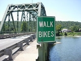
The Upper Black Eddy-Milford Bridge is a free bridge over the Delaware River
, owned and operated by the Delaware River Joint Toll Bridge Commission
. The bridge carries Bridge Street, connecting CR 519
in Milford
, Hunterdon County
, New Jersey
, with Pennsylvania Route 32
in Upper Black Eddy
, Bucks County
, Pennsylvania
. The bridge currently has a 55 ton weight limit, the heaviest free bridge on the Delaware.
could not handle. The bridge was severely damaged by the flood of 1903 in which it lost one of its three wooden spans. The ferry was put back into service while the bridge was repaired however, and the wood spans remained in use until replaced by the current steel bridge in the nineteen thirties. Only the stone piers were reused at that time. Two more flood
s damaged the bridge, including the Flood of 1955 in the aftermath of both Hurricane Connie
and Hurricane Diane
. The 1955 flood left the bridge under seven feet of water, and while not completely destroying the bridge, did cause structural damage.
Delaware River
The Delaware River is a major river on the Atlantic coast of the United States.A Dutch expedition led by Henry Hudson in 1609 first mapped the river. The river was christened the South River in the New Netherland colony that followed, in contrast to the North River, as the Hudson River was then...
, owned and operated by the Delaware River Joint Toll Bridge Commission
Delaware River Joint Toll Bridge Commission
The Delaware River Joint Toll Bridge Commission is a bistate, public agency charged with providing safe, dependable and efficient river crossings between Pennsylvania and New Jersey. The DRJTBC was established under legislation enacted in the two states in 1934. The federal Compact for the...
. The bridge carries Bridge Street, connecting CR 519
County Route 519 (New Jersey)
County Route 519 is a county highway in the U.S. state of New Jersey. The highway extends from Daniel Bray Highway in Delaware Township to the New York state line in Wantage Township...
in Milford
Milford, New Jersey
Milford is a Borough located in western Hunterdon County, New Jersey. As of the United States 2010 Census, the borough population was 1,233....
, Hunterdon County
Hunterdon County, New Jersey
Hunterdon County is a county located in the western section of the U.S. state of New Jersey. As of the 2010 United States Census, the population was 128,349. It is part of the New York Metropolitan Area. Its county seat is Flemington....
, New Jersey
New Jersey
New Jersey is a state in the Northeastern and Middle Atlantic regions of the United States. , its population was 8,791,894. It is bordered on the north and east by the state of New York, on the southeast and south by the Atlantic Ocean, on the west by Pennsylvania and on the southwest by Delaware...
, with Pennsylvania Route 32
Pennsylvania Route 32
Pennsylvania Route 32 is a scenic two-lane highway that runs along the side of the Delaware River in Bucks County, Pennsylvania. It begins at U.S. 1 in Falls Township and ends at Pennsylvania Route 611 near the village of Kintnersville...
in Upper Black Eddy
Upper Black Eddy, Pennsylvania
The village of Upper Black Eddy aka "UBE" is located in northern Bucks County, Pennsylvania who have second homes here due to the early american 18th and 19th century charm, rural character of the area and short distance from the "City" located only 58 miles to the east.Upper Black Eddy...
, Bucks County
Bucks County, Pennsylvania
- Industry and commerce :The boroughs of Bristol and Morrisville were prominent industrial centers along the Northeast Corridor during World War II. Suburban development accelerated in Lower Bucks in the 1950s with the opening of Levittown, Pennsylvania, the second such "Levittown" designed by...
, Pennsylvania
Pennsylvania
The Commonwealth of Pennsylvania is a U.S. state that is located in the Northeastern and Mid-Atlantic regions of the United States. The state borders Delaware and Maryland to the south, West Virginia to the southwest, Ohio to the west, New York and Ontario, Canada, to the north, and New Jersey to...
. The bridge currently has a 55 ton weight limit, the heaviest free bridge on the Delaware.
History
Following a great flood in 1841, the original wood timbered, covered bridge was built in 1842, to accommodate business needs that ferriesFerry
A ferry is a form of transportation, usually a boat, but sometimes a ship, used to carry primarily passengers, and sometimes vehicles and cargo as well, across a body of water. Most ferries operate on regular, frequent, return services...
could not handle. The bridge was severely damaged by the flood of 1903 in which it lost one of its three wooden spans. The ferry was put back into service while the bridge was repaired however, and the wood spans remained in use until replaced by the current steel bridge in the nineteen thirties. Only the stone piers were reused at that time. Two more flood
Flood
A flood is an overflow of an expanse of water that submerges land. The EU Floods directive defines a flood as a temporary covering by water of land not normally covered by water...
s damaged the bridge, including the Flood of 1955 in the aftermath of both Hurricane Connie
Hurricane Connie
Hurricane Connie was the first in a series of hurricanes to strike North Carolina during the 1955 Atlantic hurricane season. Connie struck as a Category 1, causing major flooding and inflicting extensive damage to the Outer Banks and inland to Raleigh....
and Hurricane Diane
Hurricane Diane
Hurricane Diane was one of three hurricanes to hit North Carolina during the 1955 Atlantic hurricane season, striking an area that had been hit by Hurricane Connie five days earlier...
. The 1955 flood left the bridge under seven feet of water, and while not completely destroying the bridge, did cause structural damage.