

U.S. Route 93
Encyclopedia
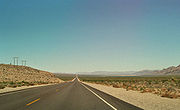
U.S. Route 93 is a major north–south United States highway in the western United States
. The southern terminus is at U.S. Route 60
in Wickenburg, Arizona
. The northern terminus is at the Canadian border north of Eureka
in Lincoln County, Montana
, where the roadway continues into Roosville, British Columbia
, as Highway 93. Major cities that US 93 travels through include Las Vegas, Nevada
, Twin Falls, Idaho
, and Missoula, Montana
.
. 30 miles (48.3 km) northwest of Wickenburg, it passes through a large forest of Joshua Trees, and is thus labeled the Arizona Joshua Parkway until it merges with I-40 to Kingman
. US 93 then splits from I-40 in Kingman and heads north to the Hoover Dam
. Chloride
is located off this highway, and Santa's Land remains are on the west side about 15 miles (24.1 km) before the Chloride exit.
This highway was known to be one of the deadliest highways in America until recently. The years of improvement have made it a much safer road to travel, according to the Federal Highway Administration
.
 US 93 enters Nevada on the Hoover Dam Bypass
, then heads north through Boulder City
towards Las Vegas
. The route merges with U.S. Route 95
through Henderson
and southeast Las Vegas, then continues north concurrently with Interstate 15
through North Las Vegas
. Outside of the Las Vegas area, US 93 diverges from I-15 to head north towards Great Basin National Park
. Near here, the highway overlaps with U.S. Route 6
and U.S. Route 50
towards Ely
. US 93 leaves US 6/50 in Ely and continues north, intersecting Interstate 80
at Wells
before crossing the Idaho
state line near Jackpot
.
Between State Route 318
and Majors Junction (US 6/50), US 93 is designated a Nevada Scenic Byway
.
From Ely to Schellbourne Ranch, US 93 is part of the Lincoln Highway
, the first road across the United States
.
 Shortly after entering Idaho at Jackpot, Nevada
, US 93 overlaps US 30 as it enters Twin Falls
. North of here, the highway crosses the Snake River Canyon
via the Perrine Bridge
en route to an interchange with Interstate 84
. US 93 passes through Shoshone
and runs concurrently with both US 26
and US 20
before reaching Arco
. The highway then turns northwest to enter the Big Lost River
valley through Mackay
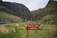
. Just south of Challis
, US 93 becomes the northern leg of the Salmon River Scenic Byway as it heads towards the town of Salmon
. From there, the highway follows portions of the Lewis and Clark National Historic Trail
and passes through the Salmon-Challis National Forest
before entering Montana
.
(web-cam) and travels north descending through the Bitterroot National Forest
. The highway continues along the Lewis and Clark trail into the Bitterroot Valley
toward Missoula
, passing through Darby
and Hamilton
.
From Missoula it continues north through the Flathead Indian Reservation
. Portions of this section run along the National Bison Range
. North of the reservation, US 93 traverses the western shore of Flathead Lake
, the largest freshwater lake west of the Mississippi River
. North of the lake the highway runs through the cities of Kalispell
and Whitefish
, traveling through the Flathead National Forest
and the Stillwater State Forest before reaching its terminus at the Canadian border near Eureka
.
The portion north of Hamilton travels through one of the most densely populated areas in Montana. This section also serves as a popular north–south connection between Yellowstone National Park
and Glacier National Park. As a result, the road tends to become more congested between Hamilton and Whitefish. A popular bumper sticker
in Montana
reads, "Pray for me, I drive Hwy 93!"
border near Eureka, Montana
south through Montana and Idaho to a southern terminus at Wells, Nevada
.
AASHO, at its June 8, 1931, meeting, approved a southerly extension of US 93 south to Glendale, Nevada
. By 1932, the Nevada Department of Highways
had marked the continuation of the highway using the routing of several preexisting state highways.
At the request of the Arizona State Highway Department
, the AASHO route numbering committee approved another extension of US 93 in 1935. This shifted the southern terminus south to Kingman, Arizona
by way of Las Vegas
. Nevada officials again extended the route along preexisting highways; however, they may not have signed the extension right away as it was not shown on Nevada's state-published maps until 1939.
Until 1993, US 93 ended a short distance north of Wickenburg, Arizona
at a junction with U.S. Highway 89. When US 89 was decommissioned in the area, the US 93 designation was carried on into Wickenburg.
A new highway segment opened in October 2010 in the area of Hoover Dam
; the Hoover Dam Bypass replaces a highway that had been closed to truck traffic due to security concerns over the dam since the September 11, 2001 attacks
. The bypass crosses the Colorado River
on a new bridge downstream of the dam. The new bypass will now make the truck detour through either Laughlin, Nevada
or Needles, California
unnecessary.
A bypass route is currently being planned to redirect US 93 around Kalispell, Montana
. Currently, US 93 enters Kalispell and becomes Main Street, a 25 mi/h arterial.
. The southern terminus is at Lages Station
in northern White Pine County
, where it separates from US 93. The route continues north to West Wendover
where it joins Interstate 80. US 93 Alternate follows I-80 west to Wells
, where it terminates at an interchange with US 93.
Alternate 93 provides a shortcut from central Nevada to Salt Lake City, Utah
via eastbound Interstate 80.
and Challis, Idaho
was also labeled Alternate US 93. This stretch of road is now designated as part of US 93. The pre-1977 routing of US 93 between those points is now designated as State Highway 75
.
Western United States
.The Western United States, commonly referred to as the American West or simply "the West," traditionally refers to the region comprising the westernmost states of the United States. Because the U.S. expanded westward after its founding, the meaning of the West has evolved over time...
. The southern terminus is at U.S. Route 60
U.S. Route 60
U.S. Route 60 is an east–west United States highway, running from the Atlantic Ocean on the east coast in Virginia to western Arizona. Despite the final "0" in its number, indicating a transcontinental designation, the 1926 route formerly ended in Springfield, Missouri, at its intersection...
in Wickenburg, Arizona
Wickenburg, Arizona
Wickenburg is a town in Maricopa County, Arizona, United States. According to 2006 Census Bureau estimates, the population of the town is 6,423.-Geography:Wickenburg is located at ....
. The northern terminus is at the Canadian border north of Eureka
Eureka, Montana
Eureka is a town in Lincoln County, Montana, United States. The population was 1,017 at the 2000 census.-Geography:Eureka is located at , approximately from Kalispell....
in Lincoln County, Montana
Lincoln County, Montana
-National protected areas:* Pacific Northwest National Scenic Trail *Flathead National Forest *Kaniksu National Forest *Kootenai National Forest -Demographics:...
, where the roadway continues into Roosville, British Columbia
Roosville, British Columbia
Roosville, British Columbia, Canada is a tiny farming community bordering the U.S. state of Montana near Lake Koocanusa, at the southeast corner of Tobacco Plains Indian Reserve No. 2. The Roosville border crossing is a primary entry into Southeast British Columbia from Northwest Montana. The name...
, as Highway 93. Major cities that US 93 travels through include Las Vegas, Nevada
Las Vegas, Nevada
Las Vegas is the most populous city in the U.S. state of Nevada and is also the county seat of Clark County, Nevada. Las Vegas is an internationally renowned major resort city for gambling, shopping, and fine dining. The city bills itself as The Entertainment Capital of the World, and is famous...
, Twin Falls, Idaho
Twin Falls, Idaho
Twin Falls is the county seat and largest city of Twin Falls County, Idaho, United States. The population was 44,125 at the 2010 censusTwin Falls is the largest city of Idaho's Magic Valley region...
, and Missoula, Montana
Missoula, Montana
Missoula is a city located in western Montana and is the county seat of Missoula County. The 2010 Census put the population of Missoula at 66,788 and the population of Missoula County at 109,299. Missoula is the principal city of the Missoula Metropolitan Area...
.
Arizona
US 93 begins at US 60 in Wickenburg, a small town about 50 miles (80.5 km) northwest of PhoenixPhoenix, Arizona
Phoenix is the capital, and largest city, of the U.S. state of Arizona, as well as the sixth most populated city in the United States. Phoenix is home to 1,445,632 people according to the official 2010 U.S. Census Bureau data...
. 30 miles (48.3 km) northwest of Wickenburg, it passes through a large forest of Joshua Trees, and is thus labeled the Arizona Joshua Parkway until it merges with I-40 to Kingman
Kingman, Arizona
Kingman is located in a desert climate on the edge of the Mojave Desert, but its higher elevation and location between the Colorado Plateau and the Lower Colorado River Valley tempers summer high temperatures and contributes to winter cold and rare snowfall. Summer daytime highs reach above 90 °F ...
. US 93 then splits from I-40 in Kingman and heads north to the Hoover Dam
Hoover Dam
Hoover Dam, once known as Boulder Dam, is a concrete arch-gravity dam in the Black Canyon of the Colorado River, on the border between the US states of Arizona and Nevada. It was constructed between 1931 and 1936 during the Great Depression and was dedicated on September 30, 1935, by President...
. Chloride
Chloride, Arizona
Chloride is a onetime silver mining camp in Mohave County, Arizona, and is considered the oldest continuously inhabited mining town in the state. Chloride has a ZIP Code of 86431; in 2000, the population of the 86431 ZCTA was 352.- History :...
is located off this highway, and Santa's Land remains are on the west side about 15 miles (24.1 km) before the Chloride exit.
This highway was known to be one of the deadliest highways in America until recently. The years of improvement have made it a much safer road to travel, according to the Federal Highway Administration
Federal Highway Administration
The Federal Highway Administration is a division of the United States Department of Transportation that specializes in highway transportation. The agency's major activities are grouped into two "programs," the Federal-aid Highway Program and the Federal Lands Highway Program...
.
Nevada
Hoover Dam Bypass
The Mike O'Callaghan – Pat Tillman Memorial Bridge, the key component to the Hoover Dam Bypass project, was the first concrete-steel composite arch bridge built in the United States, and it incorporates the longest concrete arch bridge in the Western Hemisphere. Opened on October 19, 2010,...
, then heads north through Boulder City
Boulder City, Nevada
Boulder City is a city in Clark County, Nevada, United States. It is approximately from the City of Las Vegas. As of the 2010 census the population of Boulder City was 15,023.Boulder City is one of only two cities in Nevada that prohibit gambling....
towards Las Vegas
Las Vegas, Nevada
Las Vegas is the most populous city in the U.S. state of Nevada and is also the county seat of Clark County, Nevada. Las Vegas is an internationally renowned major resort city for gambling, shopping, and fine dining. The city bills itself as The Entertainment Capital of the World, and is famous...
. The route merges with U.S. Route 95
U.S. Route 95 in Nevada
In the U.S. state of Nevada, U.S. Route 95 is a major U.S. highway traversing the state from north to south directly through Las Vegas and providing connections to both Carson City and Reno...
through Henderson
Henderson, Nevada
-Demographics:According to the 2000 census, there were 175,381 people, 66,331 households, and 47,095 families residing in the city. The population density was 2,200.8 people per square mile . There were 71,149 housing units at an average density of 892.8 per square mile...
and southeast Las Vegas, then continues north concurrently with Interstate 15
Interstate 15 in Nevada
In the U.S. State of Nevada, Interstate 15 begins in Primm, continues through Las Vegas and it crosses the border with Arizona in Mesquite. The freeway runs entirely in Clark County. Many motorists use Interstate 15 to visit Las Vegas, as it is the only primary Interstate Highway in the city. The...
through North Las Vegas
North Las Vegas, Nevada
North Las Vegas is a city in Clark County, Nevada, United States, located in the Las Vegas metropolitan area. The city was incorporated on May 16, 1946.-Geography:...
. Outside of the Las Vegas area, US 93 diverges from I-15 to head north towards Great Basin National Park
Great Basin National Park
Great Basin National Park is a United States National Park established in 1986, located in east-central Nevada near the Utah border. The park derives its name from the Great Basin, the dry and mountainous region between the Sierra Nevada and the Wasatch Mountains. Topographically, this area is...
. Near here, the highway overlaps with U.S. Route 6
U.S. Route 6 in Nevada
In the U.S. state of Nevada, U.S. Route 6 cuts across the middle portion of the state, serving the cities of Tonopah and Ely, en route to Utah and points further east....
and U.S. Route 50
U.S. Route 50 in Nevada
U.S. Route 50 is a transcontinental highway in the United States, stretching from Sacramento, California in the west to Ocean City, Maryland on the east coast. The Nevada portion crosses the center of state and was named The Loneliest Road in America by Life magazine in July 1986...
towards Ely
Ely, Nevada
Ely is the largest city and county seat of White Pine County, Nevada, United States. Ely was founded as a stagecoach station along the Pony Express and Central Overland Route. Ely's mining boom came later than the other towns along US 50, with the discovery of copper in 1906...
. US 93 leaves US 6/50 in Ely and continues north, intersecting Interstate 80
Interstate 80 in Nevada
In the U.S. state of Nevada, Interstate 80 traverses the northern portion of the state. The freeway serves the Reno-Sparks metropolitan area, and also goes through the towns of Fernley, Lovelock, Winnemucca, Battle Mountain, Elko, Wells and West Wendover on its way through the state.I-80 follows...
at Wells
Wells, Nevada
Wells is a city in Elko County, in northeast Nevada in the western United States. The population was 1,346 at the 2000 census. Wells is located at the junction of U.S. Route 93 and Interstate 80, approximately east of Elko and is part of the Elko Micropolitan Statistical Area.-History:The site...
before crossing the Idaho
Idaho
Idaho is a state in the Rocky Mountain area of the United States. The state's largest city and capital is Boise. Residents are called "Idahoans". Idaho was admitted to the Union on July 3, 1890, as the 43rd state....
state line near Jackpot
Jackpot, Nevada
Jackpot is an unincorporated community in Elko County, Nevada, United States. The Zip Code Tabulation Area for its ZIP code, 89825, had a population of 1,189 as of the 2010 census. Located less than 1 mile from the Idaho border on U.S...
.
Between State Route 318
Nevada State Route 318
State Route 318 runs from U.S. Route 93 at Crystal Springs, Nevada north to a location on U.S. Route 6 approximately southwest of Ely. It is often used as a shortcut between Ely and Las Vegas....
and Majors Junction (US 6/50), US 93 is designated a Nevada Scenic Byway
Nevada Scenic Byways
In 1983, a system of scenic byways was established in the U.S. state of Nevada. Currently there are 19 designated state scenic byways. Some of these overlap the three National Scenic Byways that have been designated in Nevada.-Federally designated scenic byways:...
.
From Ely to Schellbourne Ranch, US 93 is part of the Lincoln Highway
Lincoln Highway
The Lincoln Highway was the first road across the United States of America.Conceived and promoted by entrepreneur Carl G. Fisher, the Lincoln Highway spanned coast-to-coast from Times Square in New York City to Lincoln Park in San Francisco, originally through 13 states: New York, New Jersey,...
, the first road across the United States
United States
The United States of America is a federal constitutional republic comprising fifty states and a federal district...
.
Idaho
Jackpot, Nevada
Jackpot is an unincorporated community in Elko County, Nevada, United States. The Zip Code Tabulation Area for its ZIP code, 89825, had a population of 1,189 as of the 2010 census. Located less than 1 mile from the Idaho border on U.S...
, US 93 overlaps US 30 as it enters Twin Falls
Twin Falls, Idaho
Twin Falls is the county seat and largest city of Twin Falls County, Idaho, United States. The population was 44,125 at the 2010 censusTwin Falls is the largest city of Idaho's Magic Valley region...
. North of here, the highway crosses the Snake River Canyon
Snake River Canyon (Idaho)
Snake River Canyon is a large canyon formed by the Snake River in the Magic Valley region of southern Idaho. It is well known as the site of an unsuccessful 1974 attempt by Evel Knievel to jump it in the Skycycle X-2....
via the Perrine Bridge
Perrine Bridge
The I. B. Perrine Bridge at Twin Falls, Idaho, United States is a truss arch four-lane bridge carrying U.S. Highway 93 over the Snake River Canyon. Perrine Bridge is approximately long and above the Snake River...
en route to an interchange with Interstate 84
Interstate 84 in Idaho
In the U.S. state of Idaho, Interstate 84 heads southeast from the Oregon state line, it spurs to Interstate 184 in Boise. Eventually I-84 spurs Interstate 86 and mainline I-84 heads southeast towards Utah and I-86 is continues due east and heads to Pocatello, meeting with Interstate 15.-Future:...
. US 93 passes through Shoshone
Shoshone, Idaho
Shoshone is the county seat and largest city of Lincoln County, Idaho, United States. The population was 1,398 at the 2000 census. In contrast to the Shoshone Native American tribe for which it is named, the city's name is correctly pronounced "Show-shown," with a silent 'e'.- History :Shoshone has...
and runs concurrently with both US 26
U.S. Route 26
U.S. Route 26 is an east–west United States highway. It started in Ogallala, Nebraska, and gradually grew to reach the West Coast in Oregon. When the U.S. highway system was first defined, it was limited to Nebraska and Wyoming; by the 1950s, it continued into Idaho and Oregon. The...
and US 20
U.S. Route 20
U.S. Route 20 is an east–west United States highway. As the "0" in its route number implies, US 20 is a coast-to-coast route. Spanning , it is the longest road in the United States, and the route sparsely parallels Interstate 90...
before reaching Arco
Arco, Idaho
Arco is a city in Butte County, Idaho, United States. The population was 995 at the 2010 census. The city is the county seat of Butte County.Craters of the Moon National Monument is located along U.S. Route 20, southwest of the city. The Idaho National Laboratory is located east of Arco...
. The highway then turns northwest to enter the Big Lost River
Big Lost River
The Big Lost River is a major river in the U.S. state of Idaho, about long. It starts in the Rocky Mountains and flows in a generally southeast direction into the Snake River Plain. True to its name, the Big Lost River's surface flow does not reach any larger river, but vanishes into the Snake...
valley through Mackay
Mackay, Idaho
Mackay is a city in Custer County, Idaho, United States. The population was 566 at the 2000 census.-Geography:Mackay is located at , at an elevation of 5,905 feet ....
. Just south of Challis
Challis, Idaho
Challis is a city in Custer County, Idaho, United States. The population was 909 at the 2000 census. The city is the county seat of Custer County.-History:...
, US 93 becomes the northern leg of the Salmon River Scenic Byway as it heads towards the town of Salmon
Salmon, Idaho
Salmon is a city in Lemhi County, Idaho, United States. The population was 3,122 at the 2000 census. The city is the county seat of Lemhi County...
. From there, the highway follows portions of the Lewis and Clark National Historic Trail
Lewis and Clark National Historic Trail
The Lewis and Clark National Historic Trail is a route across the United States commemorating the Lewis and Clark Expedition of 1804 to 1806. It is part of the National Trails System of the United States...
and passes through the Salmon-Challis National Forest
Salmon-Challis National Forest
Salmon-Challis National Forest is located in east central sections of the U.S. state of Idaho. At 4,235,940 acres it is one of the largest national forests in the lower 48 states and also has most of the land area of the Frank Church River of No Return Wilderness, which is the largest wilderness...
before entering Montana
Montana
Montana is a state in the Western United States. The western third of Montana contains numerous mountain ranges. Smaller, "island ranges" are found in the central third of the state, for a total of 77 named ranges of the Rocky Mountains. This geographical fact is reflected in the state's name,...
.
Montana
US 93 enters Montana from Idaho at Lost Trail PassLost Trail Pass
Lost Trail Pass is a mountain pass in the Rocky Mountains of the United States, on the border of Idaho and Montana in the Bitterroot Mountains. The pass is at an elevation of 7014 feet above sea level and is traversed by U.S. Highway 93...
(web-cam) and travels north descending through the Bitterroot National Forest
Bitterroot National Forest
Bitterroot National Forest comprises 1.587 million acres in west-central Montana and eastern Idaho, of the United States. It is located primarily in Ravalli County, Montana , but also has acreage in Idaho County, Idaho , and Missoula County, Montana .Founded in 1898, the forest is located in the...
. The highway continues along the Lewis and Clark trail into the Bitterroot Valley
Bitterroot Valley
The Bitterroot Valley is located in southwestern Montana in the northwestern United States. It extends over 100 miles from remote Horse Creek Pass north to a point near the city of Missoula...
toward Missoula
Missoula, Montana
Missoula is a city located in western Montana and is the county seat of Missoula County. The 2010 Census put the population of Missoula at 66,788 and the population of Missoula County at 109,299. Missoula is the principal city of the Missoula Metropolitan Area...
, passing through Darby
Darby, Montana
Darby is a town in Ravalli County, Montana, United States. The population was 710 at the 2000 census. Darby is located near the southwestern border of Montana and Idaho, along the Continental Divide...
and Hamilton
Hamilton, Montana
Hamilton is a city in and the county seat of Ravalli County, Montana, United States. The population was 3,705 at the 2000 census. Significant outlying population growth is shown in the area; the ZIP Code Tabulation Area for Hamilton's ZIP Code, 59840, had a population of 12,327at the 2000 census.-...
.
From Missoula it continues north through the Flathead Indian Reservation
Flathead Indian Reservation
The Flathead Indian Reservation, located in western Montana on the Flathead River, is home to the Bitterroot Salish, Kootenai, and Pend d'Oreilles Tribes - also known as theConfederated Salish and Kootenai Tribes of the Flathead Nation...
. Portions of this section run along the National Bison Range
National Bison Range
The National Bison Range is a National Wildlife Refuge located in western Montana established in 1908 to provide a sanctuary for the American bison. The NBR is one of the oldest National Wildlife Refuges in the United States. The size of the bison herd at the NBR is relatively small, numbering...
. North of the reservation, US 93 traverses the western shore of Flathead Lake
Flathead Lake
Flathead Lake is the largest natural freshwater lake in the western part of the contiguous United States. With a surface area of between and , it is slightly larger than Lake Tahoe. The lake is a remnant of the ancient inland sea, Lake Missoula of the era of the last interglacial. Flathead Lake...
, the largest freshwater lake west of the Mississippi River
Mississippi River
The Mississippi River is the largest river system in North America. Flowing entirely in the United States, this river rises in western Minnesota and meanders slowly southwards for to the Mississippi River Delta at the Gulf of Mexico. With its many tributaries, the Mississippi's watershed drains...
. North of the lake the highway runs through the cities of Kalispell
Kalispell, Montana
Kalispell is a city in and the county seat of Flathead County, Montana, United States. The 2010 census put Kalispell's population at 19,927 up 5,704 over 2000. At 40.1% this is the largest percentage of growth of any incorporated city in Montana. Kalispell is the largest city and commercial center...
and Whitefish
Whitefish, Montana
Whitefish is a city in Flathead County, Montana, United States. The population was 5,032 at the 2000 census. It is home to a ski resort on Big Mountain called Whitefish Mountain Resort. Montana Governor Brian Schweitzer hails from Whitefish....
, traveling through the Flathead National Forest
Flathead National Forest
The Flathead National Forest is a national forest in the western part of the U.S. state of Montana. The forest covers of which about 1 million acres is designated wilderness. It is named after the Flathead Indians who lived in the area. The forest is located in the Rocky Mountains with elevations...
and the Stillwater State Forest before reaching its terminus at the Canadian border near Eureka
Eureka, Montana
Eureka is a town in Lincoln County, Montana, United States. The population was 1,017 at the 2000 census.-Geography:Eureka is located at , approximately from Kalispell....
.
The portion north of Hamilton travels through one of the most densely populated areas in Montana. This section also serves as a popular north–south connection between Yellowstone National Park
Yellowstone National Park
Yellowstone National Park, established by the U.S. Congress and signed into law by President Ulysses S. Grant on March 1, 1872, is a national park located primarily in the U.S. state of Wyoming, although it also extends into Montana and Idaho...
and Glacier National Park. As a result, the road tends to become more congested between Hamilton and Whitefish. A popular bumper sticker
Bumper sticker
A bumper sticker is an adhesive label or sticker with a message, intended to be attached to the bumper of an automobile and to be read by the occupants of other vehicles - although they are often stuck onto other objects...
in Montana
Montana
Montana is a state in the Western United States. The western third of Montana contains numerous mountain ranges. Smaller, "island ranges" are found in the central third of the state, for a total of 77 named ranges of the Rocky Mountains. This geographical fact is reflected in the state's name,...
reads, "Pray for me, I drive Hwy 93!"
History
U.S. Route 93 was not one of the original U.S. highways proposed in the 1925 Bureau of Public Roads plan. However, the revised numbering plan approved by the American Association of State Highway Officials (AASHO) on November 11, 1926, established US 93 from the CanadianCanada
Canada is a North American country consisting of ten provinces and three territories. Located in the northern part of the continent, it extends from the Atlantic Ocean in the east to the Pacific Ocean in the west, and northward into the Arctic Ocean...
border near Eureka, Montana
Eureka, Montana
Eureka is a town in Lincoln County, Montana, United States. The population was 1,017 at the 2000 census.-Geography:Eureka is located at , approximately from Kalispell....
south through Montana and Idaho to a southern terminus at Wells, Nevada
Wells, Nevada
Wells is a city in Elko County, in northeast Nevada in the western United States. The population was 1,346 at the 2000 census. Wells is located at the junction of U.S. Route 93 and Interstate 80, approximately east of Elko and is part of the Elko Micropolitan Statistical Area.-History:The site...
.
AASHO, at its June 8, 1931, meeting, approved a southerly extension of US 93 south to Glendale, Nevada
Glendale, Nevada
Glendale is an unincorporated community in Clark County, Nevada, United States. The community is an elevation of ....
. By 1932, the Nevada Department of Highways
Nevada Department of Transportation
The Nevada Department of Transportation is a government agency in the U.S. state of Nevada. NDOT is responsible for maintaining and improving Nevada's highway system, which includes U.S. highways and Interstate highways within the state's boundaries. The department is notable for its...
had marked the continuation of the highway using the routing of several preexisting state highways.
At the request of the Arizona State Highway Department
Arizona Department of Transportation
The Arizona Department of Transportation is an Arizona state government agency charged with facilitating mobility within the state. In addition to managing the state's highway system, the agency is also involved with public transportation and municipal airports...
, the AASHO route numbering committee approved another extension of US 93 in 1935. This shifted the southern terminus south to Kingman, Arizona
Kingman, Arizona
Kingman is located in a desert climate on the edge of the Mojave Desert, but its higher elevation and location between the Colorado Plateau and the Lower Colorado River Valley tempers summer high temperatures and contributes to winter cold and rare snowfall. Summer daytime highs reach above 90 °F ...
by way of Las Vegas
Las Vegas, Nevada
Las Vegas is the most populous city in the U.S. state of Nevada and is also the county seat of Clark County, Nevada. Las Vegas is an internationally renowned major resort city for gambling, shopping, and fine dining. The city bills itself as The Entertainment Capital of the World, and is famous...
. Nevada officials again extended the route along preexisting highways; however, they may not have signed the extension right away as it was not shown on Nevada's state-published maps until 1939.
Until 1993, US 93 ended a short distance north of Wickenburg, Arizona
Wickenburg, Arizona
Wickenburg is a town in Maricopa County, Arizona, United States. According to 2006 Census Bureau estimates, the population of the town is 6,423.-Geography:Wickenburg is located at ....
at a junction with U.S. Highway 89. When US 89 was decommissioned in the area, the US 93 designation was carried on into Wickenburg.
A new highway segment opened in October 2010 in the area of Hoover Dam
Hoover Dam
Hoover Dam, once known as Boulder Dam, is a concrete arch-gravity dam in the Black Canyon of the Colorado River, on the border between the US states of Arizona and Nevada. It was constructed between 1931 and 1936 during the Great Depression and was dedicated on September 30, 1935, by President...
; the Hoover Dam Bypass replaces a highway that had been closed to truck traffic due to security concerns over the dam since the September 11, 2001 attacks
September 11, 2001 attacks
The September 11 attacks The September 11 attacks The September 11 attacks (also referred to as September 11, September 11th or 9/119/11 is pronounced "nine eleven". The slash is not part of the pronunciation...
. The bypass crosses the Colorado River
Colorado River
The Colorado River , is a river in the Southwestern United States and northwestern Mexico, approximately long, draining a part of the arid regions on the western slope of the Rocky Mountains. The watershed of the Colorado River covers in parts of seven U.S. states and two Mexican states...
on a new bridge downstream of the dam. The new bypass will now make the truck detour through either Laughlin, Nevada
Laughlin, Nevada
Laughlin is a census-designated place in Clark County, Nevada, United States, and a port located on the Colorado River. Laughlin is south of Las Vegas, located in the far southern tip of Nevada. It is best known for its gaming, entertainment, and water recreation. As of the 2010 census, the...
or Needles, California
Needles, California
Needles is a city located in the Mojave Desert on the western banks of the Colorado River in San Bernardino County, California. It is located in the Mohave Valley, which straddles the California–Arizona border. The city is accessible via Interstate 40 and U.S. Route 95...
unnecessary.
Future
US 93 (with US 60 to the southeast of Wickenburg) is the shortest route between Las Vegas and Phoenix, two of the fastest-growing cities in America. Upgrades of US 60 and US 93 to expressway status are scheduled between Las Vegas and Phoenix.A bypass route is currently being planned to redirect US 93 around Kalispell, Montana
Montana
Montana is a state in the Western United States. The western third of Montana contains numerous mountain ranges. Smaller, "island ranges" are found in the central third of the state, for a total of 77 named ranges of the Rocky Mountains. This geographical fact is reflected in the state's name,...
. Currently, US 93 enters Kalispell and becomes Main Street, a 25 mi/h arterial.
Lages Junction–Wells alternate
U.S. Route 93 Alternate is an alternate route of US 93 in northeastern NevadaNevada
Nevada is a state in the western, mountain west, and southwestern regions of the United States. With an area of and a population of about 2.7 million, it is the 7th-largest and 35th-most populous state. Over two-thirds of Nevada's people live in the Las Vegas metropolitan area, which contains its...
. The southern terminus is at Lages Station
Lages Station, Nevada
Lages Station is a ghost town in White Pine County, in the U.S. state of Nevada....
in northern White Pine County
White Pine County, Nevada
White Pine County is a county located in the U.S. state of Nevada. Its population at the 2010 census was 10,030. Its county seat is Ely. It is the home of Great Basin National Park...
, where it separates from US 93. The route continues north to West Wendover
West Wendover, Nevada
West Wendover is a city in Elko County, Nevada, United States. The population was 4,721 at the 2000 census. It is part of the Elko Micropolitan Statistical Area. West Wendover is located on the eastern border of Nevada and the western edge of the Great Salt Lake Desert, and is contiguous with...
where it joins Interstate 80. US 93 Alternate follows I-80 west to Wells
Wells, Nevada
Wells is a city in Elko County, in northeast Nevada in the western United States. The population was 1,346 at the 2000 census. Wells is located at the junction of U.S. Route 93 and Interstate 80, approximately east of Elko and is part of the Elko Micropolitan Statistical Area.-History:The site...
, where it terminates at an interchange with US 93.
Alternate 93 provides a shortcut from central Nevada to Salt Lake City, Utah
Salt Lake City, Utah
Salt Lake City is the capital and the most populous city of the U.S. state of Utah. The name of the city is often shortened to Salt Lake or SLC. With a population of 186,440 as of the 2010 Census, the city lies in the Salt Lake City metropolitan area, which has a total population of 1,124,197...
via eastbound Interstate 80.
Shoshone-Challis alternate
Between 1926 and 1977 a road between Shoshone, IdahoShoshone, Idaho
Shoshone is the county seat and largest city of Lincoln County, Idaho, United States. The population was 1,398 at the 2000 census. In contrast to the Shoshone Native American tribe for which it is named, the city's name is correctly pronounced "Show-shown," with a silent 'e'.- History :Shoshone has...
and Challis, Idaho
Challis, Idaho
Challis is a city in Custer County, Idaho, United States. The population was 909 at the 2000 census. The city is the county seat of Custer County.-History:...
was also labeled Alternate US 93. This stretch of road is now designated as part of US 93. The pre-1977 routing of US 93 between those points is now designated as State Highway 75
Idaho State Highway 75
State Highway 75 is a two-lane highway that travels through the Sawtooth Range of central Idaho from Shoshone to Challis. The road is designated as one of Idaho's scenic byways and provides access to Sawtooth National Recreation Area...
.