

U.S. Route 3
Encyclopedia
U.S. Route 3 is a north–south United States highway that runs from its southern terminus in Cambridge, Massachusetts
through New Hampshire
to its terminus near Third Connecticut Lake
at the Canadian border, where the road continues north as Quebec Route 257
.
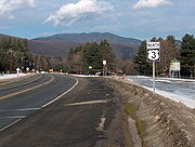
In New Hampshire parts of US 3 are known as the Daniel Webster Highway
. From Burlington, Massachusetts
to Nashua, New Hampshire
, US 3 is a freeway. (The 6.7 miles (10.8 km) in New Hampshire are a free portion of the Everett Turnpike
.) A second freeway portion exists in northern New Hampshire, where US 3 utilizes the Franconia Notch
Parkway and a short segment of Interstate 93
, before proceeding on two-lane roads north to the border with Canada
. While the southern terminus has not changed there have been different northern termini to this route.
Massachusetts Route 3 continues beyond Boston to Cape Cod
, but has never been part of US 3.
|NH
|| 241.49 || 388.55
|-
|MA
|| 35.52 || 57.14
|-
|Total || 277.00 || 445.70
|}
/Route 128 to the New Hampshire border is numbered using the original exit numbering system from the days when US 3's freeway portion
was to extend south of Route 128 to Boston to connect with Massachusetts Route 2 and the never-built Inner Belt (I-695)
. The numbering 'begins' with Exit 25 at Route 128 and proceeds north. All other freeways which once used that system have been renumbered with more conventional exit numbers. Because of the cancellation of Route 3 as an expressway inside of 128, one travelling on Route 3 will travel along a wrong-way concurrency with MA-128/I-95 for a short while (going South on Route 3 is 128 and 95 North), as to link up the "old" Route 3 inside of the belt and the "new" Route 3 outside of it.
The "old" Route 3 runs south from I-95/Route 128 Exit 33, through portions of Burlington
, Woburn
, and Winchester
without intersecting any other numbered routes. In Arlington
, it joins with Massachusetts Routes 60 and 2A in Arlington Center. It is only briefly joined with Route 60, as that route goes south, while the joined Routes 3 and 2A go east along Massachusetts Avenue
, until it intersects the Alewife Brook Parkway
and Massachusetts Route 16
, at which point Route 3 joins those routes heading south. At the Alewife MBTA Station
, Route 3 joins Massachusetts Route 2 and the Fresh Pond Parkway
bearing south and east to Memorial Drive
in Cambridge
. US Route 3 ends on Memorial Drive at the point where it meets Massachusetts Route 3.
Route 3 crosses the New Hampshire-Massachusetts border, leaving the town of Tyngsborough, Massachusetts
and entering the city of Nashua, New Hampshire, and becomes known as the Everett Turnpike
. Route 3 leaves the Everett Turnpike at Exit 7E in Nashua and turns northeast for approximately 1.5 miles (2.4 km) along a segment known as the Henri Burque Highway, before turning north onto Concord Street, which soon becomes known as the Daniel Webster Highway. Many locals will erroneously refer to the Everett Turnpike from Exit 7 through the I-293 interchange as Route 3 and refer to the actual Route 3 only as the Daniel Webster Highway. Route 3 continues north through the town of Merrimack
and into Bedford
, where it becomes South River Road. Route 3 parallels Interstate 293
until it turns east, crossing the Merrimack River
on Queen City Avenue approximately three-quarters of a mile north of the Bedford-Manchester
line. After approximately three-quarters of a mile, Route 3 then turns north onto Elm Street in downtown Manchester. After approximately 2.2 miles (3.5 km) on Elm Street, Route 3 turns east onto Webster Street, then joins NH Route 28
to proceed in a northeasterly direction on another segment of the Daniel Webster Highway.
In Suncook, New Hampshire
, Route 28 leaves to the northeast, and Route 3 proceeds northwest towards Concord
on Pembroke Street, becoming Manchester Street when it enters the Concord city limits. Route 3 traverses downtown Concord, where it is known as North and South Main Street, then follows North State Street to Fisherville Road to Village Street in Penacook
before crossing the Contoocook River
into Boscawen
. Route 3 travels north through Boscawen, briefly joining U.S. Route 4
. Route 3 parallels the Merrimack River north into Franklin
. In Franklin, the route joins New Hampshire Route 11
and turns east, briefly coinciding with New Hampshire Route 127
, and passing through Tilton
, where it crosses NH 132
and passes the western end of NH 140
. Continuing northeast past Winnisquam Lake
, Routes 3 and 11 reach Laconia
and turn onto the Laconia-Gilford
Bypass, passing interchanges with New Hampshire Routes 106
, 107
, and 11A. At the north end of the bypass, Routes 3 and 11 diverge, with Route 3 continuing north on Lake Street to Weirs Beach
and an intersection with 11B. Route 3 continues north as the Daniel Webster Highway
to Meredith
at the north end of Meredith Bay on Lake Winnipesaukee
. In Meredith, after passing the northern terminus of NH 106, Route 3 joins NH 25
and continues north past Squam Lake
into Holderness
, passing the west ends of NH 25B and NH 113
. Through Holderness, Routes 3 and 25 gradually turn west, then southwest, passing the southern end of NH 175
, and then reaching the northern end of NH 132
in Ashland
.
 From Ashland to North Woodstock
, Route 3 proceeds north, roughly paralleling I-93
in the Pemigewasset River
valley. Along this stretch it passes through the towns of Plymouth
(where NH 25 diverges to the west), West Campton
(where it meets the western end of NH 49
, the principal access road to Waterville Valley
), Thornton
, and Woodstock
. In North Woodstock, Route 3 crosses NH 112
(also known as the Kancamagus Highway to the east). Continuing north, Route 3 joins with I-93 as it passes through Franconia Notch State Park
, one of the more scenic drives in the White Mountains
. It separates from I-93 shortly north of the northern park boundary in Franconia
, about 1.5 miles (2.4 km) north of the exit with NH 18
. From there, after NH 141
branches northwest, Route 3 heads north and east toward Twin Mountain
and a junction with US Route 302. This portion of the road is noted for fairly frequent moose
sightings, especially during sunrise and sunset when moose are particularly active.
Heading north from Twin Mountain, Route 3 passes through the village of Carroll
, where NH 115
branches to the northeast, and Route 3 bears to the northwest and the town of Whitefield
. In the center of Whitefield, NH 142
branches to the northwest, and NH 116
crosses, running roughly southwest to northeast. Route 3 continues north to Lancaster
, where it joins US Route 2 in the town center, and where NH 135
branches left. After US 2 leaves to the west, Route 3 continues north, roughly paralleling the course of the Connecticut River
(which also forms the border with Vermont
), through Northumberland
and Groveton
, where NH 110
ends. North of Groveton, Route 3 continues to follow the river, through Stratford
, North Stratford, and Columbia
, until it reaches Colebrook
, where New Hampshire Routes 145
and 26 begin. Still following the Connecticut River north, Route 3 passes through portions of Stewartstown
and Clarksville
. In Stewartstown, the road turns more directly east (still following the Connecticut River, which is no longer a boundary), before resuming a northeasterly direction through Pittsburg
, where it meets the northern end of NH 145, eventually heading directly north to the Canadian
border crossing at Chartierville, Quebec
, where it becomes Quebec Route 257
.
 Prior to the U.S. Highway system, the section of US 3 from Orleans, Massachusetts
to Colebrook, New Hampshire
was part of New England Interstate Route 6 (NE-6). It was replaced in its entirety with the establishment of US 3 in 1926.
and Middlesex Turnpike
.
The modern expressway was begun around Massachusetts Route 110 at Lowell
before World War II
. In the 1950s, it was extended south to Route 128, and by the 1960s, it was completed north from Chelmsford
to New Hampshire. In the first half of the first decade of the 21st century, the chronically congested four-lane road, largely with antiquated ramps around Lowell, was widened to six lanes (as it had been in Nashua, New Hampshire a few years previously), and many interchanges were modernized in what was comically known as "The Big Wide," in reference to Massachusetts' other "Big" construction project. The $365 million 21 miles (33.8 km) widening project was completed in 2005 from Burlington to the New Hampshire border.
in Boston, Massachusetts, after crossing the Charles River
at the Boston University Bridge
. However, MassDOT officially places the southern terminus at the junction of Route 2A and Route 3 in Cambridge
, which is where Route 2A crosses the Charles along the Harvard Bridge
(also known as the Massachusetts Avenue Bridge). The original northern terminus (in 1926) was Colebrook, New Hampshire
, but the highway was extended to West Stewartstown, New Hampshire
in 1928, and to Pittsburg, New Hampshire
in 1937. Colebrook was temporarily the northern terminus again from 1939 to 1940. Since 1940, the highway has run through Pittsburg to the New Hampshire
-Quebec
border.
running north–south through downtown Laconia
, New Hampshire. It runs from US 3 in Laconia south to US 3 and NH 11
in Belmont, New Hampshire
along New Hampshire Route 107
and New Hampshire Route 11A.
Cambridge, Massachusetts
Cambridge is a city in Middlesex County, Massachusetts, United States, in the Greater Boston area. It was named in honor of the University of Cambridge in England, an important center of the Puritan theology embraced by the town's founders. Cambridge is home to two of the world's most prominent...
through New Hampshire
New Hampshire
New Hampshire is a state in the New England region of the northeastern United States of America. The state was named after the southern English county of Hampshire. It is bordered by Massachusetts to the south, Vermont to the west, Maine and the Atlantic Ocean to the east, and the Canadian...
to its terminus near Third Connecticut Lake
Third Connecticut Lake
Third Connecticut Lake is a water body located in Coos County in northern New Hampshire, in the town of Pittsburg, less than one mile from the Canadian border. The lake is the third in a chain of lakes marking the headwaters of the Connecticut River. It is approximately 100 ft deep at its...
at the Canadian border, where the road continues north as Quebec Route 257
Quebec Route 257
Route 257 is a north-south highway on the south shore of the St. Lawrence River, in the Eastern Townships region of Quebec. Its northern terminus is in Saint-Adrien at a junction with Route 216 and its southern terminus is at the New Hampshire border, where it becomes US 3.-Towns along Route 257:*...
.
In New Hampshire parts of US 3 are known as the Daniel Webster Highway
Daniel Webster Highway
Daniel Webster Highway is the name for several sections of U.S. Route 3 in New Hampshire. The highway is named after 19th century statesman Daniel Webster, a New Hampshire native.-Extent:...
. From Burlington, Massachusetts
Burlington, Massachusetts
Burlington is a town in Middlesex County, Massachusetts, United States. The population was 24,498 at the 2010 census.- History :It is believed that Burlington takes its name from the English town of Bridlington, however this has never been confirmed....
to Nashua, New Hampshire
Nashua, New Hampshire
-Climate:-Demographics:As of the census of 2010, there were 86,494 people, 35,044 households, and 21,876 families residing in the city. The population density was 2,719.9 people per square mile . There were 37,168 housing units at an average density of 1,202.8 per square mile...
, US 3 is a freeway. (The 6.7 miles (10.8 km) in New Hampshire are a free portion of the Everett Turnpike
Everett Turnpike
The Frederick E. Everett Turnpike, also called the Central New Hampshire Turnpike, is a toll road in New Hampshire, USA, running from the Massachusetts border at Nashua north to Concord...
.) A second freeway portion exists in northern New Hampshire, where US 3 utilizes the Franconia Notch
Franconia Notch
Franconia Notch is a major mountain pass through the White Mountains of New Hampshire. Dominated by Cannon Mountain, it lies principally within Franconia Notch State Park and is traversed by the Franconia Notch Parkway Franconia Notch (el. 1950 ft. / 590 m.) is a major mountain pass through...
Parkway and a short segment of Interstate 93
Interstate 93
Interstate 93 is an Interstate Highway in the New England section of the United States. Its southern terminus is in Canton, Massachusetts, in the Boston metropolitan area, at Interstate 95; its northern terminus is near St. Johnsbury, Vermont, at Interstate 91...
, before proceeding on two-lane roads north to the border with Canada
Canada
Canada is a North American country consisting of ten provinces and three territories. Located in the northern part of the continent, it extends from the Atlantic Ocean in the east to the Pacific Ocean in the west, and northward into the Arctic Ocean...
. While the southern terminus has not changed there have been different northern termini to this route.
Massachusetts Route 3 continues beyond Boston to Cape Cod
Cape Cod
Cape Cod, often referred to locally as simply the Cape, is a cape in the easternmost portion of the state of Massachusetts, in the Northeastern United States...
, but has never been part of US 3.
Route description
|-|NH
New Hampshire
New Hampshire is a state in the New England region of the northeastern United States of America. The state was named after the southern English county of Hampshire. It is bordered by Massachusetts to the south, Vermont to the west, Maine and the Atlantic Ocean to the east, and the Canadian...
|| 241.49 || 388.55
|-
|MA
Massachusetts
The Commonwealth of Massachusetts is a state in the New England region of the northeastern United States of America. It is bordered by Rhode Island and Connecticut to the south, New York to the west, and Vermont and New Hampshire to the north; at its east lies the Atlantic Ocean. As of the 2010...
|| 35.52 || 57.14
|-
|Total || 277.00 || 445.70
|}
Massachusetts
In Massachusetts, US 3's freeway portion heading from Interstate 95Interstate 95 in Massachusetts
Interstate 95 is the main highway on the East Coast of the United States, paralleling the Atlantic Ocean from Florida to Maine. The Massachusetts portion of the highway enters from the state of Rhode Island in Attleboro and travels in a northeasterly direction to the junction with Route 128 in...
/Route 128 to the New Hampshire border is numbered using the original exit numbering system from the days when US 3's freeway portion
Northwest Expressway (Boston)
The Northwest Expressway is a 19.3-mile expressway that carries U.S. Route 3 from its junction with Interstate 95 in Burlington north to the New Hampshire state line in Tyngsborough, where it connects to the Frederick E...
was to extend south of Route 128 to Boston to connect with Massachusetts Route 2 and the never-built Inner Belt (I-695)
Interstate 695 (Massachusetts)
The Inner Belt in Boston was a planned six-lane, limited-access highway that would have run through parts of Boston, Brookline, Cambridge, and Somerville.-History:...
. The numbering 'begins' with Exit 25 at Route 128 and proceeds north. All other freeways which once used that system have been renumbered with more conventional exit numbers. Because of the cancellation of Route 3 as an expressway inside of 128, one travelling on Route 3 will travel along a wrong-way concurrency with MA-128/I-95 for a short while (going South on Route 3 is 128 and 95 North), as to link up the "old" Route 3 inside of the belt and the "new" Route 3 outside of it.
The "old" Route 3 runs south from I-95/Route 128 Exit 33, through portions of Burlington
Burlington, Massachusetts
Burlington is a town in Middlesex County, Massachusetts, United States. The population was 24,498 at the 2010 census.- History :It is believed that Burlington takes its name from the English town of Bridlington, however this has never been confirmed....
, Woburn
Woburn, Massachusetts
Woburn is a city in Middlesex County, Massachusetts, USA. The population was 38,120 at the 2010 census. Woburn is located north of Boston, Massachusetts, and just south of the intersection of I-93 and I-95.- History :...
, and Winchester
Winchester, Massachusetts
Winchester is a town located in Middlesex County, Massachusetts, eight miles north of Boston. With its agricultural roots having mostly disappeared, it is now an affluent suburb...
without intersecting any other numbered routes. In Arlington
Arlington, Massachusetts
Arlington is a town in Middlesex County, Massachusetts, United States, six miles northwest of Boston. The population was 42,844 at the 2010 census.-History:...
, it joins with Massachusetts Routes 60 and 2A in Arlington Center. It is only briefly joined with Route 60, as that route goes south, while the joined Routes 3 and 2A go east along Massachusetts Avenue
Massachusetts Avenue (Boston)
Massachusetts Avenue, known to locals as Mass Ave, is a major thoroughfare in Boston, Massachusetts, and several cities and towns northwest of Boston...
, until it intersects the Alewife Brook Parkway
Alewife Brook Parkway
Alewife Brook Parkway is a short parkway in Cambridge and Somerville, Massachusetts. It is listed on the National Register of Historic Places. It begins at Fresh Pond in Cambridge , and heads north on the east bank of Alewife Brook, crossing into West Somerville and ending at the Mystic River on...
and Massachusetts Route 16
Massachusetts Route 16
Route 16 is an east–west state highway in Massachusetts. It begins in the west at an intersection with Route 12 and Route 193 in Webster, just north of the Connecticut state border...
, at which point Route 3 joins those routes heading south. At the Alewife MBTA Station
Alewife (MBTA station)
Alewife, located at the intersection of Alewife Brook Parkway and Cambridgepark West in Cambridge, Massachusetts, is a local intermodal transportation hub. It is the northern terminus of the MBTA's Red Line, and a bus terminal for several local routes and one intercity route. It opened in 1985.The...
, Route 3 joins Massachusetts Route 2 and the Fresh Pond Parkway
Fresh Pond Parkway
Fresh Pond Parkway is an historic park and parkway, found in the westernmost neighborhoods of Cambridge, Massachusetts. The site was built in 1899 and added to the National Register of Historic Places in 2005....
bearing south and east to Memorial Drive
Memorial Drive (Cambridge)
Memorial Drive runs along the north bank of the Charles River in Cambridge, Massachusetts. It is designated as U.S. Route 3 or Massachusetts Route 3 for its entire length, and Massachusetts Route 2 over the portion west of the Boston University Bridge....
in Cambridge
Cambridge, Massachusetts
Cambridge is a city in Middlesex County, Massachusetts, United States, in the Greater Boston area. It was named in honor of the University of Cambridge in England, an important center of the Puritan theology embraced by the town's founders. Cambridge is home to two of the world's most prominent...
. US Route 3 ends on Memorial Drive at the point where it meets Massachusetts Route 3.
New Hampshire
U.S. Route 3 is one of New Hampshire's most well-known roads, as it passes through most of the state's major cities and towns. It is the only signed/numbered route in the state to extend fully from its southern border with Massachusetts to its northern border with Quebec; thus, it is also the longest route within New Hampshire, at 241 miles (387.9 km).Route 3 crosses the New Hampshire-Massachusetts border, leaving the town of Tyngsborough, Massachusetts
Tyngsborough, Massachusetts
Tyngsborough is a town located in the northwest section of Middlesex County, Massachusetts. Composed of of land and surface water, Tyngsborough borders the towns of Dunstable, Groton, Westford, Chelmsford, Dracut, and the City of Lowell, as well as the New Hampshire communities of Hudson,...
and entering the city of Nashua, New Hampshire, and becomes known as the Everett Turnpike
Everett Turnpike
The Frederick E. Everett Turnpike, also called the Central New Hampshire Turnpike, is a toll road in New Hampshire, USA, running from the Massachusetts border at Nashua north to Concord...
. Route 3 leaves the Everett Turnpike at Exit 7E in Nashua and turns northeast for approximately 1.5 miles (2.4 km) along a segment known as the Henri Burque Highway, before turning north onto Concord Street, which soon becomes known as the Daniel Webster Highway. Many locals will erroneously refer to the Everett Turnpike from Exit 7 through the I-293 interchange as Route 3 and refer to the actual Route 3 only as the Daniel Webster Highway. Route 3 continues north through the town of Merrimack
Merrimack, New Hampshire
Merrimack is a town in Hillsborough County, New Hampshire, United States. The population was 25,494 at the 2010 census, making it the eighth-largest municipality in New Hampshire....
and into Bedford
Bedford, New Hampshire
-Demographics:As of the Census of 2000, there were 18,274 people, 6,251 households, and 5,125 families residing in the town. The population density was 556.6 people per square mile . There were 6,401 housing units at an average density of 195.0 per square mile...
, where it becomes South River Road. Route 3 parallels Interstate 293
Interstate 293
Interstate 293 is an long loop surrounding Manchester, New Hampshire, USA roughly shaped like two sides of a triangle. Completing the loop in the northeast is Interstate 93. The southern portion of the loop shares the road with NH 101 and passes near Manchester-Boston Regional Airport and the...
until it turns east, crossing the Merrimack River
Merrimack River
The Merrimack River is a river in the northeastern United States. It rises at the confluence of the Pemigewasset and Winnipesaukee rivers in Franklin, New Hampshire, flows southward into Massachusetts, and then flows northeast until it empties into the Atlantic Ocean at Newburyport...
on Queen City Avenue approximately three-quarters of a mile north of the Bedford-Manchester
Manchester, New Hampshire
Manchester is the largest city in the U.S. state of New Hampshire, the tenth largest city in New England, and the largest city in northern New England, an area comprising the states of Maine, New Hampshire, and Vermont. It is in Hillsborough County along the banks of the Merrimack River, which...
line. After approximately three-quarters of a mile, Route 3 then turns north onto Elm Street in downtown Manchester. After approximately 2.2 miles (3.5 km) on Elm Street, Route 3 turns east onto Webster Street, then joins NH Route 28
New Hampshire Route 28
New Hampshire Route 28 is an north–south state highway in southeastern New Hampshire. It connects the town of Ossipee in east-central New Hampshire with Salem on the Massachusetts border....
to proceed in a northeasterly direction on another segment of the Daniel Webster Highway.
In Suncook, New Hampshire
Suncook, New Hampshire
Suncook is a census-designated place in Merrimack County, New Hampshire, United States. The population was 5,379 at the 2010 census. Approximately 2/3 of Suncook village is located in the town of Pembroke, with the remainder in Allenstown....
, Route 28 leaves to the northeast, and Route 3 proceeds northwest towards Concord
Concord, New Hampshire
The city of Concord is the capital of the state of New Hampshire in the United States. It is also the county seat of Merrimack County. As of the 2010 census, its population was 42,695....
on Pembroke Street, becoming Manchester Street when it enters the Concord city limits. Route 3 traverses downtown Concord, where it is known as North and South Main Street, then follows North State Street to Fisherville Road to Village Street in Penacook
Penacook, New Hampshire
Penacook, originally called "Fisherville", is a village within the city of Concord in Merrimack County, New Hampshire, USA. It lies along Concord's northern border with Boscawen. The name comes from the Pennacook tribe that lived in the area...
before crossing the Contoocook River
Contoocook River
The Contoocook River is a river in New Hampshire. It flows from Pool Pond and Contoocook Lake on the Jaffrey/Rindge border to Penacook , where it empties into the Merrimack River. It is one of only a few rivers in New Hampshire that flow in a predominantly northward direction...
into Boscawen
Boscawen, New Hampshire
Boscawen is a town in Merrimack County, New Hampshire, United States. The population was 3,965 at the 2010 census.-History:The native Pennacook tribe called the area Contoocook, meaning "place of the river near pines." On June 6, 1733, Governor Jonathan Belcher granted it to John Coffin and 90...
. Route 3 travels north through Boscawen, briefly joining U.S. Route 4
U.S. Route 4
U.S. Route 4 is a long United States highway that runs from East Greenbush, New York, in the west to Portsmouth, New Hampshire, in the east, traversing through Vermont.In New York, US 4 is signed north–south to reflect its alignment in the state...
. Route 3 parallels the Merrimack River north into Franklin
Franklin, New Hampshire
The median income for a household in the city was $34,613, and the median income for a family was $41,698. Males had a median income of $32,318 versus $25,062 for females. The per capita income for the city was $17,155...
. In Franklin, the route joins New Hampshire Route 11
New Hampshire Route 11
New Hampshire Route 11 is a long east–west state highway in New Hampshire, running westward along the southern shore of Lake Winnipesaukee. Its eastern terminus is at the Maine state line in the city of Rochester, where it continues north as Maine State Route 11. U.S. Route 202, which runs...
and turns east, briefly coinciding with New Hampshire Route 127
New Hampshire Route 127
New Hampshire Route 127 is a north–south state highway in central New Hampshire. The highway runs from Hopkinton in Merrimack County northward to Sanbornton in Belknap County....
, and passing through Tilton
Tilton, New Hampshire
Tilton is a town located on the Winnipesaukee River in Belknap County, New Hampshire, United States. The population was 3,567 at the 2010 census. It includes the village of Lochmere. Tilton is home to the Tilton School, a private preparatory school.-History:...
, where it crosses NH 132
New Hampshire Route 132
New Hampshire Route 132 is a long north–south highway in Belknap and Merrimack counties in central New Hampshire. NH 132 runs from Concord north to Ashland in the Lakes Region....
and passes the western end of NH 140
New Hampshire Route 140
New Hampshire Route 140 is a long east–west state highway in New Hampshire. It runs from Tilton to Alton.The western terminus of NH 140 is in Tilton at U.S. Route 3 and New Hampshire Route 11. The eastern terminus is in Alton at NH 11 and New Hampshire Route 28A . In Alton, the road is named the...
. Continuing northeast past Winnisquam Lake
Winnisquam Lake
Winnisquam Lake is located in Belknap County in central New Hampshire, in the communities of Meredith, Laconia, Sanbornton, Belmont, and Tilton. At , it is the fourth-largest lake located entirely in New Hampshire. The lake is primarily fed by the outlet from Lake Winnipesaukee, and Winnisquam's...
, Routes 3 and 11 reach Laconia
Laconia, New Hampshire
As of the census of 2000, there were 16,411 people, 6,724 households, and 4,168 families residing in the city. The population density was 809.3 people per square mile . There were 8,554 housing units at an average density of 421.8 per square mile...
and turn onto the Laconia-Gilford
Gilford, New Hampshire
Gilford is a town in Belknap County, New Hampshire, United States. The population was 7,126 at the 2010 census. Situated on Lake Winnipesaukee, Gilford is home to Governors Island, Ellacoya State Beach, Belknap Mountain State Forest, Gunstock Mountain Ski Resort, and Meadowbrook U.S...
Bypass, passing interchanges with New Hampshire Routes 106
New Hampshire Route 106
New Hampshire Route 106 is a long secondary north–south highway in Merrimack and Belknap counties in central New Hampshire...
, 107
New Hampshire Route 107
New Hampshire Route 107 is a long north–south state highway in New Hampshire. It connects Laconia in the Lakes Region with Seabrook on the Atlantic coast....
, and 11A. At the north end of the bypass, Routes 3 and 11 diverge, with Route 3 continuing north on Lake Street to Weirs Beach
Weirs Beach, New Hampshire
Weirs Beach is a village within the city of Laconia in Belknap County, New Hampshire, United States. It is located on the southern shore of Lake Winnipesaukee. The cruise ship Mount Washington terminates there...
and an intersection with 11B. Route 3 continues north as the Daniel Webster Highway
Daniel Webster Highway
Daniel Webster Highway is the name for several sections of U.S. Route 3 in New Hampshire. The highway is named after 19th century statesman Daniel Webster, a New Hampshire native.-Extent:...
to Meredith
Meredith, New Hampshire
Meredith is a town in Belknap County, New Hampshire, USA. The population was 6,241 at the 2010 census. Meredith is situated beside Lake Winnipesaukee. It is home to Stonedam Island Natural Area and the Winnipesaukee Scenic Railroad...
at the north end of Meredith Bay on Lake Winnipesaukee
Lake Winnipesaukee
Lake Winnipesaukee is the largest lake in the U.S. state of New Hampshire. It is approximately long and from wide , covering — when Paugus Bay is included—with a maximum depth of ....
. In Meredith, after passing the northern terminus of NH 106, Route 3 joins NH 25
New Hampshire Route 25
New Hampshire Route 25 is a long east–west state highway in New Hampshire. It runs completely across the state from Vermont to Maine.The western terminus of Route 25 is at the Vermont state line on the Connecticut River in Piermont, where the road continues west as Vermont Route 25...
and continues north past Squam Lake
Squam Lake
Squam Lake is a lake located in central New Hampshire, USA, south of the White Mountains, straddling the borders of Grafton, Carroll, and Belknap counties. The largest town center on the lake is Holderness...
into Holderness
Holderness, New Hampshire
Holderness is a town in Grafton County, New Hampshire, United States. The population was 2,108 at the 2010 census. An agricultural and resort area, Holderness is home to the Squam Lakes Natural Science Center and is located on Squam Lake...
, passing the west ends of NH 25B and NH 113
New Hampshire Route 113
New Hampshire Route 113 is a long east–west state highway in east-central New Hampshire. Route 113 begins in the Lakes Region at an intersection with U.S. Route 3 and New Hampshire Route 25 in Holderness, and stretches eastward across the central part of the state, ending at an intersection with...
. Through Holderness, Routes 3 and 25 gradually turn west, then southwest, passing the southern end of NH 175
New Hampshire Route 175
New Hampshire Route 175 is a long north–south state highway in Grafton County in central New Hampshire. The highway winds from Holderness in the Lakes Region, north along the Pemigewasset River, to Woodstock in the White Mountains Region...
, and then reaching the northern end of NH 132
New Hampshire Route 132
New Hampshire Route 132 is a long north–south highway in Belknap and Merrimack counties in central New Hampshire. NH 132 runs from Concord north to Ashland in the Lakes Region....
in Ashland
Ashland, New Hampshire
Ashland is a town in Grafton County, New Hampshire, United States. The population was 2,076 at the 2010 census. Located near the geographical center of the state, Ashland is home to Scribner-Fellows State Forest....
.
North Woodstock, New Hampshire
North Woodstock is a census-designated place in the town of Woodstock in Grafton County, New Hampshire. It had a population of 528 at the 2010 census....
, Route 3 proceeds north, roughly paralleling I-93
Interstate 93
Interstate 93 is an Interstate Highway in the New England section of the United States. Its southern terminus is in Canton, Massachusetts, in the Boston metropolitan area, at Interstate 95; its northern terminus is near St. Johnsbury, Vermont, at Interstate 91...
in the Pemigewasset River
Pemigewasset River
The Pemigewasset River , known locally as "The Pemi", is a river in the state of New Hampshire, the United States. It is in length and drains approximately...
valley. Along this stretch it passes through the towns of Plymouth
Plymouth, New Hampshire
Plymouth is a town in Grafton County, New Hampshire, United States, in the White Mountains Region. Plymouth is located at the convergence of the Pemigewasset and Baker rivers. The population was 6,990 at the 2010 census...
(where NH 25 diverges to the west), West Campton
Campton, New Hampshire
Campton is a town in Grafton County, New Hampshire, United States. The population was 3,333 at the 2010 census. Campton, which includes the villages of Blair, Campton Hollow, Lower Campton and West Campton, is home to Blair State Forest and Livermore Falls State Forest...
(where it meets the western end of NH 49
New Hampshire Route 49
New Hampshire Route 49 is a long east–west state highway in Grafton County, within the White Mountains in central New Hampshire. It runs from Campton to Waterville Valley....
, the principal access road to Waterville Valley
Waterville Valley, New Hampshire
Waterville Valley is a town in Grafton County, New Hampshire, United States. The population was 247 at the 2010 census.Waterville Valley attracts many visitors in the winter months with alpine skiing at Waterville Valley Resort and many miles of trails for cross-country skiing. During the summer,...
), Thornton
Thornton, New Hampshire
Thornton is a town in Grafton County, New Hampshire, United States. The population was 2,490 at the 2010 census.- History :Thornton was incorporated in 1763, and named for Doctor Matthew Thornton, a signer of the Declaration of Independence.- Geography :...
, and Woodstock
Woodstock, New Hampshire
Woodstock is a town in Grafton County, New Hampshire, United States. The population was 1,374 at the 2010 census. Woodstock includes the village of North Woodstock, the commercial center. Its extensive land area is largely forested, and includes the Hubbard Brook Experimental Forest. Parts of the...
. In North Woodstock, Route 3 crosses NH 112
New Hampshire Route 112
New Hampshire Route 112 is a long east–west state highway in northern New Hampshire. The highway winds across the state, connecting Bath to Conway via the scenic and mountainous area of the White Mountain National Forest. Part of this highway, which runs through the White Mountains, is known as...
(also known as the Kancamagus Highway to the east). Continuing north, Route 3 joins with I-93 as it passes through Franconia Notch State Park
Franconia Notch State Park
Franconia Notch State Park is located in the White Mountains in northern New Hampshire and straddles of Interstate 93 as it passes through Franconia Notch, a mountain pass between the Kinsman Range and Franconia Range...
, one of the more scenic drives in the White Mountains
White Mountains (New Hampshire)
The White Mountains are a mountain range covering about a quarter of the state of New Hampshire and a small portion of western Maine in the United States. Part of the Appalachian Mountains, they are considered the most rugged mountains in New England...
. It separates from I-93 shortly north of the northern park boundary in Franconia
Franconia, New Hampshire
Franconia is a town in Grafton County, New Hampshire, United States. The population was 1,104 at the 2010 census. Set in the White Mountains, Franconia is home to the northern half of Franconia Notch State Park. Parts of the White Mountain National Forest are in the eastern and southern portions...
, about 1.5 miles (2.4 km) north of the exit with NH 18
New Hampshire Route 18
New Hampshire Route 18 is a long north–south state highway in New Hampshire. Its northern terminus is at the Vermont state line in the town of Littleton, where the road continues north as Vermont Route 18. The southern terminus of NH 18 is at an interchange with Interstate 93 and U.S...
. From there, after NH 141
New Hampshire Route 141
New Hampshire Route 141 is a long east–west state highway located entirely within the town of Franconia. Its western end is at New Hampshire Route 18. Its eastern end is at U.S. Route 3. It is called Butterhill Road for its entire length....
branches northwest, Route 3 heads north and east toward Twin Mountain
Twin Mountain, New Hampshire
Twin Mountain is a village within the town of Carroll in the White Mountains of New Hampshire. It is named for two prominent summits which rise to the south of the village, North Twin Mountain and South Twin Mountain ....
and a junction with US Route 302. This portion of the road is noted for fairly frequent moose
Moose
The moose or Eurasian elk is the largest extant species in the deer family. Moose are distinguished by the palmate antlers of the males; other members of the family have antlers with a dendritic configuration...
sightings, especially during sunrise and sunset when moose are particularly active.
Heading north from Twin Mountain, Route 3 passes through the village of Carroll
Carroll, New Hampshire
Carroll is a town in Coos County, New Hampshire, United States. The population was 763 at the 2010 census. The two largest villages are Twin Mountain and Bretton Woods. Carroll is an important access point for recreational areas in the White Mountains, including many 4,000-footers, the Zealand...
, where NH 115
New Hampshire Route 115
New Hampshire Route 115 is a long north–south state highway in Coos County in northern New Hampshire. The southern terminus of NH 115 is at U.S. Route 3 in Carroll north of Twin Mountain. The northern terminus is at the intersection with U.S. Route 2 in Jefferson...
branches to the northeast, and Route 3 bears to the northwest and the town of Whitefield
Whitefield, New Hampshire
Whitefield is a town in Coos County, New Hampshire, USA, in the White Mountains Region. The population was 2,306 at the 2010 census. Situated on the northern edge of the White Mountains, Whitefield is home to the Mount Washington Regional Airport and the White Mountains Regional High...
. In the center of Whitefield, NH 142
New Hampshire Route 142
New Hampshire Route 142 is a long north–south state highway in northern New Hampshire. The highway runs between Franconia in the White Mountains Region to Dalton in the upper Connecticut River valley....
branches to the northwest, and NH 116
New Hampshire Route 116
New Hampshire Route 116 is a long east–west highway in northern New Hampshire. NH 116 is a scenic rural highway stretching from Haverhill, which lies along the Connecticut River, to Jefferson, in the White Mountains Region....
crosses, running roughly southwest to northeast. Route 3 continues north to Lancaster
Lancaster, New Hampshire
Lancaster is a town in Coos County, New Hampshire, USA, on the Connecticut River named after Lancaster, England. As of the 2010 census, the town population was 3,507, the second largest in the county after Berlin. It is the county seat of Coos County and gateway to the Great North Woods Region...
, where it joins US Route 2 in the town center, and where NH 135
New Hampshire Route 135
New Hampshire Route 135 is a long north–south state highway in New Hampshire. The highway runs north along the Connecticut River from Woodsville to Lancaster....
branches left. After US 2 leaves to the west, Route 3 continues north, roughly paralleling the course of the Connecticut River
Connecticut River
The Connecticut River is the largest and longest river in New England, and also an American Heritage River. It flows roughly south, starting from the Fourth Connecticut Lake in New Hampshire. After flowing through the remaining Connecticut Lakes and Lake Francis, it defines the border between the...
(which also forms the border with Vermont
Vermont
Vermont is a state in the New England region of the northeastern United States of America. The state ranks 43rd in land area, , and 45th in total area. Its population according to the 2010 census, 630,337, is the second smallest in the country, larger only than Wyoming. It is the only New England...
), through Northumberland
Northumberland, New Hampshire
Northumberland is a town located in southwestern Coos County, New Hampshire, U.S., north of Lancaster. It is part of the Berlin, NH–VT micropolitan statistical area...
and Groveton
Groveton, New Hampshire
Groveton is a census-designated place in the town of Northumberland in Coos County, New Hampshire, United States. The population was 1,118 at the 2010 census. It is located at the intersection of U.S...
, where NH 110
New Hampshire Route 110
New Hampshire Route 110 is a long east–west state highway in Coos County, northern New Hampshire. The road winds through the scenic, mountainous country of New Hampshire north of the White Mountain National Forest. NH 110 is locally named the Berlin-Groveton Highway.The eastern terminus of NH 110...
ends. North of Groveton, Route 3 continues to follow the river, through Stratford
Stratford, New Hampshire
Stratford is a town located on the Connecticut River in Coos County, New Hampshire, United States. The population was 746 at the 2010 census. Within the town are the villages of North Stratford and Stratford Hollow. U.S...
, North Stratford, and Columbia
Columbia, New Hampshire
Columbia is a town in Coos County, New Hampshire, United States. The population was 757 at the 2010 census. It is part of the Berlin, NH–VT micropolitan statistical area.-History:...
, until it reaches Colebrook
Colebrook, New Hampshire
Colebrook is a town in Coos County, New Hampshire, United States. The population was 2,301 at the 2010 census. Situated in the Great North Woods Region, it is bounded on the west by the Connecticut River and home to Beaver Brook Falls Natural Area....
, where New Hampshire Routes 145
New Hampshire Route 145
New Hampshire Route 145 is a long north–south state highway in Coos County in northern New Hampshire. The highway runs between Colebrook and Pittsburg, paralleling U.S. Route 3 for its entire length....
and 26 begin. Still following the Connecticut River north, Route 3 passes through portions of Stewartstown
Stewartstown, New Hampshire
Stewartstown is a town in Coos County, New Hampshire, United States. The population was 1,004 at the 2010 census. It includes the village of West Stewartstown and is part of the Berlin, NH–VT Micropolitan Statistical Area.-History:...
and Clarksville
Clarksville, New Hampshire
Clarksville is a town located in northern Coos County, New Hampshire, United States. The population was 265 at the 2010 census. It is part of the Berlin, NH–VT Micropolitan Statistical Area.- History :...
. In Stewartstown, the road turns more directly east (still following the Connecticut River, which is no longer a boundary), before resuming a northeasterly direction through Pittsburg
Pittsburg, New Hampshire
Pittsburg is a town in Coos County, New Hampshire, United States. The population was 869 at the 2010 census. It is the northernmost town in New Hampshire and the largest town by area in the state - and in New England as well - more than twice the size of the next largest town, Lincoln. U.S...
, where it meets the northern end of NH 145, eventually heading directly north to the Canadian
Canada
Canada is a North American country consisting of ten provinces and three territories. Located in the northern part of the continent, it extends from the Atlantic Ocean in the east to the Pacific Ocean in the west, and northward into the Arctic Ocean...
border crossing at Chartierville, Quebec
Chartierville, Quebec
Chartierville is a small village of 300 people in Le Haut-Saint-François Regional County Municipality, in Quebec, Canada.Chartierville is located Route 257 South. Prior to its founding in 1870 by colonists from Saint-Hyacinthe, gold-seekers flocked to the area...
, where it becomes Quebec Route 257
Quebec Route 257
Route 257 is a north-south highway on the south shore of the St. Lawrence River, in the Eastern Townships region of Quebec. Its northern terminus is in Saint-Adrien at a junction with Route 216 and its southern terminus is at the New Hampshire border, where it becomes US 3.-Towns along Route 257:*...
.
NE-6
Orleans, Massachusetts
Orleans is a town in Barnstable County, Massachusetts, United States. Barnstable County is coextensive with Cape Cod. The population was 5,890 at the 2010 census....
to Colebrook, New Hampshire
Colebrook, New Hampshire
Colebrook is a town in Coos County, New Hampshire, United States. The population was 2,301 at the 2010 census. Situated in the Great North Woods Region, it is bounded on the west by the Connecticut River and home to Beaver Brook Falls Natural Area....
was part of New England Interstate Route 6 (NE-6). It was replaced in its entirety with the establishment of US 3 in 1926.
Massachusetts
Route 3 in Massachusetts (from Tyngsborough to Cambridge) closely follows the route of the early 19th Century Middlesex CanalMiddlesex Canal
The Middlesex Canal was a 27-mile barge canal connecting the Merrimack River with the port of Boston. When operational it was 30 feet wide, and 3 feet deep, with 20 locks, each 80 feet long and between 10 and 11 feet wide...
and Middlesex Turnpike
Middlesex Turnpike (Massachusetts)
The Middlesex Turnpike was an early turnpike between Cambridge and Tyngsborough, Massachusetts and the New Hampshire border, where it connected with the Amherst Turnpike and thence Nashua and Claremont, New Hampshire....
.
The modern expressway was begun around Massachusetts Route 110 at Lowell
Lowell, Massachusetts
Lowell is a city in Middlesex County, Massachusetts, USA. According to the 2010 census, the city's population was 106,519. It is the fourth largest city in the state. Lowell and Cambridge are the county seats of Middlesex County...
before World War II
World War II
World War II, or the Second World War , was a global conflict lasting from 1939 to 1945, involving most of the world's nations—including all of the great powers—eventually forming two opposing military alliances: the Allies and the Axis...
. In the 1950s, it was extended south to Route 128, and by the 1960s, it was completed north from Chelmsford
Chelmsford, Massachusetts
Chelmsford is a suburban town in Middlesex County, Massachusetts in the Greater Boston area. As of the 2010 United States Census, the town's population was 33,802. The Census Bureau's 2008 population estimate for the town was 34,409, ranking it 14th in population among the 54 municipalities in...
to New Hampshire. In the first half of the first decade of the 21st century, the chronically congested four-lane road, largely with antiquated ramps around Lowell, was widened to six lanes (as it had been in Nashua, New Hampshire a few years previously), and many interchanges were modernized in what was comically known as "The Big Wide," in reference to Massachusetts' other "Big" construction project. The $365 million 21 miles (33.8 km) widening project was completed in 2005 from Burlington to the New Hampshire border.
Termini
According to the AASHTO route log, the southern terminus of U.S. Route 3 is at U.S. Route 20U.S. Route 20
U.S. Route 20 is an east–west United States highway. As the "0" in its route number implies, US 20 is a coast-to-coast route. Spanning , it is the longest road in the United States, and the route sparsely parallels Interstate 90...
in Boston, Massachusetts, after crossing the Charles River
Charles River
The Charles River is an long river that flows in an overall northeasterly direction in eastern Massachusetts, USA. From its source in Hopkinton, the river travels through 22 cities and towns until reaching the Atlantic Ocean at Boston...
at the Boston University Bridge
Boston University Bridge
The Boston University Bridge , and commonly referred to as the BU Bridge, is a steel truss bridge with a suspended deck carrying Route 2 over the Charles River, connecting Boston to Cambridge, Massachusetts. According to the American Association of State Highway and Transportation Officials route...
. However, MassDOT officially places the southern terminus at the junction of Route 2A and Route 3 in Cambridge
Cambridge, Massachusetts
Cambridge is a city in Middlesex County, Massachusetts, United States, in the Greater Boston area. It was named in honor of the University of Cambridge in England, an important center of the Puritan theology embraced by the town's founders. Cambridge is home to two of the world's most prominent...
, which is where Route 2A crosses the Charles along the Harvard Bridge
Harvard Bridge
The Harvard Bridge carries Massachusetts Avenue from Back Bay, Boston to Cambridge, Massachusetts. It is the longest bridge over the Charles River....
(also known as the Massachusetts Avenue Bridge). The original northern terminus (in 1926) was Colebrook, New Hampshire
Colebrook, New Hampshire
Colebrook is a town in Coos County, New Hampshire, United States. The population was 2,301 at the 2010 census. Situated in the Great North Woods Region, it is bounded on the west by the Connecticut River and home to Beaver Brook Falls Natural Area....
, but the highway was extended to West Stewartstown, New Hampshire
West Stewartstown, New Hampshire
West Stewartstown is a census-designated place in the town of Stewartstown in Coos County, New Hampshire. It had a population of 386 at the 2010 census....
in 1928, and to Pittsburg, New Hampshire
Pittsburg, New Hampshire
Pittsburg is a town in Coos County, New Hampshire, United States. The population was 869 at the 2010 census. It is the northernmost town in New Hampshire and the largest town by area in the state - and in New England as well - more than twice the size of the next largest town, Lincoln. U.S...
in 1937. Colebrook was temporarily the northern terminus again from 1939 to 1940. Since 1940, the highway has run through Pittsburg to the New Hampshire
New Hampshire
New Hampshire is a state in the New England region of the northeastern United States of America. The state was named after the southern English county of Hampshire. It is bordered by Massachusetts to the south, Vermont to the west, Maine and the Atlantic Ocean to the east, and the Canadian...
-Quebec
Quebec
Quebec or is a province in east-central Canada. It is the only Canadian province with a predominantly French-speaking population and the only one whose sole official language is French at the provincial level....
border.
Major intersections
- Note: milepost readings in parentheses reflect the actual posted milemarkers in Massachusetts. Since US-3 and MA Route 3 are treated as one continuous route by the state, mileposts continuously increase and do not reset when the designation changes in Cambridge.
Laconia business loop
U.S. Route 3 Business is a 4.2 miles (6.76 km) long business routeBusiness route
A business route in the United States and Canada is a short special route connected to a parent numbered highway at its beginning, then routed through the central business district of a nearby city or town, and finally reconnecting with the same parent numbered highway again at its...
running north–south through downtown Laconia
Laconia, New Hampshire
As of the census of 2000, there were 16,411 people, 6,724 households, and 4,168 families residing in the city. The population density was 809.3 people per square mile . There were 8,554 housing units at an average density of 421.8 per square mile...
, New Hampshire. It runs from US 3 in Laconia south to US 3 and NH 11
New Hampshire Route 11
New Hampshire Route 11 is a long east–west state highway in New Hampshire, running westward along the southern shore of Lake Winnipesaukee. Its eastern terminus is at the Maine state line in the city of Rochester, where it continues north as Maine State Route 11. U.S. Route 202, which runs...
in Belmont, New Hampshire
Belmont, New Hampshire
Belmont is a town in Belknap County, New Hampshire, United States. The population was 7,356 at the 2010 census.The primary settlement in town, where 1,301 people resided at the 2010 census, is defined by the U.S...
along New Hampshire Route 107
New Hampshire Route 107
New Hampshire Route 107 is a long north–south state highway in New Hampshire. It connects Laconia in the Lakes Region with Seabrook on the Atlantic coast....
and New Hampshire Route 11A.