

Treaty of Brownstown
Encyclopedia
United States
The United States of America is a federal constitutional republic comprising fifty states and a federal district...
and the Council of Three Fires
Council of Three Fires
The Council of Three Fires, also known as the People of the Three Fires, the Three Fires Confederacy, the United Nations of Chippewa, Ottawa, and Potawatomi Indians, or Niswi-mishkodewin in the Anishinaabe language, is a long-standing Anishinaabe alliance of the Ojibwe , Ottawa , and Potawatomi...
(Chippewa
Ojibwa
The Ojibwe or Chippewa are among the largest groups of Native Americans–First Nations north of Mexico. They are divided between Canada and the United States. In Canada, they are the third-largest population among First Nations, surpassed only by Cree and Inuit...
, Ottawa
Ottawa (tribe)
The Odawa or Ottawa, said to mean "traders," are a Native American and First Nations people. They are one of the Anishinaabeg, related to but distinct from the Ojibwe nation. Their original homelands are located on Manitoulin Island, near the northern shores of Lake Huron, on the Bruce Peninsula in...
, Potawatomi
Potawatomi
The Potawatomi are a Native American people of the upper Mississippi River region. They traditionally speak the Potawatomi language, a member of the Algonquian family. In the Potawatomi language, they generally call themselves Bodéwadmi, a name that means "keepers of the fire" and that was applied...
), Wyandott, and Shawanoese
Shawnee
The Shawnee, Shaawanwaki, Shaawanooki and Shaawanowi lenaweeki, are an Algonquian-speaking people native to North America. Historically they inhabited the areas of Ohio, Virginia, West Virginia, Western Maryland, Kentucky, Indiana, and Pennsylvania...
Indian Nations
Indigenous peoples of the Americas
The indigenous peoples of the Americas are the pre-Columbian inhabitants of North and South America, their descendants and other ethnic groups who are identified with those peoples. Indigenous peoples are known in Canada as Aboriginal peoples, and in the United States as Native Americans...
. It was concluded November 25, 1808 at Brownstown in Michigan Territory
Michigan Territory
The Territory of Michigan was an organized incorporated territory of the United States that existed from June 30, 1805, until January 26, 1837, when the final extent of the territory was admitted to the Union as the State of Michigan...
, and provided cession of a strip of Indian land for a road to connect two disconnected areas of land previously ceded by Indians to the United States.
History
With the Treaty of GreenvilleTreaty of Greenville
The Treaty of Greenville was signed at Fort Greenville , on August 3, 1795, between a coalition of Native Americans & Frontiers men, known as the Western Confederacy, and the United States following the Native American loss at the Battle of Fallen Timbers. It put an end to the Northwest Indian War...
in 1795 the Indian Nations ceded southern and eastern Ohio
Ohio
Ohio is a Midwestern state in the United States. The 34th largest state by area in the U.S.,it is the 7th‑most populous with over 11.5 million residents, containing several major American cities and seven metropolitan areas with populations of 500,000 or more.The state's capital is Columbus...
to white settlement. The Treaty of Fort Industry
Treaty of Fort Industry
The Treaty of Fort Industry was a successor treaty to the Treaty of Greenville, which moved the eastern boundary of Indian lands in northern Ohio from the Tuscarawas River and Cuyahoga River westward to a line 120 miles west of the Pennsylvania boundary, which coincided with the western boundary of...
in 1805 moved the boundary westward to a line 120 miles (193.1 km) west of Pennsylvania
Pennsylvania
The Commonwealth of Pennsylvania is a U.S. state that is located in the Northeastern and Mid-Atlantic regions of the United States. The state borders Delaware and Maryland to the south, West Virginia to the southwest, Ohio to the west, New York and Ontario, Canada, to the north, and New Jersey to...
, which coincided with the western boundary of the Firelands
Firelands
The Firelands or Sufferers' Lands tract was located at the western end of the Connecticut Western Reserve in what is now the U.S. state of Ohio...
of the Connecticut Western Reserve
Connecticut Western Reserve
The Connecticut Western Reserve was land claimed by Connecticut from 1662 to 1800 in the Northwest Territory in what is now northeastern Ohio.-History:...
. In 1807, the Treaty of Detroit
Treaty of Detroit
The Treaty of Detroit was a treaty between the United States and the Ottawa, Chippewa, Wyandot and Potawatomi Native American nations. The treaty was signed at Detroit, Michigan on November 17, 1807, with William Hull, governor of the Michigan Territory and superintendent of Indian affairs the sole...
called for the cession of lands northwest of the Maumee River
Maumee River
The Maumee River is a river in northwestern Ohio and northeastern Indiana in the United States. It is formed at Fort Wayne, Indiana by the confluence of the St. Joseph and St. Marys rivers, and meanders northeastwardly for through an agricultural region of glacial moraines before flowing into the...
, mostly in the Territory of Michigan. The area between the Maumee River and the 1805 boundary remained Indian Lands, and thus, the United States could not legally build a road connecting settlements in Ohio
Ohio
Ohio is a Midwestern state in the United States. The 34th largest state by area in the U.S.,it is the 7th‑most populous with over 11.5 million residents, containing several major American cities and seven metropolitan areas with populations of 500,000 or more.The state's capital is Columbus...
and the Territory of Michigan. This area was also swampy
Great Black Swamp
The Great Black Swamp, or simply Black Swamp, was a glacially caused wetland in northwest Ohio, United States, extending into extreme northeastern Indiana, that existed from the end of the Wisconsin glaciation until the late 19th century...
, and would require much engineering effort and funds to cross with a road.
Article I
The parties agree a road would be beneficial to all parties, and to promote it, agree to the following articles.Article II
The Indian Nations agree to “give, grant, and cede, unto the said United States, a tract of land for a road, of one hundred twenty feet in weadth, from the foot of the rapids of the river Miami of the Lake ErieMaumee River
The Maumee River is a river in northwestern Ohio and northeastern Indiana in the United States. It is formed at Fort Wayne, Indiana by the confluence of the St. Joseph and St. Marys rivers, and meanders northeastwardly for through an agricultural region of glacial moraines before flowing into the...
, to the western line of the Connecticut reserve
Connecticut Western Reserve
The Connecticut Western Reserve was land claimed by Connecticut from 1662 to 1800 in the Northwest Territory in what is now northeastern Ohio.-History:...
, and all the land within one mile of the said road, on each side thereof, for the purpose of establishing settlements along the same; also a tract of land, for a road only, of one hundred twenty feet in weadth, to run southwardly from what is called Lower Sandusky, to the boundary line established by the Treaty of Greenville, with the privelege of taking at all times, such timber and other materials, from the adjacent lands as may be necessary for making and keeping in repair the said road, with the bridges that may be required along the same.”
Note: Miami of the Lake Erie was the name of the Maumee river in that period. The foot of the rapids are at Perrysburg, Ohio
Perrysburg, Ohio
As of the census of 2000, there were 16,945 people, 6,592 households, and 4,561 families residing in the city. The population density was 1,899.2 people per square mile . There were 6,964 housing units at an average density of 780.5 per square mile...
. The western line of the Connecticut reserve is at Bellevue, Ohio
Bellevue, Ohio
Bellevue is a city in Erie, Huron, Sandusky and Seneca counties in the U.S. state of Ohio. The population was 8,193 at the 2000 census. The National Arbor Day Foundation has designated Bellevue as a Tree City USA....
along the line between Huron County, Ohio
Huron County, Ohio
As of the census of 2000, there were 59,487 people, 22,307 households, and 16,217 families residing in the county. The population density was 121 people per square mile . There were 23,594 housing units at an average density of 48 per square mile...
and Sandusky County, Ohio
Sandusky County, Ohio
Sandusky County is a county in the U.S. state of Ohio. As of the 2010 census, the population was 60,944. Its county seat is Fremont and it is named for a native word meaning "water" ....
. Lower Sandusky was the name for Fremont, Ohio
Fremont, Ohio
Fremont Public Schools enroll 4,450 students in public primary and secondary schools. The district administers 9 public schools including seven elementary schools, one middle school, and one high school, Fremont Ross. In addition, the city is home to one private catholic high school, Saint Joseph...
.
Article III
The lines mentioned in Article II will be run in directions thought most advisable by the President of the United States.Article IV
The Indian nations retain the right to fish and hunt on the ceded lands, so long as the same shall remain property of the United States.Note: The United States intended to sell land to private parties, so this was a temporary right.
Article V
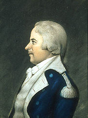
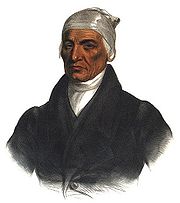
The Indians nations acknowledge they are under the protection of the United States and no others.Chippewas
- Ne-me-kas, or Little Thunder
- Puck-e-nese, or Spark of Fire
- Macquettequet, or Little Bear
- Shimnaquette
Wyandotts
- Miere, or Walk in the Water
- I-yo-na-yo-ta-ha, or Joe
- Ska-ho, or Black Chief
- Adam Brown
Consequences

Canton, Ohio
Canton is the county seat of Stark County in northeastern Ohio, approximately south of Akron and south of Cleveland.The City of Caton is the largest incorporated area within the Canton-Massillon Metropolitan Statistical Area...
Land Office. No action was taken on either, so, in 1820, the Ohio legislature asked Congress to take action. In 1823, the land along route had already been ceded by the Indians and surveyed into townships
Survey township
Survey township, sometimes called Congressional township, as used by the United States Public Land Survey System, refers to a square unit of land, that is nominally six miles on a side...
and sections
Section (United States land surveying)
In U.S. land surveying under the Public Land Survey System , a section is an area nominally one square mile, containing , with 36 sections making up one survey township on a rectangular grid....
, and Congress authorized the state of Ohio to build the road, and granted land one mile (1.6 km) on each side of the road to the state, bounded by sectional lines. This grant became known as the Maumee Road Lands
Maumee Road Lands
Maumee Road Lands were a group of land tracts granted by the United States Congress to the state of Ohio in 1823 along the path of a proposed road in the northwest corner of the state.-History:...
. In 1825 Ohio appropriated moneys to build the road, and provided for sale of granted lands to pay for it. The section of road is about 46 miles (74 km) long, and the land granted to Ohio amounted to about 60000 acres (242.8 km²). United States Route 20 is situated along the Maumee road.
The road to run southwardly from Lower Sandusky mentioned in Article II was also not provided for by Congress. It became more desirable to run a road to Sandusky City
Sandusky, Ohio
Sandusky is a city in the U.S. state of Ohio and the county seat of Erie County. It is located in northern Ohio and is situated on the shores of Lake Erie, almost exactly half-way between Toledo to the west and Cleveland to the east....
on Lake Erie
Lake Erie
Lake Erie is the fourth largest lake of the five Great Lakes in North America, and the tenth largest globally. It is the southernmost, shallowest, and smallest by volume of the Great Lakes and therefore also has the shortest average water residence time. It is bounded on the north by the...
. In 1828, Congress granted 49 sections of land along the path of the road, amounting to 31596 acres (127.9 km²), to Ohio, in a grant known as the Turnpike Lands
Turnpike Lands
Turnpike Lands were a group of land tracts granted by the United States Congress to the state of Ohio in 1827 along the path of a proposed road in the northwest corner of the state.-History:...
. Ohio State Route 4 north of Bucyrus
Bucyrus, Ohio
As of the census of 2000, there were 13,224 people, 5,559 households, and 3,552 families residing in the city. The population density was 1,812.0 people per square mile . There were 5,955 housing units at an average density of 816.0 per square mile...
in Seneca
Seneca County, Ohio
Seneca County is a county located in the state of Ohio, United States. As of the 2010 census, the population was 56,745. Its county seat is Tiffin and it is named for the Seneca Indians.The Tiffin Micropolitan Statistical Area includes all of Seneca County....
and Crawford
Crawford County, Ohio
Crawford County is a county located in the state of Ohio, United States. It was named for Colonel William Crawford, a soldier during the American Revolution....
counties, and Ohio State Route 98
Ohio State Route 98
State Route 98 is a north–south state highway in the northern portion of the U.S. state of Ohio. Its southern terminus is at the State Route 47/State Route 423 concurrency in Waldo, and its northern terminus is at State Route 61 in Plymouth....
south of Bucyrus in Crawford and Marion
Marion County, Ohio
Marion County is a county located in the state of Ohio, United States. As of the 2010 census, the population was 66,501. Its county seat is the city of Marion and is named for General Francis "The Swamp Fox" Marion, an officer in the Revolutionary War....
counties are situated along the path of the Columbus and Sandusky Turnpike where the 1828 grant was made.