
Trabuco Creek
Encyclopedia
Trabuco Creek is a small river in the U.S. state
of California
, flowing from the westernmost extreme of Riverside County
through Orange County
to join San Juan Creek
in the city of San Juan Capistrano. 21.8 miles (35.1 km) long, its watershed covers 54 mi2 in southeastern Orange County, including portions of three incorporated cities. Rising in a wild and undeveloped canyon in the southern Santa Ana Mountains
, Trabuco Creek generally flows west and later south, and its upper and middle reaches are one of the few relatively undeveloped stretches of river of Orange County.
Tongva and Luiseño Native American people lived along the perennial stream in settlements and hunting camps for 8,000 years before the invasion
of Spanish colonization
. Trabuco is Spanish
for a Blunderbuss
, a type of shotgun. Local legend attributes a Franciscan
missionary friar traveling with the Gaspar de Portolà Expedition
in 1769 for the story that a blunderbuss was lost in the upper canyon by the creek, and so the naming of the area. John (Don Juan) Forster
received a Mexican land grant in 1846 for the canyon lands and creek and established Rancho Trabuco
here.
Although the riverside habitat
is generally degrading in quality because of increasing pollution from urban and agricultural runoff, Trabuco Creek once supported one of the largest steelhead habitats of Orange County, and birds, large mammals, and amphibians still flourish in the rich riparian zone
along its undeveloped portions. Upper Trabuco Creek, also referred to as Trabuco Canyon, is a popular hiking and off-roading area, and long, narrow O'Neill Regional Park on the creek is also a well-known recreational venue.
, close to the boundary of Orange and Riverside Counties, at an elevation of 4310 feet (1,313.7 m). Its first few miles are in a large and deep canyon just north of Los Piños Peak, a roughly 4400 feet (1,341.1 m) summit of the Santa Ana Mountains, and south of Trabuco Peak, which rises to 4604 feet (1,403.3 m). From its headwaters, the creek flows in this narrow gorge for its first 4 miles (6.4 km). Inside the arid, roughly 2000 feet (609.6 m)-deep gorge, Holy Jim and Falls Canyon creeks join Trabuco before it passes the unincorporated community of Trabuco Canyon
, where Live Oak Canyon Creek joins from the right.
 Entering the boundaries of the city of Rancho Santa Margarita
, the creek proceeds to flow southwest through a long, narrow wilderness preserve known as O'Neill Regional Park. Once out of the mountains, Trabuco Creek slows down dramatically and winds across a wide and sandy bed known as the Plano Trabuco. It crosses under California State Route 241
, a toll road
that follows the western foothills of the Santa Ana Mountains, and passes close to Lake Mission Viejo
, a popular recreational lake in the city of Mission Viejo
.
Still steadily bending southwards, Tijeras Canyon Creek shortly joins Trabuco from the left bank, then the combined waters pass under a high bridge for Oso Parkway and leave the southern boundary of O'Neill Regional Park. Even after exiting the park, the creek winds through a broad riparian zone
at the bottom of a shallow canyon, but after passing Saddleback College
, located near the southern junction of California State Route 73
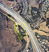
and Interstate 5
, the creek flows through a residential community and is diverted into twin culvert
s underneath the interstate.
The creek drops over two large man-made drop structure
s, the first of which marks the beginning of a small canyon the creek has carved out with the additional flow it incorporates from urban runoff
. Passing into the northernmost extreme of San Juan Capistrano, its major tributary, Oso Creek
, joins from the right, and the creek flows south through an agricultural area until it is forced into a concrete channel, passes by Mission San Juan Capistrano
, and enters San Juan Creek within downtown San Juan Capistrano.
 The Trabuco Creek watershed covers 54 mi2 in the northern and far eastern parts of the San Juan Creek watershed. Located in an arid coastal basin in southern Orange County, the creek's watershed comprises 40.3% of the 133.9 mi2 San Juan Creek watershed. It makes a wide bend from northeast to southwest, bounded by the Santa Ana Mountains to the north, the foothills of the Santa Anas to the west, and a drainage divide within the San Juan watershed itself on the south and east.
Although much of the Trabuco Creek watershed is bounded by the San Juan Creek basin it also borders on several other major Orange and Riverside County watersheds. Listed from east to west, the major San Juan Creek subwatersheds it bounds are Bell Canyon
, Cañada Gobernadora
, Cañada Chiquita and El Horno Creek
. Trabuco Creek's headwaters are actually not physically far from that of Bell Canyon and San Juan Creek, the first of which is the second longest tributary of San Juan Creek. On the west of the Trabuco Creek watershed is the Aliso Creek drainage basin, on the north the Santiago Creek
, and on the northeast streams draining into the Lake Elsinore
area.
There are between 140,000 and 145,000 people living in the major cities in the Trabuco Creek watershed. This is similar to the population in the Aliso Creek watershed in the north, but in reality the population density of the Trabuco Creek watershed is much lower than that of most Orange County streams like Aliso Creek. (San Juan Creek, excluding Trabuco Creek, is even less urbanized.) The population density of the Trabuco Creek watershed is 2,639 people per square mile, while that of Aliso Creek is 4,904 people per square mile.
. The Santa Ana Mountains, forming the northern, eastern and southeastern boundaries of the entire San Juan Creek watershed, did not begin to form until roughly 5.5 million years ago (MYA). The Santa Ana Mountains at the headwaters of San Juan Creek are composed primarily of Jurassic
-age (196.6-145.5 MYA) igneous and sedimentary rock
overlain by Cretaceous
-age (145.5-65.5 MYA) granite
, gabbro
, tolamite, siltstone
, sandstone
and conglomerate
s. The underlying rock of the Santa Ana foothills are Tertiary
-age (65.5-2.59 MYA) sandstone.
As the Santa Ana Mountains rose, Trabuco Creek first formed as a canyon cut into the southeastern part of the range. Many of the creeks draining the range—including Santiago Creek
, San Diego Creek
, Bell Canyon
and San Juan Creek—first formed in the same way. The uplift of the San Joaquin Hills
, a coastal mountain range generally following the Pacific coast
of Orange County, created a physical barrier for these streams flowing off the Santa Ana Mountains. But by the Wisconsinian Glaciation, an enormous climate change helped solve that problem. During the Wisconsinian Glaciation, a period of time that lasted from about 70,000 to 10,000 years ago, glacier
s and ice sheet
s moved south from northern Canada
into the northern United States, radically altering the climate of the entire continent. The arid Southern California climate was supplanted by a temperate rainforest climate that would receive rainfall in excess of 80 to 90 in (2,032 to 2,286 mm) per year. Trabuco Creek and other streams along the Orange County coast became powerful rivers that cut their way through the San Joaquin Hills.
This changed climate did not last, and by the time it had ended, several enormous canyons had been cut through the 600 to 1000 ft (182.9 to 304.8 m) high San Joaquin Hills. The Trabuco/San Juan Creek canyon is one of the less prominent ones, and is the last canyon before the San Joaquin Hills continue south into San Diego County
. Because of the enormous erosion channels carved out by the Wisconsinian-era rivers, the creeks now flow on broad and deep beds of sediment that have filled these canyons.
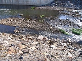
 The Trabuco Creek watershed, especially the Oso Creek subwatershed, has been severely and negatively affected by suburban development. The lower riparian area of the creek has been damaged and pollution from the creek travels down the last, channelized part of San Juan Creek to Doheny State Beach
, creating pollution problems in Capistrano Bay at Dana Point
. Such pollutants include urban runoff
, fertilizer
s, heavy metals and oils.
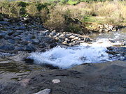
There is one dam on Trabuco Creek, located inside Trabuco Canyon. There are also many drop structure
s on the lower creek.
make up most of the vegetation in the hilly and sometimes mountainous Trabuco Creek basin. 16 different vegetation "bands", or zones, have been identified in the San Juan Creek watershed as a whole, and most of these also exist in the Trabuco Creek watershed. These range from riparian to chaparral, coastal sage scrub
and rocky outcroppings where little to no vegetation grows. In the undeveloped Plano Trabuco, there are grassland
s, and most of the lower Trabuco Creek Valley is urbanized.
 Riparian zones, consisting of small to medium-sized trees and a variety of other streambank flora, line Trabuco Creek, Tijeras Canyon Creek, and the upper tributaries including Live Oak Canyon, Falls Canyon and Holy Jim Canyon. These riparian habitats are now only found in the upper watershed. Oso Creek is heavily developed, and has little to no riparian vegetation. Lower Trabuco Creek still supports some riparian zones, but they have decreased in health because of the introduction of urban and agricultural runoff.
Aside from the large mammals including mountain lions, coyote
s, and bobcat
s (the last California grizzly bear in the Santa Ana Mountains was shot near Trabuco Canyon) the creek was once a productive habitat for steelhead trout.
Its upper portions, which include numerous gravel beds and bars, stream pools, and cascades, are suitable habitat for the anadromous fish, which still exist as rainbow trout
in upper Trabuco Creek. Because of extensive modifications—affecting the stability and water quality of the creek—steelhead no longer migrate to the upper reaches of the Trabuco Creek watershed. Conversely, steelhead were sighted in 2003 and 2005 along the creek. A project was proposed in 2005 to build a fish ladder
into a concrete drop structure
in Trabuco Creek that blocks steelhead passage. $1.2 million was allocated by the California State Wildlife Conservation Board in 2005 to fund the project, but it has not been begun.
Ecoregion
, with California oak woodland
and Chaparral
plant communities of California native plants
, with invasive plant species
of Noxious weeds in the riparian and 'bunch grass' grasslands.
origin occupied a 12 miles (19.3 km)-long, 8 miles (12.9 km)-wide strip of land along much of central Trabuco Creek and most of Oso Creek
, its major tributary, beginning at an unknown date. The Shoshoneans centered around the Trabuco/Oso Creek confluence and had a primarily hunter-gatherer
way of life.
Eventually, the people in the Southern Orange County/Northern San Diego County area settled down in semi-permanent villages, and this area became part of the Acjachemen tribal territory. There were two Acjachemen villages on the main stem of the Trabuco and one on Oso Creek, as well as numerous settlements at the confluence of San Juan and Trabuco Creeks all the way downstream to the Pacific. This was the historic landscape encountered by the Spanish
conquistador
s when they began expeditions to the area in the 18th century.
In 1769 Gaspar de Portola
led an expedition to the canyons of the Santa Ana Mountains. They camped on a bluff east of Trabuco Creek on the night of July 24–25, and the next day, one of the soldiers found his trabuco, or blunderbuss
(the type of gun), missing. The expedition never found the gun, and they named the creek Arroyo Trabuco as a memorial. Mission San Juan Capistrano
was established in 1776 at the confluence of San Juan and Trabuco creeks.
Rancho Trabuco
was a Mexican land grant that covered most of the upper Trabuco Creek watershed. Created in 1841, its boundaries were changed in both 1843 and 1846. In 1880, the land was sold to F.L.S. Pioche and the final owners were James L. Flood and Jerome O'Neill, who created the O'Neill Ranch out of the Rancho Trabuco. The name stayed and most of the ranch is now the site of O'Neill Regional Park, which was dedicated on October 5, 1982.
U.S. state
A U.S. state is any one of the 50 federated states of the United States of America that share sovereignty with the federal government. Because of this shared sovereignty, an American is a citizen both of the federal entity and of his or her state of domicile. Four states use the official title of...
of California
California
California is a state located on the West Coast of the United States. It is by far the most populous U.S. state, and the third-largest by land area...
, flowing from the westernmost extreme of Riverside County
Riverside County, California
Riverside County is a county in the U.S. state of California. One of 58 California counties, it covers in the southern part of the state, and stretches from Orange County to the Colorado River, which forms the state border with Arizona. The county derives its name from the city of Riverside,...
through Orange County
Orange County, California
Orange County is a county in the U.S. state of California. Its county seat is Santa Ana. As of the 2010 census, its population was 3,010,232, up from 2,846,293 at the 2000 census, making it the third most populous county in California, behind Los Angeles County and San Diego County...
to join San Juan Creek
San Juan Creek
San Juan Creek, also called the San Juan River, is a stream in Orange County, California that consists of a catchment basin encompassing . Its mainstem rises in the Santa Ana Mountains, in the Trabuco Ranger District of the Cleveland National Forest...
in the city of San Juan Capistrano. 21.8 miles (35.1 km) long, its watershed covers 54 mi2 in southeastern Orange County, including portions of three incorporated cities. Rising in a wild and undeveloped canyon in the southern Santa Ana Mountains
Santa Ana Mountains
The Santa Ana Mountains are a short peninsular mountain range along the coast of Southern California in the United States. They extend for approximately 36 mi southeast of the Los Angeles Basin largely along the border between Orange and Riverside counties.- Geography :The range starts in the...
, Trabuco Creek generally flows west and later south, and its upper and middle reaches are one of the few relatively undeveloped stretches of river of Orange County.
Tongva and Luiseño Native American people lived along the perennial stream in settlements and hunting camps for 8,000 years before the invasion
Population of Native California
Estimates of the Native Californian population have varied substantially, both with respect to California's pre-contact count and for changes during subsequent periods. Pre-contact estimates range from 133,000 to 705,000 with some recent scholars concluding that these estimates are low...
of Spanish colonization
Spanish colonization of the Americas
Colonial expansion under the Spanish Empire was initiated by the Spanish conquistadores and developed by the Monarchy of Spain through its administrators and missionaries. The motivations for colonial expansion were trade and the spread of the Christian faith through indigenous conversions...
. Trabuco is Spanish
Spanish language
Spanish , also known as Castilian , is a Romance language in the Ibero-Romance group that evolved from several languages and dialects in central-northern Iberia around the 9th century and gradually spread with the expansion of the Kingdom of Castile into central and southern Iberia during the...
for a Blunderbuss
Blunderbuss
The blunderbuss is a muzzle-loading firearm with a short, large caliber barrel, which is flared at the muzzle and frequently throughout the entire bore, and used with shot and other projectiles of relevant quantity and/or caliber. The blunderbuss could be considered to be an early form of shotgun,...
, a type of shotgun. Local legend attributes a Franciscan
Franciscan
Most Franciscans are members of Roman Catholic religious orders founded by Saint Francis of Assisi. Besides Roman Catholic communities, there are also Old Catholic, Anglican, Lutheran, ecumenical and Non-denominational Franciscan communities....
missionary friar traveling with the Gaspar de Portolà Expedition
Gaspar de Portolà
Gaspar de Portolà i Rovira was a soldier, governor of Baja and Alta California , explorer and founder of San Diego and Monterey. He was born in Os de Balaguer, province of Lleida, in Catalonia, Spain, of Catalan nobility. Don Gaspar served as a soldier in the Spanish army in Italy and Portugal...
in 1769 for the story that a blunderbuss was lost in the upper canyon by the creek, and so the naming of the area. John (Don Juan) Forster
John (Don Juan) Forster
John Forster was born in England; became a Mexican citizen of early California, and was one of the largest landowners in California.-Early life:...
received a Mexican land grant in 1846 for the canyon lands and creek and established Rancho Trabuco
Rancho Trabuco
Rancho Trabuco was a Mexican land grant in present day Orange County, California. The five square league grant consisted of two square leagues given in 1841 by Governor Juan B. Alvarado to Santiago Argüello plus three square leagues given in 1846 by Governor Pío Pico to John Forster. The name...
here.
Although the riverside habitat
Habitat
* Habitat , a place where a species lives and grows*Human habitat, a place where humans live, work or play** Space habitat, a space station intended as a permanent settlement...
is generally degrading in quality because of increasing pollution from urban and agricultural runoff, Trabuco Creek once supported one of the largest steelhead habitats of Orange County, and birds, large mammals, and amphibians still flourish in the rich riparian zone
Riparian zone
A riparian zone or riparian area is the interface between land and a river or stream. Riparian is also the proper nomenclature for one of the fifteen terrestrial biomes of the earth. Plant habitats and communities along the river margins and banks are called riparian vegetation, characterized by...
along its undeveloped portions. Upper Trabuco Creek, also referred to as Trabuco Canyon, is a popular hiking and off-roading area, and long, narrow O'Neill Regional Park on the creek is also a well-known recreational venue.
Course
Trabuco Creek begins in the Trabuco Ranger District of the Cleveland National ForestCleveland National Forest
Cleveland National Forest encompasses 460,000 acres , mostly of chaparral, with a few riparian areas. A warm dry mediterranean climate prevails over the Forest. It is the southernmost National forest of California. It is administered by the United States Forest Service, a government agency within...
, close to the boundary of Orange and Riverside Counties, at an elevation of 4310 feet (1,313.7 m). Its first few miles are in a large and deep canyon just north of Los Piños Peak, a roughly 4400 feet (1,341.1 m) summit of the Santa Ana Mountains, and south of Trabuco Peak, which rises to 4604 feet (1,403.3 m). From its headwaters, the creek flows in this narrow gorge for its first 4 miles (6.4 km). Inside the arid, roughly 2000 feet (609.6 m)-deep gorge, Holy Jim and Falls Canyon creeks join Trabuco before it passes the unincorporated community of Trabuco Canyon
Trabuco Canyon, California
Trabuco Canyon is a small unincorporated community located in the foothills of the Santa Ana Mountains in eastern Orange County, California, and lies partly within the Cleveland National Forest.Trabuco Canyon is north of the town of Rancho Santa Margarita...
, where Live Oak Canyon Creek joins from the right.
Rancho Santa Margarita, California
Rancho Santa Margarita is a city in Orange County, California. One of Orange County's youngest cities, Rancho Santa Margarita is a master planned community set upon rolling hills. Most neighborhoods in Rancho Santa Margarita are within various homeowners associations...
, the creek proceeds to flow southwest through a long, narrow wilderness preserve known as O'Neill Regional Park. Once out of the mountains, Trabuco Creek slows down dramatically and winds across a wide and sandy bed known as the Plano Trabuco. It crosses under California State Route 241
California State Route 241
State Route 241 is a state highway in the U.S. state of California. For its entire run, Route 241 is a toll road. Its northern half is part of the Eastern Toll Road while its southern half is part of the Foothill Toll Road....
, a toll road
Toll road
A toll road is a privately or publicly built road for which a driver pays a toll for use. Structures for which tolls are charged include toll bridges and toll tunnels. Non-toll roads are financed using other sources of revenue, most typically fuel tax or general tax funds...
that follows the western foothills of the Santa Ana Mountains, and passes close to Lake Mission Viejo
Lake Mission Viejo
Lake Mission Viejo is a reservoir entirely within Mission Viejo, in Orange County in the U.S. state of California. About south of Santiago Peak, a peak in the Santa Ana Mountains, the reservoir is formed by an earthfill dam across the canyon of Oso Creek, which is part of the Trabuco Creek and San...
, a popular recreational lake in the city of Mission Viejo
Mission Viejo, California
Mission Viejo is a city located in southern Orange County, California, U.S. in the Saddleback Valley. Mission Viejo is considered one of the largest master-planned communities ever built under a single project in the United States, and is rivaled only by Highlands Ranch, Colorado, in its size...
.
Still steadily bending southwards, Tijeras Canyon Creek shortly joins Trabuco from the left bank, then the combined waters pass under a high bridge for Oso Parkway and leave the southern boundary of O'Neill Regional Park. Even after exiting the park, the creek winds through a broad riparian zone
Riparian zone
A riparian zone or riparian area is the interface between land and a river or stream. Riparian is also the proper nomenclature for one of the fifteen terrestrial biomes of the earth. Plant habitats and communities along the river margins and banks are called riparian vegetation, characterized by...
at the bottom of a shallow canyon, but after passing Saddleback College
Saddleback College
The athletic programs are supported in part by the Associated Student Body at Saddleback College. Revenue generated from attendance at athletic events helps support the entire student activities program.-On-campus media outlets:*The Lariat...
, located near the southern junction of California State Route 73
California State Route 73
State Route 73 is a state highway in the U.S. state of California. The route runs from Interstate 405 to Interstate 5 through the San Joaquin Hills in Orange County. From its northern terminus, the first three miles of the highway are called the Corona del Mar Freeway; this section of highway...
and Interstate 5
Interstate 5
Interstate 5 is the main Interstate Highway on the West Coast of the United States, running largely parallel to the Pacific Ocean coastline from Canada to Mexico . It serves some of the largest cities on the U.S...
, the creek flows through a residential community and is diverted into twin culvert
Culvert
A culvert is a device used to channel water. It may be used to allow water to pass underneath a road, railway, or embankment. Culverts can be made of many different materials; steel, polyvinyl chloride and concrete are the most common...
s underneath the interstate.
The creek drops over two large man-made drop structure
Drop structure
A drop structure, also known as a grade control, sill, or weir, is a manmade structure, typically small and built on minor streams, or as part of a dam's spillway, to pass water to a lower elevation while controlling the energy and velocity of the water as it passes over...
s, the first of which marks the beginning of a small canyon the creek has carved out with the additional flow it incorporates from urban runoff
Urban runoff
Urban runoff is surface runoff of rainwater created by urbanization. This runoff is a major source of water pollution in many parts of the United States and other urban communities worldwide.-Overview:...
. Passing into the northernmost extreme of San Juan Capistrano, its major tributary, Oso Creek
Oso Creek
Oso Creek is an approximately tributary of Trabuco Creek in southern Orange County in the U.S. state of California. Draining about in a region north of the San Joaquin Hills and south of the Santa Ana Mountains, the creek is Trabuco Creek's largest tributary, and is part of the San Juan Creek...
, joins from the right, and the creek flows south through an agricultural area until it is forced into a concrete channel, passes by Mission San Juan Capistrano
Mission San Juan Capistrano
Mission San Juan Capistrano was a Spanish mission in Southern California, located in present-day San Juan Capistrano. It was founded on All Saints Day November 1, 1776, by Spanish Catholics of the Franciscan Order...
, and enters San Juan Creek within downtown San Juan Capistrano.
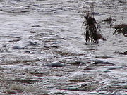
Discharge
On Trabuco Creek, the USGS operated two stream gauges, one from 1932–1981, and the second from 1973–2008, both near its mouth. The USGS refers to this creek as "Arroyo Trabuco". For the former gauge, the highest recorded flow was on 6 February 1937, water flow 9240 cuft/s, with gauge height 6.8 feet (2.1 m). During 2 March 1938, the second highest flow during that period occurred, with 4400 cuft/s of water, gauge height 7.5 feet (2.3 m). For the latter gauge, the peak flow was 10000 cuft/s (estimated) on 23 February 1998, with a gauge height of 19.81 feet (6 m). The USGS states that "All or part of the record affected by Urbanization, Mining, Agricultural changes, Channelization, or other", indicating the contribution of urban runoff to this flow. The second highest flow was 5510 cuft/s on 9 January 2005, with gauge height 16.96 feet (5.2 m). Above the confluence, Trabuco Creek actually is both longer and has more flow than San Juan Creek, but San Juan Creek drains more area.General description
Although much of the Trabuco Creek watershed is bounded by the San Juan Creek basin it also borders on several other major Orange and Riverside County watersheds. Listed from east to west, the major San Juan Creek subwatersheds it bounds are Bell Canyon
Bell Canyon
Bell Canyon is a gorge in the Santa Ana Mountains, its stream flowing about to its confluence with San Juan Creek, in Orange County of the U.S. state of California...
, Cañada Gobernadora
Cañada Gobernadora
Cañada Gobernadora is a tributary to San Juan Creek, about long, in southern Orange County in the U.S. state of California...
, Cañada Chiquita and El Horno Creek
El Horno Creek
El Horno Creek or Horno Creek is a tributary stream of San Juan Creek in Orange County in the U.S. state of California. It is approximately long and drains an area of . The creek joins San Juan Creek on the right bank, only a few hundred yards upstream of the Trabuco Creek confluence, within the...
. Trabuco Creek's headwaters are actually not physically far from that of Bell Canyon and San Juan Creek, the first of which is the second longest tributary of San Juan Creek. On the west of the Trabuco Creek watershed is the Aliso Creek drainage basin, on the north the Santiago Creek
Santiago Creek
Santiago Creek is a major watercourse in Orange County in the U.S. state of California. About long, it drains most of the northern Santa Ana Mountains and is a tributary to the Santa Ana River...
, and on the northeast streams draining into the Lake Elsinore
Lake Elsinore
Lake Elsinore, originally named Laguna Grande by the Spanish explorers, renamed for the town Lake Elsinore, California established on its northeastern shore April 9, 1888.-Limnology:...
area.
There are between 140,000 and 145,000 people living in the major cities in the Trabuco Creek watershed. This is similar to the population in the Aliso Creek watershed in the north, but in reality the population density of the Trabuco Creek watershed is much lower than that of most Orange County streams like Aliso Creek. (San Juan Creek, excluding Trabuco Creek, is even less urbanized.) The population density of the Trabuco Creek watershed is 2,639 people per square mile, while that of Aliso Creek is 4,904 people per square mile.
Geology
Geologically the present-day Trabuco Creek basin did not exist as early as the end of the most recent Ice AgeIce age
An ice age or, more precisely, glacial age, is a generic geological period of long-term reduction in the temperature of the Earth's surface and atmosphere, resulting in the presence or expansion of continental ice sheets, polar ice sheets and alpine glaciers...
. The Santa Ana Mountains, forming the northern, eastern and southeastern boundaries of the entire San Juan Creek watershed, did not begin to form until roughly 5.5 million years ago (MYA). The Santa Ana Mountains at the headwaters of San Juan Creek are composed primarily of Jurassic
Jurassic
The Jurassic is a geologic period and system that extends from about Mya to Mya, that is, from the end of the Triassic to the beginning of the Cretaceous. The Jurassic constitutes the middle period of the Mesozoic era, also known as the age of reptiles. The start of the period is marked by...
-age (196.6-145.5 MYA) igneous and sedimentary rock
Sedimentary rock
Sedimentary rock are types of rock that are formed by the deposition of material at the Earth's surface and within bodies of water. Sedimentation is the collective name for processes that cause mineral and/or organic particles to settle and accumulate or minerals to precipitate from a solution....
overlain by Cretaceous
Cretaceous
The Cretaceous , derived from the Latin "creta" , usually abbreviated K for its German translation Kreide , is a geologic period and system from circa to million years ago. In the geologic timescale, the Cretaceous follows the Jurassic period and is followed by the Paleogene period of the...
-age (145.5-65.5 MYA) granite
Granite
Granite is a common and widely occurring type of intrusive, felsic, igneous rock. Granite usually has a medium- to coarse-grained texture. Occasionally some individual crystals are larger than the groundmass, in which case the texture is known as porphyritic. A granitic rock with a porphyritic...
, gabbro
Gabbro
Gabbro refers to a large group of dark, coarse-grained, intrusive mafic igneous rocks chemically equivalent to basalt. The rocks are plutonic, formed when molten magma is trapped beneath the Earth's surface and cools into a crystalline mass....
, tolamite, siltstone
Siltstone
Siltstone is a sedimentary rock which has a grain size in the silt range, finer than sandstone and coarser than claystones.- Description :As its name implies, it is primarily composed of silt sized particles, defined as grains 1/16 - 1/256 mm or 4 to 8 on the Krumbein phi scale...
, sandstone
Sandstone
Sandstone is a sedimentary rock composed mainly of sand-sized minerals or rock grains.Most sandstone is composed of quartz and/or feldspar because these are the most common minerals in the Earth's crust. Like sand, sandstone may be any colour, but the most common colours are tan, brown, yellow,...
and conglomerate
Conglomerate (geology)
A conglomerate is a rock consisting of individual clasts within a finer-grained matrix that have become cemented together. Conglomerates are sedimentary rocks consisting of rounded fragments and are thus differentiated from breccias, which consist of angular clasts...
s. The underlying rock of the Santa Ana foothills are Tertiary
Tertiary
The Tertiary is a deprecated term for a geologic period 65 million to 2.6 million years ago. The Tertiary covered the time span between the superseded Secondary period and the Quaternary...
-age (65.5-2.59 MYA) sandstone.
As the Santa Ana Mountains rose, Trabuco Creek first formed as a canyon cut into the southeastern part of the range. Many of the creeks draining the range—including Santiago Creek
Santiago Creek
Santiago Creek is a major watercourse in Orange County in the U.S. state of California. About long, it drains most of the northern Santa Ana Mountains and is a tributary to the Santa Ana River...
, San Diego Creek
San Diego Creek
San Diego Creek is a waterway flowing into Upper Newport Bay in central Orange County in the U.S. state of California. Its basin covers in parts of eight cities, including Irvine, Tustin, and Costa Mesa. The major tributary of the northeast-flowing stream is Peters Canyon Wash, which joins a few...
, Bell Canyon
Bell Canyon
Bell Canyon is a gorge in the Santa Ana Mountains, its stream flowing about to its confluence with San Juan Creek, in Orange County of the U.S. state of California...
and San Juan Creek—first formed in the same way. The uplift of the San Joaquin Hills
San Joaquin Hills
The San Joaquin Hills are a set of low hills in coastal Orange County, California. They extend in a northwest-southeast direction, starting in the northwest in Newport Beach at the southern edge of the Los Angeles Basin, and extending southeast to San Juan Capistrano.-Geography and habitats:Named...
, a coastal mountain range generally following the Pacific coast
Pacific Coast
A country's Pacific coast is the part of its coast bordering the Pacific Ocean.-The Americas:Countries on the western side of the Americas have a Pacific coast as their western border.* Geography of Canada* Geography of Chile* Geography of Colombia...
of Orange County, created a physical barrier for these streams flowing off the Santa Ana Mountains. But by the Wisconsinian Glaciation, an enormous climate change helped solve that problem. During the Wisconsinian Glaciation, a period of time that lasted from about 70,000 to 10,000 years ago, glacier
Glacier
A glacier is a large persistent body of ice that forms where the accumulation of snow exceeds its ablation over many years, often centuries. At least 0.1 km² in area and 50 m thick, but often much larger, a glacier slowly deforms and flows due to stresses induced by its weight...
s and ice sheet
Ice sheet
An ice sheet is a mass of glacier ice that covers surrounding terrain and is greater than 50,000 km² , thus also known as continental glacier...
s moved south from northern Canada
Canada
Canada is a North American country consisting of ten provinces and three territories. Located in the northern part of the continent, it extends from the Atlantic Ocean in the east to the Pacific Ocean in the west, and northward into the Arctic Ocean...
into the northern United States, radically altering the climate of the entire continent. The arid Southern California climate was supplanted by a temperate rainforest climate that would receive rainfall in excess of 80 to 90 in (2,032 to 2,286 mm) per year. Trabuco Creek and other streams along the Orange County coast became powerful rivers that cut their way through the San Joaquin Hills.
This changed climate did not last, and by the time it had ended, several enormous canyons had been cut through the 600 to 1000 ft (182.9 to 304.8 m) high San Joaquin Hills. The Trabuco/San Juan Creek canyon is one of the less prominent ones, and is the last canyon before the San Joaquin Hills continue south into San Diego County
San Diego County, California
San Diego County is a large county located in the southwestern corner of the US state of California. Hence, San Diego County is also located in the southwestern corner of the 48 contiguous United States. Its county seat and largest city is San Diego. Its population was about 2,813,835 in the 2000...
. Because of the enormous erosion channels carved out by the Wisconsinian-era rivers, the creeks now flow on broad and deep beds of sediment that have filled these canyons.
Pollution and modifications
Doheny State Beach
Doheny State Beach, protected as part of the California Department of Parks and Recreation, is a beach on the Pacific coast of Orange County, in Dana Point, Southern California....
, creating pollution problems in Capistrano Bay at Dana Point
Dana Point, California
-Climate:Dana Point enjoys a mild climate where temperatures tend to average around the 60's. The warmest month of the year is August with an average temperature of 79 degrees Fahrenheit. The coldest month is December with an average minimum temperature of 44 degrees Fahrenheit.-2010:The 2010...
. Such pollutants include urban runoff
Urban runoff
Urban runoff is surface runoff of rainwater created by urbanization. This runoff is a major source of water pollution in many parts of the United States and other urban communities worldwide.-Overview:...
, fertilizer
Fertilizer
Fertilizer is any organic or inorganic material of natural or synthetic origin that is added to a soil to supply one or more plant nutrients essential to the growth of plants. A recent assessment found that about 40 to 60% of crop yields are attributable to commercial fertilizer use...
s, heavy metals and oils.
There is one dam on Trabuco Creek, located inside Trabuco Canyon. There are also many drop structure
Drop structure
A drop structure, also known as a grade control, sill, or weir, is a manmade structure, typically small and built on minor streams, or as part of a dam's spillway, to pass water to a lower elevation while controlling the energy and velocity of the water as it passes over...
s on the lower creek.
Climate and biology
The climate of the Trabuco Creek watershed is almost entirely semi-arid. Scrubland and chaparralChaparral
Chaparral is a shrubland or heathland plant community found primarily in the U.S. state of California and in the northern portion of the Baja California peninsula, Mexico...
make up most of the vegetation in the hilly and sometimes mountainous Trabuco Creek basin. 16 different vegetation "bands", or zones, have been identified in the San Juan Creek watershed as a whole, and most of these also exist in the Trabuco Creek watershed. These range from riparian to chaparral, coastal sage scrub
Coastal sage scrub
Coastal sage scrub is a low scrubland plant community found in the California chaparral and woodlands ecoregion of coastal California and northern Baja California. It is characterized by low-growing aromatic, and drought-deciduous shrubs adapted to the semi-arid Mediterranean climate of the...
and rocky outcroppings where little to no vegetation grows. In the undeveloped Plano Trabuco, there are grassland
Grassland
Grasslands are areas where the vegetation is dominated by grasses and other herbaceous plants . However, sedge and rush families can also be found. Grasslands occur naturally on all continents except Antarctica...
s, and most of the lower Trabuco Creek Valley is urbanized.
Aside from the large mammals including mountain lions, coyote
Coyote
The coyote , also known as the American jackal or the prairie wolf, is a species of canine found throughout North and Central America, ranging from Panama in the south, north through Mexico, the United States and Canada...
s, and bobcat
Bobcat
The bobcat is a North American mammal of the cat family Felidae, appearing during the Irvingtonian stage of around 1.8 million years ago . With twelve recognized subspecies, it ranges from southern Canada to northern Mexico, including most of the continental United States...
s (the last California grizzly bear in the Santa Ana Mountains was shot near Trabuco Canyon) the creek was once a productive habitat for steelhead trout.
Its upper portions, which include numerous gravel beds and bars, stream pools, and cascades, are suitable habitat for the anadromous fish, which still exist as rainbow trout
Rainbow trout
The rainbow trout is a species of salmonid native to tributaries of the Pacific Ocean in Asia and North America. The steelhead is a sea run rainbow trout usually returning to freshwater to spawn after 2 to 3 years at sea. In other words, rainbow trout and steelhead trout are the same species....
in upper Trabuco Creek. Because of extensive modifications—affecting the stability and water quality of the creek—steelhead no longer migrate to the upper reaches of the Trabuco Creek watershed. Conversely, steelhead were sighted in 2003 and 2005 along the creek. A project was proposed in 2005 to build a fish ladder
Fish ladder
A fish ladder, also known as a fishway, fish pass or fish steps, is a structure on or around artificial barriers to facilitate diadromous fishes' natural migration. Most fishways enable fish to pass around the barriers by swimming and leaping up a series of relatively low steps into the waters on...
into a concrete drop structure
Drop structure
A drop structure, also known as a grade control, sill, or weir, is a manmade structure, typically small and built on minor streams, or as part of a dam's spillway, to pass water to a lower elevation while controlling the energy and velocity of the water as it passes over...
in Trabuco Creek that blocks steelhead passage. $1.2 million was allocated by the California State Wildlife Conservation Board in 2005 to fund the project, but it has not been begun.
Flora
The canyon is in the California chaparral and woodlandsCalifornia chaparral and woodlands
The California chaparral and woodlands is a terrestrial ecoregion of lower northern, central, and southern California and northwestern Baja California , located on the west coast of North America...
Ecoregion
Ecoregion
An ecoregion , sometimes called a bioregion, is an ecologically and geographically defined area that is smaller than an ecozone and larger than an ecosystem. Ecoregions cover relatively large areas of land or water, and contain characteristic, geographically distinct assemblages of natural...
, with California oak woodland
California oak woodland
California oak woodland is a plant community found throughout the California chaparral and woodlands ecoregion of California in the United States and northwestern Baja California in Mexico...
and Chaparral
Chaparral
Chaparral is a shrubland or heathland plant community found primarily in the U.S. state of California and in the northern portion of the Baja California peninsula, Mexico...
plant communities of California native plants
California native plants
California native plants are plants that existed in California prior to the arrival of European explorers and colonists in the late 18th century...
, with invasive plant species
Invasive species
"Invasive species", or invasive exotics, is a nomenclature term and categorization phrase used for flora and fauna, and for specific restoration-preservation processes in native habitats, with several definitions....
of Noxious weeds in the riparian and 'bunch grass' grasslands.
History
It is hypothesized that Hokan-speaking Native Americans of ShoshoneShoshone
The Shoshone or Shoshoni are a Native American tribe in the United States with three large divisions: the Northern, the Western and the Eastern....
origin occupied a 12 miles (19.3 km)-long, 8 miles (12.9 km)-wide strip of land along much of central Trabuco Creek and most of Oso Creek
Oso Creek
Oso Creek is an approximately tributary of Trabuco Creek in southern Orange County in the U.S. state of California. Draining about in a region north of the San Joaquin Hills and south of the Santa Ana Mountains, the creek is Trabuco Creek's largest tributary, and is part of the San Juan Creek...
, its major tributary, beginning at an unknown date. The Shoshoneans centered around the Trabuco/Oso Creek confluence and had a primarily hunter-gatherer
Hunter-gatherer
A hunter-gatherer or forage society is one in which most or all food is obtained from wild plants and animals, in contrast to agricultural societies which rely mainly on domesticated species. Hunting and gathering was the ancestral subsistence mode of Homo, and all modern humans were...
way of life.
Eventually, the people in the Southern Orange County/Northern San Diego County area settled down in semi-permanent villages, and this area became part of the Acjachemen tribal territory. There were two Acjachemen villages on the main stem of the Trabuco and one on Oso Creek, as well as numerous settlements at the confluence of San Juan and Trabuco Creeks all the way downstream to the Pacific. This was the historic landscape encountered by the Spanish
Spanish people
The Spanish are citizens of the Kingdom of Spain. Within Spain, there are also a number of vigorous nationalisms and regionalisms, reflecting the country's complex history....
conquistador
Conquistador
Conquistadors were Spanish soldiers, explorers, and adventurers who brought much of the Americas under the control of Spain in the 15th to 16th centuries, following Europe's discovery of the New World by Christopher Columbus in 1492...
s when they began expeditions to the area in the 18th century.
In 1769 Gaspar de Portola
Gaspar de Portolà
Gaspar de Portolà i Rovira was a soldier, governor of Baja and Alta California , explorer and founder of San Diego and Monterey. He was born in Os de Balaguer, province of Lleida, in Catalonia, Spain, of Catalan nobility. Don Gaspar served as a soldier in the Spanish army in Italy and Portugal...
led an expedition to the canyons of the Santa Ana Mountains. They camped on a bluff east of Trabuco Creek on the night of July 24–25, and the next day, one of the soldiers found his trabuco, or blunderbuss
Blunderbuss
The blunderbuss is a muzzle-loading firearm with a short, large caliber barrel, which is flared at the muzzle and frequently throughout the entire bore, and used with shot and other projectiles of relevant quantity and/or caliber. The blunderbuss could be considered to be an early form of shotgun,...
(the type of gun), missing. The expedition never found the gun, and they named the creek Arroyo Trabuco as a memorial. Mission San Juan Capistrano
Mission San Juan Capistrano
Mission San Juan Capistrano was a Spanish mission in Southern California, located in present-day San Juan Capistrano. It was founded on All Saints Day November 1, 1776, by Spanish Catholics of the Franciscan Order...
was established in 1776 at the confluence of San Juan and Trabuco creeks.
Rancho Trabuco
Rancho Trabuco
Rancho Trabuco was a Mexican land grant in present day Orange County, California. The five square league grant consisted of two square leagues given in 1841 by Governor Juan B. Alvarado to Santiago Argüello plus three square leagues given in 1846 by Governor Pío Pico to John Forster. The name...
was a Mexican land grant that covered most of the upper Trabuco Creek watershed. Created in 1841, its boundaries were changed in both 1843 and 1846. In 1880, the land was sold to F.L.S. Pioche and the final owners were James L. Flood and Jerome O'Neill, who created the O'Neill Ranch out of the Rancho Trabuco. The name stayed and most of the ranch is now the site of O'Neill Regional Park, which was dedicated on October 5, 1982.