

Terence James Elkins
Encyclopedia
Terence James Elkins is an Australian-born American physicist
. In 1960, he participated in an expedition from Mawson Station
which conducted the first geological surveys of the Napier Mountains
in Antarctica. The highest of this group of mountains, Mount Elkins
, was subsequently named after him. In 1979, he received the Harold Brown Award
, the Air Force's highest honour for research and development, for research he conducted that contributed to the development of the AN/FPS-118 over-the-horizon
backscatter
(OTH-B) air defence radar
system. This system, consisting of six one-megawatt transmitters and their associated horizontal linear phased array antennas, is currently the largest radar system in the world.
degree from University of Melbourne
in 1957. He earned his Masters Degree in Physics
and Astronomy
from Boston University
in 1967. He earned his PhD from the same institution in 1970, publishing a thesis entitled Studies of Ionospheric Irregularity Using Radio Astronomical Techniques.
team that wintered over at Mawson Station
in Australian Antarctic Territory
, East Antarctica
in 1960. The wintering party comprised 33 expeditioners including 12 members of the RAAF Antarctic Flight; the Officer-in-Charge was Hendrick Geysen. That year, Elkins was part of a mechanised and sledging field party that travelled from Mawson Station to the Napier Mountains
in Enderby Land
, East Antarctica
. The men of this expedition, led by fellow Antarctic explorer Syd Kirkby
, conducted the first geological surveys of that area of the continent. The highest of this small group of mountains, Mount Elkins
, was subsequently named after Dr. Elkins.
Other survey teams that year visited the Framnes Mountains
, conducted geological and survey work in the Prince Charles Mountains
, and visited the Emperor penguin
colonies at Taylor Glacier
and Fold Island
.
ANARE has since been renamed the Australian Antarctic Program, managed by the Australian Antarctic Division
, itself a division of the Department of the Environment, Water, Heritage and the Arts.
 Elkins emigrated from his native Australia to the United States in 1963, at the height of the Space Race
, after being recruited by the scientific research program of the United States Air Force
. Beginning in the early 1960s, he conducted research focused mainly on the upper atmosphere and ionosphere
, and improvements to ground, airborne, and space-based surveillance and reconnaissance systems, including over-the-horizon radar systems.
In addition to his work at Hanscom Air Force Base
, much of his early research was also conducted at Sagamore Hill Radio Observatory
, a ground-based solar
observatory
located in Hamilton, Massachusetts
. Sagamore Hill Solar Radio Observatory is a functional component of the Radio Solar Telescope Network
(RSTN).
In 1980, he developed and published an aurora
l echo-scattering model to predict the obscuration of targets when the radar transmission path is through the auroral region.
(RADC) engineers that developed and constructed components for frequency modulation/continuous wave (FM/CW) radars capable of detecting and tracking objects at over-the-horizon ranges. A prototype radar was installed and evaluated on 15 September 1970. The system incorporated a Beverage array receive antenna (located at Columbia Air Force Station), a high-power transmitter array (located at Moscow Air Force Station), and an operations center (located at Bangor Airport). This prototype became operational on 30 October of that year. Experimental transmissions from the Maine site covered a 60° sector from 16.5° to 76.5° azimuth and from 900 to 3,300 km in range from the radar.
Based on the success of these early experiments, the Department of Defense proposed to deploy a fully operational radar system. This radar system, covering 180° in azimuth, was built at the same locations in Maine. Initial testing was conducted from June 1980 to June 1981. GE Aerospace (now Lockheed Martin Ocean, Radar and Sensor Systems) received a contract in mid-1982 for full-scale development of the AN/FPS-118 program.
The operational system consisted of multiple OTH-B radars functioning as an early warning system, to detect incoming enemy bombers and cruise missiles. The system, as initially envisioned, was to consist of four sectors:
Only months after the system became fully operational, the Cold War
came to an end. The military requirement for the OTH-B radar network was therefore greatly diminished. The mission of the ECRS radar system was redirected to counter-narcotics surveillance and drug interdiction, and the ECRS operated in this capacity for several years. The three OTH radars of the WCRS were mothballed, and the incomplete North Sector in Alaska was cancelled.
The Air Force currently maintains the six East Coast and West Coast OTH-B radars in a state called warm storage, which preserves the physical and electrical integrity of the system and permits recall, should a need arise. It would require at least 24 months to bring these first generation OTH-B radars into an operational status.
, where he conducted research at several of the tenant commands, including the Air Force Cambridge Research Laboratories (AFCRL) and the Geophysics Laboratory. He also conducted research at the Rome Air Development Center
, located at Griffiss Air Force Base
in Rome, New York
. The Geophysics Laboratory is now known as the Phillips Laboratory
, while the Rome Air Development Center is now known as the Rome Laboratory
. Both research laboratories operate under the Air Force Materiel Command
(AFMC).
Over the course of a career that spanned nearly five decades, Dr. Elkins' research focused on development and deployment of electronic systems for the gathering and dissemination of military intelligence
, including command, control and communications
, satellite imagery
, electronic warfare
, and systems for remote sensing
of the environment from surface, airborne, space and undersea based platforms.
After more than 20 years in research and development
for the United States Air Force, he joined the Mitre Corporation in McLean, Virginia
, where he continued his research for another 25 years. The majority of his work at MITRE was for the Command, Control, Communications, and Intelligence (C3I
) Federally Funded Research and Development Center (FFRDC) supporting the United States Department of Defense
.
. The Harold Brown Award is the Air Force's highest honour for research and development.
Physicist
A physicist is a scientist who studies or practices physics. Physicists study a wide range of physical phenomena in many branches of physics spanning all length scales: from sub-atomic particles of which all ordinary matter is made to the behavior of the material Universe as a whole...
. In 1960, he participated in an expedition from Mawson Station
Mawson Station
Mawson Station is one of three permanent Australian bases in the Australian Antarctic Territory of East Antarctica. Named after Antarctic explorer Sir Douglas Mawson, the base is managed by the Australian Antarctic Division...
which conducted the first geological surveys of the Napier Mountains
Napier Mountains
The Napier Mountains are a group of more-or-less separated peaks, the highest being Mount Elkins, at about 2,300 meters above sea level. This mountain range is located in Enderby Land, in the claimed Australian Antarctic Territory, East Antarctica.-Location:...
in Antarctica. The highest of this group of mountains, Mount Elkins
Mount Elkins
Mount Elkins, also known as Jökelen is a dark, steep-sided mountain with three major peaks, the highest 2,300 metres above sea level. This peak is located in the Napier Mountains, in Enderby Land. Enderby Land is part of the Australian Antarctic Territory, in East Antarctica...
, was subsequently named after him. In 1979, he received the Harold Brown Award
Harold Brown Award
The Harold Brown Award is the highest award given by the United States Air Force to a scientist or engineer who applies scientific research to solve a problem critical to the needs of the Air Force.-History and purpose of the Harold Brown Award:...
, the Air Force's highest honour for research and development, for research he conducted that contributed to the development of the AN/FPS-118 over-the-horizon
Over-the-horizon radar
Over-the-horizon radar, or OTH , is a design concept for radar systems to allow them to detect targets at very long ranges, typically up to thousands of kilometers...
backscatter
Backscatter
In physics, backscatter is the reflection of waves, particles, or signals back to the direction they came from. It is a diffuse reflection due to scattering, as opposed to specular reflection like a mirror...
(OTH-B) air defence radar
Radar
Radar is an object-detection system which uses radio waves to determine the range, altitude, direction, or speed of objects. It can be used to detect aircraft, ships, spacecraft, guided missiles, motor vehicles, weather formations, and terrain. The radar dish or antenna transmits pulses of radio...
system. This system, consisting of six one-megawatt transmitters and their associated horizontal linear phased array antennas, is currently the largest radar system in the world.
Education
Elkins earned his Bachelor of Electrical EngineeringBachelor of Electrical Engineering
Bachelor of Electrical Engineering is an undergraduate academic degree offered to a student who completes three to five years of study in electrical engineering at a university...
degree from University of Melbourne
University of Melbourne
The University of Melbourne is a public university located in Melbourne, Victoria. Founded in 1853, it is the second oldest university in Australia and the oldest in Victoria...
in 1957. He earned his Masters Degree in Physics
Physics
Physics is a natural science that involves the study of matter and its motion through spacetime, along with related concepts such as energy and force. More broadly, it is the general analysis of nature, conducted in order to understand how the universe behaves.Physics is one of the oldest academic...
and Astronomy
Astronomy
Astronomy is a natural science that deals with the study of celestial objects and phenomena that originate outside the atmosphere of Earth...
from Boston University
Boston University
Boston University is a private research university located in Boston, Massachusetts. With more than 4,000 faculty members and more than 31,000 students, Boston University is one of the largest private universities in the United States and one of Boston's largest employers...
in 1967. He earned his PhD from the same institution in 1970, publishing a thesis entitled Studies of Ionospheric Irregularity Using Radio Astronomical Techniques.
Mawson Station (1960–1961)
After completion of his Bachelor's degree, Elkins joined the ANAREAustralian National Antarctic Research Expeditions
The Australian National Antarctic Research Expeditions is the historical name for the Australian Antarctic Program administered for Australia by the Australian Antarctic Division .-The ANARE Name:...
team that wintered over at Mawson Station
Mawson Station
Mawson Station is one of three permanent Australian bases in the Australian Antarctic Territory of East Antarctica. Named after Antarctic explorer Sir Douglas Mawson, the base is managed by the Australian Antarctic Division...
in Australian Antarctic Territory
Australian Antarctic Territory
The Australian Antarctic Territory is a part of Antarctica. It was claimed by the United Kingdom and placed under the authority of the Commonwealth of Australia in 1933. It is the largest territory of Antarctica claimed by any nation...
, East Antarctica
East Antarctica
East Antarctica, also called Greater Antarctica, constitutes the majority of the Antarctic continent, lying on the Indian Ocean side of the Transantarctic Mountains...
in 1960. The wintering party comprised 33 expeditioners including 12 members of the RAAF Antarctic Flight; the Officer-in-Charge was Hendrick Geysen. That year, Elkins was part of a mechanised and sledging field party that travelled from Mawson Station to the Napier Mountains
Napier Mountains
The Napier Mountains are a group of more-or-less separated peaks, the highest being Mount Elkins, at about 2,300 meters above sea level. This mountain range is located in Enderby Land, in the claimed Australian Antarctic Territory, East Antarctica.-Location:...
in Enderby Land
Enderby Land
Enderby Land is a projecting land mass of Antarctica, extending from Shinnan Glacier at to William Scoresby Bay at .Enderby Land was discovered in February 1831 by John Biscoe in the whaling brig Tula, and named after the Enderby Brothers of London, owners of the Tula, who encouraged their...
, East Antarctica
East Antarctica
East Antarctica, also called Greater Antarctica, constitutes the majority of the Antarctic continent, lying on the Indian Ocean side of the Transantarctic Mountains...
. The men of this expedition, led by fellow Antarctic explorer Syd Kirkby
Sydney L. Kirkby
Sydney L. Kirkby, MBE is an Australian surveyor and Antarctic explorer.-Work:Syd Kirkby was first appointed as Surveyor at Mawson Station for 1956, the third year of ANARE operations in Antarctica....
, conducted the first geological surveys of that area of the continent. The highest of this small group of mountains, Mount Elkins
Mount Elkins
Mount Elkins, also known as Jökelen is a dark, steep-sided mountain with three major peaks, the highest 2,300 metres above sea level. This peak is located in the Napier Mountains, in Enderby Land. Enderby Land is part of the Australian Antarctic Territory, in East Antarctica...
, was subsequently named after Dr. Elkins.
Other survey teams that year visited the Framnes Mountains
Framnes Mountains
Framnes Mountains is an Antarctic mountain range consisting of Casey Range, Masson Range, David Range, and Brown Range, and adjacent peaks and mountains. The three major ranges and other lesser features were sighted and named in February 1931 by the British Australian New Zealand Antarctic Research...
, conducted geological and survey work in the Prince Charles Mountains
Prince Charles Mountains
Prince Charles Mountains is a major group of mountains in Mac. Robertson Land in Antarctica, including the Athos Range, the Porthos Range, and the Aramis Range. The highest peak is Mount Menzies . Other prominent peaks are Mount Izabelle and Mount Stinear...
, and visited the Emperor penguin
Emperor Penguin
The Emperor Penguin is the tallest and heaviest of all living penguin species and is endemic to Antarctica. The male and female are similar in plumage and size, reaching in height and weighing anywhere from . The dorsal side and head are black and sharply delineated from the white belly,...
colonies at Taylor Glacier
Taylor Glacier
The Taylor Glacier is an Antarctic glacier about long, flowing from the plateau of Victoria Land into the western end of Taylor Valley, north of the Kukri Hills, south of the Asgard Range...
and Fold Island
Fold Island
Fold Island is an offshore island north of Ives Tongue, 6 mi long and 3 mi wide, which, with smaller islands south, separate Stefansson Bay to the west from William Scoresby Bay to the east. This feature was seen by Discovery Investigations personnel on the RSS William Scoresby in February 1936,...
.
ANARE has since been renamed the Australian Antarctic Program, managed by the Australian Antarctic Division
Australian Antarctic Division
The Australian Antarctic Division is an agency of the Department of Sustainability, Environment, Water, Population and Communities . The division undertakes science programs and research projects to contribute to an understanding of Antarctica and the Southern Ocean...
, itself a division of the Department of the Environment, Water, Heritage and the Arts.
Emigration to the United States and early career
Space Race
The Space Race was a mid-to-late 20th century competition between the Soviet Union and the United States for supremacy in space exploration. Between 1957 and 1975, Cold War rivalry between the two nations focused on attaining firsts in space exploration, which were seen as necessary for national...
, after being recruited by the scientific research program of the United States Air Force
United States Air Force
The United States Air Force is the aerial warfare service branch of the United States Armed Forces and one of the American uniformed services. Initially part of the United States Army, the USAF was formed as a separate branch of the military on September 18, 1947 under the National Security Act of...
. Beginning in the early 1960s, he conducted research focused mainly on the upper atmosphere and ionosphere
Ionosphere
The ionosphere is a part of the upper atmosphere, comprising portions of the mesosphere, thermosphere and exosphere, distinguished because it is ionized by solar radiation. It plays an important part in atmospheric electricity and forms the inner edge of the magnetosphere...
, and improvements to ground, airborne, and space-based surveillance and reconnaissance systems, including over-the-horizon radar systems.
In addition to his work at Hanscom Air Force Base
Hanscom Air Force Base
Hanscom Air Force Base is a United States Air Force base located approximately south-southwest of Bedford, Massachusetts. The facility is a joint use civil airport/military base with Hanscom Field which provides general aviation and charter service.The host unit at Hanscom is the non-flying...
, much of his early research was also conducted at Sagamore Hill Radio Observatory
Sagamore Hill Radio Observatory
- Location :Sagamore Hill, Hamilton, Massachusetts, USA The Sagamore Hill Solar Radio Observatory is a ground-based solar radio telescope observatory located in Hamilton, Massachusetts that operates on a daily basis to obtain scientific observations of the sun. It is a functional component of the...
, a ground-based solar
Sun
The Sun is the star at the center of the Solar System. It is almost perfectly spherical and consists of hot plasma interwoven with magnetic fields...
observatory
Observatory
An observatory is a location used for observing terrestrial or celestial events. Astronomy, climatology/meteorology, geology, oceanography and volcanology are examples of disciplines for which observatories have been constructed...
located in Hamilton, Massachusetts
Hamilton, Massachusetts
Hamilton is a town located in the eastern central portion of Essex County in eastern Massachusetts. It is primarily a suburban bedroom community, most commonly known for its equestrian estates...
. Sagamore Hill Solar Radio Observatory is a functional component of the Radio Solar Telescope Network
Radio Solar Telescope Network
The Radio Solar Telescope Network is a network of solar observatories maintained and operated by the U.S.Air Force Weather Agency. The RSTN consists of ground-based observatories in Australia, Italy, Massachusetts, New Mexico and Hawaii.- History :...
(RSTN).
In 1980, he developed and published an aurora
Aurora (astronomy)
An aurora is a natural light display in the sky particularly in the high latitude regions, caused by the collision of energetic charged particles with atoms in the high altitude atmosphere...
l echo-scattering model to predict the obscuration of targets when the radar transmission path is through the auroral region.
Development of the over-the-horizon air defence radar system
Elkins was part of a team of Rome Air Development CenterRome Laboratory
The Rome Laboratory, formerly known as the Rome Air Development Center, is one of eight research and development labs run by the US Air Force located at Griffiss AFB in Rome, NY. One of four superlabs run by the Air Force, the Rome Lab is tasked with generic research, as opposed to having a...
(RADC) engineers that developed and constructed components for frequency modulation/continuous wave (FM/CW) radars capable of detecting and tracking objects at over-the-horizon ranges. A prototype radar was installed and evaluated on 15 September 1970. The system incorporated a Beverage array receive antenna (located at Columbia Air Force Station), a high-power transmitter array (located at Moscow Air Force Station), and an operations center (located at Bangor Airport). This prototype became operational on 30 October of that year. Experimental transmissions from the Maine site covered a 60° sector from 16.5° to 76.5° azimuth and from 900 to 3,300 km in range from the radar.
Based on the success of these early experiments, the Department of Defense proposed to deploy a fully operational radar system. This radar system, covering 180° in azimuth, was built at the same locations in Maine. Initial testing was conducted from June 1980 to June 1981. GE Aerospace (now Lockheed Martin Ocean, Radar and Sensor Systems) received a contract in mid-1982 for full-scale development of the AN/FPS-118 program.
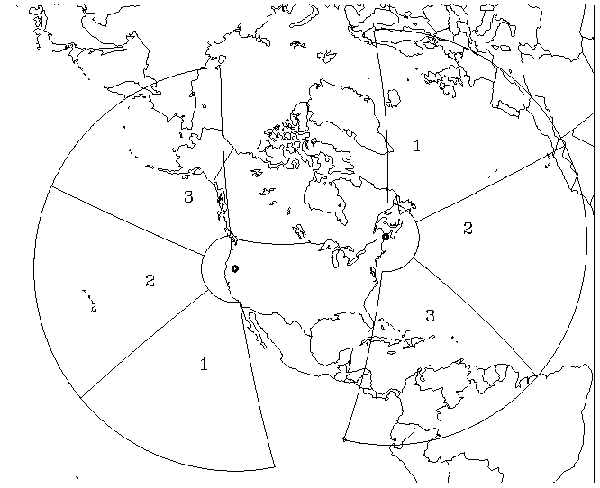
The operational system consisted of multiple OTH-B radars functioning as an early warning system, to detect incoming enemy bombers and cruise missiles. The system, as initially envisioned, was to consist of four sectors:
- East Coast Sector (ECRS): facing east, including a group of three transmitters at Moscow Air Force Station, MaineMoscow, MaineMoscow is a town in Somerset County, Maine, United States. The population was 577 at the 2000 census.-Geography:According to the United States Census Bureau, the town has a total area of , of which, of it is land and of it is water.-Demographics:...
, a group of three receivers at Columbia Air Force Station, also in Maine, and an operations center located at Bangor International AirportBangor International AirportBangor International Airport is a joint civil-military public airport located west of the city of Bangor, in Penobscot County, Maine, United States. It is owned and operated by the City of Bangor and was formerly a military installation known as Dow Air Force Base. The airport possesses a single...
. - West Coast Sector (WCRS): facing west, including a group of three transmitters at Christmas Valley, OregonChristmas Valley, OregonChristmas Valley is an unincorporated community in Lake County, Oregon, United States. The community was named after nearby dry Christmas Lake, east of the present townsite and the site of the former Lake post office, which ran from 1906 until 1943. Real estate development around a planned...
, a group of three receivers at Tule LakeTule LakeTule Lake is an intermittent lake covering an area of , long and across, in northeastern Siskiyou County and northwestern Modoc County in California, along the border with Oregon.-Geography:Tule Lake is fed by the Lost River...
, near Alturas, CaliforniaAlturas, CaliforniaAlturas is the county seat of Modoc County, California, United States. Alturas is located on the Pit River, east of the center of Modoc County, at an elevation of 4370 feet...
, and an operations center at Mountain Home Air Force BaseMountain Home Air Force BaseMountain Home Air Force Base is a United States Air Force installation located in southwestern Idaho, United States. The base is in Elmore County, 12 miles southwest of the city of Mountain Home, which is 40 miles southeast of Boise, via Interstate 84.The host unit at Mountain Home since 1972...
, IdahoIdahoIdaho is a state in the Rocky Mountain area of the United States. The state's largest city and capital is Boise. Residents are called "Idahoans". Idaho was admitted to the Union on July 3, 1890, as the 43rd state....
. - North Sector (in AlaskaAlaskaAlaska is the largest state in the United States by area. It is situated in the northwest extremity of the North American continent, with Canada to the east, the Arctic Ocean to the north, and the Pacific Ocean to the west and south, with Russia further west across the Bering Strait...
): facing north, cancelled prior to completion - Central Sector (in Texas): facing south
Only months after the system became fully operational, the Cold War
Cold War
The Cold War was the continuing state from roughly 1946 to 1991 of political conflict, military tension, proxy wars, and economic competition between the Communist World—primarily the Soviet Union and its satellite states and allies—and the powers of the Western world, primarily the United States...
came to an end. The military requirement for the OTH-B radar network was therefore greatly diminished. The mission of the ECRS radar system was redirected to counter-narcotics surveillance and drug interdiction, and the ECRS operated in this capacity for several years. The three OTH radars of the WCRS were mothballed, and the incomplete North Sector in Alaska was cancelled.
The Air Force currently maintains the six East Coast and West Coast OTH-B radars in a state called warm storage, which preserves the physical and electrical integrity of the system and permits recall, should a need arise. It would require at least 24 months to bring these first generation OTH-B radars into an operational status.
Later career
Dr. Elkins spent much of his career at Hanscom Air Force Base in Bedford, MassachusettsBedford, Massachusetts
Bedford is a town in Middlesex County, Massachusetts, United States. It is within the Greater Boston area, north-west of the city of Boston. The population of Bedford was 13,320 at the 2010 census.- History :...
, where he conducted research at several of the tenant commands, including the Air Force Cambridge Research Laboratories (AFCRL) and the Geophysics Laboratory. He also conducted research at the Rome Air Development Center
Rome Laboratory
The Rome Laboratory, formerly known as the Rome Air Development Center, is one of eight research and development labs run by the US Air Force located at Griffiss AFB in Rome, NY. One of four superlabs run by the Air Force, the Rome Lab is tasked with generic research, as opposed to having a...
, located at Griffiss Air Force Base
Griffiss Air Force Base
Griffiss Air Force Base, is a former United States Air Force base, located in Rome, New York, about NW of Utica. Missions at Griffiss AFB included fighter interceptors, electronic research, installation, and support activities, aerial refueling, and bombers...
in Rome, New York
Rome, New York
Rome is a city in Oneida County, New York, United States. It is located in north-central or "upstate" New York. The population was 44,797 at the 2010 census. It is in New York's 24th congressional district. In 1758, British forces began construction of Fort Stanwix at this strategic location, but...
. The Geophysics Laboratory is now known as the Phillips Laboratory
Phillips Laboratory
Phillips Laboratory was a research and development organization operated by the United States Air Force Materiel Command. In 1997, the Laboratory was merged into the Air Force Research Laboratory as the Space Vehicles and Directed Energy Directorates. It was located at Kirtland Air Force Base in...
, while the Rome Air Development Center is now known as the Rome Laboratory
Rome Laboratory
The Rome Laboratory, formerly known as the Rome Air Development Center, is one of eight research and development labs run by the US Air Force located at Griffiss AFB in Rome, NY. One of four superlabs run by the Air Force, the Rome Lab is tasked with generic research, as opposed to having a...
. Both research laboratories operate under the Air Force Materiel Command
Air Force Materiel Command
Air Force Materiel Command is a major command of the United States Air Force. AFMC was created July 1, 1992 through the reorganization of Air Force Logistics Command and Air Force Systems Command....
(AFMC).
Over the course of a career that spanned nearly five decades, Dr. Elkins' research focused on development and deployment of electronic systems for the gathering and dissemination of military intelligence
Military intelligence
Military intelligence is a military discipline that exploits a number of information collection and analysis approaches to provide guidance and direction to commanders in support of their decisions....
, including command, control and communications
C4ISTAR
In military usage, a number of abbreviations in the format C followed by additional letters are used, based on expanded versions of the abbreviation C2 - command and control.C2I stands for command, control, and intelligence....
, satellite imagery
Satellite imagery
Satellite imagery consists of photographs of Earth or other planets made by means of artificial satellites.- History :The first images from space were taken on sub-orbital flights. The U.S-launched V-2 flight on October 24, 1946 took one image every 1.5 seconds...
, electronic warfare
Electronic warfare
Electronic warfare refers to any action involving the use of the electromagnetic spectrum or directed energy to control the spectrum, attack an enemy, or impede enemy assaults via the spectrum. The purpose of electronic warfare is to deny the opponent the advantage of, and ensure friendly...
, and systems for remote sensing
Remote sensing
Remote sensing is the acquisition of information about an object or phenomenon, without making physical contact with the object. In modern usage, the term generally refers to the use of aerial sensor technologies to detect and classify objects on Earth by means of propagated signals Remote sensing...
of the environment from surface, airborne, space and undersea based platforms.
After more than 20 years in research and development
Research and development
The phrase research and development , according to the Organization for Economic Co-operation and Development, refers to "creative work undertaken on a systematic basis in order to increase the stock of knowledge, including knowledge of man, culture and society, and the use of this stock of...
for the United States Air Force, he joined the Mitre Corporation in McLean, Virginia
McLean, Virginia
McLean is an unincorporated community and census-designated place in Fairfax County in Northern Virginia. The community had a total population of 48,115 as of the 2010 census....
, where he continued his research for another 25 years. The majority of his work at MITRE was for the Command, Control, Communications, and Intelligence (C3I
C4ISTAR
In military usage, a number of abbreviations in the format C followed by additional letters are used, based on expanded versions of the abbreviation C2 - command and control.C2I stands for command, control, and intelligence....
) Federally Funded Research and Development Center (FFRDC) supporting the United States Department of Defense
United States Department of Defense
The United States Department of Defense is the U.S...
.
Awards and recognition
Elkins was the recipient of the 1979 Harold Brown AwardHarold Brown Award
The Harold Brown Award is the highest award given by the United States Air Force to a scientist or engineer who applies scientific research to solve a problem critical to the needs of the Air Force.-History and purpose of the Harold Brown Award:...
. The Harold Brown Award is the Air Force's highest honour for research and development.
Publications
Elkins has published many scientific journal articles, including:- Ionospheric effects associated with nuclear weapon tests, July–December 1962: a scientific report, by Terence J. Elkins & Alv Egeland (Kiruna Geophysical Observatory, 63:2, 1 MAR 1963).
- Influence of solar protons on high-latitude ionospheric disturbance, by Terence J. Elkins (Radio Sci., 1: 1195–1200, OCT 1966).
- Frequency dependence of radio star scintillations, by J. Aarons, R.S. Allen, and T.J. Elkins (Journal of Geophysical Research, Volume 72, Issue 11, Pages 2891–2902, 1 JUN 1967).
- Measurement and interpretation of power spectrums of ionospheric scintillation at a sub-auroral location, by Terence J. Elkins and Michael D. Papagiannis (Journal of Geophysical Research, Volume 74, Pages 4105–4115, 1 AUG 1969).
- Observations of travelling ionospheric disturbances using stationary satellites, by T.J. Elkins and F.F. Slack (Journal of Atmospheric and Terrestrial Physics, Volume 31, Issue 3, Pages 421–439, MAR 1969).
- Dispersive motions of ionospheric irregularities, by Michael D. Papagiannis and Terence J. Elkins (Journal of Atmospheric and Terrestrial Physics, Volume 32, Issue 3, Pages 383–395, MAR 1970).