

Temerin
Encyclopedia
Temerin is a town and municipality in South Bačka District
of Vojvodina
, Serbia
. Temerin town has a population of 19,143, and Temerin municipality 28,201.
Temerin municipality encompasses of towns of Temerin and Bački Jarak
(Hungarian: historically Tiszaistvánfalva, in modern usage Járek), and Sirig
village.
, the town is known as Temerin (Темерин), in Hungarian
as Temerin, in German
as Temeri, and in Croatian
as Temerin.
The Serbian and Hungarian languages are officially used by municipal authorities.
plain. On its east side it borders on Municipality of Žabalj
, on the north side on Municipality of Srbobran
, Municipality of Vrbas is on the west and Novi Sad
borders on its south side.
The most influential factor in the development of Temerin is the vicinity of the most developed business center in Vojvodina
– Novi Sad
. The territory of the Municipality of Temerin covers the area of around 170 km² (66 mi²), and has a shape of irregular trapezoid
, spreading in the northwest – southeast direction. The longer axis, covering the direction Sirig–Temerin, is 14 km long and the shorter axis in Bački Jarak
–Temerin direction is 11 km long.
The boundaries of municipality are artificial lines, mostly in rectilinear directions. The only natural boundary of the municipality is on its northeast side where it follows the water current of river Jegrička
. On the southeast side the boundary is made with the embankment called Rimski Šanac II.
 In regard to relief shapes of Vojvodina
, whole territory of Municipality of Temerin is placed on a south loessial ridge of Bačka
. It leaves the impression of an almost flat surface. The river Jegrička
flows through the north side of the municipality with few smaller channeled tributaries. It is established that thermo-mineral waters are present. Soil composition is quite equalized and fertility is naturally high. Different types of chernozem dominate in the area of the municipality. Along the riverbank swampy dark types of soil and solonchak
can be found; these are partly or fully salted soil types.
The Municipality of Temerin has three settlements: Temerin, Bački Jarak
and Sirig
and the territory is divided into four cadastre
s: Temerin, Bački Jarak, Sirig and Kamendin
. Geographical location of the Municipality of Temerin is very favorable. In the meridian direction the municipality is cut by three important roads. The most important is international road E-75 which drives from Novi Sad
towards Subotica
and then further to Hungary
.
 Road section Novi Sad
–Srbobran
, cutting the west part of the Municipality of Temerin, was put into use in 1984. The second road by its importance is highway M-22 (since recently international way E-5) which has the nearly the same direction. M-22 leads bit more eastern than E-75 and goes through village named Sirig
.
The third road is one with regional importance (R-120), going through Novi Sad
, Bački Jarak
and Temerin and leading to Bečej
, Senta
and Kanjiža
. At Sirig
and Temerin all these roads are crossed by regional road (R-104) which has Odžaci
–Zmajevo
–Sirig
–Temerin–Žabalj
direction. From here a main road leads over Tisa
to Zrenjanin
and other towns in Banat
. Through the southeast part of the municipality and its two settlements—Bački Jarak
and Temerin, leads a railway from Novi Sad
to Žabalj
, Bečej
and Senta
.
 In written documents, Temerin is mentioned for the first time in 1332 in the receipt by the pope, issued to Laurentius de Temeri, parish priest, for the payment of pope’s tax. Temerin was part of Hungarian Kingdom until battle of Mohács
in 1526. After that year it was part of the Ottoman Empire.
In view of the fact that Temerin used to be a rich village, between 1746 and 1749 locals built an orthodox church and dedicated it to Christ’s ascension into Heaven. It was located at the beginning of today’s Bosanska street, on its right side, where are now houses with numerations from 2 to 10.
Military map and religious books from that same church are proving the existence of the church. Some of them are still kept in the church of Christ’s ascension into Heaven in the village Đurđevo. The church was made of bricks – solid material (which is important because in the most of the villages churches were made of wood – as log cabins). Church dimensions were: length 17 m, width 6.5 m, walls were nearly 6 m high. The church had church steeple, built just besides main building, 11 special windows with iron bars on them. Johan Milner built the church with assistance and coordination of Visarion Pavlović, the bishop of Bačko-Segedinska eparchy.
Among church school students was also one of the most important people from Temerin, writer, theology professor and
bishop, polyglot Lukijan Mušicki
, born in Temerin in 1777. He was a friend and associate of Vuk Stefanović Karadžić
(he added a letter “đ” to the Vuk alphabet).
In 1796 Chamber sold Temerin and Bački Jarak
to count Sándor Szécsen for a price of 80,000 forints
. Organized colonization of Temerin by Hungarians started in 1782 and the migration of Germans started in 1787. In that year they founded and settled Bački Jarak, a place which used to be barren area of Bačka until then.
Count Sándor Szécsen tried to turn Serbs into his peasants which resulted in their four years long attempt (from 1796 to 1800) to annex Temerin to the Military Border and its nearest unit battalion of Šajkaš. This attempt failed and on July 21, 1799 they decided to move out of Temerin. Delegation sent by parish commission stopped them in their attempt by postponing their migration. On the same day that commission made a document of a great importance. Document was called “a listing of all orthodox families from Temerin who came out for migration to the military battalion in the Paška barren area”. This important document contents the names of 178 heads of families that were leaving.
After a few months the number of immigrant families raised to 210 families and 1,610 living souls. In the spring of 1800 they tore down their houses and their church and carried all of its building material to Paška barren area where they founded new village named Đurđevo. Name was given because they moved on a St. George day (“Sveti Đorđe”). Only five years later they built a new, even bigger church out of the material they brought with themselves. They dedicated the new church to Christ’s ascension into Heaven, same as they did in Temerin.
For next 120 years Temerin was without Serbs, count Szécsen brought Hungarian colonizers, peasants from tribal states Pest, Fehér and Tolna. Same count ordered building of a very representative palace (castle), so called "Kastély", which is now under state jurisdiction. Nowadays it houses secondary school of techniques.
Szécsen family sold the Temerin property and "Кastély" to grain merchant Antal Fernbah from Apatin
. Ana and Petar Fernbah were his heirs and they kept complete Temerin property until agrarian reform in the Kingdom of SHS (Serbs, Croats and Slovenes) in 1920.
In 1799 Temerin was declared a town and was given a right to hold 4 livestock fairs per year. Catholic Church was built in 1804, and the "old school" in 1835. Tumultuous times and 1848 did not spare Temerin. In clashes it burned ompletely and the settlers migrated to the north, in Bačka Topola
, Mali Iđoš, Čantavir
and other settlements. After 4-6 month most of them returned to their old homes.
On July 2, 1899 a railway direction Novi Sad–Temerin–Bečej was built and put in function as well as the railway station in Temerin. That started industrial development of Temerin, putting into operation one brick plant and first steam mills. Temerin soon became one of the important trading centers in the southeast part of Bačka.
Creation of the Kingdom SHS (Serbs, Croats and Slovenes) marked a new period in the history and the economy of the town. Fernbah's properties were one of the agrarian reform targets. Agrarian authorities from Belgrade
and Novi Sad
put a new law into effect, colonized farmers from Novi Sad and its vicinity and colonized volunteers. In 1920 started a creation of a new colony of volunteers south of Temerin, 18 km north of Novi Sad and next to road Novi Sad
–Bečej
–Senta
. In the memory of an old Serbian village in Temerin, immigrants called their new settlement Staro Đurđevo in 1929. At the beginning it had 42 families, now it has grown into a place with over 1,100 households and about 4,000 settlers.
In 1927, between two wars, Temerin got electricity. During the Hungarian military occupation (1941–1944) settlers of Staro Đurđevo and Sirig
were expelled from their homes and Hungarian families from Bukovina were settled on this land. During the occupation, in 1942 raid, 48 inhabitants of the town were murdered, of whom 14 were men, 15 women, 7 children, and 12 old people. By nationality, victims included 42 Jews, and 6 Serbs. In 1944, Hungarians from Bukovina
resettled in Hungary
. The Germans from Bački Jarak
were resettled and murdered. Founders of Đurđevo and Sirig returned to their old settlements. Bački Jarak became almost completely colonized with immigrants from Bosnia and Herzegovina
.
October 1944 the Soviet Red Army entered Temerin who were followed by the yugoslav communist partizans.
All of the three settlements in the municipality have an ethnic Serb majority.
Migrations largely influenced population structure of Temerin.
In 1800 Serbs with 1,610 inhabitants from 210 families left the village and established new one about 20 km east of Temerin. Today it is called Đurđevo and is located near Žabalj
. That left Temerin without Serbs until 1920. That year volunteers established new settlement, Staro Đurđevo, which is now local community of the Municipality of Temerin. In 1991 it had 3,718 inhabitants and today more than 4,000 people live there.
Bački Jarak
, until 1944 was settled with mostly German settlers, and was during 1946-1947 settled with Serb colonists, mostly from Bosnia and Herzegovina
, in order to increase the number of inhabitants in Novi Sad
, 2,276 settlers came in Bački Jarak, the nearest settlement to Novi Sad. In 1991 Bački Jarak had 6,000 inhabitants.
Sirig
is colonized as well, in this town 63% of inhabitants are colonizers. During the 1960s and 1970s several hundred families from village Vrbljani
(the Municipality of Ključ
, Bosnia and Herzegovina
) migrated to the local community Staro Đurđevo. Economical situation was reason for that.
Temerin itself is one of the settlements where natives were absolute majority. In 1961, 9,447 inhabitants were in this category, only one third of settlers (3 258) were immigrants.
According to census in 1991 Temerin has 8,174 households; 3,059 of that number are farm households placed in 8,595 apartments. One of the local communities named Staro Đurđevo (3,718 inhabitants), even overgrown a village Sirig (2,546 inhabitants).
Finally, the civil war on the territory of former Yugoslavia
brought to significant changes in the population structure of this municipality. Temerin was a stop point for 9,650 refugees, 4,950 of them still live here at their relatives and friends homes as well as in 4 organized refugee shelters that still exist. These changes brought population number to 30,000 in 1999.
ial ridge, alluvial ridge of river Danube and inundational planes of river Danube and river Tisa.
Total area of the Municipality of Temerin is placed in the eastern part of south loessial ridge of Bačka. Heights above sea level
vary from 81 m to 83 m. Monotony of Bačka plain is disturbed only by lonely hillocks and valleys of smaller water currents.
Jegrička is the biggest stream on the south loessial Bačka ridge and area of the Municipality of Temerin. Jegrička is a 64.5 km long tributary of Tisa that empties into the Tisa on its right side. The river course was formed during the Holocene, the youngest period of Earth history. At that period ground in the south part of Bačka lowered in a line that was later inherited by this water current.
Jegrička is formed from water of few swamps from areas of Despotovo, Silbaš, Parage, Ratkovo and Pivnice. River enters into the Temerin territory on its west side, from the Municipality of Vrbas. The part of Jegrička that flows through the Municipality of Temerin has the length of 18 km which is 28% of its total length. River flows about 1 km north of Sirig and about 2 km north of Temerin. From a place where the river crosses the Temerin–Bečej road it becomes the municipality borderline.
of Vojvodina we can separate eight different types of soil in the territory of the Municipality of Temerin. The most represented are subtypes of chernozem
: carbonated chernozem, carbonated chernozem with signs of earlier contact with swamp, carbonated chernozem with signs of gleying in loess, solonchak chernozem, carbonated and sporadically salted swampy dark soil, meadow carbonated dark soil, swampy noncarbonated dark soil and solonchak
.
Narrow areas along rivers and lines of communication are full of wild growing vegetation: wild poppy, corn cockle, spurge, horse basil, meadow buttercup, red clover, yarrow, foxglove, burdock, nettle, chamomile, mustard, etc. Around and in riverbeds you can find plenty of cane, cattail, water lily and alga.
There are no bigger forest areas, but around farms (“salaš”) smaller forests of black locust and poplar with few mulberry trees can be seen. Around motels near Sirig and Temerin pine trees have been planted.
Field mice and rats live on large areas planted with corn as well as polecats, weasels, ground squirrels, hamsters, hedgehogs and moles. If we look for big game, important for hunting, we can find roe deer, foxes and hares. Of game birds we can find pheasants, partridges, mallards and wild geese as well as rock doves. There are also a lot of other bird species: sparrows, swallows, woodpeckers, starlings, cuckoos, blackbirds, wrens, storks, hooded crows, etc.
There are a lot of insects: mosquitoes, flees, wasps, bees, gypsy moths, green crickets, hornets, different louses, crickets, ladybugs, moths, butterflies, etc. Among agricultural pests the widest spreads are: potato beetle, turnip beetle, grain weevil and bean weevil.
In and around water currents live various fishes: carp, bream, robin, pike, perch, as well as other animals: snails, leeches, various frogs, marsh shells, snakes, etc.
A large number of domestic animals are raised.
 Thermo-mineral waters in Temerin were first discovered in 1914 and that is also when their exploitation started. At that time a 417 m well hole was drilled. Grisa Andraš was name of the owner. This well cuts through Quaternary
and paludina deposits and gives water of 27 °C (81 °F). The quantity of water pouring out used to be 397 l/min but has lately been slightly reduced. Since these waters are also present in a depth of 200 to 1000 m, “Naftagas” from Novi Sad drilled a research drill in the center of Temerin in 1968. The drill is 2,004.5 m deep.
Chemical analysis was made in 1979 by the Institute of Physics from the University of Novi Sad. The results showed slightly base reaction (rN – 7.8), total mineralization of 2.669 g/l; characteristic ions are sodium (0.708), hydro-carbonate (1.512) and chlorine (0.337). Among other healing ingredients presence of iodine, bromine, fluorine, lithium and strontium is proven.
Analysis showed presence of carbon dioxide in water. Methane which was also present was used for heating of water and rooms after separation.
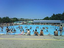
Nowadays this thermo-mineral spring is used in contemporary spa bath tubes. A well next to Olympic pool has similar composition and mineralization. Its water is coming from the depth of 690 m and is used for open hot thermo-mineral pool (water temperature is 37 °C). These pools are also used by people from Novi Sad, Žabalj, Kisač, Petrovac and from all other surrounding settlements. This natural wealth is planned to be a basis for future development of a health, sport and tourist complex.
South Backa District
South Bačka District is a northern district of Serbia. It lies in the southern part of Bačka and northern part of Syrmia, in the autonomous province of Vojvodina. It has a population of 607,835...
of Vojvodina
Vojvodina
Vojvodina, officially called Autonomous Province of Vojvodina is an autonomous province of Serbia. Its capital and largest city is Novi Sad...
, Serbia
Serbia
Serbia , officially the Republic of Serbia , is a landlocked country located at the crossroads of Central and Southeast Europe, covering the southern part of the Carpathian basin and the central part of the Balkans...
. Temerin town has a population of 19,143, and Temerin municipality 28,201.
Temerin municipality encompasses of towns of Temerin and Bački Jarak
Backi Jarak
Bački Jarak is a town located in the Temerin municipality, in the South Bačka District of Serbia. It is situated in the Autonomous Province of Vojvodina...
(Hungarian: historically Tiszaistvánfalva, in modern usage Járek), and Sirig
Sirig
Sirig is a village located in the Temerin municipality, in the South Bačka District of Serbia. It is situated in the Autonomous Province of Vojvodina. The village has a Serb ethnic majority and its population numbering 3,010 people ....
village.
Name
In SerbianSerbian language
Serbian is a form of Serbo-Croatian, a South Slavic language, spoken by Serbs in Serbia, Bosnia and Herzegovina, Montenegro, Croatia and neighbouring countries....
, the town is known as Temerin (Темерин), in Hungarian
Hungarian language
Hungarian is a Uralic language, part of the Ugric group. With some 14 million speakers, it is one of the most widely spoken non-Indo-European languages in Europe....
as Temerin, in German
German language
German is a West Germanic language, related to and classified alongside English and Dutch. With an estimated 90 – 98 million native speakers, German is one of the world's major languages and is the most widely-spoken first language in the European Union....
as Temeri, and in Croatian
Croatian language
Croatian is the collective name for the standard language and dialects spoken by Croats, principally in Croatia, Bosnia and Herzegovina, the Serbian province of Vojvodina and other neighbouring countries...
as Temerin.
The Serbian and Hungarian languages are officially used by municipal authorities.
Location, borders and size
Territory of Municipality of Temerin is in the southeast part of BačkaBacka
Bačka is a geographical area within the Pannonian plain bordered by the river Danube to the west and south, and by the river Tisza to the east of which confluence is located near Titel...
plain. On its east side it borders on Municipality of Žabalj
Žabalj
Žabalj is a town and municipality in South Bačka District of Vojvodina, Serbia. Žabalj town has a population of 9,582, and Žabalj municipality 27,418. It is located in southeastern part of Bačka, known as Šajkaška.-Name:...
, on the north side on Municipality of Srbobran
Srbobran
Srbobran is a town and municipality in South Bačka District of Vojvodina, Serbia. The town is located on the north bank of the Danube-Tisa-Danube channel...
, Municipality of Vrbas is on the west and Novi Sad
Novi Sad
Novi Sad is the capital of the northern Serbian province of Vojvodina, and the administrative centre of the South Bačka District. The city is located in the southern part of Pannonian Plain on the Danube river....
borders on its south side.
The most influential factor in the development of Temerin is the vicinity of the most developed business center in Vojvodina
Vojvodina
Vojvodina, officially called Autonomous Province of Vojvodina is an autonomous province of Serbia. Its capital and largest city is Novi Sad...
– Novi Sad
Novi Sad
Novi Sad is the capital of the northern Serbian province of Vojvodina, and the administrative centre of the South Bačka District. The city is located in the southern part of Pannonian Plain on the Danube river....
. The territory of the Municipality of Temerin covers the area of around 170 km² (66 mi²), and has a shape of irregular trapezoid
Trapezoid
In Euclidean geometry, a convex quadrilateral with one pair of parallel sides is referred to as a trapezoid in American English and as a trapezium in English outside North America. A trapezoid with vertices ABCD is denoted...
, spreading in the northwest – southeast direction. The longer axis, covering the direction Sirig–Temerin, is 14 km long and the shorter axis in Bački Jarak
Backi Jarak
Bački Jarak is a town located in the Temerin municipality, in the South Bačka District of Serbia. It is situated in the Autonomous Province of Vojvodina...
–Temerin direction is 11 km long.
The boundaries of municipality are artificial lines, mostly in rectilinear directions. The only natural boundary of the municipality is on its northeast side where it follows the water current of river Jegrička
Jegricka
The Jegrička , is a river in northern Serbia, in the Bačka region of the Vojvodina province, a 65 km-long left tributary to the Tisa river, often erroneously referred to as the longest river in Vojvodina.The Jegrička originates south of the Pivnice village, in the central Bačka and flows in the...
. On the southeast side the boundary is made with the embankment called Rimski Šanac II.
Vojvodina
Vojvodina, officially called Autonomous Province of Vojvodina is an autonomous province of Serbia. Its capital and largest city is Novi Sad...
, whole territory of Municipality of Temerin is placed on a south loessial ridge of Bačka
Backa
Bačka is a geographical area within the Pannonian plain bordered by the river Danube to the west and south, and by the river Tisza to the east of which confluence is located near Titel...
. It leaves the impression of an almost flat surface. The river Jegrička
Jegricka
The Jegrička , is a river in northern Serbia, in the Bačka region of the Vojvodina province, a 65 km-long left tributary to the Tisa river, often erroneously referred to as the longest river in Vojvodina.The Jegrička originates south of the Pivnice village, in the central Bačka and flows in the...
flows through the north side of the municipality with few smaller channeled tributaries. It is established that thermo-mineral waters are present. Soil composition is quite equalized and fertility is naturally high. Different types of chernozem dominate in the area of the municipality. Along the riverbank swampy dark types of soil and solonchak
Solonchak
Solonchak is pale or grey soil type found in arid to subhumid, poorly drained conditions. The word is Russian for "salt marsh" in turn from Russian sol , "salt"....
can be found; these are partly or fully salted soil types.
The Municipality of Temerin has three settlements: Temerin, Bački Jarak
Backi Jarak
Bački Jarak is a town located in the Temerin municipality, in the South Bačka District of Serbia. It is situated in the Autonomous Province of Vojvodina...
and Sirig
Sirig
Sirig is a village located in the Temerin municipality, in the South Bačka District of Serbia. It is situated in the Autonomous Province of Vojvodina. The village has a Serb ethnic majority and its population numbering 3,010 people ....
and the territory is divided into four cadastre
Cadastre
A cadastre , using a cadastral survey or cadastral map, is a comprehensive register of the metes-and-bounds real property of a country...
s: Temerin, Bački Jarak, Sirig and Kamendin
Kamendin
Kamendin can refer to:* Kamendin, Zemun, part of Zemun, Serbia* Kamendin, Sirig, part of Sirig, Serbia...
. Geographical location of the Municipality of Temerin is very favorable. In the meridian direction the municipality is cut by three important roads. The most important is international road E-75 which drives from Novi Sad
Novi Sad
Novi Sad is the capital of the northern Serbian province of Vojvodina, and the administrative centre of the South Bačka District. The city is located in the southern part of Pannonian Plain on the Danube river....
towards Subotica
Subotica
Subotica is a city and municipality in northern Serbia, in the Autonomous Province of Vojvodina...
and then further to Hungary
Hungary
Hungary , officially the Republic of Hungary , is a landlocked country in Central Europe. It is situated in the Carpathian Basin and is bordered by Slovakia to the north, Ukraine and Romania to the east, Serbia and Croatia to the south, Slovenia to the southwest and Austria to the west. The...
.
Novi Sad
Novi Sad is the capital of the northern Serbian province of Vojvodina, and the administrative centre of the South Bačka District. The city is located in the southern part of Pannonian Plain on the Danube river....
–Srbobran
Srbobran
Srbobran is a town and municipality in South Bačka District of Vojvodina, Serbia. The town is located on the north bank of the Danube-Tisa-Danube channel...
, cutting the west part of the Municipality of Temerin, was put into use in 1984. The second road by its importance is highway M-22 (since recently international way E-5) which has the nearly the same direction. M-22 leads bit more eastern than E-75 and goes through village named Sirig
Sirig
Sirig is a village located in the Temerin municipality, in the South Bačka District of Serbia. It is situated in the Autonomous Province of Vojvodina. The village has a Serb ethnic majority and its population numbering 3,010 people ....
.
The third road is one with regional importance (R-120), going through Novi Sad
Novi Sad
Novi Sad is the capital of the northern Serbian province of Vojvodina, and the administrative centre of the South Bačka District. The city is located in the southern part of Pannonian Plain on the Danube river....
, Bački Jarak
Backi Jarak
Bački Jarak is a town located in the Temerin municipality, in the South Bačka District of Serbia. It is situated in the Autonomous Province of Vojvodina...
and Temerin and leading to Bečej
Becej
Bečej is a town and municipality located in the South Bačka District in Vojvodina, Serbia. The town has a population of 25,703, while Bečej municipality has 40,877 inhabitants. It is multiethnic town, with Hungarians and Serbs as largest ethnic groups...
, Senta
Senta
Senta is a town and municipality on the bank of the Tisa river in the Vojvodina province, Serbia. Although geographically located in Bačka, it is part of the North Banat District...
and Kanjiža
Kanjiža
Kanjiža is a town and municipality in the North Banat District of Vojvodina, Serbia...
. At Sirig
Sirig
Sirig is a village located in the Temerin municipality, in the South Bačka District of Serbia. It is situated in the Autonomous Province of Vojvodina. The village has a Serb ethnic majority and its population numbering 3,010 people ....
and Temerin all these roads are crossed by regional road (R-104) which has Odžaci
Odžaci
Odžaci is a town and municipality in the West Bačka District of Serbia. It is situated in the Autonomous Province of Vojvodina. The town of Odžaci has a population of 9,832 people, while the population of the municipality of Odžaci is 35,474 people .-Name:The name Odžaci means "chimneys" in Serbian...
–Zmajevo
Zmajevo
Zmajevo is a village in Serbia. It is situated in the Vrbas municipality, in the South Bačka District, Vojvodina province. The village has a Serb ethnic majority and its population numbering 4,361 people . It has beautiful lakes that are full of carp , a very big hunting ground with a lot of wild...
–Sirig
Sirig
Sirig is a village located in the Temerin municipality, in the South Bačka District of Serbia. It is situated in the Autonomous Province of Vojvodina. The village has a Serb ethnic majority and its population numbering 3,010 people ....
–Temerin–Žabalj
Žabalj
Žabalj is a town and municipality in South Bačka District of Vojvodina, Serbia. Žabalj town has a population of 9,582, and Žabalj municipality 27,418. It is located in southeastern part of Bačka, known as Šajkaška.-Name:...
direction. From here a main road leads over Tisa
Tisá
Tisá is a village and municipality in Ústí nad Labem District in the Ústí nad Labem Region of the Czech Republic.The municipality covers an area of , and has a population of 786 ....
to Zrenjanin
Zrenjanin
Zrenjanin is a city and municipality located in the eastern part of Serbian province of Vojvodina. It is the administrative centre of the Central Banat District of Serbia...
and other towns in Banat
Banat
The Banat is a geographical and historical region in Central Europe currently divided between three countries: the eastern part lies in western Romania , the western part in northeastern Serbia , and a small...
. Through the southeast part of the municipality and its two settlements—Bački Jarak
Backi Jarak
Bački Jarak is a town located in the Temerin municipality, in the South Bačka District of Serbia. It is situated in the Autonomous Province of Vojvodina...
and Temerin, leads a railway from Novi Sad
Novi Sad
Novi Sad is the capital of the northern Serbian province of Vojvodina, and the administrative centre of the South Bačka District. The city is located in the southern part of Pannonian Plain on the Danube river....
to Žabalj
Žabalj
Žabalj is a town and municipality in South Bačka District of Vojvodina, Serbia. Žabalj town has a population of 9,582, and Žabalj municipality 27,418. It is located in southeastern part of Bačka, known as Šajkaška.-Name:...
, Bečej
Becej
Bečej is a town and municipality located in the South Bačka District in Vojvodina, Serbia. The town has a population of 25,703, while Bečej municipality has 40,877 inhabitants. It is multiethnic town, with Hungarians and Serbs as largest ethnic groups...
and Senta
Senta
Senta is a town and municipality on the bank of the Tisa river in the Vojvodina province, Serbia. Although geographically located in Bačka, it is part of the North Banat District...
.
History
Battle of Mohács
The Battle of Mohács was fought on August 29, 1526 near Mohács, Hungary. In the battle, forces of the Kingdom of Hungary led by King Louis II of Hungary and Bohemia were defeated by forces of the Ottoman Empire led by Sultan Suleiman the Magnificent....
in 1526. After that year it was part of the Ottoman Empire.
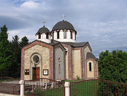
In view of the fact that Temerin used to be a rich village, between 1746 and 1749 locals built an orthodox church and dedicated it to Christ’s ascension into Heaven. It was located at the beginning of today’s Bosanska street, on its right side, where are now houses with numerations from 2 to 10.
Military map and religious books from that same church are proving the existence of the church. Some of them are still kept in the church of Christ’s ascension into Heaven in the village Đurđevo. The church was made of bricks – solid material (which is important because in the most of the villages churches were made of wood – as log cabins). Church dimensions were: length 17 m, width 6.5 m, walls were nearly 6 m high. The church had church steeple, built just besides main building, 11 special windows with iron bars on them. Johan Milner built the church with assistance and coordination of Visarion Pavlović, the bishop of Bačko-Segedinska eparchy.
Among church school students was also one of the most important people from Temerin, writer, theology professor and
bishop, polyglot Lukijan Mušicki
Lukijan Mušicki
Lukijan Mušicki was a Serbian poet, prose writer, and polyglot.Mušicki was a monk, and later abbot of a monastery in Fruška Gora, whose religious poetry in Church Slavonic, a language distant from the spoken koine, but the only literary language of his time, was recognised and valued by the...
, born in Temerin in 1777. He was a friend and associate of Vuk Stefanović Karadžić
Vuk Stefanovic Karadžic
Vuk Stefanović Karadžić was a Serbian philolog and linguist, the major reformer of the Serbian language, and deserves, perhaps, for his collections of songs, fairy tales, and riddles to be called the father of the study of Serbian folklore. He was the author of the first Serbian dictionary...
(he added a letter “đ” to the Vuk alphabet).
In 1796 Chamber sold Temerin and Bački Jarak
Backi Jarak
Bački Jarak is a town located in the Temerin municipality, in the South Bačka District of Serbia. It is situated in the Autonomous Province of Vojvodina...
to count Sándor Szécsen for a price of 80,000 forints
Hungarian forint
The forint is the currency of Hungary. It is divided into 100 fillér, although fillér coins are no longer in circulation. The introduction of the forint on 1 August 1946 was a crucial step of the post-WWII stabilization of the Hungarian economy, and the currency remained relatively stable until...
. Organized colonization of Temerin by Hungarians started in 1782 and the migration of Germans started in 1787. In that year they founded and settled Bački Jarak, a place which used to be barren area of Bačka until then.
Count Sándor Szécsen tried to turn Serbs into his peasants which resulted in their four years long attempt (from 1796 to 1800) to annex Temerin to the Military Border and its nearest unit battalion of Šajkaš. This attempt failed and on July 21, 1799 they decided to move out of Temerin. Delegation sent by parish commission stopped them in their attempt by postponing their migration. On the same day that commission made a document of a great importance. Document was called “a listing of all orthodox families from Temerin who came out for migration to the military battalion in the Paška barren area”. This important document contents the names of 178 heads of families that were leaving.
After a few months the number of immigrant families raised to 210 families and 1,610 living souls. In the spring of 1800 they tore down their houses and their church and carried all of its building material to Paška barren area where they founded new village named Đurđevo. Name was given because they moved on a St. George day (“Sveti Đorđe”). Only five years later they built a new, even bigger church out of the material they brought with themselves. They dedicated the new church to Christ’s ascension into Heaven, same as they did in Temerin.
For next 120 years Temerin was without Serbs, count Szécsen brought Hungarian colonizers, peasants from tribal states Pest, Fehér and Tolna. Same count ordered building of a very representative palace (castle), so called "Kastély", which is now under state jurisdiction. Nowadays it houses secondary school of techniques.
Szécsen family sold the Temerin property and "Кastély" to grain merchant Antal Fernbah from Apatin
Apatin
Apatin is a town and municipality in the Vojvodina administrative region of Serbia, located in the West Bačka District, at . The town of Apatin is the administrative, economic, cultural, educational and tourist centre of the municipality of Apatin...
. Ana and Petar Fernbah were his heirs and they kept complete Temerin property until agrarian reform in the Kingdom of SHS (Serbs, Croats and Slovenes) in 1920.
In 1799 Temerin was declared a town and was given a right to hold 4 livestock fairs per year. Catholic Church was built in 1804, and the "old school" in 1835. Tumultuous times and 1848 did not spare Temerin. In clashes it burned ompletely and the settlers migrated to the north, in Bačka Topola
Backa Topola
Bačka Topola is a town and municipality in the North Bačka District of Vojvodina, Serbia...
, Mali Iđoš, Čantavir
Cantavir
Čantavir is the largest village with Hungarian ethnic majority in the autonomous province of Vojvodina, Serbia. It is situated in the municipality of Subotica, North Bačka District. The population of the village is 7,178...
and other settlements. After 4-6 month most of them returned to their old homes.
On July 2, 1899 a railway direction Novi Sad–Temerin–Bečej was built and put in function as well as the railway station in Temerin. That started industrial development of Temerin, putting into operation one brick plant and first steam mills. Temerin soon became one of the important trading centers in the southeast part of Bačka.
Creation of the Kingdom SHS (Serbs, Croats and Slovenes) marked a new period in the history and the economy of the town. Fernbah's properties were one of the agrarian reform targets. Agrarian authorities from Belgrade
Belgrade
Belgrade is the capital and largest city of Serbia. It is located at the confluence of the Sava and Danube rivers, where the Pannonian Plain meets the Balkans. According to official results of Census 2011, the city has a population of 1,639,121. It is one of the 15 largest cities in Europe...
and Novi Sad
Novi Sad
Novi Sad is the capital of the northern Serbian province of Vojvodina, and the administrative centre of the South Bačka District. The city is located in the southern part of Pannonian Plain on the Danube river....
put a new law into effect, colonized farmers from Novi Sad and its vicinity and colonized volunteers. In 1920 started a creation of a new colony of volunteers south of Temerin, 18 km north of Novi Sad and next to road Novi Sad
Novi Sad
Novi Sad is the capital of the northern Serbian province of Vojvodina, and the administrative centre of the South Bačka District. The city is located in the southern part of Pannonian Plain on the Danube river....
–Bečej
Becej
Bečej is a town and municipality located in the South Bačka District in Vojvodina, Serbia. The town has a population of 25,703, while Bečej municipality has 40,877 inhabitants. It is multiethnic town, with Hungarians and Serbs as largest ethnic groups...
–Senta
Senta
Senta is a town and municipality on the bank of the Tisa river in the Vojvodina province, Serbia. Although geographically located in Bačka, it is part of the North Banat District...
. In the memory of an old Serbian village in Temerin, immigrants called their new settlement Staro Đurđevo in 1929. At the beginning it had 42 families, now it has grown into a place with over 1,100 households and about 4,000 settlers.
In 1927, between two wars, Temerin got electricity. During the Hungarian military occupation (1941–1944) settlers of Staro Đurđevo and Sirig
Sirig
Sirig is a village located in the Temerin municipality, in the South Bačka District of Serbia. It is situated in the Autonomous Province of Vojvodina. The village has a Serb ethnic majority and its population numbering 3,010 people ....
were expelled from their homes and Hungarian families from Bukovina were settled on this land. During the occupation, in 1942 raid, 48 inhabitants of the town were murdered, of whom 14 were men, 15 women, 7 children, and 12 old people. By nationality, victims included 42 Jews, and 6 Serbs. In 1944, Hungarians from Bukovina
Bukovina
Bukovina is a historical region on the northern slopes of the northeastern Carpathian Mountains and the adjoining plains.-Name:The name Bukovina came into official use in 1775 with the region's annexation from the Principality of Moldavia to the possessions of the Habsburg Monarchy, which became...
resettled in Hungary
Hungary
Hungary , officially the Republic of Hungary , is a landlocked country in Central Europe. It is situated in the Carpathian Basin and is bordered by Slovakia to the north, Ukraine and Romania to the east, Serbia and Croatia to the south, Slovenia to the southwest and Austria to the west. The...
. The Germans from Bački Jarak
Backi Jarak
Bački Jarak is a town located in the Temerin municipality, in the South Bačka District of Serbia. It is situated in the Autonomous Province of Vojvodina...
were resettled and murdered. Founders of Đurđevo and Sirig returned to their old settlements. Bački Jarak became almost completely colonized with immigrants from Bosnia and Herzegovina
Bosnia and Herzegovina
Bosnia and Herzegovina , sometimes called Bosnia-Herzegovina or simply Bosnia, is a country in Southern Europe, on the Balkan Peninsula. Bordered by Croatia to the north, west and south, Serbia to the east, and Montenegro to the southeast, Bosnia and Herzegovina is almost landlocked, except for the...
.
October 1944 the Soviet Red Army entered Temerin who were followed by the yugoslav communist partizans.
Ethnic groups in the municipality
Ethnical population structure of the Municipality of Temerin according to census in 2002:- SerbsSerbsThe Serbs are a South Slavic ethnic group of the Balkans and southern Central Europe. Serbs are located mainly in Serbia, Montenegro and Bosnia and Herzegovina, and form a sizable minority in Croatia, the Republic of Macedonia and Slovenia. Likewise, Serbs are an officially recognized minority in...
= 18,155 (64.2%) - Hungarians = 8,341 (29.49%)
- YugoslavsYugoslavsYugoslavs is a national designation used by a minority of South Slavs across the countries of the former Yugoslavia and in the diaspora...
= 407 (1.44%) - Others.
All of the three settlements in the municipality have an ethnic Serb majority.
Ethnic groups in the town
Ethnical population structure of the town of Temerin according to census in 2002:- SerbsSerbsThe Serbs are a South Slavic ethnic group of the Balkans and southern Central Europe. Serbs are located mainly in Serbia, Montenegro and Bosnia and Herzegovina, and form a sizable minority in Croatia, the Republic of Macedonia and Slovenia. Likewise, Serbs are an officially recognized minority in...
= 9,660 (50.27%) - Hungarians = 8,187 (42.61%)
- Others.
Population Demographic trends
Nowadays, the municipality of Temerin is a multinational community with 16 nationalities and 28,275 inhabitants. Trend of population growth in Temerin area is very specific. During the last few centuries’ number of inhabitants increased for 72%.Migrations largely influenced population structure of Temerin.
In 1800 Serbs with 1,610 inhabitants from 210 families left the village and established new one about 20 km east of Temerin. Today it is called Đurđevo and is located near Žabalj
Žabalj
Žabalj is a town and municipality in South Bačka District of Vojvodina, Serbia. Žabalj town has a population of 9,582, and Žabalj municipality 27,418. It is located in southeastern part of Bačka, known as Šajkaška.-Name:...
. That left Temerin without Serbs until 1920. That year volunteers established new settlement, Staro Đurđevo, which is now local community of the Municipality of Temerin. In 1991 it had 3,718 inhabitants and today more than 4,000 people live there.
Bački Jarak
Backi Jarak
Bački Jarak is a town located in the Temerin municipality, in the South Bačka District of Serbia. It is situated in the Autonomous Province of Vojvodina...
, until 1944 was settled with mostly German settlers, and was during 1946-1947 settled with Serb colonists, mostly from Bosnia and Herzegovina
Bosnia and Herzegovina
Bosnia and Herzegovina , sometimes called Bosnia-Herzegovina or simply Bosnia, is a country in Southern Europe, on the Balkan Peninsula. Bordered by Croatia to the north, west and south, Serbia to the east, and Montenegro to the southeast, Bosnia and Herzegovina is almost landlocked, except for the...
, in order to increase the number of inhabitants in Novi Sad
Novi Sad
Novi Sad is the capital of the northern Serbian province of Vojvodina, and the administrative centre of the South Bačka District. The city is located in the southern part of Pannonian Plain on the Danube river....
, 2,276 settlers came in Bački Jarak, the nearest settlement to Novi Sad. In 1991 Bački Jarak had 6,000 inhabitants.
Sirig
Sirig
Sirig is a village located in the Temerin municipality, in the South Bačka District of Serbia. It is situated in the Autonomous Province of Vojvodina. The village has a Serb ethnic majority and its population numbering 3,010 people ....
is colonized as well, in this town 63% of inhabitants are colonizers. During the 1960s and 1970s several hundred families from village Vrbljani
Vrbljani
Vrbljani is a village in the municipality of Ribnik, Bosnia and Herzegovina.-References:...
(the Municipality of Ključ
Kljuc
Ključ is a town and municipality by the same name in western Bosnia and Herzegovina. It is located in the Federation of Bosnia and Herzegovina, specifically the Una-Sana Canton. The name of the town and the municipality translates to "Key" in Bosnian....
, Bosnia and Herzegovina
Bosnia and Herzegovina
Bosnia and Herzegovina , sometimes called Bosnia-Herzegovina or simply Bosnia, is a country in Southern Europe, on the Balkan Peninsula. Bordered by Croatia to the north, west and south, Serbia to the east, and Montenegro to the southeast, Bosnia and Herzegovina is almost landlocked, except for the...
) migrated to the local community Staro Đurđevo. Economical situation was reason for that.
Temerin itself is one of the settlements where natives were absolute majority. In 1961, 9,447 inhabitants were in this category, only one third of settlers (3 258) were immigrants.
According to census in 1991 Temerin has 8,174 households; 3,059 of that number are farm households placed in 8,595 apartments. One of the local communities named Staro Đurđevo (3,718 inhabitants), even overgrown a village Sirig (2,546 inhabitants).
Finally, the civil war on the territory of former Yugoslavia
Yugoslavia
Yugoslavia refers to three political entities that existed successively on the western part of the Balkans during most of the 20th century....
brought to significant changes in the population structure of this municipality. Temerin was a stop point for 9,650 refugees, 4,950 of them still live here at their relatives and friends homes as well as in 4 organized refugee shelters that still exist. These changes brought population number to 30,000 in 1999.
Historical population of the town
- 1900: 9581 inhabitants, 8711 Hungarians, 787 Germans, 13 Serbs
- 1961: 12,705
- 1971: 13,584
- 1981: 14,875
- 1991: 16,971
- 2011: 19,613
Politics
Seats in the municipal parliament won in the 2004 local elections: http://www.cesid.org/lokalni2004/rezultati.jsp?opstina=80446- Serbian Radical Party (12)
- Democratic Party (6)
- Democratic Party of Vojvodina Hungarians (5)
- Alliance of Vojvodina Hungarians (3)
- Serbian Strength Movement (2)
- Socialist Party of Serbia (2)
- Group of citizens "List for prosperity" (2)
- Democratic Party of Serbia (1)
Relief
Territory of the Municipality of Temerin is a plain terrain with almost imperceptible distinctions in height. If we study relief the southern part of Bačka (in Vojvodina) and we can single out few geomorphological shapes based on soil composition and its genesis. These are Titelski breg – loessLoess
Loess is an aeolian sediment formed by the accumulation of wind-blown silt, typically in the 20–50 micrometre size range, twenty percent or less clay and the balance equal parts sand and silt that are loosely cemented by calcium carbonate...
ial ridge, alluvial ridge of river Danube and inundational planes of river Danube and river Tisa.
Total area of the Municipality of Temerin is placed in the eastern part of south loessial ridge of Bačka. Heights above sea level
Above mean sea level
The term above mean sea level refers to the elevation or altitude of any object, relative to the average sea level datum. AMSL is used extensively in radio by engineers to determine the coverage area a station will be able to reach...
vary from 81 m to 83 m. Monotony of Bačka plain is disturbed only by lonely hillocks and valleys of smaller water currents.
Climate
Being a part of Pannonia plain the Municipality of Temerin has its climate characteristics. Pannonian plain is quite far away from Adriatic or Mediterranean see on the south and Atlantic Ocean on the west. These distances are even bigger because of Dinarics and Alps mountain ranges which keep the humid airstreams coming from seas and oceans away. Airstreams, influencing weather changes through the year, are conditioned by unequal warming of Earth surface and different atmospheric pressures above Adriatic and Mediterranean, Atlantic Ocean and wide Euro-Asian land. Water surfaces cause breach of humid airflows into Pannonia plain and land surfaces on the north and east influence dry, very cold airstreams in winter and very hot airstreams in summer. Influenced by all of these causes, Pannonia plain has the most continental climate in Serbia.Rivers
There are no natural water currents on the territory of the Municipality of Temerin any more, all of them were transformed into canals and included in the DTD hydro system so they can now be used for irrigation of agricultural areas.Jegrička is the biggest stream on the south loessial Bačka ridge and area of the Municipality of Temerin. Jegrička is a 64.5 km long tributary of Tisa that empties into the Tisa on its right side. The river course was formed during the Holocene, the youngest period of Earth history. At that period ground in the south part of Bačka lowered in a line that was later inherited by this water current.
Jegrička is formed from water of few swamps from areas of Despotovo, Silbaš, Parage, Ratkovo and Pivnice. River enters into the Temerin territory on its west side, from the Municipality of Vrbas. The part of Jegrička that flows through the Municipality of Temerin has the length of 18 km which is 28% of its total length. River flows about 1 km north of Sirig and about 2 km north of Temerin. From a place where the river crosses the Temerin–Bečej road it becomes the municipality borderline.
Soil
Analyzing the soil mapSoil map
Soil map is a map showing distribution of soil types and/or soil properties in the area of interest. It is typically the end result of a soil survey inventory, i.e. soil survey. Soil maps are most commonly used for land evaluation, spatial planning, agricultural extension, environmental protection...
of Vojvodina we can separate eight different types of soil in the territory of the Municipality of Temerin. The most represented are subtypes of chernozem
Chernozem
Chernozem , also known as "black land" or "black earth", is a black-coloured soil containing a high percentage of humus 7% to 15%, and high percentages of phosphoric acids, phosphorus and ammonia...
: carbonated chernozem, carbonated chernozem with signs of earlier contact with swamp, carbonated chernozem with signs of gleying in loess, solonchak chernozem, carbonated and sporadically salted swampy dark soil, meadow carbonated dark soil, swampy noncarbonated dark soil and solonchak
Solonchak
Solonchak is pale or grey soil type found in arid to subhumid, poorly drained conditions. The word is Russian for "salt marsh" in turn from Russian sol , "salt"....
.
Flora
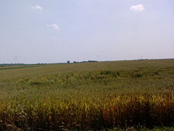
Area of loessial ridge that covers the biggest part of the Municipality of Temerin resembles steppe grassy vegetation. Development of agriculture during the 18th and 19th centuries brought disappearance of pastures with growing wild vegetation. Cultivation plants were planted; nowadays dominating plants are cereals, industrial plants and vegetables. Fruits and grapevine are not so often.Narrow areas along rivers and lines of communication are full of wild growing vegetation: wild poppy, corn cockle, spurge, horse basil, meadow buttercup, red clover, yarrow, foxglove, burdock, nettle, chamomile, mustard, etc. Around and in riverbeds you can find plenty of cane, cattail, water lily and alga.
There are no bigger forest areas, but around farms (“salaš”) smaller forests of black locust and poplar with few mulberry trees can be seen. Around motels near Sirig and Temerin pine trees have been planted.
Fauna
Animal world used to be more numerous and various. Changes in agriculture development caused reduction of total number and number of wild animal species.Field mice and rats live on large areas planted with corn as well as polecats, weasels, ground squirrels, hamsters, hedgehogs and moles. If we look for big game, important for hunting, we can find roe deer, foxes and hares. Of game birds we can find pheasants, partridges, mallards and wild geese as well as rock doves. There are also a lot of other bird species: sparrows, swallows, woodpeckers, starlings, cuckoos, blackbirds, wrens, storks, hooded crows, etc.
There are a lot of insects: mosquitoes, flees, wasps, bees, gypsy moths, green crickets, hornets, different louses, crickets, ladybugs, moths, butterflies, etc. Among agricultural pests the widest spreads are: potato beetle, turnip beetle, grain weevil and bean weevil.
In and around water currents live various fishes: carp, bream, robin, pike, perch, as well as other animals: snails, leeches, various frogs, marsh shells, snakes, etc.
A large number of domestic animals are raised.
Thermo-mineral waters
Quaternary
The Quaternary Period is the most recent of the three periods of the Cenozoic Era in the geologic time scale of the ICS. It follows the Neogene Period, spanning 2.588 ± 0.005 million years ago to the present...
and paludina deposits and gives water of 27 °C (81 °F). The quantity of water pouring out used to be 397 l/min but has lately been slightly reduced. Since these waters are also present in a depth of 200 to 1000 m, “Naftagas” from Novi Sad drilled a research drill in the center of Temerin in 1968. The drill is 2,004.5 m deep.
Chemical analysis was made in 1979 by the Institute of Physics from the University of Novi Sad. The results showed slightly base reaction (rN – 7.8), total mineralization of 2.669 g/l; characteristic ions are sodium (0.708), hydro-carbonate (1.512) and chlorine (0.337). Among other healing ingredients presence of iodine, bromine, fluorine, lithium and strontium is proven.
Analysis showed presence of carbon dioxide in water. Methane which was also present was used for heating of water and rooms after separation.
Nowadays this thermo-mineral spring is used in contemporary spa bath tubes. A well next to Olympic pool has similar composition and mineralization. Its water is coming from the depth of 690 m and is used for open hot thermo-mineral pool (water temperature is 37 °C). These pools are also used by people from Novi Sad, Žabalj, Kisač, Petrovac and from all other surrounding settlements. This natural wealth is planned to be a basis for future development of a health, sport and tourist complex.