

TaskForceMajella
Encyclopedia
The TaskForceMajella is an industry funded geoscientific research project
conducted between the years 1998 and 2005. The project involved numerous universities distributed worldwide, and was sponsored by a number of international major oil companies. The area of research was the Majella Mountain in Central Italy
, regarded as an analogue of a faulted and fractured hydrocarbon reservoir as can be found in major provinces like the Middle East
, Caspian Basin
, Mediterranean Basin
, and other areas. The scope was to obtain knowledge on the relation between fracture and fault generation, and all types of geological aspects of the evolution of the geological structure
.
structure as an analogue of a faulted and fractured carbonate reservoir similar to those in production
and explored by the sponsors of the Project, Eni
and Norsk Hydro
(now merged into StaoilHydro
) (e.g. Iran
, Irak, Libya
, Canada
, Caspian Sea
area, etc.). The aim is to provide a predictive tool for the exploration and production of these prospects and reservoirs, which are characterized by the fact that their production is for a considerable amount controlled by the presence of fractures and faults.
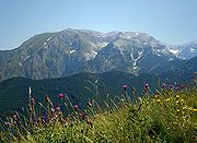
The Montagna della Majella is a mountain massif in the Apennines, in Abruzzo
, central Italy
, at the boundary between the provinces of Chieti
, Pescara
and L'Aquila
. It is part of the Central Apennines Mountain range, and consists mainly of carbonate rocks showing a complete sedimentary sequence of Upper Jurassic
up till Middle Pliocene
of Age , , ,
, , , , , , , .
The TFM Project comprises a study of all geological aspects of the Montagna della Majella and aims at reconstructing a complete model of its geological evolution using both previous and newly collected data, and applying the latest technologies. The Project which can be considered as the largest of this kind ever conducted, comprises numerous Research Institutes and Universities distributed in Italy
and other Europe
an countries and the United States
, with a working team composed of over 100 collaborators such as technical personnel, University Professors and Research Assistants and students.
The structure and technical details which define the Project were described in a Work Plan which was been written in order to define the work schedule, technical specifications, responsibilities and financial specifications and was freely distributed amongst potential project partners . A general geological description can be found in the official but not freely available Eni Majella Field Guide , and in the Official Field Guide of Central Italy of the Italian Geological Society .
, in an area of the National Park; numerous roads and mountain tracks provide access to 60% of the area, excluded the high mountain central sectors. The area is close to the Rome
-Pescara
highway, with less than 1 hour drive to the nearby international airport of Pescara, and 2 hours drive to the Roma airports.
structure of the Majella is similar to many broad foreland anticlines in various hydrocarbon provinces, both in size, dimension and structural characteristics (few tens of kilometres long and wide).
, Lasmo
and British Gas
. A huge data base is present in literature regarding its sedimentary evolution, in studies by French and Swiss research groups. Previous to the TFM Project, in Italy
, Torino and Pisa Universities have conducted ten years of geological research in the area during the nineties of the twentieth century, focussing mainly on sedimentary and stratigraphic aspects of the area.
The oil in the Pescara
Valley has been dug in open mines since ancient Roman times, and Eni
is exploring and producing from subsurface satellite anticlines since the fifties of the previous century. Most of these small oil fields are at present depleted. See below for the description of one of the study sites of the Projects.
, through a round-table discussion at the National Conference of the Italian Geological Society (SGI) in Palermo
in Sicily
. All possible research institutes interested in participating in the Project presented themselves and a lively debate, also attended by Prof. Dr. Alberto Bally who had worked in the area in the lat[e forties and fifties, initiated the organisation of the working plan. Following that, the official start date was May 2000 when the project work plan was defined. Initial sponsor was Eni
E&P Division (former Agip
), followed by NorskHydro (After that Hydro O&G and now Statoil
) which entered the Project in February 2001.
The Universities that were involved directly and indirectly are:
The Project benefitted from collaborations and support from regional and local administrations:
was in the privileged position of being the only company involved in all three of them). In this way, the Projects could mutually benefit from the results obtained, and provide suggestions for steering of their relative research activities.
District Office of Eni
(DORT) and based in the harbour area of Ortona
in the SAF (Deep Water Survey Project) building.
, based in Bologna
. It was designed by Dott. Luca Benvenuti, and remained active until some years after the closure of the Project in 2006 .
of the Project was performed by Maria Lanzellotti, and was vital for the contacts with local, regional and national administrations for authorisations, contacts with supporting companies, logistics, organisations of meetings of Working Groups and conferences, public relations, etc. Furthermore, in the second stage of the Project, the Association SFERA managed numerous organisational aspects. The TFM web site and a special brochure designed to provide visibility to the Project, played important roles in the organisation and the success of the Project on local, regional and international scales.
(Dott. B. Compagnioni, Dott. F. Galluzzo) was officially involved in the geological mapping group of the TFM Project in order to follow national standards of cartography and integrate the surface data with the official national geological map sheets of the area. Furthermore and on the other hand, the project CARG benefitted from the technical specifications and experiences of the G-Map tool of the TFM Project. Other sinergies were created with the Italian National Seismic Monitoring Service (Dott.ssa Daniela di Bucci, Dott. Giuseppe Naso, Dott.ssa Roberta Giuliani, Dott.ssa Annamaria Blumetti).
E&P Division, based in San Donato Milanese
(Italy
), was technically involved in the Project in order to provide regional subsurface data sets (non sensible seismic
and well data
) for the construction of the regional geological model. Furthermore, the data were confronted with the deep crustal seismic profile which passed through the area, acquired in the CROP the Italian National CROP Project, which data were integrated in the construction of the regional geological model (Profile CROP 11a, 11b, 11c; Civitavecchia
- Vasto
; CROP references: Prof. Castellerin, Prof. Maurizio Parotto).
The photogrammetrical survey engineering group of Eni was heavily involved in the three dimensional monitoring of sites with specific interest and the analysis of three dimensional fracture and faults networks at different scales (see below). A number of technical support companies provided the necessary local service.
of the Majella anticline. Each single outcrop was separately mapped and all data relative to the mapping are stored in the digital data base system G-MAP
, especially designed for the Project.
The working group 'Stratigraphy' coordinated the stratigraphic aspects of the mapping, whereas the working group 'Structure' coordinated the collection of structural data. The working group 'Fracture' provided the structural field data collected, integrating them with other structural geological data.
A geological map of the Majella Mountain was compiled on a 1:25,000 scale which showed the distribution of the main stratigraphic units .
In addition to these field data, the G–MAP data base (see above) comprised all cartographic material (digital maps
on various scales), location of all data collected in the Project such as the stereophotogrammetrical sites, sample sites, stratigraphic
and sedimentological
logs, and the various interpreted geological maps.
Parallel to these structural cartography activities, a three dimensional model
was constructed based on the geological map of the area by .
This map was vectorised and calibrated in three dimensions, using geological profiles available. The work was performed in Milano, by the Archs. Pasquale Femia and Antonio Sergi, in collaboration with Eni E&P and Interservice. The outcome was a complete 3D model of the area constructed in the software AutoCad of AutoDesk
, and a series of 1:25,000 scale geological maps.
The work can be regarded as the first step in the industrial process known as "Seismic to simulation
", where from the available geophysical and geological information a model is constructed which is the basis of a dynamic reservoir simulation.
', led by Pisa University and coordinated by Pisa and Rome-I Universities, constructed a stratigraphic map of the Majella Mountain focussing on the carbonate succession. A new sequence stratigraphic scheme was built based on the field work, 25 sections were logged in detail (see e.g. , and about 4000 spot samples were analysed. The stratigraphic map was constructed in collaboration with the members of the field mapping working group 'Structure', using the main structural elements as a geometrical framework.
The codification of the new stratigraphic framework was used in the G-MAP data base system in order to define the stratigraphic reference for all structural geological data collected.
A new geological map of the Majella Mountain was compiled on a 1:25,000 scale which showed the distribution of these newly defined stratigraphic units .
Numerical simulations were performed of the sedimentory evolution of the Carbonate Platform margin and slope ,
, .
', led by Chieti University and coordinated by Chieti and Rome-III University, constructed a structural map of the Majella mountain. This structural framework is accompanied by five structural cross-sections of the anticline
, which together provide an overview of the internal structure of the Majella mountain.
The Working Group furthermore performed a systematic analysis of kinematic data collected on fault surfaces (indications for type of movement and timing of the fault network). This resulted in a detailed framework for the deformation history of the Majella anticline, which shows the style of movement on various sets of faults and their relationships in time.
In order to obtain a constraint on the type of stress field responsible for the deformations observed, a paleostress
analysis using numerical inversion techniques was performed on the same kinematic data, and a palaeo-stress map was constructed.
Connected to the structural cartography and mapping, analyses was conducted regarding the slope stability of the area and the occurrence of large scale land-slides that occurred in (pre-)historical times. Some results can be found in , , and .
Another fundamental piece of research performed during the project concerns the analysis of present day uplift and subsidence rates of the area using remote sensing techniques such as Radar Interferometric techniques
. The first results of the research were published by , and .
About 50 vertical and horizontal outcrop surfaces were scanned and properties (orientation, dimension, surface texture, aperture) of about 4500 fractures were measured. Additionally, 25 scan lines on main faults were measured in order to analyse the properties of the fault zones and their relation to the stratigrapy and structural setting. Furthermore, in collaboration with Eni
SpA and Serma SrL
personnel, data acquisition was performed on a number of selected sites using stereo-photogrammetrical techniques, which allowed the acquisition of three dimensional data on the fault and fracture networks up to tens of metres scale. Using these techniques, about 120.000 fractures were measured at these selected sites. Some results of these analyses and modelling can be found in , , , , , and .
Hundreds of smaller and larger areas were studied during the TFM Project, and three sites of particular interest are mentioned here:
The ancient Madonna della Mazza stone Quarry, located on the eastern central side of the mountain massif near the village Pretoro
, was extensively studied by the various members of the project, on various scales and applying different type of data acquisition and analyses techniques. The quarry was identified in 1993 by an Eni scouting field trip. In 1995 it was extensively described for the first time and its potential for fracture studies was outlined . After these preliminary notes, the studies of the TaskForceMajella were performed (such as a complete 3D photogrammetrical survey), and the quarry became one of the favorite sites for a visit during many field excursions . For this purpose, the quarry was extensively cleaned and made available for visiting and studying, will all kinds of instruments, as part of the logistics activities of the TFM Project. During these numerous visits, the results of the TaskForceMajella Project were illustrated, and the quarry became well known as the site where deformation bands in carbonate rocks had been discovered and described for the first time . The first results of the fracture studies were published by .
Another extensively studied site (where also three dimensional photogrammetrical surveys were performed on various scales) regards the ancient Valle Romana bitumen quarry situated in the area of the village Lettomanoppello
, where calcarenites partially impregnated with heavy oil testify that the Majella anticline can be regarded as a partially filled oil reservoir. This, still active quarry was identified in 1992 by an Eni field scouting as a potential study site. In 1995 it was extensively described for the first time . Studies that formed part of TaskForceMajella were carried out, following on these preliminary but exhaustive notes (The present owner Italcementi
gave their permission, thanks to the extensive logistics efforts performed for the TFM Project). Amongst other, the quarry was covered by a complete topographic and 3D photogrammetrical survey on various scales. For obvious reasons, the quarry became one of the favorite sites visited on many field excursions . The first results of the fracture studies were successively published by and (see also ).
A site of intensive study was the Valle Santo Spirito, situated in the area of the village Fara San Martino
. This area is characterised by steep canyons in strongly lithified platform carbonates which show characteristic deformation patterns. Basic observations and characterisation of the site were described by Extensive photogrammetrical surveys at various scales were conducted in this area during the TFM Project. Some results of the studies can be found in , and .
The pain stacking analysis of all these data resulted in a number of major constraints on the relation between fracture network and anticline structure and evolution, and fault zones and mechanical Stratigraphy.
, such as:
These modelling exercises provide insight into the relationships between the deformation styles we observe today and the processes that are responsible for these end-results.
In order to perform the numerical and analogue simulations, data had to be collected in order to describe the geomechanical properties of the various tectonostratigraphic units and environments that characterise the Majella anticline and its bordering area. Representative samples were collected by the various operational units of the Project and laboratory deformation experiments were performed in Eni and in NorskHydro mechanical laboratories.
(See also the Italian-language version of those pages)
Research and development
The phrase research and development , according to the Organization for Economic Co-operation and Development, refers to "creative work undertaken on a systematic basis in order to increase the stock of knowledge, including knowledge of man, culture and society, and the use of this stock of...
conducted between the years 1998 and 2005. The project involved numerous universities distributed worldwide, and was sponsored by a number of international major oil companies. The area of research was the Majella Mountain in Central Italy
Italy
Italy , officially the Italian Republic languages]] under the European Charter for Regional or Minority Languages. In each of these, Italy's official name is as follows:;;;;;;;;), is a unitary parliamentary republic in South-Central Europe. To the north it borders France, Switzerland, Austria and...
, regarded as an analogue of a faulted and fractured hydrocarbon reservoir as can be found in major provinces like the Middle East
Middle East
The Middle East is a region that encompasses Western Asia and Northern Africa. It is often used as a synonym for Near East, in opposition to Far East...
, Caspian Basin
Caspian Sea
The Caspian Sea is the largest enclosed body of water on Earth by area, variously classed as the world's largest lake or a full-fledged sea. The sea has a surface area of and a volume of...
, Mediterranean Basin
Mediterranean Basin
In biogeography, the Mediterranean Basin refers to the lands around the Mediterranean Sea that have a Mediterranean climate, with mild, rainy winters and hot, dry summers, which supports characteristic Mediterranean forests, woodlands, and scrub vegetation...
, and other areas. The scope was to obtain knowledge on the relation between fracture and fault generation, and all types of geological aspects of the evolution of the geological structure
.
Introduction
The scope and mission of the Project TaskForceMajella (TFM) is to construct a model of the Montagna della Majella anticlineAnticline
In structural geology, an anticline is a fold that is convex up and has its oldest beds at its core. The term is not to be confused with antiform, which is a purely descriptive term for any fold that is convex up. Therefore if age relationships In structural geology, an anticline is a fold that is...
structure as an analogue of a faulted and fractured carbonate reservoir similar to those in production
Petroleum industry
The petroleum industry includes the global processes of exploration, extraction, refining, transporting , and marketing petroleum products. The largest volume products of the industry are fuel oil and gasoline...
and explored by the sponsors of the Project, Eni
Eni
Eni S.p.A. is an Italian multinational oil and gas company, present in 70 countries, and currently Italy's largest industrial company with a market capitalization of 87.7 billion euros , as of July 24, 2008...
and Norsk Hydro
Norsk Hydro
Norsk Hydro ASA is a Norwegian aluminium and renewable energy company, headquartered in Oslo. Hydro is the fourth largest integrated aluminium company worldwide. It has operations in some 40 countries around the world and is active on all continents. The Norwegian state holds a 43.8 percent...
(now merged into StaoilHydro
Statoil
Statoil ASA is a Norwegian petroleum company established in 1972. It merged with Norsk Hydro in 2007 and was known as StatoilHydro until 2009, when the name was changed back to Statoil ASA. The brand Statoil was retained as a chain of fuel stations owned by StatoilHydro...
) (e.g. Iran
Iran
Iran , officially the Islamic Republic of Iran , is a country in Southern and Western Asia. The name "Iran" has been in use natively since the Sassanian era and came into use internationally in 1935, before which the country was known to the Western world as Persia...
, Irak, Libya
Libya
Libya is an African country in the Maghreb region of North Africa bordered by the Mediterranean Sea to the north, Egypt to the east, Sudan to the southeast, Chad and Niger to the south, and Algeria and Tunisia to the west....
, Canada
Canada
Canada is a North American country consisting of ten provinces and three territories. Located in the northern part of the continent, it extends from the Atlantic Ocean in the east to the Pacific Ocean in the west, and northward into the Arctic Ocean...
, Caspian Sea
Caspian Sea
The Caspian Sea is the largest enclosed body of water on Earth by area, variously classed as the world's largest lake or a full-fledged sea. The sea has a surface area of and a volume of...
area, etc.). The aim is to provide a predictive tool for the exploration and production of these prospects and reservoirs, which are characterized by the fact that their production is for a considerable amount controlled by the presence of fractures and faults.
The Montagna della Majella is a mountain massif in the Apennines, in Abruzzo
Abruzzo
Abruzzo is a region in Italy, its western border lying less than due east of Rome. Abruzzo borders the region of Marche to the north, Lazio to the west and south-west, Molise to the south-east, and the Adriatic Sea to the east...
, central Italy
Italy
Italy , officially the Italian Republic languages]] under the European Charter for Regional or Minority Languages. In each of these, Italy's official name is as follows:;;;;;;;;), is a unitary parliamentary republic in South-Central Europe. To the north it borders France, Switzerland, Austria and...
, at the boundary between the provinces of Chieti
Chieti
Chieti is a city and comune in Central Italy, 200 km northeast of Rome. It is the capital of the Province of Chieti in the Abruzzo region...
, Pescara
Pescara
Pescara is the capital city of the Province of Pescara, in the Abruzzo region of Italy. As of January 1, 2007 it was the most populated city within Abruzzo at 123,059 residents, 400,000 with the surrounding metropolitan area...
and L'Aquila
L'Aquila
L'Aquila is a city and comune in central Italy, both the capital city of the Abruzzo region and of the Province of L'Aquila. , it has a population of 73,150 inhabitants, but has a daily presence in the territory of 100,000 people for study, tertiary activities, jobs and tourism...
. It is part of the Central Apennines Mountain range, and consists mainly of carbonate rocks showing a complete sedimentary sequence of Upper Jurassic
Jurassic
The Jurassic is a geologic period and system that extends from about Mya to Mya, that is, from the end of the Triassic to the beginning of the Cretaceous. The Jurassic constitutes the middle period of the Mesozoic era, also known as the age of reptiles. The start of the period is marked by...
up till Middle Pliocene
Pliocene
The Pliocene Epoch is the period in the geologic timescale that extends from 5.332 million to 2.588 million years before present. It is the second and youngest epoch of the Neogene Period in the Cenozoic Era. The Pliocene follows the Miocene Epoch and is followed by the Pleistocene Epoch...
of Age , , ,
, , , , , , , .
The TFM Project comprises a study of all geological aspects of the Montagna della Majella and aims at reconstructing a complete model of its geological evolution using both previous and newly collected data, and applying the latest technologies. The Project which can be considered as the largest of this kind ever conducted, comprises numerous Research Institutes and Universities distributed in Italy
Italy
Italy , officially the Italian Republic languages]] under the European Charter for Regional or Minority Languages. In each of these, Italy's official name is as follows:;;;;;;;;), is a unitary parliamentary republic in South-Central Europe. To the north it borders France, Switzerland, Austria and...
and other Europe
Europe
Europe is, by convention, one of the world's seven continents. Comprising the westernmost peninsula of Eurasia, Europe is generally 'divided' from Asia to its east by the watershed divides of the Ural and Caucasus Mountains, the Ural River, the Caspian and Black Seas, and the waterways connecting...
an countries and the United States
United States
The United States of America is a federal constitutional republic comprising fifty states and a federal district...
, with a working team composed of over 100 collaborators such as technical personnel, University Professors and Research Assistants and students.
The structure and technical details which define the Project were described in a Work Plan which was been written in order to define the work schedule, technical specifications, responsibilities and financial specifications and was freely distributed amongst potential project partners . A general geological description can be found in the official but not freely available Eni Majella Field Guide , and in the Official Field Guide of Central Italy of the Italian Geological Society .
Why Majella?
Mainly, six basic arguments are used to explain why the Majella Mountain structure was chosen as the study object of the TFM Project:Accessibility
The Majella Mountain structure is located in central ItalyItaly
Italy , officially the Italian Republic languages]] under the European Charter for Regional or Minority Languages. In each of these, Italy's official name is as follows:;;;;;;;;), is a unitary parliamentary republic in South-Central Europe. To the north it borders France, Switzerland, Austria and...
, in an area of the National Park; numerous roads and mountain tracks provide access to 60% of the area, excluded the high mountain central sectors. The area is close to the Rome
Rome
Rome is the capital of Italy and the country's largest and most populated city and comune, with over 2.7 million residents in . The city is located in the central-western portion of the Italian Peninsula, on the Tiber River within the Lazio region of Italy.Rome's history spans two and a half...
-Pescara
Pescara
Pescara is the capital city of the Province of Pescara, in the Abruzzo region of Italy. As of January 1, 2007 it was the most populated city within Abruzzo at 123,059 residents, 400,000 with the surrounding metropolitan area...
highway, with less than 1 hour drive to the nearby international airport of Pescara, and 2 hours drive to the Roma airports.
Tectonic Structure and Dimension
The tectonicTectonics
Tectonics is a field of study within geology concerned generally with the structures within the lithosphere of the Earth and particularly with the forces and movements that have operated in a region to create these structures.Tectonics is concerned with the orogenies and tectonic development of...
structure of the Majella is similar to many broad foreland anticlines in various hydrocarbon provinces, both in size, dimension and structural characteristics (few tens of kilometres long and wide).
Background knowledge
Some aspects of the Montagna della Majella anticline were previously studied by some scientific research groups, partly also in collaboration with oil companies such as ExxonExxon
Exxon is a chain of gas stations as well as a brand of motor fuel and related products by ExxonMobil. From 1972 to 1999, Exxon was the corporate name of the company previously known as Standard Oil Company of New Jersey or Jersey Standard....
, Lasmo
Lasmo
Lasmo plc was a leading British oil and gas exploration and production business. It was listed on the London Stock Exchange and was a constituent of the FTSE 100 Index.-History:...
and British Gas
BG Group
BG Group plc is a global oil and gas company headquartered in Reading, United Kingdom. It has operations in 25 countries across Africa, Asia, Australasia, Europe, North America and South America and produces around 680,000 barrels of oil equivalent per day. It has a major Liquefied Natural Gas ...
. A huge data base is present in literature regarding its sedimentary evolution, in studies by French and Swiss research groups. Previous to the TFM Project, in Italy
Italy
Italy , officially the Italian Republic languages]] under the European Charter for Regional or Minority Languages. In each of these, Italy's official name is as follows:;;;;;;;;), is a unitary parliamentary republic in South-Central Europe. To the north it borders France, Switzerland, Austria and...
, Torino and Pisa Universities have conducted ten years of geological research in the area during the nineties of the twentieth century, focussing mainly on sedimentary and stratigraphic aspects of the area.
Basin to Carbonate transition: Guarantee of facies variability
The presence inside the mountain of a major E-W trending platform-basin transition provides the possibility of evaluating many different carbonate facies, ranging from tight platform carbonates to marl-chalk interbedded sequences and porous bioclastic grainstones.Previous studies and degree of outcropping
Previous studies, conducted by research consortia mentioned above and during scouting field trips by Eni-Agip experts, had shown that a large amount of data regarding fracture and fault systems and their characteristics can easily be acquired in the area due to the excellent degree of outcropping.The Majella Petroleum System
The northern part of the Majella Anticline is locally filled with hydrocarbon which indicates that the "Majella Petroleum System" was active throughout the Neogene and the Majella Anticline can thus be considered as an aborted hydrocarbon reservoir. The chemical characteristics of this oil was previously and extensively studies by Eni experts, and compared with source rocks of nearby oil fields .The oil in the Pescara
Pescara
Pescara is the capital city of the Province of Pescara, in the Abruzzo region of Italy. As of January 1, 2007 it was the most populated city within Abruzzo at 123,059 residents, 400,000 with the surrounding metropolitan area...
Valley has been dug in open mines since ancient Roman times, and Eni
Eni
Eni S.p.A. is an Italian multinational oil and gas company, present in 70 countries, and currently Italy's largest industrial company with a market capitalization of 87.7 billion euros , as of July 24, 2008...
is exploring and producing from subsurface satellite anticlines since the fifties of the previous century. Most of these small oil fields are at present depleted. See below for the description of one of the study sites of the Projects.
General organisational aspects
The Project was initialised in 1998 and managed throughout its project lifetime by Dr. J.P. van Dijk of the company EniEni
Eni S.p.A. is an Italian multinational oil and gas company, present in 70 countries, and currently Italy's largest industrial company with a market capitalization of 87.7 billion euros , as of July 24, 2008...
, through a round-table discussion at the National Conference of the Italian Geological Society (SGI) in Palermo
Palermo
Palermo is a city in Southern Italy, the capital of both the autonomous region of Sicily and the Province of Palermo. The city is noted for its history, culture, architecture and gastronomy, playing an important role throughout much of its existence; it is over 2,700 years old...
in Sicily
Sicily
Sicily is a region of Italy, and is the largest island in the Mediterranean Sea. Along with the surrounding minor islands, it constitutes an autonomous region of Italy, the Regione Autonoma Siciliana Sicily has a rich and unique culture, especially with regard to the arts, music, literature,...
. All possible research institutes interested in participating in the Project presented themselves and a lively debate, also attended by Prof. Dr. Alberto Bally who had worked in the area in the lat[e forties and fifties, initiated the organisation of the working plan. Following that, the official start date was May 2000 when the project work plan was defined. Initial sponsor was Eni
Eni
Eni S.p.A. is an Italian multinational oil and gas company, present in 70 countries, and currently Italy's largest industrial company with a market capitalization of 87.7 billion euros , as of July 24, 2008...
E&P Division (former Agip
Agip
Agip is an Italian automotive gasoline and diesel retailer established in 1926. It is a subsidiary of the multinational petroleum company Eni.In 2003, Eni S.p.A...
), followed by NorskHydro (After that Hydro O&G and now Statoil
Statoil
Statoil ASA is a Norwegian petroleum company established in 1972. It merged with Norsk Hydro in 2007 and was known as StatoilHydro until 2009, when the name was changed back to Statoil ASA. The brand Statoil was retained as a chain of fuel stations owned by StatoilHydro...
) which entered the Project in February 2001.
Partners and components
The University components were divided into five working groups (Mapping, Stratigraphy, Structure, Fracture and Modelling), each composed of various Universities representatives in a way that each University was part of different Working Groups.The Universities that were involved directly and indirectly are:
- Torino UniversityUniversity of TurinThe University of Turin is a university in the city of Turin in the Piedmont region of north-western Italy...
(Italy) (Prof. Livio Vezzani, Dott. Andrea Festa, Dott.ssa Anna D’Atri, Dott. Daniele Giordan, Dott.ssa Maria Estefania Sanchez Palomo, Dott. Giuseppe Mancari, Dott. Ivan Vanzo, Dott. Mojca Battistini, Dott.ssa Stefania Lucchesi) - Chieti UniversityUniversity of ChietiThe G. d'Annunzio University is a university located in Chieti and Pescara, Italy. It was founded in 1960 and is organized in 11 Faculties. Student enrollment at the University is currently in excess of 23,000.-History:...
(Italy) (Prof. Uberto Crescenti, Prof. Fernando Calamita, Dott. Alberto Pizzi, Dott. Giovanni Rusciadelli, Rusciadelli, Dott.ssa Maria Luisa Milia, Dott.ssa Camilla De Girolamo, Dott. Raffaele Montefalcone, Dott. Gabriele Pugliese, Dott.ssa Loretta Finocchio, Dott. Giuseppe Palmitesta, Dott. Michele Morsilli, Dott.ssa Giada Vighi, Dott. Vittorio Scisciani, Dott. Pino Catavitelli, Dott. Fiorenzo Fumanti, Prof. Sergio Rusi, Prof. Enrico Miccadei, Dott.ssa Chiavaroli) - Roma 1 University “La Sapienza” (Italy) (Prof. Ernesto Centamore, Dott.ssa Sabina Bigi, Dott. David Rossi, Dott.ssa Patrizia Costa Pisani, Dott.ssa Rinalda Di Stefano, Dott. Mario Del Castello, Dott. Joannes Pignatti, Dott. Raffaele Di Bella)
- University Roma 3 (Italy) (Late Prof. Renato Fiuniciello, Prof. Maurizio Parotto, Prof. Domenico Cosentino, Dott.ssa Paola Cipollari, Dott.ssa Sveva Corrado, Dott. Giorgio Pipponzo, Dott. Vincenzo Pasquali, Dott. C. Fattori, Dott. T. Piacentini, Dott. S. Gambini, Dott. C. Berti, Dott. P. Pitzianti, Dott. E. Gliozzi, Dott. L. Di Bella)
- Pisa UniversityUniversity of PisaThe University of Pisa , located in Pisa, Tuscany, is one of the oldest universities in Italy. It was formally founded on September 3, 1343 by an edict of Pope Clement VI, although there had been lectures on law in Pisa since the 11th century...
(Italy) (Prof. Etta Patacca, Prof. Paolo Scandone, Dott. Donato Merola, Dott. Antonio Cascella, Dott. Ermanno Danese) - Camerino UniversityUniversity of CamerinoThe University of Camerino is a university located in Camerino, Italy. It claims to have been founded in 1336, was officially recognized by the Pope in 1727, and is organized into five faculties.-History:...
(Italy) (Late Prof. Giuseppe Cello, Dott. Emanuele Tondi, Dott.ssa Maria Chiara Invernizzi, Dott. Luca Micarelli, Dott. Alessandro Zanni, Dott. Bruno Prugni, Dott. Leonardo Marchigiani, Dott.ssa Giordana Bellezza) - Perugia UniversityUniversity of PerugiaUniversity of Perugia is a public-owned university based in Perugia, Italy. It was founded in 1308, as attested by the Bull issued by Pope Clement V certifying the birth of the Studium Generale....
(Italy) (Late Prof. Pialli, Prof. Giorgio Minelli, Dott. Mauro Foglietta (see below), Dott. Cristina Pauselli, Dott. Federico Costanzo, Dott.ssa P.T. Brunozzi, Dott. J. Braun, Dott. A. Frigeri) - CNRConsiglio Nazionale delle RicercheThe Consiglio Nazionale delle Ricerche or National Research Council, is an Italian public organization set up to support scientific and technological research. Its headquarters are in Rome.-History:The institution was founded in 1923...
(Research Centre) Roma (Italy) (Dott. Gian Paolo Cavinato, Dott.ssa Francesca Giardina, Dott. Emiliano Di Luzio, Dott. Mario Tozzi, Dott. Alberto Di Ludovico, Dott. Davide Scrocca) Consiglio Nazionale delle Ricerche - CNR - CNRConsiglio Nazionale delle RicercheThe Consiglio Nazionale delle Ricerche or National Research Council, is an Italian public organization set up to support scientific and technological research. Its headquarters are in Rome.-History:The institution was founded in 1923...
(Research Centre) Milano (Italy) (Dott. Corrado Magistroni) - ETH ZurichETH ZurichThe Swiss Federal Institute of Technology Zurich or ETH Zürich is an engineering, science, technology, mathematics and management university in the City of Zurich, Switzerland....
(Switzerland) (Prof. Dr. Daniel Bernoulli) - Free University of Amsterdam (VU)Vrije UniversiteitThe Vrije Universiteit is a university in Amsterdam, Netherlands. The Dutch name is often abbreviated as VU and in English the university uses the name "VU University". The university is located on a compact urban campus in the southern part of Amsterdam in the Buitenveldert district...
(the Netherlands) (Prof. Dr. Sierd Cloetingh, Prof. Dr. Dick Nieuwland - Stanford UniversityStanford UniversityThe Leland Stanford Junior University, commonly referred to as Stanford University or Stanford, is a private research university on an campus located near Palo Alto, California. It is situated in the northwestern Santa Clara Valley on the San Francisco Peninsula, approximately northwest of San...
(USA) (Prof. Dr. Atilla Aydin, Dr. Brita Graham, Dr. Marco Antonellini, Dr. Fabrizio Agosta) - Montpellier University (France) (Prof. Jean-Pierre Petit, Dott. Pascal Cortes, Dott. Loïc Bazalgette)
- Liverpool UniversityUniversity of LiverpoolThe University of Liverpool is a teaching and research university in the city of Liverpool, England. It is a member of the Russell Group of large research-intensive universities and the N8 Group for research collaboration. Founded in 1881 , it is also one of the six original "red brick" civic...
(United Kingdom) - Dublin UniversityUniversity of DublinThe University of Dublin , corporately designated the Chancellor, Doctors and Masters of the University of Dublin , located in Dublin, Ireland, was effectively founded when in 1592 Queen Elizabeth I issued a charter for Trinity College, Dublin, as "the mother of a university" – this date making it...
(Ireland) (Prof. Dr. John Walsh, Dr. Chris Bonson) - Various Universities - Mauro Foglietta (Reading University)
The Project benefitted from collaborations and support from regional and local administrations:
- the "Regione Abruzzo"Politics of AbruzzoThe Politics of Abruzzo, Italy takes place in a framework of a presidential representative democracy, whereby the President of Regional Government is the head of government, and of a pluriform multi-party system. Executive power is exercised by the Regional Government...
, - three Provinces (Aquila, PescaraProvince of PescaraThe Province of Pescara is a province in the Abruzzo region of Italy. Its capital is the city of Pescara.It has an area of 1,225 km², and a total population of 295,463 . There are 46 comunes in the province. At May 31, 2005, the main communes by population are:For a complete list, see Comunes of...
, ChietiProvince of ChietiThe Province of Chieti is a province in the Abruzzo region of Italy. Its capital is the city of Chieti.It has an area of 2,588 km², and a total population of 381,993...
), - the National Nature Park MajellaMajella National ParkThe Majella National Park is a national park located in the provinces of Chieti, Pescara and L'Aquila, in the region Abruzzo, Italy....
(“Ente Parco Nazionale Majella”), - the Majella Park Mountain Rangers (“il Corpo Forestale”),
- and various local administrations such as the Local Fireman Corps SectionSearch and rescueSearch and rescue is the search for and provision of aid to people who are in distress or imminent danger.The general field of search and rescue includes many specialty sub-fields, mostly based upon terrain considerations...
.
Synergy with other projects
A synergie was created with the technical activities performed in the Stanford Rock Fracture Project ("RFP", ran by Stanford University), and the GeoFracNet consortium ("GFN", ran by Montpellier University) and supported by the company GeoTER. These two projects had overlaps in research objectives though run in a completely different manner: The RFP tackled questions related to fault and fracture zones in different tectonic regimes but mainly in clastic sedimentary rocks, and was sponsored by a considerable amount of Oil Companies, whereas the GFN was sponsored by only a few companies and focussed on specific genetic relationships in different selected sites. Furthermore between the three projects there was an overlap in industrial sponsors and stake holders (though EniEni
Eni S.p.A. is an Italian multinational oil and gas company, present in 70 countries, and currently Italy's largest industrial company with a market capitalization of 87.7 billion euros , as of July 24, 2008...
was in the privileged position of being the only company involved in all three of them). In this way, the Projects could mutually benefit from the results obtained, and provide suggestions for steering of their relative research activities.
Office
A technical office of the TFM was founded and is supported by the OrtonaOrtona
Ortona is a coastal town and municipality of the Province of Chieti in the Italian region of Abruzzo, with some 23,000 inhabitants.Ortona was the site of fierce fighting between German and Canadian forces during the Italian campaign in World War II...
District Office of Eni
Eni
Eni S.p.A. is an Italian multinational oil and gas company, present in 70 countries, and currently Italy's largest industrial company with a market capitalization of 87.7 billion euros , as of July 24, 2008...
(DORT) and based in the harbour area of Ortona
Ortona
Ortona is a coastal town and municipality of the Province of Chieti in the Italian region of Abruzzo, with some 23,000 inhabitants.Ortona was the site of fierce fighting between German and Canadian forces during the Italian campaign in World War II...
in the SAF (Deep Water Survey Project) building.
Web Site
The web site http://www.taskforcemajella.com was set up and was managed by Temars - Eni-Data, the former software company of EniEni
Eni S.p.A. is an Italian multinational oil and gas company, present in 70 countries, and currently Italy's largest industrial company with a market capitalization of 87.7 billion euros , as of July 24, 2008...
, based in Bologna
Bologna
Bologna is the capital city of Emilia-Romagna, in the Po Valley of Northern Italy. The city lies between the Po River and the Apennine Mountains, more specifically, between the Reno River and the Savena River. Bologna is a lively and cosmopolitan Italian college city, with spectacular history,...
. It was designed by Dott. Luca Benvenuti, and remained active until some years after the closure of the Project in 2006 .
Logistics
The logistic serviceLogistics
Logistics is the management of the flow of goods between the point of origin and the point of destination in order to meet the requirements of customers or corporations. Logistics involves the integration of information, transportation, inventory, warehousing, material handling, and packaging, and...
of the Project was performed by Maria Lanzellotti, and was vital for the contacts with local, regional and national administrations for authorisations, contacts with supporting companies, logistics, organisations of meetings of Working Groups and conferences, public relations, etc. Furthermore, in the second stage of the Project, the Association SFERA managed numerous organisational aspects. The TFM web site and a special brochure designed to provide visibility to the Project, played important roles in the organisation and the success of the Project on local, regional and international scales.
Steering
The Project was monitored by the sponsors through a Steering Committee, and accompanied and guided by a Scientific Committee (The President of the Steering Committee was Prof. U. Crescenti, in this period also the president of the Italian National Geological Society (SGI)).Geological Map
The Geological Cartography Project (CARG) of the Italian National Geological Survey (SGN) of the Ministry of Environmental Control of the Italian national administration(Dott. B. Compagnioni, Dott. F. Galluzzo) was officially involved in the geological mapping group of the TFM Project in order to follow national standards of cartography and integrate the surface data with the official national geological map sheets of the area. Furthermore and on the other hand, the project CARG benefitted from the technical specifications and experiences of the G-Map tool of the TFM Project. Other sinergies were created with the Italian National Seismic Monitoring Service (Dott.ssa Daniela di Bucci, Dott. Giuseppe Naso, Dott.ssa Roberta Giuliani, Dott.ssa Annamaria Blumetti).
Involvement
EniEni
Eni S.p.A. is an Italian multinational oil and gas company, present in 70 countries, and currently Italy's largest industrial company with a market capitalization of 87.7 billion euros , as of July 24, 2008...
E&P Division, based in San Donato Milanese
San Donato Milanese
San Donato Milanese is a comune in the Province of Milan in the Italian region Lombardy, located about 10 km southeast of Milan.-History:...
(Italy
Italy
Italy , officially the Italian Republic languages]] under the European Charter for Regional or Minority Languages. In each of these, Italy's official name is as follows:;;;;;;;;), is a unitary parliamentary republic in South-Central Europe. To the north it borders France, Switzerland, Austria and...
), was technically involved in the Project in order to provide regional subsurface data sets (non sensible seismic
Reflection seismology
Reflection seismology is a method of exploration geophysics that uses the principles of seismology to estimate the properties of the Earth's subsurface from reflected seismic waves. The method requires a controlled seismic source of energy, such as dynamite/Tovex, a specialized air gun or a...
and well data
Well logging
Well logging, also known as borehole logging is the practice of making a detailed record of the geologic formations penetrated by a borehole. The log may be based either on visual inspection of samples brought to the surface or on physical measurements made by instruments lowered into the hole...
) for the construction of the regional geological model. Furthermore, the data were confronted with the deep crustal seismic profile which passed through the area, acquired in the CROP the Italian National CROP Project, which data were integrated in the construction of the regional geological model (Profile CROP 11a, 11b, 11c; Civitavecchia
Civitavecchia
Civitavecchia is a town and comune of the province of Rome in the central Italian region of Lazio. A sea port on the Tyrrhenian Sea, it is located 80 kilometers west-north-west of Rome, across the Mignone river. The harbor is formed by two piers and a breakwater, on which is a lighthouse...
- Vasto
Vasto
Vasto is a town and comune on the Adriatic coast of the Province of Chieti in southern Abruzzo, Italy. The population is now just over 40,000.-History:According to tradition, the town was founded by Diomedes, the Greek hero...
; CROP references: Prof. Castellerin, Prof. Maurizio Parotto).
The photogrammetrical survey engineering group of Eni was heavily involved in the three dimensional monitoring of sites with specific interest and the analysis of three dimensional fracture and faults networks at different scales (see below). A number of technical support companies provided the necessary local service.
Main Cartography and Database Support
Two main supporting items were set up which function and the technical work base for the project data base:- The digital topographic cartography (by CGR ParmaParmaParma is a city in the Italian region of Emilia-Romagna famous for its ham, its cheese, its architecture and the fine countryside around it. This is the home of the University of Parma, one of the oldest universities in the world....
)- During the year 2000 a new stereophotogrammetrical digital topography was acquired by the Company CGR (“Compagnia Generale Ripreseaeree”), based in ParmaParmaParma is a city in the Italian region of Emilia-Romagna famous for its ham, its cheese, its architecture and the fine countryside around it. This is the home of the University of Parma, one of the oldest universities in the world....
(ItalyItalyItaly , officially the Italian Republic languages]] under the European Charter for Regional or Minority Languages. In each of these, Italy's official name is as follows:;;;;;;;;), is a unitary parliamentary republic in South-Central Europe. To the north it borders France, Switzerland, Austria and...
). It is composed of a unique 1:10.000 topographic 3D digital vector based survey of the area, with accompanied high resolution colour GeotiffGeoTIFFGeoTIFF is a public domain metadata standard which allows georeferencing information to be embedded within a TIFF file. The potential additional information includes map projection, coordinate systems, ellipsoids, datums, and everything else necessary to establish the exact spatial reference for...
georeferenced aerial photographs.
- During the year 2000 a new stereophotogrammetrical digital topography was acquired by the Company CGR (“Compagnia Generale Ripreseaeree”), based in Parma
- The data base management software: G-MAP (by TEMARS-ENI-Data BolognaBolognaBologna is the capital city of Emilia-Romagna, in the Po Valley of Northern Italy. The city lies between the Po River and the Apennine Mountains, more specifically, between the Reno River and the Savena River. Bologna is a lively and cosmopolitan Italian college city, with spectacular history,...
)- A new GIS based system, called G-MAP (application tool in ESRIESRIEsri is a software development and services company providing Geographic Information System software and geodatabase management applications. The headquarters of Esri is in Redlands, California....
’s ArcViewArcViewArcView 3.x was a geographic information system software product produced by ESRI.-History:ArcView started as a graphical program for spatial data and maps made using ESRI's other software products. Over time more and more functionality was added to ArcView and it became a real GIS program capable...
environment, now called ArcGISArcGISArcGIS is a suite consisting of a group of geographic information system software products produced by Esri.ArcGIS is a system for working with maps and geographic information...
), was designed by Dott. Luca Benvenuti of the Eni ITC Company Temars-Eni Data, based in BolognaBolognaBologna is the capital city of Emilia-Romagna, in the Po Valley of Northern Italy. The city lies between the Po River and the Apennine Mountains, more specifically, between the Reno River and the Savena River. Bologna is a lively and cosmopolitan Italian college city, with spectacular history,...
(ItalyItalyItaly , officially the Italian Republic languages]] under the European Charter for Regional or Minority Languages. In each of these, Italy's official name is as follows:;;;;;;;;), is a unitary parliamentary republic in South-Central Europe. To the north it borders France, Switzerland, Austria and...
), to incorporate all geological data collected in the project, and accompanied by a web-browse release. The software can be viewed as a forerunner of nowadays digital geological mapping systemsDigital geologic mappingDigital geologic mapping is the process by which geologic features are observed, analyzed, and recorded in the field and displayed in real-time on a computer or personal digital assistant...
and online map based storage environments like Google EarthGoogle EarthGoogle Earth is a virtual globe, map and geographical information program that was originally called EarthViewer 3D, and was created by Keyhole, Inc, a Central Intelligence Agency funded company acquired by Google in 2004 . It maps the Earth by the superimposition of images obtained from satellite...
and similar.
- A new GIS based system, called G-MAP (application tool in ESRI
Cartography
All Working Groups of the Project have contributed to a completely new geological mappingGeologic map
A geologic map or geological map is a special-purpose map made to show geological features. Rock units or geologic strata are shown by color or symbols to indicate where they are exposed at the surface...
of the Majella anticline. Each single outcrop was separately mapped and all data relative to the mapping are stored in the digital data base system G-MAP
Digital geologic mapping
Digital geologic mapping is the process by which geologic features are observed, analyzed, and recorded in the field and displayed in real-time on a computer or personal digital assistant...
, especially designed for the Project.
The working group 'Stratigraphy' coordinated the stratigraphic aspects of the mapping, whereas the working group 'Structure' coordinated the collection of structural data. The working group 'Fracture' provided the structural field data collected, integrating them with other structural geological data.
A geological map of the Majella Mountain was compiled on a 1:25,000 scale which showed the distribution of the main stratigraphic units .
In addition to these field data, the G–MAP data base (see above) comprised all cartographic material (digital maps
Digital geologic mapping
Digital geologic mapping is the process by which geologic features are observed, analyzed, and recorded in the field and displayed in real-time on a computer or personal digital assistant...
on various scales), location of all data collected in the Project such as the stereophotogrammetrical sites, sample sites, stratigraphic
Stratigraphy
Stratigraphy, a branch of geology, studies rock layers and layering . It is primarily used in the study of sedimentary and layered volcanic rocks....
and sedimentological
Sedimentology
Sedimentology encompasses the study of modern sediments such as sand, mud , and clay, and the processes that result in their deposition. Sedimentologists apply their understanding of modern processes to interpret geologic history through observations of sedimentary rocks and sedimentary...
logs, and the various interpreted geological maps.
Parallel to these structural cartography activities, a three dimensional model
Geologic modelling
Geologic modelling or Geomodelling is the applied science of creating computerized representations of portions of the Earth's crust based on geophysical and geological observations made on and below the Earth surface. A Geomodel is the numerical equivalent of a three-dimensional geological map...
was constructed based on the geological map of the area by .
This map was vectorised and calibrated in three dimensions, using geological profiles available. The work was performed in Milano, by the Archs. Pasquale Femia and Antonio Sergi, in collaboration with Eni E&P and Interservice. The outcome was a complete 3D model of the area constructed in the software AutoCad of AutoDesk
AutoCAD
AutoCAD is a software application for computer-aided design and drafting in both 2D and 3D. It is developed and sold by Autodesk, Inc. First released in December 1982, AutoCAD was one of the first CAD programs to run on personal computers, notably the IBM PC...
, and a series of 1:25,000 scale geological maps.
The work can be regarded as the first step in the industrial process known as "Seismic to simulation
Seismic to simulation
Seismic to Simulation is the process and associated techniques used to develop highly accurate static and dynamic 3D models of hydrocarbon reservoirs for use in predicting future production, placing additional wells, and evaluating alternative reservoir management scenarios...
", where from the available geophysical and geological information a model is constructed which is the basis of a dynamic reservoir simulation.
Stratigraphy
The working group 'StratigraphyStratigraphy
Stratigraphy, a branch of geology, studies rock layers and layering . It is primarily used in the study of sedimentary and layered volcanic rocks....
', led by Pisa University and coordinated by Pisa and Rome-I Universities, constructed a stratigraphic map of the Majella Mountain focussing on the carbonate succession. A new sequence stratigraphic scheme was built based on the field work, 25 sections were logged in detail (see e.g. , and about 4000 spot samples were analysed. The stratigraphic map was constructed in collaboration with the members of the field mapping working group 'Structure', using the main structural elements as a geometrical framework.
The codification of the new stratigraphic framework was used in the G-MAP data base system in order to define the stratigraphic reference for all structural geological data collected.
A new geological map of the Majella Mountain was compiled on a 1:25,000 scale which showed the distribution of these newly defined stratigraphic units .
Numerical simulations were performed of the sedimentory evolution of the Carbonate Platform margin and slope ,
, .
Structure
The working group 'StructureStructural geology
Structural geology is the study of the three-dimensional distribution of rock units with respect to their deformational histories. The primary goal of structural geology is to use measurements of present-day rock geometries to uncover information about the history of deformation in the rocks, and...
', led by Chieti University and coordinated by Chieti and Rome-III University, constructed a structural map of the Majella mountain. This structural framework is accompanied by five structural cross-sections of the anticline
Anticline
In structural geology, an anticline is a fold that is convex up and has its oldest beds at its core. The term is not to be confused with antiform, which is a purely descriptive term for any fold that is convex up. Therefore if age relationships In structural geology, an anticline is a fold that is...
, which together provide an overview of the internal structure of the Majella mountain.
The Working Group furthermore performed a systematic analysis of kinematic data collected on fault surfaces (indications for type of movement and timing of the fault network). This resulted in a detailed framework for the deformation history of the Majella anticline, which shows the style of movement on various sets of faults and their relationships in time.
In order to obtain a constraint on the type of stress field responsible for the deformations observed, a paleostress
Paleostress
Paleostress is a subset of mechanical stress within geology. Variations in stress fields within the Earth's crust can result in a variety of mechanical responses:*Microscopic:*Crystal deformation, including twinning,*pressure solution*Microfractures,...
analysis using numerical inversion techniques was performed on the same kinematic data, and a palaeo-stress map was constructed.
Connected to the structural cartography and mapping, analyses was conducted regarding the slope stability of the area and the occurrence of large scale land-slides that occurred in (pre-)historical times. Some results can be found in , , and .
Another fundamental piece of research performed during the project concerns the analysis of present day uplift and subsidence rates of the area using remote sensing techniques such as Radar Interferometric techniques
Insar
Insar is a town and the administrative center of Insarsky District of the Republic of Mordovia, Russia, located southwest of Saransk at the confluence of the Issa and Insarka Rivers. Population:...
. The first results of the research were published by , and .
Fracture acquisition and modeling
The working group 'Fracture', led and coordinated by Camerino University, has examined the fracture network of the Majella anticline on various scales using different acquisition and analysis techniques.About 50 vertical and horizontal outcrop surfaces were scanned and properties (orientation, dimension, surface texture, aperture) of about 4500 fractures were measured. Additionally, 25 scan lines on main faults were measured in order to analyse the properties of the fault zones and their relation to the stratigrapy and structural setting. Furthermore, in collaboration with Eni
Eni
Eni S.p.A. is an Italian multinational oil and gas company, present in 70 countries, and currently Italy's largest industrial company with a market capitalization of 87.7 billion euros , as of July 24, 2008...
SpA and Serma SrL
personnel, data acquisition was performed on a number of selected sites using stereo-photogrammetrical techniques, which allowed the acquisition of three dimensional data on the fault and fracture networks up to tens of metres scale. Using these techniques, about 120.000 fractures were measured at these selected sites. Some results of these analyses and modelling can be found in , , , , , and .
Hundreds of smaller and larger areas were studied during the TFM Project, and three sites of particular interest are mentioned here:
The ancient Madonna della Mazza stone Quarry, located on the eastern central side of the mountain massif near the village Pretoro
Pretoro
Pretoro is a town of about 1,100 inhabitants situated in Majella National Park, in the province of Chieti, Abruzzo region. Though geographically in central Italy, the Abruzzi were a constituent part of the Kingdom of Naples and thus the Mezzogiorno. To this day it is considered by no less than...
, was extensively studied by the various members of the project, on various scales and applying different type of data acquisition and analyses techniques. The quarry was identified in 1993 by an Eni scouting field trip. In 1995 it was extensively described for the first time and its potential for fracture studies was outlined . After these preliminary notes, the studies of the TaskForceMajella were performed (such as a complete 3D photogrammetrical survey), and the quarry became one of the favorite sites for a visit during many field excursions . For this purpose, the quarry was extensively cleaned and made available for visiting and studying, will all kinds of instruments, as part of the logistics activities of the TFM Project. During these numerous visits, the results of the TaskForceMajella Project were illustrated, and the quarry became well known as the site where deformation bands in carbonate rocks had been discovered and described for the first time . The first results of the fracture studies were published by .
Another extensively studied site (where also three dimensional photogrammetrical surveys were performed on various scales) regards the ancient Valle Romana bitumen quarry situated in the area of the village Lettomanoppello
Lettomanoppello
Lettomanoppello is a town and comune in Pescara province, in Abruzzo, central Italy. In Roman times the area was known for its asphalt mines and later for a white stone that could be carved.-Geography:...
, where calcarenites partially impregnated with heavy oil testify that the Majella anticline can be regarded as a partially filled oil reservoir. This, still active quarry was identified in 1992 by an Eni field scouting as a potential study site. In 1995 it was extensively described for the first time . Studies that formed part of TaskForceMajella were carried out, following on these preliminary but exhaustive notes (The present owner Italcementi
Italcementi
Italcementi is an Italian multinational company, quoted on the Borsa Italiana, which produces cement, ready-mix concrete and construction aggregates...
gave their permission, thanks to the extensive logistics efforts performed for the TFM Project). Amongst other, the quarry was covered by a complete topographic and 3D photogrammetrical survey on various scales. For obvious reasons, the quarry became one of the favorite sites visited on many field excursions . The first results of the fracture studies were successively published by and (see also ).
A site of intensive study was the Valle Santo Spirito, situated in the area of the village Fara San Martino
Fara San Martino
Fara San Martino is a comune and town in the Province of Chieti in the Abruzzo region of Italy...
. This area is characterised by steep canyons in strongly lithified platform carbonates which show characteristic deformation patterns. Basic observations and characterisation of the site were described by Extensive photogrammetrical surveys at various scales were conducted in this area during the TFM Project. Some results of the studies can be found in , and .
The pain stacking analysis of all these data resulted in a number of major constraints on the relation between fracture network and anticline structure and evolution, and fault zones and mechanical Stratigraphy.
Numerical simulation and analogue modeling
The Working Group Modelling, led by the Research Centre CNR of Rome, has performed various types of modeling exercisesGeologic modelling
Geologic modelling or Geomodelling is the applied science of creating computerized representations of portions of the Earth's crust based on geophysical and geological observations made on and below the Earth surface. A Geomodel is the numerical equivalent of a three-dimensional geological map...
, such as:
- the construction of a regional subsurface model based on the interpretation and calibration of a number of composite seismic sections (Rome, Pisa and Chieti University),
- the numerical modelling of the deformation history of the anticline (Eni and Perugia University) using Fracture mechanicsFracture mechanicsFracture mechanics is the field of mechanics concerned with the study of the propagation of cracks in materials. It uses methods of analytical solid mechanics to calculate the driving force on a crack and those of experimental solid mechanics to characterize the material's resistance to fracture.In...
related algorithms, - a number of modeling exercisesGeologic modellingGeologic modelling or Geomodelling is the applied science of creating computerized representations of portions of the Earth's crust based on geophysical and geological observations made on and below the Earth surface. A Geomodel is the numerical equivalent of a three-dimensional geological map...
were performed to generate three dimensional models of Discrete Fault and Fracture Networks for different type settings (Camerino University, Eni, NorskHydro), which properties are used to populate dynamic simulators during the dynamic simulation of hydrocarbon reservoirsReservoir simulationReservoir simulation is an area of reservoir engineering in which computer models are used to predict the flow of fluids through porous media.-Uses:...
, and - the analogue modelling through sandbox experiments of the deformation history of the area (Amsterdam University).
These modelling exercises provide insight into the relationships between the deformation styles we observe today and the processes that are responsible for these end-results.
In order to perform the numerical and analogue simulations, data had to be collected in order to describe the geomechanical properties of the various tectonostratigraphic units and environments that characterise the Majella anticline and its bordering area. Representative samples were collected by the various operational units of the Project and laboratory deformation experiments were performed in Eni and in NorskHydro mechanical laboratories.
Area
- MajellaMajellaThe Maiella is a massif in the Central Apennines, in Abruzzo, central Italy, at the boundary between the provinces of Chieti, Pescara and L'Aquila....
- Majella National ParkMajella National ParkThe Majella National Park is a national park located in the provinces of Chieti, Pescara and L'Aquila, in the region Abruzzo, Italy....
- Apennines
- AbruzzoAbruzzoAbruzzo is a region in Italy, its western border lying less than due east of Rome. Abruzzo borders the region of Marche to the north, Lazio to the west and south-west, Molise to the south-east, and the Adriatic Sea to the east...
(See also the Italian-language version of those pages)
Geology
- GeologyGeologyGeology is the science comprising the study of solid Earth, the rocks of which it is composed, and the processes by which it evolves. Geology gives insight into the history of the Earth, as it provides the primary evidence for plate tectonics, the evolutionary history of life, and past climates...
- Petroleum industryPetroleum industryThe petroleum industry includes the global processes of exploration, extraction, refining, transporting , and marketing petroleum products. The largest volume products of the industry are fuel oil and gasoline...
- Research and developmentResearch and developmentThe phrase research and development , according to the Organization for Economic Co-operation and Development, refers to "creative work undertaken on a systematic basis in order to increase the stock of knowledge, including knowledge of man, culture and society, and the use of this stock of...
- PetroleumPetroleumPetroleum or crude oil is a naturally occurring, flammable liquid consisting of a complex mixture of hydrocarbons of various molecular weights and other liquid organic compounds, that are found in geologic formations beneath the Earth's surface. Petroleum is recovered mostly through oil drilling...
- Fracture mechanicsFracture mechanicsFracture mechanics is the field of mechanics concerned with the study of the propagation of cracks in materials. It uses methods of analytical solid mechanics to calculate the driving force on a crack and those of experimental solid mechanics to characterize the material's resistance to fracture.In...
- Fault (geology)
- Fracture (geology)
Sources - further reading
This is a series of references made to scientific works that treat the geoscience of the Majella Mountain, and publications related to the subjects threatened in the TaskForceMajella Project.Sources - TFM related papers
This list contains papers issued during and after the TaskForceMajella Project, which are the result of research conducted directly for the Project, in relation with the Project, and/or benefitting considerably of the activities of the Project, issued both during and after the Project.Links
- The National Park of the Majella; Italian
- The Majella National Park; English
- The association Sfera
- Pages compiled by the Park Authority on the web site Parks.it
- Majella National A map of the National Park
- The Company Eni
- The Company Statoil (merged with NorskHydro -> Norsk O&G)
- Geological Mapping Project of the Italian Governement
- Italian Geological Society