
Taconic Mountains
Encyclopedia
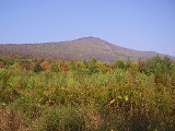
The Taconic Mountains or Taconic Range are a physiographic section
of the larger New England province
and part of the Appalachian Mountains
, running along the eastern border of New York State
and adjacent New England from northwest Connecticut
to western Massachusetts
, north to central western Vermont
. The range includes notable summits such as Mount Equinox and Mount Greylock
, the highest point in Massachusetts
.
The Taconic Range is known for their ecological value, conservation land, scenic landscapes, natural beauty, and recreational opportunities. It contains several hundred miles of trails including sections of the 2175 miles (3,500.3 km) Appalachian Trail
and over sixty designated areas of land protected by federal, state, county, and municipal, government agencies and non-profit organizations. The range has been targeted for conservation by government agencies in four states, the federal government, and over a dozen non-profit organizations. The Nature Conservancy calls the Berkshire Taconic landscape, which includes part of the Taconic Range, one of its "Last Great Places." Multiple government and non-profit conservation partnerships have been formed with the intention of conserving the Taconic landscape and ecosystem.
name, was once transliterated as the Taghkanic or Taughannock, meaning "in the trees" and used as the name of a Lenape
chieftain. Taghkanic is still used in parts of eastern New York, as in the name of a small town in the region
, for both features within and outside the Taconic Mountains region.
and extend through western Berkshire County, Massachusetts
and the adjacent counties in New York, then along the border of New York and Vermont to the town of Brandon, after which they lose prominence and dwindle into scattered hills and isolated peaks which continue north toward Burlington, Vermont
. To the south, they fade into the Hudson Highlands
range in New York.
Beginning in New York State, a 12 miles (19.3 km) wide region of foothills gradually rises to the crest of the Taconic Mountains along the state's eastern border. To the east, the Taconic Mountains fall off abruptly, ending in the valleys of the Housatonic River
, the upper Hoosic River
, and the greater Valley of Vermont. The Berkshires
and the Green Mountains
rise to the east of the Taconics. To the west, the Taconic foothills are bordered by the Hudson River Valley and, near the northern terminus of the Taconic Mountains, they are touched on by the eastern foothills of the Adirondak Mountains in Washington County, New York
.
In Massachusetts and Connecticut, the Taconic Mountains are often popularly grouped as part of the Berkshires; in Vermont they are similarly grouped as part of the Green Mountains
. However, the Taconic Mountains are geologically distinct from the Berkshires and Green Mountains.
The highest peak of the Taconic Mountains is Mount Equinox 3816 feet (1,163.1 m), located in Manchester, Vermont. Mount Greylock
3492 feet (1,064.4 m), the highest point in Massachusetts, and Mount Frissell
2454 feet (748 m), the highest point in Connecticut, are also part of the Taconic Mountains.
The Taconic Mountains lie within the New England-Acadian forests ecoregion
.
Because the Taconic Mountains are geologically related and contiguous with the Hudson Highlands
, the southern boundary of the Taconics is difficult to define. Some notable South Taconic peaks include Mount Frissell, the south slope of which contains the highest point in Connecticut at 2379 feet (725.1 m); Bear Mountain 2326 feet (709 m), the highest mountain peak in Connecticut; Alander Mountain
2239 feet (682.4 m) and Brace Mountain
2311 feet (704.4 m), Mount Everett
2624 feet (799.8 m), the highest point in the South Taconic subrange and the home of an upland pitch pine
and scrub oak
biome
; and Mount Fray
1893 feet (577 m), home of the Catamount Ski Area
. Bash Bish Falls
, reputedly Massachusetts' highest waterfall, is located in the South Taconic Range. The Appalachian Trail traverses the eastern escarpment of the range; the 15.7 miles (25.3 km) South Taconic Trail
traverses the western escarpment.
Central Segment and Upper Hoosic River Valley Region
North of Catamount Ski Area, the higher hills shift slightly west and become somewhat less prominent. North of White Hill the Green River cuts through the range. Immediately beyond this, notable summits include Bald Mountain, 1768 feet (538.9 m), and Harvey Mountain, 2057 feet (627 m), part of the newly created Harvey Mountain State Forest (expanded in 2006 http://www.dec.ny.gov/environmentdec/18895.html in New York and the site of extensive heath
barrens; and Beebe Hill, 1726 feet (526.1 m), with its abrupt, expansive views of the Hudson River
valley from a summit firetower. http://beebehill.info/
Several miles to the east of Harvey Mountain is Yokun Ridge
, a well defined 9 miles (14.5 km) long ridge extending from the Massachusetts Turnpike to the southerly neighborhoods of Pittsfield at elevations ranging between roughly 1500 and 2000 ft (457.2 and 609.6 m). The ridge contains an area designated The Stockbridge-Yokun Ridge Reserve by the U.S. Forest Service and thus eligible for certain conservation easements.
At Pittsfield, the crest shifts west once again to hills contained within Pittfield State Forest, Balance Rock and Bates Memorial State Park, where heights include Holy Mount
1968 feet (599.8 m), once the location of religious rituals practiced by a former Shaker community and Berry Hill
2200 feet (670.6 m), notable for its extensive stands of wild azalea
.
North of Jiminy Peak 2392 feet (729.1 m), the valley of Kinderhook Creek cuts through the hills. Here the western-most ridgeline is dominated by Misery Mountain and Berlin Mountain
2818 feet (858.9 m) and extending into Pownal, Vermont
; the eastern-most, which terminates in Williamstown, Massachusetts
is ruled by Mount Greylock 3491 feet (1,064.1 m), the highest point in Massachusetts. Between these is the long ridge of Brodie Mountain. The area hosts three long distance trails (the Appalachian Trail
, the Taconic Crest Trail
, and the Taconic Skyline Trail
) and an extensive network of smaller trails.
Southern Vermont
North of the Massachusetts border, the profile of the Taconic Range is cut and eroded by the Hoosic River
as it turns west and then south toward its confluence with the Hudson River, and by its tributary rivers in the vicinity of Bennington, Vermont. Mount Anthony 2320 feet (707.1 m), notable for its caves and as the location of Southern Vermont College
, stands as a satellite peak above the surrounding eroded terrain. North of Bennington, the range gradually rises to its highest prominence with peaks such as Mount Equinox 3850 feet (1,173.5 m), the high point of the Taconic Mountains, and Dorset Mountain
3770 feet (1,149.1 m), a New England 100 Highest list summit. Other notable summits include Grass Mountain
3109 feet (947.6 m), a New England Fifty Finest
list mountain; and Mount Aeolus 3230 feet (984.5 m), the location of several defunct limestone
quarries and the site of Aeolus Cave
an important bat
hibernaculum
. Designated hiking trails are located on Mount Equinox, Dorset Mountain, and Mount Aeolus, and several other peaks within the region.
Terminus of the range
Immediately north of Danby, Vermont
, the Taconic Range broadens and becomes shorter. It exhibits several parallel ridgelines, dominated to the west by mountains composed of slate
and similar rock, most notably the ridgeline of Saint Catherine Mountain 1200 feet (365.8 m), with its conspicuous 5 miles (8 km) long cliff face visible from Wells
and Poultney
. The area around Lake Saint Catherine
contains extensive slate
quarries. The ridgeline to the east, composed of schist
and phyllite
, is dominated by the 7 miles (11.3 km) escarpment of Tinmouth Mountain 2835 feet (864.1 m), overlooking the Valley of Vermont to the east in the town of Tinmouth
. A field of less descript ridges and peaks lies between these two summits.
Near the end of the range, in the vicinity of Rutland, Vermont
, the Taconic Mountains show several prominent peaks with dramatic, irregular cliff faces clearly visible from U.S. Route 4
west of the city of Rutland; these include Herrick Mountain 2726 feet (830.9 m); Grandpa's Knob 1976 feet (602.3 m), the former site of the Smith-Putnam wind turbine
, the first large-scale electricity-producing wind turbine
; and the butte
-like Bird Mountain (also called Birdseye Mountain) 2216 feet (675.4 m), home of the Bird Mountain Wildlife Management Area and notable as an important raptor
migration path and nesting site. Also part of the Taconic Mountains are the foothills of the Lake Bomoseen region west of Birdseye and Granpa's Knob, notable for their extensive slate
quarrying operations. North of Grandpa's Knob, the Taconic Range soon diminishes into scattered hills which extend north into the Burlington, Vermont
region. Isolated summits in this area include Snake Mountain (Vermont)
1281 feet (390.4 m), a Nature Conservancy preserve featuring a variety of rare and endangered species; and Mount Philo
968 feet (295 m), home of Mount Philo State Park
with its mountaintop campground.
into a volcanic island arc
, similar to modern-day Taiwan
, during the late Ordovician period
, around 440 million years ago.
The western side of the Taconics rise gradually from a series of hills in eastern New York to a sharp mountain crest along the west border of the New England states; the east side of the Taconics falls off abruptly where river valleys divide it from the Berkshires and Green Mountains. The total length of the range is about 200 miles (321.9 km) with a varying width of 5 to 20 mi (8 to 32.2 km).
The Taconic Mountains are a physiographic section
of the larger New England province
, which in turn is part of the larger Appalachian
physiographic division.
extraction has been an important industry in the Taconic Mountains; extraction industries have included marble
, limestone
, slate
, and iron
mining as well as logging
and charcoal
ing.
for potential conservation as the "Taconic Mountains Forest Legacy Area" under its Forest Legacy Program
. The designated area averages perhaps a mile in width extending east of the state line, but is considerably wider in the southern Taconics region and middle section of Berkshire County. The district in Massachusetts abut parts of New York State and Connecticut that carry similar designations under the federal program, which affords subsidies for the acquisition of conservation easements when available for purchase. http://www.mass.gov/dcr/stewardship/forestry/other/Taconc_Range_Amendment_2000.pdf The "Stockbridge-Yokun Ridge
Reserve was designated as such at a slightly earlier date under the same federal program, which is aimed at close coordination with state and local government authorities. Multi-parter collaboratives that have targeted the Taconic Mountains include the New England Wildlands and Woodlands Collaborative, a regional conservation agenda for the New England
states produced by representatives of dozens of non-profits and academic institutions and, more specifically, the Taconic Crest Project, which involves the states of New York, Massachusetts, and Vermont in collaboration with local land trusts and The Nature Conservancy.
Physiographic regions of the world
The physiographic regions of the world are a means of defining the Earth's landforms into distinct regions based upon classic 1916 three-tiered approach defining divisions, provinces, and sections...
of the larger New England province
New England province
The New England province is a physiographic province of the larger Appalachian division of eastern North America. The province consists of the Seaboard Lowland, New England Upland, White Mountain, Green Mountain, and Taconic sections.-Geology:...
and part of the Appalachian Mountains
Appalachian Mountains
The Appalachian Mountains #Whether the stressed vowel is or ,#Whether the "ch" is pronounced as a fricative or an affricate , and#Whether the final vowel is the monophthong or the diphthong .), often called the Appalachians, are a system of mountains in eastern North America. The Appalachians...
, running along the eastern border of New York State
New York
New York is a state in the Northeastern region of the United States. It is the nation's third most populous state. New York is bordered by New Jersey and Pennsylvania to the south, and by Connecticut, Massachusetts and Vermont to the east...
and adjacent New England from northwest Connecticut
Connecticut
Connecticut is a state in the New England region of the northeastern United States. It is bordered by Rhode Island to the east, Massachusetts to the north, and the state of New York to the west and the south .Connecticut is named for the Connecticut River, the major U.S. river that approximately...
to western Massachusetts
Massachusetts
The Commonwealth of Massachusetts is a state in the New England region of the northeastern United States of America. It is bordered by Rhode Island and Connecticut to the south, New York to the west, and Vermont and New Hampshire to the north; at its east lies the Atlantic Ocean. As of the 2010...
, north to central western Vermont
Vermont
Vermont is a state in the New England region of the northeastern United States of America. The state ranks 43rd in land area, , and 45th in total area. Its population according to the 2010 census, 630,337, is the second smallest in the country, larger only than Wyoming. It is the only New England...
. The range includes notable summits such as Mount Equinox and Mount Greylock
Mount Greylock
Mount Greylock is the highest natural point in Massachusetts at . Its peak is located in the northwest corner of the state in the western part of the town of Adams in Berkshire County. Although geologically part of the Taconic Mountains, Mount Greylock is commonly associated with the abutting...
, the highest point in Massachusetts
Massachusetts
The Commonwealth of Massachusetts is a state in the New England region of the northeastern United States of America. It is bordered by Rhode Island and Connecticut to the south, New York to the west, and Vermont and New Hampshire to the north; at its east lies the Atlantic Ocean. As of the 2010...
.
The Taconic Range is known for their ecological value, conservation land, scenic landscapes, natural beauty, and recreational opportunities. It contains several hundred miles of trails including sections of the 2175 miles (3,500.3 km) Appalachian Trail
Appalachian Trail
The Appalachian National Scenic Trail, generally known as the Appalachian Trail or simply the AT, is a marked hiking trail in the eastern United States extending between Springer Mountain in Georgia and Mount Katahdin in Maine. It is approximately long...
and over sixty designated areas of land protected by federal, state, county, and municipal, government agencies and non-profit organizations. The range has been targeted for conservation by government agencies in four states, the federal government, and over a dozen non-profit organizations. The Nature Conservancy calls the Berkshire Taconic landscape, which includes part of the Taconic Range, one of its "Last Great Places." Multiple government and non-profit conservation partnerships have been formed with the intention of conserving the Taconic landscape and ecosystem.
History
"Taconic", a Native AmericanIndigenous languages of the Americas
Indigenous languages of the Americas are spoken by indigenous peoples from Alaska and Greenland to the southern tip of South America, encompassing the land masses which constitute the Americas. These indigenous languages consist of dozens of distinct language families as well as many language...
name, was once transliterated as the Taghkanic or Taughannock, meaning "in the trees" and used as the name of a Lenape
Lenape
The Lenape are an Algonquian group of Native Americans of the Northeastern Woodlands. They are also called Delaware Indians. As a result of the American Revolutionary War and later Indian removals from the eastern United States, today the main groups live in Canada, where they are enrolled in the...
chieftain. Taghkanic is still used in parts of eastern New York, as in the name of a small town in the region
Taghkanic, New York
Taghkanic is a town in Columbia County, New York, United States. The town is in the south-central part of the county. The population was 1,118 at the 2000 census...
, for both features within and outside the Taconic Mountains region.
Geography
The Taconic Mountains begin in northwest Connecticut and northeast Dutchess County, New YorkDutchess County, New York
Dutchess County is a county located in the U.S. state of New York, in the state's Mid-Hudson Region of the Hudson Valley. The 2010 census lists the population as 297,488...
and extend through western Berkshire County, Massachusetts
Berkshire County, Massachusetts
Berkshire County is a non-governmental county located on the western edge of the U.S. state of Massachusetts. As of the 2010 census, the population was 131,219. Its largest city and traditional county seat is Pittsfield...
and the adjacent counties in New York, then along the border of New York and Vermont to the town of Brandon, after which they lose prominence and dwindle into scattered hills and isolated peaks which continue north toward Burlington, Vermont
Burlington, Vermont
Burlington is the largest city in the U.S. state of Vermont and the shire town of Chittenden County. Burlington lies south of the U.S.-Canadian border and some south of Montreal....
. To the south, they fade into the Hudson Highlands
Hudson Highlands
The Hudson Highlands are mountains on both sides of the Hudson River in the U.S. state of New York, between Newburgh Bay and Haverstraw Bay, which form the northern region of the New York - New Jersey Highlands....
range in New York.
Beginning in New York State, a 12 miles (19.3 km) wide region of foothills gradually rises to the crest of the Taconic Mountains along the state's eastern border. To the east, the Taconic Mountains fall off abruptly, ending in the valleys of the Housatonic River
Housatonic River
The Housatonic River is a river, approximately long, in western Massachusetts and western Connecticut in the United States. It flows south to southeast, and drains about of southwestern New England into Long Island Sound...
, the upper Hoosic River
Hoosic River
The Hoosic River, also known as the Hoosac, the Hoosick and the Hoosuck , is a tributary of the Hudson River in the northeastern United States. The different spellings are the result of varying transliterations of the river's original Algonquian name...
, and the greater Valley of Vermont. The Berkshires
The Berkshires
The Berkshires , is a highland geologic region located in the western parts of Massachusetts and Connecticut.Also referred to as the Berkshire Hills, Berkshire Mountains, and Berkshire Plateau, the region enjoys a vibrant tourism industry based on music, arts, and recreation.-Definition:The term...
and the Green Mountains
Green Mountains
The Green Mountains are a mountain range in the U.S. state of Vermont. The range extends approximately .-Peaks:The most notable mountains in the range include:*Mount Mansfield, , the highest point in Vermont*Killington Peak, *Mount Ellen,...
rise to the east of the Taconics. To the west, the Taconic foothills are bordered by the Hudson River Valley and, near the northern terminus of the Taconic Mountains, they are touched on by the eastern foothills of the Adirondak Mountains in Washington County, New York
Washington County, New York
Washington County is a county located in the U.S. state of New York. It is part of the Glens Falls, New York, Metropolitan Statistical Area. As of the 2010 census, the population was 63,216. It was named for the Revolutionary War general George Washington...
.
In Massachusetts and Connecticut, the Taconic Mountains are often popularly grouped as part of the Berkshires; in Vermont they are similarly grouped as part of the Green Mountains
Green Mountains
The Green Mountains are a mountain range in the U.S. state of Vermont. The range extends approximately .-Peaks:The most notable mountains in the range include:*Mount Mansfield, , the highest point in Vermont*Killington Peak, *Mount Ellen,...
. However, the Taconic Mountains are geologically distinct from the Berkshires and Green Mountains.
The highest peak of the Taconic Mountains is Mount Equinox 3816 feet (1,163.1 m), located in Manchester, Vermont. Mount Greylock
Mount Greylock
Mount Greylock is the highest natural point in Massachusetts at . Its peak is located in the northwest corner of the state in the western part of the town of Adams in Berkshire County. Although geologically part of the Taconic Mountains, Mount Greylock is commonly associated with the abutting...
3492 feet (1,064.4 m), the highest point in Massachusetts, and Mount Frissell
Mount Frissell
Mount Frissell, , located on the border of southwest Massachusetts and northwest Connecticut, is a prominent peak of the Taconic Range. The peak and northern part of the mountain are located within Massachusetts. The southern slope of Mount Frissell is located within Connecticut and rises to the...
2454 feet (748 m), the highest point in Connecticut, are also part of the Taconic Mountains.
The Taconic Mountains lie within the New England-Acadian forests ecoregion
Ecoregion
An ecoregion , sometimes called a bioregion, is an ecologically and geographically defined area that is smaller than an ecozone and larger than an ecosystem. Ecoregions cover relatively large areas of land or water, and contain characteristic, geographically distinct assemblages of natural...
.
Sub-ranges and regions
The South Taconic RangeBecause the Taconic Mountains are geologically related and contiguous with the Hudson Highlands
Hudson Highlands
The Hudson Highlands are mountains on both sides of the Hudson River in the U.S. state of New York, between Newburgh Bay and Haverstraw Bay, which form the northern region of the New York - New Jersey Highlands....
, the southern boundary of the Taconics is difficult to define. Some notable South Taconic peaks include Mount Frissell, the south slope of which contains the highest point in Connecticut at 2379 feet (725.1 m); Bear Mountain 2326 feet (709 m), the highest mountain peak in Connecticut; Alander Mountain
Alander Mountain
Alander Mountain, is a prominent peak of the south Taconic Mountains; it is located in southwest Massachusetts and adjacent New York. Part of the summit is grassy and open and part is covered with scrub oak and shrubs; the sides of the mountain are wooded with northern hardwood tree species....
2239 feet (682.4 m) and Brace Mountain
Brace Mountain
Brace Mountain is the peak of a ridge in the southern Taconic Mountains, near the tripoint of the U.S. states of New York, Connecticut and Massachusetts...
2311 feet (704.4 m), Mount Everett
Mount Everett
Mount Everett at 2,624 ft - or 800 m - is the highest peak in the south Taconic Mountains of Massachusetts. The mountain is known for its expansive views of the southern Taconics and Berkshires; for its fragile ecosystem of old growth pitch pine and scrub oak; and for its rare plant and animal...
2624 feet (799.8 m), the highest point in the South Taconic subrange and the home of an upland pitch pine
Pitch Pine
The Pitch Pine, Pinus rigida, is a small-to-medium sized pine, native to eastern North America. This species occasionally hybridizes with other pine species such as Loblolly Pine , Shortleaf Pine , and Pond Pine The Pitch Pine, Pinus rigida, is a small-to-medium sized (6-30 meters or 20-100 feet)...
and scrub oak
Scrub Oak
Scrub Oak is a general name for several species of small, shrubby oaks, including the following species:*California Scrub Oak *Leather Oak *Coastal Scrub Oak...
biome
Biome
Biomes are climatically and geographically defined as similar climatic conditions on the Earth, such as communities of plants, animals, and soil organisms, and are often referred to as ecosystems. Some parts of the earth have more or less the same kind of abiotic and biotic factors spread over a...
; and Mount Fray
Mount Fray
Mount Fray, , also known as Catamount because of the Catamount Ski Area located on its north slope, is a prominent peak of the south Taconic Mountains, located in southwest Massachusetts and adjacent New York. The summit is open and covered in scrub oak; it offers views west over the Hudson River...
1893 feet (577 m), home of the Catamount Ski Area
Catamount Ski Area
Catamount Ski Area is a ski resort located on Mount Fray of the Taconic Mountains in Hillsdale, New York and South Egremont, Massachusetts. It is one of the few remaining family-owned ski areas in New England.-History:...
. Bash Bish Falls
Bash Bish Falls
Bash Bish Falls, a waterfall in Bash Bish Falls State Park in the Taconic Mountains of southwestern Massachusetts , is the highest waterfall in the state...
, reputedly Massachusetts' highest waterfall, is located in the South Taconic Range. The Appalachian Trail traverses the eastern escarpment of the range; the 15.7 miles (25.3 km) South Taconic Trail
South Taconic Trail
The South Taconic Trail is a hiking trail in the Taconic Mountains of southwest Massachusetts and adjacent New York. The trail extends from the village of Whitehouse Crossing in Millerton, New York, north along the ridgecrest of the southern Taconic Range and the border of New York and...
traverses the western escarpment.
Central Segment and Upper Hoosic River Valley Region
North of Catamount Ski Area, the higher hills shift slightly west and become somewhat less prominent. North of White Hill the Green River cuts through the range. Immediately beyond this, notable summits include Bald Mountain, 1768 feet (538.9 m), and Harvey Mountain, 2057 feet (627 m), part of the newly created Harvey Mountain State Forest (expanded in 2006 http://www.dec.ny.gov/environmentdec/18895.html in New York and the site of extensive heath
Heath (habitat)
A heath or heathland is a dwarf-shrub habitat found on mainly low quality acidic soils, characterised by open, low growing woody vegetation, often dominated by plants of the Ericaceae. There are some clear differences between heath and moorland...
barrens; and Beebe Hill, 1726 feet (526.1 m), with its abrupt, expansive views of the Hudson River
Hudson River
The Hudson is a river that flows from north to south through eastern New York. The highest official source is at Lake Tear of the Clouds, on the slopes of Mount Marcy in the Adirondack Mountains. The river itself officially begins in Henderson Lake in Newcomb, New York...
valley from a summit firetower. http://beebehill.info/
Several miles to the east of Harvey Mountain is Yokun Ridge
Yokun Ridge
Yokun Ridge is a well defined ridge within the Taconic Mountains in Berkshire County, Massachusetts that principally include West Stockbridge Mountain and Lenox Mountain as well as other related features...
, a well defined 9 miles (14.5 km) long ridge extending from the Massachusetts Turnpike to the southerly neighborhoods of Pittsfield at elevations ranging between roughly 1500 and 2000 ft (457.2 and 609.6 m). The ridge contains an area designated The Stockbridge-Yokun Ridge Reserve by the U.S. Forest Service and thus eligible for certain conservation easements.
At Pittsfield, the crest shifts west once again to hills contained within Pittfield State Forest, Balance Rock and Bates Memorial State Park, where heights include Holy Mount
Holy Mount
Holy Mount, , is a prominent peak in the Taconic Mountains of western Massachusetts, formerly used as the location of religious ceremonies by a nearby Shaker community. The mountain is located in Pittsfield State Forest and is traversed by the loop Shaker Trail which begins at the historic Hancock...
1968 feet (599.8 m), once the location of religious rituals practiced by a former Shaker community and Berry Hill
Berry Hill
Berry Hill may refer to landforms, historic buildings, or populated areas:in England*Berry Hill, Gloucestershire*Berry Hill, Staffordshire**Berry Hill High School and Sports College, secondary schoolin the United States...
2200 feet (670.6 m), notable for its extensive stands of wild azalea
Azalea
Azaleas are flowering shrubs comprising two of the eight subgenera of the genus Rhododendron, Pentanthera and Tsutsuji . Azaleas bloom in spring, their flowers often lasting several weeks...
.
North of Jiminy Peak 2392 feet (729.1 m), the valley of Kinderhook Creek cuts through the hills. Here the western-most ridgeline is dominated by Misery Mountain and Berlin Mountain
Berlin Mountain
Berlin Mountain, , is a prominent peak in the Taconic Mountains of western New England and adjacent New York. The summit and west side of the mountain are located in New York; the east side lies within Massachusetts. The mountain is a bald, notable for its grassy summit and expansive views of the...
2818 feet (858.9 m) and extending into Pownal, Vermont
Pownal, Vermont
Pownal is a town in Bennington County, Vermont, United States. As of the 2000 census, the town population was 3,560. The town of Pownal includes the villages of Pownal, North Pownal, and Pownal Center.-History:...
; the eastern-most, which terminates in Williamstown, Massachusetts
Williamstown, Massachusetts
Williamstown is a town in Berkshire County, in the northwest corner of Massachusetts. It shares a border with Vermont to the north and New York to the west. It is part of the Pittsfield, Massachusetts Metropolitan Statistical Area. The population was 7,754 at the 2010 census...
is ruled by Mount Greylock 3491 feet (1,064.1 m), the highest point in Massachusetts. Between these is the long ridge of Brodie Mountain. The area hosts three long distance trails (the Appalachian Trail
Appalachian Trail
The Appalachian National Scenic Trail, generally known as the Appalachian Trail or simply the AT, is a marked hiking trail in the eastern United States extending between Springer Mountain in Georgia and Mount Katahdin in Maine. It is approximately long...
, the Taconic Crest Trail
Taconic Crest Trail
The Taconic Crest Trail is a hiking trail in the Taconic Mountains of the Berkshires. The trail extends from U.S. Route 20 in Hancock, Massachusetts, less than east of the New York border, north along the ridgecrest of the Taconic Range, first within Massachusetts, then weaving along the border...
, and the Taconic Skyline Trail
Taconic Skyline Trail
The Taconic Skyline Trail is a multi-use trail in the Taconic Mountains of Berkshire County, Massachusetts. The trail extends from U.S. Route 20 in Hancock, Massachusetts, less than east of the New York border, north along the ridgecrest of the Taconic Range within Pittsfield State Forest and...
) and an extensive network of smaller trails.
Southern Vermont
North of the Massachusetts border, the profile of the Taconic Range is cut and eroded by the Hoosic River
Hoosic River
The Hoosic River, also known as the Hoosac, the Hoosick and the Hoosuck , is a tributary of the Hudson River in the northeastern United States. The different spellings are the result of varying transliterations of the river's original Algonquian name...
as it turns west and then south toward its confluence with the Hudson River, and by its tributary rivers in the vicinity of Bennington, Vermont. Mount Anthony 2320 feet (707.1 m), notable for its caves and as the location of Southern Vermont College
Southern Vermont College
Southern Vermont College is a private, four-year liberal arts college located on the former Edward Everett Estate near Bennington, Vermont in the southwestern corner of the state bordering New York and Massachusetts.-Overview:...
, stands as a satellite peak above the surrounding eroded terrain. North of Bennington, the range gradually rises to its highest prominence with peaks such as Mount Equinox 3850 feet (1,173.5 m), the high point of the Taconic Mountains, and Dorset Mountain
Dorset Mountain
Dorset Mountain located in Vermont, on the border of Rutland and Bennington counties, is a mountain of the Taconic Range. The highest summit of Dorset Mountain, named "Dorset Peak", is within the town of Danby...
3770 feet (1,149.1 m), a New England 100 Highest list summit. Other notable summits include Grass Mountain
Grass Mountain (Vermont)
Grass Mountain is a mountain located in Bennington County, Vermont.Grass Mountain is flanked to the north by Big Spruce Mountain, and to the southeast by Spruce Mountain....
3109 feet (947.6 m), a New England Fifty Finest
New England Fifty Finest
The New England Fifty Finest is a list of mountains in New England, used in the mountaineering sport of peak bagging.The list comprises the fifty summits with the highest topographic prominence — a peak's height above the lowest contour which encloses that peak and no higher peak.This list differs...
list mountain; and Mount Aeolus 3230 feet (984.5 m), the location of several defunct limestone
Limestone
Limestone is a sedimentary rock composed largely of the minerals calcite and aragonite, which are different crystal forms of calcium carbonate . Many limestones are composed from skeletal fragments of marine organisms such as coral or foraminifera....
quarries and the site of Aeolus Cave
Aeolus Cave
Aeolus Bat Cave is a cave located up in the Taconic Mountains in East Dorset, Vermont, USA. Alternate names that have shown up in the literature include Aeolus Cave, Mount Aeolus Cave, and Dorset Bat Cave....
an important bat
Bat
Bats are mammals of the order Chiroptera "hand" and pteron "wing") whose forelimbs form webbed wings, making them the only mammals naturally capable of true and sustained flight. By contrast, other mammals said to fly, such as flying squirrels, gliding possums, and colugos, glide rather than fly,...
hibernaculum
Hibernaculum
Hibernaculum can refer to:* Hibernaculum , the location chosen by an animal for hibernation...
. Designated hiking trails are located on Mount Equinox, Dorset Mountain, and Mount Aeolus, and several other peaks within the region.
Terminus of the range
Immediately north of Danby, Vermont
Danby, Vermont
Danby is a town in Rutland County, Vermont, United States. The population was 1,311 at the 2010 census.-Geography:According to the United States Census Bureau, the town has a total area of , of which is land and , or 0.22%, is water.-Geology:...
, the Taconic Range broadens and becomes shorter. It exhibits several parallel ridgelines, dominated to the west by mountains composed of slate
Slate
Slate is a fine-grained, foliated, homogeneous metamorphic rock derived from an original shale-type sedimentary rock composed of clay or volcanic ash through low-grade regional metamorphism. The result is a foliated rock in which the foliation may not correspond to the original sedimentary layering...
and similar rock, most notably the ridgeline of Saint Catherine Mountain 1200 feet (365.8 m), with its conspicuous 5 miles (8 km) long cliff face visible from Wells
Wells, Vermont
Wells is a town in Rutland County, Vermont, United States. As of the 2000 census, the town had a total population of 1,150.-Geography:According to the United States Census Bureau, the town has a total area of , of which is land and , or 3.42%, is water....
and Poultney
Poultney, Vermont
Poultney is a village in Rutland County of the U.S. state of Vermont. The village is entirely within the town of Poultney. The population was 1,612 at the 2010 census...
. The area around Lake Saint Catherine
Lake Saint Catherine (Vermont)
Lake Saint Catherine is an body of water located in Rutland County, Vermont in the towns of Wells and Poultney. Lake St. Catherine State Park is located along its eastern shore.-History Of Lake St. Catherine:History of Lake St. Catherine...
contains extensive slate
Slate
Slate is a fine-grained, foliated, homogeneous metamorphic rock derived from an original shale-type sedimentary rock composed of clay or volcanic ash through low-grade regional metamorphism. The result is a foliated rock in which the foliation may not correspond to the original sedimentary layering...
quarries. The ridgeline to the east, composed of schist
Schist
The schists constitute a group of medium-grade metamorphic rocks, chiefly notable for the preponderance of lamellar minerals such as micas, chlorite, talc, hornblende, graphite, and others. Quartz often occurs in drawn-out grains to such an extent that a particular form called quartz schist is...
and phyllite
Phyllite
Phyllite is a type of foliated metamorphic rock primarily composed of quartz, sericite mica, and chlorite; the rock represents a gradation in the degree of metamorphism between slate and mica schist. Minute crystals of graphite, sericite, or chlorite impart a silky, sometimes golden sheen to the...
, is dominated by the 7 miles (11.3 km) escarpment of Tinmouth Mountain 2835 feet (864.1 m), overlooking the Valley of Vermont to the east in the town of Tinmouth
Tinmouth, Vermont
Tinmouth is a town in Rutland County, Vermont, United States. The population was 613 at the 2010 census.-History:Tinmouth was established in 1761 in a region that came to be known as the New Hampshire Grants. At the first U.S. census, the town had a population of 935...
. A field of less descript ridges and peaks lies between these two summits.
Near the end of the range, in the vicinity of Rutland, Vermont
Rutland (town), Vermont
Rutland is a town in Rutland County, Vermont, United States. The population was 4,054 at the 2010 census. Rutland completely surrounds the city of Rutland, which is incorporated separately from the town of Rutland.-History:...
, the Taconic Mountains show several prominent peaks with dramatic, irregular cliff faces clearly visible from U.S. Route 4
U.S. Route 4
U.S. Route 4 is a long United States highway that runs from East Greenbush, New York, in the west to Portsmouth, New Hampshire, in the east, traversing through Vermont.In New York, US 4 is signed north–south to reflect its alignment in the state...
west of the city of Rutland; these include Herrick Mountain 2726 feet (830.9 m); Grandpa's Knob 1976 feet (602.3 m), the former site of the Smith-Putnam wind turbine
Smith-Putnam wind turbine
In 1941 the Smith-Putnam wind turbine, the world's first megawatt-size wind turbine, was connected to the local electrical distribution system on Grandpa's Knob in Castleton, Vermont, USA. It was designed by Palmer Cosslett Putnam and manufactured by the S. Morgan Smith Company...
, the first large-scale electricity-producing wind turbine
Wind turbine
A wind turbine is a device that converts kinetic energy from the wind into mechanical energy. If the mechanical energy is used to produce electricity, the device may be called a wind generator or wind charger. If the mechanical energy is used to drive machinery, such as for grinding grain or...
; and the butte
Butte
A butte is a conspicuous isolated hill with steep, often vertical sides and a small, relatively flat top; it is smaller than mesas, plateaus, and table landform tables. In some regions, such as the north central and northwestern United States, the word is used for any hill...
-like Bird Mountain (also called Birdseye Mountain) 2216 feet (675.4 m), home of the Bird Mountain Wildlife Management Area and notable as an important raptor
Bird of prey
Birds of prey are birds that hunt for food primarily on the wing, using their keen senses, especially vision. They are defined as birds that primarily hunt vertebrates, including other birds. Their talons and beaks tend to be relatively large, powerful and adapted for tearing and/or piercing flesh....
migration path and nesting site. Also part of the Taconic Mountains are the foothills of the Lake Bomoseen region west of Birdseye and Granpa's Knob, notable for their extensive slate
Slate
Slate is a fine-grained, foliated, homogeneous metamorphic rock derived from an original shale-type sedimentary rock composed of clay or volcanic ash through low-grade regional metamorphism. The result is a foliated rock in which the foliation may not correspond to the original sedimentary layering...
quarrying operations. North of Grandpa's Knob, the Taconic Range soon diminishes into scattered hills which extend north into the Burlington, Vermont
Burlington, Vermont
Burlington is the largest city in the U.S. state of Vermont and the shire town of Chittenden County. Burlington lies south of the U.S.-Canadian border and some south of Montreal....
region. Isolated summits in this area include Snake Mountain (Vermont)
Snake Mountain (Vermont)
Snake Mountain, , also called Grand View Mountain, is an isolated mountain located in Addison and Weybridge, Vermont; it belongs to a series of scattered hills extending from the greater Taconic Mountains geology. Snake Mountain contains the state of Vermont's Snake Mountain Wildlife Management...
1281 feet (390.4 m), a Nature Conservancy preserve featuring a variety of rare and endangered species; and Mount Philo
Mount Philo State Park
Mount Philo State Park is a state park located in Charlotte, Vermont. The park protects the area around Mount Philo and provides views of Lake Champlain and the Adirondack Mountains to the west. The Green Mountains can be seen to the east and south...
968 feet (295 m), home of Mount Philo State Park
Mount Philo State Park
Mount Philo State Park is a state park located in Charlotte, Vermont. The park protects the area around Mount Philo and provides views of Lake Champlain and the Adirondack Mountains to the west. The Green Mountains can be seen to the east and south...
with its mountaintop campground.
Geology and physiography
The Taconic mountain range was formed from the collision of the North American PlateNorth American Plate
The North American Plate is a tectonic plate covering most of North America, Greenland, Cuba, Bahamas, and parts of Siberia, Japan and Iceland. It extends eastward to the Mid-Atlantic Ridge and westward to the Chersky Range in eastern Siberia. The plate includes both continental and oceanic crust...
into a volcanic island arc
Volcanic arc
A volcanic arc is a chain of volcanoes positioned in an arc shape as seen from above. Offshore volcanoes form islands, resulting in a volcanic island arc. Generally they result from the subduction of an oceanic tectonic plate under another tectonic plate, and often parallel an oceanic trench...
, similar to modern-day Taiwan
Taiwan
Taiwan , also known, especially in the past, as Formosa , is the largest island of the same-named island group of East Asia in the western Pacific Ocean and located off the southeastern coast of mainland China. The island forms over 99% of the current territory of the Republic of China following...
, during the late Ordovician period
Ordovician
The Ordovician is a geologic period and system, the second of six of the Paleozoic Era, and covers the time between 488.3±1.7 to 443.7±1.5 million years ago . It follows the Cambrian Period and is followed by the Silurian Period...
, around 440 million years ago.
The western side of the Taconics rise gradually from a series of hills in eastern New York to a sharp mountain crest along the west border of the New England states; the east side of the Taconics falls off abruptly where river valleys divide it from the Berkshires and Green Mountains. The total length of the range is about 200 miles (321.9 km) with a varying width of 5 to 20 mi (8 to 32.2 km).
The Taconic Mountains are a physiographic section
Physiographic regions of the world
The physiographic regions of the world are a means of defining the Earth's landforms into distinct regions based upon classic 1916 three-tiered approach defining divisions, provinces, and sections...
of the larger New England province
New England province
The New England province is a physiographic province of the larger Appalachian division of eastern North America. The province consists of the Seaboard Lowland, New England Upland, White Mountain, Green Mountain, and Taconic sections.-Geology:...
, which in turn is part of the larger Appalachian
Appalachian Mountains
The Appalachian Mountains #Whether the stressed vowel is or ,#Whether the "ch" is pronounced as a fricative or an affricate , and#Whether the final vowel is the monophthong or the diphthong .), often called the Appalachians, are a system of mountains in eastern North America. The Appalachians...
physiographic division.
Natural resources extraction
Natural resourceNatural resource
Natural resources occur naturally within environments that exist relatively undisturbed by mankind, in a natural form. A natural resource is often characterized by amounts of biodiversity and geodiversity existent in various ecosystems....
extraction has been an important industry in the Taconic Mountains; extraction industries have included marble
Marble
Marble is a metamorphic rock composed of recrystallized carbonate minerals, most commonly calcite or dolomite.Geologists use the term "marble" to refer to metamorphosed limestone; however stonemasons use the term more broadly to encompass unmetamorphosed limestone.Marble is commonly used for...
, limestone
Limestone
Limestone is a sedimentary rock composed largely of the minerals calcite and aragonite, which are different crystal forms of calcium carbonate . Many limestones are composed from skeletal fragments of marine organisms such as coral or foraminifera....
, slate
Slate
Slate is a fine-grained, foliated, homogeneous metamorphic rock derived from an original shale-type sedimentary rock composed of clay or volcanic ash through low-grade regional metamorphism. The result is a foliated rock in which the foliation may not correspond to the original sedimentary layering...
, and iron
Iron
Iron is a chemical element with the symbol Fe and atomic number 26. It is a metal in the first transition series. It is the most common element forming the planet Earth as a whole, forming much of Earth's outer and inner core. It is the fourth most common element in the Earth's crust...
mining as well as logging
Logging
Logging is the cutting, skidding, on-site processing, and loading of trees or logs onto trucks.In forestry, the term logging is sometimes used in a narrow sense concerning the logistics of moving wood from the stump to somewhere outside the forest, usually a sawmill or a lumber yard...
and charcoal
Charcoal
Charcoal is the dark grey residue consisting of carbon, and any remaining ash, obtained by removing water and other volatile constituents from animal and vegetation substances. Charcoal is usually produced by slow pyrolysis, the heating of wood or other substances in the absence of oxygen...
ing.
Conservation
A narrow strip along the entire Western border of Massachusetts has been designated by the U.S. Forest ServiceForest Service
Forest Service may refer to:* Canadian Forest Service* Indian Forest Service* New Zealand Forest Service* United States Forest Service* Forestry Commission in the United Kingdom...
for potential conservation as the "Taconic Mountains Forest Legacy Area" under its Forest Legacy Program
Forest Legacy Program
The Forest Legacy Program was established in the 1990 Farm Bill to protect environmentally important forest lands that are threatened by conversion to nonforest uses...
. The designated area averages perhaps a mile in width extending east of the state line, but is considerably wider in the southern Taconics region and middle section of Berkshire County. The district in Massachusetts abut parts of New York State and Connecticut that carry similar designations under the federal program, which affords subsidies for the acquisition of conservation easements when available for purchase. http://www.mass.gov/dcr/stewardship/forestry/other/Taconc_Range_Amendment_2000.pdf The "Stockbridge-Yokun Ridge
Yokun Ridge
Yokun Ridge is a well defined ridge within the Taconic Mountains in Berkshire County, Massachusetts that principally include West Stockbridge Mountain and Lenox Mountain as well as other related features...
Reserve was designated as such at a slightly earlier date under the same federal program, which is aimed at close coordination with state and local government authorities. Multi-parter collaboratives that have targeted the Taconic Mountains include the New England Wildlands and Woodlands Collaborative, a regional conservation agenda for the New England
New England
New England is a region in the northeastern corner of the United States consisting of the six states of Maine, New Hampshire, Vermont, Massachusetts, Rhode Island, and Connecticut...
states produced by representatives of dozens of non-profits and academic institutions and, more specifically, the Taconic Crest Project, which involves the states of New York, Massachusetts, and Vermont in collaboration with local land trusts and The Nature Conservancy.