

Sydney-Newcastle Freeway
Encyclopedia
The Sydney-Newcastle Freeway is a 127 km (79 mi) stretch of motorway linking Sydney
to the Central Coast
, Newcastle
and Hunter regions of New South Wales
. It is part of the AusLink road corridor between Sydney and Brisbane
, carrying the route designation.
The freeway is also identified as the F3 by the NSW Roads and Traffic Authority (RTA) and locals and is signposted every 1 km at the median crossover to differentiate from with other freeways.
, Wahroonga, near its junction with the Pacific Highway
in Sydney's north. The freeway goes under the Pacific Highway at Pearce's Corner and heads north, skirting the western edge of the Ku-ring-gai Chase National Park
and running parallel with the railway line
until it descends to the Hawkesbury River
at Brooklyn
. After crossing the river, the Hawkesbury River interchange at Mooney Mooney provides access to Brooklyn and related river communities. The motorway passes through the Brisbane Water National Park
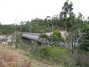
, and the Calga interchange gives access to Peats Ridge and the Mount White interchange. At Calga there are major heavy vehicle checking stations on both northbound and southbound sections to assess compliance and roadworthiness of trucks. The freeway crosses Mooney Mooney Creek with the 480 m (1,575 ft) long, 75 m (246 ft) high Mooney Mooney Bridge
before it reaches the first major interchange on the Central Coast at Kariong
.
After Kariong, the motorway continues through rural and semi-rural areas of the Central Coast with interchanges at Ourimbah
, Tuggerah
, Warnervale
and Kiar, near Doyalson
. From the Doyalson interchange the freeway continues to the west of Lake Macquarie with interchanges near Morisset
, Cessnock
, Toronto
and Cardiff
.
After the Cardiff interchange a link road takes traffic into Newcastle via Wallsend
while the motorway continues north to reach its end with a 2-lane roundabout at the junction of Weakleys Drive and John Renshaw Drive, Beresfield
. From here the National Highway route continues to Brisbane via the New England Highway
(accessed via Weakleys Drive), while traffic on Highway 1
takes John Renshaw Drive and the New England Highway eastwards to meet the Pacific Highway at Hexham
. There are rumble strips (perceptual countermeasures) at the end of the freeway to augment road signage in alerting drivers to the end of the 110 km/h freeway speed limit and to slow traffic down.
The route between Mount White and Kariong was originally planned to go further east than the current route with an easier crossing of Mooney Mooney Creek. By the time that construction on this section was to begin, resistance from the National Parks and Wildlife Service to the proposed route forced the government to take a route through Calga which at the time would have formed part of a route to Singleton
.
The route through Wyong Shire also changed; instead of passing along the western edge of the Tuggerah Lakes, development in that area forced the freeway to move further west with a link road being constructed to meet the Pacific Highway near Doyalson.
Perhaps the most significant effect on the freeway's route and its connections was the anti-freeway movement of 1972. Strong public resistance to freeways being constructed within cities along with less than favourable results from government inquiries resulted in unconstructed freeway projects being cancelled and those under construction being revised or cut short. For the Sydney-Newcastle Freeway, this meant that the connecting Lane Cove Valley and North Western Expressway
s in Sydney would not be built - forcing traffic to travel along the Pacific Highway between Wahroonga and the city. In addition, the freeway would now go to the west of Lake Macquarie rather than the east and bypass Newcastle. Sections of State Highway 123
, one of the two expressway routes that the freeway would have connected to in Newcastle, have been constructed (with calls to complete the whole route between Bennetts Green and Sandgate), while the freeway route between Belmont and Bennetts Green and the connecting expressway route to Merewether are still reserved with the possibility that they could be constructed in the future.
The major stages in the construction of the freeway are:
entrance to the Sydney-Newcastle Freeway also reads F3 FREEWAY.
Traffic on the freeway is frequently affected by vehicle crashes, often involving trucks. These events have encouraged the NSW motoring organisation NRMA
to call for more freight to be moved by rail to reduce the number of trucks using the freeway.
Bushfires have caused closure of the freeway and the nearby railway line
and Pacific Highway between the Sydney Basin
and the Hawkesbury River
on a number of occasions in recent decades. One such event of this type was recorded on 21 and 22 January 2007, when a fire broke out in the adjoining Kuring-gai Chase National Park. The fire forced the closure of the two roads and the railway line between Sydney and the Central Coast, resulting in extended disruption to traffic flow.
Because of the frequency of these disruptions to traffic flow, arguments for a second major freeway north from the Sydney metropolitan area continue to be pushed forward.
This particularly includes the Federal Government's proposal for a new motorway connecting the Sydney-Newcastle freeway near Mount White to the northwestern corner of the M7
.
Following criticism of significant delays due to accidents and blockages, the NSW Roads and Traffic Authority (RTA) is in the process of constructing a $28 million emergency plan for the freeway which involves development of a 40 km/h contraflow traffic scheme to allow vehicles to travel around an accident.
(AADT) data from the Roads and Traffic Authority showed a decline in traffic volume on the freeway near its southern end at Wahroonga
, from 78,600 in 2002 to approximately 76,600 in 2005 and then to 75,800 in 2006.
The 2004 AADT figures for other locations on the freeway include 73,400 at Mooney Mooney
, just north of the Hawkesbury River
bridge, 60,100 near Wyong
, 38,500 near Wyee
, 27,000 near Freemans Waterhole
and 33,000 near its northern terminus at Beresfield.
 Plans are currently underway for extensions at and near both ends of the F3:
Sydney
Sydney is the most populous city in Australia and the state capital of New South Wales. Sydney is located on Australia's south-east coast of the Tasman Sea. As of June 2010, the greater metropolitan area had an approximate population of 4.6 million people...
to the Central Coast
Central Coast, New South Wales
The Central Coast is an urban region in the Australian state of New South Wales, located on the coast north of Sydney and south of Lake Macquarie....
, Newcastle
Newcastle, New South Wales
The Newcastle metropolitan area is the second most populated area in the Australian state of New South Wales and includes most of the Newcastle and Lake Macquarie Local Government Areas...
and Hunter regions of New South Wales
New South Wales
New South Wales is a state of :Australia, located in the east of the country. It is bordered by Queensland, Victoria and South Australia to the north, south and west respectively. To the east, the state is bordered by the Tasman Sea, which forms part of the Pacific Ocean. New South Wales...
. It is part of the AusLink road corridor between Sydney and Brisbane
Brisbane
Brisbane is the capital and most populous city in the Australian state of Queensland and the third most populous city in Australia. Brisbane's metropolitan area has a population of over 2 million, and the South East Queensland urban conurbation, centred around Brisbane, encompasses a population of...
, carrying the
route designation.The freeway is also identified as the F3 by the NSW Roads and Traffic Authority (RTA) and locals and is signposted every 1 km at the median crossover to differentiate from with other
freeways.Route
At its southern end, the freeway starts from Pennant Hills RoadPennant Hills Road
Pennant Hills Road is a major highway located in Sydney, New South Wales. It runs from the suburb of Wahroonga, in the north, to the major central business district of Parramatta, Australia.-History:...
, Wahroonga, near its junction with the Pacific Highway
Pacific Highway (Australia)
The Pacific Highway is a major transport route along part of the east coast of Australia and is part of Australia's national route 1.It is 960 km long and links Sydney, the capital of New South Wales, to Brisbane, the capital of Queensland, along the coast, via Gosford, Newcastle, Taree, Port...
in Sydney's north. The freeway goes under the Pacific Highway at Pearce's Corner and heads north, skirting the western edge of the Ku-ring-gai Chase National Park
Ku-ring-gai Chase National Park
Ku-ring-gai Chase is a national park in New South Wales, Australia, 25 km north of Sydney located largely within the Ku-ring-gai, Hornsby, Warringah and Pittwater municipal areas. Ku-ring-gai Chase is also officially classed as a suburb by the Geographical Names Board of New South Wales...
and running parallel with the railway line
Main North railway line, New South Wales
The Main North Line is a major railway in New South Wales, Australia. It runs through the Central Coast, Hunter and the New England regions. The line was the original main line between Sydney and Brisbane, however this required a change of gauge at Wallangarra...
until it descends to the Hawkesbury River
Hawkesbury River
The Hawkesbury River, also known as Deerubbun, is one of the major rivers of the coastal region of New South Wales, Australia. The Hawkesbury River and its tributaries virtually encircle the metropolitan region of Sydney.-Geography:-Course:...
at Brooklyn
Brooklyn, New South Wales
Brooklyn is a small suburb of northern Sydney, in the state of New South Wales, Australia. Brooklyn is located 51 kilometres north of the Sydney central business district, in the local government area of Hornsby Shire and is part of the North Shore region...
. After crossing the river, the Hawkesbury River interchange at Mooney Mooney provides access to Brooklyn and related river communities. The motorway passes through the Brisbane Water National Park
Brisbane Water National Park
Brisbane Water National park is a national park in New South Wales, , 47 km north of Sydney.The park has many pleasant and interesting walks that can vary from mild to rugged. One walk that can be easily accessed via public transport, is the walk to Pindar Cave on the escarpment above...
, and the Calga interchange gives access to Peats Ridge and the Mount White interchange. At Calga there are major heavy vehicle checking stations on both northbound and southbound sections to assess compliance and roadworthiness of trucks. The freeway crosses Mooney Mooney Creek with the 480 m (1,575 ft) long, 75 m (246 ft) high Mooney Mooney Bridge
Mooney Mooney Bridge
Mooney Mooney Creek Bridge is a twin cantilever bridge that spans Mooney Mooney Creek in Brisbane Water National Park on the Central Coast of New South Wales as part of the Sydney-Newcastle Freeway. It is the highest road bridge in Australia as measured from the road bed to the water below...
before it reaches the first major interchange on the Central Coast at Kariong
Kariong, New South Wales
Kariong is a locality of the Central Coast region of New South Wales, Australia, located to the west of Gosford along the Central Coast Highway. It is part of the City of Gosford local government area.Kariong in the local Original language means meeting place...
.
After Kariong, the motorway continues through rural and semi-rural areas of the Central Coast with interchanges at Ourimbah
Ourimbah, New South Wales
Ourimbah is a small township and a suburb of the Central Coast region of New South Wales, Australia, located about north of the Sydney CBD. The township today consists of small scattered local shops and businesses along the Pacific Highway, as well as the Central Coast campus of the University of...
, Tuggerah
Tuggerah, New South Wales
Tuggerah is a suburb of the Central Coast region of New South Wales, Australia, situated on the Main North Line and Sydney-Newcastle Freeway about 90 km north of Sydney. It is part of the Wyong Shire local government area....
, Warnervale
Warnervale, New South Wales
Warnervale is a rapidly growing town in the Australian state of New South Wales. It lies approximately 95 km north of the Sydney CBD, located west of Tuggerah Lake, a large shallow coastal lake, and just north of Wyong.-History:...
and Kiar, near Doyalson
Doyalson, New South Wales
Doyalson is a suburb of the Central Coast region of New South Wales, Australia. It is part of the Wyong Shire local government area....
. From the Doyalson interchange the freeway continues to the west of Lake Macquarie with interchanges near Morisset
Morisset, New South Wales
Morisset is a commercial centre and suburb of the City of Lake Macquarie in New South Wales, Australia, and is located west of Lake Macquarie just off the Sydney-Newcastle Freeway.-History:...
, Cessnock
Cessnock, New South Wales
Cessnock is a city in the Hunter Region of New South Wales, Australia, about by road west of Newcastle. It is the administrative centre of the Cessnock City Council LGA and was named after an 1826 grant of land called Cessnock Estate, which was owned by John Campbell...
, Toronto
Toronto, New South Wales
Toronto is a town within the city of Lake Macquarie in New South Wales, Australia, approximately from Newcastle's central business district and is a commercial hub for the sprawling suburbs on the western shore of the lake.-History:...
and Cardiff
Cardiff, New South Wales
Cardiff is a suburb of Newcastle, New South Wales, Australia, located west-southwest of Newcastle's central business district. It is part of the City of Lake Macquarie local government area....
.
After the Cardiff interchange a link road takes traffic into Newcastle via Wallsend
Wallsend, New South Wales
Wallsend is a western suburb of Newcastle, New South Wales, Australia, located from Newcastle's central business district. It is part of the City of Newcastle local government area.- Origins :...
while the motorway continues north to reach its end with a 2-lane roundabout at the junction of Weakleys Drive and John Renshaw Drive, Beresfield
Beresfield, New South Wales
Beresfield is a north-western suburb of Newcastle, New South Wales, Australia, located from Newcastle's central business district. It is part of the City of Newcastle local government area.The suburb of Beresfield had a population of 3,118 in 2006....
. From here the National Highway route continues to Brisbane via the New England Highway
New England Highway
The New England Highway is a highway in Australia running from Hexham near Newcastle at its southern end to Yarraman near Toowoomba at its northern end. At its southern end it connects to the Pacific Highway and at its northern end it connects to the D'Aguilar Highway. It traverses the Hunter...
(accessed via Weakleys Drive), while traffic on Highway 1
Highway 1 (Australia)
Australia's Highway 1 is a network of highways that circumnavigate the Australian continent, joining all mainland state capitals. At a total length of approximately it is the longest national highway in the world, longer than the Trans-Siberian Highway and the Trans-Canada Highway...
takes John Renshaw Drive and the New England Highway eastwards to meet the Pacific Highway at Hexham
Hexham, New South Wales
Hexham is a suburb of the city of Newcastle, about inland from Newcastle in New South Wales, Australia on the bank of the Hunter River.Settlement occurred at Hexham in the 1820s when the land was granted to Edward Sparke...
. There are rumble strips (perceptual countermeasures) at the end of the freeway to augment road signage in alerting drivers to the end of the 110 km/h freeway speed limit and to slow traffic down.
Interchanges
| Sydney - Newcastle Freeway |
||
| Northbound exits | Distance from Sydney CBD |
Southbound exits |
.svg.png) Roundabout (clockwise from freeway) Roundabout (clockwise from freeway) John Renshaw Drive  to Kurri Kurri to Kurri KurriKurri Kurri, New South Wales Kurri Kurri is a small town in the Hunter Region of New South Wales, Australia, in the Cessnock LGA. At the 2006 census its population was 5,644... (16 km) and Cessnock Cessnock, New South Wales Cessnock is a city in the Hunter Region of New South Wales, Australia, about by road west of Newcastle. It is the administrative centre of the Cessnock City Council LGA and was named after an 1826 grant of land called Cessnock Estate, which was owned by John Campbell... (30 km) Weakleys Drive (New England Highway New England Highway The New England Highway is a highway in Australia running from Hexham near Newcastle at its southern end to Yarraman near Toowoomba at its northern end. At its southern end it connects to the Pacific Highway and at its northern end it connects to the D'Aguilar Highway. It traverses the Hunter... )  to Maitland to MaitlandMaitland, New South Wales Maitland is a city in the Lower Hunter Valley of New South Wales, Australia and the seat of Maitland City Council, situated on the Hunter River approximately by road north of Sydney and north-west of Newcastle... (14 km) and Brisbane Brisbane Brisbane is the capital and most populous city in the Australian state of Queensland and the third most populous city in Australia. Brisbane's metropolitan area has a population of over 2 million, and the South East Queensland urban conurbation, centred around Brisbane, encompasses a population of... (836 km) John Renshaw Drive (Pacific Highway Pacific Highway (Australia) The Pacific Highway is a major transport route along part of the east coast of Australia and is part of Australia's national route 1.It is 960 km long and links Sydney, the capital of New South Wales, to Brisbane, the capital of Queensland, along the coast, via Gosford, Newcastle, Taree, Port... )  to Newcastle to NewcastleNewcastle, New South Wales The Newcastle metropolitan area is the second most populated area in the Australian state of New South Wales and includes most of the Newcastle and Lake Macquarie Local Government Areas... (22 km), Taree Taree, New South Wales Taree is a city on the Mid North Coast, New South Wales, Australia. Taree and nearby Cundletown were settled in 1831 by William Wynter. Since then Taree has grown to a population of around 20,000 people and is the centre of a significant agricultural district. It is 16 km from the sea coast,... (160 km) and Brisbane Brisbane Brisbane is the capital and most populous city in the Australian state of Queensland and the third most populous city in Australia. Brisbane's metropolitan area has a population of over 2 million, and the South East Queensland urban conurbation, centred around Brisbane, encompasses a population of... (784 km) |
||
| End Sydney - Newcastle Freeway |
Start Sydney - Newcastle Freeway |
|
| no exit | 149 | BLACK HILL INTERCHANGE Lenaghan Lenaghan, New South Wales Lenaghan is an outer northwestern suburb of Newcastle, New South Wales, Australia, located from Newcastle's central business district. It is part of the City of Newcastle local government area.... , Minmi Minmi, New South Wales Minmi is an outer western suburb of Newcastle, New South Wales, Australia, located from Newcastle's central business district. It is part of the City of Newcastle local government area.... Lenaghans Drive |
| NEWCASTLE INTERCHANGE Wallsend Wallsend, New South Wales Wallsend is a western suburb of Newcastle, New South Wales, Australia, located from Newcastle's central business district. It is part of the City of Newcastle local government area.- Origins :... , Newcastle Newcastle, New South Wales The Newcastle metropolitan area is the second most populated area in the Australian state of New South Wales and includes most of the Newcastle and Lake Macquarie Local Government Areas... Newcastle Link Road |
140 | NEWCASTLE INTERCHANGE Wallsend Wallsend, New South Wales Wallsend is a western suburb of Newcastle, New South Wales, Australia, located from Newcastle's central business district. It is part of the City of Newcastle local government area.- Origins :... , Newcastle Newcastle, New South Wales The Newcastle metropolitan area is the second most populated area in the Australian state of New South Wales and includes most of the Newcastle and Lake Macquarie Local Government Areas... Newcastle Link Road |
| WEST WALLSEND INTERCHANGE West Wallsend West Wallsend, New South Wales West Wallsend is a suburb and small town in the City of Lake Macquarie in New South Wales, Australia. It is located near the Sydney-Newcastle Freeway, not far from the western suburbs of Newcastle.-Coal & railways:... , Seahampton Seahampton, New South Wales Seahampton is a hamlet situated north of West Wallsend, New South Wales, Australia, located west of the city of Newcastle's central business district and west of the Sydney-Newcastle Freeway. It is regarded as a suburb of the City of Lake Macquarie local government area.Seahampton's origins are in... , Cardiff Cardiff, New South Wales Cardiff is a suburb of Newcastle, New South Wales, Australia, located west-southwest of Newcastle's central business district. It is part of the City of Lake Macquarie local government area.... George Booth Drive |
139 | no exit |
| AWABA INTERCHANGE Awaba Awaba, New South Wales Awaba is a small town and locality in the City of Lake Macquarie in New South Wales, Australia, inland from Toronto. The name Awaba is of Aboriginal origins, and means "flat or plain surface", referring to Lake Macquarie.-History:... , Toronto Toronto, New South Wales Toronto is a town within the city of Lake Macquarie in New South Wales, Australia, approximately from Newcastle's central business district and is a commercial hub for the sprawling suburbs on the western shore of the lake.-History:... Palmers Road |
126 | AWABA INTERCHANGE Awaba Awaba, New South Wales Awaba is a small town and locality in the City of Lake Macquarie in New South Wales, Australia, inland from Toronto. The name Awaba is of Aboriginal origins, and means "flat or plain surface", referring to Lake Macquarie.-History:... , Toronto Toronto, New South Wales Toronto is a town within the city of Lake Macquarie in New South Wales, Australia, approximately from Newcastle's central business district and is a commercial hub for the sprawling suburbs on the western shore of the lake.-History:... Palmers Road |
| FREEMANS WATERHOLE INTERCHANGE Kurri Kurri Kurri Kurri, New South Wales Kurri Kurri is a small town in the Hunter Region of New South Wales, Australia, in the Cessnock LGA. At the 2006 census its population was 5,644... , Cessnock Cessnock, New South Wales Cessnock is a city in the Hunter Region of New South Wales, Australia, about by road west of Newcastle. It is the administrative centre of the Cessnock City Council LGA and was named after an 1826 grant of land called Cessnock Estate, which was owned by John Campbell... , Hunter Valley Freemans Drive 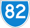 |
122 | no exit |
| MORISSET INTERCHANGE Morisset Morisset, New South Wales Morisset is a commercial centre and suburb of the City of Lake Macquarie in New South Wales, Australia, and is located west of Lake Macquarie just off the Sydney-Newcastle Freeway.-History:... , Cooranbong Cooranbong, New South Wales Cooranbong is a town and rural suburb of the City of Lake Macquarie in New South Wales, Australia, and is located west of the town of Morisset off the Sydney-Newcastle Freeway.... Mandalong Road |
109 | MORISSET INTERCHANGE Morisset Morisset, New South Wales Morisset is a commercial centre and suburb of the City of Lake Macquarie in New South Wales, Australia, and is located west of Lake Macquarie just off the Sydney-Newcastle Freeway.-History:... , Cooranbong Cooranbong, New South Wales Cooranbong is a town and rural suburb of the City of Lake Macquarie in New South Wales, Australia, and is located west of the town of Morisset off the Sydney-Newcastle Freeway.... , Doyalson Doyalson, New South Wales Doyalson is a suburb of the Central Coast region of New South Wales, Australia. It is part of the Wyong Shire local government area.... Mandalong Road |
| WALLARAH CREEK INTERCHANGE Budgewoi Budgewoi, New South Wales Budgewoi is a suburb located on the Central Coast of New South Wales, Australia, as part of the Wyong Shire local government area. Budgewoi itself is located more than 100 km north of the Sydney central business district.... , Swansea Swansea, New South Wales Swansea is a locality and commercial centre at the entrance to Lake Macquarie from the Pacific Ocean in New South Wales, Australia. It is part of the City of Lake Macquarie local government area.... , Charlestown Charlestown, New South Wales Charlestown is a suburb of Newcastle, New South Wales, Australia, and the largest town within the City of Lake Macquarie. It is located approximately west-southwest of the central business district of Newcastle.... Motorway Link to Pacific Highway Pacific Highway (Australia) The Pacific Highway is a major transport route along part of the east coast of Australia and is part of Australia's national route 1.It is 960 km long and links Sydney, the capital of New South Wales, to Brisbane, the capital of Queensland, along the coast, via Gosford, Newcastle, Taree, Port...  |
98 | no exit |
| WARNERVALE INTERCHANGE Wyee Wyee, New South Wales Wyee is a small town in the Lake Macquarie region of New South Wales, Australia, in the City of Lake Macquarie. It is near the Sydney-Newcastle Freeway and has a station on the CityRail Newcastle and Central Coast railway line. It had a population of 1,487 in 2001... , Toukley Toukley, New South Wales Toukley is a town in the Central Coast region of the Australian state of New South Wales. It lies approximately 107 km north of Sydney via the F3 freeway. It is located between Tuggerah Lake, Budgewoi Lake, and the Pacific Ocean. The town is within the area of the Wyong Shire... , Warnervale Warnervale, New South Wales Warnervale is a rapidly growing town in the Australian state of New South Wales. It lies approximately 95 km north of the Sydney CBD, located west of Tuggerah Lake, a large shallow coastal lake, and just north of Wyong.-History:... Sparks Road |
95 | WARNERVALE INTERCHANGE Wyee Wyee, New South Wales Wyee is a small town in the Lake Macquarie region of New South Wales, Australia, in the City of Lake Macquarie. It is near the Sydney-Newcastle Freeway and has a station on the CityRail Newcastle and Central Coast railway line. It had a population of 1,487 in 2001... , Toukley Toukley, New South Wales Toukley is a town in the Central Coast region of the Australian state of New South Wales. It lies approximately 107 km north of Sydney via the F3 freeway. It is located between Tuggerah Lake, Budgewoi Lake, and the Pacific Ocean. The town is within the area of the Wyong Shire... , Warnervale Warnervale, New South Wales Warnervale is a rapidly growing town in the Australian state of New South Wales. It lies approximately 95 km north of the Sydney CBD, located west of Tuggerah Lake, a large shallow coastal lake, and just north of Wyong.-History:... Sparks Road |
| Caltex Caltex Caltex is a petroleum brand name of Chevron Corporation used in more than 60 countries in the Asia-Pacific region, the Middle East, and southern Africa.-History:... Service Centre |
91 | Caltex Caltex Caltex is a petroleum brand name of Chevron Corporation used in more than 60 countries in the Asia-Pacific region, the Middle East, and southern Africa.-History:... Service Centre |
| TUGGERAH INTERCHANGE Tuggerah Tuggerah, New South Wales Tuggerah is a suburb of the Central Coast region of New South Wales, Australia, situated on the Main North Line and Sydney-Newcastle Freeway about 90 km north of Sydney. It is part of the Wyong Shire local government area.... , Wyong Wyong, New South Wales Wyong was proclaimed a town in 1888 and is currently a major northern suburb of the Central Coast region of New South Wales, located approximately 89 km NNE of Sydney. It is the administrative centre for the Wyong Shire local government area.- History :... , The Entrance The Entrance, New South Wales The Entrance is a district centre and town of the Central Coast region of New South Wales, Australia. It is part of the Wyong Shire local government area. At the 2006 census, The Entrance had a population of 2,632 people.... Wyong Road |
86 | TUGGERAH INTERCHANGE Tuggerah Tuggerah, New South Wales Tuggerah is a suburb of the Central Coast region of New South Wales, Australia, situated on the Main North Line and Sydney-Newcastle Freeway about 90 km north of Sydney. It is part of the Wyong Shire local government area.... , Wyong Wyong, New South Wales Wyong was proclaimed a town in 1888 and is currently a major northern suburb of the Central Coast region of New South Wales, located approximately 89 km NNE of Sydney. It is the administrative centre for the Wyong Shire local government area.- History :... , The Entrance The Entrance, New South Wales The Entrance is a district centre and town of the Central Coast region of New South Wales, Australia. It is part of the Wyong Shire local government area. At the 2006 census, The Entrance had a population of 2,632 people.... Wyong Road |
| OURIMBAH INTERCHANGE Ourimbah Ourimbah, New South Wales Ourimbah is a small township and a suburb of the Central Coast region of New South Wales, Australia, located about north of the Sydney CBD. The township today consists of small scattered local shops and businesses along the Pacific Highway, as well as the Central Coast campus of the University of... , Palmdale Palmdale, New South Wales Palmdale is a suburb of the Central Coast region of New South Wales, Australia. It is part of the Wyong Shire local government area.It is bounded on most sides by the Ourimbah State Forest, and is home to the Palmdale Memorial Park and Crematorium. It is a sister suburb to Palmdale Spain and home... , University of Newcastle Central Coast Campus University of Newcastle, Australia The University of Newcastle is an Australian public university that was established in 1965. The University's main and largest campus is located in Callaghan, a suburb of Newcastle in New South Wales... Pacific Highway Pacific Highway (Australia) The Pacific Highway is a major transport route along part of the east coast of Australia and is part of Australia's national route 1.It is 960 km long and links Sydney, the capital of New South Wales, to Brisbane, the capital of Queensland, along the coast, via Gosford, Newcastle, Taree, Port...  |
80 | OURIMBAH INTERCHANGE Ourimbah Ourimbah, New South Wales Ourimbah is a small township and a suburb of the Central Coast region of New South Wales, Australia, located about north of the Sydney CBD. The township today consists of small scattered local shops and businesses along the Pacific Highway, as well as the Central Coast campus of the University of... , Palmdale Palmdale, New South Wales Palmdale is a suburb of the Central Coast region of New South Wales, Australia. It is part of the Wyong Shire local government area.It is bounded on most sides by the Ourimbah State Forest, and is home to the Palmdale Memorial Park and Crematorium. It is a sister suburb to Palmdale Spain and home... , University of Newcastle Central Coast Campus University of Newcastle, Australia The University of Newcastle is an Australian public university that was established in 1965. The University's main and largest campus is located in Callaghan, a suburb of Newcastle in New South Wales... Pacific Highway Pacific Highway (Australia) The Pacific Highway is a major transport route along part of the east coast of Australia and is part of Australia's national route 1.It is 960 km long and links Sydney, the capital of New South Wales, to Brisbane, the capital of Queensland, along the coast, via Gosford, Newcastle, Taree, Port... |
| SOMERSBY INTERCHANGE Somersby Somersby, New South Wales Somersby is a semi-rural locality of the Central Coast region of New South Wales, Australia, located to the northwest of Gosford along the Pacific Highway... , Peats Ridge Peats Ridge, New South Wales Peats Ridge is a suburb located in the Central Coast region of New South Wales, Australia, as part of the Gosford City Council local government area.... , Wisemans Ferry Wisemans Ferry, New South Wales Wisemans Ferry is a town north of Sydney, in the state of New South Wales, Australia. Wisemans Ferry is located 75 kilometres north-west of the Sydney central business district in the local government areas of Hornsby Shire, The Hills Shire, City of Hawkesbury and City of Gosford.The town is a... Peats Ridge Road |
74 | SOMERSBY INTERCHANGE Somersby Somersby, New South Wales Somersby is a semi-rural locality of the Central Coast region of New South Wales, Australia, located to the northwest of Gosford along the Pacific Highway... , Peats Ridge Peats Ridge, New South Wales Peats Ridge is a suburb located in the Central Coast region of New South Wales, Australia, as part of the Gosford City Council local government area.... , Wisemans Ferry Wisemans Ferry, New South Wales Wisemans Ferry is a town north of Sydney, in the state of New South Wales, Australia. Wisemans Ferry is located 75 kilometres north-west of the Sydney central business district in the local government areas of Hornsby Shire, The Hills Shire, City of Hawkesbury and City of Gosford.The town is a... Peats Ridge Road |
| KARIONG INTERCHANGE Kariong Kariong, New South Wales Kariong is a locality of the Central Coast region of New South Wales, Australia, located to the west of Gosford along the Central Coast Highway. It is part of the City of Gosford local government area.Kariong in the local Original language means meeting place... , Gosford Gosford, New South Wales Gosford is a city located on the Central Coast of New South Wales, Australia, approximately 76 km north of the Sydney central business district... , Woy Woy Woy Woy, New South Wales Woy Woy is a coastal town and a southern suburb of the Central Coast region of New South Wales, Australia, located on the southern reaches of Brisbane Water north of Sydney... , Terrigal Terrigal, New South Wales Terrigal is a major coastal suburb of the Central Coast region of New South Wales, Australia, located east of Gosford on the Pacific Ocean. It is part of the City of Gosford local government area.... Central Coast Highway Central Coast Highway The Central Coast Highway is a major road corridor through the Central Coast region of New South Wales. The route was officially named by the New South Wales state government on 9 August 2006 and aims to provide an easily identifiable route through the Coast for visitors to the region... |
67 | KARIONG INTERCHANGE Kariong Kariong, New South Wales Kariong is a locality of the Central Coast region of New South Wales, Australia, located to the west of Gosford along the Central Coast Highway. It is part of the City of Gosford local government area.Kariong in the local Original language means meeting place... , Gosford Gosford, New South Wales Gosford is a city located on the Central Coast of New South Wales, Australia, approximately 76 km north of the Sydney central business district... , Woy Woy Woy Woy, New South Wales Woy Woy is a coastal town and a southern suburb of the Central Coast region of New South Wales, Australia, located on the southern reaches of Brisbane Water north of Sydney... , Terrigal Terrigal, New South Wales Terrigal is a major coastal suburb of the Central Coast region of New South Wales, Australia, located east of Gosford on the Pacific Ocean. It is part of the City of Gosford local government area.... Central Coast Highway Central Coast Highway The Central Coast Highway is a major road corridor through the Central Coast region of New South Wales. The route was officially named by the New South Wales state government on 9 August 2006 and aims to provide an easily identifiable route through the Coast for visitors to the region... |
| CALGA INTERCHANGE Calga Calga, New South Wales Calga is a suburb of the Central Coast region of New South Wales, Australia, located north of Sydney. It is part of the City of Gosford local government area.... , Peats Ridge Peats Ridge, New South Wales Peats Ridge is a suburb located in the Central Coast region of New South Wales, Australia, as part of the Gosford City Council local government area.... Peats Ridge Road, Pacific Highway Pacific Highway (Australia) The Pacific Highway is a major transport route along part of the east coast of Australia and is part of Australia's national route 1.It is 960 km long and links Sydney, the capital of New South Wales, to Brisbane, the capital of Queensland, along the coast, via Gosford, Newcastle, Taree, Port... |
60 | CALGA INTERCHANGE Calga Calga, New South Wales Calga is a suburb of the Central Coast region of New South Wales, Australia, located north of Sydney. It is part of the City of Gosford local government area.... , Peats Ridge Peats Ridge, New South Wales Peats Ridge is a suburb located in the Central Coast region of New South Wales, Australia, as part of the Gosford City Council local government area.... Peats Ridge Road, Pacific Highway Pacific Highway (Australia) The Pacific Highway is a major transport route along part of the east coast of Australia and is part of Australia's national route 1.It is 960 km long and links Sydney, the capital of New South Wales, to Brisbane, the capital of Queensland, along the coast, via Gosford, Newcastle, Taree, Port... |
| MOUNT WHITE INTERCHANGE Mount White Mount White, New South Wales Mount White is a suburb of the Central Coast region of New South Wales, Australia, located north of Sydney. It is part of the City of Gosford local government area.It is home to a minor interchange on the Sydney-Newcastle Freeway.-External links:... Pacific Highway Pacific Highway (Australia) The Pacific Highway is a major transport route along part of the east coast of Australia and is part of Australia's national route 1.It is 960 km long and links Sydney, the capital of New South Wales, to Brisbane, the capital of Queensland, along the coast, via Gosford, Newcastle, Taree, Port... |
55 | MOUNT WHITE INTERCHANGE Mount White Mount White, New South Wales Mount White is a suburb of the Central Coast region of New South Wales, Australia, located north of Sydney. It is part of the City of Gosford local government area.It is home to a minor interchange on the Sydney-Newcastle Freeway.-External links:... Pacific Highway Pacific Highway (Australia) The Pacific Highway is a major transport route along part of the east coast of Australia and is part of Australia's national route 1.It is 960 km long and links Sydney, the capital of New South Wales, to Brisbane, the capital of Queensland, along the coast, via Gosford, Newcastle, Taree, Port... |
| HAWKESBURY RIVER INTERCHANGE Mooney Mooney Mooney Mooney, New South Wales Mooney Mooney is a suburb of the Central Coast region of New South Wales, Australia, located on the north bank of the Hawkesbury River north of Sydney. It is part of the City of Gosford local government area.-Profile:... , Brooklyn Brooklyn, New South Wales Brooklyn is a small suburb of northern Sydney, in the state of New South Wales, Australia. Brooklyn is located 51 kilometres north of the Sydney central business district, in the local government area of Hornsby Shire and is part of the North Shore region... Pacific Highway Pacific Highway (Australia) The Pacific Highway is a major transport route along part of the east coast of Australia and is part of Australia's national route 1.It is 960 km long and links Sydney, the capital of New South Wales, to Brisbane, the capital of Queensland, along the coast, via Gosford, Newcastle, Taree, Port... |
47 | HAWKESBURY RIVER INTERCHANGE Mooney Mooney Mooney Mooney, New South Wales Mooney Mooney is a suburb of the Central Coast region of New South Wales, Australia, located on the north bank of the Hawkesbury River north of Sydney. It is part of the City of Gosford local government area.-Profile:... , Brooklyn Brooklyn, New South Wales Brooklyn is a small suburb of northern Sydney, in the state of New South Wales, Australia. Brooklyn is located 51 kilometres north of the Sydney central business district, in the local government area of Hornsby Shire and is part of the North Shore region... Pacific Highway Pacific Highway (Australia) The Pacific Highway is a major transport route along part of the east coast of Australia and is part of Australia's national route 1.It is 960 km long and links Sydney, the capital of New South Wales, to Brisbane, the capital of Queensland, along the coast, via Gosford, Newcastle, Taree, Port... |
| Hawkesbury River Hawkesbury River The Hawkesbury River, also known as Deerubbun, is one of the major rivers of the coastal region of New South Wales, Australia. The Hawkesbury River and its tributaries virtually encircle the metropolitan region of Sydney.-Geography:-Course:... |
||
| no exit | 37 | BEROWRA INTERCHANGE Berowra Berowra, New South Wales Berowra is a suburb of northern Sydney, in the state of New South Wales, Australia. Berowra is located 38 kilometres north of the Sydney central business district, in the local government area of Hornsby Shire... Pacific Highway Pacific Highway (Australia) The Pacific Highway is a major transport route along part of the east coast of Australia and is part of Australia's national route 1.It is 960 km long and links Sydney, the capital of New South Wales, to Brisbane, the capital of Queensland, along the coast, via Gosford, Newcastle, Taree, Port... |
| WINDYBANKS INTERCHANGE Berowra Berowra, New South Wales Berowra is a suburb of northern Sydney, in the state of New South Wales, Australia. Berowra is located 38 kilometres north of the Sydney central business district, in the local government area of Hornsby Shire... Pacific Highway Pacific Highway (Australia) The Pacific Highway is a major transport route along part of the east coast of Australia and is part of Australia's national route 1.It is 960 km long and links Sydney, the capital of New South Wales, to Brisbane, the capital of Queensland, along the coast, via Gosford, Newcastle, Taree, Port... |
33 | no exit |
| MOUNT COLAH INTERCHANGE Mount Colah Mount Colah, New South Wales Mount Colah is a suburb of northern Sydney, in the state of New South Wales, Australia. Mount Colah is located 29 kilometres north-west of the Sydney central business district, in the local government area of Hornsby Shire.... , Bobbin Head Bobbin Head, New South Wales Bobbin Head is a locality in Sydney, in the state of New South Wales, Australia.Bobbin Head is a scenic area that is a "near-urban" part of Ku-ring-gai Chase National Park... Ku-ring-gai Chase Road |
27 | no exit |
| Start Sydney - Newcastle Freeway End  Start Start |
23 | WAHROONGA INTERCHANGE Hornsby Hornsby, New South Wales * Highest Maximum Temperature: 42 °C* Lowest Maximum Temperature: 4.9 °C* Warmest Month: January* Coolest Month: July* Highest Precipitation: February* Lowest Precipitation: July-Notable residents:... , Sydney Pacific Highway Pacific Highway (Australia) The Pacific Highway is a major transport route along part of the east coast of Australia and is part of Australia's national route 1.It is 960 km long and links Sydney, the capital of New South Wales, to Brisbane, the capital of Queensland, along the coast, via Gosford, Newcastle, Taree, Port...  |
| End Sydney - Newcastle Freeway continues on as Cumberland Highway to Parramatta Parramatta, New South Wales Parramatta is a suburb of Sydney, in the state of New South Wales, Australia. It is located in Greater Western Sydney west of the Sydney central business district on the banks of the Parramatta River. Parramatta is the administrative seat of the Local Government Area of the City of Parramatta... and Canberra Canberra Canberra is the capital city of Australia. With a population of over 345,000, it is Australia's largest inland city and the eighth-largest city overall. The city is located at the northern end of the Australian Capital Territory , south-west of Sydney, and north-east of Melbourne... |
||
History
Planning for the freeway began in 1952, with the aim of providing a high-speed replacement for a section of the Pacific Highway that had been built in 1928 and was struggling to cope with the increased traffic. It was planned that the freeway would connect to the freeway systems being proposed for both Sydney and Newcastle, providing a city-to-city freeway link. However, for several reasons the goal and route of the freeway changed significantly so that it bypasses Newcastle rather than going into it.The route between Mount White and Kariong was originally planned to go further east than the current route with an easier crossing of Mooney Mooney Creek. By the time that construction on this section was to begin, resistance from the National Parks and Wildlife Service to the proposed route forced the government to take a route through Calga which at the time would have formed part of a route to Singleton
Singleton, New South Wales
-Industry & Commerce:Major industries near Singleton include coal mining, energy generation, light industry, vineyards, horse breeding and cattle production. Dairying was once a mainstay in the area, but has declined....
.
The route through Wyong Shire also changed; instead of passing along the western edge of the Tuggerah Lakes, development in that area forced the freeway to move further west with a link road being constructed to meet the Pacific Highway near Doyalson.
Perhaps the most significant effect on the freeway's route and its connections was the anti-freeway movement of 1972. Strong public resistance to freeways being constructed within cities along with less than favourable results from government inquiries resulted in unconstructed freeway projects being cancelled and those under construction being revised or cut short. For the Sydney-Newcastle Freeway, this meant that the connecting Lane Cove Valley and North Western Expressway
North Western Expressway
The North Western Expressway was a planned freeway route in Sydney, New South Wales, Australia, intended to link the Sydney CBD to its north-western suburbs, and ultimately the F3 Freeway to Newcastle....
s in Sydney would not be built - forcing traffic to travel along the Pacific Highway between Wahroonga and the city. In addition, the freeway would now go to the west of Lake Macquarie rather than the east and bypass Newcastle. Sections of State Highway 123
Newcastle Inner City Bypass
The Newcastle Inner City Bypass is a ring road in Newcastle New South Wales, Australia. Alternate titles include State Highway 23, Main Road 123 and H23....
, one of the two expressway routes that the freeway would have connected to in Newcastle, have been constructed (with calls to complete the whole route between Bennetts Green and Sandgate), while the freeway route between Belmont and Bennetts Green and the connecting expressway route to Merewether are still reserved with the possibility that they could be constructed in the future.
The major stages in the construction of the freeway are:
- April 1963 - Construction begins on a 7 km section of dual carriageways from the Hawkesbury River to Mount WhiteMount White, New South WalesMount White is a suburb of the Central Coast region of New South Wales, Australia, located north of Sydney. It is part of the City of Gosford local government area.It is home to a minor interchange on the Sydney-Newcastle Freeway.-External links:...
. This section was opened as a toll road in June 1965. The toll was removed in 1990 when the Federal Government decreed that all National Highways should be toll free. - December 1967 - Opening of Berowra to Hawkesbury River section as a toll road.
- April 1979 - Opening of the current 6 lane Hawkesbury River bridge. At this time the toll from each of the north and south sections open (20 cents for each section) was combined with the new bridge (which linked both sections) for a toll of 50 cents. This was collected at the existing Berowra toll booths.
- December 1983 - Opening of the SomersbySomersby, New South WalesSomersby is a semi-rural locality of the Central Coast region of New South Wales, Australia, located to the northwest of Gosford along the Pacific Highway...
to Wallarah CreekWallarah, New South WalesWallarah is a sparsely populated suburb of the Central Coast region of New South Wales, Australia. It is part of the Wyong Shire local government area.It is home to the Wallarah Creek interchange on the Sydney-Newcastle Freeway....
section. - December 1986 - Opening of a 15 km (9 mi) section between CalgaCalga, New South WalesCalga is a suburb of the Central Coast region of New South Wales, Australia, located north of Sydney. It is part of the City of Gosford local government area....
and Somersby - 22 March 1989 - Berowra to Wahroonga section opened
- December 1990 - Freeway completed from Wallarah Creek to Palmer's Road
- December 1993 - Palmer's Road to Minmi section opened
- December 1997 - The second "Missing link" between Ourimbah and Kangy Angy opened.
- December 1998 - Final stage of freeway opened between Minmi and John Renshaw Drive, Beresfield.
- December 2004 - Completion of widening between Calga and Jolls Bridge.
- November 2009 - Completion of six lanes from Wahroonga to Kariong achieved.
"F3" Designation
In addition to the National Highway 1 designation, the freeway at one stage carried the Freeway Route 3 (F3) designation. This route numbering system, introduced in 1973, was to provide distinctive route numbering and signage for freeways in Sydney and the surrounding areas. Although the route was never signed with the F3 route marker (the numbering system was removed in the late 1980s), the route is now widely known as the F3, with this title being used not only colloquially but on all state and federal government documents and web sites. The median crossover signs (located every 1 km) feature an F3 identification sign; in addition, the sign at the WahroongaWahroonga, New South Wales
Wahroonga is a suburb on the Upper North Shore of Sydney, in the state of New South Wales, Australia. Wahroonga is located 22 kilometres north-west of the Sydney central business district, in the local government area of Ku-ring-gai Council and Hornsby Shire....
entrance to the Sydney-Newcastle Freeway also reads F3 FREEWAY.
Traffic disruption
The freeway is one of the few direct routes between Sydney and the Central Coast, and is the major road route for road transport to the Hunter region, northern NSW and Queensland. The freeway thus carries a heavy mix of commuter traffic, road freight transport, and (periodically) holiday and recreational travellers. It often suffers from traffic disruptions, generally associated with traffic volume and congestion related to on-road breakdowns and vehicle accidents, or natural disasters (in particular, bushfire).Traffic on the freeway is frequently affected by vehicle crashes, often involving trucks. These events have encouraged the NSW motoring organisation NRMA
NRMA
NRMA refers to either of two historically related Australian companies:*The National Roads and Motorists' Association, known as NRMA Motoring and Services, is a member-owned mutual organisation offering , motoring advice and other services in New South Wales and the Australian Capital...
to call for more freight to be moved by rail to reduce the number of trucks using the freeway.
Bushfires have caused closure of the freeway and the nearby railway line
Main North railway line, New South Wales
The Main North Line is a major railway in New South Wales, Australia. It runs through the Central Coast, Hunter and the New England regions. The line was the original main line between Sydney and Brisbane, however this required a change of gauge at Wallangarra...
and Pacific Highway between the Sydney Basin
Sydney Basin
The Sydney Basin is a sedimentary basin on the east coast of New South Wales, Australia consisting of Permian and Triassic sedimentary rocks...
and the Hawkesbury River
Hawkesbury River
The Hawkesbury River, also known as Deerubbun, is one of the major rivers of the coastal region of New South Wales, Australia. The Hawkesbury River and its tributaries virtually encircle the metropolitan region of Sydney.-Geography:-Course:...
on a number of occasions in recent decades. One such event of this type was recorded on 21 and 22 January 2007, when a fire broke out in the adjoining Kuring-gai Chase National Park. The fire forced the closure of the two roads and the railway line between Sydney and the Central Coast, resulting in extended disruption to traffic flow.
Because of the frequency of these disruptions to traffic flow, arguments for a second major freeway north from the Sydney metropolitan area continue to be pushed forward.
This particularly includes the Federal Government's proposal for a new motorway connecting the Sydney-Newcastle freeway near Mount White to the northwestern corner of the M7
Westlink M7
Westlink M7 - formerly Western Sydney Orbital - is one of Sydney, Australia's urban motorways and a part of Metroad 7 and the Sydney Orbital Network. It connects three Metroads: M5 at Prestons, M4 at Eastern Creek and M2 at Baulkham Hills...
.
Following criticism of significant delays due to accidents and blockages, the NSW Roads and Traffic Authority (RTA) is in the process of constructing a $28 million emergency plan for the freeway which involves development of a 40 km/h contraflow traffic scheme to allow vehicles to travel around an accident.
Traffic volume
The Annual average daily trafficAnnual average daily traffic
Average Annual daily traffic, abbreviated AADT, is a measure used primarily in transportation planning and transportation engineering. It is the total volume of vehicle traffic of a highway or road for a year divided by 365 days. AADT is a useful and simple measurement of how busy the road is...
(AADT) data from the Roads and Traffic Authority showed a decline in traffic volume on the freeway near its southern end at Wahroonga
Wahroonga, New South Wales
Wahroonga is a suburb on the Upper North Shore of Sydney, in the state of New South Wales, Australia. Wahroonga is located 22 kilometres north-west of the Sydney central business district, in the local government area of Ku-ring-gai Council and Hornsby Shire....
, from 78,600 in 2002 to approximately 76,600 in 2005 and then to 75,800 in 2006.
The 2004 AADT figures for other locations on the freeway include 73,400 at Mooney Mooney
Mooney Mooney, New South Wales
Mooney Mooney is a suburb of the Central Coast region of New South Wales, Australia, located on the north bank of the Hawkesbury River north of Sydney. It is part of the City of Gosford local government area.-Profile:...
, just north of the Hawkesbury River
Hawkesbury River
The Hawkesbury River, also known as Deerubbun, is one of the major rivers of the coastal region of New South Wales, Australia. The Hawkesbury River and its tributaries virtually encircle the metropolitan region of Sydney.-Geography:-Course:...
bridge, 60,100 near Wyong
Wyong, New South Wales
Wyong was proclaimed a town in 1888 and is currently a major northern suburb of the Central Coast region of New South Wales, located approximately 89 km NNE of Sydney. It is the administrative centre for the Wyong Shire local government area.- History :...
, 38,500 near Wyee
Wyee, New South Wales
Wyee is a small town in the Lake Macquarie region of New South Wales, Australia, in the City of Lake Macquarie. It is near the Sydney-Newcastle Freeway and has a station on the CityRail Newcastle and Central Coast railway line. It had a population of 1,487 in 2001...
, 27,000 near Freemans Waterhole
Freemans Waterhole, New South Wales
Freemans Waterhole is a small quiet town west of Lake Macquarie in New South Wales, Australia, located along State Route 82 between Cooranbong and Mulbring. It is part of the West Ward of the City of Lake Macquarie local government area...
and 33,000 near its northern terminus at Beresfield.
Upgrades and proposed connections
- A freeway standard Sydney BypassSydney BypassThere have been various forms of Sydney Bypass for decades. Some have taken the form of local suburban roads which have gradually become more and more congested until they were no longer effective as a bypass. Others have been proposals that never eventuated...
has been intended as part of the National HighwayNational Highway (Australia)thumb|right|150px|The National Highway Shield in NSW, QLD, WA, NT & TAS.The National Highway is a system of roads connecting all the States and Territories of Australia, and is the major network of highways connecting Australia's largest and most important cities.The National Highway was...
system for decades. At the southern end, an underground route will link the freeway at Pearce's Corner, Wahroonga with the M2 MotorwayMetroad 2Metroad 2 is a Metroad in Sydney, New South Wales, Australia. It links Windsor to Artarmon.-Route Information:* Extremities: Lane Cove Tunnel at Artarmon to Windsor* Approximate length: 53 km...
near the Pennant Hills Road interchange. This will provide the motorway standard missing link between the F3 and the Sydney Orbital Network that was originally to be provided by the cancelled Lane Cove Valley Freeway section of the North West Expressway. Many previous corridor's have been proposed and all have been abandoned. Due to community concern, The Honorable Mahla Pearlman carried out an independent review, which was completed in August 2007. The review concluded that the proposed tunnels under Pennant Hills Road should proceed, but urged that planning for the longer term connection between the F3 and the M7 should also commence immediately.
- Towards the northern end, the Hunter Expressway will branch off the freeway at the Newcastle Link Road interchange and connect to the New England HighwayNew England HighwayThe New England Highway is a highway in Australia running from Hexham near Newcastle at its southern end to Yarraman near Toowoomba at its northern end. At its southern end it connects to the Pacific Highway and at its northern end it connects to the D'Aguilar Highway. It traverses the Hunter...
at the Belford Bends Deviation west of BranxtonBranxton, New South WalesBranxton is a town in the Hunter Valley region of New South Wales, Australia. Branxton is north of Sydney via the Sydney-Newcastle Freeway and New England Highway.Branxton is located mostly in Cessnock City Council, but part of it is in Singleton Shire...
. This will allow traffic to bypass MaitlandMaitland, New South WalesMaitland is a city in the Lower Hunter Valley of New South Wales, Australia and the seat of Maitland City Council, situated on the Hunter River approximately by road north of Sydney and north-west of Newcastle...
and its surrounding suburbs. Funding for that road was announced in May 2009, with construction commencing immediately and taking 4 years.
- As part of the upgrade of the Pacific Highway between Hexham and the New South Wales/QueenslandQueenslandQueensland is a state of Australia, occupying the north-eastern section of the mainland continent. It is bordered by the Northern Territory, South Australia and New South Wales to the west, south-west and south respectively. To the east, Queensland is bordered by the Coral Sea and Pacific Ocean...
border, a freeway link will be constructed between the F3 near Black Hill and the Raymond TerraceRaymond Terrace, New South WalesRaymond Terrace is a town in the Hunter Region of New South Wales, Australia, about by road north of Newcastle on the Pacific Highway. Established in 1837 it is situated at the confluence of the Hunter and Williams rivers and has about 12,600 residents. It is the administrative centre of the Port...
Bypass. This section is currently a major bottleneck during holiday and long weekend periods, with delays lasting hours not uncommon. The layout of the two bridges at Hexham was designed primarily for local commuter traffic to and from Newcastle, rather than for access to the current end of the freeway. Northbound traffic from the freeway uses a single lane ramp onto the northbound Hexham Bridge, while southbound traffic must use the right lane of the southbound bridge to access the right turn lanes at traffic lights just past the end of the bridge. When completed, freeway conditions will extend to the northern end of the Raymond Terrace bypass.
- The Southern section from Wahroonga to just north of Ku-ring-gai Chase Road was originally built six lanes wide. The section between Cowan and Ku-ring-gai Chase Road has been completed as of November 2009 and is now 6 lanes wide, having been upgraded from 4 lanes. This work was completed in Three Stages; Stage 1 - Cowan to Berowra (3.4 km (2 mi), Started December 2006 - Completed September 2008) , Stage 2 - Berowra to Mount Kuring-Gai (4.9 km (3 mi), Started March 2008 - Completed September 2009) and Stage 3 - Mount Kuring-Gai to Mount Colah (4.2 km (3 mi), Started September 2008 - Completed November 2009). The widening having been completed, the F3 provides a minimum of 6 lanes for 43 km (27 mi) from Wahroonga to Kariong. The upgrade also included a fourth stage which involved the resurfacing of the F3 from Mount Colah to Wahroonga (5 km (3 mi), started September 2008 - completed November 2009), as well as the addition of a truck parking area underneath the Pacific Highway interchange at Wahroonga.
See also
- Freeways in AustraliaFreeways in AustraliaThis is a list of freeways and motorways in Australia, sorted by states and territories and their corresponding routes. This list includes toll roads such as the CityLink freeway system in Melbourne. This list has over 70 entries...
- Freeways in New South Wales
External links
- Sydney-Newcastle Freeway at Ozroads Detailed site containing many existing and historical photos.
- NSW RTA F3 Real-Time Traffic Cameras