
Sudd
Encyclopedia

Swamp
A swamp is a wetland with some flooding of large areas of land by shallow bodies of water. A swamp generally has a large number of hammocks, or dry-land protrusions, covered by aquatic vegetation, or vegetation that tolerates periodical inundation. The two main types of swamp are "true" or swamp...
in South Sudan
South Sudan
South Sudan , officially the Republic of South Sudan, is a landlocked country located in the Sahel region of northeastern Africa. It is also part of the North Africa UN sub-region. Its current capital is Juba, which is also its largest city; the capital city is planned to be moved to the more...
, formed by the White Nile
White Nile
The White Nile is a river of Africa, one of the two main tributaries of the Nile from Egypt, the other being the Blue Nile. In the strict meaning, "White Nile" refers to the river formed at Lake No at the confluence of the Bahr al Jabal and Bahr el Ghazal rivers...
. The word “sudd” is derived from the Arabic word “sadd”, meaning “block.” The term has come to refer to any large solid floating vegetation island or mat. The area which the swamp covers is one of the world's largest wetland
Wetland
A wetland is an area of land whose soil is saturated with water either permanently or seasonally. Wetlands are categorised by their characteristic vegetation, which is adapted to these unique soil conditions....
s and the largest freshwater wetland in the Nile basin.
Location
The Sudd stretches from MongallaMongalla, South Sudan
Mongalla or Mangalla is a community in Central Equatoria state in South Sudan, on the east side of the Bahr al Jebel or White Nile river. It lies about by road northeast of Juba. The towns of Terekeka and Bor lie downstream, north of Mongalla....
to just outside the Sobat confluence with the White Nile just upstream of Malakal as well as westwards along the Bahr el Ghazal
Bahr el Ghazal
The Bahr el Ghazal is a region of western South Sudan. Its name comes from the river Bahr el Ghazal.- Geography :The region consists of the states of Northern Bahr el Ghazal, Western Bahr el Ghazal, Lakes, and Warrap. It borders Central African Republic to the west...
. The shallow and flat inland delta lays between 5.5 and 9.5 degrees latitude North and covers an area of 500 km south to north and 200 km east to west between Mongalla in the south and Malakal
Malakal
-Location:The city of Malakal is located in Malakal County, Upper Nile State, in the northeast of South Sudan, close to the International borders with the Republic of Sudan and with Ethiopia...
in the north.
Its size is highly variable, averaging over 30,000 square kilometers. During the wet season
Wet season
The the wet season, or rainy season, is the time of year, covering one or more months, when most of the average annual rainfall in a region occurs. The term green season is also sometimes used as a euphemism by tourist authorities. Areas with wet seasons are dispersed across portions of the...
it may extend to over 130,000 km², depending on the inflowing waters, with the discharge from Lake Victoria
Lake Victoria
Lake Victoria is one of the African Great Lakes. The lake was named for Queen Victoria of the United Kingdom, by John Hanning Speke, the first European to discover this lake....
being the main control factor of flood levels and area inundation. A main hydrological factor is that Sudd area, consisting of various meandering channels, lagoons, reed and papyrus
Papyrus
Papyrus is a thick paper-like material produced from the pith of the papyrus plant, Cyperus papyrus, a wetland sedge that was once abundant in the Nile Delta of Egypt....
fields, loses half of the inflowing water through evapotranspiration in the permanent and seasonal floodplains. A major feature of the area, even if not completed and not functional, is the Jonglei Canal
Jonglei Canal
The Jonglei Canal is a project that has been proposed, started but never completed to divert water through the vast Sudd wetlands of South Sudan so as to deliver more water downstream to Sudan and Egypt for use in agriculture.-Concept:...
, planned to bypass waters from the Sudd to avoid evaporation losses and increase the amount of water discharged at the outlet of the Sudd.
From 1961 to 1963 a great increase in the inundated area occurred when the level of Lake Victoria rose and the outflow increased. The total area is related to the amount of water reaching Bor from Albert Nile and from torrents or seasonal watercourses that can add substantial amounts to the flow in the upstream end of the Sudd. During the 1960s increase in Lake Victoria discharge, where flows at Mongalla have roughly doubled, the flows at Malakal at the northern end of the swamps had increased by 1.5 times the previous average flow. As a consequence of these high flows, the areas of permanent swamp and seasonal floodplains have, together, increased to 2.5 times their former size. The swamps have increased the most but even so the seasonal floodplain is 1.5 times its previous size.
From the southern inflow of the Bahr al Jabal
Bahr al Jabal
Bahr al Jabal may refer to:* Bahr al Jabal, a section of the White Nile between Nimule and Lake No* Bahr al Jabal, a state of Southern Sudan renamed Central Equatoria in 2005...
("Sea of the Mountain") at Mongalla, the defined riverbed successively widens into a floodplain, where the waters flow in meandering river stretches and various channels and lagoons throughout the dry season. It expands over the semi flooded grasslands during the flood season with rising water levels.
Slightly downstream of Bor
Bor, Sudan
-Location:The town of Bor is located in Bor South County, Jonglei State, in central South Sudan, approximately , by road, north of Juba, the capital and largest city in that country. The town is located on the east bank of the White Nile...
, the Bahr el Zeraf
Bahr el Zeraf
The Bahr el Zeraf is an arm of the White Nile in the Sudd region of South Sudan, Africa. It is completely contained within the South Sudanese state of Jonglei...
("Sea of the Giraffe
Giraffe
The giraffe is an African even-toed ungulate mammal, the tallest of all extant land-living animal species, and the largest ruminant...
s") river branches off the Bahr al Jabal to the east, diverting part of the flow, to join the Bahr al Jabal again just before reaching Malakal. During the course of its flow, the Bahr al Jabal passes Lake No
Lake No
Lake No is a lake in South Sudan. It is located just north of the vast swamp of the Sudd, at the confluence of the Bahr al Jabal and Bahr el Ghazal rivers. It marks the transition between the Bahr al Jabal and White Nile proper. Lake No is located approximately 1,156 km downstream of Uganda's...
, where the Bahr el Ghazal ("Sea of the Gazelle
Gazelle
A gazelle is any of many antelope species in the genus Gazella, or formerly considered to belong to it. Six species are included in two genera, Eudorcas and Nanger, which were formerly considered subgenera...
s") connects to the Bahr al Jabal, contributing an inflow with seasonal variation. At Malakal, the Sobat River joins into the system. The combined flows then stream to the north as the White Nile in a defined bed, joining with the Blue Nile waters at Khartoum to form the main Nile.
Sudd was designated as a Ramsar Wetland of International Importance on 5 June 2006.
Climate
Hydrologically the Sudd plays an important role in storing floodwaters and trapping sediments from the Bahr al JabalBahr al Jabal
Bahr al Jabal may refer to:* Bahr al Jabal, a section of the White Nile between Nimule and Lake No* Bahr al Jabal, a state of Southern Sudan renamed Central Equatoria in 2005...
. Roughly 55 percent of water entering the area is lost to evaporation. Water levels fluctuate up to 1.5 meters, depending on the intensity of seasonal flooding.
The region receives less rainfall (typically between 55 and 65 centimeters per year) than neighbouring areas at the same latitude. Orographic lift
Orographic lift
Orographic lift occurs when an air mass is forced from a low elevation to a higher elevation as it moves over rising terrain. As the air mass gains altitude it quickly cools down adiabatically, which can raise the relative humidity to 100% and create clouds and, under the right conditions,...
ing on the eastern and western sides of the Sudd contribute to that condition.
Geomorphology
The morphology of the area is defined by the channel and lagoon system of the permanent Sudd swamps, the adjacent flood plains and the surrounding flat terrain. The Bahr al Jabal runs to the north-northwest and therefore in an angle to the gradient of the flood plain which is sloping down to the north. While north of Juba the river flows in an incised trough. The banks of this trough decrease in height from south to north with the Bahr al JabalBahr al Jabal
Bahr al Jabal may refer to:* Bahr al Jabal, a section of the White Nile between Nimule and Lake No* Bahr al Jabal, a state of Southern Sudan renamed Central Equatoria in 2005...
approaching Bor and end into the Sudd flood plain just north of Bor
Bor
Bor may refer to:* Matej Bor, the pen name of the Slovene poet Vladimir Pavšič *Bor , a location in Afghanistan*Bor , a town in Plzeň Region , Czech Republic...
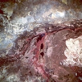
on the eastern bank and towards Shambe on the western bank. In the southern part, the river meanders from side to side in the restraining trough in one or more channels, but further north the swamp is not limited by higher ground and the system of river channels becomes increasingly complex. The characteristics of the river with the network of channels and lagoons are distinguishable from satellite imagery and digital elevation models.
The geology of the area is defined by heavy clay soils, highly impermeable with a top layer of black cotton of approximately 500 mm in average. Sandy soils are found only in depth of approximately 30m and below, referring to well drilling profiles (Petersen, 2008). This indicates a very limited groundwater influence on the area hydrology.
Population
DinkaDinka
The Dinka is an ethnic group inhabiting the Bahr el Ghazal region of the Nile basin, Jonglei and parts of southern Kordufan and Upper Nile regions. They are mainly agro-pastoral people, relying on cattle herding at riverside camps in the dry season and growing millet and other varieties of grains ...
, Nuer and Shilluk pastoralists use the Sudd and the surrounding areas extensively. Livestock and rain-fed agriculture are the dominant means of support for the largely rural population for which the seasonal flooded grasslands along the Sudd provides valuable grazing lands.
Vegetation and ecosystem
Vegetation cover of the area can generally be classified in five categories which occur depending on the elevation of the area above river flood level: the lakes and rivers themselves, the floating plant life of the swamp, river-flooded grasslands (Toic), rain-flooded grasslands, and wooded grasslands on the fringes. Areas of the grassland and woodland have been cultivated (by local populations).The density of the grasslands along the sudd is changing depending on the season, being tall grass in the rainy season and short and dry in the dry season, where also frequent burnings occur. The fluvial area is mostly overgrown with vegetation, with some main and side channels as well as lagoons of open water. The vegetation distribution is described in further detail in Sutcliffe (1974) and Petersen (2007). The main species are:
- Phragmites communis (shallow flooded, buried roots)
- Echinochloa pyramidalis (shallow flooded, buried roots)
- Oryza barthiiOryza barthiiOryza barthii is a grass in the rice genus Oryza. It is an annual, erect to semierect grass. It has leaves with a short ligule Oryza barthii is a grass in the rice genus Oryza. It is an annual, erect to semierect grass. It has leaves with a short ligule Oryza barthii is a grass in the rice genus...
(shallow flooded, buried roots) - Echinochloa stagninaEchinochloa stagninaEchinochloa stagnina is a species of Echinochloa widespread in tropical Africa and Asia, with an invasive status in many Pacific islands....
(deep flooded, superficial/floating roots) - Vossia cuspidate (deep flooded, superficial/floating roots)
- Cyperus papyrusCyperus papyrusCyperus papyrus is a monocot belonging to the sedge family Cyperaceae. It is a herbaceous perennial native to Africa, and forms tall stands of reed-like swamp vegetation in shallow water....
(deep flooded, superficial/floating roots) - Typha domingensisTypha domingensisTypha domingensis Pers., also known as Southern Cattail or Cumbungi, is a perennial herbaceous plant of genus Typha.It is found throughout temperate and tropical regions worldwide...
The first three species are anchored so their distribution is limited to depth of flooding, for the last species their root system needs to be in water or saturated soil permanently which gives a good indicator on flood patterns. P. communis, E. pyramidalis and O. barthii for example dominate only in areas where the depth of flooding does not exceed 130 cm over a period of ten years or 118 cm for a month in the year.
Floating vegetation of C. papyrus had caused blockages in the Sudd swamps in a number of occasions between 1879 and 1900, when the plants were torn out by increased floods. C. papyrus needs saturated conditions and can tolerate flooding that is not more than 150 cm deep.
When the matted vegetation breaks free of its moorings, it forms floating islands of vegetation up to 30 km in length. Such islands, in varying stages of decomposition, eventually break up.
The sluggish waters are host to a large population of mosquito
Mosquito
Mosquitoes are members of a family of nematocerid flies: the Culicidae . The word Mosquito is from the Spanish and Portuguese for little fly...
es and parasites that cause waterborne diseases
Waterborne diseases
Waterborne diseases are caused by pathogenic microorganisms which are directly transmitted when contaminated fresh water is consumed. Contaminated fresh water, used in the preparation of food, can be the source of foodborne disease through consumption of the same microorganisms...
.
According to Marcia Merry Baker, in her 1997 article "The potential of the Nile river basin and the economic development of Sudan"
, the Sudd is nearly impassable, either overland or by watercraft, although she also writes that "For many locations in Sudan, the Nile River is the key transport link. River transport between Kosti and Juba (1,436 km, 892 miles) had no overland alternative as of the mid-1980s".
The early explorers searching for the source of the Nile experienced considerable difficulties, sometimes taking months to get through. In The White Nile, Alan Moorehead
Alan Moorehead
Alan McCrae Moorehead OBE was a war correspondent and author of popular histories, most notably two books on the nineteenth-century exploration of the Nile, The White Nile and The Blue Nile . Australian-born, he lived in England, and Italy, from 1937.-Biography:Alan Moorehead was born in...
says of the Sudd, "there is no more formidable swamp in the world".
Fauna
The Sudd provides food and water to large populations of migrating birds, with more than 400 species of bird found here including ShoebillShoebill
The Shoebill also known as Whalehead or Shoe-billed Stork, is a very large stork-like bird. It derives its name from its massive shoe-shaped bill. The adult bird is tall, long, across the wingspan and weighs . Their beaks have an average length of length of . The adult is mainly grey while the...
s, Great White Pelicans, and Black Crowned Crane
Black Crowned Crane
The Black Crowned Crane is a bird in the crane family Gruidae. It was once called also Kaffir Crane.It occurs in dry savannah in Africa south of the Sahara, although in nests in somewhat wetter habitats. There are two subspecies: B. p. pavonina in the west and the more numerous B. p...
s. As the surrounding landscape is a large swathe of dry Sahel
Sahel
The Sahel is the ecoclimatic and biogeographic zone of transition between the Sahara desert in the North and the Sudanian Savannas in the south.It stretches across the North African continent between the Atlantic Ocean and the Red Sea....
across Africa the swamp is also a haven for migrating animals, especially antelope
Antelope
Antelope is a term referring to many even-toed ungulate species indigenous to various regions in Africa and Eurasia. Antelopes comprise a miscellaneous group within the family Bovidae, encompassing those old-world species that are neither cattle, sheep, buffalo, bison, nor goats...
s such as the endangered Nile Lechwe
Nile Lechwe
The Nile Lechwe, Wasserbock or Mrs Gray's Lechwe or waterbuck is an endangered species of antelope found in floodplains in Southern Sudan and far south-western Ethiopia...
, Tiang, Reedbuck, and the world's largest population of White-eared Kob
Kob
The Kob is an antelope found across Sub-Saharan Africa from Senegal to South Sudan. Found along the Northern Savanna, often seen in Murchison Falls and Queen Elizabeth National Park, Uganda; Garamba and Virunga National Park, Democratic Republic of the Congo, as well as grassy floodplains of...
, estimated at around 1.2 million – animal populations comparable to Tanzania's better-known Serengeti National Park
Serengeti National Park
The Serengeti National Park is a large national park in Serengeti area, Tanzania. It is most famous for its annual migration of over one and a half million white bearded wildebeest and 250,000 zebra...
. Meanwhile the shallow water is frequented by crocodile
Crocodile
A crocodile is any species belonging to the family Crocodylidae . The term can also be used more loosely to include all extant members of the order Crocodilia: i.e...
s and hippopotami
Hippopotamus
The hippopotamus , or hippo, from the ancient Greek for "river horse" , is a large, mostly herbivorous mammal in sub-Saharan Africa, and one of only two extant species in the family Hippopotamidae After the elephant and rhinoceros, the hippopotamus is the third largest land mammal and the heaviest...
. In more upland areas the Sudd has been known as a historic habitat
Habitat
* Habitat , a place where a species lives and grows*Human habitat, a place where humans live, work or play** Space habitat, a space station intended as a permanent settlement...
for the endangered Painted Hunting Dog, Lycaon pictus; however, this canid may be extirpated in the region.
Threats and preservation
The long-running civil war in Southern SudanSecond Sudanese Civil War
The Second Sudanese Civil War started in 1983, although it was largely a continuation of the First Sudanese Civil War of 1955 to 1972. Although it originated in southern Sudan, the civil war spread to the Nuba mountains and Blue Nile by the end of the 1980s....
seriously disrupted conservation efforts in the Sudd, especially as the widespread availability of weapons has encouraged poaching of wildlife, including elephants. There are three game reserves Zeraf Island between the Zeraf River and the Nile, Shambe Reserve, and Mongalla Game Reserve
Mongalla Game Reserve
The Mongalla Game Reserve is found in South Sudan. It was established in 1939. This site covers 75 km²....
.
The Jonglei diversion canal
Because of the Sudd swamp, the water from the southwestern tributaries (the Bahr el Ghazal system) for all practical purposes does not reach the main river and is lost through evaporationEvaporation
Evaporation is a type of vaporization of a liquid that occurs only on the surface of a liquid. The other type of vaporization is boiling, which, instead, occurs on the entire mass of the liquid....
and transpiration
Transpiration
Transpiration is a process similar to evaporation. It is a part of the water cycle, and it is the loss of water vapor from parts of plants , especially in leaves but also in stems, flowers and roots. Leaf surfaces are dotted with openings which are collectively called stomata, and in most plants...
.
Hydrogeologists in the 1930s proposed digging a canal
Canal
Canals are man-made channels for water. There are two types of canal:#Waterways: navigable transportation canals used for carrying ships and boats shipping goods and conveying people, further subdivided into two kinds:...
east of the Sudd which would divert water from the Bahr al Jabal
Bahr al Jabal
Bahr al Jabal may refer to:* Bahr al Jabal, a section of the White Nile between Nimule and Lake No* Bahr al Jabal, a state of Southern Sudan renamed Central Equatoria in 2005...
above the Sudd to a point farther down the White Nile, bypassing the swamps and carrying the White Nile's water's directly to the main channel of the river.
The Jonglei canal scheme was first studied by the government of Egypt in 1946 and plans were developed in 1954-59. Construction work on the canal began in 1978 but the outbreak of political instability in Sudan has held up work for many years. By 1984 when the Southern Sudanese rebels (SPLA)
Sudan People's Liberation Army
The Sudan People's Liberation Movement is a political party in South Sudan. It was initially founded as a rebel political movement with a military wing known as the Sudan People's Liberation Army estimated at 180,000 soldiers. The SPLM fought in the Second Sudanese Civil War against the Sudanese...
brought the works to a halt, 240 km of the canal of a total of 360 km had been excavated. The rusting remains of the giant German-built excavation machine – nicknamed "Sarah" - are visible on a Google Earth image at the south end of the canal. It was destroyed by a missile. As peace was restored in 2000, speculation grew about a restart of the project. However on 21/2/08, the Sudanese Government said the revival of the project was not a priority. However, in 2008, Sudan and Egypt agreed to restart the project and finish the canal after 24 years.
It is estimated that the Jonglei canal project would produce 3.5-4.8 x 10⁹ m³ of water per year (equal to a mean annual discharge of 110–152 m³/s (3,883-5,368 ft³/s),
an increase of around five to seven per cent of Egypt's current supply. The canal's benefits would be shared by Egypt and Sudan, with the expected damage falling on South Sudan
South Sudan
South Sudan , officially the Republic of South Sudan, is a landlocked country located in the Sahel region of northeastern Africa. It is also part of the North Africa UN sub-region. Its current capital is Juba, which is also its largest city; the capital city is planned to be moved to the more...
. The complex environmental and social issues involved, including the collapse of fisheries, drying of grazing lands, a drop of groundwater levels and a reduction of rainfall in the region, may limit the scope of the project in practical terms. The draining of the Sudd is likely to have environmental effects comparable to drying of Lake Chad
Lake Chad
Lake Chad is a historically large, shallow, endorheic lake in Africa, whose size has varied over the centuries. According to the Global Resource Information Database of the United Nations Environment Programme, it shrank as much as 95% from about 1963 to 1998; yet it also states that "the 2007 ...
or the draining of the Aral Sea
Aral Sea
The Aral Sea was a lake that lay between Kazakhstan in the north and Karakalpakstan, an autonomous region of Uzbekistan, in the south...
.
See also
- Aral SeaAral SeaThe Aral Sea was a lake that lay between Kazakhstan in the north and Karakalpakstan, an autonomous region of Uzbekistan, in the south...
- Lake ChadLake ChadLake Chad is a historically large, shallow, endorheic lake in Africa, whose size has varied over the centuries. According to the Global Resource Information Database of the United Nations Environment Programme, it shrank as much as 95% from about 1963 to 1998; yet it also states that "the 2007 ...
- Okavango DeltaOkavango DeltaThe Okavango Delta , in Botswana, is the world's largest inland delta. It is formed where the Okavango River empties onto a swamp in an endorheic basin in the Kalahari Desert, where most of the water is lost to evaporation and transpiration instead of draining into the sea...
- Draining of the Mesopotamian Marshes
Further reading
- E. A. Stanton, "The Great Marshes of the White Nile", Journal of the Royal African Society, 2 (July, 1903), pp. 375–379.