
Strait of Kerch
Encyclopedia
The Kerch Strait connects the Black Sea
and the Sea of Azov
, separating the Kerch Peninsula in the west from the Taman Peninsula
in the east. The strait is 4.5 kilometres (2.8 mi) to 15 kilometres (9.3 mi) wide and up to 18 metres (59.1 ft) deep.
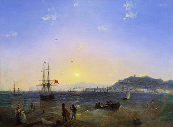
The most important harbor is the Crimea
n city of Kerch
which gives its name to the strait, formerly known as the Cimmerian Bosporus
. The Russian side of the strait contains the Taman Bay
encircled by the Tuzla Spit
to the south and Chushka Spit
to the north. The most important settlement on the Russian side is Taman
where an important cargo port is under construction.
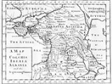
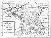 The straits are about 5 kilometres (3.1 mi) long and 4 kilometres (2.5 mi) broad at the narrowest, and are formed by an eastern extension of Crimea
(Taurica
, in ancient times) and the peninsula of Taman, a kind of continuation of the Caucasus
. This in ancient times seems to have formed a group of islands intersected by arms of the Kuban River
(Hypanis) and various sounds
now silted up. The straits were called the Cimmerian Bosporus because of the similarity to the Bosporus
straits between the Aegean Sea
and the Black Sea, and after the Cimmerians
the equestrian nomads on the steppes north of the Black Sea.
During the Second World War, the Kerch Peninsula was the scene of much desperate combat between forces of the Soviet
Red Army
and Germany. Fighting frequency intensified in the coldest months of year when the strait froze over, allowing the movement of troops over the ice.
Hitler demanded a three-mile road and rail bridge across the Strait of Kerch in the spring of 1943 to support a push through the Caucasus to Persia
, although the Cable Railway (aerial tramway
) which went into operation on 14 July with a daily capacity of one thousand tons was adequate for the defensive needs of the Seventeenth Army
in the Kuban bridgehead. Because of frequent earth tremors, vast quantities of extra-strength girders of precious steel would be required, and their transport would curtail shipments of military material to the Crimea. Hitler's bridgehead on the continent of Asia was evacuated in September.
In 1944, the Soviets built a "provisional" railway bridge
across the strait. Construction made use of supplies captured from the Germans. The bridge was completed in November 1944, but was destroyed by moving ice floes in February 1945; reconstruction was not attempted.
and the Krasnodar Krai
(Port Krym
– Port Kavkaz
line). Originally there were four train-ferry ships; later three car-ferry ships were added. Train transportation continued for almost 40 years. The aging train-ferries became obsolete in the late 1980s and were removed from service. In the autumn of 2004, new ships were delivered as replacements and train transportation was re-established.
Moscow mayor Yuri Luzhkov campaigned for a highway bridge to be constructed across the strait. Since 1944, various bridge projects to span the strait have been proposed or attempted, always hampered by the difficult geologic and geographic configuration of the area. Construction of an approach was actually started in 2003, provoking the Tuzla Island
conflict.
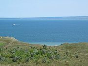
 Several fish-processing plants are located on the Crimean coast of the strait. Fishing season begins in late autumn and lasts for 2–3 months, when many seiners put out into the strait to fish. The Taman Bay
is a major fishing ground, with many fishing villages scattered along the coast.
. Four ships sank, six ran aground on a sandbank, and two tankers were damaged, resulting in a major oil spill and the death of 23 sailors.
The Russian-flagged oil tanker
, Volgoneft-139, encountered trouble in the Kerch Strait where it sought shelter from the above storm. During the storm the tanker split the tanker in half, releasing more than 2000 tonne
s of fuel oil. It is thought that the effects of the spill are likely to be felt for many years to come. Four other boats sank in the storm, resulting in the release of sulphur cargo. Efforts to rescue crew members were hampered by the storm.
Another victim of the storm the Russian cargo ship Volnogorsk loaded with sulphur sunk at Port Kavkaz
on the same day.
Black Sea
The Black Sea is bounded by Europe, Anatolia and the Caucasus and is ultimately connected to the Atlantic Ocean via the Mediterranean and the Aegean seas and various straits. The Bosphorus strait connects it to the Sea of Marmara, and the strait of the Dardanelles connects that sea to the Aegean...
and the Sea of Azov
Sea of Azov
The Sea of Azov , known in Classical Antiquity as Lake Maeotis, is a sea on the south of Eastern Europe. It is linked by the narrow Strait of Kerch to the Black Sea to the south and is bounded on the north by Ukraine mainland, on the east by Russia, and on the west by the Ukraine's Crimean...
, separating the Kerch Peninsula in the west from the Taman Peninsula
Taman peninsula
The Taman Peninsula is a peninsula in the present-day Krasnodar Krai of Russia. It is bounded on the north by the Sea of Azov, on the west by the Strait of Kerch and on the south by the Black Sea. The peninsula has evolved over the past two millennia from a chain of islands into the peninsula it is...
in the east. The strait is 4.5 kilometres (2.8 mi) to 15 kilometres (9.3 mi) wide and up to 18 metres (59.1 ft) deep.
The most important harbor is the Crimea
Crimea
Crimea , or the Autonomous Republic of Crimea , is a sub-national unit, an autonomous republic, of Ukraine. It is located on the northern coast of the Black Sea, occupying a peninsula of the same name...
n city of Kerch
Kerch
Kerch is a city on the Kerch Peninsula of eastern Crimea, an important industrial, transport and tourist centre of Ukraine. Kerch, founded 2600 years ago, is considered as one of the most ancient cities in Ukraine.-Ancient times:...
which gives its name to the strait, formerly known as the Cimmerian Bosporus
Bosporus
The Bosphorus or Bosporus , also known as the Istanbul Strait , is a strait that forms part of the boundary between Europe and Asia. It is one of the Turkish Straits, along with the Dardanelles...
. The Russian side of the strait contains the Taman Bay
Taman Bay
The Taman Bay is a shallow bay or gulf on the east coast of the Strait of Kerch shaped by the Tuzla and Chushka spits. It dips into the Taman Peninsula of Krasnodar Krai, Russia for about 16 km. The bay is 8 km wide at its mouth and is up to 5 meters deep. Fishing villages and the...
encircled by the Tuzla Spit
Tuzla Spit
Tuzla is a long narrow peninsula, or sandy spit, in the southern part of the Strait of Kerch which extends from Cape Tuzla to the north-west in the direction of the city Kerch for almost 12 km....
to the south and Chushka Spit
Chushka Spit
Chushka is a long narrow peninsula, or sandy spit, in the northern part of the Strait of Kerch which extends from Cape Achilleion to the south-west in the direction of the Black Sea for almost 18 km....
to the north. The most important settlement on the Russian side is Taman
Taman, Russia
Taman is a village in Temryuksky District of Krasnodar Krai, Russia, located on the coast of the Taman Bay. Population: -History:Taman occupies the site of the ancient cities of Hermonassa and Tmutarakan...
where an important cargo port is under construction.
History
Crimea
Crimea , or the Autonomous Republic of Crimea , is a sub-national unit, an autonomous republic, of Ukraine. It is located on the northern coast of the Black Sea, occupying a peninsula of the same name...
(Taurica
Taurica
Taurica, Tauric Chersonese, and Taurida were names by which the territory of Crimea was known to the Greeks and Romans.- Etymology of the name :...
, in ancient times) and the peninsula of Taman, a kind of continuation of the Caucasus
Caucasus
The Caucasus, also Caucas or Caucasia , is a geopolitical region at the border of Europe and Asia, and situated between the Black and the Caspian sea...
. This in ancient times seems to have formed a group of islands intersected by arms of the Kuban River
Kuban River
The Kuban River is a river in Russia, in the North Caucasus region. It flows mostly through Krasnodar Krai but also in the Karachay-Cherkess Republic, Stavropol Krai and the Republic of Adygea....
(Hypanis) and various sounds
Sound (geography)
In geography a sound or seaway is a large sea or ocean inlet larger than a bay, deeper than a bight and wider than a fjord; or it may be defined as a narrow sea or ocean channel between two bodies of land ....
now silted up. The straits were called the Cimmerian Bosporus because of the similarity to the Bosporus
Bosporus
The Bosphorus or Bosporus , also known as the Istanbul Strait , is a strait that forms part of the boundary between Europe and Asia. It is one of the Turkish Straits, along with the Dardanelles...
straits between the Aegean Sea
Aegean Sea
The Aegean Sea[p] is an elongated embayment of the Mediterranean Sea located between the southern Balkan and Anatolian peninsulas, i.e., between the mainlands of Greece and Turkey. In the north, it is connected to the Marmara Sea and Black Sea by the Dardanelles and Bosporus...
and the Black Sea, and after the Cimmerians
Cimmerians
The Cimmerians or Kimmerians were ancient equestrian nomads of Indo-European origin.According to the Greek historian Herodotus, of the 5th century BC, the Cimmerians inhabited the region north of the Caucasus and the Black Sea during the 8th and 7th centuries BC, in what is now Ukraine and Russia...
the equestrian nomads on the steppes north of the Black Sea.
During the Second World War, the Kerch Peninsula was the scene of much desperate combat between forces of the Soviet
Soviet Union
The Soviet Union , officially the Union of Soviet Socialist Republics , was a constitutionally socialist state that existed in Eurasia between 1922 and 1991....
Red Army
Red Army
The Workers' and Peasants' Red Army started out as the Soviet Union's revolutionary communist combat groups during the Russian Civil War of 1918-1922. It grew into the national army of the Soviet Union. By the 1930s the Red Army was among the largest armies in history.The "Red Army" name refers to...
and Germany. Fighting frequency intensified in the coldest months of year when the strait froze over, allowing the movement of troops over the ice.
Hitler demanded a three-mile road and rail bridge across the Strait of Kerch in the spring of 1943 to support a push through the Caucasus to Persia
Operation Edelweiss
Operation Edelweiss , named after the mountain flower, was a German plan to gain control over the Caucasus and capture the oil fields of Baku during the Soviet-German War. The operation was authorised by Hitler on 23 July 1942...
, although the Cable Railway (aerial tramway
Aerial tramway
An aerial tramway , cable car , ropeway or aerial tram is a type of aerial lift which uses one or two stationary ropes for support while a third moving rope provides propulsion...
) which went into operation on 14 July with a daily capacity of one thousand tons was adequate for the defensive needs of the Seventeenth Army
17th Army (Germany)
The German Seventeenth Army was a World War II field army.-Commanding officers:* General der Infanterie Carl-Heinrich von Stülpnagel * Generaloberst Hermann Hoth...
in the Kuban bridgehead. Because of frequent earth tremors, vast quantities of extra-strength girders of precious steel would be required, and their transport would curtail shipments of military material to the Crimea. Hitler's bridgehead on the continent of Asia was evacuated in September.
In 1944, the Soviets built a "provisional" railway bridge
Kerch Strait Bridge
The Kerch Strait bridge is a proposal for a bridge spanning the Strait of Kerch between the Chushka Spit, Taman Peninsula, Russia and the Kerch Peninsula, Crimea, Ukraine. The current connection is by ferry between Port Kavkaz and Port Krym...
across the strait. Construction made use of supplies captured from the Germans. The bridge was completed in November 1944, but was destroyed by moving ice floes in February 1945; reconstruction was not attempted.
Ferry and bridge transportation
After the war, ferry transportation across the strait was established in 1952, connecting CrimeaCrimea
Crimea , or the Autonomous Republic of Crimea , is a sub-national unit, an autonomous republic, of Ukraine. It is located on the northern coast of the Black Sea, occupying a peninsula of the same name...
and the Krasnodar Krai
Krasnodar Krai
-External links:* **...
(Port Krym
Port Krym
Port Krym is a port in Ukraine. It is located on the western shore of Kerch Strait, in the north-eastern part of Kerch city. Next to the port is located a train station "Krym" as well as a customs/border checkpoint....
– Port Kavkaz
Port Kavkaz
Port Kavkaz is a small harbour on the Kerch Strait in Krasnodar Krai, Russia. The port may handle the vessels being up to 130 m in length, up to 14'5 m in breadth and with draft up to 5 m...
line). Originally there were four train-ferry ships; later three car-ferry ships were added. Train transportation continued for almost 40 years. The aging train-ferries became obsolete in the late 1980s and were removed from service. In the autumn of 2004, new ships were delivered as replacements and train transportation was re-established.
Moscow mayor Yuri Luzhkov campaigned for a highway bridge to be constructed across the strait. Since 1944, various bridge projects to span the strait have been proposed or attempted, always hampered by the difficult geologic and geographic configuration of the area. Construction of an approach was actually started in 2003, provoking the Tuzla Island
Tuzla Island
Tuzla Spit Island is a sandy islet in a form of a spit located in the middle of the Strait of Kerch between the Kerch Peninsula in the west and the Taman Peninsula in the east.-Conflict:...
conflict.
Fishing
Taman Bay
The Taman Bay is a shallow bay or gulf on the east coast of the Strait of Kerch shaped by the Tuzla and Chushka spits. It dips into the Taman Peninsula of Krasnodar Krai, Russia for about 16 km. The bay is 8 km wide at its mouth and is up to 5 meters deep. Fishing villages and the...
is a major fishing ground, with many fishing villages scattered along the coast.
Autumn storm of 2007
On Sunday 11 November 2007, news agencies reported a very strong storm on the Black SeaBlack Sea
The Black Sea is bounded by Europe, Anatolia and the Caucasus and is ultimately connected to the Atlantic Ocean via the Mediterranean and the Aegean seas and various straits. The Bosphorus strait connects it to the Sea of Marmara, and the strait of the Dardanelles connects that sea to the Aegean...
. Four ships sank, six ran aground on a sandbank, and two tankers were damaged, resulting in a major oil spill and the death of 23 sailors.
The Russian-flagged oil tanker
Oil tanker
An oil tanker, also known as a petroleum tanker, is a merchant ship designed for the bulk transport of oil. There are two basic types of oil tankers: the crude tanker and the product tanker. Crude tankers move large quantities of unrefined crude oil from its point of extraction to refineries...
, Volgoneft-139, encountered trouble in the Kerch Strait where it sought shelter from the above storm. During the storm the tanker split the tanker in half, releasing more than 2000 tonne
Tonne
The tonne, known as the metric ton in the US , often put pleonastically as "metric tonne" to avoid confusion with ton, is a metric system unit of mass equal to 1000 kilograms. The tonne is not an International System of Units unit, but is accepted for use with the SI...
s of fuel oil. It is thought that the effects of the spill are likely to be felt for many years to come. Four other boats sank in the storm, resulting in the release of sulphur cargo. Efforts to rescue crew members were hampered by the storm.
Another victim of the storm the Russian cargo ship Volnogorsk loaded with sulphur sunk at Port Kavkaz
Port Kavkaz
Port Kavkaz is a small harbour on the Kerch Strait in Krasnodar Krai, Russia. The port may handle the vessels being up to 130 m in length, up to 14'5 m in breadth and with draft up to 5 m...
on the same day.