

St. Louis County, Missouri
Encyclopedia
St. Louis County is a county located in the U.S. state
of Missouri
. Its county seat
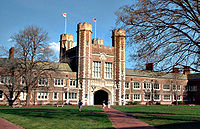
is Clayton
. St. Louis County is part of the St. Louis Metro Area
wherein the independent City
of St. Louis
and its suburbs in St. Louis County, as well as the surrounding counties in both Missouri and Illinois all together account for a total population of over 2.8 million people. St. Louis County borders the City of St. Louis
, which is independent from St. Louis County. Census 2010 put the county population at 998,954—which is more than 3 times the size of its adjoining namesake city.
), named for the French King Louis IX
, known as Saint Louis. Its original county seat was in various buildings including the Old Courthouse in downtown St. Louis by the Gateway Arch
.
In 1877, the City of St. Louis
separated itself from the county, creating an independent city
. The city in August 1876 narrowly approved the separation while county residents overwhelmingly opposed the separation. City residents had argued they wanted to be free of "rid of county taxes and state influence over county government." At the time the city had 350,000 residents while the rural county had 30,000. The rural county also had only 150 miles of gravel roads. The election was challenged in the courts and the they were formally separated in March 1877.
The county's former courthouse in St. Louis city became city property. The new (and then much smaller county government met at the Mount Olive Hotel, near today's Hanley Road and Olive Boulevard in what today is University City, Missouri
until deciding on a new location for the courthouse. The county considered locations for a new courthouse in
Kirkwood, Missouri
(which claims to be the first planned suburb in St. Louis County and first suburb built west of the Mississippi River) and Florissant, Missouri
(then in an area known as St. Ferdinand township). A farmer named Ralph Clayton (who was 90 at the time) donated 100 acres in what would become Clayton, Missouri
for the site that was ultimately chosen in part because it was on the route of the Hodiamont
narrow gauge
street cars which stretched from Pine Lawn through Normandy and Kinloch to Florissant. Clayton said the site "a half day's ride from the city" and more accessible than other villages in the county. The first $38,000 courthouse in the newly defined county opened December 1878 west of Hanley Road and north of Clayton Road. A new courthouse was built in 1945 (it is today's County Police headquarters). The original 1878 courthouse was torn down in 1971 to be replaced by county government plaza and modern six-story courthouse.
The county became larger than the city in the 1970 U.S. Census when it had 951,353 compared to the city's 750,026. With the city dropping to its lowest population since the 19th century in the 2010 U.S. Census and the county also dropping in population for the first time in its history there has been talk of the two entities reuniting.
under the Missouri constitution
, in 1950. The current St. Louis County Charter was adopted by the voters on November 6, 1979.
Executive power
of the county is vested in the county executive
, which is a full-time salaried position. The current county executive is Charlie Dooley
, who was re-elected November 2, 2010. The county executive's term is 4 years; he/she is elected by the general population of the county.
Ordinances are passed by a county council. The council is made up of 7 members, each from a separate district within the county. Council member terms are 4 years, beginning on January 1 following the election. Elections are held in even-numbered years, with terms for even- and odd-numbered districts staggered.
The county's public library
system is St. Louis County Library
, which has 20 branches.
is the largest and primary law enforcement agency in St. Louis County. The agency is currently led by Colonel Timothy E. Fitch, Chief of Police.
It reported an average drop of 19% in crime for the first half of 2009 compared to the same time frame in 2008. Categories include: murder, rape, robbery, aggravated assault, burglary, larceny, vehicle theft, and arson. Burglaries had the sharpest drop: down 35%, with arson down 33%, vehicle theft down 17%, robbery down 15%, and larceny down 15%. There were only two murders, compared to the six in 2008
St. Louis County is statistically much more moderate than its heavily Democratic
neighbor, St. Louis city
. However, it is considerably less conservative than the rural parts of the state
. Along with the independent city
of St. Louis, both St. Louis County and Jackson County
, containing most of the population and area of Kansas City
as well as most of its Missouri suburbs, were the only two urban counties in the state of Missouri
to have a Democratic
majority of votes in the 2004 presidential election.
In the 2008 presidential primaries, 41% of Republicans
in St. Louis County voted for John McCain with 37% voting for Mitt Romney
. For Democrats in St. Louis County 63% voted for Barack Obama
while 36% voted for Hillary Clinton. In total 187,234 votes were cast for Democratic Party candidates and 95,437 votes were cast for the Republican Party candidates.
In the 2008 presidential election
59.5% of ballots were in favor of the Democratic candidate Barack Obama
totaling 333,123 votes, while Republican candidate John McCain
took 39.6% with 221,705 votes.
There are 796,979 registered voters.
, the county has a total area of 524 square miles (1,357.2 km²), of which, 508 square miles (1,315.7 km²) of it is land and 16 square miles (41.4 km²) of it (3.03%) is water. St. Louis County is part of the Greater St. Louis metropolitan area.
I-55 goes through St. Louis County from mile 192.7 to mile 201.6
forms the northern border with St. Charles County, exclusive of a few areas where the river has changed its course. The Meramec River forms most of its southern border with Jefferson County
. To the east is the City of St. Louis
and the Mississippi River
. The western boundary with Franklin County
is the north-south line where the distance between the Meramec and Missouri Rivers is the shortest, bisecting the City of Pacific roughly 2 blocks east of Hwy OO/F (First street).
, in the western part of the county, along the Missouri River, formerly called "Gumbo Flats" after its rich, dark soil; it was submerged by at least ten feet of water during the Great Flood of 1993
, but recent development there is protected by a higher levee. The Columbia Bottom is a floodplain in the northeast of the county at the confluence
of the Mississippi and Missouri Rivers; this is a conservation area open to the public. The Missouri Bottom area between the two other floodplains is largely agricultural, but is being increasingly developed. The River des Peres
drains the interior of county before flowing underground into the City of St. Louis and then resurfacing to form the boundary between southern portions of St. Louis City and St. Louis County. Other streams include Coldwater Creek, Bonhomme Creek, and Creve Coeur Creek, flowing into the Missouri River
; Keifer Creek and Grand Glaize Creek, flowing into the Meramec River; Deer Creek and Gravois Creek, flowing into the River des Peres
; and Maline Creek, flowing into the Mississippi River
.
and dolomite
, and much of the county near the rivers is Karst
terrain, with numerous caves, sinkholes, and springs. No igneous or metamorphic rock
is exposed on the surface. A major outcropping of the St. Peter Sandstone
formation, a fine white sandstone used for making clear glass, is mined in the southwest corner of the county in Pacific
. Brick clay mining was once a major industry in the county. The Charbonier Bluff along the Missouri River is an outcropping of coal, and was used a fueling station for steamboats. The "St. Louis Anticline", an underground formation, has small petroleum deposits in north part of the county.
via burning. Trees are mainly oak
, maple
, and hickory
, similar to the forests of the Ozarks
; common understory trees include Eastern redbud
, serviceberry
, and flowering dogwood
. Riparian areas are heavily forested with mainly American sycamore
. By the 1920s most of the timber in the county was harvested; since that time, large parks and undeveloped areas in the western and southern parts of the county have grown dense forest cover. Old pastures are usually colonized with Eastern red cedar
. Most of the residential area of the county is planted with large native shade trees. In Autumn, the changing color of the trees is notable. St. Louis County has the most recorded native species of plants in the state, but this is probably due to the intensive botanical research done in the area. Most species here are typical of the Eastern Woodland; but some southern species are found in swampland, and typical northern species survive in sheltered hollows
. Invasive species, most notably Japanese Honeysuckle
, are common in some homesteads converted to parks; these are actively removed.
Large mammal
s include growing populations of whitetail deer and coyote
s, which are becoming increasingly urbanized. Eastern gray squirrel
, cottontail rabbit
, and other rodents are abundant, as well as opossum, beaver
, muskrat
, raccoon
, and skunk
. Large bird species include wild turkey
, Canada goose
, mallard duck, various raptors
like the turkey vulture
and red-tailed Hawk
, as well as shorebirds, including the great egret
and great blue heron
. Winter populations of bald eagle
s are found by the Mississippi River
around the Chain of Rocks Bridge
. The county is on the Mississippi Flyway
, used by migrating birds, and has a large variety of small bird species, common to the eastern U.S. The Eurasian tree sparrow, an introduced species, is limited in North America to the counties surrounding St. Louis.
Frogs are commonly found in the springtime, especially after extensive wet periods. Common species include American toad
and species of chorus frogs, commonly called "spring peepers" that are found in nearly every pond. Some years have outbreaks of cicadas or ladybugs. Mosquitos and houseflies are common insect
nuisances; because of this, windows are nearly universally fitted with screens
, and "screened-in" porch
es are common in homes of the area. Populations of honeybees have sharply declined in recent years, and numerous species of pollinator
insects have filled their ecological niche.
. The county has four distinct seasons. Spring is the wettest season and produces erratic severe weather ranging from tornado
es to winter storm
s. Summers are hot, and the humidity can make the heat index
rise to temperatures above 100 °F (37.8 °C). Fall is mild with lower humidity and can produce intermittent bouts of heavy rainfall with the first snow flurries
usually forming in late November. Winters are cool to cold with periodic snow and temperatures often below freezing. Winter storm systems, such as Alberta Clipper
s, can bring days of heavy freezing rain
, ice pellets
, and snowfall.
The average annual temperature for the years 1971–2000, recorded at Lambert–St. Louis International Airport, is 56.3 °F (13.5 °C), and average precipitation is 36 inches (914 mm). The average high temperature in July is 88.4 °F (32 °C), and the average low temperature in January is 22.6 °F (−6 °C), although these values are often exceeded. Temperatures of 0 °F (-17.8 °C) or below occur 3 days per year on average. The highest temperature ever recorded in St. Louis was 115 °F (46 °C), on July 14, 1954, while the lowest temperature on record is −23 °F (−31 °C), on January 29, 1873
Winter is the driest season, averaging about 6 inches of total precipitation. Springtime (March through May), is typically the wettest season, with just under 10.5 inches. Dry spells of one or two weeks duration are common during the growing seasons.
Thunderstorm
s can be expected on 40 to 50 days per year. A few of them will be severe with locally destructive winds and large hail
, and occasionally accompanied by tornadoes. A period of unseasonably warm weather late in Autumn known as Indian summer
is common – rose
s will still be in bloom as late as November or early December in some years.
Manchester Road (Route 100) follows an ancient path westward out of St. Louis, following the boundary between the Missouri
and Meramec watersheds, and is one of only two ways to leave the county without crossing rivers (the other being State Highway T.)
The Sinks is a karst
area in the far northern part of the county, with numerous sinkhole
s.
of 2010, there were 998,954 people. There were 404,765 households with 263,423 family households. The population density
was 1,966 people per square mile (773/km²). There were 423,749 housing units at an average density of 834 per square mile (322/km²). The racial makeup of the county was 70.3% White (68.9% Non-Hispanic White), 23.3% African American, 0.2% Native American, 3.5% Asian, 0.03% Pacific Islander, 0.9% from other races
, and 1.9% from two or more races. Hispanic or Latino of any race were 2.5% of the population.
There were 404,765 households out of which 31.0% had children under the age of 18 living with them, 51.00% were married couples
living together, 12.70% had a female householder with no husband present, and 33.00% were non-families. 28.00% of all households were made up of individuals and 10.10% had someone living alone who was 65 years of age or older. The average household size was 2.47 and the average family size was 3.05.
In the county the population was spread out with 25.20% under the age of 18, 8.30% from 18 to 24, 29.00% from 25 to 44, 23.50% from 45 to 64, and 14.10% who were 65 years of age or older. The median age was 38 years. For every 100 females there were 90.00 males. For every 100 females age 18 and over, there were 85.70 males.
The median income for a household in the county was $50,532, and the median income for a family was $61,680. Males had a median income of $45,714 versus $30,278 for females. The per capita income
for the county was $27,595. About 5.00% of families and 6.90% of the population were below the poverty line, including 9.30% of those under age 18 and 5.30% of those age 65 or over. St. Louis County is the most affluent county in the state of Missouri.
Consistent with national trends, the county saw considerable job growth in the late 1990s followed by a period of job loss following the 2001 recession. Job growth resumed in 2004 and has continued at a modest pace, coupled with solid wage gains through the first quarter of 2006.
The county's employment base has become more diverse as manufacturing employment has been in a long-term decline since the 1980s, with job growth coming from a variety of service industries. The share of employment from manufacturing fell from 15 percent in 1995 to 11 percent in 2005. In contrast, several service industry groups, particularly education and health services, grew substantially.
The unemployment rate for St. Louis County was below that of the metropolitan area and even farther below the national rate throughout the 1990s. Since 2000, the county's employment rate has been more closely aligned with both metro area and national unemployment rates.
and Mid County lies in the middle of the three main bordering highways (I-70, I-270 & I-44) and the St. Louis county-city line.
, Clarkson Valley
, Creve Coeur
, Des Peres
, Ellisville
, Eureka
, Manchester
, Town and Country
, Twin Oaks
, Valley Park
, and Wildwood
. West County is home to two major shopping centers: Chesterfield Mall
and West County Center
. Local school districts include the Parkway School District
and Rockwood School District
along with numerous private schools. Leisure spots in West County include Bellerive Country Club
and Faust Park, which is home to the Butterfly House.
. Municipalities include Clayton
, Maplewood
, Brentwood
, Webster Groves
, Kirkwood
, Richmond Heights
, Frontenac
, Warson Woods
, Ladue
, Rock Hill
, Olivette
, University City
, St. Ann
, and Overland
. With access to Interstate 70 and Interstate 44 to the north and south of Mid County, access to Interstate 270 and Interstate 170 on the west and east and Interstate 64 running through the middle of Mid County, the area is never far from highway transportation. The closest major mall to Downtown St. Louis is the St. Louis Galleria
located in Richmond Heights
. Other popular areas are The Loop
on Delmar Blvd. in University City
and Westport Plaza
in Maryland Heights
. Clayton
is also known for its wide variety of local shops, boutiques and original restaurants.
, and Emerson Electric Company
. The population is one of the most diverse in St. Louis County. Public transportation has been beneficial to North County and was the first area of Metro St. Louis served by the metropolitan rail system, MetroLink
. North County boasts major malls including Jamestown Mall in Florissant
and St. Louis Mills
in Hazelwood
. Cities of North County also include Bellefontaine Neighbors
, Bridgeton
, Ferguson
, Jennings
and Spanish Lake
. Residents of some communities, such as Bridgeton and Hazelwood, often distinguish themselves from locations further north by labeling their area as "Northwest County." North St. Louis County is not only diverse in racial makeup but also by socioeconomic means. There are numerous black and mixed raced villages located in North-Central county along the Natural Bridge Corridor east of Interstate 170 including Glen Echo Park
, Bellerive
, Bel-Ridge
, Bel-Nor
, and Pasadena Hills
, second to Olympia Fields, Illinois
as the most affluent majority black community north of the Mason-Dixon line
. Some of the inner-ring suburbs located between Interstate 70 and Interstate 270 along the city-county line show past and current signs of white flight
.
, Lemay
, Mehlville
, Oakville
, Affton
, and Sunset Hills
. The start of the Ozark Mountains and Ozark plateau begin in South St. Louis county and neighboring Jefferson County
. Many communities have an abundance of gently rolling hills.
St. Louis County has 90 municipalities and 9 unincorporated census-designated place
s:
making up 173 square miles (448.1 km²). In these areas, St. Louis County provides local services, such as zoning, code enforcement and police to these residents who do not reside in one of the 91 St. Louis County municipalities. These municipal-like services are available to the 322,085 residents of the unincorporated areas of St. Louis County. These local services are delivered to several areas throughout the West, Central, North and South portions of the county. The St. Louis County Trash Collection and Recycling program is one example of such a service. This program split the unincorporated areas into 8 districts for trash collection and recycling service. Prior to the program, citizens in unincorporated St. Louis County were responsible for contracting their own trash hauling providers.
schools, including the largest number of Catholic affiliated secondary institutions in the continental U.S. This is partly due to St. Louis's status as an archdiocese
and historically Catholic city. Most of the prestigious private schools reside in West St. Louis County, one of the wealthiest areas in the region.
Current list of hospitals in St. Louis County:
Many large enterprises from a variety of industry sectors have their worldwide headquarters in St. Louis County. Imo's Pizza
and Save-A-Lot
have headquarters in unincorporated area
s in the county.
St. Louis County Economic Council
is the economic development
arm of St. Louis County government, dedicated to increasing opportunities for its businesses and residents.
U.S. state
A U.S. state is any one of the 50 federated states of the United States of America that share sovereignty with the federal government. Because of this shared sovereignty, an American is a citizen both of the federal entity and of his or her state of domicile. Four states use the official title of...
of Missouri
Missouri
Missouri is a US state located in the Midwestern United States, bordered by Iowa, Illinois, Kentucky, Tennessee, Arkansas, Oklahoma, Kansas and Nebraska. With a 2010 population of 5,988,927, Missouri is the 18th most populous state in the nation and the fifth most populous in the Midwest. It...
. Its county seat
County seat
A county seat is an administrative center, or seat of government, for a county or civil parish. The term is primarily used in the United States....
is Clayton
Clayton, Missouri
Clayton is an inner-ring suburb of St. Louis and the county seat of St. Louis County, Missouri. The population was 15,939 at the 2010 census. The city was organized in 1877 and is named after Ralph Clayton, who donated the land for the courthouse.-Geography:...
. St. Louis County is part of the St. Louis Metro Area
St. Louis Metropolitan Statistical Area
Greater St. Louis is the area of Missouri and Illinois that surrounds and includes the independent city of St. Louis. Depending on the counties included in the area, it can refer to the St. Louis, MO-IL metropolitan statistical area or the St. Louis-St. Charles-Farmington, MO-IL combined...
wherein the independent City
Independent city (United States)
In the United States, an independent city is a city that does not belong to any particular county. Because counties have historically been a strong institution in local government in most of the United States, independent cities are relatively rare outside of Virginia , whose state constitution...
of St. Louis
St. Louis, Missouri
St. Louis is an independent city on the eastern border of Missouri, United States. With a population of 319,294, it was the 58th-largest U.S. city at the 2010 U.S. Census. The Greater St...
and its suburbs in St. Louis County, as well as the surrounding counties in both Missouri and Illinois all together account for a total population of over 2.8 million people. St. Louis County borders the City of St. Louis
St. Louis, Missouri
St. Louis is an independent city on the eastern border of Missouri, United States. With a population of 319,294, it was the 58th-largest U.S. city at the 2010 U.S. Census. The Greater St...
, which is independent from St. Louis County. Census 2010 put the county population at 998,954—which is more than 3 times the size of its adjoining namesake city.
History
The county was organized in 1812 and was originally a French colonial district (French LouisianaLouisiana (New France)
Louisiana or French Louisiana was an administrative district of New France. Under French control from 1682–1763 and 1800–03, the area was named in honor of Louis XIV, by French explorer René-Robert Cavelier, Sieur de la Salle...
), named for the French King Louis IX
Louis IX of France
Louis IX , commonly Saint Louis, was King of France from 1226 until his death. He was also styled Louis II, Count of Artois from 1226 to 1237. Born at Poissy, near Paris, he was an eighth-generation descendant of Hugh Capet, and thus a member of the House of Capet, and the son of Louis VIII and...
, known as Saint Louis. Its original county seat was in various buildings including the Old Courthouse in downtown St. Louis by the Gateway Arch
Gateway Arch
The Gateway Arch, or Gateway to the West, is an arch that is the centerpiece of the Jefferson National Expansion Memorial in St. Louis, Missouri. It was built as a monument to the westward expansion of the United States...
.
In 1877, the City of St. Louis
St. Louis, Missouri
St. Louis is an independent city on the eastern border of Missouri, United States. With a population of 319,294, it was the 58th-largest U.S. city at the 2010 U.S. Census. The Greater St...
separated itself from the county, creating an independent city
Independent city
An independent city is a city that does not form part of another general-purpose local government entity. These type of cities should not be confused with city-states , which are fully sovereign cities that are not part of any other sovereign state.-Historical precursors:In the Holy Roman Empire,...
. The city in August 1876 narrowly approved the separation while county residents overwhelmingly opposed the separation. City residents had argued they wanted to be free of "rid of county taxes and state influence over county government." At the time the city had 350,000 residents while the rural county had 30,000. The rural county also had only 150 miles of gravel roads. The election was challenged in the courts and the they were formally separated in March 1877.
The county's former courthouse in St. Louis city became city property. The new (and then much smaller county government met at the Mount Olive Hotel, near today's Hanley Road and Olive Boulevard in what today is University City, Missouri
University City, Missouri
University City is an inner-ring suburb in St. Louis County, Missouri. The population was 35,371 in 2010 census. The city was shaped by Washington University in St. Louis, whose campus abuts the city to the southeast....
until deciding on a new location for the courthouse. The county considered locations for a new courthouse in
Kirkwood, Missouri
Kirkwood, Missouri
Kirkwood is an inner-ring suburb of St. Louis, located in St. Louis County, Missouri. As of the 2010 census, the city population was 27,540. Founded in 1853, the city is named for James Pugh Kirkwood, builder of the Pacific Railroad through that town. It was the first planned suburb located west...
(which claims to be the first planned suburb in St. Louis County and first suburb built west of the Mississippi River) and Florissant, Missouri
Florissant, Missouri
Florissant is a second-ring suburb of St. Louis, located in northern St. Louis County, Missouri, United States. The city has a total population of 52,158 in 2010 census.-History:...
(then in an area known as St. Ferdinand township). A farmer named Ralph Clayton (who was 90 at the time) donated 100 acres in what would become Clayton, Missouri
Clayton, Missouri
Clayton is an inner-ring suburb of St. Louis and the county seat of St. Louis County, Missouri. The population was 15,939 at the 2010 census. The city was organized in 1877 and is named after Ralph Clayton, who donated the land for the courthouse.-Geography:...
for the site that was ultimately chosen in part because it was on the route of the Hodiamont
Streetcars in St. Louis
Streetcars in St. Louis, Missouri operated as part of the transportation network of St. Louis from the middle of the 19th century through the early 1960s. During the first forty years of the streetcar in the city, a variety of private companies operated several dozen lines; from the turn of the...
narrow gauge
Narrow gauge
A narrow gauge railway is a railway that has a track gauge narrower than the of standard gauge railways. Most existing narrow gauge railways have gauges of between and .- Overview :...
street cars which stretched from Pine Lawn through Normandy and Kinloch to Florissant. Clayton said the site "a half day's ride from the city" and more accessible than other villages in the county. The first $38,000 courthouse in the newly defined county opened December 1878 west of Hanley Road and north of Clayton Road. A new courthouse was built in 1945 (it is today's County Police headquarters). The original 1878 courthouse was torn down in 1971 to be replaced by county government plaza and modern six-story courthouse.
The county became larger than the city in the 1970 U.S. Census when it had 951,353 compared to the city's 750,026. With the city dropping to its lowest population since the 19th century in the 2010 U.S. Census and the county also dropping in population for the first time in its history there has been talk of the two entities reuniting.
Law and government
St. Louis County was the first Missouri County to adopt a home-rule charterCharter
A charter is the grant of authority or rights, stating that the granter formally recognizes the prerogative of the recipient to exercise the rights specified...
under the Missouri constitution
Constitution
A constitution is a set of fundamental principles or established precedents according to which a state or other organization is governed. These rules together make up, i.e. constitute, what the entity is...
, in 1950. The current St. Louis County Charter was adopted by the voters on November 6, 1979.
Executive power
Executive Power
Executive Power is Vince Flynn's fifth novel, and the fourth to feature Mitch Rapp, an American agent that works for the CIA as an operative for a covert counter terrorism unit called the "Orion Team."-Plot summary:...
of the county is vested in the county executive
County executive
A county executive is the head of the executive branch of government in a county. This position is common in the United States.The executive may be an elected or an appointed position...
, which is a full-time salaried position. The current county executive is Charlie Dooley
Charlie Dooley
Charlie A. Dooley is an American politician. He currently serves as the County Executive of St. Louis County, Missouri. Dooley is the first African American to hold this position. He is a Democrat.- Early life and career :...
, who was re-elected November 2, 2010. The county executive's term is 4 years; he/she is elected by the general population of the county.
Ordinances are passed by a county council. The council is made up of 7 members, each from a separate district within the county. Council member terms are 4 years, beginning on January 1 following the election. Elections are held in even-numbered years, with terms for even- and odd-numbered districts staggered.
The county's public library
Public library
A public library is a library that is accessible by the public and is generally funded from public sources and operated by civil servants. There are five fundamental characteristics shared by public libraries...
system is St. Louis County Library
St. Louis County Library
St. Louis County Library serves residents of St. Louis County, Missouri, United States. It is the busiest public library in Missouri, circulating nearly 12 million items in 2010. It consists of 20 branches, including the Headquarters branch, which is located at 1640 S. Lindbergh Blvd in Ladue....
, which has 20 branches.
Crime and safety
When compared to other large urban counties, St. Louis County's crime rate per 100,000 residents is among the lowest in the nation. For example, there were just 30 homicides reported in 2003 out of a population of over 1 million people. There has been a 25% decrease in crime since 1991, and St. Louis County is now at its lowest level of crime since 1973. The St. Louis County Police DepartmentSt. Louis County Police Department
The St. Louis County Police Department is the primary and largest law enforcement agency serving St. Louis County in the U.S. state of Missouri. The current police chief is Colonel Timothy E. Fitch. According to the Charter of St. Louis County, the county police chief has all of the duties of...
is the largest and primary law enforcement agency in St. Louis County. The agency is currently led by Colonel Timothy E. Fitch, Chief of Police.
It reported an average drop of 19% in crime for the first half of 2009 compared to the same time frame in 2008. Categories include: murder, rape, robbery, aggravated assault, burglary, larceny, vehicle theft, and arson. Burglaries had the sharpest drop: down 35%, with arson down 33%, vehicle theft down 17%, robbery down 15%, and larceny down 15%. There were only two murders, compared to the six in 2008
Politics
| Year | DEM Democratic Party (United States) The Democratic Party is one of two major contemporary political parties in the United States, along with the Republican Party. The party's socially liberal and progressive platform is largely considered center-left in the U.S. political spectrum. The party has the lengthiest record of continuous... |
GOP Republican Party (United States) The Republican Party is one of the two major contemporary political parties in the United States, along with the Democratic Party. Founded by anti-slavery expansion activists in 1854, it is often called the GOP . The party's platform generally reflects American conservatism in the U.S... |
|---|---|---|
| 2008 | 59.5% 333,123 | 39.6% 221,705 |
| 2004 | 54.4% 295,284 | 45.1% 244,969 |
| 2000 | 51.5% 250,631 | 46.2% 224,689 |
| 1996 | 48.8% 225,524 | 42.4% 196,096 |
| 1992 | 44.1% 235,760 | 35.2% 188,285 |
| 1988 | 45.1% 216,534 | 54.7% 262,784 |
| 1984 | 36.0% 173,144 | 64.0% 307,684 |
| 1980 | 39.8% 192,796 | 54.4% 263,518 |
| 1976 | 43.5% 196,915 | 54.6% 246,988 |
| 1972 | 37.8% 160,801 | 62.2% 264,147 |
| 1968 | 43.0% 165,786 | 46.8% 180,355 |
| 1964 | 61.3% 213,658 | 38.7% 134,962 |
| 1960 | 51.3% 166,508 | 48.7% 157,992 |
St. Louis County is statistically much more moderate than its heavily Democratic
Democratic Party (United States)
The Democratic Party is one of two major contemporary political parties in the United States, along with the Republican Party. The party's socially liberal and progressive platform is largely considered center-left in the U.S. political spectrum. The party has the lengthiest record of continuous...
neighbor, St. Louis city
St. Louis, Missouri
St. Louis is an independent city on the eastern border of Missouri, United States. With a population of 319,294, it was the 58th-largest U.S. city at the 2010 U.S. Census. The Greater St...
. However, it is considerably less conservative than the rural parts of the state
Missouri
Missouri is a US state located in the Midwestern United States, bordered by Iowa, Illinois, Kentucky, Tennessee, Arkansas, Oklahoma, Kansas and Nebraska. With a 2010 population of 5,988,927, Missouri is the 18th most populous state in the nation and the fifth most populous in the Midwest. It...
. Along with the independent city
Independent city
An independent city is a city that does not form part of another general-purpose local government entity. These type of cities should not be confused with city-states , which are fully sovereign cities that are not part of any other sovereign state.-Historical precursors:In the Holy Roman Empire,...
of St. Louis, both St. Louis County and Jackson County
Jackson County, Missouri
Jackson County is a county located in the U.S. state of Missouri. With a population of 674,158 in the 2010 census, Jackson County is the second most populous of Missouri's counties, after St. Louis County. Kansas City, the state's most populous city and focus city of the Kansas City Metropolitan...
, containing most of the population and area of Kansas City
Kansas City, Missouri
Kansas City, Missouri is the largest city in the U.S. state of Missouri and is the anchor city of the Kansas City Metropolitan Area, the second largest metropolitan area in Missouri. It encompasses in parts of Jackson, Clay, Cass, and Platte counties...
as well as most of its Missouri suburbs, were the only two urban counties in the state of Missouri
Missouri
Missouri is a US state located in the Midwestern United States, bordered by Iowa, Illinois, Kentucky, Tennessee, Arkansas, Oklahoma, Kansas and Nebraska. With a 2010 population of 5,988,927, Missouri is the 18th most populous state in the nation and the fifth most populous in the Midwest. It...
to have a Democratic
Democratic Party (United States)
The Democratic Party is one of two major contemporary political parties in the United States, along with the Republican Party. The party's socially liberal and progressive platform is largely considered center-left in the U.S. political spectrum. The party has the lengthiest record of continuous...
majority of votes in the 2004 presidential election.
In the 2008 presidential primaries, 41% of Republicans
Republican Party (United States)
The Republican Party is one of the two major contemporary political parties in the United States, along with the Democratic Party. Founded by anti-slavery expansion activists in 1854, it is often called the GOP . The party's platform generally reflects American conservatism in the U.S...
in St. Louis County voted for John McCain with 37% voting for Mitt Romney
Mitt Romney
Willard Mitt Romney is an American businessman and politician. He was the 70th Governor of Massachusetts from 2003 to 2007 and is a candidate for the 2012 Republican Party presidential nomination.The son of George W...
. For Democrats in St. Louis County 63% voted for Barack Obama
Barack Obama
Barack Hussein Obama II is the 44th and current President of the United States. He is the first African American to hold the office. Obama previously served as a United States Senator from Illinois, from January 2005 until he resigned following his victory in the 2008 presidential election.Born in...
while 36% voted for Hillary Clinton. In total 187,234 votes were cast for Democratic Party candidates and 95,437 votes were cast for the Republican Party candidates.
In the 2008 presidential election
United States presidential election, 2008
The United States presidential election of 2008 was the 56th quadrennial presidential election. It was held on November 4, 2008. Democrat Barack Obama, then the junior United States Senator from Illinois, defeated Republican John McCain, the senior U.S. Senator from Arizona. Obama received 365...
59.5% of ballots were in favor of the Democratic candidate Barack Obama
Barack Obama
Barack Hussein Obama II is the 44th and current President of the United States. He is the first African American to hold the office. Obama previously served as a United States Senator from Illinois, from January 2005 until he resigned following his victory in the 2008 presidential election.Born in...
totaling 333,123 votes, while Republican candidate John McCain
John McCain
John Sidney McCain III is the senior United States Senator from Arizona. He was the Republican nominee for president in the 2008 United States election....
took 39.6% with 221,705 votes.
There are 796,979 registered voters.
Geography
According to the U.S. Census BureauUnited States Census Bureau
The United States Census Bureau is the government agency that is responsible for the United States Census. It also gathers other national demographic and economic data...
, the county has a total area of 524 square miles (1,357.2 km²), of which, 508 square miles (1,315.7 km²) of it is land and 16 square miles (41.4 km²) of it (3.03%) is water. St. Louis County is part of the Greater St. Louis metropolitan area.
I-55 goes through St. Louis County from mile 192.7 to mile 201.6
National protected areas
- Big Muddy National Fish and Wildlife RefugeBig Muddy National Fish and Wildlife RefugeThe Big Muddy National Fish and Wildlife Refuge was established in 1994, and has grown to over . Like pearls on a string, these acres are spread out as individual units along the Missouri River between Kansas City and St. Louis. These pearls of habitat benefit floodplain-dependent fish and wildlife...
(part, Boone's Crossing Unit in Chesterfield, MissouriChesterfield, MissouriChesterfield is a second-ring western suburb of St. Louis and is the largest city in west St. Louis County, Missouri, United States. As of the 2010 census the population is 47,484. Chesterfield also celebrated its 20th birthday in 2008.- Geography :...
) - Ulysses S. Grant National Historic SiteUlysses S. Grant National Historic SiteUlysses S. Grant National Historic Site is a United States National Historic Site located 10 miles southwest of Downtown St. Louis, Missouri within the municipality of Grantwood Village. The site, also known as White Haven, commemorates the life, military career, and Presidency of Ulysses S. Grant...
Natural boundaries
The Missouri RiverMissouri River
The Missouri River flows through the central United States, and is a tributary of the Mississippi River. It is the longest river in North America and drains the third largest area, though only the thirteenth largest by discharge. The Missouri's watershed encompasses most of the American Great...
forms the northern border with St. Charles County, exclusive of a few areas where the river has changed its course. The Meramec River forms most of its southern border with Jefferson County
Jefferson County, Missouri
Jefferson County is a county located in East Central Missouri in the United States. The county was included as the mean center of U.S. population in 1980. It is the sixth most-populous county in Missouri. Census 2010 put the population at 218,733 Its county seat is Hillsboro. The county was...
. To the east is the City of St. Louis
St. Louis, Missouri
St. Louis is an independent city on the eastern border of Missouri, United States. With a population of 319,294, it was the 58th-largest U.S. city at the 2010 U.S. Census. The Greater St...
and the Mississippi River
Mississippi River
The Mississippi River is the largest river system in North America. Flowing entirely in the United States, this river rises in western Minnesota and meanders slowly southwards for to the Mississippi River Delta at the Gulf of Mexico. With its many tributaries, the Mississippi's watershed drains...
. The western boundary with Franklin County
Franklin County, Missouri
Franklin County is a county located in the U.S. state of Missouri on the south side of the Missouri River. Franklin County is part of the St. Louis Metro Area and contains many of the St. Louis exurbs. Census 2010 put the population at 101,492; making it the 10th most populous county in Missouri....
is the north-south line where the distance between the Meramec and Missouri Rivers is the shortest, bisecting the City of Pacific roughly 2 blocks east of Hwy OO/F (First street).
Topography
The foothills of the Ozark Mountains begin in southwestern St. Louis County, with most of the rest of the county being a fairly level plateau. This western part of the county is the least developed, due to rugged topography. Bluffs along the Mississippi in the south of the county rise about 200–300 feet above the river. A major floodplain area is the Chesterfield ValleyChesterfield, Missouri
Chesterfield is a second-ring western suburb of St. Louis and is the largest city in west St. Louis County, Missouri, United States. As of the 2010 census the population is 47,484. Chesterfield also celebrated its 20th birthday in 2008.- Geography :...
, in the western part of the county, along the Missouri River, formerly called "Gumbo Flats" after its rich, dark soil; it was submerged by at least ten feet of water during the Great Flood of 1993
Great Flood of 1993
The Great Mississippi and Missouri Rivers Flood of 1993 occurred in the American Midwest, along the Mississippi and Missouri rivers and their tributaries, from April to October 1993. The flood was among the most costly and devastating to ever occur in the United States, with $15 billion in damages...
, but recent development there is protected by a higher levee. The Columbia Bottom is a floodplain in the northeast of the county at the confluence
Confluence (geography)
In geography, a confluence is the meeting of two or more bodies of water. It usually refers to the point where two streams flow together, merging into a single stream...
of the Mississippi and Missouri Rivers; this is a conservation area open to the public. The Missouri Bottom area between the two other floodplains is largely agricultural, but is being increasingly developed. The River des Peres
River des Peres
The River des Peres is a metropolitan river in St. Louis, Missouri. It is the backbone of sanitary and stormwater systems in the city of St. Louis and portions of St. Louis County...
drains the interior of county before flowing underground into the City of St. Louis and then resurfacing to form the boundary between southern portions of St. Louis City and St. Louis County. Other streams include Coldwater Creek, Bonhomme Creek, and Creve Coeur Creek, flowing into the Missouri River
Missouri River
The Missouri River flows through the central United States, and is a tributary of the Mississippi River. It is the longest river in North America and drains the third largest area, though only the thirteenth largest by discharge. The Missouri's watershed encompasses most of the American Great...
; Keifer Creek and Grand Glaize Creek, flowing into the Meramec River; Deer Creek and Gravois Creek, flowing into the River des Peres
River des Peres
The River des Peres is a metropolitan river in St. Louis, Missouri. It is the backbone of sanitary and stormwater systems in the city of St. Louis and portions of St. Louis County...
; and Maline Creek, flowing into the Mississippi River
Mississippi River
The Mississippi River is the largest river system in North America. Flowing entirely in the United States, this river rises in western Minnesota and meanders slowly southwards for to the Mississippi River Delta at the Gulf of Mexico. With its many tributaries, the Mississippi's watershed drains...
.
Geology
The bedrock is mainly limestoneLimestone
Limestone is a sedimentary rock composed largely of the minerals calcite and aragonite, which are different crystal forms of calcium carbonate . Many limestones are composed from skeletal fragments of marine organisms such as coral or foraminifera....
and dolomite
Dolomite
Dolomite is a carbonate mineral composed of calcium magnesium carbonate CaMg2. The term is also used to describe the sedimentary carbonate rock dolostone....
, and much of the county near the rivers is Karst
KARST
Kilometer-square Area Radio Synthesis Telescope is a Chinese telescope project to which FAST is a forerunner. KARST is a set of large spherical reflectors on karst landforms, which are bowlshaped limestone sinkholes named after the Kras region in Slovenia and Northern Italy. It will consist of...
terrain, with numerous caves, sinkholes, and springs. No igneous or metamorphic rock
Metamorphic rock
Metamorphic rock is the transformation of an existing rock type, the protolith, in a process called metamorphism, which means "change in form". The protolith is subjected to heat and pressure causing profound physical and/or chemical change...
is exposed on the surface. A major outcropping of the St. Peter Sandstone
St. Peter Sandstone
The St. Peter Sandstone is an Ordovician formation in the Chazyan stage of the Champlainian series. This sandstone originated as a sheet of sand in clear, shallow water near the shore of a Paleozoic sea and consists of fine-to-medium-size, well-rounded quartz grains with frosted surfaces...
formation, a fine white sandstone used for making clear glass, is mined in the southwest corner of the county in Pacific
Pacific, Missouri
Pacific is a city in Franklin and St. Louis counties in the U.S. state of Missouri. The population was 7,002 at the 2010 census.-Geography:Pacific is located at . The city straddles the Franklin County/St. Louis County line, which lies halfway on the blocks between Elm and Neosho streets. St...
. Brick clay mining was once a major industry in the county. The Charbonier Bluff along the Missouri River is an outcropping of coal, and was used a fueling station for steamboats. The "St. Louis Anticline", an underground formation, has small petroleum deposits in north part of the county.
Flora and fauna
Before European settlement, the area was prairie and open parklike forest, maintained by Native AmericansNative Americans in the United States
Native Americans in the United States are the indigenous peoples in North America within the boundaries of the present-day continental United States, parts of Alaska, and the island state of Hawaii. They are composed of numerous, distinct tribes, states, and ethnic groups, many of which survive as...
via burning. Trees are mainly oak
Oak
An oak is a tree or shrub in the genus Quercus , of which about 600 species exist. "Oak" may also appear in the names of species in related genera, notably Lithocarpus...
, maple
Maple
Acer is a genus of trees or shrubs commonly known as maple.Maples are variously classified in a family of their own, the Aceraceae, or together with the Hippocastanaceae included in the family Sapindaceae. Modern classifications, including the Angiosperm Phylogeny Group system, favour inclusion in...
, and hickory
Hickory
Trees in the genus Carya are commonly known as hickory, derived from the Powhatan language of Virginia. The genus includes 17–19 species of deciduous trees with pinnately compound leaves and big nuts...
, similar to the forests of the Ozarks
The Ozarks
The Ozarks are a physiographic and geologic highland region of the central United States. It covers much of the southern half of Missouri and an extensive portion of northwestern and north central Arkansas...
; common understory trees include Eastern redbud
Eastern Redbud
Cercis canadensis L. is a large shrub or small tree native to eastern North America from Southern Ontario, Canada south to northern Florida, United States....
, serviceberry
Serviceberry
Amelanchier , also known as shadbush, shadwood or shadblow, serviceberry or sarvisberry, wild pear, juneberry, saskatoon, sugarplum or wild-plum, and chuckley pear is a genus of about 20 species of deciduous-leaved shrubs and small trees in the Rose family .Amelanchier is native to temperate regions...
, and flowering dogwood
Flowering Dogwood
Cornus florida is a species of dogwood native to eastern North America, from southern Maine west to southern Ontario, Illinois, and eastern Kansas, and south to northern Florida and eastern Texas, with a disjunct population in Nuevo León and Veracruz in eastern Mexico.-Classification:The flowering...
. Riparian areas are heavily forested with mainly American sycamore
American sycamore
Platanus occidentalis, also known as American Sycamore, American plane, Occidental plane, and Buttonwood, is one of the species of Platanus native to North America...
. By the 1920s most of the timber in the county was harvested; since that time, large parks and undeveloped areas in the western and southern parts of the county have grown dense forest cover. Old pastures are usually colonized with Eastern red cedar
Juniperus virginiana
Juniperus virginiana is a species of juniper native to eastern North America, from southeastern Canada to the Gulf of Mexico, east of the Great Plains...
. Most of the residential area of the county is planted with large native shade trees. In Autumn, the changing color of the trees is notable. St. Louis County has the most recorded native species of plants in the state, but this is probably due to the intensive botanical research done in the area. Most species here are typical of the Eastern Woodland; but some southern species are found in swampland, and typical northern species survive in sheltered hollows
Valley
In geology, a valley or dale is a depression with predominant extent in one direction. A very deep river valley may be called a canyon or gorge.The terms U-shaped and V-shaped are descriptive terms of geography to characterize the form of valleys...
. Invasive species, most notably Japanese Honeysuckle
Japanese Honeysuckle
The Japanese Honeysuckle is a species of honeysuckle native to eastern Asia including China , Japan, and Korea. It is a twining vine able to climb up to high or more in trees, with opposite, simple oval leaves long and broad...
, are common in some homesteads converted to parks; these are actively removed.
Large mammal
Mammal
Mammals are members of a class of air-breathing vertebrate animals characterised by the possession of endothermy, hair, three middle ear bones, and mammary glands functional in mothers with young...
s include growing populations of whitetail deer and coyote
Coyote
The coyote , also known as the American jackal or the prairie wolf, is a species of canine found throughout North and Central America, ranging from Panama in the south, north through Mexico, the United States and Canada...
s, which are becoming increasingly urbanized. Eastern gray squirrel
Eastern Gray Squirrel
The eastern gray squirrel is a tree squirrel in the genus Sciurus native to the eastern and midwestern United States, and to the southerly portions of the eastern provinces of Canada...
, cottontail rabbit
Cottontail rabbit
The cottontail rabbits are among the 16 lagomorph species in the genus Sylvilagus, found in the Americas.In appearance, most cottontail rabbits closely resemble the wild European Rabbit...
, and other rodents are abundant, as well as opossum, beaver
Beaver
The beaver is a primarily nocturnal, large, semi-aquatic rodent. Castor includes two extant species, North American Beaver and Eurasian Beaver . Beavers are known for building dams, canals, and lodges . They are the second-largest rodent in the world...
, muskrat
Muskrat
The muskrat , the only species in genus Ondatra, is a medium-sized semi-aquatic rodent native to North America, and introduced in parts of Europe, Asia, and South America. The muskrat is found in wetlands and is a very successful animal over a wide range of climates and habitats...
, raccoon
Raccoon
Procyon is a genus of nocturnal mammals, comprising three species commonly known as raccoons, in the family Procyonidae. The most familiar species, the common raccoon , is often known simply as "the" raccoon, as the two other raccoon species in the genus are native only to the tropics and are...
, and skunk
Skunk
Skunks are mammals best known for their ability to secrete a liquid with a strong, foul odor. General appearance varies from species to species, from black-and-white to brown or cream colored. Skunks belong to the family Mephitidae and to the order Carnivora...
. Large bird species include wild turkey
Wild Turkey
The Wild Turkey is native to North America and is the heaviest member of the Galliformes. It is the same species as the domestic turkey, which derives from the South Mexican subspecies of wild turkey .Adult wild turkeys have long reddish-yellow to grayish-green...
, Canada goose
Canada Goose
The Canada Goose is a wild goose belonging to the genus Branta, which is native to arctic and temperate regions of North America, having a black head and neck, white patches on the face, and a brownish-gray body....
, mallard duck, various raptors
Bird of prey
Birds of prey are birds that hunt for food primarily on the wing, using their keen senses, especially vision. They are defined as birds that primarily hunt vertebrates, including other birds. Their talons and beaks tend to be relatively large, powerful and adapted for tearing and/or piercing flesh....
like the turkey vulture
Turkey Vulture
The Turkey Vulture is a bird found throughout most of the Americas. It is also known in some North American regions as the Turkey Buzzard , and in some areas of the Caribbean as the John Crow or Carrion Crow...
and red-tailed Hawk
Red-tailed Hawk
The Red-tailed Hawk is a bird of prey, one of three species colloquially known in the United States as the "chickenhawk," though it rarely preys on standard sized chickens. It breeds throughout most of North America, from western Alaska and northern Canada to as far south as Panama and the West...
, as well as shorebirds, including the great egret
Great Egret
The Great Egret , also known as the Great White Egret or Common Egret, White Heron, or Great White Heron, is a large, widely-distributed egret. Distributed across most of the tropical and warmer temperate regions of the world, in southern Europe it is rather localized...
and great blue heron
Great Blue Heron
The Great Blue Heron is a large wading bird in the heron family Ardeidae, common near the shores of open water and in wetlands over most of North and Central America as well as the West Indies and the Galápagos Islands. It is a rare vagrant to Europe, with records from Spain, the Azores and England...
. Winter populations of bald eagle
Bald Eagle
The Bald Eagle is a bird of prey found in North America. It is the national bird and symbol of the United States of America. This sea eagle has two known sub-species and forms a species pair with the White-tailed Eagle...
s are found by the Mississippi River
Mississippi River
The Mississippi River is the largest river system in North America. Flowing entirely in the United States, this river rises in western Minnesota and meanders slowly southwards for to the Mississippi River Delta at the Gulf of Mexico. With its many tributaries, the Mississippi's watershed drains...
around the Chain of Rocks Bridge
Chain of Rocks Bridge
The Chain of Rocks Bridge spans the Mississippi River on the north edge of St. Louis, Missouri. The eastern end of the bridge is on Chouteau Island, , while the western end is on the Missouri shoreline....
. The county is on the Mississippi Flyway
Mississippi Flyway
The Mississippi Flyway is a bird migration route that generally follows the Mississippi River in the United States and the Mackenzie River in Canada. The main endpoints of the flyway include central Canada and the region surrounding the Gulf of Mexico...
, used by migrating birds, and has a large variety of small bird species, common to the eastern U.S. The Eurasian tree sparrow, an introduced species, is limited in North America to the counties surrounding St. Louis.
Frogs are commonly found in the springtime, especially after extensive wet periods. Common species include American toad
American toad
The American Toad is a common species of toad found throughout the eastern United States and Canada. It is divided into three subspecies—the Eastern American Toad , the Dwarf American Toad , and the rare Hudson Bay Toad...
and species of chorus frogs, commonly called "spring peepers" that are found in nearly every pond. Some years have outbreaks of cicadas or ladybugs. Mosquitos and houseflies are common insect
Insect
Insects are a class of living creatures within the arthropods that have a chitinous exoskeleton, a three-part body , three pairs of jointed legs, compound eyes, and two antennae...
nuisances; because of this, windows are nearly universally fitted with screens
Window screen
A window screen, insect screen or bug screen is a metal wire, fiberglass, or other synthetic fiber mesh, stretched in a frame of wood or metal, designed to cover the opening of an open window. Its primary purpose is to keep leaves, debris, insects, birds, and other animals from entering a building...
, and "screened-in" porch
Porch
A porch is external to the walls of the main building proper, but may be enclosed by screen, latticework, broad windows, or other light frame walls extending from the main structure.There are various styles of porches, all of which depend on the architectural tradition of its location...
es are common in homes of the area. Populations of honeybees have sharply declined in recent years, and numerous species of pollinator
Pollination
Pollination is the process by which pollen is transferred in plants, thereby enabling fertilisation and sexual reproduction. Pollen grains transport the male gametes to where the female gamete are contained within the carpel; in gymnosperms the pollen is directly applied to the ovule itself...
insects have filled their ecological niche.
Climate
St. Louis County has a continental climate, and has neither large mountains nor large bodies of water to moderate its temperature. The area is affected by both cold Canadian Arctic air, and also hot, humid air from the Gulf of MexicoGulf of Mexico
The Gulf of Mexico is a partially landlocked ocean basin largely surrounded by the North American continent and the island of Cuba. It is bounded on the northeast, north and northwest by the Gulf Coast of the United States, on the southwest and south by Mexico, and on the southeast by Cuba. In...
. The county has four distinct seasons. Spring is the wettest season and produces erratic severe weather ranging from tornado
Tornado
A tornado is a violent, dangerous, rotating column of air that is in contact with both the surface of the earth and a cumulonimbus cloud or, in rare cases, the base of a cumulus cloud. They are often referred to as a twister or a cyclone, although the word cyclone is used in meteorology in a wider...
es to winter storm
Winter storm
A winter storm is an event in which the dominant varieties of precipitation are formed that only occur at low temperatures, such as snow or sleet, or a rainstorm where ground temperatures are low enough to allow ice to form...
s. Summers are hot, and the humidity can make the heat index
Heat index
The heat index is an index that combines air temperature and relative humidity in an attempt to determine the human-perceived equivalent temperature — how hot it feels, termed the felt air temperature. The human body normally cools itself by perspiration, or sweating, which evaporates and carries...
rise to temperatures above 100 °F (37.8 °C). Fall is mild with lower humidity and can produce intermittent bouts of heavy rainfall with the first snow flurries
Snow flurry
A snow flurry is a brief instance of light snow, with very little or no accumulation of snow on the ground.-External links:* *...
usually forming in late November. Winters are cool to cold with periodic snow and temperatures often below freezing. Winter storm systems, such as Alberta Clipper
Alberta clipper
An Alberta clipper is a fast moving low pressure area which generally affects the central provinces of Canada and parts of the Upper Midwest and Great Lakes regions of the United States. Most clippers occur between December and February, but can also occur occasionally in the month of November...
s, can bring days of heavy freezing rain
Freezing rain
Freezing rain is the name given to rain that falls when surface temperatures are below freezing. The raindrops become supercooled while passing through a sub-freezing layer of air, many hundred feet , just above the surface, and then freeze upon impact with any object they encounter. The resulting...
, ice pellets
Ice pellets
Ice pellets are a form of precipitation consisting of small, translucent balls of ice. Ice pellets usually are smaller than hailstones. They often bounce when they hit the ground, and generally do not freeze into a solid mass unless mixed with freezing rain...
, and snowfall.
The average annual temperature for the years 1971–2000, recorded at Lambert–St. Louis International Airport, is 56.3 °F (13.5 °C), and average precipitation is 36 inches (914 mm). The average high temperature in July is 88.4 °F (32 °C), and the average low temperature in January is 22.6 °F (−6 °C), although these values are often exceeded. Temperatures of 0 °F (-17.8 °C) or below occur 3 days per year on average. The highest temperature ever recorded in St. Louis was 115 °F (46 °C), on July 14, 1954, while the lowest temperature on record is −23 °F (−31 °C), on January 29, 1873
Winter is the driest season, averaging about 6 inches of total precipitation. Springtime (March through May), is typically the wettest season, with just under 10.5 inches. Dry spells of one or two weeks duration are common during the growing seasons.
Thunderstorm
Thunderstorm
A thunderstorm, also known as an electrical storm, a lightning storm, thundershower or simply a storm is a form of weather characterized by the presence of lightning and its acoustic effect on the Earth's atmosphere known as thunder. The meteorologically assigned cloud type associated with the...
s can be expected on 40 to 50 days per year. A few of them will be severe with locally destructive winds and large hail
Hail
Hail is a form of solid precipitation. It consists of balls or irregular lumps of ice, each of which is referred to as a hail stone. Hail stones on Earth consist mostly of water ice and measure between and in diameter, with the larger stones coming from severe thunderstorms...
, and occasionally accompanied by tornadoes. A period of unseasonably warm weather late in Autumn known as Indian summer
Indian summer
An Indian summer is a meteorological phenomenon that occurs in the autumn. It refers to a period of considerably above normal temperatures, accompanied by dry and hazy conditions, usually after there has been a killing frost...
is common – rose
Rose
A rose is a woody perennial of the genus Rosa, within the family Rosaceae. There are over 100 species. They form a group of erect shrubs, and climbing or trailing plants, with stems that are often armed with sharp prickles. Flowers are large and showy, in colours ranging from white through yellows...
s will still be in bloom as late as November or early December in some years.
Other geography
The largest natural lake in the state is Creve Coeur Lake, which was originally an oxbow of the nearby Missouri River and is now the centerpiece of a popular county park.Manchester Road (Route 100) follows an ancient path westward out of St. Louis, following the boundary between the Missouri
Missouri River
The Missouri River flows through the central United States, and is a tributary of the Mississippi River. It is the longest river in North America and drains the third largest area, though only the thirteenth largest by discharge. The Missouri's watershed encompasses most of the American Great...
and Meramec watersheds, and is one of only two ways to leave the county without crossing rivers (the other being State Highway T.)
The Sinks is a karst
KARST
Kilometer-square Area Radio Synthesis Telescope is a Chinese telescope project to which FAST is a forerunner. KARST is a set of large spherical reflectors on karst landforms, which are bowlshaped limestone sinkholes named after the Kras region in Slovenia and Northern Italy. It will consist of...
area in the far northern part of the county, with numerous sinkhole
Sinkhole
A sinkhole, also known as a sink, shake hole, swallow hole, swallet, doline or cenote, is a natural depression or hole in the Earth's surface caused by karst processes — the chemical dissolution of carbonate rocks or suffosion processes for example in sandstone...
s.
Adjacent counties
- St. Charles County (north, northwest)
- Madison County, IllinoisMadison County, IllinoisMadison County is a county located in the U.S. state of Illinois. Madison County is part of the Metro-East region of the St. Louis Metro Area. According to the 2010 census, it has a population of 269,282, which is an increase of 4.0% from 258,941 in 2000. The county seat is Edwardsville, home to...
(northeast) - City of St. LouisSt. Louis, MissouriSt. Louis is an independent city on the eastern border of Missouri, United States. With a population of 319,294, it was the 58th-largest U.S. city at the 2010 U.S. Census. The Greater St...
(east) - St. Clair County, IllinoisSt. Clair County, IllinoisSt. Clair County is a county located in the U.S. state of Illinois. In 1970, the U.S. Census Bureau placed the mean center of U.S. population in St. Clair County. According to the 2010 census, it has a population of 270,056, which is an increase of 5.5% from 256,082 in 2000. Its county seat is...
& Monroe County, IllinoisMonroe County, IllinoisMonroe County is a county located in the U.S. state of Illinois. According to the 2010 census, it has a population of 32,957, which is an increase of 19.3% from 27,619 in 2000. Its county seat is Waterloo...
(southeast) - Jefferson CountyJefferson County, MissouriJefferson County is a county located in East Central Missouri in the United States. The county was included as the mean center of U.S. population in 1980. It is the sixth most-populous county in Missouri. Census 2010 put the population at 218,733 Its county seat is Hillsboro. The county was...
(south) - Franklin CountyFranklin County, MissouriFranklin County is a county located in the U.S. state of Missouri on the south side of the Missouri River. Franklin County is part of the St. Louis Metro Area and contains many of the St. Louis exurbs. Census 2010 put the population at 101,492; making it the 10th most populous county in Missouri....
(southwest)
Major freeways and highways
|
 US-40 US-40 US-50 US-50 US-61 US-61 US-66 (1926–1979) US-66 (1926–1979) US-67 US-67 Route 21 Route 21 Route 30 Route 30 |
 Route 100 Route 100 Route 115 Route 115 Route 141 Route 141 Route 180 Route 180 Route 231 Route 231 Route 267 Route 267 Route 364 Route 364 |
 Route 366 Route 366 Route 367 Route 367 Route 370 Route 370 |
 I-44
I-44 I-55
I-55 I-64
I-64 I-70
I-70 I-170
I-170 I-255
I-255
Demographics
As of the censusCensus
A census is the procedure of systematically acquiring and recording information about the members of a given population. It is a regularly occurring and official count of a particular population. The term is used mostly in connection with national population and housing censuses; other common...
of 2010, there were 998,954 people. There were 404,765 households with 263,423 family households. The population density
Population density
Population density is a measurement of population per unit area or unit volume. It is frequently applied to living organisms, and particularly to humans...
was 1,966 people per square mile (773/km²). There were 423,749 housing units at an average density of 834 per square mile (322/km²). The racial makeup of the county was 70.3% White (68.9% Non-Hispanic White), 23.3% African American, 0.2% Native American, 3.5% Asian, 0.03% Pacific Islander, 0.9% from other races
Race (United States Census)
Race and ethnicity in the United States Census, as defined by the Federal Office of Management and Budget and the United States Census Bureau, are self-identification data items in which residents choose the race or races with which they most closely identify, and indicate whether or not they are...
, and 1.9% from two or more races. Hispanic or Latino of any race were 2.5% of the population.
There were 404,765 households out of which 31.0% had children under the age of 18 living with them, 51.00% were married couples
Marriage
Marriage is a social union or legal contract between people that creates kinship. It is an institution in which interpersonal relationships, usually intimate and sexual, are acknowledged in a variety of ways, depending on the culture or subculture in which it is found...
living together, 12.70% had a female householder with no husband present, and 33.00% were non-families. 28.00% of all households were made up of individuals and 10.10% had someone living alone who was 65 years of age or older. The average household size was 2.47 and the average family size was 3.05.
In the county the population was spread out with 25.20% under the age of 18, 8.30% from 18 to 24, 29.00% from 25 to 44, 23.50% from 45 to 64, and 14.10% who were 65 years of age or older. The median age was 38 years. For every 100 females there were 90.00 males. For every 100 females age 18 and over, there were 85.70 males.
The median income for a household in the county was $50,532, and the median income for a family was $61,680. Males had a median income of $45,714 versus $30,278 for females. The per capita income
Per capita income
Per capita income or income per person is a measure of mean income within an economic aggregate, such as a country or city. It is calculated by taking a measure of all sources of income in the aggregate and dividing it by the total population...
for the county was $27,595. About 5.00% of families and 6.90% of the population were below the poverty line, including 9.30% of those under age 18 and 5.30% of those age 65 or over. St. Louis County is the most affluent county in the state of Missouri.
Employment
St. Louis County's rapid job growth in the past two decades has brought the County's share of the State of Missouri's jobs to 28 percent. St. Louis County emerged as the economic center of the St. Louis region in the 1980s with both the largest number of jobs and largest resident labor force in the region. Since then, the county's economy continued to thrive, with continued low unemployment rates. The county contains about one-fourth of all jobs in the State of Missouri and about half the jobs in the St. Louis Metro area.Consistent with national trends, the county saw considerable job growth in the late 1990s followed by a period of job loss following the 2001 recession. Job growth resumed in 2004 and has continued at a modest pace, coupled with solid wage gains through the first quarter of 2006.
The county's employment base has become more diverse as manufacturing employment has been in a long-term decline since the 1980s, with job growth coming from a variety of service industries. The share of employment from manufacturing fell from 15 percent in 1995 to 11 percent in 2005. In contrast, several service industry groups, particularly education and health services, grew substantially.
The unemployment rate for St. Louis County was below that of the metropolitan area and even farther below the national rate throughout the 1990s. Since 2000, the county's employment rate has been more closely aligned with both metro area and national unemployment rates.
Population and residents
St. Louis County is often divided into Mid, North, West and South sections. North County lies north of Interstate 70, West County lies west of Interstate 270, South County lies south of Interstate 44Interstate 44
Interstate 44 is a major highway in the central United States. Its western terminus is in Wichita Falls, Texas at a concurrency with US 277, US 281 and US 287; its eastern terminus is at the Illinois state line on the Poplar Street Bridge over the Mississippi River in St...
and Mid County lies in the middle of the three main bordering highways (I-70, I-270 & I-44) and the St. Louis county-city line.
West County
Some sections of West County are inhabited by pro athletes, professionals and new wealth, creating a large area of high-income residents. Communities include Ballwin, ChesterfieldChesterfield, Missouri
Chesterfield is a second-ring western suburb of St. Louis and is the largest city in west St. Louis County, Missouri, United States. As of the 2010 census the population is 47,484. Chesterfield also celebrated its 20th birthday in 2008.- Geography :...
, Clarkson Valley
Clarkson Valley, Missouri
Clarkson Valley is a city in St. Louis County, Missouri, United States. The population was 2,632 at the 2010 census.-Geography:Clarkson Valley is located at ....
, Creve Coeur
Creve Coeur, Missouri
Creve Coeur, derived from French for "heartbreak" , is a second-ring suburb of St. Louis, located in west St. Louis County, Missouri, United States. The city derives its name from Creve Coeur Lake, which is shaped like a broken heart. The population was 17,833 at the 2010 census...
, Des Peres
Des Peres, Missouri
Des Peres is a city in St. Louis County, Missouri, United States. The population was 8,373 at the 2010 census.-History:The first inhabitants of Des Peres were the Cahokia, the Kaskaskia, the Michigamea, the Moingwena, and the Tamaora Native American tribes....
, Ellisville
Ellisville, Missouri
Ellisville is a city in St. Louis County, Missouri, United States. The population was 9,133 at the 2010 census.In 2009, Money magazine ranked Ellisville #25 on the annual Best Places to Live in America list.- History :...
, Eureka
Eureka, Missouri
Eureka is a city located in St. Louis County, Missouri, United States, between St. Louis and Pacific, Missouri, along Interstate 44. As of the 2010 census, the city had a total population of 10,189. The city is west of the former site of Times Beach, the site of dioxin contamination discovered in...
, Manchester
Manchester, Missouri
Manchester is a city in St. Louis County, Missouri, United States. The population was 18,094 at the 2010 census. The mayor is David Willson.-Geography:Manchester is located at ....
, Town and Country
Town and Country, Missouri
Town and Country is a wealthy inner ring suburb in west St. Louis County, Missouri, United States, with a population of 10,815 as of the 2010 census. Town and Country has the highest median household income of any city in Missouri with population over 10,000 and also has one of the highest median...
, Twin Oaks
Twin Oaks, Missouri
Twin Oaks is a village in St. Louis County, Missouri, United States. The population was 392 at the 2010 census.-Geography:Twin Oaks is located at According to the United States Census Bureau, the village has a total area of , all of it land....
, Valley Park
Valley Park, Missouri
Valley Park is a city in St. Louis County, Missouri, United States. The population was 6,942 at the 2010 census.-History:The town was a Mississippian Indian settlement along the Meramec River as early as the mid-18th century, until it was settled by French and German immigrant farmers in the 1760s...
, and Wildwood
Wildwood, Missouri
Wildwood is a third-ring suburb of St. Louis, located in far western St. Louis County, Missouri, United States. As of the 2010 census, the population was 35,517....
. West County is home to two major shopping centers: Chesterfield Mall
Chesterfield Mall
Chesterfield Mall is a shopping center in Chesterfield, Missouri, at the intersection of Interstate 64 and Clarkson Road. The mall opened in 1976, built by Richard Jacobs. Chesterfield Mall includes about 150 shops, three anchor stores , and an AMC Megaplex theater...
and West County Center
West County Center
West County Center is a shopping mall located in Des Peres, Missouri, originally built in 1969. The original mall closed in 2001, and a new mall on the site opened in 2002. From the mid-1990s to 2007, the mall was known as Westfield West County and was one of seven St...
. Local school districts include the Parkway School District
Parkway School District
Parkway School District is in St. Louis County, Missouri, United States. Their central offices are located at 455 N. Woods Mill Rd., Chesterfield, Missouri.-Incidents on Parkway School District property:* Parkway South Junior High School shooting...
and Rockwood School District
Rockwood School District
Rockwood School District is in St. Louis County, Missouri, United States.The Rockwood School District is St. Louis County's largest public school system, serving about 22,000 students....
along with numerous private schools. Leisure spots in West County include Bellerive Country Club
Bellerive Country Club
Bellerive Country Club is a golf country club located in Town and Country, Missouri, a suburb of St. Louis, Missouri. The course will be hosting the 2013 Senior PGA Championship, and also the 100th annual PGA Championship, which will be held in 2018.-History:...
and Faust Park, which is home to the Butterfly House.
Mid County
Mid County is made up of the central and eastern portion of St. Louis county. The bulk of Mid County lies just west of the City of St. LouisSt. Louis, Missouri
St. Louis is an independent city on the eastern border of Missouri, United States. With a population of 319,294, it was the 58th-largest U.S. city at the 2010 U.S. Census. The Greater St...
. Municipalities include Clayton
Clayton, Missouri
Clayton is an inner-ring suburb of St. Louis and the county seat of St. Louis County, Missouri. The population was 15,939 at the 2010 census. The city was organized in 1877 and is named after Ralph Clayton, who donated the land for the courthouse.-Geography:...
, Maplewood
Maplewood, Missouri
Maplewood is an inner-ring suburb of St. Louis, located in St. Louis County. The population was 8,046 at the 2010 census.-Geography:Maplewood is located at ....
, Brentwood
Brentwood, Missouri
Brentwood is an inner-ring suburb of St. Louis, located in St. Louis County, Missouri. The population was 8,055 at the 2010 census. Brentwood is home to Brentwood High School, a 2006 National Blue Ribbon Award winner, and Mark Twain Elementary School, a 2009 National Blue Ribbon Award...
, Webster Groves
Webster Groves, Missouri
Webster Groves is an inner-ring suburb of St. Louis, located in St. Louis County, Missouri, United States. The population was 22,995 at the 2010 census. The city is named after New England politician Daniel Webster....
, Kirkwood
Kirkwood, Missouri
Kirkwood is an inner-ring suburb of St. Louis, located in St. Louis County, Missouri. As of the 2010 census, the city population was 27,540. Founded in 1853, the city is named for James Pugh Kirkwood, builder of the Pacific Railroad through that town. It was the first planned suburb located west...
, Richmond Heights
Richmond Heights, Missouri
Richmond Heights, a city in St. Louis County, is an inner-ring suburb of St. Louis, Missouri. The population was 8,603 at the 2010 census. According to Robert L. Ramsay, the name was suggested by Robert E. Lee, who thought the topography of the area resembled Richmond, Virginia...
, Frontenac
Frontenac, Missouri
Frontenac is a wealthy inner-ring suburb of St. Louis, located in St. Louis County, Missouri, United States. The signature landmark is Plaza Frontenac, a high-end mall featuring many prominent retailers such as Saks Fifth Avenue, Neiman Marcus, and Tiffany & Co., among others...
, Warson Woods
Warson Woods, Missouri
Warson Woods is a city in St. Louis County, Missouri, United States. The population was 1,962 at the 2010 census.-Geography:Warson Woods is located at ....
, Ladue
Ladue, Missouri
Ladue is an inner-ring suburb of St. Louis, located in central St. Louis County, Missouri, USA. As of the 2010 census, the city had a population of 8,521....
, Rock Hill
Rock Hill, Missouri
Rock Hill is a city in St. Louis County, Missouri, United States. The population was 4,635 at the 2010 census.-Geography:Rock Hill is located at ....
, Olivette
Olivette, Missouri
Olivette is an inner-ring suburb of St. Louis, located in St. Louis County, Missouri, United States. The population was 7,737 at the 2010 census.-History:...
, University City
University City, Missouri
University City is an inner-ring suburb in St. Louis County, Missouri. The population was 35,371 in 2010 census. The city was shaped by Washington University in St. Louis, whose campus abuts the city to the southeast....
, St. Ann
St. Ann, Missouri
St. Ann is an inner-ring suburb of St. Louis in mid St. Louis County, Missouri, United States. The population was 13,020 at the 2010 census.-Geography:...
, and Overland
Overland, Missouri
Overland is a city in St. Louis County, Missouri, United States. The population was 16,062 at the 2010 census.-Geography:Overland is located at ....
. With access to Interstate 70 and Interstate 44 to the north and south of Mid County, access to Interstate 270 and Interstate 170 on the west and east and Interstate 64 running through the middle of Mid County, the area is never far from highway transportation. The closest major mall to Downtown St. Louis is the St. Louis Galleria
St. Louis Galleria
The Saint Louis Galleria is a shopping mall in the St. Louis suburb of Richmond Heights. The mall is owned and operated by General Growth Properties...
located in Richmond Heights
Richmond Heights, Missouri
Richmond Heights, a city in St. Louis County, is an inner-ring suburb of St. Louis, Missouri. The population was 8,603 at the 2010 census. According to Robert L. Ramsay, the name was suggested by Robert E. Lee, who thought the topography of the area resembled Richmond, Virginia...
. Other popular areas are The Loop
Delmar Loop
The Delmar Loop is an entertainment, cultural and restaurant district in University City, Missouri and the ajoining western edge of St. Louis, Missouri. Most of its attractions are located in the streetcar suburb of University City, but the area is expanding eastward into the Skinker-Debaliviere...
on Delmar Blvd. in University City
University City, Missouri
University City is an inner-ring suburb in St. Louis County, Missouri. The population was 35,371 in 2010 census. The city was shaped by Washington University in St. Louis, whose campus abuts the city to the southeast....
and Westport Plaza
Westport Plaza
Westport Plaza is a , commercial development, resort, and entertainment center located in Maryland Heights. Westport opened in 1973 and since has grown to over of offices buildings, restaurants and entertainment venues, and hotels. The property is owned jointly by Chicago-based real estate company...
in Maryland Heights
Maryland Heights, Missouri
Maryland Heights is a second-ring west-central suburb of St. Louis, located in St. Louis County, Missouri, United States. The population was 27,472 at the 2010 census. The city was incorporated in 1985. Edwin L. Dirck was elected the city's first mayor. Mark M. Levin has been City Administrator...
. Clayton
Clayton, Missouri
Clayton is an inner-ring suburb of St. Louis and the county seat of St. Louis County, Missouri. The population was 15,939 at the 2010 census. The city was organized in 1877 and is named after Ralph Clayton, who donated the land for the courthouse.-Geography:...
is also known for its wide variety of local shops, boutiques and original restaurants.
North County
North County is home to Boeing's Defense, Space & Security unit, Lambert-St. Louis International AirportLambert-St. Louis International Airport
Lambert-St. Louis International Airport is a Class B international airport serving Greater St. Louis. It is located approximately northwest of downtown St. Louis in unincorporated St. Louis County between Berkeley and Bridgeton. It is the largest and busiest airport in the state with 250 daily...
, and Emerson Electric Company
Emerson Electric Company
Emerson Electric Company is a major multinational corporation headquartered in Ferguson, Missouri, United States. This Fortune 500 company manufactures products and provides engineering services for a wide range of industrial, commercial, and consumer markets.Emerson is one of the largest...
. The population is one of the most diverse in St. Louis County. Public transportation has been beneficial to North County and was the first area of Metro St. Louis served by the metropolitan rail system, MetroLink
St. Louis Metrolink
MetroLink is the light rail transit system in the Greater St. Louis area of Missouri and the Metro East area of Illinois. The entire system currently consists of two lines connecting Lambert-St. Louis International Airport and Shrewsbury, MO with Scott Air Force Base near Shiloh, Illinois through...
. North County boasts major malls including Jamestown Mall in Florissant
Florissant, Missouri
Florissant is a second-ring suburb of St. Louis, located in northern St. Louis County, Missouri, United States. The city has a total population of 52,158 in 2010 census.-History:...
and St. Louis Mills
St. Louis Mills
St. Louis Mills is a shopping center in Hazelwood, Missouri, just off Route 370. When it opened in November 2003, it had over 200 specialty shops and 8 anchor stores. Due to the current weaker economy, this number shrank to just over 180. It is a venture investment by developer and former owner,...
in Hazelwood
Hazelwood, Missouri
Hazelwood is a second-ring suburb of St. Louis, located in northwestern St. Louis County, Missouri. The population was 25,703 as of the 2010 census. Hazelwood, a northern suburb of St. Louis, is located north of Lambert-St...
. Cities of North County also include Bellefontaine Neighbors
Bellefontaine Neighbors, Missouri
Bellefontaine ' Neighbors is a city in St. Louis County, Missouri, United States. The population was 10,860 at the 2010 census. At 22 letters, it has the longest name of any incorporated place in the United States.-Geography:...
, Bridgeton
Bridgeton, Missouri
Bridgeton is a city in northwestern St. Louis County, Missouri, serving as a suburb and transport hub within Greater St. Louis. The population at the 2010 census was 11,550. Portions of Lambert-Saint Louis International Airport are within Bridgeton.-Location:...
, Ferguson
Ferguson, Missouri
Ferguson is a city in St. Louis County, Missouri, United States. The population was 21,203 at the 2010 census.-Geography:Ferguson is located at ....
, Jennings
Jennings, Missouri
Jennings is a city in St. Louis County, Missouri, United States. The population was 14,712 at the 2010 census.-Geography:Jennings is located at ....
and Spanish Lake
Spanish Lake, Missouri
Spanish Lake is a census-designated place in St. Louis County, Missouri, United States. The population was 19,650 at the 2010 census.-Geography:Spanish Lake is located at ....
. Residents of some communities, such as Bridgeton and Hazelwood, often distinguish themselves from locations further north by labeling their area as "Northwest County." North St. Louis County is not only diverse in racial makeup but also by socioeconomic means. There are numerous black and mixed raced villages located in North-Central county along the Natural Bridge Corridor east of Interstate 170 including Glen Echo Park
Glen Echo Park, Missouri
Glen Echo Park is a village in St. Louis County, Missouri, United States. The population was 160 at the 2010 census. The village is one of many small affluent majority black communities located in the Natural Bridge corridor of north St...
, Bellerive
Bellerive, Missouri
Bellerive is a northern suburban village in St. Louis County, Missouri, United States. The population was 188 at the 2010 census.-Geography:Bellerive is located at ....
, Bel-Ridge
Bel-Ridge, Missouri
Bel-Ridge is a northern suburban village in St. Louis County, Missouri, United States. The population was 2,737 at the 2010 census. Bel-Ridge is part of the Normandy School System and borders the affluent villages of Bel-Nor and Bellerive.-Geography:...
, Bel-Nor
Bel-Nor, Missouri
Bel-Nor is a northern suburban village in St. Louis County, Missouri, United States. The population was 1,499 as of the 2010 census. The events that were the basis for the 1971 novel and 1973 movie The Exorcist have a connection to the village of Bel-Nor....
, and Pasadena Hills
Pasadena Hills, Missouri
Pasadena Hills is a city in St. Louis County, Missouri, United States. The population was 930 at the 2010 census.-Geography:Pasadena Hills is located at ....
, second to Olympia Fields, Illinois
Olympia Fields, Illinois
Olympia Fields is a village in Cook County, Illinois, United States. The population was 4,732 at the 2000 census. It is the location of the prestigious Olympia Fields Country Club, and is also noteworthy as one of the wealthiest majority black communities in the United States...
as the most affluent majority black community north of the Mason-Dixon line
Mason-Dixon line
The Mason–Dixon Line was surveyed between 1763 and 1767 by Charles Mason and Jeremiah Dixon in the resolution of a border dispute between British colonies in Colonial America. It forms a demarcation line among four U.S. states, forming part of the borders of Pennsylvania, Maryland, Delaware, and...
. Some of the inner-ring suburbs located between Interstate 70 and Interstate 270 along the city-county line show past and current signs of white flight
White flight
White flight has been a term that originated in the United States, starting in the mid-20th century, and applied to the large-scale migration of whites of various European ancestries from racially mixed urban regions to more racially homogeneous suburban or exurban regions. It was first seen as...
.
South County
While largely populated, much of South County is unincorporated. It is the most homogeneous area within St. Louis county and major communities include FentonFenton, Missouri
Fenton is a city in St. Louis County, Missouri, United States, and a suburb of St. Louis. The population was 4,022 at the 2010 census.-History:Due to its proximity to fertile land and the Meramec River, the Fenton area has been inhabited for over 1,000 years...
, Lemay
Lemay, Missouri
Lemay is a census-designated place in St. Louis County, Missouri, United States. The population was 16,645 at the 2010 census.-History:Lemay was named after Francois Lemai, who operated a ferry boat across the Mississippi River in the early nineteenth century.-Geography:Lemay is located at ...
, Mehlville
Mehlville, Missouri
Mehlville is a census-designated place in St. Louis County, Missouri, United States, and an inner-ring suburb of St. Louis. The population was 28,380 at the 2010 census.-Geography:Mehlville is located at...
, Oakville
Oakville, Missouri
Oakville is a census-designated place in St. Louis County, Missouri, United States. The population was 36,143 at the 2010 census. Oakville is south of the city of St. Louis and borders the Mississippi and Meramec rivers; the area is part of "South County" .-Geography:Oakville is located at...
, Affton
Affton, Missouri
Affton is an unincorporated inner-ring suburb of St. Louis, located in St. Louis County, Missouri, USA. As of the 2010 census, the community had a total population of 20,307.-Geography:...
, and Sunset Hills
Sunset Hills, Missouri
Sunset Hills is a city in St. Louis County, Missouri, United States. The population was 8,496 at the 2010 census.-Geography:Sunset Hills is located at 38°32'8" North, 90°24'14" West ....
. The start of the Ozark Mountains and Ozark plateau begin in South St. Louis county and neighboring Jefferson County
Jefferson County, Missouri
Jefferson County is a county located in East Central Missouri in the United States. The county was included as the mean center of U.S. population in 1980. It is the sixth most-populous county in Missouri. Census 2010 put the population at 218,733 Its county seat is Hillsboro. The county was...
. Many communities have an abundance of gently rolling hills.
Cities and towns
- For a listing by population, see: St. Louis Metropolitan Statistical AreaSt. Louis Metropolitan Statistical AreaGreater St. Louis is the area of Missouri and Illinois that surrounds and includes the independent city of St. Louis. Depending on the counties included in the area, it can refer to the St. Louis, MO-IL metropolitan statistical area or the St. Louis-St. Charles-Farmington, MO-IL combined...
.
St. Louis County has 90 municipalities and 9 unincorporated census-designated place
Census-designated place
A census-designated place is a concentration of population identified by the United States Census Bureau for statistical purposes. CDPs are delineated for each decennial census as the statistical counterparts of incorporated places such as cities, towns and villages...
s:
|
Creve Coeur, Missouri Creve Coeur, derived from French for "heartbreak" , is a second-ring suburb of St. Louis, located in west St. Louis County, Missouri, United States. The city derives its name from Creve Coeur Lake, which is shaped like a broken heart. The population was 17,833 at the 2010 census... Crystal Lake Park, Missouri Crystal Lake Park is a Missouri Class 4 city in St. Louis County, Missouri, United States. The population was 470 at the 2010 census.-Geography:Crystal Lake Park is located at .... Dellwood, Missouri Dellwood is a city in north St. Louis County, Missouri, United States. The population was 5,025 at the 2010 census.-Geography:Dellwood is located at .... Des Peres, Missouri Des Peres is a city in St. Louis County, Missouri, United States. The population was 8,373 at the 2010 census.-History:The first inhabitants of Des Peres were the Cahokia, the Kaskaskia, the Michigamea, the Moingwena, and the Tamaora Native American tribes.... Earth City, Missouri Earth City, Missouri is an unincorporated community located in St. Louis County, along Interstate 70 near the Missouri River. It is bounded by the city of Bridgeton on the east and north, the city of Maryland Heights to the south, and the Missouri River to the west. It is also in proximity to... † Edmundson, Missouri Edmundson is a city in St. Louis County, Missouri, United States. The population was 834 at the 2010 census.-Geography:Edmundson is located at .... Ellisville, Missouri Ellisville is a city in St. Louis County, Missouri, United States. The population was 9,133 at the 2010 census.In 2009, Money magazine ranked Ellisville #25 on the annual Best Places to Live in America list.- History :... Eureka, Missouri Eureka is a city located in St. Louis County, Missouri, United States, between St. Louis and Pacific, Missouri, along Interstate 44. As of the 2010 census, the city had a total population of 10,189. The city is west of the former site of Times Beach, the site of dioxin contamination discovered in... Fenton, Missouri Fenton is a city in St. Louis County, Missouri, United States, and a suburb of St. Louis. The population was 4,022 at the 2010 census.-History:Due to its proximity to fertile land and the Meramec River, the Fenton area has been inhabited for over 1,000 years... Ferguson, Missouri Ferguson is a city in St. Louis County, Missouri, United States. The population was 21,203 at the 2010 census.-Geography:Ferguson is located at .... Flordell Hills, Missouri Flordell Hills is a city in St. Louis County, Missouri, United States. The population was 822 at the 2010 census.-Geography:Flordell Hills is located at .... Florissant, Missouri Florissant is a second-ring suburb of St. Louis, located in northern St. Louis County, Missouri, United States. The city has a total population of 52,158 in 2010 census.-History:... Frontenac, Missouri Frontenac is a wealthy inner-ring suburb of St. Louis, located in St. Louis County, Missouri, United States. The signature landmark is Plaza Frontenac, a high-end mall featuring many prominent retailers such as Saks Fifth Avenue, Neiman Marcus, and Tiffany & Co., among others... Glasgow Village, Missouri Glasgow Village is a census-designated place in St. Louis County, Missouri, United States. The population was 5,429 at the 2010 census.-Geography:Glasgow Village is located at .... † Glencoe, Missouri Glencoe is an unincorporated community in western St. Louis County, Missouri, United States. It is located on the west side of the Meramec River north of Eureka in the southern part of Wildwood and is just off Route 109.-External links:*... Glendale, Missouri Glendale is a city in St. Louis County, Missouri, United States. The population was 5,925 at the 2010 census.-Geography:Glendale is located at .... Glen Echo Park, Missouri Glen Echo Park is a village in St. Louis County, Missouri, United States. The population was 160 at the 2010 census. The village is one of many small affluent majority black communities located in the Natural Bridge corridor of north St... Grantwood Village, Missouri Grantwood Village is a village in St. Louis County, Missouri, United States. The population was 863 at the 2010 census.-Geography:Grantwood Village is located at .... Greendale, Missouri Greendale is a city in St. Louis County, Missouri, United States. The population was 651 at the 2010 census.-Geography:Greendale is located at .... Green Park, Missouri Green Park is a city in St. Louis County, Missouri, United States. The population was 2,622 at the 2010 census.-Geography:Green Park is located at .... Grover, Missouri Grover was an unincorporated community in western St. Louis County, Missouri. It was located on Old Manchester Road , but has now been wholly incorporated into Wildwood, whose City Hall is located in old Grover.... † Hanley Hills, Missouri Hanley Hills is a village in St. Louis County, Missouri, United States. The population was 2,101 at the 2010 census.-Geography:Hanley Hills is located at .... Hazelwood, Missouri Hazelwood is a second-ring suburb of St. Louis, located in northwestern St. Louis County, Missouri. The population was 25,703 as of the 2010 census. Hazelwood, a northern suburb of St. Louis, is located north of Lambert-St... Hillsdale, Missouri Hillsdale is a village in St. Louis County, Missouri, United States. The population was 1,478 at the 2010 census.-Geography:Hillsdale is located at .... Huntleigh, Missouri Huntleigh is a city in St. Louis County, Missouri, United States. The population was 334 at the 2010 census.-History:The community, most of which encompasses what was the original 1700s farm of Stephen Maddox, is residential, with no commercial or industrial uses. Police services are provided by... Jennings, Missouri Jennings is a city in St. Louis County, Missouri, United States. The population was 14,712 at the 2010 census.-Geography:Jennings is located at .... Kinloch, Missouri Kinloch is a city in St. Louis County, Missouri, United States. The population was 298 at the 2010 census.Kinloch is the oldest African-American community to be incorporated in the state of Missouri and was home to a vibrant and flourishing black community for much of the 19th and 20th century. It... Kirkwood, Missouri Kirkwood is an inner-ring suburb of St. Louis, located in St. Louis County, Missouri. As of the 2010 census, the city population was 27,540. Founded in 1853, the city is named for James Pugh Kirkwood, builder of the Pacific Railroad through that town. It was the first planned suburb located west... |
Ladue, Missouri Ladue is an inner-ring suburb of St. Louis, located in central St. Louis County, Missouri, USA. As of the 2010 census, the city had a population of 8,521.... Lakeshire, Missouri Lakeshire is a city in St. Louis County, Missouri, United States. The population was 1,432 at the 2010 census.-Geography:Lakeshire is located at .... Lemay, Missouri Lemay is a census-designated place in St. Louis County, Missouri, United States. The population was 16,645 at the 2010 census.-History:Lemay was named after Francois Lemai, who operated a ferry boat across the Mississippi River in the early nineteenth century.-Geography:Lemay is located at ... † Mackenzie, Missouri Mackenzie is a village in St. Louis County, Missouri, United States. The population was 134 at the 2010 census.-Geography:Mackenzie is located at .... Manchester, Missouri Manchester is a city in St. Louis County, Missouri, United States. The population was 18,094 at the 2010 census. The mayor is David Willson.-Geography:Manchester is located at .... Maplewood, Missouri Maplewood is an inner-ring suburb of St. Louis, located in St. Louis County. The population was 8,046 at the 2010 census.-Geography:Maplewood is located at .... Marlborough, Missouri Marlborough is a village in St. Louis County, Missouri, United States. The population was 2,179 at the 2010 census.-Geography:Marlborough is located at .... Maryland Heights, Missouri Maryland Heights is a second-ring west-central suburb of St. Louis, located in St. Louis County, Missouri, United States. The population was 27,472 at the 2010 census. The city was incorporated in 1985. Edwin L. Dirck was elected the city's first mayor. Mark M. Levin has been City Administrator... Mehlville, Missouri Mehlville is a census-designated place in St. Louis County, Missouri, United States, and an inner-ring suburb of St. Louis. The population was 28,380 at the 2010 census.-Geography:Mehlville is located at... † Moline Acres, Missouri Moline Acres is a city in St. Louis County, Missouri, United States. The population was 2,442 at the 2010 census.-Geography:Moline Acres is located at .... Normandy, Missouri Normandy is a city in St. Louis County, Missouri, United States. The population was 5,008 at the 2010 census.-History:The town is on land once owned by Charles Lucas. Lucas obtained property from the federal government with land grants, and he purchased the land from victims of the New Madrid... Northwoods, Missouri Northwoods is a city in St. Louis County, Missouri, United States. The population was 4,227 at the 2010 census.-Geography:Northwoods is located at .... Norwood Court, Missouri Norwood Court is a village in St. Louis County, Missouri, United States. The population was 959 at the 2010 census.-Geography:Norwood Court is located at .... Oakland, Missouri Oakland is a city in St. Louis County, Missouri, United States. The population was 1,381 at the 2010 census.-Geography:Oakland is located at .... Oakville, Missouri Oakville is a census-designated place in St. Louis County, Missouri, United States. The population was 36,143 at the 2010 census. Oakville is south of the city of St. Louis and borders the Mississippi and Meramec rivers; the area is part of "South County" .-Geography:Oakville is located at... † Olivette, Missouri Olivette is an inner-ring suburb of St. Louis, located in St. Louis County, Missouri, United States. The population was 7,737 at the 2010 census.-History:... Overland, Missouri Overland is a city in St. Louis County, Missouri, United States. The population was 16,062 at the 2010 census.-Geography:Overland is located at .... Pacific, Missouri Pacific is a city in Franklin and St. Louis counties in the U.S. state of Missouri. The population was 7,002 at the 2010 census.-Geography:Pacific is located at . The city straddles the Franklin County/St. Louis County line, which lies halfway on the blocks between Elm and Neosho streets. St... Pagedale, Missouri Pagedale is a city in St. Louis County, Missouri, United States. The population was 3,304 at the 2010 census.-Geography:Pagedale is located at .... Pasadena Hills, Missouri Pasadena Hills is a city in St. Louis County, Missouri, United States. The population was 930 at the 2010 census.-Geography:Pasadena Hills is located at .... Pasadena Park, Missouri Pasadena Park is a village in St. Louis County, Missouri, United States. The population was 470 at the 2010 census. It is part of the Normandy School District, and is distinct from the city of Pasadena Hills.-Geography:... Peerless Park, Missouri Peerless Park, Missouri is a former, disincorporated town located at the junction of Interstate 44 and Route 141 in St. Louis County. It was incorporated in 1935, and by the 1980s, the majority of the town was businesses and its population did not exceed 50. At the request of its citizens, the... ‡ Pine Lawn, Missouri Pine Lawn is a city in St. Louis County, Missouri, United States. The population was 3,275 at the 2010 census.-Geography:Pine Lawn is located at... Richmond Heights, Missouri Richmond Heights, a city in St. Louis County, is an inner-ring suburb of St. Louis, Missouri. The population was 8,603 at the 2010 census. According to Robert L. Ramsay, the name was suggested by Robert E. Lee, who thought the topography of the area resembled Richmond, Virginia... Riverview, St. Louis County, Missouri As of the census of 2010, there were 2,856 people, 1,125 households, and 700 families residing in the village. The population density was 3,570 people per square mile . There were 1,125 housing units at an average density of 1,406/sq mi... Rock Hill, Missouri Rock Hill is a city in St. Louis County, Missouri, United States. The population was 4,635 at the 2010 census.-Geography:Rock Hill is located at .... |
Sappington, Missouri Sappington is an unincorporated census-designated place in St. Louis County, Missouri, United States. The population was 7,580 at the 2010 census.-Geography:Sappington is located at .... † Sherman, Missouri Sherman is an unincorporated community in western St. Louis County, Missouri. It is located on the Meramec River about three miles northeast of Eureka. It formerly had a post office, but mail now comes from Ballwin.... † Shrewsbury, Missouri Shrewsbury is an inner-ring suburb of St. Louis, located in St. Louis County, Missouri. The population was 6,254 at the 2010 census.The city is home to the broadcast towers of KSDK- and KDNL-TV.-Geography:Shrewsbury is located at .... Spanish Lake, Missouri Spanish Lake is a census-designated place in St. Louis County, Missouri, United States. The population was 19,650 at the 2010 census.-Geography:Spanish Lake is located at .... † St. Ann, Missouri St. Ann is an inner-ring suburb of St. Louis in mid St. Louis County, Missouri, United States. The population was 13,020 at the 2010 census.-Geography:... St. George, Missouri St. George is a city in St. Louis County, Missouri, United States. The population was 1,337 at the 2010 census.On November 8, 2011, St. George residents voted 345-128 to disincorporate. The city will become part of unincorporated St. Louis County.... ‡ St. John, Missouri St. John is a suburban city in St. Louis County, Missouri, with its commercial district centered along St. Charles Rock Road. It is a few miles southeast of Lambert-Saint Louis International Airport.As of the 2010 census, the city population was 6,517.... Sunset Hills, Missouri Sunset Hills is a city in St. Louis County, Missouri, United States. The population was 8,496 at the 2010 census.-Geography:Sunset Hills is located at 38°32'8" North, 90°24'14" West .... Sycamore Hills, Missouri Sycamore Hills is a village in St. Louis County, Missouri, United States. The population was 668 at the 2010 census.-Geography:Sycamore Hills is located at .... Times Beach, Missouri Times Beach, Missouri was a small town of 2,240 residents in St. Louis County, Missouri, 17 miles southwest of St. Louis and 2 mi east of Eureka, Missouri. The town was completely evacuated early in 1983 due to a dioxin scare that made national headlines... ‡ Town and Country, Missouri Town and Country is a wealthy inner ring suburb in west St. Louis County, Missouri, United States, with a population of 10,815 as of the 2010 census. Town and Country has the highest median household income of any city in Missouri with population over 10,000 and also has one of the highest median... Twin Oaks, Missouri Twin Oaks is a village in St. Louis County, Missouri, United States. The population was 392 at the 2010 census.-Geography:Twin Oaks is located at According to the United States Census Bureau, the village has a total area of , all of it land.... University City, Missouri University City is an inner-ring suburb in St. Louis County, Missouri. The population was 35,371 in 2010 census. The city was shaped by Washington University in St. Louis, whose campus abuts the city to the southeast.... Uplands Park, Missouri Uplands Park is a village in St. Louis County, Missouri, United States. The population was 445 at the 2010 census. The village is one of many small affluent majority black communities located in the Natural Bridge corridor of mid-St... Valley Park, Missouri Valley Park is a city in St. Louis County, Missouri, United States. The population was 6,942 at the 2010 census.-History:The town was a Mississippian Indian settlement along the Meramec River as early as the mid-18th century, until it was settled by French and German immigrant farmers in the 1760s... Velda City, Missouri Velda City is a city in St. Louis County, Missouri, United States. The population was 1,420 at the 2010 census.-Geography:Velda City is located at .... Velda Village Hills, Missouri Velda Village Hills is a village in St. Louis County, Missouri, United States. The population was 1,055 at the 2010 census.-Geography:Velda Village Hills is located at .... Vinita Park, Missouri Vinita Park is a city in St. Louis County, Missouri, United States, located just east of I-170 and south of St. Charles Rock Road. The population was 1,880 at the 2010 census.-Geography:Vinita Park is located at .... Vinita Terrace, Missouri Vinita Terrace is a village in St. Louis County, Missouri, United States. The population was 277 at the 2010 census.-Geography:Vinita Terrace is located at .... Warson Woods, Missouri Warson Woods is a city in St. Louis County, Missouri, United States. The population was 1,962 at the 2010 census.-Geography:Warson Woods is located at .... Webster Groves, Missouri Webster Groves is an inner-ring suburb of St. Louis, located in St. Louis County, Missouri, United States. The population was 22,995 at the 2010 census. The city is named after New England politician Daniel Webster.... Wellston, Missouri Wellston is a city in St. Louis County, Missouri, United States, along the northwest border of the city of St. Louis. The population was 2,313 at the 2010 census.-History:... Westwood, Missouri Westwood is a village in west St. Louis County, Missouri, United States. The population was 278 at the 2010 census. It is one of the most affluent communities in the United States.-Geography:Westwood is located at .... Wilbur Park, Missouri Wilbur Park is a village in St. Louis County, Missouri, United States. The population was 471 at the 2010 census.-Geography:Wilbur Park is located at .... Wildwood, Missouri Wildwood is a third-ring suburb of St. Louis, located in far western St. Louis County, Missouri, United States. As of the 2010 census, the population was 35,517.... Winchester, Missouri Winchester is a city in St. Louis County, Missouri, United States. The population was 1,547 at the 2010 census.-Geography:Winchester is located at .... Woodson Terrace, Missouri Woodson Terrace is a city in St. Louis County, Missouri, United States. The population was 4,063 at the 2010 census.-Geography:Woodson Terrace is located at .... |
- † unincorporated
- ‡ Times Beach was disincorporated in 1985, Peerless Park was disincorporated in 1999, Carsonville disincorporated, St. George voted to disincorporate on November 8, 2011
Unincorporated St. Louis County
In St. Louis County, one-third of its population and land area is unincorporatedUnincorporated area
In law, an unincorporated area is a region of land that is not a part of any municipality.To "incorporate" in this context means to form a municipal corporation, a city, town, or village with its own government. An unincorporated community is usually not subject to or taxed by a municipal government...
making up 173 square miles (448.1 km²). In these areas, St. Louis County provides local services, such as zoning, code enforcement and police to these residents who do not reside in one of the 91 St. Louis County municipalities. These municipal-like services are available to the 322,085 residents of the unincorporated areas of St. Louis County. These local services are delivered to several areas throughout the West, Central, North and South portions of the county. The St. Louis County Trash Collection and Recycling program is one example of such a service. This program split the unincorporated areas into 8 districts for trash collection and recycling service. Prior to the program, citizens in unincorporated St. Louis County were responsible for contracting their own trash hauling providers.
Unified school districts
|
Ladue Horton Watkins High School Ladue Horton Watkins High School, is a public high school located in the St. Louis suburb of Ladue, Missouri. It opened in the fall of 1952, and was named after Horton Watkins, Vice President of the International Shoe Company, who had just died in 1949. Mrs... Lindbergh High School (St. Louis, Missouri) Lindbergh High School is the high school of the Lindbergh School District and is located at 4900 South Lindbergh Boulevard in St. Louis County, Missouri. Each year the high school graduates over 420 students. The school district encompasses Crestwood, Sunset Hills, Concord, and parts of Fenton,... Parkway School District Parkway School District is in St. Louis County, Missouri, United States. Their central offices are located at 455 N. Woods Mill Rd., Chesterfield, Missouri.-Incidents on Parkway School District property:* Parkway South Junior High School shooting... Pattonville School District Pattonville School District is a district in the suburbs of west-central St. Louis County. Pattonville consists of and it encompasses parts of the municipalities of Bridgeton, Maryland Heights, and St. Ann. Other portions are in unincorporated St. Louis County . The district is located near... |
Rockwood School District Rockwood School District is in St. Louis County, Missouri, United States.The Rockwood School District is St. Louis County's largest public school system, serving about 22,000 students.... |
High schools
In addition to its public high schools, St. Louis has an abundance of private and parochialParish
A parish is a territorial unit historically under the pastoral care and clerical jurisdiction of one parish priest, who might be assisted in his pastoral duties by a curate or curates - also priests but not the parish priest - from a more or less central parish church with its associated organization...
schools, including the largest number of Catholic affiliated secondary institutions in the continental U.S. This is partly due to St. Louis's status as an archdiocese
Diocese
A diocese is the district or see under the supervision of a bishop. It is divided into parishes.An archdiocese is more significant than a diocese. An archdiocese is presided over by an archbishop whose see may have or had importance due to size or historical significance...
and historically Catholic city. Most of the prestigious private schools reside in West St. Louis County, one of the wealthiest areas in the region.
Universities
- Washington University in St. LouisWashington University in St. LouisWashington University in St. Louis is a private research university located in suburban St. Louis, Missouri. Founded in 1853, and named for George Washington, the university has students and faculty from all fifty U.S. states and more than 110 nations...
Danforth Campus (western 80 percent located within the county with the eastern portion in the City of St. Louis) - Saint Louis UniversitySaint Louis UniversitySaint Louis University is a private, co-educational Jesuit university located in St. Louis, Missouri, United States. Founded in 1818 by the Most Reverend Louis Guillaume Valentin Dubourg SLU is the oldest university west of the Mississippi River. It is one of 28 member institutions of the...
- University of Missouri-St. Louis
- Webster UniversityWebster UniversityWebster University is an American non-profit private university with its main campus in Webster Groves, a suburb of St. Louis, Missouri. Webster University is accredited by The Higher Learning Commission and is a member of the North Central Association of Colleges and Schools...
- Webster Groves - Fontbonne UniversityFontbonne UniversityFontbonne University is a co-ed liberal arts Catholic institution of approximately 3,000 students in Clayton, Missouri, a suburb of St. Louis. It is a member of the St. Louis Intercollegiate Athletic Conference Fontbonne is accredited by the Higher Learning Commission and is a member of the North...
- Missouri Baptist UniversityMissouri Baptist UniversityMissouri Baptist University is a private evangelical Christian, coeducational university located in western St. Louis County in Creve Coeur Missouri. In August 2002, the Missouri Baptist College was officially renamed Missouri Baptist University...
- Maryville UniversityMaryville UniversityMaryville University of St. Louis is a private, coeducational university in Town and Country, Missouri, United States. It was founded in 1872 by the Religious of the Sacred Heart, a Roman Catholic order established in France by women dedicated to education....
- Lindenwood UniversityLindenwood UniversityLindenwood University, often referred to as Lindenwood or LU, is a private, coeducational, liberal arts university located in Saint Charles, Missouri, United States...
Health care
In 1927 a one million dollar bond was issued allocating funds for the construction of the first St. Louis County Hospital. Construction of the 200-bed, non-segregated hospital began in 1929 in the city of Clayton. The hospital opened in July 1931 and ran until June 1986.Current list of hospitals in St. Louis County:
|
St. Anthony's Medical Center St. Anthony's Medical Center, St. Louis, Missouri, is the third-largest medical center in the St. Louis metropolitan area. It also serves families in Jefferson County, Mo., and St. Clair and Monroe counties in Illinois. In addition, St. Anthony’s operates four urgent carefacilities located in... |
County parks
|
Laumeier Sculpture Park Laumeier Sculpture Park is a open-air museum and sculpture park located in Sunset Hills, Missouri, near St. Louis and is maintained by the St. Louis County Parks and Recreation Department. It houses over 70 outdoor sculptures and features a walking trail, outdoor movies, and summer camps... McDonnell Park McDonnell Park is a county park in unincorporated Central St. Louis County between the cities of Overland, St. Ann, Creve Coeur and Maryland Heights. The park is named in honor of James S. McDonnell founder of McDonnell Douglas Aircraft.-History:... Museum of Transportation The Museum of Transportation of the St. Louis County, Missouri, United States Parks Department is a museum located in the Greater St. Louis area. It was first founded in 1944 by a group of individuals dedicated to preserving the past and has a wide variety of vehicles from American history... |
|
Undeveloped county parks
- Bright-Fowler
- CastlewoodCastlewood State ParkThe Castlewood State park is located in St. Louis County, Missouri. The park was established in 1974. The most visited section of the park lies on the north side of the Meramec River, but it includes significant acreage on the south side of the river that is accessed from Lone Elk County Park. ...
- Fairmont
- Forrest Staley
- GrassoGrassoGrasso is a surname, and may refer to:* Ella T. Grasso, , American politician* Domenico Grasso, American engineer and educator* Francis Grasso, , American disc jockey...
- Linear Parks South
- Long Log Cabin
- Lower Meramec River
- MSD Union Road
- Packwood Park
- St. Stanislaus
- Winding Trails
Economy
St. Louis County is the largest county in Missouri with an employment contribution of nearly half of the metropolitan area's jobs and a quarter of the entire state's. Additionally, St. Louis County boasts the highest per capita personal income of any other county in Missouri - $49,727. In addition to the 13 Fortune 1000 companies that call St. Louis County home, it has set itself apart as the entrepreneurial hub of the state with more companies formed here than anywhere else statewide.Many large enterprises from a variety of industry sectors have their worldwide headquarters in St. Louis County. Imo's Pizza
Imo's Pizza
Imo's Pizza is a U.S. chain of pizza restaurants based in the greater St. Louis, Missouri area. It is headquartered in unincorporated St. Louis County....
and Save-A-Lot
Save-A-Lot
Save-a-Lot is a discount supermarket chain headquartered in Earth City, Missouri, near St. Louis, United States. The subsidiary of Supervalu comprises approximately 1,250 stores in the United States with over $4 billion in annual sales....
have headquarters in unincorporated area
Unincorporated area
In law, an unincorporated area is a region of land that is not a part of any municipality.To "incorporate" in this context means to form a municipal corporation, a city, town, or village with its own government. An unincorporated community is usually not subject to or taxed by a municipal government...
s in the county.
St. Louis County Economic Council
St. Louis County Economic Council
The St. Louis County Economic Council serves as St. Louis County, Missouri’s economic development agency. Part public entity and part private sector, the Economic Council drives growth and prosperity in the most economically important county in Missouri....
is the economic development
Economic development
Economic development generally refers to the sustained, concerted actions of policymakers and communities that promote the standard of living and economic health of a specific area...
arm of St. Louis County government, dedicated to increasing opportunities for its businesses and residents.
Municipal fire departments
- Berkeley - 36
- Brentwood - 4
- Clayton - 32
- Crestwood
- Des Peres - 28
- Ferguson - 30
- Frontenac - 29
- Glendale - 14
- Hazelwood - 41
- Jennings - 42
- Kirkwood - 15
- Ladue - 39
- Maplewood - 31
- Olivette - 27
- Pacific
- Richmond Heights - 21
- Rock Hill
- Shrewsbury
- University City - 26
- Webster Groves
Fire protection districts
- Affton - 11
- Black Jack - 37
- Community - 38
- Creve Coeur - 23
- Eureka - 24
- Fenton - 13
- Florissant Valley - 40
- Kinloch - 43
- Lemay
- Maryland Heights - 44
- Mehlville - 17
- Metro West - 33
- Mid-County - 45
- Moline
- Monarch - 22
- Normandy - 47
- Pattonville Bridgeton Terrace - 48
- Riverview -49
- Robertson -50
- Spanish Lake - 51
- Valley Park
- West County EMS - 35
- West Overland - 52
See also
- List of counties in Missouri
- List of county executives of St. Louis County, Missouri
- Missouri census statistical areasMissouri census statistical areasThe United States Census Bureau has defined 3 Combined Statistical Areas , 8 Metropolitan Statistical Areas , and 20 Micropolitan Statistical Areas in the State of Missouri...
- National Register of Historic Places listings in St. Louis County, Missouri
External links
- St. Louis County profile
- St. Louis County Government
- St. Louis County Municipalities page
- St. Louis climate, from the National Weather Service
- St. Louis County Economic Council
- Digitized 1930 Plat Book of St. Louis County from University of MissouriUniversity of MissouriThe University of Missouri System is a state university system providing centralized administration for four universities, a health care system, an extension program, five research and technology parks, and a publishing press. More than 64,000 students are currently enrolled at its four campuses...
Division of Special Collections, Archives, and Rare Books