
.gif)
South Station (Boston)
Encyclopedia
South Station, New England's second-largest transportation center (after Logan International Airport
), located at the intersection of Atlantic Avenue
and Summer Street
in Dewey Square
, Boston, Massachusetts
, is the largest train station
and intercity bus terminal in Greater Boston
, a prominent train station in the northeastern United States and serves as a major intermodal
domestic transportation hub, with service to the Greater Boston
region and the Midwestern and Northeastern United States.
The station is accessible by the general public 24 hours a day, every day of the year.
is housed in a separate building built over the train platforms along Atlantic Avenue. The bus terminal hosts service by several bus companies to all of New England
, New York City
, the Mid-Atlantic and Montreal
, Canada. It has its own concession area and can be accessed from the Track 1 platform or Atlantic Avenue.
lines, plus Amtrak's Downeaster
service to Maine
, originate from North Station, about 1¼ miles (2 km) around the Boston peninsula from South Station. Transfers from North Station to all other Amtrak trains and the MBTA Commuter Rail's Providence/Stoughton
, Needham
, Franklin
and Framingham/Worcester
lines may be made at Back Bay
(a one-seat ride on the Orange Line
); transfers from the Fitchburg Line
to South Station lines can be made at Porter
on the Red Line; all other passengers have to change subway trains at either Park Street
or Downtown Crossing
stations. A North-South Rail Link
is proposed to unify the two halves of the rail system, but as of May 2006 the Commonwealth of Massachusetts has withdrawn its sponsorship of the proposal due to its high cost. The North-South Rail Link is not mentioned in the MBTA's FY2010–FY2014 Capital Investment Program. Currently passenger equipment is transferred between the two halves of the system via the Grand Junction Railroad
, which is not used for passenger service.
More recently, ridership has grown considerably, in part due to the reopening of Old Colony commuter rail service and the electrification
of the Amtrak Northeast Corridor from New Haven to Boston, which allowed high speed Acela service. Of the eleven Amtrak stations in Massachusetts, South Station was again the busiest in FY2010, boarding or detraining an average of nearly 3,600 passengers daily.
South Station Ridership (passengers/year)
South Station combined the four terminals in one spot (a union station
).
 South Station opened as South Central Station on January 1, 1899 at a cost of $3.6 million (1899 dollars). The architects were Shepley, Rutan and Coolidge
of Boston, with the actual construction undertaken by the engineering firm of Westinghouse, Church, Kerr & Co. It became the busiest station in the country by 1910. A station on the Atlantic Avenue Elevated
served the station from 1901 to 1938; what is now the Red Line subway was extended from Park Street
to South Station in 1913. The train shed, one of the largest in the world, was eliminated in a 1930 renovation due to corrosion from the nearby ocean's salt air. While the station handled 125,000 passengers each day during World War II
, after the war passenger rail declined in the U.S. In 1959, the Old Colony Railroad
, which served the South Shore and Cape Cod
, stopped passenger service. The New York, New Haven and Hartford Railroad
went bankrupt
in 1961. South Station was sold to the Boston Redevelopment Authority
(BRA) in 1965. Portions of the station were demolished and the land was used to build the Boston South Postal Annex and the Stone and Webster building.
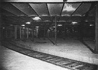
In the original configuration, two tracks came off each approach to join into a four-track line and then run under the main platforms in a two-track loop. These tracks were never put into service, and later became a parking lot
and bowling alley for employees.
, to the MBTA, though the BRA retained air rights over the station. Funding was obtained for a major renovation of the station that was completed in 1989. A total of 13 tracks became available, all with high level platforms and some capable of handling 12-car trains. Piers were installed for the eventual construction of an office building and bus station above the tracks. After some delays, an inter-city bus terminal opened in October 1995, replacing one on top of the I-93 Dewey Square Tunnel
diagonally across from the station between Summer Street and Congress Street. The new bus terminal has been called “the best bus facility in the country” and has direct ramp connections to I-93 and the Massachusetts Turnpike
(though there are two traffic lights in the outbound direction). The renovations, including the bus terminal, cost $195 million (2001 dollars).
The Red Line subway platforms were extended in 1985 to allow six-car trains, and renovated again in 2005 as part of the Silver Line Phase II project, which serves the waterfront and Logan Airport. The Phase II tunnel was constructed in conjunction with Boston's "Big Dig" and was originally referred to as the South Boston Piers Transitway. Phase II opened on Friday, December 17, 2004, with the first route running only to Silver Line Way. An new Phase I Silver Line route, the SL4 was added on October 13, 2009, with a stop across the street from South Station.
Phase III would build a tunnel connecting South Station with the Silver Line Phase I BRT service to Dudley Square
, Roxbury
. Currently, those wishing to take the Silver Line to Dudley Square can walk to the Atlantic Avenue side of South Station (by Track 1) and cross Atlantic Avenue to the Silver Line bus stop. T. F. Green Airport Station
in Rhode Island
is complete with limited service. An extension to Fall River
and New Bedford
, Massachusetts is being planned.
A proposed relocation of the Boston General Mail Facility would provide room for the addition of seven new tracks and would allow more MBTA Commuter Rail and Amtrak trains to use the station. In October 2010, the state of Massachusetts was awarded a US$32.5 million grant from the federal government to begin planning for this expansion.
Logan International Airport
General Edward Lawrence Logan International Airport is located in the East Boston neighborhood of Boston, Massachusetts . It covers , has six runways, and employs an estimated 16,000 people. It is the 19th busiest airport in the United States.Boston serves as a focus city for JetBlue Airways...
), located at the intersection of Atlantic Avenue
Atlantic Avenue (Boston)
Atlantic Avenue is a street in downtown Boston, Massachusetts, USA, partly serving as a frontage road for the underground Central Artery and partly running along the Boston Harbor...
and Summer Street
Summer Street (Boston)
Summer Street in Boston, Massachusetts extends from Downtown Crossing in the Financial District, over Fort Point Channel, and into South Boston...
in Dewey Square
Dewey Square
Dewey Square is a square in downtown Boston, Massachusetts, USA. It lies at the intersection of Atlantic Avenue, Summer Street, Federal Street, Purchase Street and Surface Artery, with the Central Artery passing underneath in the Dewey Square Tunnel and Big Dig...
, Boston, Massachusetts
Boston
Boston is the capital of and largest city in Massachusetts, and is one of the oldest cities in the United States. The largest city in New England, Boston is regarded as the unofficial "Capital of New England" for its economic and cultural impact on the entire New England region. The city proper had...
, is the largest train station
Train station
A train station, also called a railroad station or railway station and often shortened to just station,"Station" is commonly understood to mean "train station" unless otherwise qualified. This is evident from dictionary entries e.g...
and intercity bus terminal in Greater Boston
Greater Boston
Greater Boston is the area of the Commonwealth of Massachusetts surrounding the city of Boston. Due to ambiguity in usage, the size of the area referred to can be anywhere between that of the metropolitan statistical area of Boston and that of the city's combined statistical area which includes...
, a prominent train station in the northeastern United States and serves as a major intermodal
Intermodal passenger transport
Intermodal passenger transport involves more than one mode of transport of passengers. Some modes of transportation have always been intermodal; for example, most major airports have extensive facilities for automobile parking and have good rail or bus connections to the cities nearby. Urban bus...
domestic transportation hub, with service to the Greater Boston
Greater Boston
Greater Boston is the area of the Commonwealth of Massachusetts surrounding the city of Boston. Due to ambiguity in usage, the size of the area referred to can be anywhere between that of the metropolitan statistical area of Boston and that of the city's combined statistical area which includes...
region and the Midwestern and Northeastern United States.
Facilities
South Station's facilities and offerings include:- The northern terminus of AmtrakAmtrakThe National Railroad Passenger Corporation, doing business as Amtrak , is a government-owned corporation that was organized on May 1, 1971, to provide intercity passenger train service in the United States. "Amtrak" is a portmanteau of the words "America" and "track". It is headquartered at Union...
's Northeast CorridorNortheast CorridorThe Northeast Corridor is a fully electrified railway line owned primarily by Amtrak serving the Northeast megalopolis of the United States from Boston in the north, via New York to Washington, D.C. in the south, with branches serving other cities...
train service, including Acela ExpressAcela ExpressThe Acela Express is Amtrak's high-speed rail service along the Northeast Corridor in the Northeast United States between Washington, D.C., and Boston via Baltimore, Philadelphia, and New York...
high-speed trains and Northeast Regional local trains. There is also a daily Amtrak train to Albany, New YorkAlbany, New YorkAlbany is the capital city of the U.S. state of New York, the seat of Albany County, and the central city of New York's Capital District. Roughly north of New York City, Albany sits on the west bank of the Hudson River, about south of its confluence with the Mohawk River...
and ChicagoChicagoChicago is the largest city in the US state of Illinois. With nearly 2.7 million residents, it is the most populous city in the Midwestern United States and the third most populous in the US, after New York City and Los Angeles...
—the Lake Shore LimitedLake Shore LimitedThe Lake Shore Limited is a daily passenger train route operated by Amtrak in the Northeastern and Midwestern United States. The train runs between Chicago and Albany, NY, where it divides into two sections that provide thru-service to New York and Boston...
. - The city terminus of the southern and western routes of the Massachusetts Bay Transportation AuthorityMassachusetts Bay Transportation AuthorityThe Massachusetts Bay Transportation Authority, often referred to as the MBTA or simply The T, is the public operator of most bus, subway, commuter rail and ferry systems in the greater Boston, Massachusetts, area. Officially a "body politic and corporate, and a political subdivision" of the...
(MBTA) commuter railMBTA Commuter RailThe MBTA Commuter Rail serves as the regional rail arm of the Massachusetts Bay Transportation Authority, in the United States. It is operated under contract by the Massachusetts Bay Commuter Railroad Company a joint partnership of Veolia Transportation, Bombardier Transportation and Alternate...
system - A station stopSouth Station (MBTA subway station)South Station also known as South Station Under is a station on the MBTA Red Line subway and Silver Line bus rapid transit located at Summer Street and Atlantic Avenue in Boston. It is a part of the South Station complex, the second busiest transportation center in New England...
on the Boston subway's Red LineRed Line (MBTA)The Red Line is a rapid transit line operated by the MBTA running roughly north-south through Boston, Massachusetts into neighboring communities. The line begins west of Boston, in Cambridge, Massachusetts at Alewife station, near the intersection of Alewife Brook Parkway and Route 2...
to downtown Boston and its northwestern and southern suburbs. - The western terminus of Phase 2 of the Silver LineSilver Line (MBTA)The Silver Line is the only bus rapid transit line currently operated by the Massachusetts Bay Transportation Authority . It operates in two sections; the first runs from Dudley Square in Roxbury to downtown Boston, Massachusetts and South Station, mostly via Washington Street, with buses...
, with direct service to all Logan International AirportLogan International AirportGeneral Edward Lawrence Logan International Airport is located in the East Boston neighborhood of Boston, Massachusetts . It covers , has six runways, and employs an estimated 16,000 people. It is the 19th busiest airport in the United States.Boston serves as a focus city for JetBlue Airways...
terminals, the Boston Convention and Exhibition CenterBoston Convention and Exhibition CenterThe Boston Convention and Exhibition Center is the largest exhibition center in the Northeast United States, with some 516,000 square feet of contiguous exhibition space. It is located on Summer Street near the South Boston waterfront, Boston's World Trade Center, and across the harbor from Logan...
, the Boston Design center and the Black Falcon Cruise Ship Terminal. - The eastern terminus of the Silver Line Phase I SL4 line to Dudley Station
- Local bus service on lines 7, 11, 448, 449, 459
- Parking garage
- Staffed ticket windows
- 24-hour baggage assistance
- A 24-hour information booth
- A ClubAcela lounge with several complimentary services, similar to a typical airline lounge at Logan Airport.
- A food court, small shopping variety and waiting area, with typical train station concessions, such as Au Bon Pain, McDonald'sMcDonald'sMcDonald's Corporation is the world's largest chain of hamburger fast food restaurants, serving around 64 million customers daily in 119 countries. Headquartered in the United States, the company began in 1940 as a barbecue restaurant operated by the eponymous Richard and Maurice McDonald; in 1948...
and Rosetta StoneRosetta Stone (software)Rosetta Stone is proprietary computer-assisted language learning software developed by Rosetta Stone Inc. Both its title and logo refer to the Rosetta Stone, an artifact inscribed in multiple languages that helped Jean-François Champollion to decipher Ancient Egyptian hieroglyphs...
. - Public artPublic artThe term public art properly refers to works of art in any media that have been planned and executed with the specific intention of being sited or staged in the physical public domain, usually outside and accessible to all...
, including a sculpture built of railroadRail transportRail transport is a means of conveyance of passengers and goods by way of wheeled vehicles running on rail tracks. In contrast to road transport, where vehicles merely run on a prepared surface, rail vehicles are also directionally guided by the tracks they run on...
car couplerCoupling (railway)A coupling is a mechanism for connecting rolling stock in a train. The design of the coupler is standard, and is almost as important as the railway gauge, since flexibility and convenience are maximised if all rolling stock can be coupled together.The equipment that connects the couplings to the...
s and a model of the planet JupiterJupiterJupiter is the fifth planet from the Sun and the largest planet within the Solar System. It is a gas giant with mass one-thousandth that of the Sun but is two and a half times the mass of all the other planets in our Solar System combined. Jupiter is classified as a gas giant along with Saturn,...
, part of the Museum of Science'sMuseum of Science, BostonThe Museum of Science is a Boston, Massachusetts landmark, located in Science Park, a plot of land spanning the Charles River. Along with over 500 interactive exhibits, the Museum features a number of live presentations throughout the building every day, along with shows at the Charles Hayden...
scale model of the solar systemSolar system modelSolar System models, especially mechanical models, called orreries, that illustrate the relative positions and motions of the planets and moons in the Solar System have been built for centuries. While they often showed relative sizes, these models were usually not built to scale...
The station is accessible by the general public 24 hours a day, every day of the year.
Bus terminal
Boston's main inter-city bus terminal, the South Station Bus TerminalSouth Station Bus Terminal
The South Station Bus Terminal is the main gateway for interstate buses into Boston, Massachusetts. It is located at 700 Atlantic Avenue, at the intersection with Beach Street, in the Chinatown/Leather District neighborhoods. The facility is immediately south-southwest of the main MBTA/Amtrak...
is housed in a separate building built over the train platforms along Atlantic Avenue. The bus terminal hosts service by several bus companies to all of New England
New England
New England is a region in the northeastern corner of the United States consisting of the six states of Maine, New Hampshire, Vermont, Massachusetts, Rhode Island, and Connecticut...
, New York City
New York City
New York is the most populous city in the United States and the center of the New York Metropolitan Area, one of the most populous metropolitan areas in the world. New York exerts a significant impact upon global commerce, finance, media, art, fashion, research, technology, education, and...
, the Mid-Atlantic and Montreal
Montreal
Montreal is a city in Canada. It is the largest city in the province of Quebec, the second-largest city in Canada and the seventh largest in North America...
, Canada. It has its own concession area and can be accessed from the Track 1 platform or Atlantic Avenue.
North Station connections
Several MBTA commuter railMBTA Commuter Rail
The MBTA Commuter Rail serves as the regional rail arm of the Massachusetts Bay Transportation Authority, in the United States. It is operated under contract by the Massachusetts Bay Commuter Railroad Company a joint partnership of Veolia Transportation, Bombardier Transportation and Alternate...
lines, plus Amtrak's Downeaster
Downeaster
The Downeaster is a 116-mile regional passenger train service managed by the Northern New England Passenger Rail Authority and operated by Amtrak, connecting North Station in Boston, Massachusetts, to Portland, Maine...
service to Maine
Maine
Maine is a state in the New England region of the northeastern United States, bordered by the Atlantic Ocean to the east and south, New Hampshire to the west, and the Canadian provinces of Quebec to the northwest and New Brunswick to the northeast. Maine is both the northernmost and easternmost...
, originate from North Station, about 1¼ miles (2 km) around the Boston peninsula from South Station. Transfers from North Station to all other Amtrak trains and the MBTA Commuter Rail's Providence/Stoughton
Providence/Stoughton Line
The Providence/Stoughton Line is a line of the MBTA Commuter Rail system running southwest from Boston, Massachusetts, USA. The main line was originally built by the Boston and Providence Rail Road, and now carries service between Boston and T. F. Green Airport, Rhode Island...
, Needham
Needham Line
The Needham Line is a branch of the MBTA Commuter Rail system, running west from downtown Boston, Massachusetts through the Boston neighborhoods ofRoxbury,Jamaica Plain,Roslindale,West Roxbury, and the town ofNeedham....
, Franklin
Franklin Line
The Franklin Line of the MBTA Commuter Rail runs from Boston's South Station in a southwesterly direction toward Franklin, Massachusetts. Most Franklin Line trains connect to the Providence/Stoughton Line at Readville though some weekday trains use the Fairmount Line to access South Station...
and Framingham/Worcester
Framingham/Worcester Line
The Framingham/Worcester Line is a railroad line of the MBTA Commuter Rail system, running west from Boston, Massachusetts to Worcester, Massachusetts, though some trains terminate at Framingham, Massachusetts...
lines may be made at Back Bay
Back Bay (MBTA station)
Back Bay station, located at 145 Dartmouth Street, between Stuart Street and Columbus Avenue, is a train station in the Back Bay neighborhood of Boston...
(a one-seat ride on the Orange Line
Orange Line (MBTA)
The Orange Line is one of the four subway lines of the Massachusetts Bay Transportation Authority. It extends from Forest Hills in Jamaica Plain, Boston in the south to Oak Grove in Malden, Massachusetts in the north. It meets the Red Line at Downtown Crossing, the Blue Line at State, and the Green...
); transfers from the Fitchburg Line
Fitchburg Line
The Fitchburg Line is an MBTA line that runs from Boston's North Station to Fitchburg, Massachusetts. The line is along the tracks of the former Fitchburg Railroad, which was a railroad line across northern Massachusetts, United States, leading to and through the Hoosac Tunnel. It is one of the...
to South Station lines can be made at Porter
Porter (MBTA station)
Porter is a train station in Cambridge, Massachusetts. It is located at the intersection of Massachusetts Avenue and Somerville Avenue . It also serves portions of Somerville. The station was designed by Cambridge Seven Associates and opened on December 8, 1984. At 105 feet below ground, it is the...
on the Red Line; all other passengers have to change subway trains at either Park Street
Park Street (MBTA station)
Park Street is a rapid transit and light rail station of the MBTA subway system in Downtown Boston. One of the four subway hub stations, Park Street is a transfer point between the Green and Red Lines. Park Street is the fourth-busiest station in the MBTA network, with an average of 19,836 entries...
or Downtown Crossing
Downtown Crossing (MBTA station)
Downtown Crossing Station of the MBTA, located at the corner of Washington Street and Summer Street and the corner of Chauncey Street and Summer Street in Boston, is the main transfer point between the Orange Line and the Red Line....
stations. A North-South Rail Link
North-South Rail Link
The North–South Rail Link is a proposed pair of approximately 1.5 mile -long rail tunnels below downtown Boston, Massachusetts.The tunnels would serve the goals of better unification for Boston's separate northern and southern MBTA Commuter Rail terminals, and provide direct linkage between...
is proposed to unify the two halves of the rail system, but as of May 2006 the Commonwealth of Massachusetts has withdrawn its sponsorship of the proposal due to its high cost. The North-South Rail Link is not mentioned in the MBTA's FY2010–FY2014 Capital Investment Program. Currently passenger equipment is transferred between the two halves of the system via the Grand Junction Railroad
Grand Junction Railroad
The Grand Junction Railroad is an 8.55-mile long railroad in the Boston, Massachusetts area, connecting the railroads heading west and north from Boston...
, which is not used for passenger service.
Nearby attractions
- Boston South Postal Annex, with a post office that is almost never closed. (There is a passageway to it at the foot of Track 13.)
- Boston's financial districtFinancial District, Boston, MassachusettsThe Financial District of Boston, Massachusetts, United States is located in the downtown area near Government Center and Chinatown.Like many areas within Boston, the Financial District has no official definition. It is roughly bounded by Atlantic Avenue, State Street, and Devonshire Street...
including the Federal Reserve Bank BuildingFederal Reserve Bank Building (Boston)The Federal Reserve Bank Building is Boston's third tallest building. Located at Dewey Square, on the convergence of Fort Point and the Financial District neighborhoods. In close proximity are the Boston Harbor, the Fort Point Channel and major intermodal South Station terminal, the building is... - Boston Children's MuseumBoston Children's MuseumBoston Children's Museum is a children's museum in Boston, Massachusetts, dedicated to the education of children. Located on Children's Wharf along the Fort Point Channel, Boston Children's Museum is the second oldest children's museum in the United States...
- Boston Tea PartyBoston Tea PartyThe Boston Tea Party was a direct action by colonists in Boston, a town in the British colony of Massachusetts, against the British government and the monopolistic East India Company that controlled all the tea imported into the colonies...
Ships & Museum (undergoing renovation, due to reopen in Summer 2011) - Boston Convention and Exhibition CenterBoston Convention and Exhibition CenterThe Boston Convention and Exhibition Center is the largest exhibition center in the Northeast United States, with some 516,000 square feet of contiguous exhibition space. It is located on Summer Street near the South Boston waterfront, Boston's World Trade Center, and across the harbor from Logan...
, about a 15 minute walk east, or one can take the Silver Line to the World Trade CenterWorld Trade Center (MBTA station)The World Trade Center station is a transportation station in Boston, Massachusetts, on the MBTA's bus rapid transit Silver Line. The station is located on Congress Street at C Street/World Trade Center Avenue on the South Boston Waterfront...
stop. - Boston's Chinatown
- Boston HarborwalkBoston HarborwalkBoston HarborWalk is a public walkway that follows the edge of piers, wharves, beaches and shoreline around Boston Harbor. Plans call for it to extend a distance of from Chelsea Creek to the Neponset River, and it is about 80% complete...
- Boston's Theatre District
- Massachusetts TurnpikeMassachusetts TurnpikeThe Massachusetts Turnpike is the easternmost stretch of Interstate 90. The Turnpike begins at the western border of Massachusetts in West Stockbridge connecting with the Berkshire Connector portion of the New York State Thruway...
- Institute of Contemporary Art, Boston
- Rose Kennedy GreenwayRose Kennedy GreenwayThe Rose Kennedy Greenway is a roughly 1.5-mile-long long series of parks and public spaces being created in downtown Boston, Massachusetts, USA. It is the final part of the Big Dig that put Interstate 93 underground and removed the elevated freeway that served as the main highway through downtown...
- Rowes Wharf ferry terminal, several blocks north of the station
- Tufts UniversityTufts UniversityTufts University is a private research university located in Medford/Somerville, near Boston, Massachusetts. It is organized into ten schools, including two undergraduate programs and eight graduate divisions, on four campuses in Massachusetts and on the eastern border of France...
medical campus and Tufts Medical CenterTufts Medical CenterTufts Medical Center is a medical institution in Boston, Massachusetts occupying space between Chinatown and the Theater District....
hospital
Accessibility
- South Station is wheelchair accessible, but finding the elevator to the subway can be a bit tricky (it's in the corridor behind the information booth). There is another elevator directly outside the Dewey Square exit, but that elevator is often locked.
- Other Amtrak stations on the Northeast Corridor are generally accessible.
- Some MBTA commuter rail stations have no wheelchair access and many of those that do have short elevated platforms that only serve one or two cars, on the outbound end of the train. See MBTA accessibilityMBTA accessibilityPhysical accessibility on the Massachusetts Bay Transportation Authority system is incomplete but improving, with accessibility on all buses , all Orange Line stations, all but 2 Red Line stations, and all but 2 Blue Line stations...
.
Ridership
In the early 1900s, after the station first opened, heavy commuter ridership made it the busiest station in the world. However, massive cutbacks made by the bankrupt New Haven Railroad, and an increase in the popularity of automobile travel later left the station with far fewer riders than at that time.More recently, ridership has grown considerably, in part due to the reopening of Old Colony commuter rail service and the electrification
Railway electrification system
A railway electrification system supplies electrical energy to railway locomotives and multiple units as well as trams so that they can operate without having an on-board prime mover. There are several different electrification systems in use throughout the world...
of the Amtrak Northeast Corridor from New Haven to Boston, which allowed high speed Acela service. Of the eleven Amtrak stations in Massachusetts, South Station was again the busiest in FY2010, boarding or detraining an average of nearly 3,600 passengers daily.
South Station Ridership (passengers/year)
| Service | 1975 | 1990 | 2001 |
|---|---|---|---|
| Intercity rail | 537,000 | 839,000 | 1,060,000 |
| Commuter rail | 2,774,000 | 12,000,000 | 18,000,000 |
| Intercity Bus | n/a | n/a | 3,000,000 |
Need for a combined station
When the railroads serving Boston were first laid out and built, each one stopped at its own terminal. The four terminals serving the south-side railroads were as follows:- The New York and New England RailroadNew York and New England RailroadThe New York and New England Railroad was a major railroad connecting southern New York state with Hartford, Connecticut, Providence, Rhode Island and Boston, Massachusetts. It operated from 1873 to 1893. Prior to 1873 it was known as the Boston, Hartford and Erie Railroad, which had been formed by...
crossed the Fort Point ChannelFort Point ChannelFort Point Channel is a maritime channel separating South Boston from downtown Boston, Massachusetts, feeding into Boston Harbor. The south part of it has been gradually filled in for use by the South Bay rail yard and several highways...
from South Boston, just south of the present Summer Street Bridge, and terminated just east of Dewey SquareDewey SquareDewey Square is a square in downtown Boston, Massachusetts, USA. It lies at the intersection of Atlantic Avenue, Summer Street, Federal Street, Purchase Street and Surface Artery, with the Central Artery passing underneath in the Dewey Square Tunnel and Big Dig...
(right at the north end of today's South Station). - The Old Colony RailroadOld Colony RailroadThe Old Colony Railroad was a major railroad system, mainly covering southeastern Massachusetts and parts of Rhode Island. It operated from 1845 to 1893. Old Colony trains ran from Boston to points such as Plymouth, Fall River, New Bedford, Newport, Providence, Fitchburg, Lowell and Cape Cod...
had a long passenger terminal on the east side of South Street, stretching from Kneeland Street south to Harvard Street. This site is now part of the South Bay InterchangeSouth Bay InterchangeThe South Bay Interchange is a massive interchange in the South Bay region of Boston, Massachusetts, USA. The interchange consists of Interstate 90, the Mass Pike Extension, and the Interstate 93 concurrency with US 1 and MA 3 south of the Thomas P. O'Neill Jr. Tunnel.The interchange was...
, near the South Station bus terminal. - The Boston and Albany RailroadBoston and Albany RailroadThe Boston and Albany Railroad was a railroad connecting Boston, Massachusetts to Albany, New York, later becoming part of the New York Central Railroad system, Conrail and CSX. The line is used by CSX for freight...
's passenger terminal was in the block bounded by Kneeland Street, Beach Street, Albany Street (now Surface Artery) and Lincoln Street. This later became a freight house, and is now a block in Chinatown; the passenger terminal was moved to the west side of Utica Street, from Kneeland Street south to a bit past Harvard Street, now part of the South Bay InterchangeSouth Bay InterchangeThe South Bay Interchange is a massive interchange in the South Bay region of Boston, Massachusetts, USA. The interchange consists of Interstate 90, the Mass Pike Extension, and the Interstate 93 concurrency with US 1 and MA 3 south of the Thomas P. O'Neill Jr. Tunnel.The interchange was...
. - The Boston and Providence Railroad continued straight where it now merges with the Boston and Albany, terminating at Park SquarePark Square (Boston)Park Square in downtown Boston, Massachusetts is bounded by Stuart, Charles, Boylston, and Arlington Streets. It is the home of the Boston Four Seasons Hotel and the Boston Park Plaza Hotel & Towers. Across Boylston Street is the Boston Public Garden...
, with the passenger terminal on the south side of Providence Street from Columbus Avenue west about two-thirds of the way to Berkeley Street.
South Station combined the four terminals in one spot (a union station
Union station
A union station is the term used for a train station where tracks and facilities are shared by two or more railway companies, allowing passengers to connect conveniently between them...
).
Opening
Shepley, Rutan and Coolidge
Shepley, Rutan and Coolidge was a successful architecture firm based in Boston, Massachusetts, operating between 1886 and 1915, with extensive commissions in monumental civic and collegiate architecture in the spirit and style of Henry Hobson Richardson....
of Boston, with the actual construction undertaken by the engineering firm of Westinghouse, Church, Kerr & Co. It became the busiest station in the country by 1910. A station on the Atlantic Avenue Elevated
Atlantic Avenue Elevated
The Atlantic Avenue Elevated was an elevated railway around the east side of downtown Boston, Massachusetts, providing a second route for the Boston Elevated Railway's Main Line around the Washington Street Tunnel...
served the station from 1901 to 1938; what is now the Red Line subway was extended from Park Street
Park Street (MBTA station)
Park Street is a rapid transit and light rail station of the MBTA subway system in Downtown Boston. One of the four subway hub stations, Park Street is a transfer point between the Green and Red Lines. Park Street is the fourth-busiest station in the MBTA network, with an average of 19,836 entries...
to South Station in 1913. The train shed, one of the largest in the world, was eliminated in a 1930 renovation due to corrosion from the nearby ocean's salt air. While the station handled 125,000 passengers each day during World War II
World War II
World War II, or the Second World War , was a global conflict lasting from 1939 to 1945, involving most of the world's nations—including all of the great powers—eventually forming two opposing military alliances: the Allies and the Axis...
, after the war passenger rail declined in the U.S. In 1959, the Old Colony Railroad
Old Colony Railroad
The Old Colony Railroad was a major railroad system, mainly covering southeastern Massachusetts and parts of Rhode Island. It operated from 1845 to 1893. Old Colony trains ran from Boston to points such as Plymouth, Fall River, New Bedford, Newport, Providence, Fitchburg, Lowell and Cape Cod...
, which served the South Shore and Cape Cod
Cape Cod
Cape Cod, often referred to locally as simply the Cape, is a cape in the easternmost portion of the state of Massachusetts, in the Northeastern United States...
, stopped passenger service. The New York, New Haven and Hartford Railroad
New York, New Haven and Hartford Railroad
The New York, New Haven and Hartford Railroad , was a railroad that operated in the northeast United States from 1872 to 1968 which served the states of Connecticut, New York, Rhode Island, and Massachusetts...
went bankrupt
Bankruptcy
Bankruptcy is a legal status of an insolvent person or an organisation, that is, one that cannot repay the debts owed to creditors. In most jurisdictions bankruptcy is imposed by a court order, often initiated by the debtor....
in 1961. South Station was sold to the Boston Redevelopment Authority
Boston Redevelopment Authority
The Boston Redevelopment Authority is the municipal planning and development agency for Boston, working on both housing and commercial developments.The BRA was established by the Boston city council and the Massachusetts legislature in 1957...
(BRA) in 1965. Portions of the station were demolished and the land was used to build the Boston South Postal Annex and the Stone and Webster building.
In the original configuration, two tracks came off each approach to join into a four-track line and then run under the main platforms in a two-track loop. These tracks were never put into service, and later became a parking lot
Parking lot
A parking lot , also known as car lot, is a cleared area that is intended for parking vehicles. Usually, the term refers to a dedicated area that has been provided with a durable or semi-durable surface....
and bowling alley for employees.
Renovation
In 1978, the BRA sold what was left of the station, now on the National Register of Historic PlacesNational Register of Historic Places
The National Register of Historic Places is the United States government's official list of districts, sites, buildings, structures, and objects deemed worthy of preservation...
, to the MBTA, though the BRA retained air rights over the station. Funding was obtained for a major renovation of the station that was completed in 1989. A total of 13 tracks became available, all with high level platforms and some capable of handling 12-car trains. Piers were installed for the eventual construction of an office building and bus station above the tracks. After some delays, an inter-city bus terminal opened in October 1995, replacing one on top of the I-93 Dewey Square Tunnel
Dewey Square Tunnel
The Dewey Square Tunnel in Boston, Massachusetts, is part of Interstate 93 , running under the heart of the city's financial district, including Dewey Square...
diagonally across from the station between Summer Street and Congress Street. The new bus terminal has been called “the best bus facility in the country” and has direct ramp connections to I-93 and the Massachusetts Turnpike
Massachusetts Turnpike
The Massachusetts Turnpike is the easternmost stretch of Interstate 90. The Turnpike begins at the western border of Massachusetts in West Stockbridge connecting with the Berkshire Connector portion of the New York State Thruway...
(though there are two traffic lights in the outbound direction). The renovations, including the bus terminal, cost $195 million (2001 dollars).
The Red Line subway platforms were extended in 1985 to allow six-car trains, and renovated again in 2005 as part of the Silver Line Phase II project, which serves the waterfront and Logan Airport. The Phase II tunnel was constructed in conjunction with Boston's "Big Dig" and was originally referred to as the South Boston Piers Transitway. Phase II opened on Friday, December 17, 2004, with the first route running only to Silver Line Way. An new Phase I Silver Line route, the SL4 was added on October 13, 2009, with a stop across the street from South Station.
Future
Planned system improvements should result in additional passenger traffic. Silver LineSilver Line (MBTA)
The Silver Line is the only bus rapid transit line currently operated by the Massachusetts Bay Transportation Authority . It operates in two sections; the first runs from Dudley Square in Roxbury to downtown Boston, Massachusetts and South Station, mostly via Washington Street, with buses...
Phase III would build a tunnel connecting South Station with the Silver Line Phase I BRT service to Dudley Square
Dudley Square
Dudley Square is the primary commercial center of the Roxbury neighborhood of Boston, Massachusetts, located at the intersection of Dudley Street and Washington Street...
, Roxbury
Roxbury, Massachusetts
Roxbury is a dissolved municipality and current neighborhood of Boston, Massachusetts, United States. It was one of the first towns founded in the Massachusetts Bay Colony in 1630, and became a city in 1846 until annexed to Boston on January 5, 1868...
. Currently, those wishing to take the Silver Line to Dudley Square can walk to the Atlantic Avenue side of South Station (by Track 1) and cross Atlantic Avenue to the Silver Line bus stop. T. F. Green Airport Station
T. F. Green Airport (MBTA station)
T. F. Green Airport is a train station and intermodal facility in Warwick, Rhode Island on the Northeast Corridor, adjacent to T. F. Green Airport...
in Rhode Island
Rhode Island
The state of Rhode Island and Providence Plantations, more commonly referred to as Rhode Island , is a state in the New England region of the United States. It is the smallest U.S. state by area...
is complete with limited service. An extension to Fall River
Fall River, Massachusetts
Fall River is a city in Bristol County, Massachusetts, in the United States. It is located about south of Boston, southeast of Providence, Rhode Island, and west of New Bedford and south of Taunton. The city's population was 88,857 during the 2010 census, making it the tenth largest city in...
and New Bedford
New Bedford, Massachusetts
New Bedford is a city in Bristol County, Massachusetts, United States, located south of Boston, southeast of Providence, Rhode Island, and about east of Fall River. As of the 2010 census, the city had a total population of 95,072, making it the sixth-largest city in Massachusetts...
, Massachusetts is being planned.
A proposed relocation of the Boston General Mail Facility would provide room for the addition of seven new tracks and would allow more MBTA Commuter Rail and Amtrak trains to use the station. In October 2010, the state of Massachusetts was awarded a US$32.5 million grant from the federal government to begin planning for this expansion.
See also
- Atlantic Avenue ElevatedAtlantic Avenue ElevatedThe Atlantic Avenue Elevated was an elevated railway around the east side of downtown Boston, Massachusetts, providing a second route for the Boston Elevated Railway's Main Line around the Washington Street Tunnel...
- Fort Point ChannelFort Point ChannelFort Point Channel is a maritime channel separating South Boston from downtown Boston, Massachusetts, feeding into Boston Harbor. The south part of it has been gradually filled in for use by the South Bay rail yard and several highways...
- North Station
- North-South Rail LinkNorth-South Rail LinkThe North–South Rail Link is a proposed pair of approximately 1.5 mile -long rail tunnels below downtown Boston, Massachusetts.The tunnels would serve the goals of better unification for Boston's separate northern and southern MBTA Commuter Rail terminals, and provide direct linkage between...
- South Station Bus TerminalSouth Station Bus TerminalThe South Station Bus Terminal is the main gateway for interstate buses into Boston, Massachusetts. It is located at 700 Atlantic Avenue, at the intersection with Beach Street, in the Chinatown/Leather District neighborhoods. The facility is immediately south-southwest of the main MBTA/Amtrak...
- South Station (MBTA subway station)South Station (MBTA subway station)South Station also known as South Station Under is a station on the MBTA Red Line subway and Silver Line bus rapid transit located at Summer Street and Atlantic Avenue in Boston. It is a part of the South Station complex, the second busiest transportation center in New England...
Further reading
External links
(with event listings)- MBTA Boston South Station
- Proposed South Station office tower
- Boston South Amtrak Station (USA RailGuide -- TrainWeb)
- "South Station, November 22, 1965"—photograph, Railroad History Archive, University of ConnecticutUniversity of ConnecticutThe admission rate to the University of Connecticut is about 50% and has been steadily decreasing, with about 28,000 prospective students applying for admission to the freshman class in recent years. Approximately 40,000 prospective students tour the main campus in Storrs annually...
Libraries Collection. - Google MapsGoogle MapsGoogle Maps is a web mapping service application and technology provided by Google, free , that powers many map-based services, including the Google Maps website, Google Ride Finder, Google Transit, and maps embedded on third-party websites via the Google Maps API...
Street ViewsGoogle Street ViewGoogle Street View is a technology featured in Google Maps and Google Earth that provides panoramic views from various positions along many streets in the world...
: