
South Ronaldsay
Encyclopedia
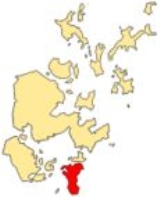
South Ronaldsay is one of the Orkney Islands
off the north coast of Scotland
. It is linked to the Orkney Mainland by the Churchill Barriers
, running via Burray
, Glimps Holm and Lamb Holm
.
, Hoy
and Sanday
. Ferries
sail from Burwick on the island to John o' Groats
on the Scottish mainland and from St Margaret's Hope
to Gills Bay
.
South Ronaldsay's main village
is St Margaret's Hope
, Orkney's third largest settlement. It is named either after Margaret, Maid of Norway
, the heir to the Scottish throne who died in Orkney age seven or possibly St. Margaret
. The village has a small blacksmith's museum
and is known for its annual Boys' Ploughing Match. During this event young girls dressed in dark jackets play the part of the horses and young boys using miniature ploughs compete with one another at ploughing furrows in the nearby sands.
The cardinal points of the island are Ayre
of Cara, by Churchill Barrier no. 4 (north), Grim Ness
(east), Brough Ness, (south) and Hoxa Head, (west). The highest elevation is Ward Hill, which reaches 118 metres (387 ft). This name is common one in Orkney for the highest point on an island and comes from the historic use of these places used for the lighting of warning beacons
.
 The island
is known for the Neolithic
Isbister Chambered Cairn, popularly known as the "Tomb of the Eagles
". Discovered by Ronald Simison in 1958 in the south east of the island, 16,000 human bones and 725 bird bones were found at the site, the latter predominantly belonging to the White-tailed Sea Eagle (Haliaeetus albicilla). The evidence suggests that the human bodies had been exposed to the elements to remove the flesh before burial. The tomb was in continuous use for a millennium or more.
The burnt mound
at nearby Liddle, discovered by Simison in 1972, is the best example of a Bronze Age
cooking place in Orkney. Made of flat slabs originally sealed with clay, the central stone trough would have been filled with water heated by stones using peat
as a fuel. The building was probably roofless.
There is a broch
site at Howe of Hoxa in the north west that may have been the burial place of Thorfinn "Skullsplitter"
.
conquest of Orkney. They were: Sant Androis at Woundwick, Our Ladie at Halcro, Sant Colmis at Loch of Burwick, Ruid chappell in Sandwick, Sant Tola [Olaf] in Wydwall, Sant Colme in Hoxay, Sant Margrat in the Howp, Sant Colmeis in Grymnes and Sant Ninian in Stow. The locations are all known although little physical evidence remains in several cases.
In the late seventeenth century South Ronaldsay was described as "fertile in Corns and abounding with People". Murdoch MacKenzie’s 1750 map of the island indicates the site of lead
workings near Grimness and a visitor in 1774 "saw several deep holes which I was informed were sunk in search of Lead ore" although only small quantities were mined.
By the late eighteenth century South Ronaldsay was divided into two unequally sized parishes, St. Peter’s covered the northern two thirds of the island while St. Mary’s formed the southern third. St. Peter’s church has a date stone of 1642 and appears on Blaeu's
1654 map. By 1793 the building had no roof and was "exposed to all the winds of heaven" but as probably repaired by 1801. A Pict
ish symbol stone was discovered in a window in the church. On one face of the slab is a mirror-case underlying part of an undecorated crescent and V-rod and on the other a crescent and V-rod, ornamented with scrollwork, below a decorated panel.
During the 19th century the island's economy benefited from the herring fishing industry and St Margaret's Hope became the main trading centre for the South Isles. In 1890 there were 20 shops and 18 tradesmen located there.
Tomison's Academy was founded by William Tomison, a native of the island who became Governor of the Hudson's Bay Company
. When it opened it had 170 pupils but the school closed in the 1960s. Tomison is buried nearby in the grounds of his former home, Dundas House.
 In 1991, the island was rocked by false allegations of widespread child abuse
and satanic rituals in a scandal that saw nine children being removed from their families by police and social workers. The case was thrown out of court when it was found the social workers were using unorthodox interrogation techniques to force confessions from the children, who all denied the abuse.
There are many well-preserved houses and other structures in the local vernacular style.
covers both South Ronaldsay and Burray.
, a sub-species of the common vole
found only in the Orkney islands. Larger than the common vole, it resembles the field vole
but has shorter, paler fur.
The Orkney voles were introduced to the archipelago
in Neolithic times. The oldest known radiocarbon-dated fossil of the Orkney vole is 4600 years BP, which marks the earliest possible date of introduction.
Orkney Islands
Orkney also known as the Orkney Islands , is an archipelago in northern Scotland, situated north of the coast of Caithness...
off the north coast of Scotland
Scotland
Scotland is a country that is part of the United Kingdom. Occupying the northern third of the island of Great Britain, it shares a border with England to the south and is bounded by the North Sea to the east, the Atlantic Ocean to the north and west, and the North Channel and Irish Sea to the...
. It is linked to the Orkney Mainland by the Churchill Barriers
Churchill Barriers
The Churchill Barriers are a series of four causeways in the Orkney Islands, Scotland, with a total length of 1.5 miles . They link the Orkney Mainland in the north to the island of South Ronaldsay via Burray and the two smaller islands of Lamb Holm and Glimps Holm.The barriers were built in the...
, running via Burray
Burray
Burray is one of the Orkney Islands in Scotland. It lies to the east of Scapa Flow and is one of a chain of islands linked by the Churchill Barriers.-Geography and geology:...
, Glimps Holm and Lamb Holm
Lamb Holm
Lamb Holm is a small uninhabited island in Orkney, Scotland. The remarkable Italian Chapel, constructed during the Second World War, is the island's main attraction.-Geography:...
.
Geography and geology
With an area of 4980 hectares (19.2 sq mi), it is the fourth largest of the Orkney islands after The MainlandThe Mainland, Orkney
The Mainland is the main island of Orkney, Scotland. Both of Orkney's burghs, Kirkwall and Stromness, lie on the island, which is also the heart of Orkney's ferry and air connections....
, Hoy
Hoy
Hoy is an island in Orkney, Scotland. With an area of it is the second largest in the archipelago after the Mainland. It is connected by a causeway called The Ayre to South Walls...
and Sanday
Sanday, Orkney
Sanday is one of the inhabited islands in the Orkney Islands, off the north coast of Scotland. With an area of , it is the third largest of the Orkney Islands. The main centres of population are Lady Village and Kettletoft. Sanday can be reached by Orkney Ferries or plane from Kirkwall on the...
. Ferries
Ferry
A ferry is a form of transportation, usually a boat, but sometimes a ship, used to carry primarily passengers, and sometimes vehicles and cargo as well, across a body of water. Most ferries operate on regular, frequent, return services...
sail from Burwick on the island to John o' Groats
John o' Groats
John o' Groats is a village in the Highland council area of Scotland. Part of the county of Caithness, John o' Groats is popular with tourists because it is usually regarded as the most northerly settlement of mainland Great Britain, although this is not a claim made by the inhabitants...
on the Scottish mainland and from St Margaret's Hope
St Margaret's Hope
St Margaret's Hope, known locally as The Hope , is a village in the Orkney Islands, situated off the north-east coast of Scotland. It has a population of about 550, making it Orkney's third largest settlement after Kirkwall and Stromness....
to Gills Bay
Gills Bay
Gills Bay, which is situated some 3mls. West of John o' Groats with the community of Gills close by, has one of the longest stretches of low-lying rock coast on the northern shores of Caithness. Its main features are a small harbour and the pier used as the mainland terminal for Pentland Ferries...
.
South Ronaldsay's main village
Village
A village is a clustered human settlement or community, larger than a hamlet with the population ranging from a few hundred to a few thousand , Though often located in rural areas, the term urban village is also applied to certain urban neighbourhoods, such as the West Village in Manhattan, New...
is St Margaret's Hope
St Margaret's Hope
St Margaret's Hope, known locally as The Hope , is a village in the Orkney Islands, situated off the north-east coast of Scotland. It has a population of about 550, making it Orkney's third largest settlement after Kirkwall and Stromness....
, Orkney's third largest settlement. It is named either after Margaret, Maid of Norway
Margaret, Maid of Norway
Margaret , usually known as the Maid of Norway , sometimes known as Margaret of Scotland , was a Norwegian princess who was Queen of Scots from 1286 until her death...
, the heir to the Scottish throne who died in Orkney age seven or possibly St. Margaret
Saint Margaret of Scotland
Saint Margaret of Scotland , also known as Margaret of Wessex and Queen Margaret of Scotland, was an English princess of the House of Wessex. Born in exile in Hungary, she was the sister of Edgar Ætheling, the short-ruling and uncrowned Anglo-Saxon King of England...
. The village has a small blacksmith's museum
Museum
A museum is an institution that cares for a collection of artifacts and other objects of scientific, artistic, cultural, or historical importance and makes them available for public viewing through exhibits that may be permanent or temporary. Most large museums are located in major cities...
and is known for its annual Boys' Ploughing Match. During this event young girls dressed in dark jackets play the part of the horses and young boys using miniature ploughs compete with one another at ploughing furrows in the nearby sands.
The cardinal points of the island are Ayre
Ayre (landform)
An ayre is a name often applied to shingle beaches in Orkney and Shetland. The term is derived from the Old Norse wordfor a shingle beach - "eyrr" - and may be applied to ordinary beaches, to cliff-foot beaches to spits, bars and tombolos, but only if formed of shingle. It is sometimes wrongly...
of Cara, by Churchill Barrier no. 4 (north), Grim Ness
Grim Ness
Grim Ness is a cliff-girt headland on the island of South Ronaldsay, in the Orkney archipelago of Scotland. It is located between Honeysgeo and Skipi Geo and rises to a height of 34 metres above sea level. There is a trig point at the summit. The name is from the Old Norse and means Grim's headland...
(east), Brough Ness, (south) and Hoxa Head, (west). The highest elevation is Ward Hill, which reaches 118 metres (387 ft). This name is common one in Orkney for the highest point on an island and comes from the historic use of these places used for the lighting of warning beacons
Beacon
A beacon is an intentionally conspicuous device designed to attract attention to a specific location.Beacons can also be combined with semaphoric or other indicators to provide important information, such as the status of an airport, by the colour and rotational pattern of its airport beacon, or of...
.
Prehistory
Island
An island or isle is any piece of sub-continental land that is surrounded by water. Very small islands such as emergent land features on atolls can be called islets, cays or keys. An island in a river or lake may be called an eyot , or holm...
is known for the Neolithic
Neolithic
The Neolithic Age, Era, or Period, or New Stone Age, was a period in the development of human technology, beginning about 9500 BC in some parts of the Middle East, and later in other parts of the world. It is traditionally considered as the last part of the Stone Age...
Isbister Chambered Cairn, popularly known as the "Tomb of the Eagles
Tomb of the Eagles
Located on at cliff edge at Isbister on South Ronaldsay in Orkney, Scotland, the Tomb of the Eagles is a Neolithic chambered tomb. First explored by Ronald Simison in 1958, he conducted his own excavations at the site in 1976...
". Discovered by Ronald Simison in 1958 in the south east of the island, 16,000 human bones and 725 bird bones were found at the site, the latter predominantly belonging to the White-tailed Sea Eagle (Haliaeetus albicilla). The evidence suggests that the human bodies had been exposed to the elements to remove the flesh before burial. The tomb was in continuous use for a millennium or more.
The burnt mound
Liddle Burnt Mound
Liddle Burnt Mound is a Bronze Age site on the island of South Ronaldsay, Orkney. The site consists of the remains of a building and a mound that surrounds it on three sides...
at nearby Liddle, discovered by Simison in 1972, is the best example of a Bronze Age
Bronze Age
The Bronze Age is a period characterized by the use of copper and its alloy bronze as the chief hard materials in the manufacture of some implements and weapons. Chronologically, it stands between the Stone Age and Iron Age...
cooking place in Orkney. Made of flat slabs originally sealed with clay, the central stone trough would have been filled with water heated by stones using peat
Peat
Peat is an accumulation of partially decayed vegetation matter or histosol. Peat forms in wetland bogs, moors, muskegs, pocosins, mires, and peat swamp forests. Peat is harvested as an important source of fuel in certain parts of the world...
as a fuel. The building was probably roofless.
There is a broch
Broch
A broch is an Iron Age drystone hollow-walled structure of a type found only in Scotland. Brochs include some of the most sophisticated examples of drystone architecture ever created, and belong to the classification "complex Atlantic Roundhouse" devised by Scottish archaeologists in the 1980s....
site at Howe of Hoxa in the north west that may have been the burial place of Thorfinn "Skullsplitter"
Thorfinn Turf-Einarsson, Earl of Orkney
Thorfinn 'Skullsplitter' Hausakljufr was earl of Orkney. He was the youngest son of Torf-Einarr. Thorfinn married Grelod, daughter of the Mormaer of Caithness and granddaughter of Thorstein the Red. Thorfinn and Grelod had five sons and two daughters...
.
History
In 1627 nine chapels were recorded on the island with some of the names hinting at the existence of Christian worship prior to the NorseViking
The term Viking is customarily used to refer to the Norse explorers, warriors, merchants, and pirates who raided, traded, explored and settled in wide areas of Europe, Asia and the North Atlantic islands from the late 8th to the mid-11th century.These Norsemen used their famed longships to...
conquest of Orkney. They were: Sant Androis at Woundwick, Our Ladie at Halcro, Sant Colmis at Loch of Burwick, Ruid chappell in Sandwick, Sant Tola [Olaf] in Wydwall, Sant Colme in Hoxay, Sant Margrat in the Howp, Sant Colmeis in Grymnes and Sant Ninian in Stow. The locations are all known although little physical evidence remains in several cases.
In the late seventeenth century South Ronaldsay was described as "fertile in Corns and abounding with People". Murdoch MacKenzie’s 1750 map of the island indicates the site of lead
Lead
Lead is a main-group element in the carbon group with the symbol Pb and atomic number 82. Lead is a soft, malleable poor metal. It is also counted as one of the heavy metals. Metallic lead has a bluish-white color after being freshly cut, but it soon tarnishes to a dull grayish color when exposed...
workings near Grimness and a visitor in 1774 "saw several deep holes which I was informed were sunk in search of Lead ore" although only small quantities were mined.
By the late eighteenth century South Ronaldsay was divided into two unequally sized parishes, St. Peter’s covered the northern two thirds of the island while St. Mary’s formed the southern third. St. Peter’s church has a date stone of 1642 and appears on Blaeu's
Willem Blaeu
Willem Janszoon Blaeu , also abbreviated to Willem Jansz. Blaeu, was a Dutch cartographer, atlas maker and publisher....
1654 map. By 1793 the building had no roof and was "exposed to all the winds of heaven" but as probably repaired by 1801. A Pict
PICT
PICT is a graphics file format introduced on the original Apple Macintosh computer as its standard metafile format. It allows the interchange of graphics , and some limited text support, between Mac applications, and was the native graphics format of QuickDraw.The original version, PICT 1, was...
ish symbol stone was discovered in a window in the church. On one face of the slab is a mirror-case underlying part of an undecorated crescent and V-rod and on the other a crescent and V-rod, ornamented with scrollwork, below a decorated panel.
During the 19th century the island's economy benefited from the herring fishing industry and St Margaret's Hope became the main trading centre for the South Isles. In 1890 there were 20 shops and 18 tradesmen located there.
Tomison's Academy was founded by William Tomison, a native of the island who became Governor of the Hudson's Bay Company
Hudson's Bay Company
The Hudson's Bay Company , abbreviated HBC, or "The Bay" is the oldest commercial corporation in North America and one of the oldest in the world. A fur trading business for much of its existence, today Hudson's Bay Company owns and operates retail stores throughout Canada...
. When it opened it had 170 pupils but the school closed in the 1960s. Tomison is buried nearby in the grounds of his former home, Dundas House.
South Ronaldsay child abuse scandal
The South Ronaldsay child abuse scandal began on February 27, 1991 when social workers and police removed nine children belonging to four families from their homes on the remote Orkney, Scotland island South Ronaldsay in dawn raids, following suspicions of ritualistic Satanic child abuse. The nine...
and satanic rituals in a scandal that saw nine children being removed from their families by police and social workers. The case was thrown out of court when it was found the social workers were using unorthodox interrogation techniques to force confessions from the children, who all denied the abuse.
There are many well-preserved houses and other structures in the local vernacular style.
Local politics
The island is part of the "East Mainland, South Ronaldsay and Burray" ward, represented on the Orkney Islands Council by three independent councillors. The local community councilCommunity council
A community council is a public representative body in Great Britain.In England they may be statutory parish councils by another name, under the Local Government and Public Involvement in Health Act 2007, or they may be non-statutory bodies...
covers both South Ronaldsay and Burray.
Natural history
Microtus arvalis ronaldshaiensis is one of five varieties of the Orkney voleOrkney vole
The Orkney vole is a population of the common vole found in the Orkney Islands, off the northern coast of Scotland, United Kingdom. Orkney voles are larger than voles from other populations of the common vole...
, a sub-species of the common vole
Common Vole
The Common Vole, Microtus arvalis, is a European mammal.- Distribution and habitat :The common vole is hardly restricted in means of distribution and habitat and inhabits large areas of Eurasia. As Microtus arvalis followed human civilisation, primary and secondary habitats can be distinguished...
found only in the Orkney islands. Larger than the common vole, it resembles the field vole
Field Vole
The field vole or short-tailed vole, Microtus agrestis, is a grey-brown vole, around 110mm in length, with only a short tail. They are one of the most common mammals in Europe, ranging from the Atlantic coast to Lake Baikal. They are found in moist grassy habitats, such as woodland, marsh, or...
but has shorter, paler fur.
The Orkney voles were introduced to the archipelago
Archipelago
An archipelago , sometimes called an island group, is a chain or cluster of islands. The word archipelago is derived from the Greek ἄρχι- – arkhi- and πέλαγος – pélagos through the Italian arcipelago...
in Neolithic times. The oldest known radiocarbon-dated fossil of the Orkney vole is 4600 years BP, which marks the earliest possible date of introduction.
See also
- List of Orkney Islands
- Alexander CarrickAlexander CarrickAlexander Carrick 1882–1966 was one of Scotland’s leading monumental sculptors of the early part of the 20th century. He was responsible for many architectural and ecclesiastical works as well as many war memorials executed in the period following World War I...
, sculptor of war memorial and linked to Saint Margaret's Hope - Clive StruttClive StruttClive Edward Hazzard Strutt is an English composer born 19th April 1942 in Aldershot, Hampshire, England. He was educated at Farnborough Grammar School....
, resident composer
Further reading
- Barthelmess, Isle Barbette (2004) A Celebration of Sunrise at the Tomb of the Eagles. Orkney Museums and Heritage. ISBN 0-954882-0-8
- Picken, Stuart D.B.,The Soul of an Orkney Parish, The Kirkwell Press, Kirkwell, 1972.