

Son River
Encyclopedia
- This is about the river in IndiaIndiaIndia , officially the Republic of India , is a country in South Asia. It is the seventh-largest country by geographical area, the second-most populous country with over 1.2 billion people, and the most populous democracy in the world...
, for a river in VietnamVietnamVietnam – sometimes spelled Viet Nam , officially the Socialist Republic of Vietnam – is the easternmost country on the Indochina Peninsula in Southeast Asia. It is bordered by China to the north, Laos to the northwest, Cambodia to the southwest, and the South China Sea –...
, see Son River (Vietnam)Son River (Vietnam)Son River or Troc River is a tributary of Gianh River in Quang Binh Province, Bac Trung Bo, Vietnam. This river runs in the territory of Quang Binh Province. The upstream of this river with the length of 7729 m runs underground in limestone mountains of Phong Nha-Ke Bang National Park.....
.
Son River (also spelt Sone) of central India
India
India , officially the Republic of India , is a country in South Asia. It is the seventh-largest country by geographical area, the second-most populous country with over 1.2 billion people, and the most populous democracy in the world...
is the largest of the Ganges' southern tributaries. A British 1850s diary shows that the river was written in English as Soane.
Course
Amarkantak
Amarkantak is a pilgrim town and a nagar panchayat in Anuppur District in the state of Madhya Pradesh, India. Also called "Teerthraj" , Amarkantak region is a unique natural heritage area and is the meeting point of the Vindhyas and the Satpuras, with the Maikal Hills being the fulcrum...
in Madhya Pradesh
Madhya Pradesh
Madhya Pradesh , often called the Heart of India, is a state in central India. Its capital is Bhopal and Indore is the largest city....
, just east of the headwater of the Narmada River
Narmada River
The Narmada , also called Rewa is a river in central India and the fifth largest river in the Indian subcontinent. It is the third largest river that completely flows within India after Ganges and Godavari...
, and flows north-northwest through Madhya Pradesh state before turning sharply eastward where it encounters the southwest-northeast-running Kaimur Range. The Son parallels the Kaimur hills, flowing east-northeast through Uttar Pradesh
Uttar Pradesh
Uttar Pradesh abbreviation U.P. , is a state located in the northern part of India. With a population of over 200 million people, it is India's most populous state, as well as the world's most populous sub-national entity...
, Jharkhand
Jharkhand
Jharkhand is a state in eastern India. It was carved out of the southern part of Bihar on 15 November 2000. Jharkhand shares its border with the states of Bihar to the north, Uttar Pradesh and Chhattisgarh to the west, Orissa to the south, and West Bengal to the east...
and Bihar
Bihar
Bihar is a state in eastern India. It is the 12th largest state in terms of geographical size at and 3rd largest by population. Almost 58% of Biharis are below the age of 25, which is the highest proportion in India....
states to join the Ganges just above Patna
Patna
Paṭnā , is the capital of the Indian state of Bihar and the second largest city in Eastern India . Patna is one of the oldest continuously inhabited places in the world...
. Geologically, the lower valley of the Son is an extension of the Narmada Valley, and the Kaimur Range an extension of the Vindhya Range
Vindhya Range
The Vindhya Range is a range of older rounded mountains and hills in the west-central Indian subcontinent, which geographically separates the Indian subcontinent into northern India and Southern India.- Introduction :...
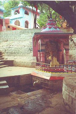
. Dehri on sone is the major town situated on Sone River.
The Son river at 784 kilometres (487.2 mi) long, is one of the largest rivers of India. Its chief tributaries are the Rihand
Rihand River
The Rihand River is a tributary of the Son River and flows through the Indian states of Chhattisgarh and Uttar Pradesh.-Course:...
and the North Koel
Koel River
South Koel River runs across Jharkhand and Orissa states in India. It originates on the Ranchi plateau a few miles east of Ranchi, and conjoins the Belsiangar and Singbum Rivers. The Koel is fed by three streams in Jharkhand, namely the North Karo, South Karo and Koina...
. The Son has a steep gradient
Gradient
In vector calculus, the gradient of a scalar field is a vector field that points in the direction of the greatest rate of increase of the scalar field, and whose magnitude is the greatest rate of change....
(35–55 cm per km) with quick run-off
Surface runoff
Surface runoff is the water flow that occurs when soil is infiltrated to full capacity and excess water from rain, meltwater, or other sources flows over the land. This is a major component of the water cycle. Runoff that occurs on surfaces before reaching a channel is also called a nonpoint source...
and ephemeral
Ephemeral
Ephemeral things are transitory, existing only briefly. Typically the term is used to describe objects found in nature, although it can describe a wide range of things....
regimes, becoming a roaring river with the rain-waters in the catchment
Drainage basin
A drainage basin is an extent or an area of land where surface water from rain and melting snow or ice converges to a single point, usually the exit of the basin, where the waters join another waterbody, such as a river, lake, reservoir, estuary, wetland, sea, or ocean...
area but turning quickly into a fordable stream. The Son, being wide and shallow, leaves disconnected pools of water in the remaining part of the year. The channel of the Son is very wide (about 5 km at Dehri on sone) but the floodplain
Floodplain
A floodplain, or flood plain, is a flat or nearly flat land adjacent a stream or river that stretches from the banks of its channel to the base of the enclosing valley walls and experiences flooding during periods of high discharge...
is narrow, only 3 to 5 km wide. In the past, the Son has been notorious for changing course, as it is traceable from several old beds near its east bank. In modern times this tendency has been checked with the anicut at Dehri, and now more so with the Indrapuri Barrage
Indrapuri Barrage
Indrapuri Barrage is across the Son River in Rohtas district in the Indian state of Bihar.-The Barrage:The Sone Barrage at Indrapuri is long and is the fourth longest barrage in the world...
.
Sir John Houlton, the British administrator, describes the Son as follows, “After passing the steep escarpments of the Kaimur range
Kaimur hills
Kaimur Range is the eastern portion of the Vindhya Range, about long, extending from around Katangi in Balaghat district of Madhya Pradesh to around Sasaram in Rohtas district of Bihar. It passes through the Rewa and Mirzapur divisions...
, it flows straight across the plain to the Ganges. For much of this distance it is over two miles – and at one point, opposite Tilothu – three miles wide. In the dry weather there is vast expanse of sand, with a stream not more than a hundred yards wide, and the hot west winds pile up the sand on the east bank, making natural embankments. After heavy rain in the hills even this wide bed cannot carry the waters of the Son and disastrous floods in Shahabad, Gaya, and Patna are not uncommon.”
Dams and bridges
The first obstruction in the Son was an anicut in 1873-74 at Dehri. The Indrapuri BarrageIndrapuri Barrage
Indrapuri Barrage is across the Son River in Rohtas district in the Indian state of Bihar.-The Barrage:The Sone Barrage at Indrapuri is long and is the fourth longest barrage in the world...
was constructed, 8 km upstream, and commissioned in 1968The Bansagar Dam in Madhya Pradesh was commissioned in 2008.
The Koilwar Bridge
Koilwar bridge
Koilwar Bridge, now named Abdul Bari Bridge, at Koilwar spans the River Sone. The bridge has been named after Professor Abdul Bari.The Koilwar Bridge is amongst the older of the longer bridges in this subcontinent. Although construction started in 1856, it was disrupted by uprisings in 1857 and...
, near Arrah, was amongst the earlier long bridges in the country. It was opened in 1862.While the Koilwar Bridge remained the longest bridge in the country, till it was over taken by Nehru Setu
Nehru Setu
Nehru Setu , across the Son River, between Dehri-on-Son and Son Nagar, in Bihar, is the second longest railway bridge in India, after Vembanad Rail Bridge in Kerala...
, at Dehri, opened in 1900, the latter started off as the longest bridge in the country, and retained its position as the longest railway bridge for more than a century.
Profiles|accessdate =25 June 2011 | }}The Government of Bihar sanctioned in 2008, a bridge across the Son River connecting Arwal
Arwal
Arwal is the administrative headquarters of Arwal district in the Indian state of Bihar.-Geography:Arwal is located at . It has an average elevation of . The district headquarters is at the bank of Sone river. The state capital, patna is 65 km to the north...
and Sahar in Bojpur district
Bhojpur district, Bihar
Bhojpur district is one of the thirty-eight districts of Bihar state in eastern India. Arrah town is the administrative headquarters of this district.-History:...
.A four-lane road bridge, carrying NH 30
National Highway 30 (India)
National Highway 30 is a National Highway entirely within the state of Bihar, India that links NH 2 to NH 19. This long stretch passes through Mohania, Kochas, Dinara, Bikramganj, Arrah, Koilwar,, Maner, Maner Sharif, Danapur, Patna, Fatuha and Bakhtiarpur in Bihar.- See also :* List of National...
, parallel to the existing rail and road Koilwar Bridge, has been planned.