

Skamania County, Washington
Encyclopedia
Skamania County is a county
located in the U.S. state
of Washington. Its name derives from the Cascades Chinook
word /sk'mániak/, meaning "obstructed". , the population was 11,066. The county seat is at Stevenson
, which is also the county's largest city, although the Carson River Valley
CDP
is more populous.
, the county has a total area of 1684 square miles (4,361.5 km²), of which 1656 square miles (4,289 km²) is land and 27 square miles (69.9 km²) (1.63%) is water. 90% of Skamania is forested and 80% is a part of Gifford Pinchot National Forest
.
 As of the census
of 2000, there were 9,872 people, 3,755 households, and 2,756 families residing in the county. The population density
was 6 people per square mile (2/km²). There were 4,576 housing units at an average density of 3 per square mile (1/km²). The racial makeup of the county was 92.11% White
, 0.30% Black
or African American
, 2.20% Native American
, 0.54% Asian
, 0.17% Pacific Islander
, 2.43% from other races
, and 2.25% from two or more races. 4.03% of the population were Hispanic
or Latino
of any race. 17.7% were of German, 12.5% English
, 12.1% Irish
, 11.2% United States
or American and 5.2% Norwegian ancestry according to Census 2000.
There were 3,755 households out of which 34.00% had children under the age of 18 living with them, 60.50% were married couples
living together, 8.20% had a female householder with no husband present, and 26.60% were non-families. 21.10% of all households were made up of individuals and 6.60% had someone living alone who was 65 years of age or older. The average household size was 2.61 and the average family size was 3.02.
In the county, the population was spread out with 26.60% under the age of 18, 6.70% from 18 to 24, 28.60% from 25 to 44, 27.10% from 45 to 64, and 11.00% who were 65 years of age or older. The median age was 39 years. For every 100 females there were 101.30 males. For every 100 females age 18 and over, there were 99.40 males.
The median income for a household in the county was $39,317, and the median income for a family was $44,586. Males had a median income of $36,732 versus $25,130 for females. The per capita income
for the county was $18,002. About 10.00% of families and 13.10% of the population were below the poverty line, including 18.10% of those under age 18 and 7.90% of those age 65 or over.
There are more Seventh-day Adventists in Skamania County than members of any other religious group. Skamania County is the only county in the United States for which this is true.
County (United States)
In the United States, a county is a geographic subdivision of a state , usually assigned some governmental authority. The term "county" is used in 48 of the 50 states; Louisiana is divided into parishes and Alaska into boroughs. Parishes and boroughs are called "county-equivalents" by the U.S...
located in the U.S. state
U.S. state
A U.S. state is any one of the 50 federated states of the United States of America that share sovereignty with the federal government. Because of this shared sovereignty, an American is a citizen both of the federal entity and of his or her state of domicile. Four states use the official title of...
of Washington. Its name derives from the Cascades Chinook
Chinookan languages
Chinookan is a small family of languages spoken in Oregon and Washington along the Columbia River by Chinook peoples.-Family division:Chinookan languages consists of three languages with multiple varieties. There is some dispute over classification, and there are two ISO 639-3 codes assigned: and...
word /sk'mániak/, meaning "obstructed". , the population was 11,066. The county seat is at Stevenson
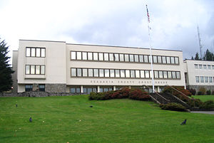
Stevenson, Washington
Stevenson is a town in Skamania County, Washington, United States. The population was 1,465 at the 2010 census, a 22% increase over 2000. It is the county seat of Skamania County and home to the Skamania County Court House and Sheriff's Office...
, which is also the county's largest city, although the Carson River Valley
Carson River Valley, Washington
Carson is a census-designated place in Skamania County, Washington, United States. The population was 2,116 at the 2000 census.-Geography:Carson is located at ....
CDP
Census-designated place
A census-designated place is a concentration of population identified by the United States Census Bureau for statistical purposes. CDPs are delineated for each decennial census as the statistical counterparts of incorporated places such as cities, towns and villages...
is more populous.
Geography
According to the U.S. Census BureauUnited States Census Bureau
The United States Census Bureau is the government agency that is responsible for the United States Census. It also gathers other national demographic and economic data...
, the county has a total area of 1684 square miles (4,361.5 km²), of which 1656 square miles (4,289 km²) is land and 27 square miles (69.9 km²) (1.63%) is water. 90% of Skamania is forested and 80% is a part of Gifford Pinchot National Forest
Gifford Pinchot National Forest
Gifford Pinchot National Forest is a U.S. National Forest located in southern Washington, USA. With an area of 1.37 million acres , it extends 116 km along the western slopes of Cascade Range from Mount Rainier National Park to the Columbia River. It includes the 110,000 acre Mount St....
.
Geographic features
- Cascade MountainsCascade RangeThe Cascade Range is a major mountain range of western North America, extending from southern British Columbia through Washington and Oregon to Northern California. It includes both non-volcanic mountains, such as the North Cascades, and the notable volcanoes known as the High Cascades...
- Columbia RiverColumbia RiverThe Columbia River is the largest river in the Pacific Northwest region of North America. The river rises in the Rocky Mountains of British Columbia, Canada, flows northwest and then south into the U.S. state of Washington, then turns west to form most of the border between Washington and the state...
- Mount St. HelensMount St. HelensMount St. Helens is an active stratovolcano located in Skamania County, Washington, in the Pacific Northwest region of the United States. It is south of Seattle, Washington and northeast of Portland, Oregon. Mount St. Helens takes its English name from the British diplomat Lord St Helens, a...
Adjacent counties
- Lewis County, WashingtonLewis County, WashingtonLewis County is a county located in the U.S. state of Washington. As of 2010, the population was 75,455. The county seat is at Chehalis, and its largest city is Centralia....
- north - Yakima County, WashingtonYakima County, WashingtonYakima County is the second largest county by area in the U.S. state of Washington. It is named after the Yakama tribe of Native Americans. In the 2010 census, its population was 243,231...
- northeast - Klickitat County, Washington - east
- Hood River County, OregonHood River County, Oregon-Demographics:As of the census of 2000, there were 20,411 people, 7,248 households, and 5,175 families residing in the county. The population density was 39 people per square mile . There were 7,818 housing units at an average density of 15 per square mile...
- south - Multnomah County, OregonMultnomah County, OregonMultnomah County is one of 36 counties in the U.S. state of Oregon. Though smallest in area, it is the most populous as its county seat, Portland, is the state's largest city...
- southwest - Clark County, WashingtonClark County, WashingtonClark County is a county located in the southwestern part of the U.S. state of Washington, across the Columbia River from Portland, Oregon.Clark County was the first county of Washington, named after William Clark of the Lewis and Clark Expedition...
- west - Cowlitz County, WashingtonCowlitz County, WashingtonCowlitz County is a county located in the U.S. state of Washington. As of the 2010 census its population was 102,410. It forms the Longview, Washington, Metropolitan Statistical Area which encompasses all of Cowlitz County. The county seat is at Kelso, and its largest city is Longview...
- west
Other communities
- CarsonCarson, WashingtonCarson is a small unincorporated town in Skamania County in the southwestern part of the U.S. state of Washington.Carson is the population base of Skamania County, located just north of the Columbia River near the towns of Stevenson, Bingen and White Salmon in Washington and Cascade Locks and Hood...
(related to Carson River Valley CDP) - StablerStabler, WashingtonStabler is a small unincorporated community in Skamania County in the southwestern part of the U.S. state of Washington.Also known as "Hemlock", Stabler is a small community in the southernmost region of the Gifford Pinchot National Forest...
(also known as Hemlock) - Mill A
- SkamaniaSkamania, WashingtonSkamania is a small unincorporated community in Skamania County in the southwestern part of the U.S. state of Washington.Skamania is home to Skamania Elementary School and the Skamania General Store...
- Willard
National protected areas
- Franz Lake National Wildlife RefugeFranz Lake National Wildlife RefugeFranz Lake National Wildlife Refuge is located in southwest Washington State, within the Columbia River Gorge National Scenic Area. The refuge provides a variety of habitats including riparian wetlands, Columbia River riparian corridor blocks, transitional woodlands from lower elevation willows,...
- Gifford Pinchot National ForestGifford Pinchot National ForestGifford Pinchot National Forest is a U.S. National Forest located in southern Washington, USA. With an area of 1.37 million acres , it extends 116 km along the western slopes of Cascade Range from Mount Rainier National Park to the Columbia River. It includes the 110,000 acre Mount St....
(part) - Mount St. Helens National Monument (part)
- Pierce National Wildlife RefugePierce National Wildlife RefugePierce National Wildlife Refuge is located in southwest Washington within the Columbia River Gorge National Scenic Area. It encompasses wetlands and uplands along the north shore of the Columbia River west of the town of North Bonneville...
Demographics
Census
A census is the procedure of systematically acquiring and recording information about the members of a given population. It is a regularly occurring and official count of a particular population. The term is used mostly in connection with national population and housing censuses; other common...
of 2000, there were 9,872 people, 3,755 households, and 2,756 families residing in the county. The population density
Population density
Population density is a measurement of population per unit area or unit volume. It is frequently applied to living organisms, and particularly to humans...
was 6 people per square mile (2/km²). There were 4,576 housing units at an average density of 3 per square mile (1/km²). The racial makeup of the county was 92.11% White
Race (United States Census)
Race and ethnicity in the United States Census, as defined by the Federal Office of Management and Budget and the United States Census Bureau, are self-identification data items in which residents choose the race or races with which they most closely identify, and indicate whether or not they are...
, 0.30% Black
Race (United States Census)
Race and ethnicity in the United States Census, as defined by the Federal Office of Management and Budget and the United States Census Bureau, are self-identification data items in which residents choose the race or races with which they most closely identify, and indicate whether or not they are...
or African American
Race (United States Census)
Race and ethnicity in the United States Census, as defined by the Federal Office of Management and Budget and the United States Census Bureau, are self-identification data items in which residents choose the race or races with which they most closely identify, and indicate whether or not they are...
, 2.20% Native American
Race (United States Census)
Race and ethnicity in the United States Census, as defined by the Federal Office of Management and Budget and the United States Census Bureau, are self-identification data items in which residents choose the race or races with which they most closely identify, and indicate whether or not they are...
, 0.54% Asian
Race (United States Census)
Race and ethnicity in the United States Census, as defined by the Federal Office of Management and Budget and the United States Census Bureau, are self-identification data items in which residents choose the race or races with which they most closely identify, and indicate whether or not they are...
, 0.17% Pacific Islander
Race (United States Census)
Race and ethnicity in the United States Census, as defined by the Federal Office of Management and Budget and the United States Census Bureau, are self-identification data items in which residents choose the race or races with which they most closely identify, and indicate whether or not they are...
, 2.43% from other races
Race (United States Census)
Race and ethnicity in the United States Census, as defined by the Federal Office of Management and Budget and the United States Census Bureau, are self-identification data items in which residents choose the race or races with which they most closely identify, and indicate whether or not they are...
, and 2.25% from two or more races. 4.03% of the population were Hispanic
Race (United States Census)
Race and ethnicity in the United States Census, as defined by the Federal Office of Management and Budget and the United States Census Bureau, are self-identification data items in which residents choose the race or races with which they most closely identify, and indicate whether or not they are...
or Latino
Race (United States Census)
Race and ethnicity in the United States Census, as defined by the Federal Office of Management and Budget and the United States Census Bureau, are self-identification data items in which residents choose the race or races with which they most closely identify, and indicate whether or not they are...
of any race. 17.7% were of German, 12.5% English
English people
The English are a nation and ethnic group native to England, who speak English. The English identity is of early mediaeval origin, when they were known in Old English as the Anglecynn. England is now a country of the United Kingdom, and the majority of English people in England are British Citizens...
, 12.1% Irish
Irish people
The Irish people are an ethnic group who originate in Ireland, an island in northwestern Europe. Ireland has been populated for around 9,000 years , with the Irish people's earliest ancestors recorded having legends of being descended from groups such as the Nemedians, Fomorians, Fir Bolg, Tuatha...
, 11.2% United States
United States
The United States of America is a federal constitutional republic comprising fifty states and a federal district...
or American and 5.2% Norwegian ancestry according to Census 2000.
There were 3,755 households out of which 34.00% had children under the age of 18 living with them, 60.50% were married couples
Marriage
Marriage is a social union or legal contract between people that creates kinship. It is an institution in which interpersonal relationships, usually intimate and sexual, are acknowledged in a variety of ways, depending on the culture or subculture in which it is found...
living together, 8.20% had a female householder with no husband present, and 26.60% were non-families. 21.10% of all households were made up of individuals and 6.60% had someone living alone who was 65 years of age or older. The average household size was 2.61 and the average family size was 3.02.
In the county, the population was spread out with 26.60% under the age of 18, 6.70% from 18 to 24, 28.60% from 25 to 44, 27.10% from 45 to 64, and 11.00% who were 65 years of age or older. The median age was 39 years. For every 100 females there were 101.30 males. For every 100 females age 18 and over, there were 99.40 males.
The median income for a household in the county was $39,317, and the median income for a family was $44,586. Males had a median income of $36,732 versus $25,130 for females. The per capita income
Per capita income
Per capita income or income per person is a measure of mean income within an economic aggregate, such as a country or city. It is calculated by taking a measure of all sources of income in the aggregate and dividing it by the total population...
for the county was $18,002. About 10.00% of families and 13.10% of the population were below the poverty line, including 18.10% of those under age 18 and 7.90% of those age 65 or over.
There are more Seventh-day Adventists in Skamania County than members of any other religious group. Skamania County is the only county in the United States for which this is true.
Recreation
- There are many hiking trails throughout Skamania County in Gifford Pinchot National ForestGifford Pinchot National ForestGifford Pinchot National Forest is a U.S. National Forest located in southern Washington, USA. With an area of 1.37 million acres , it extends 116 km along the western slopes of Cascade Range from Mount Rainier National Park to the Columbia River. It includes the 110,000 acre Mount St....
, the Columbia River GorgeColumbia River GorgeThe Columbia River Gorge is a canyon of the Columbia River in the Pacific Northwest of the United States. Up to deep, the canyon stretches for over as the river winds westward through the Cascade Range forming the boundary between the State of Washington to the north and Oregon to the south...
and the Mount St. Helens National Volcanic MonumentMount St. Helens National Volcanic MonumentMount St. Helens National Volcanic Monument is a U.S. National Monument that includes the area around Mount St. Helens in Washington. It was established on August 27, 1982 by U.S. President Ronald Reagan following the 1980 eruption of Mount St. Helens. The 110,000 acre National Volcanic...
. The Pacific Crest TrailPacific Crest TrailThe Pacific Crest Trail is a long-distance mountain hiking and equestrian trail on the Western Seaboard of the United States. The southern terminus is at the California border with Mexico...
passes through Skamania County. - There are many fishing opportunities throughout Skamania County. Some of the most popular species include rainbow troutRainbow troutThe rainbow trout is a species of salmonid native to tributaries of the Pacific Ocean in Asia and North America. The steelhead is a sea run rainbow trout usually returning to freshwater to spawn after 2 to 3 years at sea. In other words, rainbow trout and steelhead trout are the same species....
, steelhead and bassBass (fish)Bass is a name shared by many different species of popular gamefish. The term encompasses both freshwater and marine species. All belong to the large order Perciformes, or perch-like fishes, and in fact the word bass comes from Middle English bars, meaning "perch."-Types of basses:*The temperate...
. - The Columbia Gorge Interpretive Center Museum, in StevensonStevenson, WashingtonStevenson is a town in Skamania County, Washington, United States. The population was 1,465 at the 2010 census, a 22% increase over 2000. It is the county seat of Skamania County and home to the Skamania County Court House and Sheriff's Office...
, offers information about the geologic and human past in the Columbia River GorgeColumbia River GorgeThe Columbia River Gorge is a canyon of the Columbia River in the Pacific Northwest of the United States. Up to deep, the canyon stretches for over as the river winds westward through the Cascade Range forming the boundary between the State of Washington to the north and Oregon to the south...
. - The Lewis and Clark ExpeditionLewis and Clark ExpeditionThe Lewis and Clark Expedition, or ″Corps of Discovery Expedition" was the first transcontinental expedition to the Pacific Coast by the United States. Commissioned by President Thomas Jefferson and led by two Virginia-born veterans of Indian wars in the Ohio Valley, Meriwether Lewis and William...
passed through Skamania County, and some of their campsites can be visited. - Those interested in historic markers can visit Fort CascadesFort CascadesFort Cascades was a United States Army fort constructed in 1855 to protect the portage road around the final section of the Cascades Rapids, known as the "lower cascades." It was built on the Washington side of the Columbia River, between the present site of North Bonneville and the Bonneville...
and Fort RainesFort RainesFort Raines was a United States Army blockhouse built in October 1855 to protect the portage road around the Cascades Rapids. It is located on the Washington side of the Columbia River, west of the Bridge of the Gods, at the "middle cascades." It was abandoned by 1857...
, both built in the 1850s to protect the portage road around the Cascades RapidsCascades RapidsThe Cascades Rapids were an area of rapids along North America's Columbia River, between the U.S. states of Washington and Oregon. Through a stretch approximately wide, the river dropped about in .-Boat portage:Boat travelers were forced to either portage boats and supplies or pull boats up with...
. - Kiteboarding and windsurfingWindsurfingWindsurfing or sailboarding is a surface water sport that combines elements of surfing and sailing. It consists of a board usually two to four metres long, powered by the orthogonal effect of the wind on a sail. The rig is connected to the board by a free-rotating universal joint and comprises a...
are seasonal sports popular in the Columbia River GorgeColumbia River GorgeThe Columbia River Gorge is a canyon of the Columbia River in the Pacific Northwest of the United States. Up to deep, the canyon stretches for over as the river winds westward through the Cascade Range forming the boundary between the State of Washington to the north and Oregon to the south...
. - Skanking to the beat.
Parks and other protected areas
There are many parks in Skamania County. Only a few have been listed.County parks
- Prindle Park is a county-maintained park with picnic facilities and a playground.
- Big Cedars Campground is a county-maintained campground with primitive campsites.
- Home Valley Campground is another county-maintained
State parks
- Beacon Rock State ParkBeacon Rock State ParkBeacon Rock State Park is a state park of Washington, USA, in the Columbia River Gorge National Scenic Area, on State Route 14 about east of Vancouver, Washington....
offers hikingHikingHiking is an outdoor activity which consists of walking in natural environments, often in mountainous or other scenic terrain. People often hike on hiking trails. It is such a popular activity that there are numerous hiking organizations worldwide. The health benefits of different types of hiking...
, campingCampingCamping is an outdoor recreational activity. The participants leave urban areas, their home region, or civilization and enjoy nature while spending one or several nights outdoors, usually at a campsite. Camping may involve the use of a tent, caravan, motorhome, cabin, a primitive structure, or no...
, rock climbingRock climbingRock climbing also lightly called 'The Gravity Game', is a sport in which participants climb up, down or across natural rock formations or artificial rock walls. The goal is to reach the summit of a formation or the endpoint of a pre-defined route without falling...
, and picnicPicnicIn contemporary usage, a picnic can be defined simply as a pleasure excursion at which a meal is eaten outdoors , ideally taking place in a beautiful landscape such as a park, beside a lake or with an interesting view and possibly at a public event such as before an open air theatre performance,...
king facilities.
Sites maintained by the US Forest Service
- Sams Walker Day Use Site offers an interpretive trail, access to the Columbia RiverColumbia RiverThe Columbia River is the largest river in the Pacific Northwest region of North America. The river rises in the Rocky Mountains of British Columbia, Canada, flows northwest and then south into the U.S. state of Washington, then turns west to form most of the border between Washington and the state...
, and opportunities to view wildlife. Portions of it are typically wheelchair-accessible. However, vegetation growth sometimes prevents people in wheelchairs from using the trails. - St. Cloud Day Use Site features a short, easy trail through a meadow, picnicPicnicIn contemporary usage, a picnic can be defined simply as a pleasure excursion at which a meal is eaten outdoors , ideally taking place in a beautiful landscape such as a park, beside a lake or with an interesting view and possibly at a public event such as before an open air theatre performance,...
area, access to the Columbia RiverColumbia RiverThe Columbia River is the largest river in the Pacific Northwest region of North America. The river rises in the Rocky Mountains of British Columbia, Canada, flows northwest and then south into the U.S. state of Washington, then turns west to form most of the border between Washington and the state...
and wildlife viewing opportunities.
National protected areas
- Franz Lake National Wildlife RefugeFranz Lake National Wildlife RefugeFranz Lake National Wildlife Refuge is located in southwest Washington State, within the Columbia River Gorge National Scenic Area. The refuge provides a variety of habitats including riparian wetlands, Columbia River riparian corridor blocks, transitional woodlands from lower elevation willows,...
- Gifford Pinchot National ForestGifford Pinchot National ForestGifford Pinchot National Forest is a U.S. National Forest located in southern Washington, USA. With an area of 1.37 million acres , it extends 116 km along the western slopes of Cascade Range from Mount Rainier National Park to the Columbia River. It includes the 110,000 acre Mount St....
(part) - Mount St. Helens Volcanic National Monument (part)
- Pierce National Wildlife RefugePierce National Wildlife RefugePierce National Wildlife Refuge is located in southwest Washington within the Columbia River Gorge National Scenic Area. It encompasses wetlands and uplands along the north shore of the Columbia River west of the town of North Bonneville...
See also
- National Register of Historic Places listings in Skamania County, Washington