

Sedgemoor
Encyclopedia
Sedgemoor is a low lying area of land in Somerset
, England. It lies close to sea level south of the Polden Hills
, historically largely marsh (or "moor" in its older sense). The eastern part is known as King's Sedgemoor
, and the western part West Sedgemoor
. Sedgemoor is part of the area now known as the Somerset Levels
. Historically the area was known as the site of the Battle of Sedgemoor
.
Sedgemoor has given its name to a local government district
formed on April 1, 1974, under the Local Government Act 1972
, by a merger of the municipal borough
of Bridgwater
, the Burnham-on-Sea
urban district
, Bridgwater Rural District
and part of Axbridge Rural District
. The district covers a larger area than the historical Sedgemoor, extending north of the Polden Hills across the Somerset Levels to the Mendip Hills
.
moor", but is instead "marsh of a man called Sicga" from the Old Norse
personal name
Sicga and Old English mor "moor". The name was recorded as Secgamere in 1165.
extraction, willow
crafts and cider
making can still be found, in addition to livestock farming. The River Parrett
provides a source of eels (anguilla anguilla) and elvers during January through to May.
However also notable is the new Isleport trading estate at Highbridge which houses many global businesses such as Geest (Isleport Foods) who make yoghurt under franchise to Ski & Muller, Brake Brothers who supply the catering trade, BFP wholesale who supply dry goods to bakeries etc., Woodbury & Haines who supply furniture globally, Polybeam Limited who supply GRP radio masts to customers such as Marconi, and also AT&T whose centre there controls all internet cable traffic to and from the US
Industry in Bridgwater has also seen major growth recently with the opening of "Express Park" which houses Gerber Foods who are a global fruit juice supplier, NHS Logistics
depot and Eddie Stobart
depot. Also south of Bridgwater at Huntworth is a large Somerfield depot which supplies their Somerfield and former Kwik Save stores in the south west.
run since its creation in 1974 when it was merged with the old Bridgwater & Burnham-On-Sea Urban District Councils. Past voting trends have placed strong cores of Labour
voters in Bridgwater Town, with Conservative support coming from the Villages such as Pawlett, Wedmore
and Shipham
. Liberal Democrats
fared well in Burnham and Highbridge areas. In 1995, the Liberal Democrats and Labour took 26 seats together, out-numbering the Conservatives 24 seats, and they formed a coalition. This continued until 1999, when the Conservatives re-took Sedgemoor, crushing the Liberal Democrats from 12 seats, to just 2. The Liberal Democrats lost even their safe seat of Highbridge to Labour.
In 2000, a Conservative Councillor died, and a By-Election was called in his seat of Huntpsill and Pawlett. Previous Liberal Democrat Councillor Marilyn Wallace fought the seat, and re-took it with 56% of the vote, bringing the Liberal Democrats back up to 3 seats.
In 2003, the Conservatives extended their majority to 35 seats of 50, leaving the Liberal Democrats on just 1 Seat, Which was held by long term veteran Liberal Democrat, Mike Mansfield, who actually took the seat from the Conservatives in Burnham South, a previously Liberal Democrat safe seat. Labour remained on 14.
In 2007, the Conservatives held a status quo of 35 seats, however the Liberal Democrats gained 3 up to 4 total, all of which were in their traditional safe seat of Highbridge. This included the election of their youngest Councillor in the South west, Councillor Joe Leach, who was aged just 19 years. Mike Mansfield was elected Leader of the Liberal Democrat group, until the untimely death of his wife. Newly elected Councillor Danny Titcombe then was elected leader of the Group. on April 14, 2008, Cllr. Danny Titcombe announced his defection to the Conservative Party, effectively boosting their majority to 36 seats. Despite calls of resignation from all sides, Cllr. Titcombe continued in his role. At 20 Years old, Cllr Joe Leach became the youngest group Leader in the Country, and still continues to lead his party on the Council at 23. The Labour Party dropped to 11 seats, losing 2 in highbridge to the Liberal Democrats, and 1 in Bridgwater Bower to the Conservatives. The Conservatives lost 1 in Highbridge to the Liberal Democrats (before defection). In 2010, Woolavington Councillor Roger Lavers, who was the Labour Group Leader, died suddenly of a brain hemorrhage, triggering a by-election in the 1 Member ward, which saw Labour drop from holding the seat, to third behind the Liberal Democrats who hadn't stood in the seat since 1991, and the Conservatives gain the seat, boostng their total number to 37 of 50 councillors. Labour dropped to 10. Councillor Kathy Pearce, Labour member for Bridgwater Hamp, was elected as the new Labour group Leader.
The Conservative Leader is Cllr. Duncan McGinty, who is also leader of council. He succeeded Cllr. John Lang in 2006.
The Labour Leader is Cllr. Kathy Pearce, who succeeded Cllr. Roger Lavers in 2010.
The Liberal Democrat Leader is Cllr. Joe Leach, who succeeded Cllr. Danny Titcombe in 2008.
Bridgwater and West Somerset and Wells
county constituencies which are represented in the House of Commons
of the Parliament of the United Kingdom
by the first past the post system of election. The current MP for Bridgewater and West Somerset is Ian Liddell-Grainger, a Conservative
; for Wells the MP is Tessa Munt
, a Liberal Democrat
.
constituency for elections to the European Parliament
.
) in Sedgemoor are operated the Children & Young People's Directorate of Somerset County Council
, although some such as The Kings of Wessex School in Cheddar
have distanced themselves from the county council by opting for foundation status
.
Somerset
The ceremonial and non-metropolitan county of Somerset in South West England borders Bristol and Gloucestershire to the north, Wiltshire to the east, Dorset to the south-east, and Devon to the south-west. It is partly bounded to the north and west by the Bristol Channel and the estuary of the...
, England. It lies close to sea level south of the Polden Hills
Polden Hills
The Polden Hills in Somerset, England are a long, low ridge, extending for , and separated from the Mendip Hills, to which they are nearly parallel, by a marshy tract, known as the Somerset Levels...
, historically largely marsh (or "moor" in its older sense). The eastern part is known as King's Sedgemoor
King's Sedgemoor
King's Sedgemoor is a piece of rich animal habit and farming land, that forms part of the Somerset Levels in South West England.The area of King's Sedgemoor fell within the Whitley Hundred,...
, and the western part West Sedgemoor
West Sedgemoor
West Sedgemoor is a 1016.0 hectare biological Site of Special Scientific Interest forms part of the Somerset Levels and Moors in Somerset, notified in 1983....
. Sedgemoor is part of the area now known as the Somerset Levels
Somerset Levels
The Somerset Levels, or the Somerset Levels and Moors as they are less commonly but more correctly known, is a sparsely populated coastal plain and wetland area of central Somerset, South West England, between the Quantock and Mendip Hills...
. Historically the area was known as the site of the Battle of Sedgemoor
Battle of Sedgemoor
The Battle of Sedgemoor was fought on 6 July 1685 and took place at Westonzoyland near Bridgwater in Somerset, England.It was the final battle of the Monmouth Rebellion and followed a series of skirmishes around south west England between the forces of James Scott, 1st Duke of Monmouth and the...
.
Sedgemoor has given its name to a local government district
Non-metropolitan district
Non-metropolitan districts, or colloquially shire districts, are a type of local government district in England. As created, they are sub-divisions of non-metropolitan counties in a so-called "two-tier" arrangement...
formed on April 1, 1974, under the Local Government Act 1972
Local Government Act 1972
The Local Government Act 1972 is an Act of Parliament in the United Kingdom that reformed local government in England and Wales on 1 April 1974....
, by a merger of the municipal borough
Municipal borough
Municipal boroughs were a type of local government district which existed in England and Wales between 1835 and 1974, in Northern Ireland from 1840 to 1973 and in the Republic of Ireland from 1840 to 2002...
of Bridgwater
Bridgwater
Bridgwater is a market town and civil parish in Somerset, England. It is the administrative centre of the Sedgemoor district, and a major industrial centre. Bridgwater is located on the major communication routes through South West England...
, the Burnham-on-Sea
Burnham-on-Sea
Burnham-on-Sea is a town in Somerset, England, at the mouth of the River Parrett and Bridgwater Bay. Burnham was a small village until the late 18th century, when it began to grow because of its popularity as a seaside resort. It forms part of the parish of Burnham-on-Sea and Highbridge...
urban district
Urban district
In the England, Wales and Ireland, an urban district was a type of local government district that covered an urbanised area. Urban districts had an elected Urban District Council , which shared local government responsibilities with a county council....
, Bridgwater Rural District
Bridgwater Rural District
Bridgwater was a rural district in Somerset, England, from 1894 to 1974.It was created in 1894 under the Local Government Act 1894.In 1974 it was abolished under the Local Government Act 1972 becoming part of Sedgemoor....
and part of Axbridge Rural District
Axbridge Rural District
Axbridge was a rural district in Somerset, England, from 1894 to 1974. It was named after the town of Axbridge.It was created in 1894 under the Local Government Act 1894 as a successor to the Axbridge rural sanitary district....
. The district covers a larger area than the historical Sedgemoor, extending north of the Polden Hills across the Somerset Levels to the Mendip Hills
Mendip Hills
The Mendip Hills is a range of limestone hills to the south of Bristol and Bath in Somerset, England. Running east to west between Weston-super-Mare and Frome, the hills overlook the Somerset Levels to the south and the Avon Valley to the north...
.
Toponymy
Sedgemoor does not mean "sedgeSedge
- Plants :* Acorus calamus, sweet flag, a plant in the Acoraceae family* Any of the plants in the family Cyperaceae- Animals :* A collective noun for several species of birds, including bitterns, cranes and herons* Sedge-fly, caddisfly- Other uses :...
moor", but is instead "marsh of a man called Sicga" from the Old Norse
Old Norse
Old Norse is a North Germanic language that was spoken by inhabitants of Scandinavia and inhabitants of their overseas settlements during the Viking Age, until about 1300....
personal name
Personal name
A personal name is the proper name identifying an individual person, and today usually comprises a given name bestowed at birth or at a young age plus a surname. It is nearly universal for a human to have a name; except in rare cases, for example feral children growing up in isolation, or infants...
Sicga and Old English mor "moor". The name was recorded as Secgamere in 1165.
Towns
- BridgwaterBridgwaterBridgwater is a market town and civil parish in Somerset, England. It is the administrative centre of the Sedgemoor district, and a major industrial centre. Bridgwater is located on the major communication routes through South West England...
- the administrative centre - Burnham-on-SeaBurnham-on-SeaBurnham-on-Sea is a town in Somerset, England, at the mouth of the River Parrett and Bridgwater Bay. Burnham was a small village until the late 18th century, when it began to grow because of its popularity as a seaside resort. It forms part of the parish of Burnham-on-Sea and Highbridge...
- North PethertonNorth PethertonNorth Petherton is a small town and civil parish in Somerset, England, situated on the edge of the eastern foothills of the Quantocks, and close to the edge of the Somerset Levels.The town has a population of 5,189...
- HighbridgeHighbridge, SomersetHighbridge is a small market town situated on the edge of the Somerset Levels near the mouth of the River Brue. It is in the County of Somerset, and is approximately north west of Taunton, the county town of Somerset. Highbridge is in the District of Sedgemoor, being situated approximately north...
- AxbridgeAxbridgeAxbridge is a town in Somerset, England, situated in the Sedgemoor district on the River Axe, near the southern edge of the Mendip Hills. The town population according to the 2001 census was 2,024.-History:...
Parishes
| Image | Name | Status | Population | Former local authority | Coordinates | Refs |
|---|---|---|---|---|---|---|
| Ashcott Ashcott Ashcott is a small village and civil parish located in the Sedgemoor area of Somerset in the south-west of England. The village has a population of 1,280. The parish includes the hamlets of Buscott, Berhill and Ashcott Corner.... |
Civil parish | Bridgwater Rural District Bridgwater Rural District Bridgwater was a rural district in Somerset, England, from 1894 to 1974.It was created in 1894 under the Local Government Act 1894.In 1974 it was abolished under the Local Government Act 1972 becoming part of Sedgemoor.... |
51.12°N 2.81°W | |||
| Axbridge Axbridge Axbridge is a town in Somerset, England, situated in the Sedgemoor district on the River Axe, near the southern edge of the Mendip Hills. The town population according to the 2001 census was 2,024.-History:... |
Town | Axbridge Rural District Axbridge Rural District Axbridge was a rural district in Somerset, England, from 1894 to 1974. It was named after the town of Axbridge.It was created in 1894 under the Local Government Act 1894 as a successor to the Axbridge rural sanitary district.... |
51.29°N 2.82°W | |||
| Badgworth Badgworth, Somerset Badgworth is a village and civil parish in the Sedgemoor district of Somerset, England, south west of Axbridge. According to the 2001 census it had a population of 487.The village is home to an equestrian centre known as the Badgworth Arena.-History:... |
Civil parish | Axbridge Rural District Axbridge Rural District Axbridge was a rural district in Somerset, England, from 1894 to 1974. It was named after the town of Axbridge.It was created in 1894 under the Local Government Act 1894 as a successor to the Axbridge rural sanitary district.... |
51.27°N 2.87°W | |||
| Bawdrip Bawdrip Bawdrip is a village and civil parish in the Sedgemoor district of Somerset, England. The village is on the south side of the Polden Hills about north-east of Bridgwater. According to the 2001 census the parish had a population of 498. The parish includes the hamlets of Bradney and Horsey... |
Civil parish | Bridgwater Rural District Bridgwater Rural District Bridgwater was a rural district in Somerset, England, from 1894 to 1974.It was created in 1894 under the Local Government Act 1894.In 1974 it was abolished under the Local Government Act 1972 becoming part of Sedgemoor.... |
51.15°N 2.94°W | |||
| Berrow Berrow, Somerset Berrow is a village and civil parish in the Sedgemoor district of Somerset, England. According to the 2001 census it had a population of 1,766.-History:Berrow was part of the hundred of Brent-cum-Wrington.-Governance:... |
Civil parish | Axbridge Rural District Axbridge Rural District Axbridge was a rural district in Somerset, England, from 1894 to 1974. It was named after the town of Axbridge.It was created in 1894 under the Local Government Act 1894 as a successor to the Axbridge rural sanitary district.... |
51.27°N 3.01°W | |||
| Brean Brean Brean is a village and civil parish between Weston-super-Mare and Burnham-on-Sea in Somerset, England. The name is derived from "Bryn" Brythonic and Modern Welsh for a hill.... |
Civil parish | Axbridge Rural District Axbridge Rural District Axbridge was a rural district in Somerset, England, from 1894 to 1974. It was named after the town of Axbridge.It was created in 1894 under the Local Government Act 1894 as a successor to the Axbridge rural sanitary district.... |
51.30°N 3.01°W | |||
| Brent Knoll | Civil parish | Axbridge Rural District Axbridge Rural District Axbridge was a rural district in Somerset, England, from 1894 to 1974. It was named after the town of Axbridge.It was created in 1894 under the Local Government Act 1894 as a successor to the Axbridge rural sanitary district.... |
51.25°N 2.95°W | |||
 |
Bridgwater Bridgwater Bridgwater is a market town and civil parish in Somerset, England. It is the administrative centre of the Sedgemoor district, and a major industrial centre. Bridgwater is located on the major communication routes through South West England... |
Town | Bridgwater Municipal Borough Bridgwater Bridgwater is a market town and civil parish in Somerset, England. It is the administrative centre of the Sedgemoor district, and a major industrial centre. Bridgwater is located on the major communication routes through South West England... |
51.13°N 2.99°W | ||
| Bridgwater Without Bridgwater Without Bridgwater Without is a civil parish in the Sedgemoor district of Somerset, England.It lies to the east and south west of Bridgwater. The parish includes the villages and hamlets of Dunwear, Horsey, Slape Cross and Sydenham... |
Civil parish | Bridgwater Rural District Bridgwater Rural District Bridgwater was a rural district in Somerset, England, from 1894 to 1974.It was created in 1894 under the Local Government Act 1894.In 1974 it was abolished under the Local Government Act 1972 becoming part of Sedgemoor.... |
51.14°N 2.97°W | |||
 |
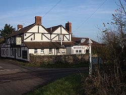
Broomfield Broomfield, Somerset Broomfield is a village and civil parish in the Sedgemoor district of Somerset, England, situated about five miles north of Taunton. According to the 2001 census it had a population of 224.... |
Civil parish | Bridgwater Rural District Bridgwater Rural District Bridgwater was a rural district in Somerset, England, from 1894 to 1974.It was created in 1894 under the Local Government Act 1894.In 1974 it was abolished under the Local Government Act 1972 becoming part of Sedgemoor.... |
51.08°N 3.11°W | ||
 |
Burnham on Sea and Highbridge Burnham-on-Sea and Highbridge Burnham-on-Sea and Highbridge is a civil parish in the Sedgemoor district of Somerset, England. It has a population of 18,922 . The parish contains the towns Burnham-on-Sea and Highbridge.... |
Town | Burnham on Sea Urban District Burnham-on-Sea and Highbridge Burnham-on-Sea and Highbridge is a civil parish in the Sedgemoor district of Somerset, England. It has a population of 18,922 . The parish contains the towns Burnham-on-Sea and Highbridge.... |
51.24°N 2.99°W | ||
| Burnham Without Burnham Without Burnham Without is a civil parish to the east of Burnham-on-Sea and north of Highbridge in the Sedgemoor district of Somerset, England.The parish includes the village of Edithmead and is the site of the Somerset Rebels Speedway track.... |
Civil Parish | Axbridge Rural District Axbridge Rural District Axbridge was a rural district in Somerset, England, from 1894 to 1974. It was named after the town of Axbridge.It was created in 1894 under the Local Government Act 1894 as a successor to the Axbridge rural sanitary district.... |
51.23°N 2.96°W | |||
 |
Burtle Burtle Burtle is a village and civil parish on the Somerset Levels in the Sedgemoor district of Somerset, England.-History:Burtle Priory originated as a hermitage on a site called Sprauellissmede, endowed by William son of Godfrey of Eddington in 1199... |
Civil parish | Bridgwater Rural District Bridgwater Rural District Bridgwater was a rural district in Somerset, England, from 1894 to 1974.It was created in 1894 under the Local Government Act 1894.In 1974 it was abolished under the Local Government Act 1972 becoming part of Sedgemoor.... |
51.17°N 2.87°W | ||
 |
Cannington Cannington, Somerset Cannington is a village and civil parish north-west of Bridgwater in the Sedgemoor district of Somerset, England. It lies on the west bank of the River Parret, and contains the hamlet of Edstock.-History:... |
Civil parish | Bridgwater Rural District Bridgwater Rural District Bridgwater was a rural district in Somerset, England, from 1894 to 1974.It was created in 1894 under the Local Government Act 1894.In 1974 it was abolished under the Local Government Act 1972 becoming part of Sedgemoor.... |
51.15°N 3.07°W | ||
 |
Catcott Catcott Catcott is a rural village and civil parish, situated close to Edington to the east of Bridgwater on the Somerset Levels to the north of the Polden Hills in the Sedgemoor district of Somerset, England.-History:... |
Civil parish | Bridgwater Rural District Bridgwater Rural District Bridgwater was a rural district in Somerset, England, from 1894 to 1974.It was created in 1894 under the Local Government Act 1894.In 1974 it was abolished under the Local Government Act 1972 becoming part of Sedgemoor.... |
51.15°N 2.87°W | ||
 |
Chapel Allerton Chapel Allerton, Somerset Chapel Allerton is a village and civil parish, south of Cheddar in the English county of Somerset. The parish includes the hamlets of Ashton and Stone Allerton.-History:... |
Civil parish | Axbridge Rural District Axbridge Rural District Axbridge was a rural district in Somerset, England, from 1894 to 1974. It was named after the town of Axbridge.It was created in 1894 under the Local Government Act 1894 as a successor to the Axbridge rural sanitary district.... |
51.25°N 2.85°W | ||
| Cheddar Cheddar Cheddar is a large village and civil parish in the Sedgemoor district of the English county of Somerset. It is situated on the southern edge of the Mendip Hills, north-west of Wells. The civil parish includes the hamlets of Nyland and Bradley Cross... |
Civil parish | Axbridge Rural District Axbridge Rural District Axbridge was a rural district in Somerset, England, from 1894 to 1974. It was named after the town of Axbridge.It was created in 1894 under the Local Government Act 1894 as a successor to the Axbridge rural sanitary district.... |
51.28°N 2.78°W | |||
 |
Chedzoy Chedzoy Chedzoy is a civil parish village east of Bridgwater in the Sedgemoor district of Somerset, England.-History:The village is at the western end of King's Sedgemoor and lies on an 'island' of Burtle marine sands, close to King's Sedgemoor Drain. The area was settled possibly in the Mesolithic... |
Civil parish | Bridgwater Rural District Bridgwater Rural District Bridgwater was a rural district in Somerset, England, from 1894 to 1974.It was created in 1894 under the Local Government Act 1894.In 1974 it was abolished under the Local Government Act 1972 becoming part of Sedgemoor.... |
51.13°N 2.95°W | ||
 |
Chilton Polden Chilton Polden Chilton Polden is a rural village and civil parish, situated close to Edington on the Somerset Levels to the north of the Polden Hills in the Sedgemoor district of Somerset, England.-History:... |
Civil parish | Bridgwater Rural District Bridgwater Rural District Bridgwater was a rural district in Somerset, England, from 1894 to 1974.It was created in 1894 under the Local Government Act 1894.In 1974 it was abolished under the Local Government Act 1972 becoming part of Sedgemoor.... |
51.15°N 2.90°W | ||
 |
Chilton Trinity Chilton Trinity Chilton Trinity is a village and civil parish on the River Parrett, north of Bridgwater in the Sedgemoor district of Somerset, England.-History:Iron age and Roman pottery have been found at Chilton village... |
Civil parish | Bridgwater Rural District Bridgwater Rural District Bridgwater was a rural district in Somerset, England, from 1894 to 1974.It was created in 1894 under the Local Government Act 1894.In 1974 it was abolished under the Local Government Act 1972 becoming part of Sedgemoor.... |
51.15°N 3.01°W | ||
 |
Compton Bishop Compton Bishop Compton Bishop is a small village and civil parish, at the western end of the Mendip Hills in the English county of Somerset. It is located close to the historic town of Axbridge... |
Civil parish | Axbridge Rural District Axbridge Rural District Axbridge was a rural district in Somerset, England, from 1894 to 1974. It was named after the town of Axbridge.It was created in 1894 under the Local Government Act 1894 as a successor to the Axbridge rural sanitary district.... |
51.30°N 2.87°W | ||
 |
Cossington Cossington, Somerset Cossington is a village and civil parish close to Woolavington and north of Bridgwater, in the Sedgemoor district in Somerset, England. The village lies on the north side of the Polden Hills.-History:... |
Civil parish | Bridgwater Rural District Bridgwater Rural District Bridgwater was a rural district in Somerset, England, from 1894 to 1974.It was created in 1894 under the Local Government Act 1894.In 1974 it was abolished under the Local Government Act 1972 becoming part of Sedgemoor.... |
51.16°N 2.92°W | ||
 |
Durleigh Durleigh Durleigh is a village and civil parish on the outskirts of Bridgwater in the Sedgemoor district of Somerset, England. According to the 2001 Census, it had a population of 609... |
Civil parish | Bridgwater Rural District Bridgwater Rural District Bridgwater was a rural district in Somerset, England, from 1894 to 1974.It was created in 1894 under the Local Government Act 1894.In 1974 it was abolished under the Local Government Act 1972 becoming part of Sedgemoor.... |
51.12°N 3.04°W | ||
 |
East Brent | Civil parish | Axbridge Rural District Axbridge Rural District Axbridge was a rural district in Somerset, England, from 1894 to 1974. It was named after the town of Axbridge.It was created in 1894 under the Local Government Act 1894 as a successor to the Axbridge rural sanitary district.... |
51.26°N 2.94°W | ||
| East Huntspill | Civil parish | Bridgwater Rural District Bridgwater Rural District Bridgwater was a rural district in Somerset, England, from 1894 to 1974.It was created in 1894 under the Local Government Act 1894.In 1974 it was abolished under the Local Government Act 1972 becoming part of Sedgemoor.... |
51.20°N 2.98°W | |||
 |
Edington Edington, Somerset Edington is a rural village, situated on the north side of the Polden Hills in the Sedgemoor district of Somerset, England.Either side of it lie the villages of Chilton Polden and Catcott, and north of it is the small village of Burtle... |
Civil parish | Bridgwater Rural District Bridgwater Rural District Bridgwater was a rural district in Somerset, England, from 1894 to 1974.It was created in 1894 under the Local Government Act 1894.In 1974 it was abolished under the Local Government Act 1972 becoming part of Sedgemoor.... |
51.15°N 2.88°W | ||
| Enmore Enmore, Somerset Enmore is a village and civil parish west of Bridgwater on the Quantock Hills in the Sedgemoor district of Somerset, England. The parish includes the hamlet of Bare Ash.-History:The parish name means Duck marsh.... |
Civil parish | Bridgwater Rural District Bridgwater Rural District Bridgwater was a rural district in Somerset, England, from 1894 to 1974.It was created in 1894 under the Local Government Act 1894.In 1974 it was abolished under the Local Government Act 1972 becoming part of Sedgemoor.... |
51.11°N 3.09°W | |||
 |
Fiddington Fiddington Fiddington is a village and civil parish north-east of Nether Stowey, and north-west of Bridgwater in the Sedgemoor district of Somerset, England... |
Civil parish | Bridgwater Rural District Bridgwater Rural District Bridgwater was a rural district in Somerset, England, from 1894 to 1974.It was created in 1894 under the Local Government Act 1894.In 1974 it was abolished under the Local Government Act 1972 becoming part of Sedgemoor.... |
51.16°N 3.12°W | ||
 |
Goathurst Goathurst Goathurst is a small village and civil parish in the English county of Somerset, around 3 miles from the town of Bridgwater. The parish includes the hamlets of Andersfield and Huntstile.-History:Goathurst was part of the hundred of Andersfield.... |
Civil parish | Bridgwater Rural District Bridgwater Rural District Bridgwater was a rural district in Somerset, England, from 1894 to 1974.It was created in 1894 under the Local Government Act 1894.In 1974 it was abolished under the Local Government Act 1972 becoming part of Sedgemoor.... |
51.10°N 3.06°W | ||
 |
Greinton Greinton Greinton is a village and civil parish in Somerset, England, situated on the Somerset Levels and Moors at the foot of the Polden Hills, west southwest of Glastonbury and east of Bridgwater in the Sedgemoor district... |
Civil Parish | Bridgwater Rural District Bridgwater Rural District Bridgwater was a rural district in Somerset, England, from 1894 to 1974.It was created in 1894 under the Local Government Act 1894.In 1974 it was abolished under the Local Government Act 1972 becoming part of Sedgemoor.... |
51.12°N 2.84°W | ||
 |
Lympsham Lympsham Lympsham is a village and civil parish six miles west of Axbridge and six miles south-east of Weston-super-Mare, close to the River Axe in Somerset, England. The parish includes the hamlet of Wick where Wick Farmhouse dates from the mid 18th century.... |
Civil parish | Axbridge Rural District Axbridge Rural District Axbridge was a rural district in Somerset, England, from 1894 to 1974. It was named after the town of Axbridge.It was created in 1894 under the Local Government Act 1894 as a successor to the Axbridge rural sanitary district.... |
51.29°N 2.95°W | ||
| Lyng Lyng, Somerset Lyng is a civil parish in Somerset, England, comprising the villages of West Lyng and East Lyng and the hamlet of Bankland.-History:The name derives from the Old English hlenc, meaning hill.... |
Civil parish | Bridgwater Rural District Bridgwater Rural District Bridgwater was a rural district in Somerset, England, from 1894 to 1974.It was created in 1894 under the Local Government Act 1894.In 1974 it was abolished under the Local Government Act 1972 becoming part of Sedgemoor.... |
51.05°N 2.96°W | |||
 |
Mark Mark, Somerset Mark is a village and civil parish which lies approximately from Bridgwater, from Axbridge, and from Highbridge in the Sedgemoor district of the county of Somerset, England... |
Civil parish | Axbridge Rural District Axbridge Rural District Axbridge was a rural district in Somerset, England, from 1894 to 1974. It was named after the town of Axbridge.It was created in 1894 under the Local Government Act 1894 as a successor to the Axbridge rural sanitary district.... |
51.23°N 2.89°W | ||
 |
Middlezoy Middlezoy Middlezoy is a village and civil parish on the River Parrett as it crosses the Somerset Levels in the Sedgemoor district of Somerset, England.-History:... |
Civil parish | Bridgwater Rural District Bridgwater Rural District Bridgwater was a rural district in Somerset, England, from 1894 to 1974.It was created in 1894 under the Local Government Act 1894.In 1974 it was abolished under the Local Government Act 1972 becoming part of Sedgemoor.... |
51.09°N 2.89°W | ||
 |
Moorlinch Moorlinch Moorlinch is a village and civil parish where the Polden Hills meet the Somerset Levels in the Sedgemoor district of Somerset, England.-History:... |
Civil parish | Bridgwater Rural District Bridgwater Rural District Bridgwater was a rural district in Somerset, England, from 1894 to 1974.It was created in 1894 under the Local Government Act 1894.In 1974 it was abolished under the Local Government Act 1972 becoming part of Sedgemoor.... |
51.13°N 2.86°W | ||
 |
Nether Stowey Nether Stowey Nether Stowey is a large village in the Sedgemoor district of Somerset, South West England. It sits in the foothills of the Quantock Hills , just below Over Stowey... |
Civil parish | Bridgwater Rural District Bridgwater Rural District Bridgwater was a rural district in Somerset, England, from 1894 to 1974.It was created in 1894 under the Local Government Act 1894.In 1974 it was abolished under the Local Government Act 1972 becoming part of Sedgemoor.... |
51.15°N 3.15°W | ||
 |
North Petherton North Petherton North Petherton is a small town and civil parish in Somerset, England, situated on the edge of the eastern foothills of the Quantocks, and close to the edge of the Somerset Levels.The town has a population of 5,189... |
Civil parish | Bridgwater Rural District Bridgwater Rural District Bridgwater was a rural district in Somerset, England, from 1894 to 1974.It was created in 1894 under the Local Government Act 1894.In 1974 it was abolished under the Local Government Act 1972 becoming part of Sedgemoor.... |
51.09°N 3.01°W | ||
 |
Othery Othery The parish and village of Othery, established in 1515, sits on a detached extension of Sowy island on the Somerset Levels. It is east of Bridgwater and north-west of Langport. It borders the hamlets and villages of Pathe, Burrowbridge, Middlezoy, Westonzoyland and Aller, which it meets at Beer Wall... |
Civil parish | Bridgwater Rural District Bridgwater Rural District Bridgwater was a rural district in Somerset, England, from 1894 to 1974.It was created in 1894 under the Local Government Act 1894.In 1974 it was abolished under the Local Government Act 1972 becoming part of Sedgemoor.... |
51.08°N 2.88°W | ||
 |
Otterhampton Otterhampton Otterhampton is a village and civil parish in the Sedgemoor district of Somerset, England, between Bridgwater and the Steart Peninsula.The village lies on Combwich Reach as the River Parrett flows to the sea.-History:... |
Civil parish | Bridgwater Rural District Bridgwater Rural District Bridgwater was a rural district in Somerset, England, from 1894 to 1974.It was created in 1894 under the Local Government Act 1894.In 1974 it was abolished under the Local Government Act 1972 becoming part of Sedgemoor.... |
51.18°N 3.08°W | ||
 |
Over Stowey Over Stowey Over Stowey is a small village and civil parish in the Sedgemoor district of Somerset, South West England. It sits in the foothills of the Quantock Hills, just below Nether Stowey and north-west of Bridgwater... |
Civil parish | Bridgwater Rural District Bridgwater Rural District Bridgwater was a rural district in Somerset, England, from 1894 to 1974.It was created in 1894 under the Local Government Act 1894.In 1974 it was abolished under the Local Government Act 1972 becoming part of Sedgemoor.... |
51.15°N 3.15°W | ||
| Pawlett Pawlett, Somerset Pawlett is a small village north of Bridgwater, in the Sedgemoor district of the English county of Somerset.The village has Roman or Saxon origins... |
Civil Parish | Bridgwater Rural District Bridgwater Rural District Bridgwater was a rural district in Somerset, England, from 1894 to 1974.It was created in 1894 under the Local Government Act 1894.In 1974 it was abolished under the Local Government Act 1972 becoming part of Sedgemoor.... |
51.18°N 3.00°W | |||
 |
Puriton Puriton Puriton is a village and a parish, at the westerly end of the Polden Hills, in the Sedgemoor district of Somerset, UK. The parish has a population of 2,124. The local parish church is named after St Michael... |
Civil parish | Bridgwater Rural District Bridgwater Rural District Bridgwater was a rural district in Somerset, England, from 1894 to 1974.It was created in 1894 under the Local Government Act 1894.In 1974 it was abolished under the Local Government Act 1972 becoming part of Sedgemoor.... |
51.17°N 2.97°W | ||
| Shapwick Shapwick, Somerset Shapwick is a village on the Somerset Levels, in the Sedgemoor district of Somerset, England. It is situated to the west of Glastonbury.-History:Shapwick is the site of one end of the Sweet Track, an ancient causeway dating from the 39th century BC.... |
Civil parish | Bridgwater Rural District Bridgwater Rural District Bridgwater was a rural district in Somerset, England, from 1894 to 1974.It was created in 1894 under the Local Government Act 1894.In 1974 it was abolished under the Local Government Act 1972 becoming part of Sedgemoor.... |
51.14°N 2.83°W | |||
 |
Shipham Shipham Shipham is a village and civil parish in Somerset, England on the western edge of the Mendip Hills near the A38, approximately south of Bristol. It is in the local government district of Sedgemoor. The parish includes the village of Rowberrow and the hamlet of Star... |
Civil parish | Axbridge Rural District Axbridge Rural District Axbridge was a rural district in Somerset, England, from 1894 to 1974. It was named after the town of Axbridge.It was created in 1894 under the Local Government Act 1894 as a successor to the Axbridge rural sanitary district.... |
51.31°N 2.80°W | ||
 |
Spaxton Spaxton Spaxton is a small village and civil parish on the Quantocks in the Sedgemoor district of Somerset, South West England.-History:Spaxton was part of the hundred of Cannington.... |
Civil parish | Bridgwater Rural District Bridgwater Rural District Bridgwater was a rural district in Somerset, England, from 1894 to 1974.It was created in 1894 under the Local Government Act 1894.In 1974 it was abolished under the Local Government Act 1972 becoming part of Sedgemoor.... |
51.13°N 3.11°W | ||
| Stawell Stawell, Somerset Stawell is a village and civil parish miles north east of Bridgwater, and north west of Moorlinch, in the Sedgemoor district of Somerset, England.The parish includes the village of Sutton Mallet.-Governance:... |
Civil parish | Bridgwater Rural District Bridgwater Rural District Bridgwater was a rural district in Somerset, England, from 1894 to 1974.It was created in 1894 under the Local Government Act 1894.In 1974 it was abolished under the Local Government Act 1972 becoming part of Sedgemoor.... |
51.14°N 2.91°W | |||
| Stockland Bristol Stockland Bristol Stockland Bristol is a village and civil parish in the Sedgemoor district of Somerset, between Bridgwater and the Steart Peninsula. The parish includes the village of Steart.-History:... |
Civil parish | Bridgwater Rural District Bridgwater Rural District Bridgwater was a rural district in Somerset, England, from 1894 to 1974.It was created in 1894 under the Local Government Act 1894.In 1974 it was abolished under the Local Government Act 1972 becoming part of Sedgemoor.... |
51.19°N 3.08°W | |||
 |
Thurloxton Thurloxton Thurloxton is a village and civil parish north east of Taunton, and south west of Bridgwater on the south-eastern slopes of the Quantock Hills in the Sedgemoor district of the county of Somerset, in England... |
Civil parish | Bridgwater Rural District Bridgwater Rural District Bridgwater was a rural district in Somerset, England, from 1894 to 1974.It was created in 1894 under the Local Government Act 1894.In 1974 it was abolished under the Local Government Act 1972 becoming part of Sedgemoor.... |
51.07°N 3.04°W | ||
 |
Weare Weare, Somerset Weare and Lower Weare are small villages in Somerset, England, on the River Axe, south of the Mendip Hills. The parish comprises the villages of Upper and Lower Weare, and the hamlets of Alston Sutton, Brinscombe and Stone Allerton.... |
Civil parish | Axbridge Rural District Axbridge Rural District Axbridge was a rural district in Somerset, England, from 1894 to 1974. It was named after the town of Axbridge.It was created in 1894 under the Local Government Act 1894 as a successor to the Axbridge rural sanitary district.... |
51.27°N 2.84°W | ||
 |
Wedmore Wedmore Wedmore is a village and civil parish in the county of Somerset, England. It is situated on raised ground, in the Somerset Levels between the River Axe and River Brue, often called the Isle of Wedmore. It forms part of Sedgemoor district... |
Civil Parish | Axbridge Rural District Axbridge Rural District Axbridge was a rural district in Somerset, England, from 1894 to 1974. It was named after the town of Axbridge.It was created in 1894 under the Local Government Act 1894 as a successor to the Axbridge rural sanitary district.... |
51.23°N 2.81°W | ||
| Wembdon Wembdon Wembdon is a rural village near Bridgwater, in Somerset, England.Wembdon is now home to an Anglican church, a small shop , a pub, a small garage and a fruit juice processing and packaging plant.-History:... |
Civil parish | Bridgwater Rural District Bridgwater Rural District Bridgwater was a rural district in Somerset, England, from 1894 to 1974.It was created in 1894 under the Local Government Act 1894.In 1974 it was abolished under the Local Government Act 1972 becoming part of Sedgemoor.... |
51.13°N 3.02°W | |||
 |
West Huntspill | Civil parish | Bridgwater Rural District Bridgwater Rural District Bridgwater was a rural district in Somerset, England, from 1894 to 1974.It was created in 1894 under the Local Government Act 1894.In 1974 it was abolished under the Local Government Act 1972 becoming part of Sedgemoor.... |
51.20°N 2.98°W | ||
 |
Westonzoyland Westonzoyland Westonzoyland is a village and civil parish in Somerset, England. It is situated on the Somerset Levels, south east of Bridgwater.-History:The name of the parish derives from its location on the "island" of Sowy, an area of slightly higher ground on the Somerset Levels between the River Cary and... |
Civil parish | Bridgwater Rural District Bridgwater Rural District Bridgwater was a rural district in Somerset, England, from 1894 to 1974.It was created in 1894 under the Local Government Act 1894.In 1974 it was abolished under the Local Government Act 1972 becoming part of Sedgemoor.... |
51.11°N 2.92°W | ||
 |
Woolavington Woolavington Woolavington is a village and civil parish on the Somerset Levels in the English county of Somerset. It forms part of the District of Sedgemoor, and is north east of Bridgwater, south east of Burnham on Sea and west of Glastonbury... |
Civil parish | Bridgwater Rural District Bridgwater Rural District Bridgwater was a rural district in Somerset, England, from 1894 to 1974.It was created in 1894 under the Local Government Act 1894.In 1974 it was abolished under the Local Government Act 1972 becoming part of Sedgemoor.... |
51.17°N 2.93°W |
Industry
Light industry now predominates, but traditional trades include peatPeat
Peat is an accumulation of partially decayed vegetation matter or histosol. Peat forms in wetland bogs, moors, muskegs, pocosins, mires, and peat swamp forests. Peat is harvested as an important source of fuel in certain parts of the world...
extraction, willow
Willow
Willows, sallows, and osiers form the genus Salix, around 400 species of deciduous trees and shrubs, found primarily on moist soils in cold and temperate regions of the Northern Hemisphere...
crafts and cider
Cider
Cider or cyder is a fermented alcoholic beverage made from apple juice. Cider varies in alcohol content from 2% abv to 8.5% abv or more in traditional English ciders. In some regions, such as Germany and America, cider may be termed "apple wine"...
making can still be found, in addition to livestock farming. The River Parrett
River Parrett
The River Parrett flows through the counties of Dorset and Somerset in South West England, from its source in the Thorney Mills springs in the hills around Chedington in Dorset...
provides a source of eels (anguilla anguilla) and elvers during January through to May.
However also notable is the new Isleport trading estate at Highbridge which houses many global businesses such as Geest (Isleport Foods) who make yoghurt under franchise to Ski & Muller, Brake Brothers who supply the catering trade, BFP wholesale who supply dry goods to bakeries etc., Woodbury & Haines who supply furniture globally, Polybeam Limited who supply GRP radio masts to customers such as Marconi, and also AT&T whose centre there controls all internet cable traffic to and from the US
Industry in Bridgwater has also seen major growth recently with the opening of "Express Park" which houses Gerber Foods who are a global fruit juice supplier, NHS Logistics
NHS Supply Chain
NHS Supply Chain is a joint venture between the Supply Chain Management Division of the NHS Business Services Authority and DHL. The organisation's role is to provide a dedicated supply chain to the National Health Service in England.-History:...
depot and Eddie Stobart
Eddie Stobart Ltd.
Stobart Group Ltd is a large British multimodal logistics company, with interests in Transport and Distribution, Estates, Infrastructure and Civils, Air and Biomass, through operations in the United Kingdom, Ireland and Belgium...
depot. Also south of Bridgwater at Huntworth is a large Somerfield depot which supplies their Somerfield and former Kwik Save stores in the south west.
Sedgemoor District Council
Sedgemoor District Council has traditionally been ConservativeConservative Party (UK)
The Conservative Party, formally the Conservative and Unionist Party, is a centre-right political party in the United Kingdom that adheres to the philosophies of conservatism and British unionism. It is the largest political party in the UK, and is currently the largest single party in the House...
run since its creation in 1974 when it was merged with the old Bridgwater & Burnham-On-Sea Urban District Councils. Past voting trends have placed strong cores of Labour
Labour Party (UK)
The Labour Party is a centre-left democratic socialist party in the United Kingdom. It surpassed the Liberal Party in general elections during the early 1920s, forming minority governments under Ramsay MacDonald in 1924 and 1929-1931. The party was in a wartime coalition from 1940 to 1945, after...
voters in Bridgwater Town, with Conservative support coming from the Villages such as Pawlett, Wedmore
Wedmore
Wedmore is a village and civil parish in the county of Somerset, England. It is situated on raised ground, in the Somerset Levels between the River Axe and River Brue, often called the Isle of Wedmore. It forms part of Sedgemoor district...
and Shipham
Shipham
Shipham is a village and civil parish in Somerset, England on the western edge of the Mendip Hills near the A38, approximately south of Bristol. It is in the local government district of Sedgemoor. The parish includes the village of Rowberrow and the hamlet of Star...
. Liberal Democrats
Liberal Democrats
The Liberal Democrats are a social liberal political party in the United Kingdom which supports constitutional and electoral reform, progressive taxation, wealth taxation, human rights laws, cultural liberalism, banking reform and civil liberties .The party was formed in 1988 by a merger of the...
fared well in Burnham and Highbridge areas. In 1995, the Liberal Democrats and Labour took 26 seats together, out-numbering the Conservatives 24 seats, and they formed a coalition. This continued until 1999, when the Conservatives re-took Sedgemoor, crushing the Liberal Democrats from 12 seats, to just 2. The Liberal Democrats lost even their safe seat of Highbridge to Labour.
In 2000, a Conservative Councillor died, and a By-Election was called in his seat of Huntpsill and Pawlett. Previous Liberal Democrat Councillor Marilyn Wallace fought the seat, and re-took it with 56% of the vote, bringing the Liberal Democrats back up to 3 seats.
In 2003, the Conservatives extended their majority to 35 seats of 50, leaving the Liberal Democrats on just 1 Seat, Which was held by long term veteran Liberal Democrat, Mike Mansfield, who actually took the seat from the Conservatives in Burnham South, a previously Liberal Democrat safe seat. Labour remained on 14.
In 2007, the Conservatives held a status quo of 35 seats, however the Liberal Democrats gained 3 up to 4 total, all of which were in their traditional safe seat of Highbridge. This included the election of their youngest Councillor in the South west, Councillor Joe Leach, who was aged just 19 years. Mike Mansfield was elected Leader of the Liberal Democrat group, until the untimely death of his wife. Newly elected Councillor Danny Titcombe then was elected leader of the Group. on April 14, 2008, Cllr. Danny Titcombe announced his defection to the Conservative Party, effectively boosting their majority to 36 seats. Despite calls of resignation from all sides, Cllr. Titcombe continued in his role. At 20 Years old, Cllr Joe Leach became the youngest group Leader in the Country, and still continues to lead his party on the Council at 23. The Labour Party dropped to 11 seats, losing 2 in highbridge to the Liberal Democrats, and 1 in Bridgwater Bower to the Conservatives. The Conservatives lost 1 in Highbridge to the Liberal Democrats (before defection). In 2010, Woolavington Councillor Roger Lavers, who was the Labour Group Leader, died suddenly of a brain hemorrhage, triggering a by-election in the 1 Member ward, which saw Labour drop from holding the seat, to third behind the Liberal Democrats who hadn't stood in the seat since 1991, and the Conservatives gain the seat, boostng their total number to 37 of 50 councillors. Labour dropped to 10. Councillor Kathy Pearce, Labour member for Bridgwater Hamp, was elected as the new Labour group Leader.
The Conservative Leader is Cllr. Duncan McGinty, who is also leader of council. He succeeded Cllr. John Lang in 2006.
The Labour Leader is Cllr. Kathy Pearce, who succeeded Cllr. Roger Lavers in 2010.
The Liberal Democrat Leader is Cllr. Joe Leach, who succeeded Cllr. Danny Titcombe in 2008.
Members of UK parliament
The area is falls within theBridgwater and West Somerset and Wells
Wells (UK Parliament constituency)
Wells is a county constituency centred on the city of Wells in Somerset. It elects one Member of Parliament to the House of Commons of the Parliament of the United Kingdom, by the first past the post voting system...
county constituencies which are represented in the House of Commons
British House of Commons
The House of Commons is the lower house of the Parliament of the United Kingdom, which also comprises the Sovereign and the House of Lords . Both Commons and Lords meet in the Palace of Westminster. The Commons is a democratically elected body, consisting of 650 members , who are known as Members...
of the Parliament of the United Kingdom
Parliament of the United Kingdom
The Parliament of the United Kingdom of Great Britain and Northern Ireland is the supreme legislative body in the United Kingdom, British Crown dependencies and British overseas territories, located in London...
by the first past the post system of election. The current MP for Bridgewater and West Somerset is Ian Liddell-Grainger, a Conservative
Conservative Party (UK)
The Conservative Party, formally the Conservative and Unionist Party, is a centre-right political party in the United Kingdom that adheres to the philosophies of conservatism and British unionism. It is the largest political party in the UK, and is currently the largest single party in the House...
; for Wells the MP is Tessa Munt
Tessa Munt
Tessa Jane Munt is a British Liberal Democrat politician. She is the Member of Parliament for Wells in Somerset.-Political career:...
, a Liberal Democrat
Liberal Democrats
The Liberal Democrats are a social liberal political party in the United Kingdom which supports constitutional and electoral reform, progressive taxation, wealth taxation, human rights laws, cultural liberalism, banking reform and civil liberties .The party was formed in 1988 by a merger of the...
.
European parliament
Residents of Sedgemoor also form part of the electorate for the South West EnglandSouth West England (European Parliament constituency)
South West England is a constituency of the European Parliament. For 2009 it elects 6 MEPs using the d'Hondt method of party-list proportional representation, reduced from 7 in 2004.-Boundaries:...
constituency for elections to the European Parliament
European Parliament
The European Parliament is the directly elected parliamentary institution of the European Union . Together with the Council of the European Union and the Commission, it exercises the legislative function of the EU and it has been described as one of the most powerful legislatures in the world...
.
Education
Schools (those which are not independentIndependent school
An independent school is a school that is independent in its finances and governance; it is not dependent upon national or local government for financing its operations, nor reliant on taxpayer contributions, and is instead funded by a combination of tuition charges, gifts, and in some cases the...
) in Sedgemoor are operated the Children & Young People's Directorate of Somerset County Council
Somerset County Council
Somerset County Council is the county council of Somerset in the South West of England, an elected local government authority responsible for the most significant local government services in most of the county.-Area covered:...
, although some such as The Kings of Wessex School in Cheddar
Cheddar
Cheddar is a large village and civil parish in the Sedgemoor district of the English county of Somerset. It is situated on the southern edge of the Mendip Hills, north-west of Wells. The civil parish includes the hamlets of Nyland and Bradley Cross...
have distanced themselves from the county council by opting for foundation status
Foundation school
In England and Wales, a foundation school is a state-funded school in which the governing body has greater freedom in the running of the school than in community schools....
.