
Savadkuh County
Encyclopedia
Savadkuh County is a county
in Mazandaran Province
in Iran
. At the 2006 census, the county's population was 66,430, in 17,918 families. The county is subdivided into two districts: the Central District
and Shirgah District
. The county has six cities: Zirab
, Shirgah
, Alasht
, and Pol-e Sefid.
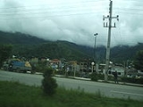
Covering an area of 2441 square kilometres, Savâdkuh is located at the centre of Mazandaran province. It is limited northward by Qaemŝahr
, westward by Babol
, eastward by Sari
, southward by the Alborz
mountain range and Tehran
, and southeast by Semnan province. The main part of this city is located in a valley, in the central Alborz region, where Tâlâr river passes.
The tallest summit of Savâdkuh, is Arfa- Kuh, with a height of 3500 metres. The most important rivers flowing in this city are Tâlâr and Babol-rud, which originate from the Alborz mountain range standing southeast and southwest of Savâdkuh. These rivers irrigate the farmlands in Babol, Babolsar and Qaemŝahr.Including two areas of mountain in the north and futhill in the south, the mountainous area has a temperate and humid climate, and the weather in the south is dry and cold.
, Zirab
, Shirgah
and Alasht
; two districts Central and Ŝirgâh; and 6 hamlets, Ŝarq o Qarbe Ŝirgâh, Lafur, Sorx-kolâ, Valupei, Rastopei and Kassiliyân. Having 250 seasonal and permanent villages, the language spoken in Savâdkuh is Mazandarani. Its native inhabitants are Shiite Muslims.
 The farmlands in Savâdkuh are limited because of its large forests and mountainous areas. So the farmers use their crops themselves, including rice, wheat, barley and sugar cane. According to geographical features, the economy of this city is based on apiculture and animal husbandry, more than agriculture.
Pateŝxârgar and, following the Arab conquest, Perso-Arabic Faršavâdjar. The Greek historiographer Strabo
records this name as Prâxovâtrâs.
In his inscription at Ka'ba-ye Zartosht, the second Sassanid monarch Shapur I
, refers to the region as Pâdešxâr. In the Book of Deeds of Ardashir, Son of Babag, it is Patešxâr again. Ebne Esfandiar and Mir Zahirod-Dine Mara‘shi – the old geographers of Mazandaran – give its name as Patešxârgar as a large area in present-day Mazandaran, including Azerbaijan
, Gilan, Tabaristan, Kumesh and Damghan.
Mohammad Hassan Khan (Etemad Saltaneh's Tadvin Fi Ahval Jebal Ŝervin, History of Savâdkuh) mentions it as the old name of the ancient area of Savâdkuh. They believe that the word "Savad" was distorted and changed to Faršavât. Savâdkuh enjoyed great importance in the history of Tabaristan and even in Iran.
Its tall mountains were the feudal seats of the Bavand dynasty
, with which the Karan-Vands
were allied. They defended the area against the invasions of the Amawid and Abbasid
s and tried to preserve their Zoroastrian
religion and culture. The existence of numerous fortresses and military fortifications that date to the 8th-10th centuries vindicate this claim. In addition, Lajim tower with its 10th century brick-face inscription in Pahlavi script demonstrates the attention of the Savâdkuhs to the script, language and customs of their ancestors. The population of this region composed many poems, describing the heroic efforts and bravery of their notables.
and Persian
, for the major part; and Mazandarani and Persian for the inhabitants of the villages.
On the right side of the cave, numerous trenches and defensive buildings were built, all of which remained firm and intact after centuries.
These two parts were connected through a road made of stones and mortar. 2 meters wide, this road was built 50 meters above earth level. Today only traces of it remain. The existence of some foundations, confirm that this cave was surrounded by a raw wall. The remains of a cistern, several silos and numerous defensive monuments are located outside the cave.
Dating back to the end of the Sassanid period, it was regarded as a fortified garrison and a fortress of Tabarestan in the early Islamic centuries. According to chronicles, this cave was used as a shelter by Xorŝid, the last ruler of Tabarestan. But other evidences indicate that it was used until 3rd-4th centuries AH.
Its L-shaped entrance is connected to a quadrilateral chamber through a corridor. 5 watchtowers stud inside the castle. It was used as a landmark for caravans, from the end of the Sassanid period to the 6-7th centuries AH.
Covering an area of 1000 square meters, the castle features 7 towers. 5 of them are circular constructions and the 2 others have rectangular plans located on both sides of the main entrance. Its 8 meter-thick wall consists of two parts, 6 meters of it, was made of cut stone and mortar, and the other part was made of fired bricks measuring 37x37x8 cm. Access to the building is gained from the south. The entrance houses two square vestibules, connected through a corridor. Housing a cistern, the monument was used from the end of the Sassanid period to the 5-6th century AH.
Two bands of brick inscriptions in Kufic and Pahlavi-Sassanid scripts adorn the tomb tower.
For more information see :
in Ŝahryâr-Kuh. Built on a rock, this tomb tower is a cylindrical construction with a twin-shelled dome. Dating back to the 9th century AH, its inner walls are adorned with stucco carvings. The tower is 3.20 meters thick and 2.20 meters high. The grave of this monument was carved in a rock. The remains of some tiles indicate that the dome was probably decorated with tile-work.
Counties of Iran
The provinces of Iran further subdivided into counties called shahrestan , an area inside an ostan, and consists of a city centre, few bakhsh and many villages around them. There are usually a few cities and rural agglomerations in each county. Rural agglomerations are a collection of a number...
in Mazandaran Province
Mazandaran Province
Mazandaran Province is a Caspian province in the north of Iran. Located on the southern coast of the Caspian Sea, it is bordered clockwise by the Golestan, Semnan, Tehran, Alborz, Qazvin, and Gilan provinces....
in Iran
Iran
Iran , officially the Islamic Republic of Iran , is a country in Southern and Western Asia. The name "Iran" has been in use natively since the Sassanian era and came into use internationally in 1935, before which the country was known to the Western world as Persia...
. At the 2006 census, the county's population was 66,430, in 17,918 families. The county is subdivided into two districts: the Central District
Central District (Savadkuh County)
The Central District of Savadkuh County is a district in Savadkuh County, Mazandaran Province, Iran. At the 2006 census, its population was 42,679, in 11,396 families. The District has three cities: Pol-e Sefid, Zirab, and Alasht....
and Shirgah District
Shirgah District
Shirgah District is a district in Savadkuh County, Mazandaran Province, Iran. At the 2006 census, its population was 23,751, in 6,522 families. The District has one city: Shirgah....
. The county has six cities: Zirab
Zirab
Zirab is a city in and capital of Savadkuh County, Mazandaran Province, Iran. At the 2006 census, its population was 18,216, in 4,764 families....
, Shirgah
Shirgah
Shirgah is a city in and capital of Shirgah District, in Savadkuh County, Mazandaran Province, Iran. At the 2006 census, its population was 8,529, in 2,269 families....
, Alasht
Alasht
Alasht is a city in the Central District of Savadkuh County, Mazandaran Province, Iran. At the 2006 census, its population was 976, in 287 families....
, and Pol-e Sefid.
Covering an area of 2441 square kilometres, Savâdkuh is located at the centre of Mazandaran province. It is limited northward by Qaemŝahr
Qa'em Shahr
Qaem Shahr , Shāhābād , and Shahi , also Romanized as Shāhī) is a city in and the capital of Qaem Shahr County, Mazandaran Province, Iran...
, westward by Babol
Babol
Babol is a city in and the capital of Babol County, Mazandaran Province, Iran. At the 2006 census, its population was 198,636, in 55,943 families....
, eastward by Sari
Sari
A sari or sareeThe name of the garment in various regional languages include: , , , , , , , , , , , , , is a strip of unstitched cloth, worn by females, ranging from four to nine metres in length that is draped over the body in various styles. It is popular in India, Bangladesh, Nepal,...
, southward by the Alborz
Alborz
Alborz , also written as Alburz, Elburz or Elborz, is a mountain range in northern Iran stretching from the borders of Azerbaijan and Armenia in the northwest to the southern end of the Caspian Sea, and ending in the east at the borders of Turkmenistan and Afghanistan...
mountain range and Tehran
Tehran
Tehran , sometimes spelled Teheran, is the capital of Iran and Tehran Province. With an estimated population of 8,429,807; it is also Iran's largest urban area and city, one of the largest cities in Western Asia, and is the world's 19th largest city.In the 20th century, Tehran was subject to...
, and southeast by Semnan province. The main part of this city is located in a valley, in the central Alborz region, where Tâlâr river passes.
The tallest summit of Savâdkuh, is Arfa- Kuh, with a height of 3500 metres. The most important rivers flowing in this city are Tâlâr and Babol-rud, which originate from the Alborz mountain range standing southeast and southwest of Savâdkuh. These rivers irrigate the farmlands in Babol, Babolsar and Qaemŝahr.Including two areas of mountain in the north and futhill in the south, the mountainous area has a temperate and humid climate, and the weather in the south is dry and cold.
Savâdkuh consists of four cities
Savâdkuh consists of four cities, PolSefidPolSefid
Pol-Sefid is an Iranian city in the Savadkuh, Mazandaran Province. It has about 11,249 residents....
, Zirab
Zirab
Zirab is a city in and capital of Savadkuh County, Mazandaran Province, Iran. At the 2006 census, its population was 18,216, in 4,764 families....
, Shirgah
Shirgah
Shirgah is a city in and capital of Shirgah District, in Savadkuh County, Mazandaran Province, Iran. At the 2006 census, its population was 8,529, in 2,269 families....
and Alasht
Alasht
Alasht is a city in the Central District of Savadkuh County, Mazandaran Province, Iran. At the 2006 census, its population was 976, in 287 families....
; two districts Central and Ŝirgâh; and 6 hamlets, Ŝarq o Qarbe Ŝirgâh, Lafur, Sorx-kolâ, Valupei, Rastopei and Kassiliyân. Having 250 seasonal and permanent villages, the language spoken in Savâdkuh is Mazandarani. Its native inhabitants are Shiite Muslims.
Historical background
Darius I, the great Achaemenian monarch in his famous inscription in Behistun, mentions Pâtišvâreš as one of the territories under his rule. This Old Persian form subsequently became Middle PersianMiddle Persian
Middle Persian , indigenously known as "Pârsig" sometimes referred to as Pahlavi or Pehlevi, is the Middle Iranian language/ethnolect of Southwestern Iran that during Sassanid times became a prestige dialect and so came to be spoken in other regions as well. Middle Persian is classified as a...
Pateŝxârgar and, following the Arab conquest, Perso-Arabic Faršavâdjar. The Greek historiographer Strabo
Strabo
Strabo, also written Strabon was a Greek historian, geographer and philosopher.-Life:Strabo was born to an affluent family from Amaseia in Pontus , a city which he said was situated the approximate equivalent of 75 km from the Black Sea...
records this name as Prâxovâtrâs.
In his inscription at Ka'ba-ye Zartosht, the second Sassanid monarch Shapur I
Shapur I
Shapur I or also known as Shapur I the Great was the second Sassanid King of the Second Persian Empire. The dates of his reign are commonly given as 240/42 - 270/72, but it is likely that he also reigned as co-regent prior to his father's death in 242 .-Early years:Shapur was the son of Ardashir I...
, refers to the region as Pâdešxâr. In the Book of Deeds of Ardashir, Son of Babag, it is Patešxâr again. Ebne Esfandiar and Mir Zahirod-Dine Mara‘shi – the old geographers of Mazandaran – give its name as Patešxârgar as a large area in present-day Mazandaran, including Azerbaijan
Azerbaijan (disambiguation)
Today, Azerbaijan or Azarbaijan is defined as north-west provinces of Iran, south of Aras River, and former Soviet republic of Azerbaijan, north of Aras.The term may refer to:- Geography :...
, Gilan, Tabaristan, Kumesh and Damghan.
Mohammad Hassan Khan (Etemad Saltaneh's Tadvin Fi Ahval Jebal Ŝervin, History of Savâdkuh) mentions it as the old name of the ancient area of Savâdkuh. They believe that the word "Savad" was distorted and changed to Faršavât. Savâdkuh enjoyed great importance in the history of Tabaristan and even in Iran.
Its tall mountains were the feudal seats of the Bavand dynasty
Bavand Dynasty
The Bavandi Dynasty was an Iranian dynasty that started in the early seventh century, as an independent group of rulers, reigning over Tabaristan in what is now northern Iran....
, with which the Karan-Vands
House of Karen
The House of Karen were an aristocratic feudal family of Hyrcania...
were allied. They defended the area against the invasions of the Amawid and Abbasid
Abbasid
The Abbasid Caliphate or, more simply, the Abbasids , was the third of the Islamic caliphates. It was ruled by the Abbasid dynasty of caliphs, who built their capital in Baghdad after overthrowing the Umayyad caliphate from all but the al-Andalus region....
s and tried to preserve their Zoroastrian
Zoroastrianism
Zoroastrianism is a religion and philosophy based on the teachings of prophet Zoroaster and was formerly among the world's largest religions. It was probably founded some time before the 6th century BCE in Greater Iran.In Zoroastrianism, the Creator Ahura Mazda is all good, and no evil...
religion and culture. The existence of numerous fortresses and military fortifications that date to the 8th-10th centuries vindicate this claim. In addition, Lajim tower with its 10th century brick-face inscription in Pahlavi script demonstrates the attention of the Savâdkuhs to the script, language and customs of their ancestors. The population of this region composed many poems, describing the heroic efforts and bravery of their notables.
Language
The languages spoken in Savâdkuh are MazandaraniMazandarani
Mazandarani may refer to :* Mazandarani people, Mazandaranis, Tabarian people* Mazandarani language, A language spoken mainly in South Caspian region* Morteza Sadouqi Mazandarani, Iranian grand ayatollah...
and Persian
Persian language
Persian is an Iranian language within the Indo-Iranian branch of the Indo-European languages. It is primarily spoken in Iran, Afghanistan, Tajikistan and countries which historically came under Persian influence...
, for the major part; and Mazandarani and Persian for the inhabitants of the villages.
Natural attractions
The most important natural attractions of Savâdkuh are: Ŝur Mâst lake, near a village by the same name, Gâzu waterfall in Lafur hamlet, waterfalls of Ŝirgâ and Gaduk, the mountains of Arfa Kuh, Sangâr and Qadamgâ, in Rassto Pei hamlet and Shervin mountain in Valu Pei hamlet; and Alaŝt city.Espâbod Xorŝid Cave
This cave is located at the beginning of Xatirkuh road, 2 km away from Ravat-sar village. Measuring 80x100 meters, its arched entrance is the largest natural one in the world. On the left side of the cave, a four-story-high castle was built. Made of stones and mortar, it is the masterpiece of architecture of its time.On the right side of the cave, numerous trenches and defensive buildings were built, all of which remained firm and intact after centuries.
These two parts were connected through a road made of stones and mortar. 2 meters wide, this road was built 50 meters above earth level. Today only traces of it remain. The existence of some foundations, confirm that this cave was surrounded by a raw wall. The remains of a cistern, several silos and numerous defensive monuments are located outside the cave.
Dating back to the end of the Sassanid period, it was regarded as a fortified garrison and a fortress of Tabarestan in the early Islamic centuries. According to chronicles, this cave was used as a shelter by Xorŝid, the last ruler of Tabarestan. But other evidences indicate that it was used until 3rd-4th centuries AH.
Ravat-sar Castle
Located on a mountain, at the junction of Xatirkuh road (the Semnan-Tabarestan road) and Firuzkuh road (the historic road from Rey to Tabarestan), overlooking Ravat-sar village, this castle has an irregular base and covers approximately 500 square meters. Made of stones and mortar, it was built according to the shape of the mountain. Its walls measure 34, 15, 36 and 13 meters. Today only 4.5 meters of its walls remain.Its L-shaped entrance is connected to a quadrilateral chamber through a corridor. 5 watchtowers stud inside the castle. It was used as a landmark for caravans, from the end of the Sassanid period to the 6-7th centuries AH.
Kangelu Castle
Located on an isolated mountain, in Rassto-pei hamlet, and made of stones and mortar, the castle is surrounded by tall walls. On the northern and southern sides of the wall, two solid towers were symmetrically built. Facing to the north and south, the walls are 18.80 meters long and the towers are 7 meters high. Housing several rums, the central tower features two arches, which show that it was a two-story-high building. The inner and exterior walls are covered by mortar. According to features of the architecture and the potteries found in it, the castle dates back to the end of the Sassanid period and the early Islamic period.Hassan Bur (Kassiliyan) Castle
With an altitude of 850 meters above free sea level, it is located in Hassan Bur forest, on a conical wuded mountain. The name of this castle appears in Ebne Esfandiyar’s Tarikhe Tabarestan and Seyyed Zahirod-Din Mar‘ashi’s Tarikhe Tabarestan, Royan Va Mazandaran. Having a hexagonal plan, it was built according to the shape of the mountain. The length of its sides ranges from 15 to 23.5 meters.Covering an area of 1000 square meters, the castle features 7 towers. 5 of them are circular constructions and the 2 others have rectangular plans located on both sides of the main entrance. Its 8 meter-thick wall consists of two parts, 6 meters of it, was made of cut stone and mortar, and the other part was made of fired bricks measuring 37x37x8 cm. Access to the building is gained from the south. The entrance houses two square vestibules, connected through a corridor. Housing a cistern, the monument was used from the end of the Sassanid period to the 5-6th century AH.
Mâziyâr Castle, Lafur
Located on a wooded mountain, near Lafurak village and covering an area of 1000 square meters, it is some 200 meters long and 50 meters wide. The plan of the castle follows the shape of the mountain. Its 4 meter-thick walls are made of stone, fired bricks and mortar. With a width of 3 meters, the entrance is located on the southern edge of the building. The castle features a small pool decorated with turquoise tile-work; and numerous barrel-drains allowed water of a spring to enter it and exit through a sewer. The castle was habitable through the early 6th to 7th century AH.Chehel-Dar Castle
Overluking Veresk bridge, near the village by the same name, atop a mountain leading to the precipices from three sides and having a rectangular plan, it is 450 meters long and 110 meters wide. The construction is made of stone and mortar. Several fired bricks were found inside the castle, indicating that it had many brick buildings in the past. Covering an area of 100 square meters, its entrance is located on the southern edge of the monument. The remains of the planks resting on the walls, indicate that the castle had several stories. Facing southward, there are numerous windows, used for shooting. Several stone cylindrical towers stud in the building, strengthening its structure. This castle and many others in Savâdkuh, belonged to the Bavand family. According to the found pieces of pottery, it was in use from the end of the Sassanid period to 6-7th centuries AH.Watchtower of Professor Ŝervin Bavand
Located on the Firuzkuh road, at the beginning of Vassi-sar village road, near a stream, atop a rock, having an octagonal plan, each of its sides is 1.50 meters long. Access to the tower is gained from the north and several windows are located on its eastern, southern and northern sides. Housing numerous battlements, it was made of stone, mortar and cement. Dating back to the end of the Sassanid period, the monument was restored several times in the Islamic period, especially during the reign of the Bavand dynasty. This watchtower was destroyed by an earthquake in 1957 AD and was later restored by professor Ŝervin Bavand, after whom it was named.Lajim Tower
Located in Lajim village, in Savâdkuh, it is called Emâmzâde Abdollah by the native inhabitants. Dating back to 413 AH, it is the burial place of Abol-Favaress Ŝahryâr Ebne ‘Abbas. It is a cylindrical brick construction crowned by a twin-shelled octagonal conical dome. Access to this tomb tower is gained from the east. The exterior facade is decorated with simple moqarnas (stalactites), which was unique in its time.Two bands of brick inscriptions in Kufic and Pahlavi-Sassanid scripts adorn the tomb tower.
For more information see :
Tomb Tower of Pir Ŝahryâr, Lamzâr Village
According to chronicles, this monument features a carved wooden door and a funerary case. The inscription of the case bears the poems of two poets from the Alborz mountain range, by the names of Sheikh Soltan Balu Kia Soltan – one of the dervishes of Tabarestan – and Darviŝ Mohammad Ŝahryâr, the devoted dervish. They lived in an interval of 170 to 200 years. In addition it gives the date of construction (Moharram, 880 AH, when Darviŝ Mohammad Ŝahryâr ruled in this area). He was one of the grandsons of the Bavand dynastyBavand Dynasty
The Bavandi Dynasty was an Iranian dynasty that started in the early seventh century, as an independent group of rulers, reigning over Tabaristan in what is now northern Iran....
in Ŝahryâr-Kuh. Built on a rock, this tomb tower is a cylindrical construction with a twin-shelled dome. Dating back to the 9th century AH, its inner walls are adorned with stucco carvings. The tower is 3.20 meters thick and 2.20 meters high. The grave of this monument was carved in a rock. The remains of some tiles indicate that the dome was probably decorated with tile-work.