
.gif)
Route 20 (New Jersey)
Encyclopedia
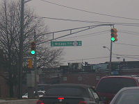
Route 20, known locally as McLean Boulevard, is a state highway
that runs 4.15 miles (6.68 km) in New Jersey
, United States
. It runs along the east side of Paterson
, Passaic County
, following the west bank of the Passaic River
between U.S. Route 46
and River Street (County Route 504
), at which point County Route 504 begins. It is a four- to six-lane divided highway
most of its length that runs through residential and commercial areas of Paterson, intersecting with Interstate 80
and Route 4 at interchanges. The northernmost part of the route is a county-maintained one-way pair
that follows 1st and 2nd Avenues.
and County Route 630 (Crooks Avenue) just north of the Garden State Parkway on the border of Clifton and Paterson. The road follows the bend of the Passaic River
directly north of Dundee Lake, heading to the north into Paterson as McLean Boulevard, a four-lane divided highway
with a 45 mph (72.4 km/h) speed limit. The route runs in between the Passaic River to the east and two large cemeteries to the west before coming to an interchange with Interstate 80
and Market Street. Past Interstate 80, Route 20 becomes a six-lane divided highway that heads through a mix of residential and commercial areas.
The next interchange along the route is for Route 4 (Broadway), with access to both eastbound Route 4 and westbound Broadway from both directions. The road continues further north as a four-lane divided highway with a speed limit of 35 mph (56.3 km/h), heading through more urbanized areas of Paterson. It crosses County Route 651 (East 33rd Street/Morlot Avenue), which crosses the Passaic River to become County Route 78 (Morlot Avenue) in Bergen County.
Route 20 continues to follow the Passaic River as a 45 mph (72.4 km/h) road through commercial areas, featuring an intersection with County Route 652 (5th Avenue). Past this intersection, the route proceeds through urban areas, turning west and splitting into a one-way pair
. Here, the route becomes county maintained, with the northbound direction following 1st Avenue and the southbound direction following 2nd Avenue before coming to an end at County Route 504
(River Street).
 The present-day routing of Route 20 north of Market Street was legislated in 1927 as part of Route 3, which was to run from the New York
border at Greenwood Lake
to Secaucus
. In addition, the present day routing south of Route 4 was also legislated as part of that route, which was to run from the George Washington Bridge
to Cape May
. In 1929, the western terminus of Route 3 was moved to Paterson as Route S4B (now Route 208) was planned to replace the alignment of Route 3 from Paterson to the New York border. McLean Boulevard through Paterson was built by the 1930s. In the 1953 New Jersey state highway renumbering
, Route 20 was legislated to follow the former alignment of Route 3 between Paterson and East Rutherford
as Route 3 was moved to the Route S3 freeway that was built between East Rutherford and Clifton.
Another freeway routing of Route 20 was planned in 1959. This road, which was to be a six-lane freeway called the Paterson Peripheral, was to run from Clifton north to the existing Route 20 in downtown Paterson. This road was completed between the Garden State Parkway and Valley Road by 1969 and north to Interstate 80 in 1971. Upon completion, this road received the Route 20 designation. In 1972, the state took over maintenance of the Paterson Plank Road from Route 3 to Route 17 in East Rutherford and made it a part of the route. As these three sections of Route 20 were not connected, they received three different route designations by the 1990s. The freeway section of Route 20 from the Garden State Parkway to Interstate 80 was designated Route 19, the section between Route 3 and Route 17 was designated Route 120
, and the Route 20 designation was retained along McLean Boulevard through Paterson. The unfinished section of Route 20 that was to connect McLean Boulevard to Paterson Plank Road was built as a northern extension of the Route 21 freeway in 2000.
{|class=wikitable
!Location
!Mile
!Destinations
!Notes
|-
|rowspan=2|Clifton
|0.00
|
|Interchange; southbound exit and northbound entrance
|-
|rowspan=2|0.08
|rowspan=2|
|rowspan=2|Interchange; southbound exit and northbound entrance
|-
|rowspan=10|Paterson
|-
|0.70
|
|Interchange
|-
|0.81
|
|Interchange
|-
|1.86
| – New York
|Interchange; no northbound entrance
|-
|1.92
|Broadway – Paterson
|
|-
|2.63
|
|
|-
|3.35
|
|
|-
|3.45
|
|
|-
|3.97
|Maple Avenue – Glen Rock, Ridgewood
|
|-
|4.15
|
|
State highway
State highway, state road or state route can refer to one of three related concepts, two of them related to a state or provincial government in a country that is divided into states or provinces :#A...
that runs 4.15 miles (6.68 km) in New Jersey
New Jersey
New Jersey is a state in the Northeastern and Middle Atlantic regions of the United States. , its population was 8,791,894. It is bordered on the north and east by the state of New York, on the southeast and south by the Atlantic Ocean, on the west by Pennsylvania and on the southwest by Delaware...
, United States
United States
The United States of America is a federal constitutional republic comprising fifty states and a federal district...
. It runs along the east side of Paterson
Paterson, New Jersey
Paterson is a city serving as the county seat of Passaic County, New Jersey, United States. As of the 2010 United States Census, its population was 146,199, rendering it New Jersey's third largest city and one of the largest cities in the New York City Metropolitan Area, despite a decrease of 3,023...
, Passaic County
Passaic County, New Jersey
Passaic County is a county located in the U.S. state of New Jersey. As of the 2010 Census, the population was 501,226. Its county seat is Paterson...
, following the west bank of the Passaic River
Passaic River
The Passaic River is a mature surface river, approximately 80 mi long, in northern New Jersey in the United States. The river in its upper course flows in a highly circuitous route, meandering through the swamp lowlands between the ridge hills of rural and suburban northern New Jersey,...
between U.S. Route 46
U.S. Route 46
U.S. Route 46 is an east–west U.S. Highway, running for , completely within the state of New Jersey. The west end is at an interchange with Interstate 80 and Route 94 in Columbia, Warren County on the Delaware River...
and River Street (County Route 504
County Route 504 (New Jersey)
County Route 504 is a county highway in the U.S. state of New Jersey. The highway extends 15.94 miles from Main Street in Montville County Route 504 is a county highway in the U.S. state of New Jersey. The highway extends 15.94 miles (25.65 kilometers) from Main Street in Montville County Route...
), at which point County Route 504 begins. It is a four- to six-lane divided highway
Divided Highway
Divided Highway is a compilation album by American rock band The Doobie Brothers, released in 2003. . All tracks are taken from the albums Cycles and Brotherhood .-Track listing:...
most of its length that runs through residential and commercial areas of Paterson, intersecting with Interstate 80
Interstate 80 in New Jersey
Interstate 80 is a major Interstate Highway in the United States, running from the New York City Metropolitan Area westward to San Francisco, California...
and Route 4 at interchanges. The northernmost part of the route is a county-maintained one-way pair
One-way pair
A one-way pair, one-way couple, or just couplet is a pair of parallel, usually one-way streets that carry opposite directions of a signed route or major traffic flow, or sometimes opposite directions of a bus or streetcar route....
that follows 1st and 2nd Avenues.
Route description
Route 20 begins at an interchange with U.S. Route 46U.S. Route 46
U.S. Route 46 is an east–west U.S. Highway, running for , completely within the state of New Jersey. The west end is at an interchange with Interstate 80 and Route 94 in Columbia, Warren County on the Delaware River...
and County Route 630 (Crooks Avenue) just north of the Garden State Parkway on the border of Clifton and Paterson. The road follows the bend of the Passaic River
Passaic River
The Passaic River is a mature surface river, approximately 80 mi long, in northern New Jersey in the United States. The river in its upper course flows in a highly circuitous route, meandering through the swamp lowlands between the ridge hills of rural and suburban northern New Jersey,...
directly north of Dundee Lake, heading to the north into Paterson as McLean Boulevard, a four-lane divided highway
Divided Highway
Divided Highway is a compilation album by American rock band The Doobie Brothers, released in 2003. . All tracks are taken from the albums Cycles and Brotherhood .-Track listing:...
with a 45 mph (72.4 km/h) speed limit. The route runs in between the Passaic River to the east and two large cemeteries to the west before coming to an interchange with Interstate 80
Interstate 80 in New Jersey
Interstate 80 is a major Interstate Highway in the United States, running from the New York City Metropolitan Area westward to San Francisco, California...
and Market Street. Past Interstate 80, Route 20 becomes a six-lane divided highway that heads through a mix of residential and commercial areas.
The next interchange along the route is for Route 4 (Broadway), with access to both eastbound Route 4 and westbound Broadway from both directions. The road continues further north as a four-lane divided highway with a speed limit of 35 mph (56.3 km/h), heading through more urbanized areas of Paterson. It crosses County Route 651 (East 33rd Street/Morlot Avenue), which crosses the Passaic River to become County Route 78 (Morlot Avenue) in Bergen County.
Route 20 continues to follow the Passaic River as a 45 mph (72.4 km/h) road through commercial areas, featuring an intersection with County Route 652 (5th Avenue). Past this intersection, the route proceeds through urban areas, turning west and splitting into a one-way pair
One-way pair
A one-way pair, one-way couple, or just couplet is a pair of parallel, usually one-way streets that carry opposite directions of a signed route or major traffic flow, or sometimes opposite directions of a bus or streetcar route....
. Here, the route becomes county maintained, with the northbound direction following 1st Avenue and the southbound direction following 2nd Avenue before coming to an end at County Route 504
County Route 504 (New Jersey)
County Route 504 is a county highway in the U.S. state of New Jersey. The highway extends 15.94 miles from Main Street in Montville County Route 504 is a county highway in the U.S. state of New Jersey. The highway extends 15.94 miles (25.65 kilometers) from Main Street in Montville County Route...
(River Street).
History
New York
New York is a state in the Northeastern region of the United States. It is the nation's third most populous state. New York is bordered by New Jersey and Pennsylvania to the south, and by Connecticut, Massachusetts and Vermont to the east...
border at Greenwood Lake
Greenwood Lake
Greenwood Lake is an interstate lake approximately seven miles long, straddling the border of New Jersey and New York. It is located in West Milford, New Jersey and Greenwood Lake, New York ....
to Secaucus
Secaucus, New Jersey
Secaucus is a town in Hudson County, New Jersey. As of the 2010 United States Census, the town population was 16,264. Located within the New Jersey Meadowlands, it is the most suburban of the county's municipalities, though large parts of the town are dedicated to light manufacturing, retail, and...
. In addition, the present day routing south of Route 4 was also legislated as part of that route, which was to run from the George Washington Bridge
George Washington Bridge
The George Washington Bridge is a suspension bridge spanning the Hudson River, connecting the Washington Heights neighborhood in the borough of Manhattan in New York City to Fort Lee, Bergen County, New Jersey. Interstate 95 and U.S. Route 1/9 cross the river via the bridge. U.S...
to Cape May
Cape May, New Jersey
Cape May is a city at the southern tip of Cape May Peninsula in Cape May County, New Jersey, where the Delaware Bay meets the Atlantic Ocean and is one of the country's oldest vacation resort destinations. It is part of the Ocean City Metropolitan Statistical Area. As of the 2010 United States...
. In 1929, the western terminus of Route 3 was moved to Paterson as Route S4B (now Route 208) was planned to replace the alignment of Route 3 from Paterson to the New York border. McLean Boulevard through Paterson was built by the 1930s. In the 1953 New Jersey state highway renumbering
1953 New Jersey state highway renumbering
On January 1, 1953, the New Jersey Department of Transportation renumbered many of the State Routes. A few rules were followed in deciding what to renumber:...
, Route 20 was legislated to follow the former alignment of Route 3 between Paterson and East Rutherford
East Rutherford, New Jersey
East Rutherford is a borough in Bergen County, New Jersey. As of the 2010 United States Census, the borough population was 8,913. It is an inner-ring suburb of New York City, located west of Midtown Manhattan....
as Route 3 was moved to the Route S3 freeway that was built between East Rutherford and Clifton.
Another freeway routing of Route 20 was planned in 1959. This road, which was to be a six-lane freeway called the Paterson Peripheral, was to run from Clifton north to the existing Route 20 in downtown Paterson. This road was completed between the Garden State Parkway and Valley Road by 1969 and north to Interstate 80 in 1971. Upon completion, this road received the Route 20 designation. In 1972, the state took over maintenance of the Paterson Plank Road from Route 3 to Route 17 in East Rutherford and made it a part of the route. As these three sections of Route 20 were not connected, they received three different route designations by the 1990s. The freeway section of Route 20 from the Garden State Parkway to Interstate 80 was designated Route 19, the section between Route 3 and Route 17 was designated Route 120
New Jersey Route 120
Route 120 is a state highway located in Bergen County, New Jersey, United States. It extends from an interchange with Route 3 in East Rutherford to another interchange with Route 17 in Carlstadt, where it continues to the west as County Route 120. NJ 120 serves the Meadowlands Sports Complex,...
, and the Route 20 designation was retained along McLean Boulevard through Paterson. The unfinished section of Route 20 that was to connect McLean Boulevard to Paterson Plank Road was built as a northern extension of the Route 21 freeway in 2000.
Major intersections
The entire route is in Passaic County.{|class=wikitable
!Location
!Mile
!Destinations
!Notes
|-
|rowspan=2|Clifton
|0.00
|
|Interchange; southbound exit and northbound entrance
|-
|rowspan=2|0.08
|rowspan=2|
|rowspan=2|Interchange; southbound exit and northbound entrance
|-
|rowspan=10|Paterson
|-
|0.70
|
|Interchange
|-
|0.81
|
|Interchange
|-
|1.86
| – New York
|Interchange; no northbound entrance
|-
|1.92
|Broadway – Paterson
|
|-
|2.63
|
|
|-
|3.35
|
|
|-
|3.45
|
|
|-
|3.97
|Maple Avenue – Glen Rock, Ridgewood
|
|-
|4.15
|
|