
.gif)
Route 16 (Japan)
Encyclopedia
National highways of Japan
Japan has a nationwide system of distinct from the expressways. The Ministry of Land, Infrastructure and Transport and other government agencies administer the national highways. Beginning in 1952, Japan classified these as Class 1 or Class 2. Class 1 highways had one- or two-digit numbers, while...
in Japan
Japan
Japan is an island nation in East Asia. Located in the Pacific Ocean, it lies to the east of the Sea of Japan, China, North Korea, South Korea and Russia, stretching from the Sea of Okhotsk in the north to the East China Sea and Taiwan in the south...
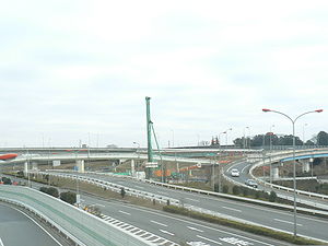
. A beltway around Tokyo
Tokyo
, ; officially , is one of the 47 prefectures of Japan. Tokyo is the capital of Japan, the center of the Greater Tokyo Area, and the largest metropolitan area of Japan. It is the seat of the Japanese government and the Imperial Palace, and the home of the Japanese Imperial Family...
, it links the major prefectural capital cities
Municipalities of Japan
Japan has three levels of government: national, prefectural, and municipal. The nation is divided into 47 prefectures. Each prefecture consists of numerous municipalities. There are four types of municipalities in Japan: cities, towns, villages and special wards...
of Yokohama (in Kanagawa Prefecture
Kanagawa Prefecture
is a prefecture located in the southern Kantō region of Japan. The capital is Yokohama. Kanagawa is part of the Greater Tokyo Area.-History:The prefecture has some archaeological sites going back to the Jōmon period...
), Saitama
Saitama, Saitama
' is the capital and the most populous city of Saitama Prefecture in Japan, situated in the south-east of the prefecture. Its area incorporates the former cities of Urawa, Ōmiya, Yono and Iwatsuki. It is a city designated by government ordinance...
(in Saitama Prefecture
Saitama Prefecture
is a prefecture of Japan located in the Kantō region of the island of Honshu. The capital is the city of Saitama.This prefecture is part of the Greater Tokyo Area, and most of Saitama's cities can be described as suburbs of Tokyo, to which a large amount of residents commute each day.- History...
), and Chiba
Chiba, Chiba
is the capital city of Chiba Prefecture, Japan. It is located approximately 40 km east of the center of Tokyo on Tokyo Bay. Chiba City became a government designated city in 1992. Its population as of 2008 is approximately 960,000....
(in Chiba Prefecture
Chiba Prefecture
is a prefecture of Japan located in the Kantō region and the Greater Tokyo Area. Its capital is Chiba City.- History :Chiba Prefecture was established on June 15, 1873 with the merger of Kisarazu Prefecture and Inba Prefecture...
) as well as Hachiōji
Hachioji, Tokyo
is a city located in Tokyo, Japan, about 40 kilometers west of the center of the special wards of Tokyo.As of January 1, 2010, the city has an estimated population of 551,901 and a population density of 2,962.27/km². The total area is 186.31 km². It is the eighth largest city in the...
(in Tokyo). It also serves Yokosuka
Yokosuka, Kanagawa
is a city located in Kanagawa, Japan. As of 2010, the city had an estimated population of 419,067 and a population density of 4,160 people per km². It covered an area of 100.62 km²...
and Sagamihara
Sagamihara, Kanagawa
is a city located in north central Kanagawa Prefecture, bordering Tokyo, Japan. It is the third most populous city in the prefecture, after Yokohama and Kawasaki, and the fifth most populous suburb of Greater Tokyo. Its northern neighbor is Machida, with which a cross-prefectural merger has been...
(in Kanagawa Prefecture), Kasukabe
Kasukabe, Saitama
is a city in eastern Saitama, Japan, approximately north of Tokyo. It was formerly located in Kitakatsushika and Minamisaitama districts. Kasukabe once prospered as part of the Nikkō Kaidō highway, an important trade route that linked Edo with Nikkō.-Overview:...
(in Saitama Prefecture), and Kisarazu
Kisarazu, Chiba
is a city located in Chiba, Japan. As of September 2010, Kisarazu has an estimated population of 126,906 and a density of 915 persons per km². The total area was 138.73 km²....
(in Chiba Prefecture). The total length is 241 km.
Route Data
- Length: 241 km (150 mi)
- Origin and Terminus: Nishi-ku, YokohamaNishi-ku, Yokohamais one of the 18 wards of the city of Yokohama in Kanagawa Prefecture, Japan. As of 2010, the ward had an estimated population of 93,027 and a density of 13,210 persons per km². The total area was 7.04 km².-Geography:...
(originates and ends at junction with Route 1Route 1 (Japan)National Route 1 is a major highway on the island of Honshū in Japan. It connects Chūō, Tokyo in the Kantō region with the city of Osaka, Osaka Prefecture in the Kansai region, passing through the Chūbu region en route. It follows the old Tōkaidō westward from Tokyo to Kyoto, and the old Kyo Kaidō...
) - Major cities: YokosukaYokosuka, Kanagawais a city located in Kanagawa, Japan. As of 2010, the city had an estimated population of 419,067 and a population density of 4,160 people per km². It covered an area of 100.62 km²...
, SagamiharaSagamihara, Kanagawais a city located in north central Kanagawa Prefecture, bordering Tokyo, Japan. It is the third most populous city in the prefecture, after Yokohama and Kawasaki, and the fifth most populous suburb of Greater Tokyo. Its northern neighbor is Machida, with which a cross-prefectural merger has been...
, HachiojiHachioji, Tokyois a city located in Tokyo, Japan, about 40 kilometers west of the center of the special wards of Tokyo.As of January 1, 2010, the city has an estimated population of 551,901 and a population density of 2,962.27/km². The total area is 186.31 km². It is the eighth largest city in the...
, KawagoeKawagoe, Saitamais a city located in Saitama Prefecture, Japan, and is about a 30-minute train ride from Ikebukuro in Tokyo.As of July 1, 2011, the city has an estimated population of 343,926...
, SaitamaSaitama, Saitama' is the capital and the most populous city of Saitama Prefecture in Japan, situated in the south-east of the prefecture. Its area incorporates the former cities of Urawa, Ōmiya, Yono and Iwatsuki. It is a city designated by government ordinance...
, KasukabeKasukabe, Saitamais a city in eastern Saitama, Japan, approximately north of Tokyo. It was formerly located in Kitakatsushika and Minamisaitama districts. Kasukabe once prospered as part of the Nikkō Kaidō highway, an important trade route that linked Edo with Nikkō.-Overview:...
, KashiwaKashiwa, Chibais a city located in northern Chiba Prefecture, Japan. As of February 2011, the city had an estimated population of 404,820 and a population density of 3520 persons per km²...
, ChibaChiba, Chibais the capital city of Chiba Prefecture, Japan. It is located approximately 40 km east of the center of Tokyo on Tokyo Bay. Chiba City became a government designated city in 1992. Its population as of 2008 is approximately 960,000....
and KisarazuKisarazu, Chibais a city located in Chiba, Japan. As of September 2010, Kisarazu has an estimated population of 126,906 and a density of 915 persons per km². The total area was 138.73 km²....