
.gif)
Route 128 (Massachusetts)
Encyclopedia
Route 128, also known as the Yankee Division Highway (for the 26th Infantry Division
), and originally the Circumferential Highway, is a partial beltway around Boston
, Massachusetts
, United States
. The majority of the highway is built to freeway standards, and about 3/5 of it is part of the Interstate Highway System
. With the rapid growth of high-technology industry in the suburban areas along Route 128 from the 1960s to the 1980s, Route 128 came to symbolize the Boston high-tech community itself. However, today the industry has expanded significantly onto Interstate 495
as well, the next beltway out.
In local culture, Route 128 is seen as something of a dividing line between the inner municipalities of Greater Boston and the more far-flung suburbs. The road's roughly 10 miles (16.1 km) radius, for example, also delimits most of the area accessible by the MBTA rapid transit
system. Much of the area within Route 128 was developed before World War II, while the area outside it was developed more recently.
The south end of Route 128 is in Canton, where Interstate 95 heads south toward Providence
, Rhode Island
, just east of the Northeast Corridor
's Route 128 Station. Common usage, as well as signs until 1997, continues Route 128 east along the first 7 miles (11 km) of Interstate 93 to the Braintree Split
in Braintree, where I-93 turns north with Route 3
toward downtown Boston. This section of former Route 128 serves as the north end of Route 24
to Fall River. (Until 1965, Route 128 continued further, southeast along Route 3
and roughly north on Route 228 to Hull.)
From Canton, Route 128 and Interstate 95 heads northwest, north, northeast and east around the Boston area to Peabody, where I-95 splits to head north toward Portsmouth
, New Hampshire
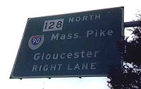
. Along this section, Route 128 has major interchange
s with Interstate 90 (the Mass Pike), Route 2
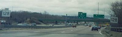
, U.S. Route 3, and Interstate 93. On roads approaching Route 128 here, guide signs only list I-95; Route 128 shields are in a separate sign assembly. U.S. Route 1 has also run along Route 128 near Dedham since 1989, forming a three-way wrong-way concurrency, with I-95 and Route 128 going one way and US 1 the other. (US 1 continues east on I-93 — former Route 128 — to Braintree, and turns north there with I-93 into Boston.)
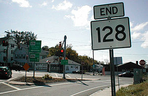
After it splits from I-95 in Peabody, Route 128 continues east into Cape Ann
. The freeway (termed a highway or expressway in Massachusetts) ends at a rotary with Route 127
in Gloucester, and the last bit of Route 128 is a surface road that bypasses downtown Gloucester to the northeast. After crossing Route 127 again (Route 127 runs in a loop through Gloucester and Rockport), Route 128 ends at Route 127A
east of downtown Gloucester.
to Gloucester
. The first, 27 miles (43.5 km), section of the current limited-access highway from Braintree
to Gloucester was opened in 1951. It was the first limited-access circumferential highway
in the United States.
 Route 128 runs concurrently with Interstate 95
from Canton
north to Peabody
and, when I-95 continues north from Peabody toward New Hampshire
, east from Peabody to Gloucester. Until the early 1990s, it also ran concurrently with the present Interstate 93
from Canton to Braintree. This stretch of Interstate 93, which is now also designated as part of U.S. Route 1, though no longer officially part of Route 128, is still often referred to as "Route 128" by locals. The I-95 and I-93 signage were added in the mid-1970s when plans to construct I-95
through Boston, directly connecting the two I-95/Route 128 interchanges, were cancelled. An unused cloverleaf
in Canton
, now removed, was the one leftover structure from this plan.
Until 1965, while and shortly after the Route 3
freeway to Cape Cod was fully finished, the section of current Route 3 between exits 15 and 20 was also designated as Route 128. The route's southern end was then truncated to its intersection with Route 3 in Braintree. The non-freeway section of Route 128 from Route 3 through Hingham
to Nantasket was redesignated Route 228. The Massachusetts Highway Department has tried twice, in 1997 and 2003, to truncate 128 even further, back to its intersection with I-95
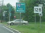
in Peabody, but local opposition has convinced them to back down. A reflection of these attempts are along every interchange, where the main signage on the intersecting route indicates the highway as I-95, while smaller signage to the sides also identifies the road as Route 128.
 The area along the western part of Route 128 is home to a number of high-technology firms and corporations. This part of Route 128 has been dubbed "America's Technology Highway", and through to the end of the 1980s, was second only to Silicon Valley
.
Route 128 makes more than a 180-degree arc around Boston, and clockwise is "north" even when the road heads slightly south of east when approaching the Atlantic Ocean. Hackers in the area refer to this as going "logical north" on the route. Interstate 93, going north-and-south, intersects Route 128, which nominally goes north-and-south, at a right angle, about 15 miles (24.1 km) north of Boston. A traveller going "logical south" on 128 (compass west) from the I-93 interchange will soon find himself driving due west, travelling logically south on 128 and I-95, and north on US 3
in a wrong-way concurrency.
Like the I-95 signage mapping onto 128, the mapping of US 3 onto this stretch of 128 is due to US 3 as a separate limited access highway terminating in Burlington
on 128 instead of further south at Route 2
in Lexington
as originally envisioned. This abrupt termination requires the US 3 signage to continue along 128 for somewhat over a mile until it can interchange the old US 3 surface arterial. Moreover, when I-93 and Route 128 ran concurrently south of Boston, before the route was truncated to the I-95 interchange in Canton, they were signed in opposite directions, so it was possible to travel north on I-93 and south on Route 128 at the same time.
Much of Route 128 is now part of the Interstate system, being concurrent with I-95 (and formerly I-93). However, the vast majority of locals will refer to these stretches as 128; it is uncommon for a local to use the Interstate designation(s) in ordinary conversation or while giving directions.
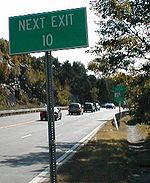 The northernmost several exits along Route 128, past exit 12, are not grade-separated
interchange
s. Exit 10 is signed as the signalized intersection with Route 127
, and there are two rotaries between that and exit 12 (the Crafts Road interchange).
In the 1990s, the exit system was changed from concurrency along 128 to a system using the I-95 exits. The exits, which had gone from Gloucester to Braintree, were renumbered along I-95, from the Rhode Island
state line to the border with New Hampshire
. Exit 37 had been the interchange with I-93, which also had its exit numbered 37 at that interchange. Coincidentally, with the renumbering, exit 37 remained exit 37.
Route 128 Station is located along the highway in Westwood
, Massachusetts
and is served by Amtrak
's Northeast Corridor
line and MBTA commuter rail.
".
Major companies located in the broader Route 128 area included Digital Equipment Corporation
, Data General
, Thermo Electron Corporation, Analog Devices
, Computervision
, Microsoft
, GTE
, Polaroid
, Sun Microsystems
, BEA Systems
, EMC Corporation
, and Raytheon
.
in Milton around the west side of Boston to Route 107 (Essex Street or Bridge Street) in Salem. Its route was as follows:
By 1928, it had been extended east to Quincy from its south end along the following streets, ending at the intersection of Route 3
and Route 3A (now Route 3A and Route 53):
The first section of the new Circumferential Highway, in no way the freeway that it is now, was the piece from Route 9
in Wellesley around the south side of Boston to Route 3
(now Route 53) in Hingham. Parts of this were built as new roads, but most of it was along existing roads that were improved to handle the traffic. In 1931, the Massachusetts Department of Public Works acquired a right-of-way
from Route 138
in Canton through Westwood, Dedham and Needham to Route 9 in Wellesley. This was mostly 80 feet (24 m) wide, only shrinking to 70 feet (21 m) in Needham, in the area of Great Plain Avenue and the Needham Line
. Much of this was along new alignment, but about half — mostly in Needham — was along existing roads:
From Route 138 in Canton east through the Blue Hills Reservation
in Canton, Milton, Quincy and Braintree, Norfolk County acquired a right-of-way in 1927 and built the Blue Hill River Road. This tied into West Street in northwest Braintree, which itself had been taken over by the county in 1923.
West Street led to Route 37, which ran southeast to Braintree center. This part of Route 37 had been taken over by the state in 1919 (to Braintree center) and 1917 (in Braintree center).
The rest of the new highway, from Route 37 east to Route 3
(now Route 53), through Braintree, Weymouth and Hingham, was taken over by the state in 1929. This was all along existing roads, except possibly the part of Park Avenue west of Route 18
in Weymouth.
By 1933, the whole Circumferential Highway had been completed, and, except for the piece from Route 9
in Wellesley south to Highland Avenue in Needham, was designated as Route 128. Former Route 128 along Highland Avenue into Needham center was left unnumbered (as was the Circumferential Highway north of Highland Avenue), but the rest of former Route 128, from Needham center east to Quincy, became part of Route 135
. Thus the full route of the Circumferential Highway, as it existed by 1933, is now the following roads:
At the same time as Route 128 was extended along the new Circumferential Highway, it was extended further into Hull. This alignment, not part of the Circumferential Highway, ran southeast on Route 3
(now Route 53) (Whiting Street) to the border of Hingham and Norwell, where it turned north on present Route 228 (Main Street) through Hingham and into Hull. The exact route through Hingham was Main Street, Short Street, Leavitt Street, East Street, and Hull Street. The end of the numbered route was at the south end of Nantasket Beach, where Nantasket Avenue curves northwest to follow the shore of Massachusetts Bay
.
. The project also included construction of a new two-lane ramp from Route 128 to I-95. The $33 million project was awarded to SPS New England of Salisbury
.
During the initial construction of Route 128, a provision had already been made for a fourth lane within the widely-spaced median
along the 1.5 mile (2.5 km) length of Route 128 running from just north of the U.S. Route 1 interchange in Dedham, MA, north-westwards to the Route 109 interchange, and this will finally be used for the Add-A-Lane project.
Construction on Phase 1 was officially completed in October 2009. Construction of Phase 2 of the project began in summer 2006. This phase of the project consisted of the replacement of the Route 1 and Route 1A bridges over Route 128 in Dedham
. Construction of four sound barriers were also included. Phase 2 of the project, as of June 2010, is 78% complete; final completion is projected for Spring 2011.
Construction on Phase 3 of the Route 128 widening project, begun in April 2009, widens Route 128 to 4 lanes in each direction from Route 24 to south of US 1. This phase of the project was expected to be completed by September 2011. Phase 4 of the Project, expected to begin in March 2011, replaces 7 bridges and widens Route 128 to 4 lanes in each direction from Route 109 to south of Highland Avenue in Needham. This phase of the project is expected to be completed by June 2015 with an estimated cost of $88 Million, the most expensive contract so far.
studied the Route 128/I-95 Corridor from approximately 2005–2010. The study focused on the heavily congested section from I-90 (Newton) to US 3 (Burlington), and was completed in November 2010. As of 2010, the highway carried over 200,000 vehicles per day. Some possible improvements to Route 128 include HOV
or HOT Lanes, reconstruction of shoulders, ramp metering, bus on shoulder, and fiber optic traffic system improvements. More studies will need to be completed before projects will begin.
A project valued at $5.8 million is expected to begin in 2012 and will replace 13 miles of traffic signs on Route 128 from Routes 4/225 in Lexington to Route 9 in Wellesley. These signs are being replaced as part of the five-phase widening project from Route 9 to Route 24.
Route 128 currently has 18 numbered interchanges, starting at 29 (southbound) and continuing downwards to 10 (former Exit 27, an at-grade intersection, was removed, and there is no Exit 11).
alternative rock artists, "Roadrunner
" by The Modern Lovers
and "Blue Thunder" by Galaxie 500
, prominently feature Route 128 in their lyrics.
26th Infantry Division (United States)
The 26th Infantry Division was an infantry division of the United States Army. As a major formation of the Massachusetts Army National Guard, it was based in Boston, Massachusetts for most of its history...
), and originally the Circumferential Highway, is a partial beltway around Boston
Boston
Boston is the capital of and largest city in Massachusetts, and is one of the oldest cities in the United States. The largest city in New England, Boston is regarded as the unofficial "Capital of New England" for its economic and cultural impact on the entire New England region. The city proper had...
, Massachusetts
Massachusetts
The Commonwealth of Massachusetts is a state in the New England region of the northeastern United States of America. It is bordered by Rhode Island and Connecticut to the south, New York to the west, and Vermont and New Hampshire to the north; at its east lies the Atlantic Ocean. As of the 2010...
, United States
United States
The United States of America is a federal constitutional republic comprising fifty states and a federal district...
. The majority of the highway is built to freeway standards, and about 3/5 of it is part of the Interstate Highway System
Interstate Highway System
The Dwight D. Eisenhower National System of Interstate and Defense Highways, , is a network of limited-access roads including freeways, highways, and expressways forming part of the National Highway System of the United States of America...
. With the rapid growth of high-technology industry in the suburban areas along Route 128 from the 1960s to the 1980s, Route 128 came to symbolize the Boston high-tech community itself. However, today the industry has expanded significantly onto Interstate 495
Interstate 495 (Massachusetts)
Interstate 495 is the designation of an Interstate Highway half-beltway in Massachusetts. It was the longest auxiliary Interstate Highway of its kind—measuring 120.74 miles —until 1996, when the PA Route 9 section of the Pennsylvania Turnpike was redesignated as Interstate 476, making it about ...
as well, the next beltway out.
In local culture, Route 128 is seen as something of a dividing line between the inner municipalities of Greater Boston and the more far-flung suburbs. The road's roughly 10 miles (16.1 km) radius, for example, also delimits most of the area accessible by the MBTA rapid transit
Rapid transit
A rapid transit, underground, subway, elevated railway, metro or metropolitan railway system is an electric passenger railway in an urban area with a high capacity and frequency, and grade separation from other traffic. Rapid transit systems are typically located either in underground tunnels or on...
system. Much of the area within Route 128 was developed before World War II, while the area outside it was developed more recently.
The south end of Route 128 is in Canton, where Interstate 95 heads south toward Providence
Providence, Rhode Island
Providence is the capital and most populous city of Rhode Island and was one of the first cities established in the United States. Located in Providence County, it is the third largest city in the New England region...
, Rhode Island
Rhode Island
The state of Rhode Island and Providence Plantations, more commonly referred to as Rhode Island , is a state in the New England region of the United States. It is the smallest U.S. state by area...
, just east of the Northeast Corridor
Northeast Corridor
The Northeast Corridor is a fully electrified railway line owned primarily by Amtrak serving the Northeast megalopolis of the United States from Boston in the north, via New York to Washington, D.C. in the south, with branches serving other cities...
's Route 128 Station. Common usage, as well as signs until 1997, continues Route 128 east along the first 7 miles (11 km) of Interstate 93 to the Braintree Split
Braintree Split
The Braintree Split is the intersection of Interstate 93/U.S. Route 1 and Massachusetts Route 3 located along the city line separating Braintree and Quincy, Massachusetts. The Braintree Split was also the southern end of Route 128 until 1997, when Route 128 was truncated to the I-95/I-93...
in Braintree, where I-93 turns north with Route 3
Route 3 (Massachusetts)
Route 3 is a southward continuation of U.S. Route 3, connecting Cambridge, Massachusetts with Cape Cod. All of it, except for the northernmost end in downtown Boston and Cambridge, is a freeway....
toward downtown Boston. This section of former Route 128 serves as the north end of Route 24
Route 24 (Massachusetts)
Route 24 is a freeway south of I-93 in southeastern Massachusetts, linking Fall River with the Boston metropolitan area. It begins in the south in Fall River at the border with Tiverton, Rhode Island where it connects with Rhode Island Route 24, and runs north to an interchange with Interstate...
to Fall River. (Until 1965, Route 128 continued further, southeast along Route 3
Route 3 (Massachusetts)
Route 3 is a southward continuation of U.S. Route 3, connecting Cambridge, Massachusetts with Cape Cod. All of it, except for the northernmost end in downtown Boston and Cambridge, is a freeway....
and roughly north on Route 228 to Hull.)
From Canton, Route 128 and Interstate 95 heads northwest, north, northeast and east around the Boston area to Peabody, where I-95 splits to head north toward Portsmouth
Portsmouth, New Hampshire
Portsmouth is a city in Rockingham County, New Hampshire in the United States. It is the largest city but only the fourth-largest community in the county, with a population of 21,233 at the 2010 census...
, New Hampshire
New Hampshire
New Hampshire is a state in the New England region of the northeastern United States of America. The state was named after the southern English county of Hampshire. It is bordered by Massachusetts to the south, Vermont to the west, Maine and the Atlantic Ocean to the east, and the Canadian...
. Along this section, Route 128 has major interchange
Interchange (road)
In the field of road transport, an interchange is a road junction that typically uses grade separation, and one or more ramps, to permit traffic on at least one highway to pass through the junction without directly crossing any other traffic stream. It differs from a standard intersection, at which...
s with Interstate 90 (the Mass Pike), Route 2
Route 2 (Massachusetts)
Route 2 is a major east–west state highway in Massachusetts, parts of which are sometimes known as the Cambridge and Concord Turnpike. Along with Route 9 and U.S. Route 20 to the south, these highways are the main alternatives to the Massachusetts Turnpike/I-90 toll highway...
, U.S. Route 3, and Interstate 93. On roads approaching Route 128 here, guide signs only list I-95; Route 128 shields are in a separate sign assembly. U.S. Route 1 has also run along Route 128 near Dedham since 1989, forming a three-way wrong-way concurrency, with I-95 and Route 128 going one way and US 1 the other. (US 1 continues east on I-93 — former Route 128 — to Braintree, and turns north there with I-93 into Boston.)
After it splits from I-95 in Peabody, Route 128 continues east into Cape Ann
Cape Ann
Cape Ann is a rocky cape in northeastern Massachusetts on the Atlantic Ocean. The cape is located approximately 30 miles northeast of Boston and forms the northern edge of Massachusetts Bay. Cape Ann includes the city of Gloucester, and the towns of Essex, Manchester-by-the-Sea, and...
. The freeway (termed a highway or expressway in Massachusetts) ends at a rotary with Route 127
Route 127 (Massachusetts)
Route 127 is a north–south Massachusetts state route that runs from Beverly to Gloucester. Much of the route is in Cape Ann.-Route description:Route 127 begins in Beverly concurrently with Route 22 at Route 1A, just north of the Essex Bridge...
in Gloucester, and the last bit of Route 128 is a surface road that bypasses downtown Gloucester to the northeast. After crossing Route 127 again (Route 127 runs in a loop through Gloucester and Rockport), Route 128 ends at Route 127A
Route 127A (Massachusetts)
Route 127A is a north–south Massachusetts state route that runs from Gloucester to Rockport. All of the route is in Cape Ann, and it serves as an alternate to Route 127. Route 127A was commissioned in the early 1950s....
east of downtown Gloucester.
Route description
The route 128 number dates from the origin of the Massachusetts highway system in the 1920s. By the 1950s, it ran from Nantasket Beach in HullHull, Massachusetts
Hull is a peninsula town in Plymouth County, Massachusetts, United States. The population was 10,293 at the 2010 census. Hull is the smallest town by land area in Plymouth County and the fourth smallest in the state...
to Gloucester
Gloucester, Massachusetts
Gloucester is a city on Cape Ann in Essex County, Massachusetts, in the United States. It is part of Massachusetts' North Shore. The population was 28,789 at the 2010 U.S. Census...
. The first, 27 miles (43.5 km), section of the current limited-access highway from Braintree
Braintree, Massachusetts
The Town of Braintree is a suburban city in Norfolk County, Massachusetts, United States. Although officially known as a town, Braintree adopted a municipal charter, effective 2008, with a mayor-council form of government and is considered a city under Massachusetts law. The population was 35,744...
to Gloucester was opened in 1951. It was the first limited-access circumferential highway
Ring road
A ring road, orbital motorway, beltway, circumferential highway, or loop highway is a road that encircles a town or city...
in the United States.
Interstate 95 in Massachusetts
Interstate 95 is the main highway on the East Coast of the United States, paralleling the Atlantic Ocean from Florida to Maine. The Massachusetts portion of the highway enters from the state of Rhode Island in Attleboro and travels in a northeasterly direction to the junction with Route 128 in...
from Canton
Canton, Massachusetts
Canton is a town in Norfolk County, Massachusetts, United States. The population was 21,561 at the 2010 census. Canton is part of Greater Boston, about 15 miles southwest of downtown Boston.- History :...
north to Peabody
Peabody, Massachusetts
Peabody is a city in Essex County, Massachusetts, United States. The population is about 53,000. Peabody is located in Boston's North Shore suburban area.- History :...
and, when I-95 continues north from Peabody toward New Hampshire
New Hampshire
New Hampshire is a state in the New England region of the northeastern United States of America. The state was named after the southern English county of Hampshire. It is bordered by Massachusetts to the south, Vermont to the west, Maine and the Atlantic Ocean to the east, and the Canadian...
, east from Peabody to Gloucester. Until the early 1990s, it also ran concurrently with the present Interstate 93
Interstate 93
Interstate 93 is an Interstate Highway in the New England section of the United States. Its southern terminus is in Canton, Massachusetts, in the Boston metropolitan area, at Interstate 95; its northern terminus is near St. Johnsbury, Vermont, at Interstate 91...
from Canton to Braintree. This stretch of Interstate 93, which is now also designated as part of U.S. Route 1, though no longer officially part of Route 128, is still often referred to as "Route 128" by locals. The I-95 and I-93 signage were added in the mid-1970s when plans to construct I-95
Interstate 95 in Massachusetts
Interstate 95 is the main highway on the East Coast of the United States, paralleling the Atlantic Ocean from Florida to Maine. The Massachusetts portion of the highway enters from the state of Rhode Island in Attleboro and travels in a northeasterly direction to the junction with Route 128 in...
through Boston, directly connecting the two I-95/Route 128 interchanges, were cancelled. An unused cloverleaf
Cloverleaf interchange
A cloverleaf interchange is a two-level interchange in which left turns, reverse direction in left-driving regions, are handled by ramp roads...
in Canton
Canton, Massachusetts
Canton is a town in Norfolk County, Massachusetts, United States. The population was 21,561 at the 2010 census. Canton is part of Greater Boston, about 15 miles southwest of downtown Boston.- History :...
, now removed, was the one leftover structure from this plan.
Until 1965, while and shortly after the Route 3
Route 3 (Massachusetts)
Route 3 is a southward continuation of U.S. Route 3, connecting Cambridge, Massachusetts with Cape Cod. All of it, except for the northernmost end in downtown Boston and Cambridge, is a freeway....
freeway to Cape Cod was fully finished, the section of current Route 3 between exits 15 and 20 was also designated as Route 128. The route's southern end was then truncated to its intersection with Route 3 in Braintree. The non-freeway section of Route 128 from Route 3 through Hingham
Hingham, Massachusetts
Hingham is a town in northern Plymouth County on the South Shore of the U.S. state of Massachusetts and suburb in Greater Boston. The United States Census Bureau 2008 estimated population was 22,561...
to Nantasket was redesignated Route 228. The Massachusetts Highway Department has tried twice, in 1997 and 2003, to truncate 128 even further, back to its intersection with I-95
Interstate 95 in Massachusetts
Interstate 95 is the main highway on the East Coast of the United States, paralleling the Atlantic Ocean from Florida to Maine. The Massachusetts portion of the highway enters from the state of Rhode Island in Attleboro and travels in a northeasterly direction to the junction with Route 128 in...
in Peabody, but local opposition has convinced them to back down. A reflection of these attempts are along every interchange, where the main signage on the intersecting route indicates the highway as I-95, while smaller signage to the sides also identifies the road as Route 128.
Silicon Valley
Silicon Valley is a term which refers to the southern part of the San Francisco Bay Area in Northern California in the United States. The region is home to many of the world's largest technology corporations...
.
Route 128 makes more than a 180-degree arc around Boston, and clockwise is "north" even when the road heads slightly south of east when approaching the Atlantic Ocean. Hackers in the area refer to this as going "logical north" on the route. Interstate 93, going north-and-south, intersects Route 128, which nominally goes north-and-south, at a right angle, about 15 miles (24.1 km) north of Boston. A traveller going "logical south" on 128 (compass west) from the I-93 interchange will soon find himself driving due west, travelling logically south on 128 and I-95, and north on US 3
U.S. Route 3
U.S. Route 3 is a north–south United States highway that runs from its southern terminus in Cambridge, Massachusetts through New Hampshire to its terminus near Third Connecticut Lake at the Canadian border, where the road continues north as Quebec Route 257.In New Hampshire parts of US 3 are...
in a wrong-way concurrency.
Like the I-95 signage mapping onto 128, the mapping of US 3 onto this stretch of 128 is due to US 3 as a separate limited access highway terminating in Burlington
Burlington, Massachusetts
Burlington is a town in Middlesex County, Massachusetts, United States. The population was 24,498 at the 2010 census.- History :It is believed that Burlington takes its name from the English town of Bridlington, however this has never been confirmed....
on 128 instead of further south at Route 2
Route 2 (Massachusetts)
Route 2 is a major east–west state highway in Massachusetts, parts of which are sometimes known as the Cambridge and Concord Turnpike. Along with Route 9 and U.S. Route 20 to the south, these highways are the main alternatives to the Massachusetts Turnpike/I-90 toll highway...
in Lexington
Lexington, Massachusetts
Lexington is a town in Middlesex County, Massachusetts, United States. The population was 31,399 at the 2010 census. This town is famous for being the site of the first shot of the American Revolution, in the Battle of Lexington on April 19, 1775.- History :...
as originally envisioned. This abrupt termination requires the US 3 signage to continue along 128 for somewhat over a mile until it can interchange the old US 3 surface arterial. Moreover, when I-93 and Route 128 ran concurrently south of Boston, before the route was truncated to the I-95 interchange in Canton, they were signed in opposite directions, so it was possible to travel north on I-93 and south on Route 128 at the same time.
Much of Route 128 is now part of the Interstate system, being concurrent with I-95 (and formerly I-93). However, the vast majority of locals will refer to these stretches as 128; it is uncommon for a local to use the Interstate designation(s) in ordinary conversation or while giving directions.
Grade separation
Grade separation is the method of aligning a junction of two or more transport axes at different heights so that they will not disrupt the traffic flow on other transit routes when they cross each other. The composition of such transport axes does not have to be uniform; it can consist of a...
interchange
Interchange (road)
In the field of road transport, an interchange is a road junction that typically uses grade separation, and one or more ramps, to permit traffic on at least one highway to pass through the junction without directly crossing any other traffic stream. It differs from a standard intersection, at which...
s. Exit 10 is signed as the signalized intersection with Route 127
Route 127 (Massachusetts)
Route 127 is a north–south Massachusetts state route that runs from Beverly to Gloucester. Much of the route is in Cape Ann.-Route description:Route 127 begins in Beverly concurrently with Route 22 at Route 1A, just north of the Essex Bridge...
, and there are two rotaries between that and exit 12 (the Crafts Road interchange).
In the 1990s, the exit system was changed from concurrency along 128 to a system using the I-95 exits. The exits, which had gone from Gloucester to Braintree, were renumbered along I-95, from the Rhode Island
Rhode Island
The state of Rhode Island and Providence Plantations, more commonly referred to as Rhode Island , is a state in the New England region of the United States. It is the smallest U.S. state by area...
state line to the border with New Hampshire
New Hampshire
New Hampshire is a state in the New England region of the northeastern United States of America. The state was named after the southern English county of Hampshire. It is bordered by Massachusetts to the south, Vermont to the west, Maine and the Atlantic Ocean to the east, and the Canadian...
. Exit 37 had been the interchange with I-93, which also had its exit numbered 37 at that interchange. Coincidentally, with the renumbering, exit 37 remained exit 37.
Route 128 Station is located along the highway in Westwood
Westwood, Massachusetts
Westwood is a town in Norfolk County, Massachusetts, United States. The population was 14,618 at the 2010 census. In July 2005, CNN/Money and Money magazine ranked Westwood 13th on its list of the 100 Best Places to Live in the United States. Boston Magazine listed Gay Street in Westwood on its...
, Massachusetts
Massachusetts
The Commonwealth of Massachusetts is a state in the New England region of the northeastern United States of America. It is bordered by Rhode Island and Connecticut to the south, New York to the west, and Vermont and New Hampshire to the north; at its east lies the Atlantic Ocean. As of the 2010...
and is served by Amtrak
Amtrak
The National Railroad Passenger Corporation, doing business as Amtrak , is a government-owned corporation that was organized on May 1, 1971, to provide intercity passenger train service in the United States. "Amtrak" is a portmanteau of the words "America" and "track". It is headquartered at Union...
's Northeast Corridor
Northeast Corridor
The Northeast Corridor is a fully electrified railway line owned primarily by Amtrak serving the Northeast megalopolis of the United States from Boston in the north, via New York to Washington, D.C. in the south, with branches serving other cities...
line and MBTA commuter rail.
The high-tech region
In 1955, Business Week ran an article titled "New England Highway Upsets Old Way of Life" and referred to Route 128 as "the Magic Semicircle". By 1958, it needed to be widened from six to eight lanes, and business growth continued. In 1957, there were 99 companies employing 17,000 workers along 128; in 1965, 574; in 1973, 1,212. In the 1980s, the positive effects of this growth on the Massachusetts economy were dubbed the "Massachusetts MiracleMassachusetts Miracle
The term "Massachusetts Miracle" refers to a period of economic growth in the state of Massachusetts during most of the 1980s. Previous to this, the state had been hit hard by deindustrialization and resulting unemployment. The growth was heavily centered in high-tech industry and financial...
".
Major companies located in the broader Route 128 area included Digital Equipment Corporation
Digital Equipment Corporation
Digital Equipment Corporation was a major American company in the computer industry and a leading vendor of computer systems, software and peripherals from the 1960s to the 1990s...
, Data General
Data General
Data General was one of the first minicomputer firms from the late 1960s. Three of the four founders were former employees of Digital Equipment Corporation. Their first product, the Data General Nova, was a 16-bit minicomputer...
, Thermo Electron Corporation, Analog Devices
Analog Devices
Analog Devices, Inc. , known as ADI, is an American multinational semiconductor company specializing in data conversion and signal conditioning technology, headquartered in Norwood, Massachusetts...
, Computervision
Computervision
Computervision, Inc. was an early pioneer in turnkey Computer Aided Design and Manufacturing . Computervision was founded in 1969 by Marty Allen and Philippe Villers, and headquartered in Bedford, Massachusetts, USA. Its early products were built on a Data General Nova platform...
, Microsoft
Microsoft
Microsoft Corporation is an American public multinational corporation headquartered in Redmond, Washington, USA that develops, manufactures, licenses, and supports a wide range of products and services predominantly related to computing through its various product divisions...
, GTE
GTE
GTE Corporation, formerly General Telephone & Electronics Corporation was the largest independent telephone company in the United States during the days of the Bell System....
, Polaroid
Polaroid Corporation
Polaroid Corporation is an American-based international consumer electronics and eyewear company, originally founded in 1937 by Edwin H. Land. It is most famous for its instant film cameras, which reached the market in 1948, and continued to be the company's flagship product line until the February...
, Sun Microsystems
Sun Microsystems
Sun Microsystems, Inc. was a company that sold :computers, computer components, :computer software, and :information technology services. Sun was founded on February 24, 1982...
, BEA Systems
BEA Systems
BEA Systems, Inc. specialized in enterprise infrastructure software products known as "middleware", which connect software applications to databases and was acquired by Oracle Corporation on April 29, 2008.- History :...
, EMC Corporation
EMC Corporation
EMC Corporation , a Financial Times Global 500, Fortune 500 and S&P 500 company, develops, delivers and supports information infrastructure and virtual infrastructure hardware, software, and services. EMC is headquartered in Hopkinton, Massachusetts, USA.Former Intel executive Richard Egan and his...
, and Raytheon
Raytheon
Raytheon Company is a major American defense contractor and industrial corporation with core manufacturing concentrations in weapons and military and commercial electronics. It was previously involved in corporate and special-mission aircraft until early 2007...
.
Surface roads and south Circumferential Highway
Route 128 was assigned by 1927 along local roads, running from Route 138Route 138 (Massachusetts)
Route 138 is a north–south state highway in Massachusetts. From Milton, Route 138 runs south through the following towns/cities:* Canton * Stoughton...
in Milton around the west side of Boston to Route 107 (Essex Street or Bridge Street) in Salem. Its route was as follows:
| Town | Streets |
|---|---|
| Milton | Milton Street |
| Boston (Hyde Park) | Neponset Valley Parkway Neponset Valley Parkway Neponset Valley Parkway is a historic parkway in Boston and Milton, Massachusetts, United States. The parkway was constructed from 1898 to 1929 by Charles Eliot and the Olmstead Brothers and added to the National Register of Historic Places in 2005. The parkway serves as a connector between the... , Milton Street |
| Dedham | Milton Street, High Street, Common Street, West Street |
| Needham | Dedham Avenue, Highland Avenue |
| Newton | Needham Street, Winchester Street, Centre Street, Walnut Street, Crafts Street, Waltham Street |
| Waltham | High Street, Newton Street, Main Street (U.S. Route 20), Lexington Street |
| Lexington | Waltham Street, Massachusetts Avenue Massachusetts Avenue (Boston) Massachusetts Avenue, known to locals as Mass Ave, is a major thoroughfare in Boston, Massachusetts, and several cities and towns northwest of Boston... (Route 2A Route 2A (Massachusetts) Route 2A exists in several sections of Massachusetts, mainly as parts of former Route 2 that have been moved or upgraded. Route 2A runs from Greenfield in the west to Boston in the east... , now Route 4 Route 4 (Massachusetts) Route 4 is an long state highway in northeastern Massachusetts. It runs south to north, serving many of Boston's western and northwestern suburbs, from an interchange with Route 2 in Lexington northwest to an intersection with Route 3A in North Chelmsford. Much of it, north of Lexington, runs... /Route 225 Route 225 (Massachusetts) Route 225 is a northwest-southeast state highway in Massachusetts, which is signed as an east–west route. It was formerly known as Route 25 prior to the construction of Interstate 495 south of Raynham in 1957, which was given the Route 25 designation... ), Woburn Street |
| Woburn | Lexington Street, Pleasant Street, Montvale Avenue |
| Stoneham | Montvale Avenue, Main Street (Route 28 Route 28 (Massachusetts) Route 28 is a nominally south–north route in the U.S. state of Massachusetts, running from the town of Orleans via Boston to the New Hampshire state line in Methuen. Following the route from its nominally southern end, Route 28 initially heads south to the town of Chatham then turns west to... ), Elm Street |
| Wakefield | Albion Street, North Avenue, Water Street, Vernon Street, New Salem Street, Salem Street |
| Lynnfield | Salem Street |
| Peabody | Lynnfield Street, Washington Street, Main Street |
| Salem | Boston Street |
By 1928, it had been extended east to Quincy from its south end along the following streets, ending at the intersection of Route 3
Route 3 (Massachusetts)
Route 3 is a southward continuation of U.S. Route 3, connecting Cambridge, Massachusetts with Cape Cod. All of it, except for the northernmost end in downtown Boston and Cambridge, is a freeway....
and Route 3A (now Route 3A and Route 53):
| Town | Streets |
|---|---|
| Quincy | Washington Street, Hancock Street, Adams Street |
| Milton | Adams Street, Centre Street, Canton Avenue, Dollar Lane |
The first section of the new Circumferential Highway, in no way the freeway that it is now, was the piece from Route 9
Route 9 (Massachusetts)
Route 9 is a major east–west state highway in Massachusetts. Along with U.S. Route 20, Route 2 and the Massachusetts Turnpike, Route 9 is one of the major east-west routes of Massachusetts, and like the others its eastern terminus is in Boston...
in Wellesley around the south side of Boston to Route 3
Route 3 (Massachusetts)
Route 3 is a southward continuation of U.S. Route 3, connecting Cambridge, Massachusetts with Cape Cod. All of it, except for the northernmost end in downtown Boston and Cambridge, is a freeway....
(now Route 53) in Hingham. Parts of this were built as new roads, but most of it was along existing roads that were improved to handle the traffic. In 1931, the Massachusetts Department of Public Works acquired a right-of-way
Easement
An easement is a certain right to use the real property of another without possessing it.Easements are helpful for providing pathways across two or more pieces of property or allowing an individual to fish in a privately owned pond...
from Route 138
Route 138 (Massachusetts)
Route 138 is a north–south state highway in Massachusetts. From Milton, Route 138 runs south through the following towns/cities:* Canton * Stoughton...
in Canton through Westwood, Dedham and Needham to Route 9 in Wellesley. This was mostly 80 feet (24 m) wide, only shrinking to 70 feet (21 m) in Needham, in the area of Great Plain Avenue and the Needham Line
Needham Line
The Needham Line is a branch of the MBTA Commuter Rail system, running west from downtown Boston, Massachusetts through the Boston neighborhoods ofRoxbury,Jamaica Plain,Roslindale,West Roxbury, and the town ofNeedham....
. Much of this was along new alignment, but about half — mostly in Needham — was along existing roads:
- Royall Street from west of Route 138 to east of Green Street (Canton)
- Green Lodge Street from Royall Street (now cut by Route 128) to Route 128 Station (Canton and Westwood)
- Greendale Avenue from Lyons Street and Common Street just south of the Charles RiverCharles RiverThe Charles River is an long river that flows in an overall northeasterly direction in eastern Massachusetts, USA. From its source in Hopkinton, the river travels through 22 cities and towns until reaching the Atlantic Ocean at Boston...
to Hunting Avenue (Dedham and Needham) - Fremont Street north from Highland Avenue (Needham)
- Reservoir Street from Central Avenue to Route 9 (Needham and Wellesley)
From Route 138 in Canton east through the Blue Hills Reservation
Blue Hills Reservation
Blue Hills Reservation is a state park in Norfolk County, Massachusetts. Managed by the Massachusetts Department of Conservation and Recreation, it extends into Milton, Quincy, Braintree, Canton, Randolph, and Dedham south of Boston.-Description:...
in Canton, Milton, Quincy and Braintree, Norfolk County acquired a right-of-way in 1927 and built the Blue Hill River Road. This tied into West Street in northwest Braintree, which itself had been taken over by the county in 1923.
West Street led to Route 37, which ran southeast to Braintree center. This part of Route 37 had been taken over by the state in 1919 (to Braintree center) and 1917 (in Braintree center).
The rest of the new highway, from Route 37 east to Route 3
Route 3 (Massachusetts)
Route 3 is a southward continuation of U.S. Route 3, connecting Cambridge, Massachusetts with Cape Cod. All of it, except for the northernmost end in downtown Boston and Cambridge, is a freeway....
(now Route 53), through Braintree, Weymouth and Hingham, was taken over by the state in 1929. This was all along existing roads, except possibly the part of Park Avenue west of Route 18
Route 18 (Massachusetts)
Route 18 is a south–north state highway in southeastern Massachusetts.-Route description:Route 18 starts as a four-lane freeway, a continuation of John F. Kennedy Memorial Highway in downtown New Bedford, at U.S. Route 6. After the intersection with I-195, Route 18 runs via surface streets...
in Weymouth.
By 1933, the whole Circumferential Highway had been completed, and, except for the piece from Route 9
Route 9 (Massachusetts)
Route 9 is a major east–west state highway in Massachusetts. Along with U.S. Route 20, Route 2 and the Massachusetts Turnpike, Route 9 is one of the major east-west routes of Massachusetts, and like the others its eastern terminus is in Boston...
in Wellesley south to Highland Avenue in Needham, was designated as Route 128. Former Route 128 along Highland Avenue into Needham center was left unnumbered (as was the Circumferential Highway north of Highland Avenue), but the rest of former Route 128, from Needham center east to Quincy, became part of Route 135
Route 135 (Massachusetts)
Route 135 is a state highway in eastern Massachusetts, running from U.S. Route 20 in Northborough east to Interstate 95 in Dedham. The first of the Boston Marathon, from Hopkinton to Wellesley, follow Route 135.-Route description:...
. Thus the full route of the Circumferential Highway, as it existed by 1933, is now the following roads:
| Town | Streets |
|---|---|
| Hingham | Derby Street, Old Derby Street |
| Weymouth | Ralph Talbot Street, Park Avenue, Columbian Street |
| Braintree | Columbian Street, Grove Street, Washington Street (Route 37), Franklin Street (Route 37), West Street, closed road in the Blue Hills Reservation Blue Hills Reservation Blue Hills Reservation is a state park in Norfolk County, Massachusetts. Managed by the Massachusetts Department of Conservation and Recreation, it extends into Milton, Quincy, Braintree, Canton, Randolph, and Dedham south of Boston.-Description:... |
| Quincy | closed road in the Blue Hills Reservation (partly upgraded on the spot to Route 128), then known as Blue Hill River Road |
| Milton | Blue Hill River Road, Hillside Street |
| Canton | Blue Hill River Road, Royall Street, Green Lodge Street (cut by the Route 128/Interstate 95 interchange Interchange (road) In the field of road transport, an interchange is a road junction that typically uses grade separation, and one or more ramps, to permit traffic on at least one highway to pass through the junction without directly crossing any other traffic stream. It differs from a standard intersection, at which... ) |
| Westwood | Blue Hill Drive (cut by Route 128 Station, and later upgraded on the spot as northbound Route 128) |
| Dedham and Westwood | upgraded on the spot as northbound Route 128 (under U.S. Route 1) and then mostly in the median |
| Needham | Greendale Avenue, Hunting Road, southbound Route 128 under Highland Avenue, Reservoir Street |
| Wellesley | inside the present Route 9 Route 9 (Massachusetts) Route 9 is a major east–west state highway in Massachusetts. Along with U.S. Route 20, Route 2 and the Massachusetts Turnpike, Route 9 is one of the major east-west routes of Massachusetts, and like the others its eastern terminus is in Boston... interchange Interchange (road) In the field of road transport, an interchange is a road junction that typically uses grade separation, and one or more ramps, to permit traffic on at least one highway to pass through the junction without directly crossing any other traffic stream. It differs from a standard intersection, at which... |
At the same time as Route 128 was extended along the new Circumferential Highway, it was extended further into Hull. This alignment, not part of the Circumferential Highway, ran southeast on Route 3
Route 3 (Massachusetts)
Route 3 is a southward continuation of U.S. Route 3, connecting Cambridge, Massachusetts with Cape Cod. All of it, except for the northernmost end in downtown Boston and Cambridge, is a freeway....
(now Route 53) (Whiting Street) to the border of Hingham and Norwell, where it turned north on present Route 228 (Main Street) through Hingham and into Hull. The exact route through Hingham was Main Street, Short Street, Leavitt Street, East Street, and Hull Street. The end of the numbered route was at the south end of Nantasket Beach, where Nantasket Avenue curves northwest to follow the shore of Massachusetts Bay
Massachusetts Bay
The Massachusetts Bay, also called Mass Bay, is one of the largest bays of the Atlantic Ocean which forms the distinctive shape of the coastline of the U.S. state of Massachusetts. Its waters extend 65 miles into the Atlantic Ocean. Massachusetts Bay includes the Boston Harbor, Dorchester Bay,...
.
West and north Circumferential Highway and extension to Gloucester
Route 128/I-95/I-93 Add-A-Lane Project
The $315 Million MassDOT Highway Division Project has started widening on the project to upgrade the existing 14.3 miles (23 km) six-lane section of highway to eight lanes from north of Route 9 in Wellesley to Route 24 in Randolph. The project consists of adding a lane on the inside of each carriageway, complete with a 10-foot inside shoulder. The existing 1950s bridges, 22 in total, will be replaced as well. The project will be constructed in five phases over a twelve-year period. Construction of Phase 1 began in 2004. The first phase of the project consisted of replacing the existing three-lane Route 128 bridges over University Avenue/MBTA/Amtrak and the Neponset River with new four-lane bridges in CantonCanton, Massachusetts
Canton is a town in Norfolk County, Massachusetts, United States. The population was 21,561 at the 2010 census. Canton is part of Greater Boston, about 15 miles southwest of downtown Boston.- History :...
. The project also included construction of a new two-lane ramp from Route 128 to I-95. The $33 million project was awarded to SPS New England of Salisbury
Salisbury, Massachusetts
Salisbury is a town in Essex County, Massachusetts, United States. The population was 7,827 at the 2000 census. The community is a popular summer resort beach town situated on the Atlantic Ocean north of Boston on the New Hampshire border....
.
During the initial construction of Route 128, a provision had already been made for a fourth lane within the widely-spaced median
Median
In probability theory and statistics, a median is described as the numerical value separating the higher half of a sample, a population, or a probability distribution, from the lower half. The median of a finite list of numbers can be found by arranging all the observations from lowest value to...
along the 1.5 mile (2.5 km) length of Route 128 running from just north of the U.S. Route 1 interchange in Dedham, MA, north-westwards to the Route 109 interchange, and this will finally be used for the Add-A-Lane project.
Construction on Phase 1 was officially completed in October 2009. Construction of Phase 2 of the project began in summer 2006. This phase of the project consisted of the replacement of the Route 1 and Route 1A bridges over Route 128 in Dedham
Dedham, Massachusetts
Dedham is a town in and the county seat of Norfolk County, Massachusetts, United States. The population was 24,729 at the 2010 census. It is located on Boston's southwest border. On the northwest it is bordered by Needham, on the southwest by Westwood and on the southeast by...
. Construction of four sound barriers were also included. Phase 2 of the project, as of June 2010, is 78% complete; final completion is projected for Spring 2011.
Construction on Phase 3 of the Route 128 widening project, begun in April 2009, widens Route 128 to 4 lanes in each direction from Route 24 to south of US 1. This phase of the project was expected to be completed by September 2011. Phase 4 of the Project, expected to begin in March 2011, replaces 7 bridges and widens Route 128 to 4 lanes in each direction from Route 109 to south of Highland Avenue in Needham. This phase of the project is expected to be completed by June 2015 with an estimated cost of $88 Million, the most expensive contract so far.
Route 128 Corridor Study
The Boston area MPOMetropolitan planning organization
A metropolitan planning organization is a federally-mandated and federally-funded transportation policy-making organization in the United States that is made up of representatives from local government and governmental transportation authorities...
studied the Route 128/I-95 Corridor from approximately 2005–2010. The study focused on the heavily congested section from I-90 (Newton) to US 3 (Burlington), and was completed in November 2010. As of 2010, the highway carried over 200,000 vehicles per day. Some possible improvements to Route 128 include HOV
HOV
HOV may refer to:* High-occupancy vehicle lane* Ørsta-Volda Airport, Hovden in Hovden, Norway* Hovig* A small street gang located in Naperville* see Hov...
or HOT Lanes, reconstruction of shoulders, ramp metering, bus on shoulder, and fiber optic traffic system improvements. More studies will need to be completed before projects will begin.
Signage
 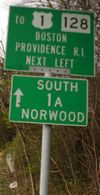 |
Signs installed before Interstate 95 was moved onto Route 128 in the 1970s prominently displayed the Route 128 designation. Even though it was built to freeway standards, Route 128 was never initially intended to be part of the Interstate system. The left sign was an overhead on Route 9 westbound for the interchange with 128 in Wellesley. This sign was replaced in 2009 with one indicating only the I-95 designation. The right sign was located on Washington Street approaching Elm Street in Dedham, and has since been removed. |
 |
Signage on Interstate 90 - the Massachusetts Turnpike Massachusetts Turnpike The Massachusetts Turnpike is the easternmost stretch of Interstate 90. The Turnpike begins at the western border of Massachusetts in West Stockbridge connecting with the Berkshire Connector portion of the New York State Thruway... - clearly shows both routes. Westbound Exit 15 signage also shows both routes, and the signs remain present. |
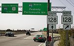  |
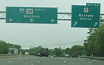
After I-95 was moved to Route 128, new signs instead featured only that designation, with Route 128 marked only on separate sign assemblies. The left signage is present on US-1 northbound at its junction with I-95 (Exits 15A-B) in Dedham. The right signage is present on Walnut Street in Lynnfield, at the Exit 43 ramps to/from I-95. |
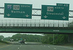  |
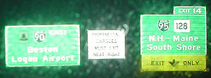
Other than on the Mass Pike, the only overhead signs to include both I-95 and Route 128 are near their northern split in Peabody. All signage in both directions for the I-95/Route 128 split was replaced in 2009 with I-95 the sole designation south of the split (with ground signage for 128 present). The right signage (at Exit 44 southbound) is the only remaining overhead on I-95 showing the Route 128 designation. |
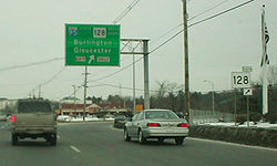 |
The overhead sign on U.S. Route 1 north at the exit to Route 128 in Lynnfield, near the split in Peabody, originally indicated both directions of Route 128. (I-95 is only marked south because a more direct ramp to I-95 north exists straight ahead.) A standard sign assembly for Route 128 south was also installed. |
 |
When the above sign was replaced in 2003 or 2004, Route 128 south was removed. |
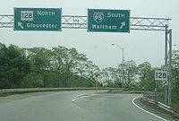 |
Overhead signage on the ramp from US 1 north to Route 128 similarly only shows Route 128 north. |
  |
Until 1997, Route 128's south end was at the Braintree Split Braintree Split The Braintree Split is the intersection of Interstate 93/U.S. Route 1 and Massachusetts Route 3 located along the city line separating Braintree and Quincy, Massachusetts. The Braintree Split was also the southern end of Route 128 until 1997, when Route 128 was truncated to the I-95/I-93... in Braintree. Several signs for Route 3 Route 3 (Massachusetts) Route 3 is a southward continuation of U.S. Route 3, connecting Cambridge, Massachusetts with Cape Cod. All of it, except for the northernmost end in downtown Boston and Cambridge, is a freeway.... in that area still indicated that in 2001. |
Sign upgrade projects on Route 128
As of 2010, the state is in the midst of a resigning program on Route 128 that replaces the 25-year-old Route 128 designation signs with new I-95 designation signs. Starting in 1998 and continuing through 2002, signs were replaced through a $1.1 million project between Reading and Lynnfield. Progress continued in 2005 and 2006 during a $2.2 million project which replaced the signs on from Peabody to Gloucester, and continued with a $1.4 million project in 2008 and 2009 that replaced signs in Peabody and the remaining ones in Lynnfield. A $2.9 million federal stimulus project is underway and expected to be completed in 2011, replacing traffic signs on Route 128 from I-93 in Woburn to US 3 in Burlington.A project valued at $5.8 million is expected to begin in 2012 and will replace 13 miles of traffic signs on Route 128 from Routes 4/225 in Lexington to Route 9 in Wellesley. These signs are being replaced as part of the five-phase widening project from Route 9 to Route 24.
Exit list
This exit list covers all of Route 128 as it existed before 1997. The stretch north of I-95, as well as the rest of the length before I-95 exit numbering was applied, has decreasing exit numbers travelling northbound (this is contrary to almost all highways in the US with numbered exits). Additionally, the lowest exit number on the highway is Exit 10 (which is an at-grade intersection near the highway's northern end). Route 128 is also the only highway in the state to contain directional exit designations (N/S or E/W after the number, as opposed to the traditional A/B/C in Massachusetts).Route 128 currently has 18 numbered interchanges, starting at 29 (southbound) and continuing downwards to 10 (former Exit 27, an at-grade intersection, was removed, and there is no Exit 11).
| County | Location | Mile | Exit Exit number An exit number is a number assigned to a road junction, usually an exit from a freeway. It is usually marked on the same sign as the destinations of the exit, as well as a sign in the gore.... |
Destinations | Notes | ||
|---|---|---|---|---|---|---|---|
| Old | |||||||
| Norfolk Norfolk County, Massachusetts -National protected areas:* Adams National Historical Park* Boston Harbor Islands National Recreation Area * Frederick Law Olmsted National Historic Site* John Fitzgerald Kennedy National Historic Site-Demographics:... |
Braintree Braintree, Massachusetts The Town of Braintree is a suburban city in Norfolk County, Massachusetts, United States. Although officially known as a town, Braintree adopted a municipal charter, effective 2008, with a mayor-council form of government and is considered a city under Massachusetts law. The population was 35,744... |
69 | southbound exit and northbound entrance | ||||
| 69 | 7 | southbound exit and northbound entrance | |||||
| 68 | 6 | ||||||
| Randolph Randolph, Massachusetts The Town of Randolph is a city in Norfolk County, Massachusetts, United States. As of the 2010 census, the town population was 32,112. Randolph adopted a new charter effective January 2010 providing for a council-manager form of government instead of the traditional town meeting... |
67 | 5 | split into 5A and 5B | ||||
| 66 | 4 | ||||||
| Milton Milton, Massachusetts Milton is a town in Norfolk County, Massachusetts, United States and part of the Greater Boston area. The population was 27,003 at the 2010 census. Milton is the birthplace of former U.S. President George H. W. Bush and architect Buckminster Fuller. Milton also has the highest percentage of... |
2.978 | 65 | 3 | Ponkapoag Trail – Houghton's Pond Houghton's Pond Houghton's Pond is a spring-fed kettle hole pond in Milton, Massachusetts, south of Boston. Like many ponds and lakes in the United States, it was formed by receding glaciers about 10,000 years ago... |
|||
| Canton Canton, Massachusetts Canton is a town in Norfolk County, Massachusetts, United States. The population was 21,561 at the 2010 census. Canton is part of Greater Boston, about 15 miles southwest of downtown Boston.- History :... |
1.781 | 61 60 |
64 | 2 | split into 2A and 2B | ||
| 63 | 1 | – Providence, RI | I-95 joins northbound and leaves southbound; I-93 ends southbound and begins northbound. This interchange has unused ramps and an unused bridge that would have been part of the Southwest Corridor Southwest Corridor The Southwest Corridor or Southwest Expressway was a project designed to bring an eight-lane highway into the City of Boston from a direction southwesterly of downtown. It was supposed to connect with Interstate 95 at Route 128... project. |
||||
| Dedham Dedham, Massachusetts Dedham is a town in and the county seat of Norfolk County, Massachusetts, United States. The population was 24,729 at the 2010 census. It is located on Boston's southwest border. On the northwest it is bordered by Needham, on the southwest by Westwood and on the southeast by... |
59 | 62 | 13 | University Avenue – MBTA/Amtrak station | |||
| Westwood Westwood, Massachusetts Westwood is a town in Norfolk County, Massachusetts, United States. The population was 14,618 at the 2010 census. In July 2005, CNN/Money and Money magazine ranked Westwood 13th on its list of the 100 Best Places to Live in the United States. Boston Magazine listed Gay Street in Westwood on its... |
28.553 28.719 |
58 | 61 | 14 | East Street; Canton Street | ||
| Dedham Dedham, Massachusetts Dedham is a town in and the county seat of Norfolk County, Massachusetts, United States. The population was 24,729 at the 2010 census. It is located on Boston's southwest border. On the northwest it is bordered by Needham, on the southwest by Westwood and on the southeast by... |
29.32 | 57 56 |
60 | 15 | split into 15A and 15B | ||
| 30.82 | 55B 55A |
59 | 16 | split into 16A and 16B | |||
| 32.3 | 55 | 58 | 17 | Norfolk County Correctional Center Norfolk County Correctional Center The Norfolk County Correctional Center is a house of correction located on the median of Route 128 in Dedham, Massachusetts. The facility has 502 beds and opened in 1993.- See also :* List of Massachusetts state correctional facilities... is in the median of Route 128 located on Route 135. |
|||
| Needham Needham, Massachusetts Needham is a town in Norfolk County, Massachusetts, United States. A suburb of Boston, its population was 28,886 at the 2010 census.- History :... |
32.77 | 54A | 57 | 18 | Great Plain Avenue – Dedham Dedham, Massachusetts Dedham is a town in and the county seat of Norfolk County, Massachusetts, United States. The population was 24,729 at the 2010 census. It is located on Boston's southwest border. On the northwest it is bordered by Needham, on the southwest by Westwood and on the southeast by... ; West Roxbury West Roxbury, Massachusetts West Roxbury is a neighborhood in Boston bordered by Roslindale to the north, the Town of Dedham to the east and south, the Town of Brookline and the City of Newton to the west. Many people mistakenly confuse West Roxbury with Roxbury, but the two are not connected. West Roxbury is separated from... |
||
| 35.55 | 54 53 |
56 | 19 | Highland Avenue – Newton Highlands Newton Highlands, Massachusetts Newton Highlands is a village of Newton, Massachusetts. Newton Highlands is largely suburban outside of the village and the commercial district running along Winchester and Needham Streets.... |
split into 19A and 19B | ||
| Wellesley Wellesley, Massachusetts Wellesley is a town in Norfolk County, Massachusetts, United States. It is part of Greater Boston. The population was 27,982 at the time of the 2010 census.It is best known as the home of Wellesley College and Babson College... |
36.6 | 52 51 |
55 | 20 | split into 20A and 20B | ||
| Middlesex Middlesex County, Massachusetts -National protected areas:* Assabet River National Wildlife Refuge* Great Meadows National Wildlife Refuge* Longfellow National Historic Site* Lowell National Historical Park* Minute Man National Historical Park* Oxbow National Wildlife Refuge... |
Newton Newton, Massachusetts Newton is a city in Middlesex County, Massachusetts, United States bordered to the east by Boston. According to the 2010 U.S. Census, the population of Newton was 85,146, making it the eleventh largest city in the state.-Villages:... |
50 49 |
54 | 21 | split into 21A and 21B southbound | ||
| 53 | 22 | Grove Street – MBTA station Riverside (MBTA station) Riverside is the western terminus of the MBTA Green Line "D" Branch light rail line. It is located at 333 Grove Street, off Exit 22 on Interstate 95 , in Auburndale, a village of Newton, Massachusetts. Scheduled travel time to Park Street is 46 minutes. Riverside includes a parking... ; Auburndale |
|||||
| Weston Weston, Massachusetts Weston is a suburb of Boston located in Middlesex County, Massachusetts, United States in the Boston metro area. The population of Weston, according to the 2010 U.S. Census, is 11,261.... |
52 | 23 | Recreation Road | northbound exit and entrance | |||
| 39.218 | 51 | 24 | |||||
| 50 | 25 | ||||||
| Waltham Waltham, Massachusetts Waltham is a city in Middlesex County, Massachusetts, United States, was an early center for the labor movement, and major contributor to the American Industrial Revolution. The original home of the Boston Manufacturing Company, the city was a prototype for 19th century industrial city planning,... |
41.16 41.31 |
44 43 |
49 | 26 | |||
| 43.09 | 42A | 48 | 27 | Totten Pond Road; Wyman Street; Winter Street – Waltham Waltham, Massachusetts Waltham is a city in Middlesex County, Massachusetts, United States, was an early center for the labor movement, and major contributor to the American Industrial Revolution. The original home of the Boston Manufacturing Company, the city was a prototype for 19th century industrial city planning,... |
split into 27A and 27B northbound | ||
| 44.35 | 42 | 47 | 28 | Trapelo Road – Belmont Belmont, Massachusetts Belmont is a town in Middlesex County, Massachusetts, a suburb of Boston. The population was 24,729 at the 2010 census.- History :Belmont was founded on March 18, 1859 by former citizens of, and land from the bordering towns of Watertown, to the south; Waltham, to the west; and Arlington, then... ; Lincoln Lincoln, Massachusetts Lincoln is a town in the historic area of Middlesex County, Massachusetts, United States. The population was 6,362 at the 2010 census, including residents of Hanscom Air Force Base that live within town limits... |
split into 28A and 28B northbound | ||
| Lexington Lexington, Massachusetts Lexington is a town in Middlesex County, Massachusetts, United States. The population was 31,399 at the 2010 census. This town is famous for being the site of the first shot of the American Revolution, in the Battle of Lexington on April 19, 1775.- History :... |
45.22 | 41 40 |
46 | 29 | split into 29A and 29B | ||
| 46.3 | 39 38 |
45 | 30 | , Hanscom Field Hanscom Field Hanscom Field , also known by its full name Laurence G. Hanscom Field, is a public airport located in Bedford, in Middlesex County, Massachusetts, United States. It is operated by the Massachusetts Port Authority.... |
split into 30A and 30B | ||
| 48.5 | 37 36 |
44 | 31 | split into 31A and 31B | |||
| Burlington Burlington, Massachusetts Burlington is a town in Middlesex County, Massachusetts, United States. The population was 24,498 at the 2010 census.- History :It is believed that Burlington takes its name from the English town of Bridlington, however this has never been confirmed.... |
49.87 | 35A | 43 | 32A | , Nashua, NH | US 3 joins northbound and leaves southbound | |
| 35 | 42 | 32B | Middlesex Turnpike Middlesex Turnpike (Massachusetts) The Middlesex Turnpike was an early turnpike between Cambridge and Tyngsborough, Massachusetts and the New Hampshire border, where it connected with the Amherst Turnpike and thence Nashua and Claremont, New Hampshire.... – Arlington Arlington, Massachusetts Arlington is a town in Middlesex County, Massachusetts, United States, six miles northwest of Boston. The population was 42,844 at the 2010 census.-History:... |
||||
| 51.565 | 34 33 |
41 | 33 | split into 33A and 33B; US 3 joins southbound and leaves northbound | |||
| 52.44 | 32 | 40 | 34 | Winn Street – Woburn Woburn, Massachusetts Woburn is a city in Middlesex County, Massachusetts, USA. The population was 38,120 at the 2010 census. Woburn is located north of Boston, Massachusetts, and just south of the intersection of I-93 and I-95.- History :... , Billerica Billerica, Massachusetts Billerica is a town in Middlesex County, Massachusetts, United States. The population was 40,243 at the 2010 census. It is the only town named Billerica in the United States and borrows its name from the town of Billericay in Essex, England.- History :... |
|||
| Woburn Woburn, Massachusetts Woburn is a city in Middlesex County, Massachusetts, USA. The population was 38,120 at the 2010 census. Woburn is located north of Boston, Massachusetts, and just south of the intersection of I-93 and I-95.- History :... |
53.487 53.581 |
31 30 |
39 | 35 | |||
| 38 | 36 | Washington Street – Winchester Winchester, Massachusetts Winchester is a town located in Middlesex County, Massachusetts, eight miles north of Boston. With its agricultural roots having mostly disappeared, it is now an affluent suburb... |
|||||
| Reading Reading, Massachusetts Reading is an affluent town situated in Middlesex County, Massachusetts, United States, some north of central Boston. The population was 24,747 at the 2010 census.-Settlement and Independence:... |
55.151 | 37 | 37 | , Concord, NH | split into 37A and 37B | ||
| 36 | 38 | split into 38A and 38B | |||||
| Wakefield Wakefield, Massachusetts -History:-Geography:The diagram above shows what is to the east, west, north, south, and other directions of the center of Wakefield. Towns with population above 25,000 are in bold italics.-Demographics:-Notable residents:... |
57.590 | 35 | 39 | North Avenue – Reading Reading, Massachusetts Reading is an affluent town situated in Middlesex County, Massachusetts, United States, some north of central Boston. The population was 24,747 at the 2010 census.-Settlement and Independence:... |
|||
| 58.259 58.416 |
34 | 40 | |||||
| Essex Essex County, Massachusetts -National protected areas:* Parker River National Wildlife Refuge* Salem Maritime National Historic Site* Saugus Iron Works National Historic Site* Thacher Island National Wildlife Refuge-Demographics:... |
Lynnfield Lynnfield, Massachusetts Lynnfield is a wealthy town in Essex County, Massachusetts, in the United States. As of the 2000 census, the town population was 11,542.- History :... |
59.11 | 33 | 41 | Main Street – Lynnfield Center; Wakefield Wakefield, Massachusetts -History:-Geography:The diagram above shows what is to the east, west, north, south, and other directions of the center of Wakefield. Towns with population above 25,000 are in bold italics.-Demographics:-Notable residents:... |
||
| Middlesex Middlesex County, Massachusetts -National protected areas:* Assabet River National Wildlife Refuge* Great Meadows National Wildlife Refuge* Longfellow National Historic Site* Lowell National Historical Park* Minute Man National Historical Park* Oxbow National Wildlife Refuge... |
Wakefield Wakefield, Massachusetts -History:-Geography:The diagram above shows what is to the east, west, north, south, and other directions of the center of Wakefield. Towns with population above 25,000 are in bold italics.-Demographics:-Notable residents:... |
60.669 | 32 | 42 | Salem Street | ||
| Essex Essex County, Massachusetts -National protected areas:* Parker River National Wildlife Refuge* Salem Maritime National Historic Site* Saugus Iron Works National Historic Site* Thacher Island National Wildlife Refuge-Demographics:... |
Lynnfield Lynnfield, Massachusetts Lynnfield is a wealthy town in Essex County, Massachusetts, in the United States. As of the 2000 census, the town population was 11,542.- History :... |
61.319 | 31 | 43 | Walnut Street – Saugus Saugus, Massachusetts Saugus is a town in Essex County, Massachusetts, United States, in the Greater Boston area. The population was 26,628 at the 2010 census.-History:Saugus was first settled in 1629. Saugus is an Indian name believed to mean "great" or "extended"... ; Lynn Lynn, Massachusetts Lynn is a city in Essex County, Massachusetts, United States. The population was 89,050 at the 2000 census. An old industrial center, Lynn is home to Lynn Beach and Lynn Heritage State Park and is about north of downtown Boston.-17th century:... |
||
| Peabody Peabody, Massachusetts Peabody is a city in Essex County, Massachusetts, United States. The population is about 53,000. Peabody is located in Boston's North Shore suburban area.- History :... |
62.701 0.000 |
30 | 44 | split into 44A and 44B northbound | |||
| 2.365 | 29 | – Portsmouth, NH | I-95 joins southbound and leaves northbound | ||||
| 28 | Forest Street; Centennial Drive | Summit Street, an at-grade intersection, was "exit 27" | |||||
| 18 | 26 | Lowell Street – Salem Salem, Massachusetts Salem is a city in Essex County, Massachusetts, United States. The population was 40,407 at the 2000 census. It and Lawrence are the county seats of Essex County... |
|||||
| 3.71 | 17 16 |
25 | split into 25A and 25B | ||||
| Danvers Danvers, Massachusetts Danvers is a town in Essex County, Massachusetts, United States. Located on the Danvers River near the northeastern coast of Massachusetts, Danvers is most widely known for its association with the 1692 Salem witch trials, and for its famous asylum, the Danvers State Hospital.-17th century:The land... |
4.42 | 15A | 24 | Endicott Street | |||
| 5.13 | 23 | split into 23N and 23S | |||||
| 5.73 | 22 | split into 22W and 22E northbound | |||||
| 21 | Trask Lane – Folly Hill | northbound exit and entrance | |||||
| 21 | Conant Street – Industrial Park | southbound exit and entrance | |||||
| Beverly Beverly, Massachusetts Beverly is a city in Essex County, Massachusetts, United States. The population was 39,343 on , which differs by no more than several hundred from the 39,862 obtained in the 2000 census. A resort, residential and manufacturing community on the North Shore, Beverly includes Beverly Farms and Prides... |
7.45 | 20 | split into 20A and 20B | ||||
| 8.100 | 19 | Sohier Road; Brimbal Avenue – Montserrat | |||||
| 9.329 | 18 | ||||||
| Wenham Wenham, Massachusetts Wenham is a town in Essex County, Massachusetts, United States. The population was 4,875 at the 2010 census.The Town of Wenham was originally settled in 1635 and has retained much of its unique historic character and tranquil rural scenery... |
11.406 | 17 | Grapevine Road – Beverly Farms, Prides Crossing | ||||
| Manchester | 13.03 | 16 | Pine Street – Magnolia | ||||
| 14.391 | 15 | School Street – Magnolia | |||||
| Gloucester Gloucester, Massachusetts Gloucester is a city on Cape Ann in Essex County, Massachusetts, in the United States. It is part of Massachusetts' North Shore. The population was 28,789 at the 2010 U.S. Census... |
17.469 | 14 | |||||
| 18.193 | 13 | Concord Street – Wingaersheek Beach Wingaersheek Beach Wingaersheek Beach is a long beach located on the Annisquam River in West Gloucester, Massachusetts, USA.According to the USGS the name is a corruption of the earlier Dutch name "Wyngaerts Hoeck", which was derived from "Wyngaerton" .... |
|||||
| 18.942 | 12 | Crafts Road – Rust Island | |||||
| 11 | Grant Circle | ||||||
| Blackburn Industrial Park Boulevard | Blackburn Circle | ||||||
| 21.6 | 10 | at-grade intersection At-grade intersection An at-grade intersection is a junction at which two or more transport axes cross at the same level .-Traffic management:With areas of high or fast traffic, an at-grade intersection normally requires a traffic control device such as a stop sign, traffic light or railway signal to manage conflicting... |
|||||
| 21.769 | 9 | , State Pier | at-grade intersection At-grade intersection An at-grade intersection is a junction at which two or more transport axes cross at the same level .-Traffic management:With areas of high or fast traffic, an at-grade intersection normally requires a traffic control device such as a stop sign, traffic light or railway signal to manage conflicting... |
||||
Cultural References
Two songs by MassachusettsMassachusetts
The Commonwealth of Massachusetts is a state in the New England region of the northeastern United States of America. It is bordered by Rhode Island and Connecticut to the south, New York to the west, and Vermont and New Hampshire to the north; at its east lies the Atlantic Ocean. As of the 2010...
alternative rock artists, "Roadrunner
Roadrunner (Jonathan Richman song)
"Roadrunner" is a song written by Jonathan Richman and recorded in various versions by Richman and his band, in most cases credited as The Modern Lovers.Critic Greil Marcus described it as "the most obvious song in the world, and the strangest"...
" by The Modern Lovers
The Modern Lovers
The Modern Lovers were an American rock band led by Jonathan Richman in the 1970s and 1980s. The original band existed from 1970–74 but their recordings were not released until 1976 or later. It featured Richman and bassist Ernie Brooks with drummer David Robinson and keyboardist Jerry Harrison...
and "Blue Thunder" by Galaxie 500
Galaxie 500
Galaxie 500 was an American alternative rock band that formed in 1987 and split up in 1991 after releasing three albums.-History:Guitarist Dean Wareham, drummer Damon Krukowski and bassist Naomi Yang had met at the Dalton School in New York City in 1981, but began playing together during their time...
, prominently feature Route 128 in their lyrics.
External links
- The Route 128 Business Council
- http://www.bostonroads.com/roads/MA-128/ - Historical overview
- http://www.route128history.org/ - Links about the region's tech history
- http://www.bambinomusical.com/128 - Includes a "virtual tour" of the highway's early days and construction, as well as movies of the 1951 opening ceremony.