
River Great Ouse
Encyclopedia
The Great Ouse ' is a river in the east of England. At 143 miles (230.1 km) long, it is the fourth-longest river in the United Kingdom. The river has been important for navigation, and for draining the low-lying region through which it flows. Its course has been modified several times, with the first recorded being in 1236, as a result of flooding. During the 1600s, the Old Bedford
and New Bedford River
s were built, to provide a quicker route for the water to reach the sea. In the 20th century, construction of the Cut-Off Channel and the Great Ouse Relief Channel have further altered water flows in the region, and helped to reduce flooding.
Improvements to assist navigation began in 1618, with the construction of sluices and locks. Bedford
could be reached by river from 1689. A major feature was the sluice at Denver
, which failed in 1713, but was rebuilt by 1750 after the problem of flooding returned. Kings Lynn, at the mouth of the river, developed as a port, with civil engineering input from many of the great engineers of the time. With the coming of the railways, the state of the river declined, so that is was unsuitable either for navigation or for drainage. The navigation was declared to be derelict in the 1870s.
A repeated problem was the number of authorities responsible for different aspects of the river. The Drainage Board created in 1918 had no powers to address navigation issues, and there were six bodies responsible for the river below Denver in 1913. When the Great Ouse Catchment Board was created under the powers of the Land Drainage Act in 1930, effective action could at last be taken. There was significant sugar beet traffic on the river between 1925 and 1959, with the last known commercial traffic occurring in 1974. Leisure boating had been popular since 1904, and the post-war period saw the creation of the Great Ouse Restoration Society in 1951, who campaigned for complete renovation of the river. It was re-opened to Bedford in 1978, and is now managed by the Environment Agency
.
in Northamptonshire
. It flows through Brackley
, Buckingham
, Milton Keynes
at Stony Stratford
, Newport Pagnell
, Olney and Kempston
, which is the current head of navigation. Passing through Bedford, St Neots
, Godmanchester
, Huntingdon
, Hemingford Grey
and St Ives
, it reaches Earith
, where there is a short tidal section connected by the Old Bedford River and New Bedford River to the lower river at Denver. The old course of the river passes through the cathedral city of Ely
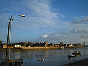
and Littleport, to reach the Denver sluice. Below this the river is tidal and passes Downham Market
to enter The Wash
at King's Lynn
. It has a catchment area of 1320 square miles (3,418.8 km²) and a mean flow of 2590 gallons (11.8 m³) per second. Its length of 143 miles (230.1 km) makes it the major navigable river in East Anglia
, and the fourth-longest river in the United Kingdom.
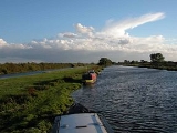
The river is navigable from the Wash to Kempston Mill, which is just beyond Bedford, a distance of 72 miles (115.9 km). This section includes 17 locks, which are maintained by the Environment Agency
, who are the navigation authority
and who attempt to attract more boaters to the river.
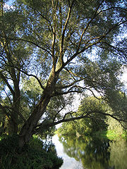
The Ouse Washes
are an internationally important area for wildlife. Sandwiched between the Old Bedford and New Bedford rivers, they consist of washland which is used as pasture during the summer but which floods in the winter, and are the largest area of such land in the United Kingdom. They act as breeding grounds for lapwings, redshanks and snipe in spring, and are home to varieties of ducks and swans during the winter months.
and the River Lark
, and made its way via Welney, Upwell and Outwell, to flow into The Wash
near Wisbech. At that time it was known as the Wellstream or Old Wellenhee, and parts of that course are marked by the Old Croft River and the border between Cambridgeshire and Norfolk. It was initially diverted to join the River Nar after flooding at Littleport in 1236, and so joined the Wash at Kings Lynn. Parts of this course were later used for the River Lark, which flows in the reverse direction along the section below Prickwillow, after the main river was moved further to the west.
An Act of Parliament
was passed in 1600 which allowed Adventurers, who paid for drainage schemes with their own money, to be repaid in land which they had drained. The Act covered large tracts of England, but no improvements were made to the region through which the Great Ouse flowed until 1618, Arnold Spencer and Thomas Girton started to improve the river between St Ives
and St Neots
. Six sluices were constructed, and Spencer attempted to obtain permission to improve the river to Bedford
, but the Act was defeated, despite support from Bedford Corporation. Some dredging was done, and Great Barford
became an inland port, but he lost a lot of money on the scheme, and the condition of the river worsened.
Below Earith
, thirteen Adventurers working with the Earl of Bedford formed a Corporation to drain the Bedford Levels. Cornelius Vermuyden
was the engineer, and a major part of the scheme was the Old Bedford River, a straight cut to carry water from Earith to a new sluice near Salters Lode, which was completed in 1637. The sluice was not popular with those who used the river for navigation, and there were some attempts to destroy the new works during the turmoil of the civil war
. A second drainage Act was obtained in 1649, and Vermuyden oversaw the construction of the New Bedford River, parallel to the Old Bedford River, which was completed in 1652. There was strong opposition from the ports and towns on the river, which increased as the old channel via Ely
gradually silted up. Above Earith, Samuel Jemmatt took control of the river, and navigation was extended to Bedford in 1689 by the construction of new staunches and sluices.
Between St Ives and Bedford, there were ten sluices, which were pound locks constructed at locations where mill weirs would have prevented navigation. There were also five staunches, which were flash locks constructed near to fords and shallows. Operation of the beam and paddle provided an extra volume of water to carry the boats over such obstructions. On the lower river, a combination of high spring tides and large volumes of floodwater resulted in the complete failure of Denver sluice in 1713. While there were celebrations among the navigators, the problem of flooding returned, and the channel below Denver deteriorated. Charles Labelye
therefore designed a new sluice for the Bedford Level Corporation, which was constructed between 1748 and 1750 and included a navigation lock. No tolls were charged on the river below St Ives or on the New Bedford, and those responsible for drainage complained about damage to the sluices and to banks by the horses used for towing boats. An Act of Parliament to regulate the situation was defeated in 1777 after fierce opposition, and it was not until 1789 that a Haling Act was passed, which ensured that tolls were charged and landowners were repaid for damage to the banks caused by horses. These measures were a success, as there were few complaints once the new system was in place.
, the town developed as a port. Evidence for this can still be seen, as two warehouses built in the 15th century for trade with the Hanseatic League
have survived. However, the harbour and the river below Denver sluice were affected by silting, and the problem was perceived to be the effects of the sluice. Sand from The Wash was deposited by the incoming tide, and the outgoing tide did not carry it away again. Colonel John Armstrong was asked to survey the river in 1724, and suggested returning it to how it was prior to the construction of the drainage works. John Smeaton
rejected this idea in 1766, suggesting that the banks should be moved inwards to create a narrower, faster-flowing channel. William Elstobb and others had suggested that the great bend in the river above King's Lynn should be removed by creating a cut, but it took 50 years of arguing before the Eau Brink Act was obtained in 1795 to authorise it, and another 26 years until the cut was finally opened in 1821. During this time, most of the major civil engineers of the time had contributed their opinions. The original project head and chief engineer was Sir Thomas Hyde Page
.
The work was overseen by John Rennie and Thomas Telford
and construction took four years. It proved to be too narrow, resulting in further silting of the harbour, and was widened at an additional cost of £33,000 on Telford's advice. The total cost for the 2.5 miles (4 km) cut was nearly £0.5 million, and although the navigators, who had opposed the scheme, benefitted most from it, there were new problems for drainage, with the surrounding land levels dropping as the peaty soil dried out. The Eau Brink Act created Drainage Commissioners and Navigation Commissioners, who had powers over the river to St Ives, but both bodies were subject to the Bedford Levels Corporation. Although often in opposition, the two parties worked together on the construction of a new lock and staunch at Brownhill, to improve navigation above Earith.
In 1835, King William IV
brought a case against the Ouse Bank Commissioners regarding a mandamus
writ issued in 1834 about the Eau Brink Cut and possible damages it caused to the King's Lynn harbour.
, but although the works cost £70,000, there were too late to return the navigation to prosperity. Railways arrived in the area rapidly after 1845, reaching Cambridge, Ely, Huntingdon, King's Lynn, St Ives, St Neots and Tempsford by 1850. The river below King's Lynn was improved by the construction of the 2 miles (3.2 km) Marsh Cut and the building of training walls beyond that to constrain the channel, but the railways were welcomed by the Bedford Levels Corporation, for whom navigation interfered with drainage, and by King's Lynn Corporation, who did not want to be superseded by other towns with railway interchange facilities.
A large interchange dock was built at Ely, to facilitate the distribution of agricultural produce from the local region to wider markets. In addition, coal for several isolated pumping stations was transferred to boats for the final part of the journey, rather than it coming all the way from King's Lynn. Decline on most of the river was rapid, with tolls halving between 1855 and 1862. Flooding in 1875 was blamed on the poor state of the navigation, and it was recommended that it should be abandoned, but there was no funds to obtain an Act of Parliament
to create a Drainage Authority. The navigation was declared to be derelict by three County Councils soon afterwards. It was then bought by the Ouse River Canal and Steam Navigation Ltd, who wanted to link Bedford to the Grand Junction Canal
, but they failed to obtain their Act of Parliament. A stockbroker called L. T. Simpson bought it in 1893, and spent some £21,000 over the next four years in restoring it. He created the Ouse Transport Company, running a fleet of tugs and lighters, and then attempted to get approval for new tolls, but was opposed by Bedfordshire and Huntingdonshire County Councils. Protracted legal battles followed, with Simpson nailing the lock gates together, and the County Councils declaring that the river was a public highway. The case eventually reached the House of Lords
in 1904, who allowed Simpson to close the locks.
 Simpson's victory in 1904 coincided with an increased use of the river for leisure. As he could not charge these boats for use of the locks, the situation was resolved for a time in 1906 by the formation of the River Ouse Locks Committee, who rented the locks between Great Barford and Bedford. Over 2000 boats were recorded using Bedford Lock in a three month period soon afterwards. Despite pressure from local authorities and navigation companies, the upper river was closed for trade, and a Royal Commission
reported in 1909 on the poor state of the lower river, the lack of any consistent authority to manage it, and the unusual practice of towing horses having to jump over fences because there were no gates where they crossed the towing path. The Ouse Drainage Board was formed in 1918, but had no powers to deal with navigation issues, and it was not until the powers of the Land Drainage Act (1930) were used to create the Great Ouse Catchment Board that effective action could be taken.
The Catchment Board bought the navigation rights from Simpson's estate, and began to dredge the river and rebuild the locks. There was an upturn in commercial traffic from 1925, when the sugar beet
factory at Queen Adelaide
near Ely was opened. They operated six or seven tugs and a fleet of over 100 barges, and three tugs and 24 barges from the Wissington sugar beet factory on the River Wissey
also operated on the river. Local commercial traffic continued around Ely until after the Second World War. The sugar beet traffic ceased in 1959, and the last commercial boat on the upper river was "Shellfen", a Dutch barge converted to carry 4000 gallons (18,184.4 l) of diesel fuel, which supplied the remote pumping stations until 1974, when the last ones were converted to electricity.
Below Denver, the situation was complicated by the fact that there were six bodies with responsibility for the river in 1913. No dredging took place, as there was no overall authority. The training walls were repaired in 1930 by the King's Lynn Conservancy Board, and the Great Ouse Catchment Board reconstructed and extended them in 1937. After major flooding in 1937 and 1947, and the North Sea flood of 1953
, flood control issues became more important, and the Cut-Off Channel was completed in 1964, to carry the headwaters of the River Wissey
, River Lark
and River Little Ouse
to join the river near Denver sluice. The Great Ouse Relief Channel, which runs parallel to the main river for 6.5 miles (10.5 km) from here to Wiggenhall bridge, was constructed at the same time. It joins the river at a sluice above King's Lynn, and was made navigable in 2001, when the Environment Agency constructed a lock at Denver to provide access.
The reconstruction by the Catchment Board had reopened the locks to Godmanchester
and then to Eaton Socon
by the onset of the Second World War. To continue the progess, the Great Ouse Restoration Society was formed in 1951, and successfully campaigned for and assisted with the restoration.
The Restoration Society campaign included the establishment of the Bedford to St. Neots Canoe
Race in 1952 which helped publicise the case for navigational restoration. The race continues to this day as the Bedford Kayak
Marathon, and is the longest established canoe race in the UK. In 1961 organisers of the 'Bedford Race' agreed to formalise canoeing activities and founded Bedford's Viking Kayak Club
.
Since 1963, the river has been the responsibility of the Environment Agency
, who issue navigation licences. The upper river was reopened to Bedford in 1978.
 The non-tidal reaches of the river are used for leisure boating, but remain largely separated from the rest of the British inland waterway system. Several of its tributaries are navigable, including the River Cam
, the River Lark
, the River Little Ouse
and the River Wissey
. Close to Denver sluice, Salters Lode lock gives access to the Middle Level Navigations
, but the intervening section is tidal, and deters many boaters. Access to the Middle Level Navigations is also possible via the Old Bedford River
and Welches Dam lock, but this route is only open for a few weekends each year, and was heavily silted in 2009. The proposed Fens Waterways Link
, which aims to improve navigation from Lincoln
to Cambridge
may result in this section being upgraded, or a non-tidal link being created at Denver.
There are two more proposed schemes to improve connections to the river. The first is for a Bedford to Milton Keynes link, to connect the river to the Grand Union Canal
. This was first suggested in 1812, when John Rennie costed a 15 miles (24.1 km) canal to join the canal, then called the Grand Junction Canal
at Fenny Stratford. His estimate of £180,807 scared investors, and no progress was made. In 1838, there was a proposal to link the river to the Newport Pagnall Canal, and again in the 1880s, the Ouse River Canal and Steam Navigation Ltd bought the river with the aim of creating the link. An enabling Act of Parliament was defeated, although Major Marindin, acting for the Board of Trade, was optimistic about the likely benefits. The idea was revived in 1994, by the Bedford and Milton Keynes Waterway Trust, who have formed a partnership with 25 bodies, including local councils, British Waterways
and various government agencies. A feasibility study was carried out in 2001, which looked at nine possible routes, and by 2006, the cost of the preferred route was between £100 and £200 million.
The second scheme is for an extension of the Great Ouse Relief Channel to link it to the River Nar, and provide a non-tidal link to King's Lynn. The project would include a large marina, and would be part of a much larger regeneration project for the south side of the town. Two locks would be required to raise boats from the Relief Channel to the River Nar.
 Tributaries
of the River Great Ouse: (upstream [source] to downstream by confluence)
between the Oxford
and Cambridge
universities took place on this river, between Littleport
and Queen Adelaide
, the only time that it has not been held on the Thames
; it was won by Oxford. The Great Ouse is used by three clubs from Cambridge University for the training of rowers, with the Boat Club (CUBC)
,
the Women's Boat Club (CUWBC)
and the Lightweight Rowing Club (CULRC)
, all using facilities at Ely. Rowing is popular in several of the towns on the Ouse, especially Bedford, which is one of the most active rowing centres in the UK.
The Great Ouse is a very popular river for canoeing
and kayaking
, particularly at Bedford which is a regional centre for the sport. Viking Kayak Club organise the Bedford Kayak Marathon with canoe racing
held along the Embankment on Bedford's riverside and dates back to the original Bedford to St Neots race in 1952, believed to be the first of its kind in the country.
Bedford also benefits from the presence of weirs and sluices, creating white water opportunities. Viking organise national ranking Canoe Slalom events at the Cardington Artificial Slalom Course
(CASC), which was the first artificial whitewater course in the UK, opened in 1982 adjacent to Cardington
Lock, in a partnership with the Environment Agency who use it as a flood relief channel. CASC is also the venue each year for the UK's National Inter Clubs Slalom Finals, the largest canoe slalom event by participation in the UK.
Since 1978, the Bedford River Festival has been held every two years, to celebrate the link between Bedford and the coast. In addition to craft often seen on the river, the 2008 festival featured a reconstruction of a first-century currach
, consisting of a wicker framework covered in cow hide, and capable of carrying ten people.
Old Bedford River
The Old Bedford River is an artificial, partial diversion of the waters of the River Great Ouse in the Fens of Cambridgeshire, England. It was named after the fourth Earl of Bedford who contracted with the local Commission of Sewers to drain the Great Level of the Fens beginning in 1630.The idea of...
and New Bedford River
New Bedford River
The New Bedford River, also known as the Hundred Foot Drain because of the distance between the tops of the two embankments on either side of the river, is a man-made cut-off or by-pass channel of the River Great Ouse in the Fens of Cambridgeshire, England. It provides an almost straight channel...
s were built, to provide a quicker route for the water to reach the sea. In the 20th century, construction of the Cut-Off Channel and the Great Ouse Relief Channel have further altered water flows in the region, and helped to reduce flooding.
Improvements to assist navigation began in 1618, with the construction of sluices and locks. Bedford
Bedford
Bedford is the county town of Bedfordshire, in the East of England. It is a large town and the administrative centre for the wider Borough of Bedford. According to the former Bedfordshire County Council's estimates, the town had a population of 79,190 in mid 2005, with 19,720 in the adjacent town...
could be reached by river from 1689. A major feature was the sluice at Denver
Denver, Norfolk
Denver is a village and civil parish in the English county of Norfolk. It is located on the River Great Ouse, 1 mile south of the small town of Downham Market, 14 miles south of the larger town of King's Lynn, and 37 miles west of the city of Norwich.The civil parish has an area of...
, which failed in 1713, but was rebuilt by 1750 after the problem of flooding returned. Kings Lynn, at the mouth of the river, developed as a port, with civil engineering input from many of the great engineers of the time. With the coming of the railways, the state of the river declined, so that is was unsuitable either for navigation or for drainage. The navigation was declared to be derelict in the 1870s.
A repeated problem was the number of authorities responsible for different aspects of the river. The Drainage Board created in 1918 had no powers to address navigation issues, and there were six bodies responsible for the river below Denver in 1913. When the Great Ouse Catchment Board was created under the powers of the Land Drainage Act in 1930, effective action could at last be taken. There was significant sugar beet traffic on the river between 1925 and 1959, with the last known commercial traffic occurring in 1974. Leisure boating had been popular since 1904, and the post-war period saw the creation of the Great Ouse Restoration Society in 1951, who campaigned for complete renovation of the river. It was re-opened to Bedford in 1978, and is now managed by the Environment Agency
Environment Agency
The Environment Agency is a British non-departmental public body of the Department for Environment, Food and Rural Affairs and an Assembly Government Sponsored Body of the Welsh Assembly Government that serves England and Wales.-Purpose:...
.
Name
The name Ouse is from the Celtic or pre-Celtic *Udso-s, and probably means simply "water" or slow flowing river. The lower reaches of the Great Ouse are also known as "Old West River" and "the Ely Ouse", but all the river is often referred to simply as the Ouse in informal usage (the word "Great", which originally meant simply big, or in the case of a river long, is used to distinguish this river from several others called the Ouse).Course
The river has several sources close to the village of WappenhamWappenham
Wappenham is a linear village and civil parish in Northamptonshire, England. It is south-west of Towcester, north of Syresham and north-west of Silverstone and forms part of the district of South Northamptonshire...
in Northamptonshire
Northamptonshire
Northamptonshire is a landlocked county in the English East Midlands, with a population of 629,676 as at the 2001 census. It has boundaries with the ceremonial counties of Warwickshire to the west, Leicestershire and Rutland to the north, Cambridgeshire to the east, Bedfordshire to the south-east,...
. It flows through Brackley
Brackley
Brackley is a town in south Northamptonshire, England. It is about from Oxford and miles form Northampton. Historically a market town based on the wool and lace trade, it was built on the intersecting trade routes between London, Birmingham and the English Midlands and between Cambridge and Oxford...
, Buckingham
Buckingham
Buckingham is a town situated in north Buckinghamshire, England, close to the borders of Northamptonshire and Oxfordshire. The town has a population of 11,572 ,...
, Milton Keynes
Milton Keynes
Milton Keynes , sometimes abbreviated MK, is a large town in Buckinghamshire, in the south east of England, about north-west of London. It is the administrative centre of the Borough of Milton Keynes...
at Stony Stratford
Stony Stratford
Stony Stratford is a constituent town of Milton Keynes and is a civil parish with a town council within the Borough of Milton Keynes. It is in the north west corner of Milton Keynes, bordering Northamptonshire and separated from it by the River Great Ouse...
, Newport Pagnell
Newport Pagnell
Newport Pagnell is a town in the Borough of Milton Keynes , England. It is separated by the M1 motorway from Milton Keynes itself, though part of the same urban area...
, Olney and Kempston
Kempston
Kempston is a town and civil parish located in Bedfordshire, England. Once known as the largest village in England, Kempston is now a town with its own town council. It has a population of about 20,000, and together with Bedford, it forms an urban area with around 100,000 inhabitants, which is the...
, which is the current head of navigation. Passing through Bedford, St Neots
St Neots
St Neots is a town and civil parish with a population of 26,356 people. It lies on the River Great Ouse in Huntingdonshire District, approximately north of central London, and is the largest town in Cambridgeshire . The town is named after the Cornish monk St...
, Godmanchester
Godmanchester
Godmanchester is a small town and civil parish within the Huntingdonshire district of Cambridgeshire, in England. It lies on the south bank of the River Great Ouse, south of the larger town of Huntingdon, and on the A14 road....
, Huntingdon
Huntingdon
Huntingdon is a market town in Cambridgeshire, England. The town was chartered by King John in 1205. It is the traditional county town of Huntingdonshire, and is currently the seat of the Huntingdonshire district council. It is known as the birthplace in 1599 of Oliver Cromwell.-History:Huntingdon...
, Hemingford Grey
Hemingford Grey
- Location:It is situated on the southern bank of the River Great Ouse in the county of Cambridgeshire, with the northern bank occupied by the flood meadow. Until 1965 it was in Huntingdonshire and between 1965 and 1974 it was in the short-lived county of Huntingdon and Peterborough...
and St Ives
St Ives, Cambridgeshire
St Ives is a market town in Cambridgeshire, England, around north-west of the city of Cambridge and north of London. It lies within the historic county boundaries of Huntingdonshire.-History:...
, it reaches Earith
Earith
Earith is a village in the Fens of Cambridgeshire, England, south of Chatteris and east of Huntingdon. At Earith, two artificial diversion channels of the River Great Ouse, the Old Bedford River and the New Bedford River, leave the river on a course to Denver Sluice near Downham Market, where they...
, where there is a short tidal section connected by the Old Bedford River and New Bedford River to the lower river at Denver. The old course of the river passes through the cathedral city of Ely
Ely, Cambridgeshire
Ely is a cathedral city in Cambridgeshire, England, 14 miles north-northeast of Cambridge and about by road from London. It is built on a Lower Greensand island, which at a maximum elevation of is the highest land in the Fens...
and Littleport, to reach the Denver sluice. Below this the river is tidal and passes Downham Market
Downham Market
Downham Market is a town and civil parish in Norfolk, England. It lies on the edge of the Fens, on the River Great Ouse, some 20 km south of the town of King's Lynn, 60 km west of the city of Norwich and the same distance north of the city of Cambridge....
to enter The Wash
The Wash
The Wash is the square-mouthed bay and estuary on the northwest margin of East Anglia on the east coast of England, where Norfolk meets Lincolnshire. It is among the largest estuaries in the United Kingdom...
at King's Lynn
King's Lynn
King's Lynn is a sea port and market town in the ceremonial county of Norfolk in the East of England. It is situated north of London and west of Norwich. The population of the town is 42,800....
. It has a catchment area of 1320 square miles (3,418.8 km²) and a mean flow of 2590 gallons (11.8 m³) per second. Its length of 143 miles (230.1 km) makes it the major navigable river in East Anglia
East Anglia
East Anglia is a traditional name for a region of eastern England, named after an ancient Anglo-Saxon kingdom, the Kingdom of the East Angles. The Angles took their name from their homeland Angeln, in northern Germany. East Anglia initially consisted of Norfolk and Suffolk, but upon the marriage of...
, and the fourth-longest river in the United Kingdom.
The river is navigable from the Wash to Kempston Mill, which is just beyond Bedford, a distance of 72 miles (115.9 km). This section includes 17 locks, which are maintained by the Environment Agency
Environment Agency
The Environment Agency is a British non-departmental public body of the Department for Environment, Food and Rural Affairs and an Assembly Government Sponsored Body of the Welsh Assembly Government that serves England and Wales.-Purpose:...
, who are the navigation authority
Navigation authority
A navigation authority is a company or statutory body which is concerned with the management of a navigable canal or river.-Rights of a navigation authority:...
and who attempt to attract more boaters to the river.
The Ouse Washes
Ouse Washes
The Ouse Washes are an area in the Fens of Cambridgeshire and Norfolk, England. They cover the area between two diversion channels of the River Great Ouse: the Old Bedford River and the New Bedford River .-History:...
are an internationally important area for wildlife. Sandwiched between the Old Bedford and New Bedford rivers, they consist of washland which is used as pasture during the summer but which floods in the winter, and are the largest area of such land in the United Kingdom. They act as breeding grounds for lapwings, redshanks and snipe in spring, and are home to varieties of ducks and swans during the winter months.
History
The river has been important both for drainage and for navigation for centuries, and these dual roles have not always been complementary. The course of the river has changed significantly, and does not follow its ancient route from Cawdle Fen near Ely to Kings Lynn. Originally, it turned to the west at Littleport, between its present junctions with the River Little OuseRiver Little Ouse
The Little Ouse is a river in the east of England, a tributary of the River Great Ouse. For much of its length it defines the boundary between Norfolk and Suffolk....
and the River Lark
River Lark
The River Lark is a river in England, which crosses the border between Suffolk and Cambridgeshire. It is a tributary of the River Great Ouse, and was extended when that river was re-routed as part of drainage improvements. It is thought to have been used for navigation since Roman times, and...
, and made its way via Welney, Upwell and Outwell, to flow into The Wash
The Wash
The Wash is the square-mouthed bay and estuary on the northwest margin of East Anglia on the east coast of England, where Norfolk meets Lincolnshire. It is among the largest estuaries in the United Kingdom...
near Wisbech. At that time it was known as the Wellstream or Old Wellenhee, and parts of that course are marked by the Old Croft River and the border between Cambridgeshire and Norfolk. It was initially diverted to join the River Nar after flooding at Littleport in 1236, and so joined the Wash at Kings Lynn. Parts of this course were later used for the River Lark, which flows in the reverse direction along the section below Prickwillow, after the main river was moved further to the west.
An Act of Parliament
Act of Parliament
An Act of Parliament is a statute enacted as primary legislation by a national or sub-national parliament. In the Republic of Ireland the term Act of the Oireachtas is used, and in the United States the term Act of Congress is used.In Commonwealth countries, the term is used both in a narrow...
was passed in 1600 which allowed Adventurers, who paid for drainage schemes with their own money, to be repaid in land which they had drained. The Act covered large tracts of England, but no improvements were made to the region through which the Great Ouse flowed until 1618, Arnold Spencer and Thomas Girton started to improve the river between St Ives
St Ives, Cambridgeshire
St Ives is a market town in Cambridgeshire, England, around north-west of the city of Cambridge and north of London. It lies within the historic county boundaries of Huntingdonshire.-History:...
and St Neots
St Neots
St Neots is a town and civil parish with a population of 26,356 people. It lies on the River Great Ouse in Huntingdonshire District, approximately north of central London, and is the largest town in Cambridgeshire . The town is named after the Cornish monk St...
. Six sluices were constructed, and Spencer attempted to obtain permission to improve the river to Bedford
Bedford
Bedford is the county town of Bedfordshire, in the East of England. It is a large town and the administrative centre for the wider Borough of Bedford. According to the former Bedfordshire County Council's estimates, the town had a population of 79,190 in mid 2005, with 19,720 in the adjacent town...
, but the Act was defeated, despite support from Bedford Corporation. Some dredging was done, and Great Barford
Great Barford
Great Barford is a village and civil parish in Bedfordshire, England, a few miles north-east of Bedford. It lies on the River Great Ouse at . It is twinned with Wöllstein, Germany...
became an inland port, but he lost a lot of money on the scheme, and the condition of the river worsened.
Below Earith
Earith
Earith is a village in the Fens of Cambridgeshire, England, south of Chatteris and east of Huntingdon. At Earith, two artificial diversion channels of the River Great Ouse, the Old Bedford River and the New Bedford River, leave the river on a course to Denver Sluice near Downham Market, where they...
, thirteen Adventurers working with the Earl of Bedford formed a Corporation to drain the Bedford Levels. Cornelius Vermuyden
Cornelius Vermuyden
Sir Cornelius Wasterdyk Vermuyden was a Dutch engineer who introduced Dutch reclamation methods to Britain, and made the first important attempts to drain The Fens of East Anglia.-Life:...
was the engineer, and a major part of the scheme was the Old Bedford River, a straight cut to carry water from Earith to a new sluice near Salters Lode, which was completed in 1637. The sluice was not popular with those who used the river for navigation, and there were some attempts to destroy the new works during the turmoil of the civil war
English Civil War
The English Civil War was a series of armed conflicts and political machinations between Parliamentarians and Royalists...
. A second drainage Act was obtained in 1649, and Vermuyden oversaw the construction of the New Bedford River, parallel to the Old Bedford River, which was completed in 1652. There was strong opposition from the ports and towns on the river, which increased as the old channel via Ely
Ely, Cambridgeshire
Ely is a cathedral city in Cambridgeshire, England, 14 miles north-northeast of Cambridge and about by road from London. It is built on a Lower Greensand island, which at a maximum elevation of is the highest land in the Fens...
gradually silted up. Above Earith, Samuel Jemmatt took control of the river, and navigation was extended to Bedford in 1689 by the construction of new staunches and sluices.
Between St Ives and Bedford, there were ten sluices, which were pound locks constructed at locations where mill weirs would have prevented navigation. There were also five staunches, which were flash locks constructed near to fords and shallows. Operation of the beam and paddle provided an extra volume of water to carry the boats over such obstructions. On the lower river, a combination of high spring tides and large volumes of floodwater resulted in the complete failure of Denver sluice in 1713. While there were celebrations among the navigators, the problem of flooding returned, and the channel below Denver deteriorated. Charles Labelye
Charles Labelye
Charles Labelye was a Swiss bridge engineer and mathematician. Moving to England in the 1720s and receiving patronage from the Duke of Bedford and Earl of Pembroke, he is best known there for his work on the original Westminster Bridge and his invention on that project of caissons as a method of...
therefore designed a new sluice for the Bedford Level Corporation, which was constructed between 1748 and 1750 and included a navigation lock. No tolls were charged on the river below St Ives or on the New Bedford, and those responsible for drainage complained about damage to the sluices and to banks by the horses used for towing boats. An Act of Parliament to regulate the situation was defeated in 1777 after fierce opposition, and it was not until 1789 that a Haling Act was passed, which ensured that tolls were charged and landowners were repaid for damage to the banks caused by horses. These measures were a success, as there were few complaints once the new system was in place.
Port of King's Lynn
After the river had been diverted to King's LynnKing's Lynn
King's Lynn is a sea port and market town in the ceremonial county of Norfolk in the East of England. It is situated north of London and west of Norwich. The population of the town is 42,800....
, the town developed as a port. Evidence for this can still be seen, as two warehouses built in the 15th century for trade with the Hanseatic League
Hanseatic League
The Hanseatic League was an economic alliance of trading cities and their merchant guilds that dominated trade along the coast of Northern Europe...
have survived. However, the harbour and the river below Denver sluice were affected by silting, and the problem was perceived to be the effects of the sluice. Sand from The Wash was deposited by the incoming tide, and the outgoing tide did not carry it away again. Colonel John Armstrong was asked to survey the river in 1724, and suggested returning it to how it was prior to the construction of the drainage works. John Smeaton
John Smeaton
John Smeaton, FRS, was an English civil engineer responsible for the design of bridges, canals, harbours and lighthouses. He was also a capable mechanical engineer and an eminent physicist...
rejected this idea in 1766, suggesting that the banks should be moved inwards to create a narrower, faster-flowing channel. William Elstobb and others had suggested that the great bend in the river above King's Lynn should be removed by creating a cut, but it took 50 years of arguing before the Eau Brink Act was obtained in 1795 to authorise it, and another 26 years until the cut was finally opened in 1821. During this time, most of the major civil engineers of the time had contributed their opinions. The original project head and chief engineer was Sir Thomas Hyde Page
Thomas Hyde Page
Sir Thomas Hyde Page, FRS was a decorated British military engineer and cartographer for the English crown.In 1777 he married Susanna, widow of Edmund Bastard of Kitley, Devon, and sister of Sir Thomas Crawley-Boevey, baronet. In 1783 he married Mary Albinia Sir Thomas Hyde Page, FRS (1746–1821)...
.
The work was overseen by John Rennie and Thomas Telford
Thomas Telford
Thomas Telford FRS, FRSE was a Scottish civil engineer, architect and stonemason, and a noted road, bridge and canal builder.-Early career:...
and construction took four years. It proved to be too narrow, resulting in further silting of the harbour, and was widened at an additional cost of £33,000 on Telford's advice. The total cost for the 2.5 miles (4 km) cut was nearly £0.5 million, and although the navigators, who had opposed the scheme, benefitted most from it, there were new problems for drainage, with the surrounding land levels dropping as the peaty soil dried out. The Eau Brink Act created Drainage Commissioners and Navigation Commissioners, who had powers over the river to St Ives, but both bodies were subject to the Bedford Levels Corporation. Although often in opposition, the two parties worked together on the construction of a new lock and staunch at Brownhill, to improve navigation above Earith.
In 1835, King William IV
William IV of the United Kingdom
William IV was King of the United Kingdom of Great Britain and Ireland and of Hanover from 26 June 1830 until his death...
brought a case against the Ouse Bank Commissioners regarding a mandamus
Mandamus
A writ of mandamus or mandamus , or sometimes mandate, is the name of one of the prerogative writs in the common law, and is "issued by a superior court to compel a lower court or a government officer to perform mandatory or purely ministerial duties correctly".Mandamus is a judicial remedy which...
writ issued in 1834 about the Eau Brink Cut and possible damages it caused to the King's Lynn harbour.
The Railway Age
Denver sluice was reconstructed in 1834, after the Eau Brink Cut had been completed. Sir John Rennie designed the new structure, which incorporated a tidal lock with four sets of gates, enabling it to be used at most states of the tide. Sir Thomas Cullam, who had inherited a part share of the upper river, invested large amounts of his own money in rebuilding the locks, sluices and staunches in the 1830s and 1840s. The South Level Drainage and Navigation Act of 1827 created Commissioners who dredged the river from Hermitage Lock to Littleport bridge, and also dredged several of its tributaries. They constructed a new cut near Ely to bypass a long meander near Padnall Fen and Burnt FenBurnt Fen
Burnt Fen is an area of low-lying land crossed by the A1101 road between Littleport in Cambridgeshire and Mildenhall in Suffolk, England. It is surrounded on three sides by rivers, and consists of prime agricultural land, with sparse settlement...
, but although the works cost £70,000, there were too late to return the navigation to prosperity. Railways arrived in the area rapidly after 1845, reaching Cambridge, Ely, Huntingdon, King's Lynn, St Ives, St Neots and Tempsford by 1850. The river below King's Lynn was improved by the construction of the 2 miles (3.2 km) Marsh Cut and the building of training walls beyond that to constrain the channel, but the railways were welcomed by the Bedford Levels Corporation, for whom navigation interfered with drainage, and by King's Lynn Corporation, who did not want to be superseded by other towns with railway interchange facilities.
A large interchange dock was built at Ely, to facilitate the distribution of agricultural produce from the local region to wider markets. In addition, coal for several isolated pumping stations was transferred to boats for the final part of the journey, rather than it coming all the way from King's Lynn. Decline on most of the river was rapid, with tolls halving between 1855 and 1862. Flooding in 1875 was blamed on the poor state of the navigation, and it was recommended that it should be abandoned, but there was no funds to obtain an Act of Parliament
Act of Parliament
An Act of Parliament is a statute enacted as primary legislation by a national or sub-national parliament. In the Republic of Ireland the term Act of the Oireachtas is used, and in the United States the term Act of Congress is used.In Commonwealth countries, the term is used both in a narrow...
to create a Drainage Authority. The navigation was declared to be derelict by three County Councils soon afterwards. It was then bought by the Ouse River Canal and Steam Navigation Ltd, who wanted to link Bedford to the Grand Junction Canal
Grand Junction Canal
The Grand Junction Canal is a canal in England from Braunston in Northamptonshire to the River Thames at Brentford, with a number of branches. The mainline was built between 1793 and 1805, to improve the route from the Midlands to London, by-passing the upper reaches of the River Thames near Oxford...
, but they failed to obtain their Act of Parliament. A stockbroker called L. T. Simpson bought it in 1893, and spent some £21,000 over the next four years in restoring it. He created the Ouse Transport Company, running a fleet of tugs and lighters, and then attempted to get approval for new tolls, but was opposed by Bedfordshire and Huntingdonshire County Councils. Protracted legal battles followed, with Simpson nailing the lock gates together, and the County Councils declaring that the river was a public highway. The case eventually reached the House of Lords
House of Lords
The House of Lords is the upper house of the Parliament of the United Kingdom. Like the House of Commons, it meets in the Palace of Westminster....
in 1904, who allowed Simpson to close the locks.
The Leisure Age
Royal Commission
In Commonwealth realms and other monarchies a Royal Commission is a major ad-hoc formal public inquiry into a defined issue. They have been held in various countries such as the United Kingdom, Australia, Canada, New Zealand, and Saudi Arabia...
reported in 1909 on the poor state of the lower river, the lack of any consistent authority to manage it, and the unusual practice of towing horses having to jump over fences because there were no gates where they crossed the towing path. The Ouse Drainage Board was formed in 1918, but had no powers to deal with navigation issues, and it was not until the powers of the Land Drainage Act (1930) were used to create the Great Ouse Catchment Board that effective action could be taken.
The Catchment Board bought the navigation rights from Simpson's estate, and began to dredge the river and rebuild the locks. There was an upturn in commercial traffic from 1925, when the sugar beet
Sugar beet
Sugar beet, a cultivated plant of Beta vulgaris, is a plant whose tuber contains a high concentration of sucrose. It is grown commercially for sugar production. Sugar beets and other B...
factory at Queen Adelaide
Queen Adelaide, Cambridgeshire
Queen Adelaide, Cambridgeshire, England, is a hamlet in the Fens about northeast of Ely. The River Great Ouse passes through it.Close to the village is the junction of the Fen, Breckland and Ely to Peterborough railway lines...
near Ely was opened. They operated six or seven tugs and a fleet of over 100 barges, and three tugs and 24 barges from the Wissington sugar beet factory on the River Wissey
River Wissey
The River Wissey is a river in Norfolk, eastern England. It rises near Bradenham, and flows for nearly to join the River Great Ouse at Fordham...
also operated on the river. Local commercial traffic continued around Ely until after the Second World War. The sugar beet traffic ceased in 1959, and the last commercial boat on the upper river was "Shellfen", a Dutch barge converted to carry 4000 gallons (18,184.4 l) of diesel fuel, which supplied the remote pumping stations until 1974, when the last ones were converted to electricity.
Below Denver, the situation was complicated by the fact that there were six bodies with responsibility for the river in 1913. No dredging took place, as there was no overall authority. The training walls were repaired in 1930 by the King's Lynn Conservancy Board, and the Great Ouse Catchment Board reconstructed and extended them in 1937. After major flooding in 1937 and 1947, and the North Sea flood of 1953
North Sea flood of 1953
The 1953 North Sea flood was a major flood caused by a heavy storm, that occurred on the night of Saturday 31 January 1953 and morning of 1 February 1953. The floods struck the Netherlands, Belgium, England and Scotland.A combination of a high spring tide and a severe European windstorm caused a...
, flood control issues became more important, and the Cut-Off Channel was completed in 1964, to carry the headwaters of the River Wissey
River Wissey
The River Wissey is a river in Norfolk, eastern England. It rises near Bradenham, and flows for nearly to join the River Great Ouse at Fordham...
, River Lark
River Lark
The River Lark is a river in England, which crosses the border between Suffolk and Cambridgeshire. It is a tributary of the River Great Ouse, and was extended when that river was re-routed as part of drainage improvements. It is thought to have been used for navigation since Roman times, and...
and River Little Ouse
River Little Ouse
The Little Ouse is a river in the east of England, a tributary of the River Great Ouse. For much of its length it defines the boundary between Norfolk and Suffolk....
to join the river near Denver sluice. The Great Ouse Relief Channel, which runs parallel to the main river for 6.5 miles (10.5 km) from here to Wiggenhall bridge, was constructed at the same time. It joins the river at a sluice above King's Lynn, and was made navigable in 2001, when the Environment Agency constructed a lock at Denver to provide access.
The reconstruction by the Catchment Board had reopened the locks to Godmanchester
Godmanchester
Godmanchester is a small town and civil parish within the Huntingdonshire district of Cambridgeshire, in England. It lies on the south bank of the River Great Ouse, south of the larger town of Huntingdon, and on the A14 road....
and then to Eaton Socon
Eaton Socon
Eaton Socon is a district of St Neots in Cambridgeshire, England. It was originally a village in Bedfordshire, along with the neighbouring village of Eaton Ford, but officially became part of the town in 1965...
by the onset of the Second World War. To continue the progess, the Great Ouse Restoration Society was formed in 1951, and successfully campaigned for and assisted with the restoration.
The Restoration Society campaign included the establishment of the Bedford to St. Neots Canoe
Canoe
A canoe or Canadian canoe is a small narrow boat, typically human-powered, though it may also be powered by sails or small electric or gas motors. Canoes are usually pointed at both bow and stern and are normally open on top, but can be decked over A canoe (North American English) or Canadian...
Race in 1952 which helped publicise the case for navigational restoration. The race continues to this day as the Bedford Kayak
Kayak
A kayak is a small, relatively narrow, human-powered boat primarily designed to be manually propelled by means of a double blade paddle.The traditional kayak has a covered deck and one or more cockpits, each seating one paddler...
Marathon, and is the longest established canoe race in the UK. In 1961 organisers of the 'Bedford Race' agreed to formalise canoeing activities and founded Bedford's Viking Kayak Club
Viking Kayak Club
Viking Kayak Club is an open, community-based, multi-disciplinary club and is now one of the foremost canoe and kayak clubs in the UK. The club offers a broad range of paddling opportunities from easy recreational paddling to competition in canoe slalom, canoe racing and canoe polo and is active in...
.
Since 1963, the river has been the responsibility of the Environment Agency
Environment Agency
The Environment Agency is a British non-departmental public body of the Department for Environment, Food and Rural Affairs and an Assembly Government Sponsored Body of the Welsh Assembly Government that serves England and Wales.-Purpose:...
, who issue navigation licences. The upper river was reopened to Bedford in 1978.
Connections
River Cam
The River Cam is a tributary of the River Great Ouse in the east of England. The two rivers join to the south of Ely at Pope's Corner. The Great Ouse connects the Cam to England's canal system and to the North Sea at King's Lynn...
, the River Lark
River Lark
The River Lark is a river in England, which crosses the border between Suffolk and Cambridgeshire. It is a tributary of the River Great Ouse, and was extended when that river was re-routed as part of drainage improvements. It is thought to have been used for navigation since Roman times, and...
, the River Little Ouse
River Little Ouse
The Little Ouse is a river in the east of England, a tributary of the River Great Ouse. For much of its length it defines the boundary between Norfolk and Suffolk....
and the River Wissey
River Wissey
The River Wissey is a river in Norfolk, eastern England. It rises near Bradenham, and flows for nearly to join the River Great Ouse at Fordham...
. Close to Denver sluice, Salters Lode lock gives access to the Middle Level Navigations
Middle Level Navigations
The Middle Level Navigations are a network of waterways in England, primarily used for land drainage, between the Rivers Nene and Great Ouse, between Peterborough and Cambridge.- History :...
, but the intervening section is tidal, and deters many boaters. Access to the Middle Level Navigations is also possible via the Old Bedford River
Old Bedford River
The Old Bedford River is an artificial, partial diversion of the waters of the River Great Ouse in the Fens of Cambridgeshire, England. It was named after the fourth Earl of Bedford who contracted with the local Commission of Sewers to drain the Great Level of the Fens beginning in 1630.The idea of...
and Welches Dam lock, but this route is only open for a few weekends each year, and was heavily silted in 2009. The proposed Fens Waterways Link
Fens Waterways Link
The Fens Waterways Link is a project to improve recreational boating opportunities in the counties of Cambridgeshire and Lincolnshire, England. By a combination of improvements to existing waterways and the construction of new links a circular route between Lincoln, Peterborough, Ely and Boston is...
, which aims to improve navigation from Lincoln
Lincoln, Lincolnshire
Lincoln is a cathedral city and county town of Lincolnshire, England.The non-metropolitan district of Lincoln has a population of 85,595; the 2001 census gave the entire area of Lincoln a population of 120,779....
to Cambridge
Cambridge
The city of Cambridge is a university town and the administrative centre of the county of Cambridgeshire, England. It lies in East Anglia about north of London. Cambridge is at the heart of the high-technology centre known as Silicon Fen – a play on Silicon Valley and the fens surrounding the...
may result in this section being upgraded, or a non-tidal link being created at Denver.
There are two more proposed schemes to improve connections to the river. The first is for a Bedford to Milton Keynes link, to connect the river to the Grand Union Canal
Grand Union Canal
The Grand Union Canal in England is part of the British canal system. Its main line connects London and Birmingham, stretching for 137 miles with 166 locks...
. This was first suggested in 1812, when John Rennie costed a 15 miles (24.1 km) canal to join the canal, then called the Grand Junction Canal
Grand Junction Canal
The Grand Junction Canal is a canal in England from Braunston in Northamptonshire to the River Thames at Brentford, with a number of branches. The mainline was built between 1793 and 1805, to improve the route from the Midlands to London, by-passing the upper reaches of the River Thames near Oxford...
at Fenny Stratford. His estimate of £180,807 scared investors, and no progress was made. In 1838, there was a proposal to link the river to the Newport Pagnall Canal, and again in the 1880s, the Ouse River Canal and Steam Navigation Ltd bought the river with the aim of creating the link. An enabling Act of Parliament was defeated, although Major Marindin, acting for the Board of Trade, was optimistic about the likely benefits. The idea was revived in 1994, by the Bedford and Milton Keynes Waterway Trust, who have formed a partnership with 25 bodies, including local councils, British Waterways
British Waterways
British Waterways is a statutory corporation wholly owned by the government of the United Kingdom, serving as the navigation authority in England, Scotland and Wales for the vast majority of the canals as well as a number of rivers and docks...
and various government agencies. A feasibility study was carried out in 2001, which looked at nine possible routes, and by 2006, the cost of the preferred route was between £100 and £200 million.
The second scheme is for an extension of the Great Ouse Relief Channel to link it to the River Nar, and provide a non-tidal link to King's Lynn. The project would include a large marina, and would be part of a much larger regeneration project for the south side of the town. Two locks would be required to raise boats from the Relief Channel to the River Nar.
Tributaries
Tributary
A tributary or affluent is a stream or river that flows into a main stem river or a lake. A tributary does not flow directly into a sea or ocean...
of the River Great Ouse: (upstream [source] to downstream by confluence)
- River ToveRiver ToveThe River Tove is a river in England, a tributary of the River Great Ouse. Rising in Northamptonshire, it flows for around 15 miles past the town of Towcester before meeting the Ouse near Milton Keynes. Its final 5 miles form part of the border between Northamptonshire and Buckinghamshire, running...
- River OuzelRiver OuzelThe River Ouzel , also known as the River Lovat, is a river in England, and a tributary of the River Great Ouse. It rises in the Chiltern Hills and flows 20 miles north to join the Ouse at Newport Pagnell....
(or Lovat) - River IvelRiver IvelThe River Ivel is a river in the east of England. It is a tributary of the River Great Ouse.-Course of the Ivel:The river Ivel rises just north of Baldock in Hertfordshire, but most of its course lies within Bedfordshire. It flows through Stotfold, Arlesey, Henlow, Langford, Biggleswade, Sandy and...
- River KymRiver KymThe River Kym is a river in Cambridgeshire, England. It flows through the village of Tilbrook, to Kimbolton, and joins the Great Ouse at St Neots....
- River CamRiver CamThe River Cam is a tributary of the River Great Ouse in the east of England. The two rivers join to the south of Ely at Pope's Corner. The Great Ouse connects the Cam to England's canal system and to the North Sea at King's Lynn...
- Soham LodeCambridgeshire LodesThe Cambridgeshire Lodes are a series of man-made waterways, believed to be Roman in origin, located in the county of Cambridgeshire, England. Bottisham, Swaffham Bulbeck, Reach, Burwell, Wicken and Monks Lodes all connect to the River Cam, while Soham Lode connects to the River Great Ouse. All...
- River LarkRiver LarkThe River Lark is a river in England, which crosses the border between Suffolk and Cambridgeshire. It is a tributary of the River Great Ouse, and was extended when that river was re-routed as part of drainage improvements. It is thought to have been used for navigation since Roman times, and...
- River Little OuseRiver Little OuseThe Little Ouse is a river in the east of England, a tributary of the River Great Ouse. For much of its length it defines the boundary between Norfolk and Suffolk....
- River WisseyRiver WisseyThe River Wissey is a river in Norfolk, eastern England. It rises near Bradenham, and flows for nearly to join the River Great Ouse at Fordham...
- Old Bedford RiverOld Bedford RiverThe Old Bedford River is an artificial, partial diversion of the waters of the River Great Ouse in the Fens of Cambridgeshire, England. It was named after the fourth Earl of Bedford who contracted with the local Commission of Sewers to drain the Great Level of the Fens beginning in 1630.The idea of...
- New Bedford RiverNew Bedford RiverThe New Bedford River, also known as the Hundred Foot Drain because of the distance between the tops of the two embankments on either side of the river, is a man-made cut-off or by-pass channel of the River Great Ouse in the Fens of Cambridgeshire, England. It provides an almost straight channel...
(also known as Hundred Foot Drain) - River BabingleyRiver BabingleyThe Babingley is a minor river in the northwest of the county Norfolk in England. It runs from its source at the village of Flitcham to the River Great Ouse at Wootton Marshes were it terminates....
- Gaywood RiverGaywood RiverGaywood River is a tributary of the River Great Ouse in the west of the county of Norfolk. Its source is 11 metres above sea level, northwest of the village of Gayton in Derby Fen, Map Reference TF 705 209...
Water Sports
In 1944 the annual boat raceThe Boat Race
The event generally known as "The Boat Race" is a rowing race in England between the Oxford University Boat Club and the Cambridge University Boat Club, rowed between competing eights each spring on the River Thames in London. It takes place generally on the last Saturday of March or the first...
between the Oxford
University of Oxford
The University of Oxford is a university located in Oxford, United Kingdom. It is the second-oldest surviving university in the world and the oldest in the English-speaking world. Although its exact date of foundation is unclear, there is evidence of teaching as far back as 1096...
and Cambridge
University of Cambridge
The University of Cambridge is a public research university located in Cambridge, United Kingdom. It is the second-oldest university in both the United Kingdom and the English-speaking world , and the seventh-oldest globally...
universities took place on this river, between Littleport
Littleport, Cambridgeshire
Littleport is the largest village in East Cambridgeshire, England, approximately north of Ely and south-east of Welney. It lies on the Bedford Level South section of the River Great Ouse, close to Burnt Fen and Mare Fen...
and Queen Adelaide
Queen Adelaide, Cambridgeshire
Queen Adelaide, Cambridgeshire, England, is a hamlet in the Fens about northeast of Ely. The River Great Ouse passes through it.Close to the village is the junction of the Fen, Breckland and Ely to Peterborough railway lines...
, the only time that it has not been held on the Thames
River Thames
The River Thames flows through southern England. It is the longest river entirely in England and the second longest in the United Kingdom. While it is best known because its lower reaches flow through central London, the river flows alongside several other towns and cities, including Oxford,...
; it was won by Oxford. The Great Ouse is used by three clubs from Cambridge University for the training of rowers, with the Boat Club (CUBC)
Cambridge University Boat Club
The Cambridge University Boat Club is the rowing club of the University of Cambridge, England, located on the River Cam at Cambridge, although training primarily takes place on the River Great Ouse at Ely. The club was founded in 1828...
,
the Women's Boat Club (CUWBC)
Cambridge University Women's Boat Club
Cambridge University Women's Boat Club is the University rowing club for women at the University of Cambridge. CUWBC field three crews to race against Oxford in the Henley Boat Races, these are the Blue Boat — the women's heavyweight VIII, the Lightweight Boat — the women's lightweight VIII and...
and the Lightweight Rowing Club (CULRC)
Cambridge University Lightweight Rowing Club
Cambridge University Lightweight Rowing Club is the University rowing club for lightweight oarsmen at the University of Cambridge. In past years it has fielded two crews to race against Oxford in the Henley Boat Races: the lightweight Blue Boat and Granta, the lightweight reserve crew. CULRC has...
, all using facilities at Ely. Rowing is popular in several of the towns on the Ouse, especially Bedford, which is one of the most active rowing centres in the UK.
The Great Ouse is a very popular river for canoeing
Canoeing
Canoeing is an outdoor activity that involves a special kind of canoe.Open canoes may be 'poled' , sailed, 'lined and tracked' or even 'gunnel-bobbed'....
and kayaking
Kayaking
Kayaking is the use of a kayak for moving across water. Kayaking and canoeing are also known as paddling. Kayaking is distinguished from canoeing by the sitting position of the paddler and the number of blades on the paddle...
, particularly at Bedford which is a regional centre for the sport. Viking Kayak Club organise the Bedford Kayak Marathon with canoe racing
Canoe racing
This article discusses canoe sprint and canoe marathon, competitive forms of canoeing and kayaking on more or less flat water. Both sports are governed by the International Canoe Federation ....
held along the Embankment on Bedford's riverside and dates back to the original Bedford to St Neots race in 1952, believed to be the first of its kind in the country.
Bedford also benefits from the presence of weirs and sluices, creating white water opportunities. Viking organise national ranking Canoe Slalom events at the Cardington Artificial Slalom Course
Cardington Artificial Slalom Course
Cardington Artificial Slalom Course was the first artificial whitewater canoe slalom course in the UK when it was completed in July 1982, having been first discussed in 1972....
(CASC), which was the first artificial whitewater course in the UK, opened in 1982 adjacent to Cardington
Cardington
Cardington may refer to:*Cardington, Bedfordshire, a village and civil parish in England*Cardington, Shropshire, a village and civil parish in England*Cardington, Ohio, a village in the United States...
Lock, in a partnership with the Environment Agency who use it as a flood relief channel. CASC is also the venue each year for the UK's National Inter Clubs Slalom Finals, the largest canoe slalom event by participation in the UK.
Since 1978, the Bedford River Festival has been held every two years, to celebrate the link between Bedford and the coast. In addition to craft often seen on the river, the 2008 festival featured a reconstruction of a first-century currach
Currach
A Currach is a type of Irish boat with a wooden frame, over which animal skins or hides were once stretched, though now canvas is more usual. It is sometimes anglicised as "Curragh". The construction and design of the currach is unique to the west coasts of Ireland and Scotland, with variations in...
, consisting of a wicker framework covered in cow hide, and capable of carrying ten people.
See also
- Bedford & Milton Keynes Waterway TrustBedford & Milton Keynes Waterway TrustBedford & Milton Keynes Waterway Trust is a waterways organisation formed in 1995 to promote a new canal route, the Bedford and Milton Keynes Waterway.It is a registered charity in Britain, and in 2008 had a gross income of £201,287....
- Bedford Rowing ClubBedford Rowing ClubDespite Bedford Regatta having been founded in 1853, it was not until 1886 that Bedford Rowing Club was founded on 15 March 1886 at a meeting chaired by the Mayor...
- The Boat RaceThe Boat RaceThe event generally known as "The Boat Race" is a rowing race in England between the Oxford University Boat Club and the Cambridge University Boat Club, rowed between competing eights each spring on the River Thames in London. It takes place generally on the last Saturday of March or the first...
- Cardington Artificial Slalom CourseCardington Artificial Slalom CourseCardington Artificial Slalom Course was the first artificial whitewater canoe slalom course in the UK when it was completed in July 1982, having been first discussed in 1972....
- The Ouse Valley WayOuse Valley WayThe Ouse Valley Way is a 150-mile footpath in England, following the River Great Ouse from its source near Brackley in Northamptonshire to its mouth in The Wash near King's Lynn...
(Long distance footpath along the Ouse) - Rivers of the United Kingdom
- RSPB Ouse Washes (Royal Society for the Protection of BirdsRoyal Society for the Protection of BirdsBird Notes and News was first published in April 1903.The title changed to 'Bird Notes' in 1947. In the 1950s, there were four copies per year . Each volume covered two years, spread over three calendar years...
reserve) - WWT Welney (Wildfowl and Wetlands TrustWildfowl and Wetlands TrustThe Wildfowl & Wetlands Trust is a wildfowl and wetland conservation charity in the United Kingdom. Its patron is Queen Elizabeth II.It was founded in 1946 by the ornithologist and artist Sir Peter Scott, initially as the Severn Wildfowl Trust...
reserve) - Viking Kayak ClubViking Kayak ClubViking Kayak Club is an open, community-based, multi-disciplinary club and is now one of the foremost canoe and kayak clubs in the UK. The club offers a broad range of paddling opportunities from easy recreational paddling to competition in canoe slalom, canoe racing and canoe polo and is active in...