

Reflection seismology
Encyclopedia
Exploration geophysics
Exploration geophysics is the applied branch of geophysics which uses surface methods to measure the physical properties of the subsurface Earth, in order to detect or infer the presence and position of ore minerals, hydrocarbons, geothermal reservoirs, groundwater reservoirs, and other geological...
that uses the principles of seismology
Seismology
Seismology is the scientific study of earthquakes and the propagation of elastic waves through the Earth or through other planet-like bodies. The field also includes studies of earthquake effects, such as tsunamis as well as diverse seismic sources such as volcanic, tectonic, oceanic,...
to estimate the properties of the Earth
Earth
Earth is the third planet from the Sun, and the densest and fifth-largest of the eight planets in the Solar System. It is also the largest of the Solar System's four terrestrial planets...
's subsurface from reflected
Reflection (physics)
Reflection is the change in direction of a wavefront at an interface between two differentmedia so that the wavefront returns into the medium from which it originated. Common examples include the reflection of light, sound and water waves...
seismic wave
Seismic wave
Seismic waves are waves of energy that travel through the earth, and are a result of an earthquake, explosion, or a volcano that imparts low-frequency acoustic energy. Many other natural and anthropogenic sources create low amplitude waves commonly referred to as ambient vibrations. Seismic waves...
s. The method requires a controlled seismic source
Seismic source
A seismic source is a device that generates controlled seismic energy used to perform both reflection and refraction seismic surveys. A seismic source can be simple, such as dynamite, or it can use more sophisticated technology, such as a specialized air gun. Seismic sources can provide single...
of energy, such as dynamite
Dynamite
Dynamite is an explosive material based on nitroglycerin, initially using diatomaceous earth , or another absorbent substance such as powdered shells, clay, sawdust, or wood pulp. Dynamites using organic materials such as sawdust are less stable and such use has been generally discontinued...
/Tovex
Tovex
Tovex is a water-gel explosive composed of ammonium nitrate and methylammonium nitrate that has several advantages over traditional dynamite, including lower toxicity and safer manufacture, transport, and storage...
, a specialized air gun
Air gun
An air gun is a rifle , pistol , or shotgun that fires projectiles by means of compressed air or other gas, in contrast to a firearm, which burns a propellant. Most air guns use metallic projectiles as ammunition. Air guns that only use plastic projectiles are classified as airsoft...
or a seismic vibrator, commonly known by the trademark name Vibroseis. Reflection seismology is similar to sonar
Sonar
Sonar is a technique that uses sound propagation to navigate, communicate with or detect other vessels...
and echolocation
Acoustic location
Acoustic location is the science of using sound to determine the distance and direction of something. Location can be done actively or passively, and can take place in gases , liquids , and in solids .* Active acoustic location involves the creation of sound in order to produce an echo, which is...
.
Outline of the method
Seismic waveSeismic wave
Seismic waves are waves of energy that travel through the earth, and are a result of an earthquake, explosion, or a volcano that imparts low-frequency acoustic energy. Many other natural and anthropogenic sources create low amplitude waves commonly referred to as ambient vibrations. Seismic waves...
s are mechanical perturbations that travel in the Earth. Any medium that can support wave propagation may be described as having an impedance (see Acoustic impedance
Acoustic impedance
The acoustic impedance at a particular frequency indicates how much sound pressure is generated by a given air vibration at that frequency. The acoustic impedance Z is frequency dependent and is very useful, for example, for describing the behaviour of musical wind instruments...
and Electromagnetic impedance). The seismic (or acoustic) impedance
 is defined by the equation
- Z=V ρ,
where
 is the seismic wave velocity
Wave velocity
Wave velocity is a wave property, which may refer to:*phase velocity, the velocity at which a wave phase propagates at a certain frequency*pulse wave velocity, the velocity at which a pulse travels through a medium, usually applied to arteries as a measure of arterial stiffness*group velocity, the...
and
 (Greek
Greek alphabet
The Greek alphabet is the script that has been used to write the Greek language since at least 730 BC . The alphabet in its classical and modern form consists of 24 letters ordered in sequence from alpha to omega...
rho
Rho (letter)
Rho is the 17th letter of the Greek alphabet. In the system of Greek numerals, it has a value of 100. It is derived from Semitic resh "head"...
) is the density
Density
The mass density or density of a material is defined as its mass per unit volume. The symbol most often used for density is ρ . In some cases , density is also defined as its weight per unit volume; although, this quantity is more properly called specific weight...
of the rock. When a seismic wave encounters a boundary between two different materials with different impedances, some of the energy of the wave will be reflected off the boundary, while some of it will be transmitted through the boundary.
In common with other geophysical methods, reflection seismology may be seen as a type of inverse problem
Inverse problem
An inverse problem is a general framework that is used to convert observed measurements into information about a physical object or system that we are interested in...
. That is, given a set of data collected by experiment
Experiment
An experiment is a methodical procedure carried out with the goal of verifying, falsifying, or establishing the validity of a hypothesis. Experiments vary greatly in their goal and scale, but always rely on repeatable procedure and logical analysis of the results...
ation and the physical laws that apply to the experiment, the experimenter wishes to develop an abstract model of the physical system being studied. In the case of reflection seismology, the experimental data are recorded seismograms, and the desired result is a model of the structure and physical properties of the Earth's crust. In common with other types of inverse problems, the results obtained from reflection seismology are usually not unique (more than one model adequately fits the data) and may be sensitive to relatively small errors in data collection, processing, or analysis. For these reasons, great care must be taken when interpreting the results of a reflection seismic survey.
Reflection experiments
A reflection experiment is carried out by initiating a seismic source (such as a dynamiteDynamite
Dynamite is an explosive material based on nitroglycerin, initially using diatomaceous earth , or another absorbent substance such as powdered shells, clay, sawdust, or wood pulp. Dynamites using organic materials such as sawdust are less stable and such use has been generally discontinued...
explosion
Explosion
An explosion is a rapid increase in volume and release of energy in an extreme manner, usually with the generation of high temperatures and the release of gases. An explosion creates a shock wave. If the shock wave is a supersonic detonation, then the source of the blast is called a "high explosive"...
) and recording the reflected waves using one or more seismometer
Seismometer
Seismometers are instruments that measure motions of the ground, including those of seismic waves generated by earthquakes, volcanic eruptions, and other seismic sources...
s. On land, the typical seismometer used in a reflection experiment is a small, portable instrument known as a geophone
Geophone
The term geophone derives from the Greek word "geo" meaning "earth" and "phone" meaning "sound".A geophone is a device which converts ground movement into voltage, which may be recorded at a recording station...
, which converts ground motion into an analog electrical signal. In water, hydrophone
Hydrophone
A hydrophone is a microphone designed to be used underwater for recording or listening to underwater sound. Most hydrophones are based on a piezoelectric transducer that generates electricity when subjected to a pressure change...
s, which convert pressure
Pressure
Pressure is the force per unit area applied in a direction perpendicular to the surface of an object. Gauge pressure is the pressure relative to the local atmospheric or ambient pressure.- Definition :...
changes into electrical signals, are used. As the seismometers detect the arrival of the seismic waves, the signals are converted to digital
Digital
A digital system is a data technology that uses discrete values. By contrast, non-digital systems use a continuous range of values to represent information...
form and recorded; early systems recorded the analog signals directly onto magnetic tape
Magnetic tape
Magnetic tape is a medium for magnetic recording, made of a thin magnetizable coating on a long, narrow strip of plastic. It was developed in Germany, based on magnetic wire recording. Devices that record and play back audio and video using magnetic tape are tape recorders and video tape recorders...
, photographic film, or paper. The signals may then be displayed by a computer as seismogram
Seismogram
A seismogram is a graph output by a seismograph. It is a record of the ground motion at a measuring station as a function of time. Seismograms typically record motions in three cartesian axes , with the z axis perpendicular to the Earth's surface and the x- and y- axes parallel to the surface...
s for interpretation by a seismologist. Typically, the recorded signals are subjected to significant amounts of signal processing
Signal processing
Signal processing is an area of systems engineering, electrical engineering and applied mathematics that deals with operations on or analysis of signals, in either discrete or continuous time...
and various imaging processes before they are ready to be interpreted. In general, the more complex the geology of the area under study, the more sophisticated are the techniques required to perform the data processing. Modern reflection seismic surveys require large amounts of computer processing, often performed on supercomputer
Supercomputer
A supercomputer is a computer at the frontline of current processing capacity, particularly speed of calculation.Supercomputers are used for highly calculation-intensive tasks such as problems including quantum physics, weather forecasting, climate research, molecular modeling A supercomputer is a...
s or on computer clusters.
Reflection and transmission
When a seismic wave encounters a boundary between two materials with different impedances, some of the energy in the wave will be reflected at the boundary, while some of the energy will continue through the boundary. The amplitudeAmplitude
Amplitude is the magnitude of change in the oscillating variable with each oscillation within an oscillating system. For example, sound waves in air are oscillations in atmospheric pressure and their amplitudes are proportional to the change in pressure during one oscillation...
of the reflected wave is predicted by multiplying the amplitude of the incoming wave by the seismic reflection coefficient
Reflection coefficient
The reflection coefficient is used in physics and electrical engineering when wave propagation in a medium containing discontinuities is considered. A reflection coefficient describes either the amplitude or the intensity of a reflected wave relative to an incident wave...
 , determined by the impedance
Acoustic impedance
The acoustic impedance at a particular frequency indicates how much sound pressure is generated by a given air vibration at that frequency. The acoustic impedance Z is frequency dependent and is very useful, for example, for describing the behaviour of musical wind instruments...
contrast between the two materials.
For a wave that hits a boundary at normal
Surface normal
A surface normal, or simply normal, to a flat surface is a vector that is perpendicular to that surface. A normal to a non-flat surface at a point P on the surface is a vector perpendicular to the tangent plane to that surface at P. The word "normal" is also used as an adjective: a line normal to a...
incidence (head-on), the expression for the reflection coefficient is simply
 ,
,where
 and
and  are the impedance of the first and second medium, respectively.
Similarly, the amplitude of the incoming wave is multiplied by the transmission coefficient
Transmission coefficient
The transmission coefficient is used in physics and electrical engineering when wave propagation in a medium containing discontinuities is considered...
to predict the amplitude of the wave transmitted through the boundary. The formula for the normal-incidence transmission coefficient (the ratio of transmitted to incident pressure amplitudes) is
 .
.As the sum of the amplitudes of the reflected and transmitted wave has to be equal to the amplitude of the incident wave, it is easy to show that
 .
.By observing changes in the strength of reflectors, seismologists can infer changes in the seismic impedances. In turn, they use this information to infer changes in the properties of the rocks at the interface, such as density
Density
The mass density or density of a material is defined as its mass per unit volume. The symbol most often used for density is ρ . In some cases , density is also defined as its weight per unit volume; although, this quantity is more properly called specific weight...
and elastic modulus
Elastic modulus
An elastic modulus, or modulus of elasticity, is the mathematical description of an object or substance's tendency to be deformed elastically when a force is applied to it...
.
For non-normal incidence (at an angle), a phenomenon known as mode conversion occurs. Longitudinal wave
Longitudinal wave
Longitudinal waves, as known as "l-waves", are waves that have the same direction of vibration as their direction of travel, which means that the movement of the medium is in the same direction as or the opposite direction to the motion of the wave. Mechanical longitudinal waves have been also...
s (P-wave
P-wave
P-waves are a type of elastic wave, also called seismic waves, that can travel through gases , solids and liquids, including the Earth. P-waves are produced by earthquakes and recorded by seismographs...
s) are converted to transverse wave
Transverse wave
A transverse wave is a moving wave that consists of oscillations occurring perpendicular to the direction of energy transfer...
s (S-wave
S-wave
A type of seismic wave, the S-wave, secondary wave, or shear wave is one of the two main types of elastic body waves, so named because they move through the body of an object, unlike surface waves....
s) and vice versa. The transmitted energy will be bent, or refracted
Refraction
Refraction is the change in direction of a wave due to a change in its speed. It is essentially a surface phenomenon . The phenomenon is mainly in governance to the law of conservation of energy. The proper explanation would be that due to change of medium, the phase velocity of the wave is changed...
, according to Snell's law
Snell's law
In optics and physics, Snell's law is a formula used to describe the relationship between the angles of incidence and refraction, when referring to light or other waves passing through a boundary between two different isotropic media, such as water and glass...
. The expressions for the reflection and transmission coefficients are found by applying appropriate boundary conditions to the wave equation
Wave equation
The wave equation is an important second-order linear partial differential equation for the description of waves – as they occur in physics – such as sound waves, light waves and water waves. It arises in fields like acoustics, electromagnetics, and fluid dynamics...
, a topic beyond the scope of this article. The resulting formulas, first determined at the beginning of the 20th century, are known as the Zoeppritz equations
Zoeppritz equations
In seismology, the Zoeppritz equations describe how seismic waves are transmitted and reflected at media boundaries, which are boundaries between two different layers of earth....
. The reflection and transmission coefficients govern the signal strength (amplitude) at each reflector. The coefficients at a given angle of incidence vary with (among many other things) the fluid content of the rock. Practical use of non-normal incidence phenomena, known as AVO (amplitude versus offset) has been facilitated by theoretical work to derive workable approximations to the Zoeppritz equations
Zoeppritz equations
In seismology, the Zoeppritz equations describe how seismic waves are transmitted and reflected at media boundaries, which are boundaries between two different layers of earth....
, and by advances in computer processing capacity. AVO studies attempt with some success to predict the fluid content (oil, gas, or water) of potential reservoirs, to lower the risk of drilling unproductive wells and to identify new petroleum reservoirs.
Interpretation of reflections
The time it takes for a reflection from a particular boundary to arrive at the geophone is called the travel time. If the seismic wave velocityWave velocity
Wave velocity is a wave property, which may refer to:*phase velocity, the velocity at which a wave phase propagates at a certain frequency*pulse wave velocity, the velocity at which a pulse travels through a medium, usually applied to arteries as a measure of arterial stiffness*group velocity, the...
in the rock is known, then the travel time may be used to estimate the depth to the reflector. For a simple vertically traveling wave, the travel time
 from the surface to the reflector and back is called the Two-Way Time (TWT) and is given by the formula
 ,
,where
 is the depth of the reflector and
  is the wave velocity in the rock.
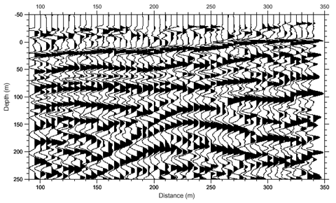
A series of apparently related reflections on several seismograms is often referred to as a reflection event. By correlating reflection events, a seismologist can create an estimated cross-section of the geologic
Geology
Geology is the science comprising the study of solid Earth, the rocks of which it is composed, and the processes by which it evolves. Geology gives insight into the history of the Earth, as it provides the primary evidence for plate tectonics, the evolutionary history of life, and past climates...
structure that generated the reflections. Interpretation of large surveys is usually performed with programs using high-end three dimensional computer graphics
Computer graphics
Computer graphics are graphics created using computers and, more generally, the representation and manipulation of image data by a computer with help from specialized software and hardware....
.
Applications
Reflection seismology is extensively used in exploration for hydrocarbonHydrocarbon
In organic chemistry, a hydrocarbon is an organic compound consisting entirely of hydrogen and carbon. Hydrocarbons from which one hydrogen atom has been removed are functional groups, called hydrocarbyls....
s (i.e., petroleum
Petroleum
Petroleum or crude oil is a naturally occurring, flammable liquid consisting of a complex mixture of hydrocarbons of various molecular weights and other liquid organic compounds, that are found in geologic formations beneath the Earth's surface. Petroleum is recovered mostly through oil drilling...
, natural gas
Natural gas
Natural gas is a naturally occurring gas mixture consisting primarily of methane, typically with 0–20% higher hydrocarbons . It is found associated with other hydrocarbon fuel, in coal beds, as methane clathrates, and is an important fuel source and a major feedstock for fertilizers.Most natural...
) and such other resources as coal
Coal
Coal is a combustible black or brownish-black sedimentary rock usually occurring in rock strata in layers or veins called coal beds or coal seams. The harder forms, such as anthracite coal, can be regarded as metamorphic rock because of later exposure to elevated temperature and pressure...
, ore
Ore
An ore is a type of rock that contains minerals with important elements including metals. The ores are extracted through mining; these are then refined to extract the valuable element....
s, mineral
Mineral
A mineral is a naturally occurring solid chemical substance formed through biogeochemical processes, having characteristic chemical composition, highly ordered atomic structure, and specific physical properties. By comparison, a rock is an aggregate of minerals and/or mineraloids and does not...
s, and geothermal energy. Reflection seismology is also used for basic research into the nature and origin of the rock
Rock (geology)
In geology, rock or stone is a naturally occurring solid aggregate of minerals and/or mineraloids.The Earth's outer solid layer, the lithosphere, is made of rock. In general rocks are of three types, namely, igneous, sedimentary, and metamorphic...
s making up the Earth's crust
Crust (geology)
In geology, the crust is the outermost solid shell of a rocky planet or natural satellite, which is chemically distinct from the underlying mantle...
. Reflection Seismology is also used in shallow application for engineering, groundwater and environmental surveying. A method similar to reflection seismology which uses electromagnetic instead of elastic waves is known as Ground-penetrating radar
Ground-penetrating radar
Ground-penetrating radar is a geophysical method that uses radar pulses to image the subsurface. This nondestructive method uses electromagnetic radiation in the microwave band of the radio spectrum, and detects the reflected signals from subsurface structures...
or GPR. GPR is widely used for mapping shallow subsurface (up to a few meters deep).
Hydrocarbon exploration
Reflection seismology, or 'seismic' as it is more commonly referred to by the oil industry, is used to map the subsurface structure of rock formations. Seismic technology is used by geologistsGeology
Geology is the science comprising the study of solid Earth, the rocks of which it is composed, and the processes by which it evolves. Geology gives insight into the history of the Earth, as it provides the primary evidence for plate tectonics, the evolutionary history of life, and past climates...
and geophysicists
Geophysics
Geophysics is the physics of the Earth and its environment in space; also the study of the Earth using quantitative physical methods. The term geophysics sometimes refers only to the geological applications: Earth's shape; its gravitational and magnetic fields; its internal structure and...
who interpret the data to map structural traps that could potentially contain hydrocarbons. Although the technology of exploration activities has improved exponentially in the past 20 years, the basic principles for acquiring seismic data have remained the same.
In simple terms and for all of the exploration environments, the general principle is to send sound energy waves (using an energy source like dynamite or Vibroseis) into the Earth, where the different layers within the Earth's crust reflect back this energy. These reflected energy waves are recorded over a predetermined time period (called the record length) by using hydrophones in water and geophones on land. The reflected signals are output onto a storage medium, which is usually magnetic tape. The general principle is similar to recording voice data using a microphone onto a tape recorder for a set period of time. Once the data is recorded onto tape, it can then be processed using specialist software which will result in processed seismic profiles being produced. These profiles or data sets can then be interpreted for possible hydrocarbon reserves.
Naturally enough, the three primary exploration environments for seismic exploration are land, the transition zone and marine (shallow and deep water):
Land - The land environment is self explanatory, but can cover just about every type of terrain that exists on Earth (such as jungle, desert, arctic tundra, swamp, forest, urban settings, mountain regions and savannah).
Transition Zone (TZ) - The transition zone is considered to be the transition area between the land and sea and can present unique challenges depending on the location. This may involve setting source and receiver stations across river deltas, in swamps, across coral reefs, on beach tidal areas and in the surf zone. TZ crews often work on land, in the transition zone and in the shallow water marine environment on a single project.
Marine - The marine zone is either in shallow water areas (water depths of less than 30 to 40 metres would normally be considered shallow water areas for 3D marine seismic operations) or in the deep water areas normally associated with the seas and oceans (such as the Gulf of Mexico).
What parameters are used for each acquisition project depends on a significant number of variables specific to a particular area. For example, in the marine environment the choice of a tuned air gun array will depend on the known sub-sea geology, data from previous seismic surveys, the depth at which the main features of geological interest exist within the Earth, the desired frequency output of the source array, the amount of energy or power required and so on. For the land environment, the source choice is normally between drilled dynamite shot holes or mechanical vibrators. Again, the choice will depend on the specific geology and characteristics of the prospect area but can also be influenced by non geophysical issues, such as terrain, safety issues especially for explosive use and storage and local environmental concerns (such as working in protected areas, working close to buildings and structures or in national parks etc.).
Land
Land crews tend to be quite large entities, employing anywhere from a few hundred to a few thousand people. They normally require substantial logistical support to cover not only the seismic operation itself, but also to support the main camp (for catering, waste management and disposal, camp accommodations, washing facilities, water supply, laundry etc.), fly camps (temporary camps set up away from the main camp on large land seismic operations, for example where the distance is too far to drive back to the main camp with vibrator trucks), all of the crew's vehicles (maintenance, fuel, spares etc.), security, possible helicopter operations, restocking of the explosive magazine, medical support and many other logistical and support functions.Outside of the camp personnel, the basic components of a seismic land crew are the surveyors, layout and loading crew, shooters and recorders and the pick up crew. The general principle is for the surveyors to survey in shot and receiver points on source and receiver lines (the latitude and longitude coordinates of which are pre-determined by the client / contractor) using mobile GPS stations. When a shot or receiver point is reached, this position will be staked out or marked with the shot or receiver station number and line number.
Once sufficient lines of shot and receiver points have been surveyed in and shot holes have been drilled to the appropriate depth, loaders put explosive charges into the shot holes on the source lines (according to the project specification) and the receiver stations will be laid out with geophone spreads on the receiver lines. When corresponding shot and receiver lines are ready, the shooters prepare a single shot hole ready for firing, whilst the recording shack will be hooked up to the geophone spread laid on the corresponding receiver line to record the reflected data. Once a charge is ready to be shot, the recording shack initiates the shot hole firing sequence via a radio link and records the seismic data from the whole geophone spread onto magnetic medium. Once a shot is completed, the shooters move to the next shot hole and the shoot / record sequence begins again.
Once lines have been shot, loaders continue to load shot holes on new source lines and the pick up crews pick up and relay geophone spreads onto new receiver lines as required in the acquisition plan. For vibrator crews, aka "Vibroseis" (vibrations are created by the computer-coordinated vibration of hydraulically controlled plates on vibrator trucks), the vibrator trucks move from shot hole to shot hole on the designated source line instead of the loaders and shooters.
Land surveys require crews to deploy the hundreds or thousands of geophone
Geophone
The term geophone derives from the Greek word "geo" meaning "earth" and "phone" meaning "sound".A geophone is a device which converts ground movement into voltage, which may be recorded at a recording station...
s necessary to record the data. Most surveys today are conducted by laying out a two-dimensional array of geophones together with a two-dimensional pattern of source points. This allows the interpreter to create a three-dimensional image of the geology beneath the array, so these are called 3D surveys. Less expensive survey methods use one-dimensional lines of geophones that only allowed the interpreter to make two-dimensional cross-sections.
Marine (streamer)
Deep water marine seismic surveys are conducted using purpose built vessels capable of towing one or more seismic cables or "streamers" (see figure) just below the sea surface, along with an energy source towed just below the surface and between the stern of the vessel and the head of the streamers. Modern 3D surveys use multiple streamers deployed in parallel and often multiple energy sources (commonly two), to record data suitable for the three-dimensional interpretation of the structures beneath the sea bed. A single vessel may tow anything up to 10+ streamers, each 6 km+ in length, spaced 50–150 m apart. HydrophoneHydrophone
A hydrophone is a microphone designed to be used underwater for recording or listening to underwater sound. Most hydrophones are based on a piezoelectric transducer that generates electricity when subjected to a pressure change...
s are built into the streamers at regular intervals; these record and digitize the energy waves which are reflected back from sub-sea structures. To accurately calculate where subsurface features are located, navigators compute the position of both the energy source and each hydrophone group which records the signal. The positioning accuracy required is achieved using a combination of acoustic networks, compass
Compass
A compass is a navigational instrument that shows directions in a frame of reference that is stationary relative to the surface of the earth. The frame of reference defines the four cardinal directions – north, south, east, and west. Intermediate directions are also defined...
es and GPS receivers (often used with a radio correction applied call a differential GPS or DGPS).
A modification on this basic technique can also be used to record sub surface data directly underneath offshore structures, predominantly exploration and production platforms and other permanent offshore structures such as FPSO's (floating production, storage and offloading unit) which cannot be moved to facilitate a survey vessel; this technique is known as undershooting. This requires a separate source vessel and a streamer vessel to pass either side of the obstruction, firing the energy source on the source vessel and recording the reflected data on the towed streamers on the streamer vessel. Both vessels are linked by a data telemetry system to co-ordinate and synchronise the firing and recording operations. By varying the distance from the source and streamer vessel to the obstruction (changing the offset), a wide swathe of data can be collected from underneath the obstruction without any disturbance to the permanent offshore operation.
Marine (OBC)
Marine surveys can also be conducted using sensors attached to an Ocean Bottom Cable (OBC) laid out on the oceanOcean
An ocean is a major body of saline water, and a principal component of the hydrosphere. Approximately 71% of the Earth's surface is covered by ocean, a continuous body of water that is customarily divided into several principal oceans and smaller seas.More than half of this area is over 3,000...
bottom rather than in towed streamers. Due to operational limitations, most of these types of surveys are conducted in water depths less than 70 meters, however OBC crews in recent years have acquired 3D surveys in depths up to 2000 meters. One operational advantage is that obstacles (such as platforms) do not limit the acquisition as much as they do for streamer surveys. Most of the OBC surveys use dual component receivers, combining a pressure sensor (hydrophone
Hydrophone
A hydrophone is a microphone designed to be used underwater for recording or listening to underwater sound. Most hydrophones are based on a piezoelectric transducer that generates electricity when subjected to a pressure change...
) and a vertical particle velocity sensor (vertical geophone
Geophone
The term geophone derives from the Greek word "geo" meaning "earth" and "phone" meaning "sound".A geophone is a device which converts ground movement into voltage, which may be recorded at a recording station...
). OBC surveys can also use four component, i.e. a hydrophone
Hydrophone
A hydrophone is a microphone designed to be used underwater for recording or listening to underwater sound. Most hydrophones are based on a piezoelectric transducer that generates electricity when subjected to a pressure change...
components plus the three orthogonal velocity sensors. Four component OBC surveys have the advantage of being able to also record shear wave
Seismic wave
Seismic waves are waves of energy that travel through the earth, and are a result of an earthquake, explosion, or a volcano that imparts low-frequency acoustic energy. Many other natural and anthropogenic sources create low amplitude waves commonly referred to as ambient vibrations. Seismic waves...
s, which do not travel through water. Multiple component OBC surveys hence can lead to improved subsurface imaging. Ocean Bottom Cable surveys can also cost significantly more than conventional streamer surveys over the same area. This additional cost is usually only justified when the improved imaging is required for accurate reservoir delineation, or when surface obstacles prevent a conventional streamer survey from being acquired in the area.
Crustal studies
The use of reflection seismology in studies of tectonicsTectonics
Tectonics is a field of study within geology concerned generally with the structures within the lithosphere of the Earth and particularly with the forces and movements that have operated in a region to create these structures.Tectonics is concerned with the orogenies and tectonic development of...
and the Earth's crust was pioneered by groups such as the Consortium for Continental Reflection Profiling (COCORP) http://www.geo.cornell.edu/geology/cocorp/COCORP.html,http://www.geo.cornell.edu/geology/cocorp/deep_seismic_links.html.
Environmental impact
As with all human activities, reflection seismic experiments may impact the Earth's natural environmentNatural environment
The natural environment encompasses all living and non-living things occurring naturally on Earth or some region thereof. It is an environment that encompasses the interaction of all living species....
. On land, conducting a seismic survey may require the building of road
Road
A road is a thoroughfare, route, or way on land between two places, which typically has been paved or otherwise improved to allow travel by some conveyance, including a horse, cart, or motor vehicle. Roads consist of one, or sometimes two, roadways each with one or more lanes and also any...
s in order to transport equipment and personnel. Even if roads are not required, vegetation may need to be cleared for the deployment of geophones. If the survey is in a relatively undeveloped area, significant habitat
Habitat (ecology)
A habitat is an ecological or environmental area that is inhabited by a particular species of animal, plant or other type of organism...
disturbance may result. Many land crews now use helicopters instead of land vehicles in remote areas. Most countries require that seismic surveys are conducted according to environmental standards established by government regulation. Higher environmental standards have encouraged the development of lower impact seismic vehicles and acquisition methodologies. Similarly modern seismic processing techniques allow seismic lines to deviate around natural obstacles, or use pre-existing non-straight tracks and trails with less loss of data quality than would once have been the case. The more recent use of inertial navigation instruments for land survey instead of theodolites decreased the impact of seismic by allowing the winding of survey lines between trees.
The main environmental concern for marine surveys is the potential of seismic sources to disturb animal life, especially cetaceans such as whale
Whale
Whale is the common name for various marine mammals of the order Cetacea. The term whale sometimes refers to all cetaceans, but more often it excludes dolphins and porpoises, which belong to suborder Odontoceti . This suborder also includes the sperm whale, killer whale, pilot whale, and beluga...
s, porpoise
Porpoise
Porpoises are small cetaceans of the family Phocoenidae; they are related to whales and dolphins. They are distinct from dolphins, although the word "porpoise" has been used to refer to any small dolphin, especially by sailors and fishermen...
s, and dolphin
Dolphin
Dolphins are marine mammals that are closely related to whales and porpoises. There are almost forty species of dolphin in 17 genera. They vary in size from and , up to and . They are found worldwide, mostly in the shallower seas of the continental shelves, and are carnivores, mostly eating...
s. Surveys involves towing an array of 15-45 pneumatic air guns below the ocean surface behind the survey vessel and emit sound pulses of a “predominantly low frequency (10–300 Hz), high intensity (215-250 dB). These animals have sensitive hearing, and some scientists believe the underwater sound waves created by air guns might disturb the animals or even damage their ear
Ear
The ear is the organ that detects sound. It not only receives sound, but also aids in balance and body position. The ear is part of the auditory system....
s. Seismic surveying can damage the reproductive processes, auditory functions and other damaging effects to highly lucrative marine species (lobster, crab) and it poses potentially fatal effects to marine mammals. Seismic testing is not fully responsible for whales running ashore or becoming stranded, but there is evidence that it plays a major role. Studies of seismic effects on several whale species such as Gray, Bowhead, Blue, Humpback and Sperm whales indicated substantial effects in behavior, breathing, feeding and diving patterns. Dr. Bernd Würsig, a professor for marine biology at Texas A&M University in Galveston, Texas states that the Gray whale will avoid its regular migratory and feeding grounds by >30 km in areas of seismic testing. Similarly the breathing of gray whales was shown to be more rapid, indicating discomfort and panic in the whale. It is circumstantial evidence such as this that has led researchers to believe that avoidance and panic might be responsible for increased whale beachings although research is ongoing into these questions.
However, the research carried out by both the E&P (exploration and production) sector and by environmental groups needs to be considered carefully in terms of impartiality as both may reference research or publish data that only promotes their own aims and goals. For example, the following quote comes from a position paper published by an E&P representative group which would appear to contradict the conclusions stated above. The quote from the executive summary states that:
"The sound produced during seismic surveys is comparable in magnitude to many naturally occurring and other man-made sound sources. Furthermore, the specific characteristics of seismic sounds and the operational procedures employed during seismic surveys are such that the resulting risks to marine mammals are expected to be exceptionally low. In fact, three decades of world-wide seismic surveying activity and a variety of research projects have shown no evidence which would suggest that sound from E&P seismic activities has resulted in any physical or auditory injury to any marine mammal species."
History
Reflections and refractions of seismic waves at geologic interfaces within the Earth were first observed on recordings of earthquake-generated seismic waves. The basic model of the Earth's deep interior is based on observations of earthquake-generated seismic waves transmitted through the Earth’s interior (e.g., Mohorovičić, 1910). The use of human-generated seismic waves to map in detail the geology of the upper few kilometers of the Earth's crust followed shortly thereafter and has developed mainly due to commercial enterprise, particularly the petroleum industry.The Canadian
Canada
Canada is a North American country consisting of ten provinces and three territories. Located in the northern part of the continent, it extends from the Atlantic Ocean in the east to the Pacific Ocean in the west, and northward into the Arctic Ocean...
inventor Reginald Fessenden
Reginald Fessenden
Reginald Aubrey Fessenden , a naturalized American citizen born in Canada, was an inventor who performed pioneering experiments in radio, including early—and possibly the first—radio transmissions of voice and music...
was the first to conceive of using reflected seismic waves to infer geology. His work was initially on the propagation of acoustic waves in water, motivated by the sinking of the Titanic by an iceberg in 1912. He also worked on methods of detecting submarines during World War I
World War I
World War I , which was predominantly called the World War or the Great War from its occurrence until 1939, and the First World War or World War I thereafter, was a major war centred in Europe that began on 28 July 1914 and lasted until 11 November 1918...
. He applied for the first patent on a seismic exploration method in 1914, which was issued in 1917. Due to the war, he was unable to follow up on the idea. Meanwhile, Ludger Mintrop, a German mine surveyor, devised a mechanical seismograph in 1914 that he successfully used to detect salt domes in Germany. He applied for a German patent in 1919 that was issued in 1926. In 1921 he founded the company Seismos, which was hired to conduct seismic exploration in Texas and Mexico, resulting in the discovery of the first commercial discovery of oil using the seismic method in 1924. John Clarence Karcher
J. Clarence Karcher
John Clarence Karcher was an American geophysicist and businessman. He invented and eventually commercialized the reflection seismograph, applying for patents on this in 1919. In doing this he created the means by which most of the world's oil reserves have been discovered...
discovered seismic reflections independently while working for the United States
United States
The United States of America is a federal constitutional republic comprising fifty states and a federal district...
Bureau of Standards (now the National Institute of Standards and Technology
National Institute of Standards and Technology
The National Institute of Standards and Technology , known between 1901 and 1988 as the National Bureau of Standards , is a measurement standards laboratory, otherwise known as a National Metrological Institute , which is a non-regulatory agency of the United States Department of Commerce...
) on methods of sound ranging to detect artillery
Artillery
Originally applied to any group of infantry primarily armed with projectile weapons, artillery has over time become limited in meaning to refer only to those engines of war that operate by projection of munitions far beyond the range of effect of personal weapons...
. In discussion with colleagues, the idea developed that these reflections could aid in exploration for petroleum
Petroleum
Petroleum or crude oil is a naturally occurring, flammable liquid consisting of a complex mixture of hydrocarbons of various molecular weights and other liquid organic compounds, that are found in geologic formations beneath the Earth's surface. Petroleum is recovered mostly through oil drilling...
. With several others, many affiliated with the University of Oklahoma
University of Oklahoma
The University of Oklahoma is a coeducational public research university located in Norman, Oklahoma. Founded in 1890, it existed in Oklahoma Territory near Indian Territory for 17 years before the two became the state of Oklahoma. the university had 29,931 students enrolled, most located at its...
, Karcher helped to form the Geological Engineering Company, incorporated in Oklahoma
Oklahoma
Oklahoma is a state located in the South Central region of the United States of America. With an estimated 3,751,351 residents as of the 2010 census and a land area of 68,667 square miles , Oklahoma is the 28th most populous and 20th-largest state...
in April, 1920. The first field tests were conducted near Oklahoma City, Oklahoma
Oklahoma City, Oklahoma
Oklahoma City is the capital and the largest city in the state of Oklahoma. The county seat of Oklahoma County, the city ranks 31st among United States cities in population. The city's population, from the 2010 census, was 579,999, with a metro-area population of 1,252,987 . In 2010, the Oklahoma...
in 1921.
The company soon folded due to a drop in the price of oil. In 1925, oil prices had rebounded, and Karcher helped to form Geophysical Research Corporation (GRC) as part of the oil company Amerada
Hess Corporation
The Hess Corporation is an integrated oil company based in New York City. The company explores, produces, transports, and refines crude oil and natural gas. Vertically completing the logistical chain, about 1,360 Hess branded filling stations market gasoline to consumers in 16 states along the...
. In 1930, Karcher left GRC and helped to found Geophysical Service Incorporated
Geophysical Service Incorporated
Geophysical Service Inc. was founded by John Clarence Karcher and Eugene McDermott in 1930 for the purpose of using refraction and reflection seismology to explore for petroleum deposits. It became one of the most successful seismic exploration contractors in the industry for many years...
(GSI). GSI was one of the most successful seismic contracting companies for over 50 years and was the parent of an even more successful company, Texas Instruments
Texas Instruments
Texas Instruments Inc. , widely known as TI, is an American company based in Dallas, Texas, United States, which develops and commercializes semiconductor and computer technology...
. Early GSI employee Henry Salvatori
Henry Salvatori
Henry Salvatori was an American geophysicist, businessman, philanthropist, and political activist. Salvatori founded Western Geophysical in 1933, and after selling the company in 1960, pursued a second career as a philanthropist and conservative political activist...
left that company in 1933 to found another major seismic contractor, Western Geophysical
Western Geophysical
Western Geophysical was a company founded in California in 1933 by Henry Salvatori for the purpose of using reflection seismology to explore for petroleum....
. As of 2005, after several mergers and acquisitions, the heritages of GSI and Western Geophysical still exist, along with several pioneering European companies such as GECO, Seismos, and Prakla, as part of the seismic contracting company WesternGeco
WesternGeco
WesternGeco is a geophysical services company. It is headquartered in the Schlumberger House on the property of London Gatwick Airport in Crawley, West Sussex, in Greater London.-Background:...
. Many other companies using reflection seismology in hydrocarbon exploration, hydrology
Hydrology
Hydrology is the study of the movement, distribution, and quality of water on Earth and other planets, including the hydrologic cycle, water resources and environmental watershed sustainability...
, engineering
Engineering
Engineering is the discipline, art, skill and profession of acquiring and applying scientific, mathematical, economic, social, and practical knowledge, in order to design and build structures, machines, devices, systems, materials and processes that safely realize improvements to the lives of...
studies, and other applications have been formed since the method was first invented. Major service companies today include CGGVeritas
CGGVeritas
CGGVeritas is a French-based geophysical services company, resulting from the 2007 combination of Compagnie Générale de Géophysique and Veritas DGC Inc.-CGG:CGG was founded in 1931 by Conrad Schlumberger and acquired its first seismic survey in 1932...
, ION Geophysical
ION Geophysical
ION Geophysical is a technology-focused seismic solutions company that provides advanced acquisition equipment, software, planning and seismic processing services, and seismic data libraries to the global oil & gas industry...
, Petroleum Geo-Services
Petroleum Geo-Services
Petroleum Geo-Services ASA, an oilfield service company, provides geophysical services worldwide. The company provides various seismic and reservoir services, including acquisition, processing, interpretation, and field evaluation. The floating production unit was demerged in 2006 and listed as a...
and Fugro
Fugro
Fugro N.V. is a Dutch multinational company headquartered in Leidschendam. The current president is K.S. Wester.Fugro provides geotechnical, survey and geoscience services to oil, gas, mining and construction industries...
. Most major oil companies also have actively conducted research into seismic methods as well as collected and processed seismic data using their own personnel and technology. Reflection seismology has also found applications in non-commercial research by academic and government scientists around the world.
See also
- DeconvolutionDeconvolutionIn mathematics, deconvolution is an algorithm-based process used to reverse the effects of convolution on recorded data. The concept of deconvolution is widely used in the techniques of signal processing and image processing...
- SEG YSEG YThe SEG Y file format is one of several standards developed by the Society of Exploration Geophysicists for storing geophysical data. It is an open standard, and is controlled by the SEG Technical Standards Committee, a non-profit organization....
, a popular file format for seismic reflection data - Depth conversionDepth conversionDepth conversion is an important step of the seismic reflection method, which converts the acoustic wave travel time to actual depth, based on the acoustic velocity of subsurface medium ....
, the conversion of acoustic waves two-way travel time to actual depth - Seismic waves
- Seismic refractionSeismic refractionSeismic refraction is a geophysical principle governed by Snell's Law. Used in the fields of engineering geology, geotechnical engineering and exploration geophysics, seismic refraction traverses are performed using a seismograph and/or geophone, in an array and an energy source...
- Swell filterSwell filterThe term swell filter in high resolution seismics or sub bottom profiling refers to the static correction that restores the coherence of a high resolution seismic profile. The coherence of the image got lost because of the relative movement of the source and receiver during the recording...
- Passive seismicPassive seismicPassive seismic is the detection of natural low frequency earth movements, usually with the purpose of discerning geological structure and locate underground oil, gas, or other resources. Usually the data listening is done in multiple measurement points that are separated by several hundred meters,...
- Seismic migration
- Synthetic seismogramSynthetic seismogramA synthetic seismogram is the result of forward modelling the seismic response of an input earth model, which is defined in terms of 1D, 2D or 3D variations in physical properties. In hydrocarbon exploration this is used to provide a 'tie' between changes in rock properties in a borehole and...
- Seismic UnixSeismic UnixSeismic Unix is an open source seismic utilities package supported by the Center for Wave Phenomena at the Colorado School of Mines .- History :...
, open source software for processing of seismic reflection data - Exploration geophysicsExploration geophysicsExploration geophysics is the applied branch of geophysics which uses surface methods to measure the physical properties of the subsurface Earth, in order to detect or infer the presence and position of ore minerals, hydrocarbons, geothermal reservoirs, groundwater reservoirs, and other geological...
Further reading
The following books cover important topics in reflection seismology. Most require some knowledge of mathematics, geology, and/or physics at the university level or above.- Chapman, C. H. (2004), Fundamentals of Seismic Wave Propagation (Cambridge University Press, Cambridge).
Further research in reflection seismology may be found particularly in books and journals of the Society of Exploration Geophysicists
Society of Exploration Geophysicists
The Society of Exploration Geophysicists is a nonprofit organization dedicated to promoting the science of geophysics and the education of exploration geophysicists. The Society fosters the expert and ethical practice of geophysics in the exploration and development of natural resources, in...
, the American Geophysical Union
American Geophysical Union
The American Geophysical Union is a nonprofit organization of geophysicists, consisting of over 50,000 members from over 135 countries. AGU's activities are focused on the organization and dissemination of scientific information in the interdisciplinary and international field of geophysics...
, and the European Association of Geoscientists and Engineers
European Association of Geoscientists and Engineers
The European Association of Geoscientists and Engineers is a multi-disciplinary professional association for geoscientists and engineers. It was founded in 1951 and has a worldwide membership...
.
External links
- Reflection Seismology Literature at Seismic Laboratory for Imaging and Modeling
- Reflection Seismology Literature at Stanford Exploration Project
- Website of the International Association of Geophysical Contractors
- IAGC/OGP position paper on seismic surveys and marine mammals (PDF)
- Tutorial on seismic reflection data processing
- A guide to marine High-Resolution Seismic / Sub-Bottom Profiler acquisition and processing and image galleries
- Overview of IAGC Marine Geophysical Operations Educational CD - 1 http://www.youtube.com/watch?v=2XlI6rp5F48