
Rangamati District
Encyclopedia
- This article is about the District. For the town, see RangamatiRangamatiRangamati is the Administrative Headquarter of Rangamati Hill District in the Chittagong Hill Tracts of Bangladesh. The town is located at 22°37'60N 92°12'0E and has an altitude of 14 metres ....
.
Rangamati(Bengali:রাঙ্গামাটি পার্বত্য জেলা) is a district in South-eastern Bangladesh
Bangladesh
Bangladesh , officially the People's Republic of Bangladesh is a sovereign state located in South Asia. It is bordered by India on all sides except for a small border with Burma to the far southeast and by the Bay of Bengal to the south...
. It is a part of the Chittagong Hill Tracts
Chittagong Hill Tracts
The Chittagong Hill Tracts comprise an area of 13,295 km2 in south-eastern Bangladesh, and borders India and Myanmar . It was a single district of Bangladesh until 1984. In that year it was divided into three separate districts: Khagrachari, Rangamati and Bandarban. Topographically, this is the...
and the town of Rangamati
Rangamati
Rangamati is the Administrative Headquarter of Rangamati Hill District in the Chittagong Hill Tracts of Bangladesh. The town is located at 22°37'60N 92°12'0E and has an altitude of 14 metres ....
serves as the headquarters of the district. Area-wise, Rangamati is the largest district of the country.
Geography
Rangamati is located in the Chittagong Division. The total area of the district is 6116.13 sq km. It is bounded by the TripuraTripura
Tripura is a state in North-East India, with an area of . It is the third smallest state of India, according to area. Tripura is surrounded by Bangladesh on the north, south, and west. The Indian states of Assam and Mizoram lie to the east. The capital is Agartala and the main languages spoken are...
state of India
India
India , officially the Republic of India , is a country in South Asia. It is the seventh-largest country by geographical area, the second-most populous country with over 1.2 billion people, and the most populous democracy in the world...
on the north, Bandarban District
Bandarban District
Bandarban is a district in South-Eastern Bangladesh, and a part of the Chittagong Division and Chittagong Hill Tracts. Bandarban , or in Marma or Arakanese language as "Rwa-daw Mro" is also known as Arvumi or the Bohmong Circle Bandarban is a district in South-Eastern Bangladesh, and a part of...
on the south, Mizoram
Mizoram
Mizoram is one of the Seven Sister States in North Eastern India, sharing borders with the states of Tripura, Assam, Manipur and with the neighbouring countries of Bangladesh and Burma. Mizoram became the 23rd state of India on 20 February 1987. Its capital is Aizawl. Mizoram is located in the...
State of India
India
India , officially the Republic of India , is a country in South Asia. It is the seventh-largest country by geographical area, the second-most populous country with over 1.2 billion people, and the most populous democracy in the world...
and Chin State
Chin State
Chin State is a state located in western Burma . The Chin State is bordered by Rakhine State in the south, Bangladesh in south-west, Sagaing Division and Magway Division in the east, Indian state of Manipur in the north and Indian state of Mizoram in the west. The Chin ethnic group make up the...
of Myanmar
Myanmar
Burma , officially the Republic of the Union of Myanmar , is a country in Southeast Asia. Burma is bordered by China on the northeast, Laos on the east, Thailand on the southeast, Bangladesh on the west, India on the northwest, the Bay of Bengal to the southwest, and the Andaman Sea on the south....
on the east, and Khagrachari and Chittagong District
Chittagong District
Chittagong District is a district located in the south-eastern region of Bangladesh. It is a part of the Chittagong Division. The port city of Chittagong, second largest city in Bangladesh, is located in this district.-History:...
s on the west.
It’s a combination of Hill- Lake-Plain land The area of the district is 6116.13 sq. km of which 1291.5 sq. km is riverine and 4824.63 sq.km.is under forest vegetation and the lake area is about 650 sq. km.
Demography
The total population is 5,08,182 according to 2005 census of which tribal 52% and non-tribal 48%. The number of males is 2,87,060 and the females are 2,38,043 (Census 2001). The density of population is 83 per square kilometer (Census 2001). The number of household is 1,03,974 having the household size 4.8 (Census 2001). The total population is divided into Bangalees and eleven tribes (ethnic minorities): ChakmaChakma
Chakma may refer to:*Chakma people, a Tibeto-Burman people of Bangladesh and Northeast India*Chakma language, the Indo-European language spoken by them*Chakma script...
, Marma
Marma
The Marma also known as Magh or Mog are Arakanese descendants inhabiting the Chittagong Hill Tracts of Bangladesh since the Arakan kingdom period in the 16th century AD. In the late 20th century, their population stood at over 210,000. Ethnically related to the Myanmar, they are largely followers...
, Tanchangya
Tanchangya
Tanchangya may refer to:*the Tanchangya people*the Tanchangya language...
, Tripura, Pankua, Lushi, Khiang, Murang, Rakhain, Chak, Bowm,Khumi.http://www.dcrangamati.gov.bd/
Tribal population : (as per census of 2005 ):
Chakma-1,86,395, Marma-44,727, Tanchanga-18,607, Tripura-6,697, Pankho- 2,118, Bowm-1,053, khyang- 791, Lusai- 217, Chak- 177, Rakhain-70, Khumi-50,Gurkha-03,Etc-174http://www.dcrangamati.gov.bd/
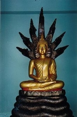
As per 1991 census, the religious break up of the population of the district were: Buddhist 53.83%,Muslim 39.28%, Hindu 5.62% and Christian 1.12%. Religious institutions Pagoda 1230, Mosque 1059, Temple 65, Church 16. Genderwise, male constituted 53.59% and female constituted 46.41% of the population.http://www.dcrangamati.gov.bd/
Rangamati Town
Rangamati Town is mainly divided into 13 areas. Namely Vedvedi, Collegegate, Rajbari, Newmarket, Banarupa, Kathaltoli, Fishery Ghath, Reserve Bazar, Launch Ghath, Pathor Ghata, Tabalchori, Mazher Basti, Asam Basti.- For the Town, see RangamatiRangamatiRangamati is the Administrative Headquarter of Rangamati Hill District in the Chittagong Hill Tracts of Bangladesh. The town is located at 22°37'60N 92°12'0E and has an altitude of 14 metres ....
.
Subdivisions
The district of Rangamati consists of 10 upazilas, 1 municipality, 9 wards, 35 mahallas, 50 union parishads, 162 mouzas and 1347 villages. The upazilas are Baghaichhari, Barkal, Kawkhali, Belaichhari, KaptaiKaptai
Kaptai is a region in south-eastern Bangladesh. The Kaptai Upazila is part of the Rangamati District of Chittagong Division. Karnaphuli Hydroelectric Power Station, the only Hydro-electric power plant of Bangladesh is located here...
, Juraichhari, Langadu, Nannerchar, RajasthaliRangapani and Rangamati sadar.
List of Unions in Rangamati District
- Rangamati Sadar UpazilaRangamati Sadar UpazilaRangamati Sadar is an Upazila of Rangamati District in the Division of Chittagong, Bangladesh.-Geography:Rangamati Sadar is located at . It has 13814 units of house hold and total area 546.49 km².-Demographics:...
- Balukhali
- Bandukbhanga
- Jibtoli
- Kutukchari
- Mogban
- Shapchari
- Belaichhari UpazilaBelaichhari UpazilaBelaichari is an Upazila of Rangamati District in the Division of Chittagong, Bangladesh.-Geography:Belaichari is located at . It has 3411 units of house hold and total area 745.92 km².-Demographics:...
- Bilaichari Sadar
- Farua
- Kengrachari
- Bagaichhari UpazilaBagaichhari UpazilaBagaichhari is an Upazila of Rangamati District in the Division of Chittagong, Bangladesh.-Geography:Bagaichhari is located at . It has 10471 units of house hold and total area 1931.28 km².-Demographics:...
- Baghaichari
- Bangaltali
- Khedar Mara
- Marishya
- Rupakari
- Sajek
- Sarbotali
- Barkal UpazilaBarkal UpazilaBarkal is an Upazila of Rangamati District in the Division of Chittagong, Bangladesh.-Geography:Barkal is located at . It has 4782 units of house hold and total area 760.88 km².-Demographics:...
- Aimachara
- Baraharina
- Barkal
- Bhushonchara
- Subalong
- Juraichhari UpazilaJuraichhari UpazilaJuraichhari is an Upazila of Rangamati District in the Division of Chittagong, Bangladesh.-Geography:Juraichhari is located at . It has 2412 units of house hold and total area 606.05 km².-Demographics:...
- Bonjugichara
- Dumdumia
- Jurachari
- Moydong
- Rajasthali UpazilaRajasthali UpazilaRajasthali is an Upazila of Rangamati District in the Division of Chittagong, Bangladesh.-Geography:Rajasthali is located at . It has 3353 units of house hold and total area 145.04 km².-Demographics:...
- Bangalhalia
- Gainda
- Ghilachari
- Kaptai UpazilaKaptai UpazilaKaptai is an Upazila of Rangamati District in the Division of Chittagong, Bangladesh.-Geography:Kaptai is located at . It has 12992 units of house hold and total area 259 km².-Demographics:...
- ChandraghonaChandraghonaChandraghona is forty-eight kilometers from Chittagong on the Kaptai Road. One of the biggest paper mills in Asian is located here. There is also a rayon factory....
- Chithmorong
- KaptaiKaptaiKaptai is a region in south-eastern Bangladesh. The Kaptai Upazila is part of the Rangamati District of Chittagong Division. Karnaphuli Hydroelectric Power Station, the only Hydro-electric power plant of Bangladesh is located here...
- Raikhali
- Wagga
- Chandraghona
- Langadu UpazilaLangadu UpazilaLangadu is an Upazila of Rangamati District in the Division of Chittagong, Bangladesh.-Geography:Langadu is located at . It has 10571 units of house hold and total area 388.5 km².-Demographics:...
- Betbunia
- Fatikchari
- Ghagra
- Kolompati
- Adarakchara
- Bhasonna Adam
- Boghachatar
- Gulshyakhali
- Kalapagazya
- Langadu
- Myanimukh
- Nannerchar Upazila
- Burighat
- Ghilachari
- Naniarchar
- Sabekkhong
Gallery

Places of interest
- KaptaiKaptaiKaptai is a region in south-eastern Bangladesh. The Kaptai Upazila is part of the Rangamati District of Chittagong Division. Karnaphuli Hydroelectric Power Station, the only Hydro-electric power plant of Bangladesh is located here...
has BangladeshBangladeshBangladesh , officially the People's Republic of Bangladesh is a sovereign state located in South Asia. It is bordered by India on all sides except for a small border with Burma to the far southeast and by the Bay of Bengal to the south...
's only hydro-electric project. The Kaptai DamKaptai DamKaptai Dam is located on the Karnaphuli River at Kaptai, 65 km upstream from Chittagong in Rangamati District, Bangladesh. It is an earthfill embankment dam with a reservoir water storage capacity of 11,000 km². The primary purpose of the construction of the dam and reservoir was to generate...
on the Karnaphuli RiverKarnaphuli RiverKarnaphuli is a wide river in the south-eastern part of Bangladesh. Originating from the Lushai hills in Mizoram, India, it flows southwest through Chittagong Hill Tracts and Chittagong into the Bay of Bengal. A large hydroelectric power plant using Karnaphuli river was built in the Kaptai...
created for this purpose resulted in the Kaptai LakeKaptai LakeKaptai Lake is a man made lake in south-eastern Bangladesh. It is located in the Kaptai Upazila under Rangamati District of Chittagong Division. The lake was created as a result of building the Kaptai Dam on the Karnaphuli River, as part of the Karnaphuli Hydro-electric project...
.
See also
- Chittagong Hill TractsChittagong Hill TractsThe Chittagong Hill Tracts comprise an area of 13,295 km2 in south-eastern Bangladesh, and borders India and Myanmar . It was a single district of Bangladesh until 1984. In that year it was divided into three separate districts: Khagrachari, Rangamati and Bandarban. Topographically, this is the...
- Banglapedia article on Rangamati district