
Ralls, Texas
Encyclopedia
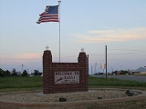
Ralls is an agricultural community in Crosby County, West Texas
, United States
, named after John Robinson Ralls, who, with the help of W.E. McLaughlin, laid out the townsite in July 1911. Ralls is surrounded by productive farm lands that primarily produce cotton and grains, with lesser amounts of soybean, sunflower, and vegetables.
between Lorenzo
to the west and Crosbyton
to the east. To the north of Ralls is the small community of Cone, Texas
and further north is a narrow portion of Blanco Canyon
, where the Spanish explorer Francisco Vázquez de Coronado and his army are believed to have camped in 1541. To the south of Ralls is the Caprock Escarpment
which marks the break between the Llano Estacado
and the rolling plains carved by the tributaries of the Brazos River
.
According to the United States Census Bureau
, the city has a total area of 1.3 sq mi (3.4 km²), all of it land.
Metropolitan Statistical Area
. According to the United States Census Bureau
, the population was 2,252 in 2000, with 776 households, and 584 families residing in the community. The population density
was 1,680.4 people per square mile (648.9/km²). There were 871 housing units at an average density of 649.9 per square mile (251.0/km²). The racial makeup of the city was 58.48% White, 2.22% African American, 0.53% Native American, 36.77% from other races
, and 2.00% from two or more races. Hispanic or Latino of any race were 55.77% of the population.
There were 776 households out of which 38.7% had children under the age of 18 living with them, 57.6% were married couples
living together, 13.4% had a female householder with no husband present, and 24.7% were non-families. 22.6% of all households were made up of individuals and 15.2% had someone living alone who was 65 years of age or older. The average household size was 2.86 and the average family size was 3.37.
In the city the population was spread out with 32.7% under the age of 18, 7.8% from 18 to 24, 23.9% from 25 to 44, 18.6% from 45 to 64, and 16.9% who were 65 years of age or older. The median age was 33 years. For every 100 females there were 87.4 males. For every 100 females age 18 and over, there were 80.8 males.
The median income for a household in the city was $23,892, and the median income for a family was $26,739. Males had a median income of $23,750 versus $15,724 for females. The per capita income
for the city was $10,557. About 25.3% of families and 28.6% of the population were below the poverty line, including 34.8% of those under age 18 and 27.2% of those age 65 or over.
Country music legend and member of the Grand Ole Opry, Billy Walker
was born in Ralls.
West Texas
West Texas is a vernacular term applied to a region in the southwestern quadrant of the United States that primarily encompasses the arid and semi-arid lands in the western portion of the state of Texas....
, United States
United States
The United States of America is a federal constitutional republic comprising fifty states and a federal district...
, named after John Robinson Ralls, who, with the help of W.E. McLaughlin, laid out the townsite in July 1911. Ralls is surrounded by productive farm lands that primarily produce cotton and grains, with lesser amounts of soybean, sunflower, and vegetables.
Geography
Ralls is located on the level plains of the Llano EstacadoLlano Estacado
Llano Estacado , commonly known as the Staked Plains, is a region in the Southwestern United States that encompasses parts of eastern New Mexico and northwestern Texas, including the South Plains and parts of the Texas Panhandle...
between Lorenzo
Lorenzo, Texas
Lorenzo is a city in Crosby County, Texas, United States. As of the 2000 census, the city population was 1,372. It is part of the Lubbock Metropolitan Statistical Area.-Geography:Lorenzo is located at on U.S...
to the west and Crosbyton
Crosbyton, Texas
Crosbyton is a city in and the county seat of Crosby County, Texas, United States. The population was 1,874 at the 2000 census. Crosbyton is part of the Lubbock Metropolitan Statistical Area....
to the east. To the north of Ralls is the small community of Cone, Texas
Cone, Texas
Cone is an unincorporated community in Crosby County, Texas, United States. It lies on U.S. Route 62, thirty-four miles northeast of Lubbock, and has an estimated population of 70. It is part of the Lubbock Metropolitan Statistical Area.-History:...
and further north is a narrow portion of Blanco Canyon
Blanco Canyon
Blanco Canyon is a canyon located in the U.S. state of Texas. Eroded by the White River into the Caprock Escarpment on the east side of the Llano Estacado, the canyon runs for in a southeasterly direction, gradually widening from its beginning in southwestern Floyd County to across at its mouth...
, where the Spanish explorer Francisco Vázquez de Coronado and his army are believed to have camped in 1541. To the south of Ralls is the Caprock Escarpment
Caprock Escarpment
The Caprock Escarpment is a term used in Texas and Eastern New Mexico to describe the geographical transition point between the level elevated plains of the Llano Estacado and the surrounding rolling terrain. In Texas, the escarpment stretches around 320 km south-southwest from the northeast...
which marks the break between the Llano Estacado
Llano Estacado
Llano Estacado , commonly known as the Staked Plains, is a region in the Southwestern United States that encompasses parts of eastern New Mexico and northwestern Texas, including the South Plains and parts of the Texas Panhandle...
and the rolling plains carved by the tributaries of the Brazos River
Brazos River
The Brazos River, called the Rio de los Brazos de Dios by early Spanish explorers , is the longest river in Texas and the 11th longest river in the United States at from its source at the head of Blackwater Draw, Curry County, New Mexico to its mouth at the Gulf of Mexico with a drainage...
.
According to the United States Census Bureau
United States Census Bureau
The United States Census Bureau is the government agency that is responsible for the United States Census. It also gathers other national demographic and economic data...
, the city has a total area of 1.3 sq mi (3.4 km²), all of it land.
Demographics
Ralls is part of the LubbockLubbock, Texas
Lubbock is a city in and the county seat of Lubbock County, Texas, United States. The city is located in the northwestern part of the state, a region known historically as the Llano Estacado, and the home of Texas Tech University and Lubbock Christian University...
Metropolitan Statistical Area
Lubbock metropolitan area
The Lubbock Metropolitan Statistical Area is a metropolitan area in the South Plains region of Texas, USA, that covers two counties - Lubbock and Crosby. As of the 2000 census, the MSA had a population of 249,700...
. According to the United States Census Bureau
United States Census Bureau
The United States Census Bureau is the government agency that is responsible for the United States Census. It also gathers other national demographic and economic data...
, the population was 2,252 in 2000, with 776 households, and 584 families residing in the community. The population density
Population density
Population density is a measurement of population per unit area or unit volume. It is frequently applied to living organisms, and particularly to humans...
was 1,680.4 people per square mile (648.9/km²). There were 871 housing units at an average density of 649.9 per square mile (251.0/km²). The racial makeup of the city was 58.48% White, 2.22% African American, 0.53% Native American, 36.77% from other races
Race (United States Census)
Race and ethnicity in the United States Census, as defined by the Federal Office of Management and Budget and the United States Census Bureau, are self-identification data items in which residents choose the race or races with which they most closely identify, and indicate whether or not they are...
, and 2.00% from two or more races. Hispanic or Latino of any race were 55.77% of the population.
There were 776 households out of which 38.7% had children under the age of 18 living with them, 57.6% were married couples
Marriage
Marriage is a social union or legal contract between people that creates kinship. It is an institution in which interpersonal relationships, usually intimate and sexual, are acknowledged in a variety of ways, depending on the culture or subculture in which it is found...
living together, 13.4% had a female householder with no husband present, and 24.7% were non-families. 22.6% of all households were made up of individuals and 15.2% had someone living alone who was 65 years of age or older. The average household size was 2.86 and the average family size was 3.37.
In the city the population was spread out with 32.7% under the age of 18, 7.8% from 18 to 24, 23.9% from 25 to 44, 18.6% from 45 to 64, and 16.9% who were 65 years of age or older. The median age was 33 years. For every 100 females there were 87.4 males. For every 100 females age 18 and over, there were 80.8 males.
The median income for a household in the city was $23,892, and the median income for a family was $26,739. Males had a median income of $23,750 versus $15,724 for females. The per capita income
Per capita income
Per capita income or income per person is a measure of mean income within an economic aggregate, such as a country or city. It is calculated by taking a measure of all sources of income in the aggregate and dividing it by the total population...
for the city was $10,557. About 25.3% of families and 28.6% of the population were below the poverty line, including 34.8% of those under age 18 and 27.2% of those age 65 or over.
Country music legend and member of the Grand Ole Opry, Billy Walker
Billy Walker (musician)
William Marvin Walker , better known as Billy Walker, was an American country music singer and guitarist best-known for his 1962 hit, " Charlie's Shoes"...
was born in Ralls.