

Radio navigation
Encyclopedia

Radio navigation or radionavigation is the application of radio
Radio
Radio is the transmission of signals through free space by modulation of electromagnetic waves with frequencies below those of visible light. Electromagnetic radiation travels by means of oscillating electromagnetic fields that pass through the air and the vacuum of space...
frequencies to determine a position on the Earth
Earth
Earth is the third planet from the Sun, and the densest and fifth-largest of the eight planets in the Solar System. It is also the largest of the Solar System's four terrestrial planets...
. Like radiolocation
Radiolocation
Radiolocating is the process of finding the location of something through the use of radio waves. It generally refers to passive uses, particularly radar—as well as detecting buried cables, water mains, and other public utilities. It is similar to radionavigation, but radiolocation usually...
, it is a type of radiodetermination
Radiodetermination
As defined by FS-1037C, radiodetermination is the determination of the position, velocity or other characteristics of an object, or the obtaining of information relating to these parameters, by means of the propagation properties of radio waves....
.
The basic principles are measurements from/to electric beacon
Electric beacon
Electric beacons are a kind of beacon used with direction finding equipment to find ones relative bearing to a known location .The term electric beacon includes radio, infrared and sonar beacons.- Radio beacons :...
s, especially
- directions, e.g. by bearing, radio phases or interferometry,
- distancesDistance Measuring EquipmentDistance measuring equipment is a transponder-based radio navigation technology that measures distance by timing the propagation delay of VHF or UHF radio signals....
, e.g. rangingRangingRanging is a process or method to determine the distance from one location or position to another location or position. Another term for this method is lateration, see unilateration...
by measurement of travel timeTravel timeTravel time may refer to* Travel, movement of people between locations* Travel journal, record made by a voyager* Propagation speed, term in physics to measure things such as the speed of light or radio waves...
s, - partly also velocityVelocityIn physics, velocity is speed in a given direction. Speed describes only how fast an object is moving, whereas velocity gives both the speed and direction of the object's motion. To have a constant velocity, an object must have a constant speed and motion in a constant direction. Constant ...
, e.g. by means of radio Doppler shift.
Radio direction finding
The first system of radio navigation was the Radio Direction Finder, or RDF. By tuning in a radio stationRadio station
Radio broadcasting is a one-way wireless transmission over radio waves intended to reach a wide audience. Stations can be linked in radio networks to broadcast a common radio format, either in broadcast syndication or simulcast or both...
and then using a directional antenna
Directional antenna
A directional antenna or beam antenna is an antenna which radiates greater power in one or more directions allowing for increased performance on transmit and receive and reduced interference from unwanted sources....
to find the direction to the broadcasting antenna, radio sources replaced the star
Star
A star is a massive, luminous sphere of plasma held together by gravity. At the end of its lifetime, a star can also contain a proportion of degenerate matter. The nearest star to Earth is the Sun, which is the source of most of the energy on Earth...
s and planet
Planet
A planet is a celestial body orbiting a star or stellar remnant that is massive enough to be rounded by its own gravity, is not massive enough to cause thermonuclear fusion, and has cleared its neighbouring region of planetesimals.The term planet is ancient, with ties to history, science,...
s of celestial navigation
Celestial navigation
Celestial navigation, also known as astronavigation, is a position fixing technique that has evolved over several thousand years to help sailors cross oceans without having to rely on estimated calculations, or dead reckoning, to know their position...
with a system that could be used in all weather
Weather
Weather is the state of the atmosphere, to the degree that it is hot or cold, wet or dry, calm or stormy, clear or cloudy. Most weather phenomena occur in the troposphere, just below the stratosphere. Weather refers, generally, to day-to-day temperature and precipitation activity, whereas climate...
and times of day. By using triangulation
Triangulation
In trigonometry and geometry, triangulation is the process of determining the location of a point by measuring angles to it from known points at either end of a fixed baseline, rather than measuring distances to the point directly...
, two such measurements can be plotted on a map where their intersection is the position. Commercial AM radio stations can be used for this task due to their long range and high power, but strings of low-power radio beacons were also set up specifically for this task. Early systems used a loop antenna
Loop antenna
A loop antenna is a radio antenna consisting of a loop of wire, tubing, or other electrical conductor with its ends connected to a balanced transmission line...
that was rotated by hand to find the angle to the signal, while modern systems use a much more directional solenoid
Solenoid
A solenoid is a coil wound into a tightly packed helix. In physics, the term solenoid refers to a long, thin loop of wire, often wrapped around a metallic core, which produces a magnetic field when an electric current is passed through it. Solenoids are important because they can create...
that is rotated rapidly by a motor
Electric motor
An electric motor converts electrical energy into mechanical energy.Most electric motors operate through the interaction of magnetic fields and current-carrying conductors to generate force...
, with electronics calculating the angle. These later systems were also called Automatic Direction Finders, or ADF.
Low frequency radio range

The low frequency radio range (LFR), also known as the four-course radio range, LF/MF four-course radio range, A-N radio range, Adcock radio range, or commonly "the Range", was the main navigation system used by aircraft for instrument flying
Instrument flight rules
Instrument flight rules are one of two sets of regulations governing all aspects of civil aviation aircraft operations; the other are visual flight rules ....
in the 1930s and 1940s in the U.S. and other countries, until the advent of the Very High Frequency Omni-directional radio range (VOR), beginning in the late 1940s. It was used for both enroute navigation as well as instrument approach
Instrument approach
For aircraft operating under instrument flight rules , an instrument approach or instrument approach procedure is a series of predetermined maneuvers for the orderly transfer of an aircraft under instrument flight conditions from the beginning of the initial approach to a landing, or to a point...
es. The ground stations emitted directed radio waves into four quadrants, with one opposing quadrant pair sending out a stream of "di dah" Morse code
Morse code
Morse code is a method of transmitting textual information as a series of on-off tones, lights, or clicks that can be directly understood by a skilled listener or observer without special equipment...
s (A), and the other, "dah dit" codes (N). The intersections between the four quadrants defined four straight course lines, or airways
Airway (aviation)
In aviation, an airway is a designated route in the air. Airways are laid out between navigational aids such as VORs, NDBs and Intersections ....
, along which the signal was a combination of the A and N codes, resulting in a uniform audio hum. When deviating from the airway, one of the Morse codes, A or N, became distinctly audible, which told the pilots to turn left or right, depending on their location and direction. Directly over the station was a "null" — no audible sound, the so-called Cone of Silence — which helped establish a definite position over the ground. The on board receiver was a simple AM
Amplitude modulation
Amplitude modulation is a technique used in electronic communication, most commonly for transmitting information via a radio carrier wave. AM works by varying the strength of the transmitted signal in relation to the information being sent...
radio, tuned to the appropriate range frequency. Effective course accuracy was about three degrees, which near the station provided sufficient safety margins for instrument approach
Instrument approach
For aircraft operating under instrument flight rules , an instrument approach or instrument approach procedure is a series of predetermined maneuvers for the orderly transfer of an aircraft under instrument flight conditions from the beginning of the initial approach to a landing, or to a point...
es down to low minimums. At its peak deployment, there were nearly 400 LFR stations in the U.S. alone.
Non-directional beacon
Non-directional beacons are ground-based transmitters which transmit omni-directional signal. The airborne system used to detect its signal is ADF. It uses vertically polarised radio signals in LF/MF band. Because of the use of LF/MF signals, the NDB has a greater range than VORVHF omnidirectional range
VOR, short for VHF omnidirectional radio range, is a type of radio navigation system for aircraft. A VOR ground station broadcasts a VHF radio composite signal including the station's identifier, voice , and navigation signal. The identifier is typically a two- or three-letter string in Morse code...
, as the LF/MF signal can follow the curvature of earth, as compared to VHF which travels only in line of sight. NDB can be categorized as long range or short range depending on their power. They are a useful navigation aid when flying over seas. The frequency band alloted to non-diretional beacons is 190-1750 kHz.
Lorenz
In the 1930s GermanGermany
Germany , officially the Federal Republic of Germany , is a federal parliamentary republic in Europe. The country consists of 16 states while the capital and largest city is Berlin. Germany covers an area of 357,021 km2 and has a largely temperate seasonal climate...
radio engineers developed a system called the "Ultrakurzwellen-Landefunkfeuer" (LFF), or simply "Leitstrahl" (guiding beam) but referred to outside Germany as Lorenz, the name of the company manufacturing the equipment. In a Lorenz system, two signals were broadcast on the same frequencies from highly directional antennas with beams a few degree
Degree (angle)
A degree , usually denoted by ° , is a measurement of plane angle, representing 1⁄360 of a full rotation; one degree is equivalent to π/180 radians...
s wide. One was pointed slightly to the left of the other, with a small angle in the middle where they overlapped. The signals were chosen as dots and dashes, timed so that when the aircraft was in the small area in the middle the sound was continuous. Planes would fly into the beams by listening to the signal to identify which side of middle they were on, and then corrected until they were in the centre.
Originally developed as a night and bad-weather landing system, in the late 1930s they were also developed as long-range versions for night bombing. In this case a second set of signals were broadcast at right angles to the first, and indicated the point at which to drop the bombs. The system was highly accurate, and the 'Battle of the Beams
Battle of the beams
The Battle of the Beams was a period early in the Second World War when bombers of the German Air Force used a number of increasingly accurate systems of radio navigation for night bombing. British "scientific intelligence" at the Air Ministry fought back with a variety of increasingly effective...
' broke out when United Kingdom
United Kingdom
The United Kingdom of Great Britain and Northern IrelandIn the United Kingdom and Dependencies, other languages have been officially recognised as legitimate autochthonous languages under the European Charter for Regional or Minority Languages...
intelligence services attempted, and then succeeded, in rendering the system useless.
VOR
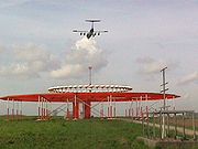
The next major advance in "beam based" navigation system was the use of two signals that varied not in sound, but in phase. In these systems, known as VHF omnidirectional range
VHF omnidirectional range
VOR, short for VHF omnidirectional radio range, is a type of radio navigation system for aircraft. A VOR ground station broadcasts a VHF radio composite signal including the station's identifier, voice , and navigation signal. The identifier is typically a two- or three-letter string in Morse code...
, or VOR, a single master signal is sent out continually from the station, and a highly directional second signal is sent out that varies in phase
Phase (waves)
Phase in waves is the fraction of a wave cycle which has elapsed relative to an arbitrary point.-Formula:The phase of an oscillation or wave refers to a sinusoidal function such as the following:...
30 times a second compared to the master. This signal is timed so that the phase varies as the secondary antenna spins, such that when the antenna is 90 degrees from north, the signal is 90 degrees out of phase of the master. By comparing the phase of the secondary signal to the master, the angle can be determined without any physical motion in the receiver. This angle is then displayed in the cockpit of the aircraft
Aircraft
An aircraft is a vehicle that is able to fly by gaining support from the air, or, in general, the atmosphere of a planet. An aircraft counters the force of gravity by using either static lift or by using the dynamic lift of an airfoil, or in a few cases the downward thrust from jet engines.Although...
, and can be used to take a fix
Position fixing
Position fixing is the branch of navigation concerned with the use of a variety of visual and electronic methods to determine the position of a ship, aircraft or person on the surface of the Earth.These techniques include:...
just like the earlier RDF systems, although it is, in theory, easier to use and more accurate.
Hyperbolic systems
Systems based on the measurement of the difference of signal arrival times from two or more locations are called hyperbolic systems due to the shape of the lines of position on the chart. These include:GEE
The British GEEGEE (navigation)
Gee was the code name given to a radio navigation system used by the Royal Air Force during World War II.Different sources record the name as GEE or Gee. The naming supposedly comes from "Grid", so the lower case form is more correct, and is the form used in Drippy's publications. See Drippy 1946....
system was developed during World War II
World War II
World War II, or the Second World War , was a global conflict lasting from 1939 to 1945, involving most of the world's nations—including all of the great powers—eventually forming two opposing military alliances: the Allies and the Axis...
. GEE used a series of transmitters sending out precisely timed signals, and the aircraft using GEE, RAF Bomber Command
RAF Bomber Command
RAF Bomber Command controlled the RAF's bomber forces from 1936 to 1968. During World War II the command destroyed a significant proportion of Nazi Germany's industries and many German cities, and in the 1960s stood at the peak of its postwar military power with the V bombers and a supplemental...
's heavy bomber
Bomber
A bomber is a military aircraft designed to attack ground and sea targets, by dropping bombs on them, or – in recent years – by launching cruise missiles at them.-Classifications of bombers:...
s, examined the time of arrival on an oscilloscope
Oscilloscope
An oscilloscope is a type of electronic test instrument that allows observation of constantly varying signal voltages, usually as a two-dimensional graph of one or more electrical potential differences using the vertical or 'Y' axis, plotted as a function of time,...
at the navigator's station. If the signal from two stations arrived at the same time, the aircraft must be an equal distance from both transmitters, allowing the navigator to determine a line of position on his chart of all the positions at that distance from both stations. By making similar measurements with other stations, additional lines of position can be produced, leading to a fix. GEE was accurate to about 165 yards (150 m) at short ranges, and up to a mile (1.6 km) at longer ranges over Germany. Used after WWII as late as the 1960s in the RAF (approx freq was by then 68 MHz).
LORAN
Other "time based" radio navigation systems were developed from the basic GEE principle. Most capable of these was LORANLORAN
LORAN is a terrestrial radio navigation system using low frequency radio transmitters in multiple deployment to determine the location and speed of the receiver....
, for "LOng-range Aid to Navigation", originally developed for navigation over the Atlantic. In LORAN a single "master" station broadcast a series of short pulses, which were picked up and re-broadcast by a series of "slave" stations, together making a "chain". Since the time between the reception and re-broadcast of the pulses by the slaves was tightly controlled, the time it took for the radio signal to travel from station to station could be measured by listening to the signals. Since the time for the re-broadcasts to reach a remote receiver varies with its distance from the slaves, the distance to each slave could be determined. By plotting the circles representing the ranges on a map, the area where they overlapped formed a fix.
At first the electronics needed to make these accurate measurements was expensive, and using it was difficult. As the sophistication of computer systems grew to the point where they could be placed on a single chip, LORAN suddenly became very simple to use, and quickly appeared in civilian systems intended for use on boats starting in the 1980s. However, like the beam systems before it, civilian use of LORAN was short-lived when newer technology quickly drove it from the market.
Other hyperbolic systems
Similar hyperbolic systems included the British/US Decca Navigator SystemDecca Navigator System
The Decca Navigator System was a low frequency hyperbolic navigation system that was first deployed during World War II when the Allied forces needed a system which could be used to achieve accurate landings...
used in the English Channel
English Channel
The English Channel , often referred to simply as the Channel, is an arm of the Atlantic Ocean that separates southern England from northern France, and joins the North Sea to the Atlantic. It is about long and varies in width from at its widest to in the Strait of Dover...
area, the US global-wide VLF/Omega Navigation System
OMEGA Navigation System
OMEGA was the first truly global radio navigation system for aircraft, operated by the United States in cooperation with six partner nations.-History:OMEGA was originally developed by the United States Navy for military aviation users...
, and the similar Alpha
Alpha (radio navigation)
Alpha is a Russian system for long range radio navigation. RSDN in Russian stands for , i.e., radio-technical long-distance navigation system....
deployed by the USSR. The expensive to maintain Omega system was shut down in 1997 as the US military migrated to using GPS, while Alpha is still in use.
GPS
Transit (satellite)
The TRANSIT system, also known as NAVSAT , was the first satellite navigation system to be used operationally. The system was primarily used by the U.S...
(doppler effect
Doppler effect
The Doppler effect , named after Austrian physicist Christian Doppler who proposed it in 1842 in Prague, is the change in frequency of a wave for an observer moving relative to the source of the wave. It is commonly heard when a vehicle sounding a siren or horn approaches, passes, and recedes from...
) systems, where one satellite provided a fix of varying quality dependent on a number of factors (one being altitude of the observer), we now see the Global Positioning System
Global Positioning System
The Global Positioning System is a space-based global navigation satellite system that provides location and time information in all weather, anywhere on or near the Earth, where there is an unobstructed line of sight to four or more GPS satellites...
's constellation of satellites providing high quality positions based on high frequency signals providing near constant highly accurate positions in three dimensions. With the availability of satellite navigation, the cost of maintaining global radio navigation systems cannot be justified anymore so such systems, such as Omega, were demolished.
See also
- MultilaterationMultilaterationMultilateration is a navigation technique based on the measurement of the difference in distance to two or more stations at known locations that broadcast signals at known times. Unlike measurements of absolute distance or angle, measuring the difference in distance results in an infinite number of...
- Real-time locating
Radio navigation systems and applications
- VHF omnidirectional rangeVHF omnidirectional rangeVOR, short for VHF omnidirectional radio range, is a type of radio navigation system for aircraft. A VOR ground station broadcasts a VHF radio composite signal including the station's identifier, voice , and navigation signal. The identifier is typically a two- or three-letter string in Morse code...
(VOR) - Distance measuring equipmentDistance Measuring EquipmentDistance measuring equipment is a transponder-based radio navigation technology that measures distance by timing the propagation delay of VHF or UHF radio signals....
(DME) - Tactical air navigation (TACAN)
- Non-directional beaconNon-directional beaconA non-directional beacon is a radio transmitter at a known location, used as an aviation or marine navigational aid. As the name implies, the signal transmitted does not include inherent directional information, in contrast to other navigational aids such as low frequency radio range, VHF...
(NDB) - Instrument landing systemInstrument Landing SystemAn instrument landing system is a ground-based instrument approach system that provides precision guidance to an aircraft approaching and landing on a runway, using a combination of radio signals and, in many cases, high-intensity lighting arrays to enable a safe landing during instrument...
(ILS) - Marker beaconMarker beaconA marker beacon is a particular type of VHF radio beacon used in aviation, usually in conjunction with an instrument landing system , to give pilots a means to determine position along an established route to a destination such as a runway...
(three-light marker beacon system) - Transponder Landing SystemTransponder Landing SystemA transponder landing system is an all-weather, precision landing system that uses existing airborne transponder and instrument landing system equipment to create a precision approach at a location where an ILS would normally not be available....
(TLS) - Microwave landing systemMicrowave landing systemA microwave landing system is an all-weather, precision landing system originally intended to replace or supplement instrument landing systems...
(MLS) - Long-range navigationLORANLORAN is a terrestrial radio navigation system using low frequency radio transmitters in multiple deployment to determine the location and speed of the receiver....
(LORAN) - Global Positioning SystemGlobal Positioning SystemThe Global Positioning System is a space-based global navigation satellite system that provides location and time information in all weather, anywhere on or near the Earth, where there is an unobstructed line of sight to four or more GPS satellites...
(GPS) - Local Area Augmentation SystemLocal Area Augmentation SystemThe Local Area Augmentation System is an all-weather aircraft landing system based on real-time differential correction of the GPS signal. Local reference receivers located around the airport send data to a central location at the airport. This data is used to formulate a correction message, which...
(LAAS) - Wide Area Augmentation SystemWide Area Augmentation SystemThe Wide Area Augmentation System is an air navigation aid developed by the Federal Aviation Administration to augment the Global Positioning System , with the goal of improving its accuracy, integrity, and availability...
(WAAS) - Differential GPSDifferential GPSDifferential Global Positioning System is an enhancement to Global Positioning System that provides improved location accuracy, from the 15-meter nominal GPS accuracy to about 10 cm in case of the best implementations....
(DGPS) - EGNOS (European Geostationary Navigation Overlay Service)
- Global Navigation Satellite SystemGLONASSGLONASS , acronym for Globalnaya navigatsionnaya sputnikovaya sistema or Global Navigation Satellite System, is a radio-based satellite navigation system operated for the Russian government by the Russian Space Forces...
(GLONASS) - Galileo positioning systemGalileo positioning systemGalileo is a global navigation satellite system currently being built by the European Union and European Space Agency . The €20 billion project is named after the famous Italian astronomer Galileo Galilei...
(Galileo) - Space Integrated GPS/INS (SIGI)Space Integrated GPS/INS (SIGI)Space Integrated GPS/INS is a strapdown Inertial Navigation Unit developed and built by Honeywell International to control and stabilize spacecraft during missions. It has integrated global positioning/inertial navigation to provide three navigation solutions: Pure inertial, GPS-only and blended...
or (SIGISigiIn the Völsung cycle, Sigi is the ancestor of the Völsung lineage. In the Völsunga saga , he is said to be one of the sons of Odin. He is also listed among Odin's sons in the Nafnaþulur. He had a son called Rerir....
) for short. - RAIMRAIMReceiver Autonomous Integrity Monitoring is a technology developed to assess the integrity of Global Positioning System signals in a GPS receiver system. It is of special importance in safety-critical GPS applications, such as in aviation or marine navigation.-General description:RAIM detects...
- American Practical Navigator
- Wind triangleWind triangleThe wind triangle is a graphical representation of the relationship between aircraft motion and wind. It is used extensively in dead reckoning navigation.The wind triangle is a vector diagram, with three vectors....
- SCR-277SCR-277The SCR-277 was a mobile, trailer mounted radio range set for radio guidance of aircraft. It was standardized by the U.S. Army in June of 1941.-Specifications:...