
Quebec Autoroute 40
Encyclopedia
Autoroute (Quebec)
The Autoroute system is a network of expressways in the province of Quebec, Canada, operating under the same principle of controlled access as the Interstate Highway System in the United States or the 400-Series Highways in neighbouring Ontario. The Autoroutes are the backbone of Quebec's highway...
on the north shore of the St. Lawrence River in Quebec
Quebec
Quebec or is a province in east-central Canada. It is the only Canadian province with a predominantly French-speaking population and the only one whose sole official language is French at the provincial level....
, Canada
Canada
Canada is a North American country consisting of ten provinces and three territories. Located in the northern part of the continent, it extends from the Atlantic Ocean in the east to the Pacific Ocean in the west, and northward into the Arctic Ocean...
. It is one of the two main connections between Montreal and Quebec City
Quebec City
Quebec , also Québec, Quebec City or Québec City is the capital of the Canadian province of Quebec and is located within the Capitale-Nationale region. It is the second most populous city in Quebec after Montreal, which is about to the southwest...
(the other being Autoroute 20
Quebec Autoroute 20
Autoroute 20 is a major Quebec Autoroute, following the Saint Lawrence River through one of the more densely-populated parts of Canada, and is part of the Trans-Canada Highway. At , it is the longest Autoroute in Quebec...
on the south shore of the St. Lawrence). Autoroute 40 is currently 347 km (215.6 mi) long.
The western terminus of Autoroute 40 is located at the Ontario
Ontario
Ontario is a province of Canada, located in east-central Canada. It is Canada's most populous province and second largest in total area. It is home to the nation's most populous city, Toronto, and the nation's capital, Ottawa....
–Quebec border, where it continues as Highway 417
Highway 417 (Ontario)
King's Highway 417, also known as Highway 417 and the Queensway through Ottawa is a 400-series highways in the Canadian province of Ontario which connects Montreal with Ottawa. It is the backbone of the transportation system in the Ottawa region, where it forms part of the Queensway along with...
towards Ottawa
Ottawa
Ottawa is the capital of Canada, the second largest city in the Province of Ontario, and the fourth largest city in the country. The city is located on the south bank of the Ottawa River in the eastern portion of Southern Ontario...
; the eastern terminus is in Boischatel
Boischatel, Quebec
Boischatel is a municipality in the Capitale-Nationale region of Quebec, Canada. Michel Guimond, current whip of the Bloc Québécois, first started his political career here as a city councillor. The town was originally called Saint-Jean-de-Boischatel....
, where it transitions into Route 138
Quebec route 138
Route 138 is a major highway in the Canadian province of Quebec, following the entire north shore of the Saint Lawrence River past Montreal to the eastern terminus in Natashquan on the Gulf of Saint Lawrence. The western terminus is in Elgin, at the border with New York State south-west of Montreal...
at the end of the freeway.
Two sections of Autoroute 40 were not part of the original plans: The original intention was to bypass Trois-Rivières
Trois-Rivières, Quebec
Trois-Rivières is a city in the Mauricie region of Quebec, Canada, located at the confluence of the Saint-Maurice and Saint Lawrence Rivers. It is situated in the Mauricie administrative region, on the north shore of the Saint Lawrence River across from the city of Bécancour...
to the north (the existing A-40 through downtown would have been Autoroute 755 and the concurrency with Autoroute 55
Quebec Autoroute 55
Autoroute 55 Autoroute 55 Autoroute 55 (also called Autoroute de l'Énergie (North of the Autoroute 20) and Autoroute Joseph-Armand Bombardier (South part) is an important north-south Autoroute and the only one running in that direction in central Quebec. It is the longest north-south Autoroute,...
would have been simply A-55). In addition, a different route was originally planned around Sainte-Foy (now in the west end of Quebec City) south of Jean Lesage International Airport
Québec/Jean Lesage International Airport
Québec City Jean Lesage International Airport, also known as Jean Lesage International Airport was established in 1939, a year after the closure of the Aérodrome Saint-Louis. It is located west southwest of Quebec City, Quebec, Canada...
(the existing 12 km segment of Autoroute 40 between St-Augustin and Autoroute 73
Quebec Autoroute 73
Autoroute 73 is an important Autoroute in east-central Quebec, Canada...
would have been the western end of Autoroute 440
Quebec Autoroute 440 (Quebec City)
Autoroute 440 is a superhighway located in Quebec City. It includes two separate segments, respectively named Autoroute Charest and Autoroute Dufferin-Montmorency...
, thus explaining the exit numbering starting at 12). While the right-of-ways of both bypasses still exist and may still be developed in the future as congestion increases, there are no immediate plans to renew construction.
Some discussion of eastward extensions of A-40 into the Charlevoix region and beyond have taken place, most likely to Route 360
Quebec Route 360
Route 360 is a provincial highway located in the Capitale-Nationale region in the south central part of the province of Quebec. The highway runs from Quebec City's Beauport sector and ends at the junction of Route 138 northeast of Saint-Tite-des-Caps in the Charlevoix region. For a large portion of...
in Beaupré
Beaupré, Quebec
Beaupré is a ville in the Canadian province of Quebec, located in La Côte-de-Beaupré Regional County Municipality. The town is along the Saint Lawrence River and Route 138 at the mouth of the Sainte-Anne-du-Nord River....
or even as far as Route 362
Quebec route 362
Route 362 is a scenic 50 km two-lane highway which follows the Saint Lawrence River in the Charlevoix region in Quebec, Canada. It starts at the junction of Route 138 in Baie-Saint-Paul and ends again at the junction of Route 138 in La Malbaie...
in La Malbaie
La Malbaie, Quebec
La Malbaie is a municipality in the Charlevoix-Est Regional County Municipality in the province of Quebec, Canada, situated on the north shore of the Saint Lawrence River, at the mouth of the Malbaie River...
since tourism in the region is increasing; however, that appears unlikely in the short term.
The portion of Autoroute 40 from the Ontario border to Autoroute 25
Quebec Autoroute 25
Autoroute 25 is an Autoroute in the Lanaudière region of Quebec. It is currently long....
is part of the Trans-Canada Highway
Trans-Canada Highway
The Trans-Canada Highway is a federal-provincial highway system that joins the ten provinces of Canada. It is, along with the Trans-Siberian Highway and Australia's Highway 1, one of the world's longest national highways, with the main route spanning 8,030 km...
.
In 1997, the highway (apart from the portion served by the Metropolitan Autoroute) was renamed Autoroute Félix-Leclerc after the late Quebec artist and political activist Félix Leclerc
Félix Leclerc
Félix Leclerc, was a French-Canadian singer-songwriter, poet, writer, actor and Québécois political activist. He was made an Officer of the Order of Canada on December 20, 1968...
.
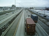
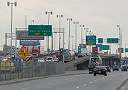
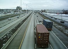
Its Metropolitan Autoroute portion in Montreal is the busiest highway in Quebec, as well as the second busiest in Canada after Highway 401
Highway 401 (Ontario)
King's Highway 401, also known by its official name as the Macdonald–Cartier Freeway and colloquially as the four-oh-one, is a 400-Series Highway in the Canadian province of Ontario stretching from Windsor to the Quebec border...
in Toronto.
Of historical note, a 25 km (15.5 mi) stretch of the highway in Pointe-Claire (from roughly St. John's Boulevard near Fairview Pointe-Claire
Fairview Pointe-Claire
Fairview Pointe-Claire, also called Fairview Centre , is one of the biggest super regional shopping malls on the island of Montreal with about spread on two levels of shopping space...
Shopping Centre to St. Charles Boulevard) was used during the 1976 Summer Olympics
1976 Summer Olympics
The 1976 Summer Olympics, officially known as the Games of the XXI Olympiad, was an international multi-sport event celebrated in Montreal, Quebec, Canada, in 1976. Montreal was awarded the rights to the 1976 Games on May 12, 1970, at the 69th IOC Session in Amsterdam, over the bids of Moscow and...
for the men's road team time trial cycling
Cycling at the 1976 Summer Olympics
The cycling competition at the 1976 Summer Olympics in Montreal consisted of two road cycling events and four track cycling events, all for men only. The 2000m tandem event, contested at the previous 13 Games since 1908, was dropped from the Olympic cycling program.-Medal summary:-Medal...
race.
Exit list
| Location | # Exit number An exit number is a number assigned to a road junction, usually an exit from a freeway. It is usually marked on the same sign as the destinations of the exit, as well as a sign in the gore.... |
Destinations | Notes |
|---|---|---|---|
| Pointe-Fortune Pointe-Fortune, Quebec Pointe-Fortune is a village in southwestern Quebec on the Ottawa River in Vaudreuil-Soulanges northwest of Montreal. The population as of the Canada 2006 Census was 507.-Population:Population trend-Language:... |
1 | Eastbound Exit 1 accesses Route 342 via Montée Jansson / Concession Road 1 and Montée La Grande (Prescott-Russell Prescott and Russell United Counties, Ontario The United Counties of Prescott and Russell are consolidated counties located in the Canadian province of Ontario. As of 2006, the population is 80,184. Its county seat is L'Orignal, Ontario. It was created as a result of a merger between Russell County and Prescott County in 1820... County Road 14). |
|
| 2 | Montée Wilson – Pointe-Fortune Pointe-Fortune, Quebec Pointe-Fortune is a village in southwestern Quebec on the Ottawa River in Vaudreuil-Soulanges northwest of Montreal. The population as of the Canada 2006 Census was 507.-Population:Population trend-Language:... |
||
| Rigaud Rigaud, Quebec Rigaud is a municipality in southwestern Quebec, Canada in the county of Vaudreuil-Soulanges at the junction of the Ottawa River and the Rigaud River. The population as of the Canada 2006 Census was 6,780... |
|||
| 6 | Montée Baie Saint-Thomas | ||
| 9 | |||
| 12 | |||
| 17 | |||
| Saint-Lazare Saint-Lazare, Quebec Saint-Lazare, also known as Saint-Lazare-de-Vaudreuil, is an off-island suburb of Montreal, in southwestern Quebec, Canada in the Regional County Municipality of Vaudreuil-Soulanges.... |
22 | Hudson Hudson, Quebec Hudson, Quebec, Canada, is a town with a population of 5,088 on the south-west bank of the lower Ottawa River, in the Vaudreuil-Soulanges Regional County Municipality. Situated about west of downtown Montreal, many residents commute to work on the Island of Montreal.- Location and... , Saint-Lazare Saint-Lazare, Quebec Saint-Lazare, also known as Saint-Lazare-de-Vaudreuil, is an off-island suburb of Montreal, in southwestern Quebec, Canada in the Regional County Municipality of Vaudreuil-Soulanges.... |
|
| Vaudreuil-Dorion | 26 | ||
| 32 | , Toronto Toronto Toronto is the provincial capital of Ontario and the largest city in Canada. It is located in Southern Ontario on the northwestern shore of Lake Ontario. A relatively modern city, Toronto's history dates back to the late-18th century, when its land was first purchased by the British monarchy from... |
||
| 35 | Avenue Saint-Charles – Vaudreuil-Dorion, Vaudreuil-sur-le-Lac Vaudreuil-sur-le-Lac, Quebec Vaudreuil-sur-le-Lac is a village and municipality in the Montérégie region of Quebec, Canada, part of the Vaudreuil-Soulanges Regional County Municipality. It is located on the western portion of the Vaudreuil Peninsula, which projects into Lake of Two Mountains... |
||
| 36 | Chemin Dumberry, Chemin des Chenaux | Westbound exit and eastbound entrance | |
| Senneville Senneville, Quebec Senneville is a village on the western tip of the Island of Montreal. It is the wealthiest town on the West Island, closely followed by Dollard-des-Ormeaux and Baie D'Urfé... |
40 | Montreal Montreal Montreal is a city in Canada. It is the largest city in the province of Quebec, the second-largest city in Canada and the seventh largest in North America... |
Westbound exit and eastbound entrance (U-turn ramp) |
| Sainte-Anne-de-Bellevue Sainte-Anne-de-Bellevue, Quebec Sainte-Anne-de-Bellevue is a town located at the western tip of the Island of Montreal in southwestern Quebec, Canada. It is the second oldest community in Montreal's West Island, having been founded as a parish in 1703... |
41 | Sainte-Anne-de-Bellevue Sainte-Anne-de-Bellevue, Quebec Sainte-Anne-de-Bellevue is a town located at the western tip of the Island of Montreal in southwestern Quebec, Canada. It is the second oldest community in Montreal's West Island, having been founded as a parish in 1703... , Île-Perrot |
|
| 44 | Boulevard Morgan | ||
| Kirkland Kirkland, Quebec Kirkland is a town on the Island of Montreal in southwestern Quebec, Canada. As of 2006, the population was 20,491. It is named after Charles-Aimé Kirkland, a Quebec provincial politician.... |
49 | Chemin Sainte-Marie | |
| 50 | Boulevard Saint-Charles | ||
| Pointe-Claire | 52 | Boulevard Saint-Jean | |
| 55 | Boulevard des Sources | ||
| Dorval | |||
| Dollard-des-Ormeaux | 58 | Boulevard Hymus, Boulevard Alfred-Nobel, Boulevard Henri-Bourassa Henri Bourassa Boulevard Henri Bourassa Boulevard is a major east-west street located in Montreal, Quebec, Canada. Situated in northern Montreal Island, it runs parallel to Gouin Boulevard. Spanning 29 kilometres in length, it links the borough of Rivière-des-Prairies–Pointe-aux-Trembles in the east to Autoroute 13 in the... |
Westbound exit is via exits 60 (Boulevard Alfred-Nobel) and 62 (Boulevard Hymus, Boulevard Henri-Bourassa) |
| Montreal Montreal Montreal is a city in Canada. It is the largest city in the province of Quebec, the second-largest city in Canada and the seventh largest in North America... |
|||
| 60 | |||
| 62 | Boulevard de la Côte-Vertu | ||
| 64 | Boulevard Cavendish | ||
| 65 | |||
| Montreal Montreal Montreal is a city in Canada. It is the largest city in the province of Quebec, the second-largest city in Canada and the seventh largest in North America... Mount Royal Mount Royal, Quebec Mount Royal is a town located on the northwest side of Mount Royal, north of downtown Montreal, on the Island of Montreal in southwestern Quebec, Canada. The town is completely surrounded by Montreal. The population was 18,933 at the 2006 census... |
66-S | , Champlain Bridge Champlain Bridge (Montreal) The Champlain Bridge is a steel truss cantilever bridge with approach viaducts constructed of prestressed concrete beams supporting a prestressed concrete deck paved with asphalt... |
West end of A-15 overlap |
| 67 | Eastbound exit is via exit 65 | ||
| 68 | Rue Stinson, Chemin Rockland | Westbound exit is via exit 70 | |
| 70 | East end of A-15 overlap | ||
| Montreal Montreal Montreal is a city in Canada. It is the largest city in the province of Quebec, the second-largest city in Canada and the seventh largest in North America... |
Boulevard de l'Acadie | Eastbound exit is via exit 68; westbound exit is via exit 71 | |
| 71 | Boulevard Saint-Laurent | ||
| Eastbound exit is via exit 71; westbound exit is via exit 73 | |||
| 73 | Rue Saint-Hubert, Avenue Christophe-Colomb Christophe Colomb Avenue thumb|240px|Christophe Colomb Avenue, seen northbound, with the tower of [[Église St-Arsène]].Christophe Colomb Avenue is a major north-south street in Montreal, Quebec, Canada. It has a length of 8.5 Kilometres, and crosses the boroughs of Le Plateau-Mont-Royal, Rosemont-La Petite-Patrie,... |
||
| Eastbound exit is via exit 73; westbound exit is via exit 75 | |||
| 74 | Rue d'Iberville | Westbound exit is via exit 75 | |
| 75 | Boulevard Saint-Michel | ||
| 76 | |||
| 77 | Boulevard Lacordaire | Westbound exit is via exit 76 | |
| 78 | Boulevard Langelier, Boulevard Les Galeries-d'Anjou | ||
| 80 | Signed as exits 80-S (south) and 80-N (north) | ||
| 82 | Boulevard Roi-René, Boulevard Ray-Lawson | ||
| 85 | Boulevard Bourget, Avenue Marien, Boulevard Saint-Jean-Baptiste | (eastbound)/(westbound) | |
| Montréal-Est Montréal-Est, Quebec Montreal East , is a town in southwestern Quebec, Canada on the island of Montreal, formerly part of the borough of Rivière-des-Prairies–Pointe-aux-Trembles–Montréal-Est. Montreal-Est has consistently been the home to many large oil refineries since 1915.Montreal-Est was originally founded in 1910... |
|||
| Montreal Montreal Montreal is a city in Canada. It is the largest city in the province of Quebec, the second-largest city in Canada and the seventh largest in North America... |
87 | Boulevard Tricentenaire | Westbound exit is via exit 85 |
| 89 | Eastbound exit is via exit 87 | ||
| 92 | Boulevard Gouin Gouin Boulevard Gouin Boulevard is the longest street on the Island of Montreal, stretching across the north side of the island from Senneville in the west to Pointe-aux-Trembles in the east at Sherbrooke Street .... |
Eastbound exit and westbound entrance | |
| Terrebonne Terrebonne, Quebec Terrebonne is an off-island suburb of Montreal, in western Quebec, Canada. It is located on the north shores of the Rivière des Mille-Îles and of the Rivière des Prairies, North of Montreal and Laval.... |
94 | ||
| 96 | Signed as exits 96-E (east) and 96-O (west) | ||
| Charlemagne Charlemagne, Quebec Charlemagne is an off-island suburb of Montreal, Quebec, Canada. It is located on the north shore of the Rivière des Prairies, northeast of Montreal's downtown core. As of 2006, the population was 5,594.... |
|||
| Repentigny Repentigny, Quebec Repentigny is an off-island suburb of Montreal, in the province of Quebec, located north of Montreal, on the lower end of the L'Assomption River and on the Saint Lawrence River. Repentigny and Charlemagne are the first towns off the island of Montreal.-History:... |
97 | Boulevard Pierre-Le Gardeur – Le Gardeur Le Gardeur, Quebec Le Gardeur was a town in southwestern Quebec, Canada on the L'Assomption River in the Regional County Municipality of L'Assomption, and connected to Montreal by Route 138, Autoroute 40, and Via Rail on the Canadian National rail line.... , Charlemagne Charlemagne, Quebec Charlemagne is an off-island suburb of Montreal, Quebec, Canada. It is located on the north shore of the Rivière des Prairies, northeast of Montreal's downtown core. As of 2006, the population was 5,594.... |
Eastbound exit and westbound entrance |
| 98 | Repentigny / Le Gardeur | ||
| 100 | Boulevard Industriel, Rue Valmont | ||
| 102 | Rue Valmont (westbound only) | ||
| L'Assomption L'Assomption, Quebec L'Assomption is an off-island suburb of Montreal, in southwestern Quebec, Canada on the L'Assomption River. It is the seat of the Regional County Municipality of L'Assomption. It is located on the outer fringes of the Montreal urban area.... |
108 | Route 341 Quebec Route 341 Route 341 is a Quebec provincial highway located in the Lanaudière region northeast of Montreal. It runs from south to north from Repentigny just south of the junction of Autoroute 40 and ends 55 kilometers north at the junction of Route 125 northwest of Rawdon, Quebec... / Route 343 Quebec Route 343 Route 343 is a provincial highway located in the Lanaudière region of Quebec. It runs from Route 138 west of Saint-Sulpice and south of Autoroute 40 and ends at the junction of Route 347 east of Saint-Come and north of Saint-Alphonse-Rodriguez where it has a concurrency with Route... L'Épiphanie, L'Assomption, Saint-Sulpice |
|
| Lavaltrie Lavaltrie, Quebec Lavaltrie is a city located within the D'Autray Regional County Municipality in the southern part of the region of Lanaudière, Quebec, Canada, northeast of Montreal outside of the suburban sprawl of the northern crown... |
118 | Point-du-Jour Service Area | |
| 122 |  Autoroute 31 Autoroute 31Quebec Autoroute 31 Autoroute 31 is a short north-south Autoroute serving the city of Joliette, Quebec. It is only , serving as a means to connect Joliette with Autoroute 40, and in turn to Montreal, and other points on the Autoroute network.... / Route 131 Quebec route 131 Route 131 is a Quebec highway running from Lavaltrie to Saint-Michel-des-Saints in Lanaudière. This route, combined with Autoroute 31, provides the key route to Joliette, and then continues northward through Saint-Félix-de-Valois, Saint-Jean-de-Matha and Saint-Zénon for a distance of almost 140... Joliette / Lavaltrie |
||
| Lanoraie Lanoraie, Quebec Lanoraie is a town in the Lanaudière region of Quebec, Canada, part of the D'Autray Regional County Municipality.-History:When Jacques Cartier passed through in the 16th century, the Iroquois had already established themselves in the area, calling it Agochanda or Agouchonda, meaning "place where... |
130 | Lanoraie | |
| Sainte-Geneviève-de-Berthier Sainte-Geneviève-de-Berthier, Quebec Sainte-Geneviève-de-Berthier is a town in the Lanaudière region of Quebec, Canada, part of the D'Autray Regional County Municipality.-Demographics:Population:* Population in 2006: 2307 * Population in 2001: 2387... |
141 | Rang Sainte-Philomène | |
| Berthierville Berthierville, Quebec Berthierville is a Canadian town located between Montreal and Trois-Rivières on the north shore of the Saint Lawrence River in the province of Quebec. Berthierville is the seat of D'Autray Regional County Municipality, and is served by Autoroute 40, and is the junction of Routes 138 and 158... |
144 | Route 158 Quebec route 158 Route 158 is an east-west arterial road running between Lachute and Berthierville, north of the Ottawa and Saint Lawrence rivers, in the Laurentides region.... Saint-Gabriel, Berthierville |
|
| Saint-Cuthbert Saint-Cuthbert, Quebec Saint-Cuthbert is a municipality in the Lanaudière region of Quebec, Canada, part of the D'Autray Regional County Municipality.-Demographics:Population:* Population in 2006: 1938 * Population in 2001: 1899... |
151 |  Route 138 Route 138Quebec route 138 Route 138 is a major highway in the Canadian province of Quebec, following the entire north shore of the Saint Lawrence River past Montreal to the eastern terminus in Natashquan on the Gulf of Saint Lawrence. The western terminus is in Elgin, at the border with New York State south-west of Montreal... Saint-Cuthbert |
|
| Saint-Barthélemy Saint-Barthélemy, Quebec Saint-Barthélemy is a parish municipality in the Lanaudière region of Quebec, Canada, part of the D'Autray Regional County Municipality.-Demographics:Population:* Population in 2006: 2037 * Population in 2001: 2000... |
155 | Saint-Bathélémy, Maskinongé | |
| Maskinongé Maskinongé, Quebec Maskinongé is a municipality in the Mauricie region of the province of Quebec in Canada.- References :... |
160 | Rang de la Rivière Sud-Est | |
| Pointe-du-Lac Rest Area | |||
| Maskinongé - Louiseville Louiseville, Quebec Louiseville is a town in the Mauricie region of the province of Quebec in Canada. It is located near the mouth of the Wolf River on the north shore of Lac Saint-Pierre.... Boundary |
166 | Louiseville, Maskinongé | |
| Louiseville - Yamachiche Yamachiche, Quebec Yamachiche is a municipality in the Mauricie region of the province of Quebec in Canada.-Etymology:The name Yamachiche was first used to identify the Little Yamachiche River which runs through the town. It came from the Native American words iyamitaw and achichki... Boundary |
174 | Route 138 Quebec route 138 Route 138 is a major highway in the Canadian province of Quebec, following the entire north shore of the Saint Lawrence River past Montreal to the eastern terminus in Natashquan on the Gulf of Saint Lawrence. The western terminus is in Elgin, at the border with New York State south-west of Montreal... Louiseville, Yamachiche |
|
| Yamachiche | 180 | Route 153 Quebec route 153 Route 153 is a two-lane north/south highway in Quebec, Canada, which starts in Yamachiche at the junction of Autoroute 40 and ends in Lac-aux-Sables at the junction of Route 363.-Municipalities along Route 153:* Yamachiche* Saint-Barnabé... Yamachiche |
|
| Trois-Rivières Trois-Rivières Trois-Rivières means three rivers in French and may refer to:in Canada*Trois-Rivières, the largest city in the Mauricie region of Quebec, Canada*Circuit Trois-Rivières, a racetrack in Trois-Rivières, Quebec... |
187 | Route 138 Quebec route 138 Route 138 is a major highway in the Canadian province of Quebec, following the entire north shore of the Saint Lawrence River past Montreal to the eastern terminus in Natashquan on the Gulf of Saint Lawrence. The western terminus is in Elgin, at the border with New York State south-west of Montreal... Pointe-du-Lac |
|
| 189 | Rang St-Charles | ||
| 192 | Chemin des Petites-Terres | ||
| 196 |  Autoroute 40 East Autoroute 40 East  Autoroute 55 Autoroute 55Quebec Autoroute 55 Autoroute 55 Autoroute 55 Autoroute 55 (also called Autoroute de l'Énergie (North of the Autoroute 20) and Autoroute Joseph-Armand Bombardier (South part) is an important north-south Autoroute and the only one running in that direction in central Quebec. It is the longest north-south Autoroute,... Route 155 Quebec route 155 Route 155 is a north/south highway on the north shore of the Saint Lawrence River in Quebec, Canada. Its northern terminus is in Chambord at the junction of Route 169, and the southern terminus is the Piles Bridge in Shawinigan... Shawinigan / Trois-Rivières, Quebec |
(3.5 km concurrency Concurrency (road) A concurrency, overlap, or coincidence in a road network is an instance of one physical road bearing two or more different highway, motorway, or other route numbers... does not count in exit numbering) |
|
| 197 | Autoroute 40 West Autoroute 55 Quebec Autoroute 55 Autoroute 55 Autoroute 55 Autoroute 55 (also called Autoroute de l'Énergie (North of the Autoroute 20) and Autoroute Joseph-Armand Bombardier (South part) is an important north-south Autoroute and the only one running in that direction in central Quebec. It is the longest north-south Autoroute,... Route 155 Quebec route 155 Route 155 is a north/south highway on the north shore of the Saint Lawrence River in Quebec, Canada. Its northern terminus is in Chambord at the junction of Route 169, and the southern terminus is the Piles Bridge in Shawinigan... Bécancour / Montreal, Shawinigan |
||
| 198 | Boulevard des Récollets | ||
| 199 | Boulevard des Forges (indicated as Trois-Rivières Centre-Ville) | ||
| 201 | Boulevard des Chenaux | ||
| Trois-Rivières | 202 | Boulevard des Estacades | |
| 203 | Route 157 Quebec route 157 Route 157 is a four-lane north/south highway on the north shore of the Saint Lawrence River in Quebec, Canada. Its northern terminus is in Shawinigan at the junction of Route 153, and the southern terminus is at the junction of Route 138 in Cap-de-la-Madeleine, now part of... Rue Thibeau, Saint-Louis-de-France, Shawinigan-Sud |
||
| 205 | Boulevard des Prairies, Sainte-Marthe-du-Cap | ||
| Saint-Maurice Saint-Maurice, Quebec Saint-Maurice is a parish municipality in the Mauricie region of the province of Quebec in Canada.-Demographics:Population trend:* Population in 2006: 2338 * Population in 2001: 2292* Population in 1996: 2295... |
210 | Route 352 Quebec route 352 Route 352 is a 55 km east-west provincial road in the Mauricie region in Quebec, Canada. It goes north from Saint-Maurice to Sainte-Thècle.... Saint-Maurice |
|
| Champlain Champlain, Quebec Champlain is a municipality in the Mauricie region of the province of Quebec in Canada.-Demographics:Population trend:* Population in 2006: 1566 * Population in 2001: 1623* Population in 1996: 1608... |
220 | Route 359 Quebec route 359 Route 359 is a 32 km north-south regional road in Quebec, Canada, going from Champlain to Grand-Mère. It is one of the direct roads linking Autoroute 40 to the Shawinigan-Grand-Mère area.... Champlain / Saint-Luc-de-Vincennes / Grand-Mère |
|
| Saint-Geneviève-de-Batiscan Sainte-Geneviève-de-Batiscan, Quebec Sainte-Geneviève-de-Batiscan is a parish municipality in the Mauricie region of the province of Quebec in Canada. It is located along the Batiscan River.- References :... |
229 | Route 361 Quebec route 361 Route 361 is a 20 km north-south regional road in Quebec, Canada, linking Batiscan and St-Narcisse, following the Batiscan river until Ste-Geneviève-de-Batiscan, the only village it goes through.This road connects with Autoroute 40 at exit 229.... Narcisse / Bastiscan / Sainte-Geneviève-de-Batiscan |
|
| Sainte-Anne-de-la-Pérade Sainte-Anne-de-la-Pérade, Quebec Sainte-Anne-de-la-Pérade is a municipality in the Les Chenaux Regional County Municipality, in the Mauricie region of the province of Quebec in Canada. The town is located near the mouth of the Sainte-Anne River along the Chemin du Roy, a historic segment of Quebec Route 138 that stretches from... |
236 | Route 159 Quebec route 159 Provincial Highway 159 is a two-lane north/south highway on the north shore of the Saint Lawrence River in Quebec, Canada. Its northern terminus is in Saint-Roch-de-Mékinac at the junction of Route 155, and the southern terminus is at the junction of Route 138 in... Saint-Prosper / Saint-Casimir / Saint-Tite / Sainte-Anne-de-La-Pérade |
|
| Deschambault-Grondines | 250 | Chemin de St-Casimir | |
| Deschambault-Grondines | 254 | Route 363 Quebec route 363 Route 363 is a 53 km south-north route in Quebec, Canada, going from Route 138 in Deschambault-Grondines along the St-Lawrence river to Lac-aux-Sables.It goes through St-Marc-des-Carrières where it is called Boulevard Bona-Dussault... Saint-Marc-des-Carrières / Deschambault-Grondines |
|
| 257 | Saint-Gilbert / Deschambault | ||
| Portneuf Portneuf, Quebec Southern main part... |
261 | Portneuf, Notre-Dame-de-Portneuf | (Rue Provencher) |
| Cap-Santé | 269 | Route 358 Quebec Route 358 Route 358 is a provincial highway located in the Capitale-Nationale region of Quebec. It runs from the junction of Route 138 in Cap-Santé and ends in the Vanier sector of Quebec City also at the junction of Highway 138... Pont-Rouge / Saint-Basile / Cap-Santé |
|
| Donnacona Donnacona, Quebec Donnacona is an industrial town located about west of Quebec City in Portneuf County, Quebec, Canada.Some people believe the city was named after Donnacona, a 16th century Wendat chief who was taken to France... |
274 | Donnacona | |
| Neuville Neuville, Quebec Neuville is a village on the north shore of the Saint Laurence River, just west of Quebec City, part of the Portneuf Regional County Municipality, Quebec, Canada. It was founded in 1684, and has remained quite picturesque throughout these years.... |
281 | Route 365 Quebec route 365 Route 365 is a 28 km north-south regional road in Quebec, Canada, linking Neuville and St-Raymond. It is the main road linking Autoroute 40 and the Quebec City area to St-Raymond and Pont-Rouge.... Pont-Rouge / Saint-Raymond / Neuville |
|
| 285 | Neuville | ||
| Saint-Augustin-de-Desmaures Saint-Augustin-de-Desmaures, Quebec Saint-Augustin-de-Desmaures is a city in central Quebec, Canada, on the Saint Lawrence River, adjacent to Quebec City.The town was founded in 1691 by three families... |
295 | Route 367 Quebec route 367 Route 367 is a 100 km two-lane north/south highway on the north shore of the Saint Lawrence River in Quebec, Canada. Although technically a north/south highway, long stretches of the road are east/west. Its northern/western terminus is close to Lac-aux-Sables at the junction of Route 363 and the... Route de Fossambault, Sainte-Catherine-de-la-Jacques-Cartier / Saint-Augustin-de-Desmaures |
|
| 298 | Route 138 Quebec route 138 Route 138 is a major highway in the Canadian province of Quebec, following the entire north shore of the Saint Lawrence River past Montreal to the eastern terminus in Natashquan on the Gulf of Saint Lawrence. The western terminus is in Elgin, at the border with New York State south-west of Montreal... Saint-Augustin-de-Desmaures / L'Anceinne-Lorette |
||
| Saint-Augustin-de-Desmaures - Quebec City Quebec City Quebec , also Québec, Quebec City or Québec City is the capital of the Canadian province of Quebec and is located within the Capitale-Nationale region. It is the second most populous city in Quebec after Montreal, which is about to the southwest... boundary |
300 | Chemin du Lac | |
| Quebec City | 302 | Route Jean-Gauvin, Cap Rouge | |
| 304 | Avenue Le Gendre | ||
| 305 |  Autoroute 540 Autoroute 540Quebec Autoroute 540 (Quebec City) Autoroute 540 is a short spur highway, connecting Route 138 to Autoroute 73 and linking the Jean Lesage International Airport with the Pierre Laporte Bridge. It is also known as Autoroute Duplessis, honouring former Premier Maurice Duplessis... Autoroute Duplessis, Pont-Pierre-Laporte / Route de l'Aéroport |
||
| 306 | Avenue Blaise-Pascal | ||
| 307 |  Autoroute 73 Autoroute 73Quebec Autoroute 73 Autoroute 73 is an important Autoroute in east-central Quebec, Canada... South (Pont-Pierre-Laporte) Autoroute 540Quebec Autoroute 540 (Quebec City) Autoroute 540 is a short spur highway, connecting Route 138 to Autoroute 73 and linking the Jean Lesage International Airport with the Pierre Laporte Bridge. It is also known as Autoroute Duplessis, honouring former Premier Maurice Duplessis... East  Autoroute 573 Autoroute 573Quebec Autoroute 573 Autoroute 573 is a short spur road located in Quebec City, Quebec, connecting Autoroute 73 and Autoroute 40 to Route 369. It facilitates access to the CFB Valcartier military base.The portion north of Avenue Industrielle is a two-lane road with intersections.... Sainte-Anne-de-Beaupré |
||
| 308 | Route 371 Quebec Route 371 Route 371 is a provincial highway located in the Capitale-Nationale region in south-central Quebec. The highway starts in the L'Ancienne-Lorette sector of Quebec City at the junction of Route 138 and ends in Stoneham-et-Tewkesbury at the junctions of Autoroute 73 and Route 175... Boulevard Masson, Boulevard de l'Ormière |
||
| 310 | Rue Letourneau / Rue Arnaud | ||
| 311 |  Autoroute 740 Autoroute 740Quebec Autoroute 740 Autoroute 740 is a short connecting highway in Quebec City, Canada. Its southern end is at the Université Laval from Boulevard Laurier. Its northern end is at Autoroute 40 at the shopping mall Les Galeries de la Capitale... Autoroute Robert-Bourassa / Boulevard Saint-Jacques |
||
| 312 | Route 358 Quebec Route 358 Route 358 is a provincial highway located in the Capitale-Nationale region of Quebec. It runs from the junction of Route 138 in Cap-Santé and ends in the Vanier sector of Quebec City also at the junction of Highway 138... Vanier; Boulevard Pierre-Bertrand |
||
| 313 | Autoroute 73 Quebec Autoroute 73 Autoroute 73 is an important Autoroute in east-central Quebec, Canada... North Route 175 Quebec route 175 Route 175 is a major north/south highway on both sides of the St. Lawrence River in Quebec, Canada. Its southern terminus is in Saint-Lambert-de-Lauzon at the junction of Route 218 and its northern terminus is in Saguenay at the junction of Route 172, in the former city of Chicoutimi... Saguenay, Alma / Québec CENTRE-VILLE |
||
| 315 | 1ère Avenue | ||
| 316 | Boulevard Henri-Bourassa | ||
| 318 | Avenue du Bourg-Royal | ||
| 319 | Avenue Saint-David | ||
| 320 | Rue Seigneuriale, Beauport CENTRE-VILLE | ||
| 321 | Rue Labelle | ||
| 322 | Boulevard des Chutes | ||
| 323 |  Autoroute 440 Autoroute 440Quebec Autoroute 440 (Quebec City) Autoroute 440 is a superhighway located in Quebec City. It includes two separate segments, respectively named Autoroute Charest and Autoroute Dufferin-Montmorency... in Quebec |
||
| 325 | Route 138 Quebec route 138 Route 138 is a major highway in the Canadian province of Quebec, following the entire north shore of the Saint Lawrence River past Montreal to the eastern terminus in Natashquan on the Gulf of Saint Lawrence. The western terminus is in Elgin, at the border with New York State south-west of Montreal... Route 368 Quebec route 368 Route 368 is a 72 km two-lane east/west highway in Quebec, Canada, which is located on Île d'Orléans and includes the Pont de l'Île which connects the island to the mainland... Ile-d'Orléans |
See also
- List of crossings of the Ottawa River
- List of bridges in Montreal