
Prince Edward Road
Encyclopedia


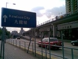
Kowloon
Kowloon is an urban area in Hong Kong comprising the Kowloon Peninsula and New Kowloon. It is bordered by the Lei Yue Mun strait in the east, Mei Foo Sun Chuen and Stonecutter's Island in the west, Tate's Cairn and Lion Rock in the north, and Victoria Harbour in the south. It had a population of...
, Hong Kong
Hong Kong
Hong Kong is one of two Special Administrative Regions of the People's Republic of China , the other being Macau. A city-state situated on China's south coast and enclosed by the Pearl River Delta and South China Sea, it is renowned for its expansive skyline and deep natural harbour...
, going in an east-west direction and linking Tai Kok Tsui
Tai Kok Tsui
Tai Kok Tsui is an area west of Mong Kok in Kowloon, Hong Kong. The mixed land use of industrial and residential is present in the old area. The Cosmopolitan Dock and oil depots were previously located there...
, Mong Kok
Mong Kok
Mong Kok , less often known as Argyle , is an area in the Yau Tsim Mong District on Kowloon Peninsula, Hong Kong...
, Kowloon Tong
Kowloon Tong
Kowloon Tong , formerly Kau Lung Tong, is an area in Hong Kong. Within New Kowloon, it is administratively divided by Kowloon City District and Sham Shui Po District...
, Kowloon City
Kowloon City
Kowloon City is an area in Kowloon, Hong Kong. It is named after the Kowloon Walled City, and is administratively part of Kowloon City District....
and San Po Kong
San Po Kong
San Po Kong is an area in New Kowloon in Hong Kong. South of Wong Tai Sin and Diamond Hill, and north of the former Kai Tak International Airport, the area is bounded by Choi Hung Road and Prince Edward Road. San Po Kong is largely industrial and partly residential. Administratively, it belongs...
(outside the retired Kai Tak Airport
Kai Tak Airport
Kai Tak Airport was the international airport of Hong Kong from 1925 until 1998. It was officially known as the Hong Kong International Airport from 1954 to 6 July 1998, when it was closed and replaced by the new Hong Kong International Airport at Chek Lap Kok, 30 km to the west...
).
The roads were named after Prince Edward in 1922, later Edward VIII of the United Kingdom
Edward VIII of the United Kingdom
Edward VIII was King of the United Kingdom and the Dominions of the British Commonwealth, and Emperor of India, from 20 January to 11 December 1936.Before his accession to the throne, Edward was Prince of Wales and Duke of Cornwall and Rothesay...
(later The Duke of Windsor), after his visit to Hong Kong.
Prince Edward Station
Prince Edward (MTR)
Prince Edward is a station of the MTR rapid transit system in Hong Kong. It is located in Northern Mong Kok, Kowloon, under the intersection of Nathan Road and Prince Edward Road West. The station is named after this road...
and the Prince Edward
Prince Edward, Hong Kong
Prince Edward is an area in northern Kowloon, Hong Kong. It is adjacent to the Prince Edward Station of the MTR rapid transit system in Mong Kok. It is administratively under the Yau Tsim Mong District. It was named after the namesake road. It contains the northern end of Nathan Road. Strictly...
area in Hong Kong are both named after Prince Edward Road, rather than Prince Edward himself.
Prince Edward Road
In the beginning of 1920s, the Hong Kong government was developing the Mong KokMong Kok
Mong Kok , less often known as Argyle , is an area in the Yau Tsim Mong District on Kowloon Peninsula, Hong Kong...
district and decided to build a road connecting this to Kowloon City
Kowloon City
Kowloon City is an area in Kowloon, Hong Kong. It is named after the Kowloon Walled City, and is administratively part of Kowloon City District....
. In April 1922, Prince Edward came to Hong Kong and visited the construction of this road. Due to this visit, the government named this road Prince Edward Road. In 1930s, Prince Edward Road was extended to the area of Ngau Chi Wan.
Prince Edward Road West
Prince Edward Road West is a road between Tai Kok Tsui, Mong Kok, Kowloon Tong and Kowloon City. This road was originally named Edward Avenue (宜華徑) before 1924. It was later renamed Prince Edward Road (英皇子道) in 1924, and in 1958 the Chinese name was changed to 太子道. In 1979 it became the Prince Edward Road West.Prince Edward Road West starts from Kowloon City where it succeeds Prince Edward Road East. It runs across Kowloon City and Prince Edward, and ends at Tai Kok Tsui at an intersection with Tong Mi Road and West Kowloon Corridor
West Kowloon Corridor
West Kowloon Corridor is part of Route 5 in Hong Kong. Bypassing existing surface roads in West Kowloon, it connects Lai Chi Kok Road in Cheung Sha Wan with the Gascoigne Road Flyover near Yau Ma Tei.The highway was built in 4 phases:...
.
It is worth noting that the section of Prince Edward Road West from Olympic Park to Nathan Road runs unidirectionally from east to west. Boundary Street
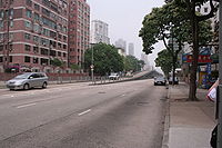
Boundary Street
[[Image:Boundary st hongkong.JPG|thumb|right|250px|Boundary Street near [[Kowloon Tong]]Boundary Street is a three-lane one-way street in [[Kowloon]], [[Hong Kong]]...
serves its complement by providing a nearby route which runs from west to east.
Prince Edward Road East
Prince Edward Road East is a road between Kowloon City and San Po Kong. It was originally the Sai Kung Road and later part of the Clear Water Bay RoadClear Water Bay Road
Clear Water Bay Road is a major road from a complex interchange in Ngau Chi Wan to a dead end in Clear Water Bay, Sai Kung. It also is a route to Sai Kung Town and Tseung Kwan O via Hang Hau Road and Hiram's Highway respectively...
. It later became part of the Prince Edward Road. In 1979 it became the Prince Edward Road East.
The modern Prince Edward Road East starts from Choi Hung Interchange, where it meets Clear Water Bay Road
Clear Water Bay Road
Clear Water Bay Road is a major road from a complex interchange in Ngau Chi Wan to a dead end in Clear Water Bay, Sai Kung. It also is a route to Sai Kung Town and Tseung Kwan O via Hang Hau Road and Hiram's Highway respectively...
to the northeast and Kwun Tong Road
Kwun Tong Road
Kwun Tong Road is a major road in Kwun Tong of New Kowloon in Hong Kong. It starts at the junction with Prince Edward Road East, Clear Water Bay Road and Lung Cheung Road in Ngau Chi Wan...
to the southeast. Then it goes west along the boundary between San Po Kong and the retired Kai Tak Airport
Kai Tak Airport
Kai Tak Airport was the international airport of Hong Kong from 1925 until 1998. It was officially known as the Hong Kong International Airport from 1954 to 6 July 1998, when it was closed and replaced by the new Hong Kong International Airport at Chek Lap Kok, 30 km to the west...
, and finally ends at Olympic Park
Olympic Park
An Olympic Park is a sports campus for hosting the Olympic Games. Typically it contains the Olympic Stadium and the International Broadcast Centre. It may also contain the Olympic Village or some of the other sports venues, such as the aquatics complex in the case of the summer games, or the main...
in Kowloon City, where it branches into three roads, Ma Tau Chung Road, Argyle Street
Argyle Street
Argyle Street is the name of a street in many cities and towns. Notable among these are:Australia*Argyle Street, the Rocks, Sydney*Argyle Street, Hobart, Tasmania*Argyle Street, Fitzroy, MelbourneCanada*Argyll Road, Edmonton...
and Prince Edward Road West.
Notable places along the road
- Mong Kok Police Station
- Diocesan Boys' SchoolDiocesan Boys' SchoolDiocesan Boys' School is a boys' school located at 131 Argyle Street, Mong Kok, Kowloon, Hong Kong. It was founded in 1869, making it one of the oldest secondary schools in Hong Kong....
- Mong Kok StadiumMong Kok StadiumMong Kok Stadium is a stadium on Flower Market Road, Mongkok, Kowloon, Hong Kong. With capacity of 8,500, the venue hosts Hong Kong First Division League matches, a football league in Hong Kong...
- Kowloon HospitalKowloon HospitalKowloon Hospital is a general care hospital at Prince Edward Road in Mong Kok of Kowloon in Hong KongThe hospital used to be an acute hospital with accident and emergency service. It was later converted to a chronic hospital to provide extended supportive care to patients from Queen Elizabeth...
- Olympic ParkOlympic ParkAn Olympic Park is a sports campus for hosting the Olympic Games. Typically it contains the Olympic Stadium and the International Broadcast Centre. It may also contain the Olympic Village or some of the other sports venues, such as the aquatics complex in the case of the summer games, or the main...
- former Kai Tak AirportKai Tak AirportKai Tak Airport was the international airport of Hong Kong from 1925 until 1998. It was officially known as the Hong Kong International Airport from 1954 to 6 July 1998, when it was closed and replaced by the new Hong Kong International Airport at Chek Lap Kok, 30 km to the west...
- Prince Edward StationPrince Edward (MTR)Prince Edward is a station of the MTR rapid transit system in Hong Kong. It is located in Northern Mong Kok, Kowloon, under the intersection of Nathan Road and Prince Edward Road West. The station is named after this road...
Events
On May 9, 2005, a dozen stacks of shelving on a construction site next to the road fell off due to adverse weather conditions. The relevant section of the road was closed, leading to a severe disruption of traffic among East Kowloon, and affecting more than 100,000 people.See also
- Prince Edward, Hong KongPrince Edward, Hong KongPrince Edward is an area in northern Kowloon, Hong Kong. It is adjacent to the Prince Edward Station of the MTR rapid transit system in Mong Kok. It is administratively under the Yau Tsim Mong District. It was named after the namesake road. It contains the northern end of Nathan Road. Strictly...
- List of streets and roads in Hong Kong