All Topics  
Physical geography

 
Physical Geography

   Email Print
   Bookmark   Link


Physical geography


Physical geography (also known as geosystems or physiography) is one of the three major subfields of geography
Geography

Geography is the study of the Earth and its lands, features, inhabitants, and phenomena. A literal translation would be "to describe or write about the Earth"....
. Physical geography focuses on understanding the processes and patterns in the natural environment
Natural environment

The natural environment, commonly referred to simply as the environment, is a term that encompasses all life and non-living things occurring nature on Earth or some region thereof....
, as opposed to the cultural or built environment
Built environment

The phrase built environment refers to the man-made surroundings that provide the setting for anthropogenic, ranging from the large-scale civic surroundings to the personal places....
, the domain of human geography
Human geography

Human geography is a branch of geography that focuses on the study of patterns and processes that shape human interaction with the built environment, with particular reference to the causes and consequences of the Space#Geography of human activity on the Earth's surface....
.


Discussion
Ask a question about 'Physical geography'
Start a new discussion about 'Physical geography'
Answer questions from other users
Full Discussion Forum


Recent Posts


Encyclopedia


Land Ocean Ice Cloud 1024
Physical geography (also known as geosystems or physiography) is one of the three major subfields of geography
Geography

Geography is the study of the Earth and its lands, features, inhabitants, and phenomena. A literal translation would be "to describe or write about the Earth"....
. Physical geography focuses on understanding the processes and patterns in the natural environment
Natural environment

The natural environment, commonly referred to simply as the environment, is a term that encompasses all life and non-living things occurring nature on Earth or some region thereof....
, as opposed to the cultural or built environment
Built environment

The phrase built environment refers to the man-made surroundings that provide the setting for anthropogenic, ranging from the large-scale civic surroundings to the personal places....
, the domain of human geography
Human geography

Human geography is a branch of geography that focuses on the study of patterns and processes that shape human interaction with the built environment, with particular reference to the causes and consequences of the Space#Geography of human activity on the Earth's surface....
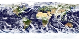
. Within the body of physical geography, the Earth
Earth

Earth is the third planet from the Sun. Earth is the largest of the terrestrial planets in the Solar System in diameter, mass and density. It is also referred to as the World and Wiktionary:Terra.Note that by International Astronomical Union convention, the term "Terra" is used for naming extensive land masses, rather...
 is often split either into several spheres
Earth's spheres

The Earth's spheres relates to the division of the Earth into broadly four interacting spheres:* Hydrosphere* Biosphere* Lithosphere* Earth's atmosphere...
 or environments, the main spheres being the atmosphere
Earth's atmosphere

The Earth's atmosphere is a layer of gases surrounding the planet Earth that is retained by the Earth's gravity. Dry air contains roughly 78.08% nitrogen, 20.95% oxygen, 0.93% argon, 0.038% Carbon dioxide in the Earth's atmosphere, and trace amounts of other gases....
, biosphere
Biosphere

The biosphere is the global sum of all ecosystems. From the broadest Geophysiology point of view, the biosphere is the global ecology system integrating all living beings and their relationships, including their interaction with the elements of the lithosphere, hydrosphere, and Earth's atmosphere....
, cryosphere
Cryosphere

The cryosphere, derived from the Greek language word kryo for "cold" or "to cold", is the term which collectively describes the portions of the Earth?s surface where water is in solid form, including sea ice, lake ice, river ice, snow cover, glaciers, ice caps and ice sheets, and frozen ground ....
, geosphere
Geosphere

The term Geosphere is often used to refer to the densest parts of Earth, which consist mostly of Rock and regolith.The term originally applies to the four nested geospheres identified since Meteorology with the states of terrestrial matter: solid , liquid , gas , and plasma ....
, hydrosphere
Hydrosphere

A hydrosphere in physical geography describes the combined mass of water found on, under, and over the surface of a planet....
, lithosphere
Lithosphere

File:Plates tect2 en.svgFile:Earth-crust-cutaway-english.svgThe lithosphere is the rigid outermost shell of a rocky planet....
 and pedosphere
Pedosphere

The pedosphere is the outermost layer of the Earth that is composed of soil and subject to pedogenesis. It exists at the interface of the lithosphere, Earth's atmosphere, hydrosphere and biosphere....
. Research in physical geography is often interdisciplinary and uses the systems approach.

Physical geography is that branch of science,which deals with the study of processes and patterns in the natural environment like atmosphere,biosphere,geosphere.

Fields of physical geography

Delicate Arch Lasalle
  • Geomorphology
    Geomorphology

    Geomorphology is the scientific study of landforms and the processes that shape them. Geomorphologists seek to understand why landscapes look the way they do: to understand landform history and dynamics, and predict future changes through a combination of field observation, physical experiment, and numerical mathematical model....
     is the science concerned with understanding the surface
    Lithosphere

    File:Plates tect2 en.svgFile:Earth-crust-cutaway-english.svgThe lithosphere is the rigid outermost shell of a rocky planet....
     of the Earth and the processes by which it is shaped, both at the present as well as in the past. Geomorphology as a field has several sub-fields that deal with the specific landforms of various environments e.g. desert
    Désert

    ?D?sert? is ?milie Simon's debut single, released in October 2002. The song was a huge success both critically and commercially in her homeland....
     geomorphology and fluvial
    Fluvial

    Fluvial is used in geography and earth science to refer to the processes associated with rivers and streams and the deposits and landforms created by them....
     geomorphology, however, these sub-fields are united by the core processes which cause them; mainly tectonic or climatic processes. Geomorphology seeks to understand landform
    Landform

    In the earth sciences and geology sub-fields a landform or physical feature comprises a geomorphology unit, and is largely defined by its surface form and location in the landscape, as part of the terrain, and as such, is typically an element of topography....
     history and dynamics, and predict future changes through a combination of field observation, physical experiment, and numerical modeling (Geomorphometry
    Geomorphometry

    Geomorphometry is the science of quantitative land surface analysis. It gathers various mathematical, statistical and image processing techniques that can be used to quantify morphological, hydrological, ecological and other aspects of a land surface....
    ). Early studies in geomorphology are the foundation for pedology, one of two main branches of soil science
    Soil science

    Soil science is the study of soil as a natural resource on the surface of the earth including pedogenesis, soil classification and mapping; physical, chemical, biological, and fertility properties of soils; and these properties in relation to the use and management of soils....
    .


Meander
  • Hydrology
    Hydrology

    Hydrology is the study of the movement, distribution, and quality of water throughout the Earth, and thus addresses both the hydrologic cycle and water resources....
     is predominantly concerned with the amounts and quality of water moving and accumulating on the land surface and in the soils and rocks near the surface and is typified by the hydrological cycle. Thus the field encompasses water in rivers, lakes, aquifers and to an extent glaciers, in which the field examines the process and dynamics involved in these bodies of water. Hydrology originated from engineering
    Engineering

    Engineering is the discipline and profession of applying Technology and science knowledge and utilizing natural laws and physical resources in order to design and implement materials, structures, machines, devices, systems, and process that safely realize a desired objective and meet specified criteria....
     and has thus developed a largely quantitative method in its research, however, it does have an earth science
    Earth science

    Earth science , is an all-embracing term for the sciences related to the planet Earth . It is arguably a special case in planetary science, the Earth being the only known life-bearing planet....
     side that embraces the systems approach. Similar to most fields of physical geography it has sub-fields that examine the specific bodies of water or their interaction with other spheres e.g. limnology
    Limnology

    Limnology is often regarded as a division of ecology or environmental science. It is, however, defined as "the study of inland waters". This comprises the biology, chemistry, physics, geology, and other attributes of all inland waters ....
     and ecohydrology
    Ecohydrology

    Ecohydrology is a new interdisciplinary area linking hydrology with ecology processes involved in the water cycle hydrological cycle. These processes generally occur within the water or on land soil and plant foliage....
    .


Grosser Aletschgletscher 3178
  • Glaciology
    Glaciology

    Glaciology is the study of glaciers, or more generally ice and natural phenomena that involve ice.Glaciology is an interdisciplinary earth science that integrates geophysics, geology, physical geography, geomorphology, climatology, meteorology, hydrology, biology, and ecology....
     is the study of glaciers and ice sheets, or more commonly the cryosphere
    Cryosphere

    The cryosphere, derived from the Greek language word kryo for "cold" or "to cold", is the term which collectively describes the portions of the Earth?s surface where water is in solid form, including sea ice, lake ice, river ice, snow cover, glaciers, ice caps and ice sheets, and frozen ground ....
     or ice
    Ice

    Ice is a solid phases of matter, usually crystalline solid, of a non-metallic substance that is liquid or gas at room temperature, such as ammonia ice or methane ice....
     and phenomena that involve ice. Glaciology groups the latter (ice sheets) as continental glaciers and the former (glaciers) as alpine glaciers. Although, research in the areas are similar with research undertaken into both the dynamics of ice sheets and glaciers the latter tends to be concerned with the interaction of ice sheets with the present climate and the latter with the impact of glaciers on the landscape. Glaciology also has a vast array of sub-fields examining the factors and processes involved in ice sheets and glaciers e.g. snow
    Snow

    Snow is a type of precipitation in the form of crystalline water ice, consisting of a multitude of snowflakes that fall from clouds. The process of this precipitation is called snowfall....
     hydrology and glacial geology.


  • Biogeography
    Biogeography

    Biogeography is the study of the distribution of biodiversity over space and time. It aims to reveal where organisms live, and at what abundance....
     is the science which deals with geographic patterns of species distribution and the processes that result in these patterns. Biogeography emerged as a field of study as a result of the work of Alfred Russel Wallace
    Alfred Russel Wallace

    Alfred Russel Wallace, Order of Merit, Fellow of the Royal Society was a United Kingdom of Great Britain and Ireland Natural history, explorer, geographer, anthropologist and biologist....
    , although the field prior to the late twentieth century had largely been viewed as historic in its outlook and descriptive in its approach. The main stimulus for the field since its founding has been that of evolution
    Evolution

    In biology, evolution is change in the heritability trait of a population of organisms from one generation to the next. These changes are caused by a combination of three main processes: variation, reproduction, and selection....
    , plate tectonics
    Plate tectonics

    Plate tectonics describes the large scale motions of Earth's lithosphere. The theory encompasses the older concepts of continental drift, developed during the first decades of the 20th century by Alfred Wegener, and seafloor spreading, understood during the 1960s....
     and the theory of island biogeography. The field can largely be divided into five sub-fields: island biogeography
    Island biogeography

    Island biogeography is a field within biogeography that attempts to establish and explain the factors that affect the species richness of natural communities....
    , paleobiogeography, phylogeography
    Phylogeography

    Phylogeography is the study of the historical processes that may be responsible for the contemporary geographic distributions of individuals. This is accomplished by considering the geographic distribution of individuals in light of the patterns associated with a gene genealogy....
    , zoogeography
    Zoogeography

    Zoogeography is the branch of the science of biogeography that is concerned with the geographic distribution of animal species and their attributes....
     and phytogeography
    Phytogeography

    Phytogeography, also called geobotany, is the branch of biogeography that is concerned with the geographic distribution of plant species, or more generally, plants....


Phanerozoic Climate Change
  • Climatology
    Climatology

    Climatology is the study of climate, scientifically defined as weather conditions averaged over a period of time, and is a branch of the atmospheric sciences....
     is the study of the climate
    Climate

    Climate encompasses the temperatures, humidity, atmospheric pressure, winds, rainfall, atmospheric particle count and numerous other Meteorology elements in a given region over long periods of time, as opposed to the term weather, which refers to current activity of these same elements....
    , scientifically defined as weather conditions averaged over a long period of time. As opposed to meteorology
    Meteorology

    Meteorology is the interdisciplinary scientific study of the Earth's atmosphere that focuses on weather processes and forecasting . Studies in the field stretch back millennia, though significant progress in meteorology did not occur until the eighteenth century....
     which studies atmospheric processes over a shorter duration, which are then examined by climatologist to find trends and frequencies in weather patterns/ phenomena. Climatology, examines both the nature of micro (local) and macro (global) climates and the natural and anthropogenic
    Anthropogenic

    Anthropogenic effects, processes or materials are those that are derived from human activities, as opposed to those occurring in natural environments without human influence....
     influences on them. The field is also sub-divided largely into the climates of various regions and the study of specific phenomena or time periods e.g. tropical cyclone rainfall climatology
    Tropical cyclone rainfall climatology

    A tropical cyclone rainfall climatology is developed to determine rainfall characteristics of past tropical cyclones. A tropical cyclone rainfall climatology can be used to help forecast current or upcoming tropical cyclone impacts....
     and paleoclimatology
    Paleoclimatology

    Paleoclimatology is the study of climate change taken on the scale of the entire history of Earth. It uses records from ice sheets, tree rings, sediment, and rock s to determine the past state of the climate system on Earth....
    .


Nitrogen Cycle
  • Pedology
    Pedology (soil study)

    Pedology is the study of soils in their natural environment. It is one of two main branches of soil science, the other being edaphology. Pedology deals with pedogenesis, soil morphology, and soil classification, while edaphology studies the way soils influence plants, fungi, and other living things....
     is the study of soils in its natural environment. It is one of two main branches of soil science
    Soil science

    Soil science is the study of soil as a natural resource on the surface of the earth including pedogenesis, soil classification and mapping; physical, chemical, biological, and fertility properties of soils; and these properties in relation to the use and management of soils....
    , the other being edaphology
    Edaphology

    Edaphology is one of two main divisions of soil science, the other being pedology . Edaphology is concerned with the influence of soils on living things, particularly plants....
    . Pedology mainly deals with pedogenesis
    Pedogenesis

    Pedogenesis or soil evolution is the process by which soil is created. It is the major topic of the science of pedology , whose other aspects include the soil morphology, soil classification of soils, and their distribution in nature, present and past ....
    , soil morphology
    Soil morphology

    Soil morphology is the field observable attributes of the soil within the various soil horizons and the description of the kind and arrangement of the horizons....
    , soil classification
    Soil classification

    Soil classification deals with the systematic categorization of soils based on distinguishing characteristics as well as criteria that dictate choices in use....
    . In physical geography pedology is largely studied due to the numerous interactions between climate (water, air, temperature), soil life (micro-organisms, plants, animals), the mineral materials within soils (biogeochemical cycles) and its position and effects on the landscape such as laterization
    Tropical rainforest

    Tropical rainforests are usually found around the equator. They are common in Asia, Australia, Africa, South America, Central America, Southern Mexico and on many of the Pacific Islands....
    .


  • Palaeogeography
    Palaeogeography

    Palaeogeography is the study of what the geography was in times past. It is most often used about the physical landscape, although nothing excludes that the word also be used about the human or cultural environment....
     is the study of the distribution of the continents through geologic time through examining the preserved material in the stratigraphic record. Palaeogeography is a cross-discipline, almost all the evidence for the positions of the continents comes from geology
    Geology

    Geology is the science and study of the solid and liquid matter that constitute the Earth. The field of geology encompasses the study of the composition, structural geology, physical properties, dynamics, and History of the Earth of Earth materials, and the processes by which they are formed, moved, and changed....
     in the form of fossils or geophysics
    Geophysics

    Geophysics, a major discipline of the Earth sciences, is the study of the Earth by the quantitative observation of its physical properties, especially by Seismology, Electromagnetism, Radioactive decay, galvanic and potential field methods....
     the use of this data has resulted in evidence for continental drift
    Continental drift

    Continental drift is the movement of the Earth's continents relative to each other. The hypothesis that continents 'drift' was first put forward by Abraham Ortelius in 1596 and was fully developed by Alfred Wegener in 1912....
    , plate tectonics
    Plate tectonics

    Plate tectonics describes the large scale motions of Earth's lithosphere. The theory encompasses the older concepts of continental drift, developed during the first decades of the 20th century by Alfred Wegener, and seafloor spreading, understood during the 1960s....
     and supercontinents this in turn has supported palaeogeographic theories such as the Wilson cycle.


Portcampbellcliffs
  • Coastal geography
    Coastal geography

    Coastal geography is the study of the dynamic interface between the ocean and the land, incorporating both the physical geography and the human geography of the coast....
     is the study of the dynamic interface between the ocean and the land, incorporating both the physical geography (i.e coastal geomorphology, geology and oceanography) and the human geography of the coast. It involves an understanding of coastal weathering
    Weathering

    Weathering is the decomposition of earth Rock , soils and their minerals through direct contact with the planet's atmosphere. Weathering occurs in situ, or "with no movement", and thus should not be confused with erosion, which involves the movement of rocks and minerals by agents such as water, ice, wind, and gravity....
     processes, particularly wave action, sediment movement and weathering, and also the ways in which humans interact with the coast. Coastal geography although predominantly geomorphological in its research is not just concerned with coastal landforms, but also the causes and influences of sea level change.


Thermohaline Circulation
  • Oceanography
    Oceanography

    Oceanography , also called oceanology or marine science, is the branch of Earth science that studies the ocean. It covers a wide range of topics, including marine organisms and ecosystem dynamics; ocean currents, waves, and geophysical fluid dynamics; plate tectonics and the geology of the sea floor; and fluxes of various chemi...
     is the branch of physical geography that studies the Earth's oceans and seas. It covers a wide range of topics, including marine organisms and ecosystem dynamics (biological oceanography); ocean currents, waves, and geophysical fluid dynamics (physical oceanography
    Physical oceanography

    Physical oceanography is the study of physics conditions and physical processes within the ocean, especially the motions and physical properties of ocean waters....
    ); plate tectonics and the geology of the sea floor (geological oceanography); and fluxes of various chemical substances and physical properties within the ocean and across its boundaries (chemical oceanography
    Chemical oceanography

    Chemical oceanography is the study of the behavior of the chemical elements within the Earth's oceans. The ocean is unique in that it contains - in greater or lesser quantities - nearly every chemical element in the periodic table....
    ). These diverse topics reflect multiple disciplines that oceanographers blend to further knowledge of the world ocean and understanding of processes within it.


  • Quaternary science
    Quaternary science

    Quaternary science is an inter-disciplinary field of study focusing on the Quaternary period, which encompasses the last 2.6 million years. The field studies the last ice age and the recent interstadial the Holocene and uses proxy evidence to reconstruct the past environments during this period to infer the Climate and environmental changes t...
     is an inter-disciplinary field of study focusing on the Quaternary
    Quaternary

    The Quaternary Period is the Geologic Time Scale period after the Neogene Period, spanning 1.805 +/- 0.005 million years ago to the present. The Quaternary includes two geologic epochs: the Pleistocene and the Holocene epoch ....
     period, which encompasses the last 2.6 million years. The field studies the last ice age and the recent interstadial the Holocene
    Holocene

    The Holocene is a geological Epoch which began approximately 11,700 years ago . According to traditional geological thinking, the Holocene continues to the present....
     and uses proxy evidence to reconstruct the past environments during this period to infer the climatic and environmental changes that have occurred.


Indiana Dunes Habitat Fragmentation
  • Landscape ecology
    Landscape ecology

    Landscape ecology is the science of studying and improving the relationship between spatial pattern and ecological processes on a multitude of landscape scales and organizational levels....
     is a sub-discipline of ecology
    Ecology

    Ecology is the science study of the distribution and Abundance of life and the interactions between organisms and their nature environment ....
     and geography that address how spatial variation in the landscape affects ecological processes such as the distribution and flow of energy, materials and individuals in the environment (which, in turn, may influence the distribution of landscape "elements" themselves such as hedgerows). The field was largely founded by the German geographer Carl Troll
    Carl Troll

    Carl Troll , was a Germany geographer, brother of botanist Wilhelm Troll.From 1919 until 1922 Troll studied amongst other biology, chemistry, geology, geography and physics at the University of Munich....
     Landscape ecology typically deals with problems in an applied and holistic context. The main difference between biogeography and landscape ecology is that the latter is concerned with how flows or energy and material are changed and their impacts on the landscape whereas the former is concerned with the spatial patterns of species and chemical cycles.


Geabios3d
  • Geomatics
    Geomatics

    Geomatics is the discipline of gathering, storing, processing, and delivery of geography information, or spatial reference information....
     is the field of gathering, storing, processing, and delivering of geographic information, or spatially referenced information. Geomatrics includes geodesy (scientific discipline that deals with the measurement and representation of the earth, its gravitational field, and other geodynamic phenomena, such as crustal motion, oceanic tides, and polar motion) and G.I.S.
    Geographic Information System

    A geographic information system captures, stores, analyzes, manages, and presents data that refers to or is linked to location.In the strictest sense, the term describes any Information systems that integrates, stores, edits, analyzes, shares, and displays georeference information....
     (a system for capturing, storing, analyzing and managing data and associated attributes which are spatially referenced to the earth) and remote sensing
    Remote sensing

    Remote sensing is the small or large-scale acquisition of information of an object or phenomenon, by the use of either recording or real-time sensing device that is not in physical or intimate contact with the object ....
     (the short or large-scale acquisition of information of an object or phenomenon, by the use of either recording or real-time sensing device(s) that is not in physical or intimate contact with the object).


Aralship2
  • Environmental geography
    Environmental geography

    Environmental geography is the branch of geography that describes the spatial aspects of interactions between humans and the natural world. It requires an understanding of the dynamics of geology, meteorology, hydrology, biogeography, and geomorphology, as well as the ways in which human societies conceptualize the environment....
     is a branch of geography that describes the spatial aspects of interactions between humans and the natural world. The branch bridges the divide between human and physical geography and thus requires an understanding of the dynamics of geology, meteorology, hydrology, biogeography, and geomorphology, as well as the ways in which human societies conceptualize the environment. Although the branch was previously more visible in research than at present with theories such as environmental determinism
    Environmental determinism

    Environmental determinism, also known as climatic determinism or geographical determinism, is the view that the physical environment, rather than social conditions, determines culture....
     linking society with the environment. It has largely become the domain of the study of environmental management or anthropogenic influences on the environment and vice a versa.


Physical geography literature


Physical geography and Earth Science journals communicate and document the results of research carried out in universities and various other research institutions. Most journals cover a specific field and publish the research within that field, however unlike human geographers, physical geographers tend to publish in inter-disciplinary journals rather than predominantly geography journal; the research is normally expressed in the form of a scientific paper. Additionally, textbooks books and magazines on geography communicate research to laypeople, although these tend to focus on environmental issues
List of environmental issues

This is a list of environmental issues that are due to human activity. These articles relate to the anthropogenic effects on the natural environment....
 or cultural dilemmas. Examples of journals that publish articles from physical geographers are:

Notable physical geographers

Alexander Von Humboldt Selfportrait
  • Eratosthenes
    Eratosthenes

    Eratosthenes of Cyrene was a Greeks mathematician, poet, sportsperson, geographer and astronomer. He made several discoveries and inventions including a system of latitude and longitude....
     (276 194 BC), who made the first known reliable estimation of the Earth's size.
  • Ptolemy
    Ptolemy

    Claudius Ptolemaeus , known in English as Ptolemy , was a Roman Greek mathematics, Greek astronomy, geographer and astrologer. He lived in History of Roman Egypt, and was probably born there in a town in the Thebaid called Ptolemais Hermiou; he died in Alexandria around 168 AD....
     (c.
    Circa

    Circa means "in approximately", generally referring to a year. It is widely used in genealogy and historical writing, when the dates of events are approximately known....
    90 c.168), who compiled Greek and Roman knowledge to produce the book Geographia.
  • Abu Rayhan Biruni (973 1048 AD), considered te father of geodesy
    Geodesy

    Geodesy , also called geodetics, a branch of earth sciences, is the scientific discipline that deals with the measurement and representation of the Earth, including its gravitational field, in a three-dimensional time-varying space....
    .
  • Ibn Sina
    Avicenna

    , known as Abu Ali Sina Balkhi or Ibn Sina and commonly known in English by his Latinized name Avicenna , was a Persian people polymath and the foremost Islamic medicine and Early Islamic philosophy of his time....
     (Avicenna, 980–1037), who formulated the law of superposition
    Law of superposition

    The law of superposition is a key axiom based on observations of natural history that is a foundational principle of sedimentary stratigraphy and so of other geology dependent natural sciences:...
     and concept of uniformitarianism
    Uniformitarianism (science)

    Uniformitarianism, in the philosophy of science, assumes that the natural processes that operated in the past are the same as those that can be observed operating in the present....
     in The Book of Healing
    The Book of Healing

    The Book of Healing is a Islamic science and Early Islamic philosophy encyclopedia written by the Islamic science polymath Avicenna from Asfahana, near Bukhara in Greater Iran ....
    .
  • Muhammad al-Idrisi
    Muhammad al-Idrisi

    Abu Abd Allah Muhammad al-Idrisi al-Qurtubi al-Hasani al-Sabti or simply El Idrisi was an Islamic geography, cartography and traveller who lived in Sicily, at the court of King Roger II of Sicily....
     (Dreses, 1100 c.1165), who drew the Tabula Rogeriana
    Tabula Rogeriana

    The Kitab Rudjdjar or Tabula Rogeriana was a world map drawn by the Geography in medieval Islam, Muhammad al-Idrisi, in 1154. Al-Idrisi worked on the accompanying commentaries and illustrations of the map for eighteen years at the court of the Normans King Roger II of Sicily....
    , the most accurate world map in pre-modern times.
  • Piri Reis
    Piri Reis

    Piri Reis was an Ottoman Empire admiral, Geography in medieval Islam, pirate and Cartography born between 1465 and 1470 in Gallipoli on the Aegean Sea coast of Turkey....
     (1465 c.1554), whose Piri Reis map
    Piri Reis map

    The Piri Reis map is a famous pre-modern world map created by 16th century Ottoman Empire-Turkish people admiral and cartographer Piri Reis. The map shows part of the western coasts of Europe and North Africa with reasonable accuracy, and the coast of Brazil is also easily recognizable....
     is the oldest surviving world map to include the Americas
    Americas

    The Americas are the region of the Western hemisphere that consists of the continents of North America and South America with their associated islands and regions....
     and possibly Antarctica
    Antarctica

    Antarctica is Earth's southernmost continent, overlying the South Pole. It is situated in the Antarctica of the southern hemisphere, almost entirely south of the Antarctic Circle, and is surrounded by the Southern Ocean....
  • Gerardus Mercator
    Gerardus Mercator

    Gerardus Mercator was a Flanders cartographer. He was born in Rupelmonde in the County of Flanders. He is remembered for the Mercator projection world map named after him....
     (1512–1594), an innovative cartographer
    Cartography

    File:Mediterranean chart fourteenth century2.jpgCartography is the study and practice of making Geography Map. Combining science, aesthetics, and technique, cartography builds on the premise that we can model reality in ways that communicate spatial information effectively....
     and originator of the Mercator projection
    Mercator projection

    The Mercator projection is a Map projection#Triangular presented by the Flemish people geographer and cartographer Gerardus Mercator, in 1569....
    .
  • Alexander Von Humboldt
    Alexander von Humboldt

    was a German people natural scientist and List of explorers, and the younger brother of the Prussian minister, philosopher, and linguistics, Wilhelm von Humboldt ....
     (1769–1859), considered the father of modern geography. Published Kosmos and founded the study of biogeography.
  • Arnold Henry Guyot
    Arnold Henry Guyot

    Arnold Henry Guyot , Switzerland-USA geologist and geographer, was born at Boudevilliers, near Neuch?tel, Switzerland.He studied at the college of Neuch?tel and in Berlin,Germany, where he began a lifelong friendship with Louis Agassiz....
     (1807–1884), who noted the structure of glaciers and advanced the understanding of glacial motion, especially in fast ice flow.
  • Louis Agassiz
    Louis Agassiz

    Jean Louis Rodolphe Agassiz was a paleontologist, glaciologist, and geologist, and was a prominent innovator in the study of the earth's natural history....
     (1807–1873), the author of a glacial theory which disputed the notion of a steady-cooling Earth.
  • Alfred Russel Wallace
    Alfred Russel Wallace

    Alfred Russel Wallace, Order of Merit, Fellow of the Royal Society was a United Kingdom of Great Britain and Ireland Natural history, explorer, geographer, anthropologist and biologist....
     (1823–1913), founder of modern biogeography and the Wallace line
    Wallace Line

    The Wallace Line is a boundary that separates the Ecozone of Asia and Wallacea . West of the line are found organisms related to Asiatic species; to the east, a mixture of species of Asian and Australian origin are present....
    .
  • Walther Penck
    Walther Penck

    Walther Penck was an Austrian geography, born in Vienna as son of geographer Albrecht Penck.Walther Penck worked 1912-1914 in Argentina as a geographer, and is best known for his contributions to the field of geomorphology....
     (1888–1923), proponent of the cycle of erosion
    Cycle of erosion

    The cycle of erosion was a model for stream erosion and landscape development proposed by William Morris Davis in the late 1800s. Davis' Stages in the fluvial cycle of erosion published in 1909 defined a young, mature, and old sequence in the development of river valleys and the landscape the rivers were eroding....
     and the simultaneous occurrence of uplift
    Uplift

    Uplift may refer to:* Biological uplift, the theoretical prospect of upgrading the capacities of a species or a civilization.** Uplift Universe, the setting for a series of novels by David Brin in which Biological Uplift is a central aspect...
     and denudation
    Denudation

    Denudation is the process by which the removal of material, through means of erosion and weathering, leads to a reduction of elevation and relief in landforms and landscapes....
    .
  • William Morris Davis
    William Morris Davis

    William Morris Davis was an United States geographer, geologist, geomorphologist, and meteorologist, often called the "father of American geography"....
     (1850–1934), father of American geography and developer of the cycle of erosion theory.
  • Sir Ernest Shackleton
    Ernest Shackleton

    Sir Ernest Henry Shackleton Royal Victorian Order Order of British Empire, was an Anglo-Irish explorer who was one of the principal figures of the period known as the Heroic Age of Antarctic Exploration....
     (1874–1922), Antarctic explorer during the Heroic Age of Antarctic Exploration
    Heroic Age of Antarctic Exploration

    The Heroic Age of Antarctic Exploration describes an era which extended from the end of the 19th century to the early 1920s. During this 25-year period the Antarctic continent became the focus of an international effort which resulted in intensive scientific and geographical exploration, sixteen major expeditions being launched from eight d...
    .
  • Robert E. Horton
    Robert E. Horton

    Robert Elmer Horton was an United States ecology and soil science, considered by many to be the father of modern hydrology.Born in Parma, Michigan, he earned his bachelor of science from Albion College in 1897....
     (1875–1945), founder of modern hydrology and concepts such as infiltration capacity and overland flow.
  • J Harlen Bretz
    J Harlen Bretz

    J Harlen Bretz was an USA geology, best known for his research that led to the acceptance of the Missoula Floods. He was born to Oliver Joseph Bretz and Rhoda Maria Howlett, farmers in Saranac, Michigan, as the oldest of five children....
     (1882–1981), pioneer of research into the shaping of landscapes by catastrophic floods, most notably the Bretz (Missoula) floods
    Missoula Floods

    The Missoula Floods refer to the cataclysmic floods that swept periodically across eastern Washington and down the Columbia River Gorge at the end of the last ice age....
    .
  • Willi Dansgaard
    Willi Dansgaard

    Willi Dansgaard is a Denmark paleoclimatologist. He is Professor Emeritus of Geophysics at the University of Copenhagen and a member of the Royal Danish Academy of Science and Letters, the Royal Swedish Academy of Sciences, the Icelandic Academy of Sciences, and the Danish Geophysical Society....
     (born 1922), palaeoclimatologist and quaternary scientist, instrumental in the use of oxygen-isotope dating and co-identifier of Dansgaard-Oeschger event
    Dansgaard-Oeschger event

    Willi Dansgaard-Hans Oeschger events are rapid climate fluctuations that occurred 25 times during the last glacial period. Some scientists claim that the events occur quasi-periodically with a recurrence time being a multiple of 1,470 years, but this is debated....
    s.
  • Hans Oeschger
    Hans Oeschger

    Professor Hans Oeschger was the founder of the Division of Climate and Environmental Physics at the Physics Institute of the University of Bern in 1963 and director until his retirement in 1992....
     (1927–1998), palaeoclimatologist and pioneer in ice core research, co-identifier of Dansgaard-Orschger events.
  • Richard Chorley
    Richard Chorley

    Richard John Chorley was a leading figure in the late 20th century for his work in Quantitative revolution, and played an instrumental role in bringing in the use of systems theory to geography....
     (1927–2002), a key contributor to the quantitative revolution
    Quantitative revolution

    The quantitative revolution was one of the four major turning points in the history of geography . The quantitative revolution occurred during the 1950s and 1960s and marked a rapid change in the method behind geographical research....
     and the use of systems theory
    Systems theory

    Systems theory is an interdisciplinary field of science and the study of the nature of complex systems in nature, society, and science. More specifically, it is a framework by which one can analyze and/or describe any group of objects that work in concert to produce some result....
     in geography.
  • Sir Nicholas Shackleton
    Nicholas Shackleton

    Sir Nicholas John Shackleton Fellow of the Royal Society was a United Kingdom geologist and climatologist who specialised in the Quaternary Period....
     (1937–2006), who demonstrated that oscillations in climate over the past few million years could be correlated with variations in the orbital and positional relationship between the Earth and the Sun.
  • Stefan Rahmstorf
    Stefan Rahmstorf

    Stefan Rahmstorf is a Germany oceanographer and climatologist. Since 2000, he has been a Professor of Physics of the Oceans at Potsdam University....
     (born 1960), professor of abrupt climate changes and author on theories of thermohaline dynamics.


See also

  • Ecology
    Ecology

    Ecology is the science study of the distribution and Abundance of life and the interactions between organisms and their nature environment ....
  • Environmental science
    Environmental science

    Environmental science is an expression encompassing the wide range of scientific disciplines that need to be brought together to understand and manage the natural environment and the many interactions among physics, chemistry, and biology components....
  • Environmental studies
    Environmental studies

    Environmental studies is the systematic study of human behavior with their environment. It is a broad field of study that includes the natural environment, built environments, social environments, organizational environments, and the sets of relationships between them....
  • Geostatistics
    Geostatistics

    Geostatistics is a branch of geology that deals with the analysis of mining processes through mathematical models. Evolved originally in the exploration of minerals, ores, and coals, it is currently applied in disciplines such as petroleum geology, hydrogeology, hydrology, meteorology, oceanography, geochemistry, geography, forestry, environm...
  • Weathering
    Weathering

    Weathering is the decomposition of earth Rock , soils and their minerals through direct contact with the planet's atmosphere. Weathering occurs in situ, or "with no movement", and thus should not be confused with erosion, which involves the movement of rocks and minerals by agents such as water, ice, wind, and gravity....
  • Physiographic regions of the world
    Physiographic regions of the world

    The physiographic regions of the world are a means of defining the Earth's landforms into distinct regions based upon Nevin Fenneman's classic three-tiered approach of divisions, provinces and sections, in 1916, which although they date from the mid 1910s, are still considered basically valid, and were the basis for similar classifications of...


Further reading


External links

  • , full text, physical geography of the Thames River Basin
  • , full text
  • , UK National Grid For Learning