
Pennsylvania Route 94
Encyclopedia
Pennsylvania Route 94 is a 29 mile (47 km) long north–south state highway
located in southern Pennsylvania
. The southern terminus of the route is at the Mason-Dixon Line
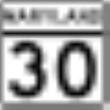
, where PA 94 continues into Maryland
as Maryland Route 30
. The northern terminus is at Pennsylvania Route 34
south of Mount Holly Springs
.
border in West Manheim Township
, York County
, where the road continues south into that state as MD 30
. From the state line, the route heads northwest on two-lane undivided Baltimore Pike, passing through agricultural areas with some woods and residential development and serving the communities of West Manheim and Pleasant Hill. PA 94 runs through more rural areas with residential subdivisions, turning north and heading into Penn Township
. At this point, the route becomes Baltimore Street and passing a mix of residential and business development, running through Parkville
and curving northwest again. The road enters Hanover
, where it is lined with several homes. Upon reaching the commercial downtown, PA 94 comes to an intersection with PA 116
and northbound PA 194
. The route becomes Carlisle Street at this point and intersects the southbound direction of PA 194 a block later. The road crosses a York Railway line and a CSX railroad line within a short distance of each other and leaves the downtown area, heading past more residences. Farther north, PA 94 gains a center left-turn lane and passes several businesses. The route becomes the border between Penn Township to the west and Hanover to the east as it runs to the west of the North Hanover Mall. The road passes more businesses before fully entering Penn Township again and narrowing back to two lanes.
in Adams County
and becomes Carlisle Pike, heading into agricultural areas with some commercial development. A short distance later, the route becomes the border between Oxford Township
to the west and Berwick Township
to the east, running through a wooded area between two lakes before heading through more farmland with some woods and development. In the commercial community of Cross Keys
, the road crosses US 30
and crosses into Hamilton Township
, running through more agricultural areas with some homes. Farther north, PA 94 crosses the Conewago Creek
into Reading Township
and runs through more rural areas before coming into the residential community of Hampton
and intersecting the eastern terminus of PA 394
. The road heads through a mix of farms, woods, and homes as it comes to a junction with PA 234
. Past this, the route continues through open farmland with some woodland and residences, passing through Round Hill. PA 94 crosses Mud Run into Huntington Township
and runs through more rural areas, turning more to the northwest as it heads into Latimore Township
. The route heads through forested areas with some homes, crossing back into Huntington Township and interchanging with US 15
, becoming a four-lane divided highway
at this point. From here, the road continues into residential areas as a two-lane undivided road and enters York Springs
, passing through the town on Main Street. PA 94 crosses back into Huntington Township and becomes Carlisle Pike again, running through farmland with a few areas of woods and homes. The route heads into Latimore Township again and turns more to the north through open farm fields.
in Cumberland County
and becomes Baltimore Pike, running through a mix of farms and woods with some homes. Farther north, the road crosses forested South Mountain
and curves to the northwest. PA 94 turns north and enters Mount Holly Springs
and becomes South Baltimore Avenue, passing through wooded areas of housing developments before ending at PA 34
.
State highway
State highway, state road or state route can refer to one of three related concepts, two of them related to a state or provincial government in a country that is divided into states or provinces :#A...
located in southern Pennsylvania
Pennsylvania
The Commonwealth of Pennsylvania is a U.S. state that is located in the Northeastern and Mid-Atlantic regions of the United States. The state borders Delaware and Maryland to the south, West Virginia to the southwest, Ohio to the west, New York and Ontario, Canada, to the north, and New Jersey to...
. The southern terminus of the route is at the Mason-Dixon Line
Mason-Dixon line
The Mason–Dixon Line was surveyed between 1763 and 1767 by Charles Mason and Jeremiah Dixon in the resolution of a border dispute between British colonies in Colonial America. It forms a demarcation line among four U.S. states, forming part of the borders of Pennsylvania, Maryland, Delaware, and...
, where PA 94 continues into Maryland
Maryland
Maryland is a U.S. state located in the Mid Atlantic region of the United States, bordering Virginia, West Virginia, and the District of Columbia to its south and west; Pennsylvania to its north; and Delaware to its east...
as Maryland Route 30
Maryland Route 30
Maryland Route 30 is a state highway in Central Maryland region in the U.S. state of Maryland. It serves as one of the major north–south routes of central Maryland.-Route description:...
. The northern terminus is at Pennsylvania Route 34
Pennsylvania Route 34
Pennsylvania Route 34 is a long state route located in southern Pennsylvania. The southern terminus of the route is at U.S. Route 15 Business in Gettysburg. The northern terminus is at U.S. Route 11 and U.S. Route 15 south of Liverpool....
south of Mount Holly Springs
Mount Holly Springs, Pennsylvania
Mount Holly Springs is a borough in Cumberland County, Pennsylvania, United States. The population was 1,925 at the 2000 census. It is part of the Harrisburg–Carlisle Metropolitan Statistical Area.-Geography:...
.
York County
PA 94 begins at the MarylandMaryland
Maryland is a U.S. state located in the Mid Atlantic region of the United States, bordering Virginia, West Virginia, and the District of Columbia to its south and west; Pennsylvania to its north; and Delaware to its east...
border in West Manheim Township
West Manheim Township, Pennsylvania
West Manheim Township is a township in York County, Pennsylvania, United States. The population was 7,744 at the 2010 census.-Geography:According to the United States Census Bureau, the township has a total area of , of which is land and , or 3.23%, is water...
, York County
York County, Pennsylvania
York County is a county in the U.S. state of Pennsylvania. As of 2010, the population was 434,972. It is in the Susquehanna Valley, a large fertile agricultural region in South Central Pennsylvania....
, where the road continues south into that state as MD 30
Maryland Route 30
Maryland Route 30 is a state highway in Central Maryland region in the U.S. state of Maryland. It serves as one of the major north–south routes of central Maryland.-Route description:...
. From the state line, the route heads northwest on two-lane undivided Baltimore Pike, passing through agricultural areas with some woods and residential development and serving the communities of West Manheim and Pleasant Hill. PA 94 runs through more rural areas with residential subdivisions, turning north and heading into Penn Township
Penn Township, York County, Pennsylvania
Penn Township is a township in York County, Pennsylvania, United States. The population was 15,612 at the 2010 census.-Geography:According to the United States Census Bureau, the township has a total area of , of which is land and , or 1.16%, is water...
. At this point, the route becomes Baltimore Street and passing a mix of residential and business development, running through Parkville
Parkville, Pennsylvania
Parkville is a census-designated place in York County, Pennsylvania, United States. The population was 6,706 at the 2010 census.-Geography:Parkville is located at in Penn Township, adjacent to the borough of Hanover....
and curving northwest again. The road enters Hanover
Hanover, Pennsylvania
Hanover is a borough in York County, Pennsylvania, southwest of York and north-northwest of Baltimore, Maryland.The town is situated in a productive agricultural region. The population was 15,289 at the 2010 census. The borough is served by a 717 area code and the Zip Codes of 17331-34...
, where it is lined with several homes. Upon reaching the commercial downtown, PA 94 comes to an intersection with PA 116
Pennsylvania Route 116
Pennsylvania Route 116 is an east–west route located in southern Pennsylvania. The route begins at Pennsylvania Route 16 in Carroll Valley north of the Pennsylvania-Maryland state line. It passes through the historic Civil War town of Gettysburg, Pennsylvania in Adams County, intersecting U.S...
and northbound PA 194
Pennsylvania Route 194
Pennsylvania Route 194 is a long north–south state highway located in south-central Pennsylvania. The southern end is at the Maryland State Line and the northern terminus is at the intersection with PA 74 in the town of Dillsburg.-Route description:PA 194 begins at the Maryland border in...
. The route becomes Carlisle Street at this point and intersects the southbound direction of PA 194 a block later. The road crosses a York Railway line and a CSX railroad line within a short distance of each other and leaves the downtown area, heading past more residences. Farther north, PA 94 gains a center left-turn lane and passes several businesses. The route becomes the border between Penn Township to the west and Hanover to the east as it runs to the west of the North Hanover Mall. The road passes more businesses before fully entering Penn Township again and narrowing back to two lanes.
Adams County
PA 94 enters Conewago TownshipConewago Township, Adams County, Pennsylvania
Conewago Township is a township in Adams County, Pennsylvania, United States. The population was 5,709 at the 2000 census.-Geography:According to the United States Census Bureau, the township has a total area of , of which, of it is land and of it is water.-Demographics:As of the census of 2000,...
in Adams County
Adams County, Pennsylvania
Adams County is a county in the U.S. state of Pennsylvania. As of the 2010 census, the population was 101,407. It was created on January 22, 1800, from part of York County and named in honor of the second President of the United States, John Adams...
and becomes Carlisle Pike, heading into agricultural areas with some commercial development. A short distance later, the route becomes the border between Oxford Township
Oxford Township, Pennsylvania
Oxford Township is a township in Adams County, Pennsylvania, United States. The population was 4,876 at the 2000 census.-Geography:According to the United States Census Bureau, the township has a total area of 9.8 square miles , of which, 9.7 square miles of it is land and 0.10% is...
to the west and Berwick Township
Berwick Township, Pennsylvania
Berwick Township is a township in Adams County, Pennsylvania, United States. The population was 2,389 at the 2010 census.-Geography:According to the United States Census Bureau, the township has a total area of , all of it land.-Demographics:...
to the east, running through a wooded area between two lakes before heading through more farmland with some woods and development. In the commercial community of Cross Keys
Cross Keys, Pennsylvania
Cross Keys is an unincorporated community in Adams County, Pennsylvania, United States. Cross Keys is located on U.S. Route 30 about 2 miles east of New Oxford.-References:USGS GNIS: Cross Keys, Pennsylvania...
, the road crosses US 30
U.S. Route 30 in Pennsylvania
In the U.S. state of Pennsylvania, U.S. Route 30 runs east–west across the southern part of the state, passing through Pittsburgh and Philadelphia on its way from the West Virginia state line east to the Benjamin Franklin Bridge over the Delaware River into New Jersey...
and crosses into Hamilton Township
Hamilton Township, Adams County, Pennsylvania
Hamilton Township is a township in Adams County, Pennsylvania, United States. The population was 2,044 at the 2000 census.-Geography:According to the United States Census Bureau, the township has a total area of , all of it land.-Demographics:...
, running through more agricultural areas with some homes. Farther north, PA 94 crosses the Conewago Creek
Conewago Creek (west)
Conewago Creek is an tributary of the Susquehanna River in Adams and York counties in Pennsylvania in the United States, with its watershed also draining a small portion of Carroll County, Maryland. The source is at an elevation of , east of Caledonia State Park, in Franklin Township in Adams County...
into Reading Township
Reading Township, Pennsylvania
Reading Township is a township in Adams County, Pennsylvania, United States. The population was 5,106 at the 2000 census.-Geography:According to the United States Census Bureau, the township has a total area of 26.8 square miles , of which, 26.6 square miles of it is land and...
and runs through more rural areas before coming into the residential community of Hampton
Hampton, Pennsylvania
Hampton is an unincorporated census-designated place in Adams County, Pennsylvania, United States. The population was 633 at the 2000 census.-Geography:Hampton is located at ....
and intersecting the eastern terminus of PA 394
Pennsylvania Route 394
Pennsylvania Route 394 is an long state highway located in Adams county in Pennsylvania. The western terminus is at PA 234 in Biglerville. The eastern terminus is at PA 94 in Hampton.-Route description:...
. The road heads through a mix of farms, woods, and homes as it comes to a junction with PA 234
Pennsylvania Route 234
Pennsylvania Route 234 is an long state highway located in Adams and York counties in Pennsylvania. The western terminus is at US 30 in Franklin Township. The eastern terminus is at PA 462 in West York...
. Past this, the route continues through open farmland with some woodland and residences, passing through Round Hill. PA 94 crosses Mud Run into Huntington Township
Huntington Township, Adams County, Pennsylvania
Huntington Township is a rural township in Adams County, Pennsylvania, United States. The population was 2,369 at the 2010 census.The currently serving township supervisors are David Boyer , Roger Sowers , and Ronald Zepp....
and runs through more rural areas, turning more to the northwest as it heads into Latimore Township
Latimore Township, Pennsylvania
Latimore Township is a township in Adams County, Pennsylvania, United States. The population was 2,528 at the 2000 census.-Geography:According to the United States Census Bureau, the township has a total area of , of which, of it is land and of it is water.-Demographics:As of the census of 2000,...
. The route heads through forested areas with some homes, crossing back into Huntington Township and interchanging with US 15
U.S. Route 15 in Pennsylvania
U.S. Route 15 is a north-south U.S. Highway in Pennsylvania.-Route description:US 15 enters Pennsylvania south of Gettysburg, Adams County. The route heads to the north toward Harrisburg. It joins with U.S. 11 going along the west shore of the Susquehanna River until they split across the river...
, becoming a four-lane divided highway
Divided Highway
Divided Highway is a compilation album by American rock band The Doobie Brothers, released in 2003. . All tracks are taken from the albums Cycles and Brotherhood .-Track listing:...
at this point. From here, the road continues into residential areas as a two-lane undivided road and enters York Springs
York Springs, Pennsylvania
York Springs is a borough in Adams County, Pennsylvania, United States. The population was 574 at the 2000 census. York Springs is served by the Bermudian Springs School District .-History:...
, passing through the town on Main Street. PA 94 crosses back into Huntington Township and becomes Carlisle Pike again, running through farmland with a few areas of woods and homes. The route heads into Latimore Township again and turns more to the north through open farm fields.
Cumberland County
PA 94 heads north into South Middleton TownshipSouth Middleton Township, Pennsylvania
South Middleton Township is a township in Cumberland County, Pennsylvania, United States. The population was 12,939 at the 2000 census.-Geography:...
in Cumberland County
Cumberland County, Pennsylvania
Cumberland County is a county located in the U.S. state of Pennsylvania and is one of three counties comprising the Harrisburg–Carlisle Metropolitan Statistical Area. As of 2010, the population was 235,406.-History:...
and becomes Baltimore Pike, running through a mix of farms and woods with some homes. Farther north, the road crosses forested South Mountain
South Mountain (Maryland and Pennsylvania)
South Mountain is the northern extension of the Blue Ridge Mountain range in Maryland and Pennsylvania. From the Potomac River near Knoxville, Maryland in the south, to Dillsburg, Pennsylvania in the north, the long range separates the Hagerstown and Cumberland valleys from the Piedmont regions of...
and curves to the northwest. PA 94 turns north and enters Mount Holly Springs
Mount Holly Springs, Pennsylvania
Mount Holly Springs is a borough in Cumberland County, Pennsylvania, United States. The population was 1,925 at the 2000 census. It is part of the Harrisburg–Carlisle Metropolitan Statistical Area.-Geography:...
and becomes South Baltimore Avenue, passing through wooded areas of housing developments before ending at PA 34
Pennsylvania Route 34
Pennsylvania Route 34 is a long state route located in southern Pennsylvania. The southern terminus of the route is at U.S. Route 15 Business in Gettysburg. The northern terminus is at U.S. Route 11 and U.S. Route 15 south of Liverpool....
.