

Pedra do Indaiá
Encyclopedia
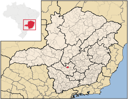
Minas Gerais
Minas Gerais is one of the 26 states of Brazil, of which it is the second most populous, the third richest, and the fourth largest in area. Minas Gerais is the Brazilian state with the largest number of Presidents of Brazil, the current one, Dilma Rousseff, being one of them. The capital is the...
. Its population as of 2007 was 3,921 people living in a total area of 349 km². The city belongs to the meso-region of Oeste de Minas and to the micro-region of Formiga
Formiga
Formiga is a and municipality in central-west Minas Gerais state, Brazil. The population of the municipality in 2007 is 64,585. The area of the municipality is 1,504 km². It is located in the statistical meso-region of Centro-Oeste de Minas and the statistical micro-region of Formiga...
. It became a municipality in 1962.
Origin of the name
The origin lies in the legend of an image of Jesus left near a stone (pedra) and later ""discovered"". A chapel was built in stone and soon people began to build their houses nearby. The settlement grew and was first called Senhor Bom Jesus da Pedra do Indaiá. In 1923 it became Pedra do Indaiá. In 1962 it separated from Itapecerica and became a municipality.Location
The city center of Pedra do Indaiá is located at an elevation of 693 meters approximately halfway between FormigaFormiga
Formiga is a and municipality in central-west Minas Gerais state, Brazil. The population of the municipality in 2007 is 64,585. The area of the municipality is 1,504 km². It is located in the statistical meso-region of Centro-Oeste de Minas and the statistical micro-region of Formiga...
and Divinópolis
Divinópolis
Divinópolis is a city and municipality located in the centre-west of Minas Gerais state, Brazil. The estimated population in 2007 was 201,921 inhabitants. The total area of the municipality is 709 km² and the elevation is 712 metres. It is located at 120 km from state capital Belo Horizonte...
. It is just north of state highway MG-050, which connects Belo Horizonte
Belo Horizonte
Belo Horizonte is the capital of and largest city in the state of Minas Gerais, located in the southeastern region of Brazil. It is the third largest metropolitan area in the country...
to Passos
Passos
-People:* Cristiano Ávalos dos Passos* John Dos Passos* Márcio Emerson Passos de Albuquerque, a Brazilian footballer* Rosa Passos* Vítor Hugo Gomes Passos, a Portuguese footballer-Brazil:* Passos, Minas Gerais, a municipality in the State of Minas Gerais...
. Neighboring municipalities are: Santo Antônio do Monte
Santo Antônio do Monte
Santo Antônio do Monte is a town in the western central part of the state of Minas Gerais, Brazil. Its coordinates are 20.0856/20° 5' 13" S and the longitude is 41.2495/41° 17' 38" W. It has 27,534 inhabitants . The city is located 194 km west of state capital Belo Horizonte...
(N), São Sebastião do Oeste
São Sebastião do Oeste
São Sebastião do Oeste is a town and municipality in the state of Minas Gerais in the Southeast region of Brazil.-References:...
(E), Itapecerica (S), and Formiga
Formiga
Formiga is a and municipality in central-west Minas Gerais state, Brazil. The population of the municipality in 2007 is 64,585. The area of the municipality is 1,504 km². It is located in the statistical meso-region of Centro-Oeste de Minas and the statistical micro-region of Formiga...
(W).
Distances to other cities
- Connection with BR-050: 6 km
- Belo Horizonte/MG - 173 km
- Formiga/MG - 46 km
- Divinópolis/MG - 40 km
- Santo Antônio do Monte/MG - 24 km
Economic activities
Services, small industry, and agriculture are the most important economic activities. In 2005 there were 9 extractive industries (quarries) and 13 transformation industries. Transformation industries employed 340 workers. The GDP in 2005 was approximately R$29 million, 3 million reais from taxes, 11 million reais from services, 9 million reais from industry, and 5 million reais from agriculture. There were 463 rural producers on 19,000 hectares of land (2006). 33 farms had tractors (2006). Approximately 1,100 persons were involved in agriculture. The main crops are rice, beans, and corn. There were 11,000 head of cattle (2006).There were no banks (2007). The motor vehicle fleet had 482 automobiles, 51 trucks, 45 pickup trucks, and 223 motorcycles (2007).
Health and education
In the health sector there were 6 public health clinics, one of which was specialized. Patients with more serious health conditions are transported to FormigaFormiga
Formiga is a and municipality in central-west Minas Gerais state, Brazil. The population of the municipality in 2007 is 64,585. The area of the municipality is 1,504 km². It is located in the statistical meso-region of Centro-Oeste de Minas and the statistical micro-region of Formiga...
or Divinópolis
Divinópolis
Divinópolis is a city and municipality located in the centre-west of Minas Gerais state, Brazil. The estimated population in 2007 was 201,921 inhabitants. The total area of the municipality is 709 km² and the elevation is 712 metres. It is located at 120 km from state capital Belo Horizonte...
. Educational needs of 750 students were met by 4 primary schools, 1 middle school, and 1 pre-primary school.
- Municipal Human Development IndexHuman Development IndexThe Human Development Index is a composite statistic used to rank countries by level of "human development" and separate "very high human development", "high human development", "medium human development", and "low human development" countries...
: 0.755 (2000) - State ranking: 249 out of 853 municipalities as of 2000
- National ranking: 1729 out of 5,138 municipalities as of 2000
- Literacy rate: 83%
- Life expectancy: 74 (average of males and females)
In 2000 the per capita monthly income of R$183.00 was well below the state and national average of R$276.00 and R$297.00 respectively. Poços de Caldas
Poços de Caldas
Poços de Caldas is a city and municipality in south-western Minas Gerais state, Brazil, in the microregion of the same name. Its estimated population in 2009 was 151,449 inhabitants...
had the highest per capita monthly income in 2000 with R$435.00. The lowest was Setubinha
Setubinha
Setubinha is a municipality in the northeast of the Brazilian state of Minas Gerais. As of 2007 the population was 10,834 in a total area of 536 km². The elevation is 729 metres. It is part of the IBGE statistical microregion of Teófilo Otoni...
with R$73.00.
The highest ranking municipality in Minas Gerais in 2000 was Poços de Caldas
Poços de Caldas
Poços de Caldas is a city and municipality in south-western Minas Gerais state, Brazil, in the microregion of the same name. Its estimated population in 2009 was 151,449 inhabitants...
with 0.841, while the lowest was Setubinha
Setubinha
Setubinha is a municipality in the northeast of the Brazilian state of Minas Gerais. As of 2007 the population was 10,834 in a total area of 536 km². The elevation is 729 metres. It is part of the IBGE statistical microregion of Teófilo Otoni...
with 0.568. Nationally the highest was São Caetano do Sul
São Caetano do Sul
São Caetano do Sul is a city in São Paulo state in Brazil, located in the Greater São Paulo Metropolitan Area. It is the city with the highest per capita income in Brazil and it also has the highest Human Development Index .-Geography:São Caetano do Sul is located on a plateau that is part of the...
in São Paulo with 0.919, while the lowest was Setubinha. In more recent statistics (considering 5,507 municipalities) Manari in the state of Pernambuco
Pernambuco
Pernambuco is a state of Brazil, located in the Northeast region of the country. To the north are the states of Paraíba and Ceará, to the west is Piauí, to the south are Alagoas and Bahia, and to the east is the Atlantic Ocean. There are about of beaches, some of the most beautiful in the...
has the lowest rating in the country—0,467—putting it in last place.
See also
- List of municipalities in Minas Gerais