

Panchmahal district
Encyclopedia
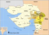
India
India , officially the Republic of India , is a country in South Asia. It is the seventh-largest country by geographical area, the second-most populous country with over 1.2 billion people, and the most populous democracy in the world...
, in the eastern portion of Gujarat State. Panch-mahal means "five tehsils/talukas" (5 sub-divisions), and refers to the five sub-divisions namely - Godhra
Godhra
Godhra is a town and originally the name came from "Gou" which means "Cow" and "Dhara" which has two meanings: one in Sanskrit which means "Hold or Land" and the other in Hindi which means Flow. So, identically it means The Land of the Cow, a municipality in Panchmahal district in Indian state of...
, Dahod
Dahod
Dahod,on the banks of river Dudhimati, is a towncity with a municipality in Dahod District within the State of Gujarat, India. The city serves as District Headquarters for Dahod District. It is approx. 200 km away from Ahmedabad and 150 km away from Vadodara...
, Halol
Halol
Halol is a city and a municipality in Panchmahal district in the Indian state of Gujarat. Located in Western india, it has an average elevation of 499 metres .- Industry :...
, Kalol
Kalol
Kalol is a city and a municipality in Panchmahal district in the Indian state of Gujarat.- Geography :Kalol is located at . It has an average elevation of 100 metres .It is famous for its oil field.- Industry :...
and Jhalod
Jhalod
Jhalod is a large town of historical and commercial importance and serves as administrative headquarters of Jhalod Taluka in Dahod District, Gujarat State, India. It is situated on the eastern border of the Gujarat State, 5 km far from Kushalgarh Tehsil in Banswara District of Rajasthan State...
that were transferred by the Maharaja Sindia of Gwalior to the British
United Kingdom
The United Kingdom of Great Britain and Northern IrelandIn the United Kingdom and Dependencies, other languages have been officially recognised as legitimate autochthonous languages under the European Charter for Regional or Minority Languages...
. The district had a population of 2,025,277 of which 12.51% were urban as of 2001. Headquarters: Godhra.
The district is located on eastern end of the state. It is bordered by Dahod
Dahod
Dahod,on the banks of river Dudhimati, is a towncity with a municipality in Dahod District within the State of Gujarat, India. The city serves as District Headquarters for Dahod District. It is approx. 200 km away from Ahmedabad and 150 km away from Vadodara...
District to the north-east & east, Vadodara
Vadodara
Vadodara formerly known as Baroda is the third most populated city in the Indian State of Gujarat . It is one of the four cities with the population of over 1 million...
District to the south (southeast and southwest also), Kheda
Kheda
Kheda is a town and a municipality in Kheda district in the Indian state of Gujarat. Kheda, also known as Kaira, is 35 km from Ahmedabad. The National Highway no. 8 connecting Ahmedabad and Mumbai passes through Kheda...
District to the west and Sabarkantha District to the northwest. Banswara
Banswara
Banswara is a city in Banswara District in south Rajasthan in India. Banswara princely state was founded by Maharawal Jagmal Singh. It is named for the "bans" or bamboo forests in the area. It is also known as 'City of Hundred Islands', due to presence of numerous islands in the Mahi River, which...
District of Rajasthan
Rajasthan
Rājasthān the land of Rajasthanis, , is the largest state of the Republic of India by area. It is located in the northwest of India. It encompasses most of the area of the large, inhospitable Great Indian Desert , which has an edge paralleling the Sutlej-Indus river valley along its border with...
State also borders the district in the northeast.
History
The history of Panchmahals district revolves around the city of ChampanerChampaner
Champaner चंमपानेर شمبنر is a historical city in the state of Gujarat, in western India. It is located in Panchmahal district, 47 kilometres from the city of Vadodara. The city was briefly the capital of Gujarat....
. It was established in 7th century (647) in the territory of King Vanraj of Solanki
Solanki
The Solanki was a royal Hindu Indian dynasty that ruled parts of western and central India between the 10th to 13th centuries. A number of scholars including V. A. Smith assign them Gurjar origin....
dynasty. In the 13th century, Chauhans acquired the city from Muslim rulers under Alauddin Khilji
Alauddin Khilji
Ali Gurshap Khan better known by his titular name as Sultan Ala-ud-din Khilji was the second ruler of the Turko-Afghan Khilji dynasty in India.He was a well and capable ruler. He belonged to the Afghanized Turkic tribe of the Khiljis...
. Their rule continued until 1484, when Sultan Mohammad Begda of Gujarat captured the city. Thereafter Godhra
Godhra
Godhra is a town and originally the name came from "Gou" which means "Cow" and "Dhara" which has two meanings: one in Sanskrit which means "Hold or Land" and the other in Hindi which means Flow. So, identically it means The Land of the Cow, a municipality in Panchmahal district in Indian state of...
became center of the district under the Mughal Empire
Mughal Empire
The Mughal Empire , or Mogul Empire in traditional English usage, was an imperial power from the Indian Subcontinent. The Mughal emperors were descendants of the Timurids...
(1575 to 1727).
Panchmahal were conquered from the Mughal Empire
Mughal Empire
The Mughal Empire , or Mogul Empire in traditional English usage, was an imperial power from the Indian Subcontinent. The Mughal emperors were descendants of the Timurids...
by the Maratha
Maratha
The Maratha are an Indian caste, predominantly in the state of Maharashtra. The term Marāthā has three related usages: within the Marathi speaking region it describes the dominant Maratha caste; outside Maharashtra it can refer to the entire regional population of Marathi-speaking people;...
general Sindhia in the eighteenth century.In the due course of time Sindhia dynasty became Maharajas of Gwalior, and after 1818 were forced to recognize British sovereignty. The Panch Mahals were transferred in 1861 by the Sindhias to British India, where they became a district in the Gujarat Division of Bombay Province. The British district consisted of two separate parts, the "western mahals" and the "eastern mahals" which were divided by the territories of Baria
Baria
Devgadh Baria is a municipality in Dohad district in the state of Gujarat, India. It is a small town nestled in the foothills on the eastern border of Gujarat State. It was established in 1782. The state was ruled by Chauhan kings until it merger with the Union of India...
(Devgadh) & Sanjeli States. The western portion was for the most part a level plain of rich soil; while the eastern portion, although it comprised few fertile valleys, was generally rugged, undulating and barren, with little cultivation. The area of the British district was 1606 sq. mi., and the population was 261,020 in 1901. The administrative headquarters were at Godhra
Godhra
Godhra is a town and originally the name came from "Gou" which means "Cow" and "Dhara" which has two meanings: one in Sanskrit which means "Hold or Land" and the other in Hindi which means Flow. So, identically it means The Land of the Cow, a municipality in Panchmahal district in Indian state of...
, pop. (1901), 20,915. The ruins of Champaner
Champaner
Champaner चंमपानेर شمبنر is a historical city in the state of Gujarat, in western India. It is located in Panchmahal district, 47 kilometres from the city of Vadodara. The city was briefly the capital of Gujarat....
, the former capital of a Hindu kingdom and later of the Sultans of Gujarat, was included in the district. It was the only district of Bombay Presidency that is administered on the non-regulation system, the Collector being also the Agent to the Governor General of India (Political Agent) for Rewa Kantha
Rewa Kantha
Rewa Kantha was a political agency or collection of princely states in British India, subordinate to the government of Bombay Presidency. It stretched for about 150 miles between the plain of Gujarat and the hills of Malwa, from the Tapti River to the Mahi River crossing the Narmada or Rewa River,...
Agency. The mineral products comprised sandstone, granite and other kinds of building stone. Mining for manganese on a large scale was begun by a European firm. The principal crops were maize, millets, rice, pulse and oilseeds; there were manufactures of lac bracelets and lacquered toys; the chief export was timber
Timber
Timber may refer to:* Timber, a term common in the United Kingdom and Australia for wood materials * Timber, Oregon, an unincorporated community in the U.S...
. Both portions of the district were crossed by the branch of the Baroda, Bombay & Central India Railways (B.B.&C.I.R) from Anand
Anand, Gujarat
]]Anand is the administrative centre of Anand District in the state of Gujarat, India. It is administered by Anand Municipality. It is part of the region known as Charotar, consisting of Anand and Kheda Districts....
, through Godhra
Godhra
Godhra is a town and originally the name came from "Gou" which means "Cow" and "Dhara" which has two meanings: one in Sanskrit which means "Hold or Land" and the other in Hindi which means Flow. So, identically it means The Land of the Cow, a municipality in Panchmahal district in Indian state of...
and Dahod
Dahod
Dahod,on the banks of river Dudhimati, is a towncity with a municipality in Dahod District within the State of Gujarat, India. The city serves as District Headquarters for Dahod District. It is approx. 200 km away from Ahmedabad and 150 km away from Vadodara...
, to Ratlam
Ratlam
Ratlam , known historically as Ratnapuri, is a city in the Malwa region in Madhya Pradesh state of central India. The town of Ratlam lies 480 m above sea level. It is the administrative headquarters of Ratlam District....
; and a chord line was opened in 1904 from Godhra
Godhra
Godhra is a town and originally the name came from "Gou" which means "Cow" and "Dhara" which has two meanings: one in Sanskrit which means "Hold or Land" and the other in Hindi which means Flow. So, identically it means The Land of the Cow, a municipality in Panchmahal district in Indian state of...
to Baroda
Vadodara
Vadodara formerly known as Baroda is the third most populated city in the Indian State of Gujarat . It is one of the four cities with the population of over 1 million...
city. The district suffered very severely from the famine of 1899-1900, and its population decreased 17% from 1891 to 1901 owing to the famine. In the year 1960, Gujarat State was created and Panchmhals became one of the districts in Gujarat State, with district headquarters at Godhra. In the year 1997, District Panchmahals was dividied into two districts Panchmahals (with district headquarters at Godhra) and a new district of Dahod was created.
Champaner
Champaner
Champaner चंमपानेर شمبنر is a historical city in the state of Gujarat, in western India. It is located in Panchmahal district, 47 kilometres from the city of Vadodara. The city was briefly the capital of Gujarat....
is a World Heritage Site. Pavagarh hosts a temple of Kalika mata
Kali
' , also known as ' , is the Hindu goddess associated with power, shakti. The name Kali comes from kāla, which means black, time, death, lord of death, Shiva. Kali means "the black one". Since Shiva is called Kāla - the eternal time, Kālī, his consort, also means "Time" or "Death" . Hence, Kāli is...
, whose holy shrine attracts about two million pilgrim
Pilgrim
A pilgrim is a traveler who is on a journey to a holy place. Typically, this is a physical journeying to some place of special significance to the adherent of a particular religious belief system...
s per annum.
Economy
In 2006 the Ministry of Panchayati RajMinistry of Panchayati Raj
The Ministry of Panchayati Raj is a branch of the Government of India looking after the ongoing process of decentralization and local governance in the States....
named Panchmahal one of the country's 250 most backward districts
Poverty in India
Poverty is widespread in India, with the nation estimated to have a third of the world's poor. According to a 2005 World Bank estimate, 41.6% of the total Indian population falls below the international poverty line of 1.25 a day...
(out of a total of 640
Districts of India
A district is an administrative division of an Indian state or territory. Districts are further subdivided, in some cases into Sub-Divisions, and otherwise directly into tehsils or talukas.District officials include:...
). It is one of the six districts in Gujarat currently receiving funds from the Backward Regions Grant Fund Programme (BRGF).
Talukas
Panchmahal district is further divided in 11 Talukas for administrative purposes. Following is the list of Talukas of Panchmahal district:-- GodhraGodhraGodhra is a town and originally the name came from "Gou" which means "Cow" and "Dhara" which has two meanings: one in Sanskrit which means "Hold or Land" and the other in Hindi which means Flow. So, identically it means The Land of the Cow, a municipality in Panchmahal district in Indian state of...
- HalolHalolHalol is a city and a municipality in Panchmahal district in the Indian state of Gujarat. Located in Western india, it has an average elevation of 499 metres .- Industry :...
- KalolKalolKalol is a city and a municipality in Panchmahal district in the Indian state of Gujarat.- Geography :Kalol is located at . It has an average elevation of 100 metres .It is famous for its oil field.- Industry :...
- LunawadaLunawadaLunawada is a town and a municipality in Panchmahal district in the state of Gujarat, India. The name Lunawada is derived from the Luneshwar Mahadev temple which is the temple of Lord Shiva. Lunawada is surrounded by water from all directions , Panam river, Vasant Sagar, Kanka Talav, Veri River and...
- SantrampurSantrampurSantrampur is a city and a Tehsil in Panchmahal district in the Indian state of Gujarat.-Demographics: India census, Santrampur had a population of 15,781. Males constitute 52% of the population and females 48%. Santrampur has an average literacy rate of 74%, higher than the national average of...
- Kadana
- JambughodaJambughodaJambughoda is a Wildlife Sanctuary situated in Gujarat, India. Jambughoda is 70 Km from Vadodara and 20 Km from prominent tourist places Pawagadh and Champaner.Places of interest around Jambughoda:* Champaner - UNESCO - World Heritage site...
- Shehra
- Morva-Hadaf
- KhanpurKhanpurKhanpur is a city and Tehsil of the Rahim Yar Khan District of Bahawalpur Division, in the Punjab Province of Pakistan. According to the census of 1998, the city population was 117,764 with an annual growth rate of 2.6%. As of in 2009, it is around 156,152....
- Goghamba
Demographics
According to the 2011 census2011 census of India
The 15th Indian National census was conducted in two phases, houselisting and population enumeration. Houselisting phase began on April 1, 2010 and involved collection of information about all buildings...
Panchmahal district has a population
Demographics of India
The demographics of India are inclusive of the second most populous country in the world, with over 1.21 billion people , more than a sixth of the world's population. Already containing 17.5% of the world's population, India is projected to be the world's most populous country by 2025, surpassing...
of 2,388,267, roughly equal to the nation of Latvia
Latvia
Latvia , officially the Republic of Latvia , is a country in the Baltic region of Northern Europe. It is bordered to the north by Estonia , to the south by Lithuania , to the east by the Russian Federation , to the southeast by Belarus and shares maritime borders to the west with Sweden...
or the US state of New Mexico
New Mexico
New Mexico is a state located in the southwest and western regions of the United States. New Mexico is also usually considered one of the Mountain States. With a population density of 16 per square mile, New Mexico is the sixth-most sparsely inhabited U.S...
. This gives it a ranking of 187th in India (out of a total of 640
Districts of India
A district is an administrative division of an Indian state or territory. Districts are further subdivided, in some cases into Sub-Divisions, and otherwise directly into tehsils or talukas.District officials include:...
). The district has a population density of 458 PD/sqkm . Its population growth rate
Family planning in India
Family planning in India is based on efforts largely sponsored by the Indian government. In the 1965-2009 period, contraceptive usage has more than tripled and the fertility rate has more than halved , but the national fertility rate is still high enough to cause long-term population growth...
over the decade 2001-2011 was 17.92 %. PanchMahal has a sex ratio
Sex ratio
Sex ratio is the ratio of males to females in a population. The primary sex ratio is the ratio at the time of conception, secondary sex ratio is the ratio at time of birth, and tertiary sex ratio is the ratio of mature organisms....
of 945 females
Women in India
The status of women in India has been subject to many great changes over the past few millennia. From equal status with men in ancient times through the low points of the medieval period, to the promotion of equal rights by many reformers, the history of women in India has been eventful...
for every 1000 males, and a literacy rate
Literacy in India
Literacy in India is key for socio-economic progress, and the Indian literacy rate grew to 74.04% in 2011 from 12% at the end of British rule in 1947. Although this was a greater than sixfold improvement, the level is well below the world average literacy rate of 84%, and India currently has the...
of 72.32 %.
External links
- - Official website(in Gujarati)