
Palapye
Encyclopedia
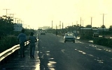
Palapye is a large town in Botswana
, situated about halfway between Francistown
and Gaborone
(240 km away from Gabarone and 170 km away from Francistown). Over the years its position has made it a convenient stopover on one of Southern Africa's principal north–south rail and road routes. Located here is the Morupule Colliery
coal mine, which supplies Morupule Power Station
, Botswana's principal domestic source of electricity. The power station has undertaken an expansion project to increase its generation capacity in an effort to meet the country's increasing demand for electricity. Construction began in 2010. Currently, the plant produces 120 MW of electricity.
In 1997 Palapye was said to be the fastest-growing village in Africa, with plans to expand its population from 30,000 to 180,000.
people, under Khama III
, are widely believed to be the first people to have settled down near present-day Palapye. There, the settlement Phalatswe, also called Old Palapye, was the capital of these people in the early part of the 20th century. The ruins of Phalatswe still stand today, a few kilometres away from the town centre.
. It is located towards the central-eastern edge of Botswana.
Due to current black-outs across the country, resulting from South Africa's refusal to supply electricity to Botswana, construction has been halted for many projects. However, they have resumed, the most important project being the expansion of the Morupule Power Station
. The Morupule Expansion Project 1, with an estimated budget of P1.5 billion, is expected to produce 3.8 million tonnes of coal.
Plans for a new hospital, similar to the newly constructed Serowe Hospital, have also been proposed. A new police station is also to be built, with land clearing having already been completed. It will be located outside the town, on the A1 Highway and is due for completion in late 2011.
From being a mere stop-over, Palapye is rapidly developing to one of Botswana's main financial, residential and educational hubs. The town's physical size has more than doubled since the 1990s.
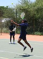
. Sports are usually played at school grounds, which have adequate facilities and fields. Palapye has currently four known soccer teams, FC Palapye, Palapye United and Palapye Swallows and Motlakase Power Dynamos. However, due to there being no stadium in the town, all four teams usually play their matches elsewhere, although occasionally some games are played in schools, on their sports fields. FC Palapye play their matches at either Letlhakane
, Orapa
, Francistown
, Sua
, Maun
or Selibe Phikwe. Both teams are not well known teams, gathering only a very small handful of supporters.
 Palapye is the home of several private schools catering for the demand for independent education. This includes the fast-growing, popular Kgaswe School
, which caters to over 500 students. It was only a pre-school and a primary school until 2006, when, under public demand and influence, the Kgaswe Board of Directors decided to open up a high school section as well. Kgaswe began Form 1 (equivalent to grade 8) in January 2006. One higher class was added after every year until Form 4 (Grade 11) in 2009. These four grades offered the Cambridge IGCSE
and O-levels syllabus. The secondary school is officially registered with the Cambridge International Examinations
. In 2010, Kgaswe introduced Cambridge A-levels.
There are also other Government High Schools. Lotsane Senior Secondary School is one of the main government schools in Palapye. It accommodates learners from Forms 4 to 5. It is one of the very few boarding schools in the area. Other schools in the town include Royal School, Mustard Seed and Kereditswe Primary School.
) has begun construction of its campus in December 2009. Currently, the construction of the first phase of the university will cost close to P450 million. It is expected to be completed by July 2011, with the first students due for enrolling in August 2011. The university's construction will help ease the burden on the University of Botswana
, in the country's capital, Gaborone, which in recent times has been known to turn away many prospective students. The Gaborone campus is the only university in the country, and it has been struggling to meet the demand for an increased number of students. The university in Palapye will help address the situation. The university is located near the Palapye Water Affairs site.
There is also a proposed plan by the University of Botswana to expand its Faculty of Medicine and locate it in Palapye.
and Lethlakane. In 2008, proposals were made to build a new Trans-Kalahari Railway to a port in Namibia
.
, Zimbabwe
has been touted to operate, but such plans are still to be considered by the government, due to the possibility of illegal immigrants gaining access into the country.
An International Airport, that will be located on the Palapye-Serowe road, is another development that is being considered. If plans do go ahead for the proposed Palapye International Airport, it will be the country's second international airport, after Sir Seretse Khama International Airport
in Gaborone, easing the increased traffic that is currently being experienced at the present airport. However, such plans have been put on halt due to the current renovations and expansion at Gaborone Airport and a newly constructed Francistown Airport.
 There are several well known tourist attractions close to Palapye. The Khama Rhino Sanctuary, located some 15 km outside of neighbouring Serowe
, is probably the best known and is some 50 km from Palapye. Here, there is plentiful opportunities for game-viewing, especially for the endangered black and white rhino.
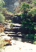
The Tswapong Hills also have many areas of historical significance and well as the Moremi Gorge. This is an area of great beauty as it has a permanent water source.
Some 20 km ESE of Palapye, close to the village of Malaka, are the remains of Phalatswe, also called Old Palapye, the capital of the Bamangwato
people under Khama III
from 1889 to 1902.
Botswana
Botswana, officially the Republic of Botswana , is a landlocked country located in Southern Africa. The citizens are referred to as "Batswana" . Formerly the British protectorate of Bechuanaland, Botswana adopted its new name after becoming independent within the Commonwealth on 30 September 1966...
, situated about halfway between Francistown
Francistown
Francistown or Nyangabgwe is the second largest city in Botswana, with a population of about 85,363, and often described as the "Capital of the North". It is located in eastern Botswana, about north-northeast from the capital, Gaborone...
and Gaborone
Gaborone
' is the capital and largest city of Botswana with a population of 191,776 based on a 2006 survey, about 10% of the total population of Botswana....
(240 km away from Gabarone and 170 km away from Francistown). Over the years its position has made it a convenient stopover on one of Southern Africa's principal north–south rail and road routes. Located here is the Morupule Colliery
Morupule Colliery
The Morupule Colliery is a coal mine located in Palapye, Botswana, and owned and operated by Debswana, a partnership between the government of Botswana and De Beers...
coal mine, which supplies Morupule Power Station
Morupule Power Station
Morupule Power Station is a coal-fired power station near Palapye, Botswana. Run by the Botswana Power Corporation , it comprises four 33 MW air-cooled units...
, Botswana's principal domestic source of electricity. The power station has undertaken an expansion project to increase its generation capacity in an effort to meet the country's increasing demand for electricity. Construction began in 2010. Currently, the plant produces 120 MW of electricity.
In 1997 Palapye was said to be the fastest-growing village in Africa, with plans to expand its population from 30,000 to 180,000.
History
The BamangwatoBamangwato
The Bamangwato can be said to be one of the eight 'principal' Tswana tribes of Botswana, and just like any other Tswana tribe in Botswana, constitutes a small percent in the central district even in their capital serowe. They ruled over majority Bakalangaand other tribes such as the san,bitwa and...
people, under Khama III
Khama III
Khama III , also known as Khama the Good, was the kgosi of the Bamangwato people of Bechuanaland , who made his country a protectorate of the United Kingdom to ensure its survival against Boer and Ndebele encroachments.-Ancestry and Youth:During the 18th century, Malope, chief of the Bakwena...
, are widely believed to be the first people to have settled down near present-day Palapye. There, the settlement Phalatswe, also called Old Palapye, was the capital of these people in the early part of the 20th century. The ruins of Phalatswe still stand today, a few kilometres away from the town centre.
Geography
Palapye is situated nearly 70 km north of the Tropic of CapricornTropic of Capricorn
The Tropic of Capricorn, or Southern tropic, marks the most southerly latitude on the Earth at which the Sun can be directly overhead. This event occurs at the December solstice, when the southern hemisphere is tilted towards the Sun to its maximum extent.Tropic of Capricorn is one of the five...
. It is located towards the central-eastern edge of Botswana.
Climate
Summer months are from mid-September to mid-April. Summers are very hot in Palapye, with daytime temperatures reaching up to 40°C. Thunderstorms are plentiful in the summer. Rainfall levels reach usually a minimum of 300mm annually. Winters in Palapye are mild and dry.Demographics
Palapye's population is believed to be bordering the 30,000 mark, however, this is not an official figure, with many quarters arguing that the actual number is much higher/lower. Christianity is the main religious belief amongst Palapye citizens. However, there is an ever-expanding population of Muslim and Hindu believers in the town.Infrastructure and developments
The Palapye Water Affairs currently provides the town with an abundant supply of water. The works is located a few kilometres outside the town. The Affairs provides Serowe with water, through a new pipe network since 2008.Due to current black-outs across the country, resulting from South Africa's refusal to supply electricity to Botswana, construction has been halted for many projects. However, they have resumed, the most important project being the expansion of the Morupule Power Station
Morupule Power Station
Morupule Power Station is a coal-fired power station near Palapye, Botswana. Run by the Botswana Power Corporation , it comprises four 33 MW air-cooled units...
. The Morupule Expansion Project 1, with an estimated budget of P1.5 billion, is expected to produce 3.8 million tonnes of coal.
Plans for a new hospital, similar to the newly constructed Serowe Hospital, have also been proposed. A new police station is also to be built, with land clearing having already been completed. It will be located outside the town, on the A1 Highway and is due for completion in late 2011.
From being a mere stop-over, Palapye is rapidly developing to one of Botswana's main financial, residential and educational hubs. The town's physical size has more than doubled since the 1990s.
Media
Palapye also has a professional recording studio, called Ruff Riddims, built in early 2009. It is the first of its kind in Palapye.Sport
The main sport played in Palapye is soccer, with many people also playing softballSoftball
Softball is a bat-and-ball sport played between two teams of 10 to 14 players. It is a direct descendant of baseball although there are some key differences: softballs are larger than baseballs, and the pitches are thrown underhand rather than overhand...
. Sports are usually played at school grounds, which have adequate facilities and fields. Palapye has currently four known soccer teams, FC Palapye, Palapye United and Palapye Swallows and Motlakase Power Dynamos. However, due to there being no stadium in the town, all four teams usually play their matches elsewhere, although occasionally some games are played in schools, on their sports fields. FC Palapye play their matches at either Letlhakane
Letlhakane
Letlhakane is a village in the Central District of Botswana. It is located south of Mmatshumo and the population of the village was 14,962 in 2001 census....
, Orapa
Orapa
Orapa is a town located in the Central District of Botswana. It is the site of the Orapa diamond mine, one of the largest diamond mines in the world, and is considered to be the diamond capital of the country...
, Francistown
Francistown
Francistown or Nyangabgwe is the second largest city in Botswana, with a population of about 85,363, and often described as the "Capital of the North". It is located in eastern Botswana, about north-northeast from the capital, Gaborone...
, Sua
Sua
This article is about a topic in Central American religion; for other uses of Sua, see Sua .Sua was a hero-god of the Muyscas of Central America, also called Bachica or Nemquetaha. The name signifies "day" or "east." He taught them the arts of life, and, like Quetzalcoatl, disappeared. Like the...
, Maun
Maun
Maun is the fifth largest town in Botswana. As of 2001, it had a population of 43,776. It is an eclectic mix of modern buildings and native huts. Maun is the "tourism capital" of Botswana and the administrative centre of Ngamiland district...
or Selibe Phikwe. Both teams are not well known teams, gathering only a very small handful of supporters.
Education
Kgaswe School
Kgaswe School is an independent, co-educational, primary and secondary school located in Palapye, Botswana. Founded in 1986, the school caters students not only located in Palapye, but also for students based in neighbouring towns Serowe and Mahalapye...
, which caters to over 500 students. It was only a pre-school and a primary school until 2006, when, under public demand and influence, the Kgaswe Board of Directors decided to open up a high school section as well. Kgaswe began Form 1 (equivalent to grade 8) in January 2006. One higher class was added after every year until Form 4 (Grade 11) in 2009. These four grades offered the Cambridge IGCSE
IGCSE
The International General Certificate of Secondary Education is an internationally recognised qualification for school students, typically in the 14–16 age group. It is similar to the GCSE in England, Wales and Northern Ireland, Standard Grade in Scotland or Junior Certificate in the Republic of...
and O-levels syllabus. The secondary school is officially registered with the Cambridge International Examinations
Cambridge International Examinations
University of Cambridge International Examinations is a provider of international qualifications for students between the ages of 14 and 19, offering examinations and qualifications in more than 150 countries. It is an Examination Board under Cambridge Assessment, founded in 1858 as a department...
. In 2010, Kgaswe introduced Cambridge A-levels.
There are also other Government High Schools. Lotsane Senior Secondary School is one of the main government schools in Palapye. It accommodates learners from Forms 4 to 5. It is one of the very few boarding schools in the area. Other schools in the town include Royal School, Mustard Seed and Kereditswe Primary School.
University
Since the turn of 2000, rumours broke of a university being built in Palapye, but nothing came of age. However, after numerous delays and extensive research, a project was finally accepted during 2004. BIUST (Botswana International University of Science and TechnologyBotswana International University of Science and Technology
The Botswana International University of Science & Technology, also known as BIUST, is an under-construction International university to be located in the town of Palapye, Botswana. It will become the nations's second university, after the University of Botswana in the country's capital, Gaborone...
) has begun construction of its campus in December 2009. Currently, the construction of the first phase of the university will cost close to P450 million. It is expected to be completed by July 2011, with the first students due for enrolling in August 2011. The university's construction will help ease the burden on the University of Botswana
University of Botswana
The University of Botswana, or UB was established in 1982 as the first institution of higher education in Botswana. The university has four campuses: two in the capital city Gaborone, one in Francistown, and another in Maun. The university is divided into six faculties: Business, Education,...
, in the country's capital, Gaborone, which in recent times has been known to turn away many prospective students. The Gaborone campus is the only university in the country, and it has been struggling to meet the demand for an increased number of students. The university in Palapye will help address the situation. The university is located near the Palapye Water Affairs site.
There is also a proposed plan by the University of Botswana to expand its Faculty of Medicine and locate it in Palapye.
Road
Palapye lies on the main A1 Highway, which connects Botswana's two major cities, Gaborone and Francistown. There is a secondary road that leads to Serowe, and later, OrapaOrapa
Orapa is a town located in the Central District of Botswana. It is the site of the Orapa diamond mine, one of the largest diamond mines in the world, and is considered to be the diamond capital of the country...
and Lethlakane. In 2008, proposals were made to build a new Trans-Kalahari Railway to a port in Namibia
Transport in Namibia
- Road :Namibia's road network is regarded as one of the best on the continent; road construction and maintenance adheres to international standards. It consists of 25,000 km of gravel roads and 9,000 km of earth-graded roads...
.
Rail
The national railway, which connects all major towns and cities all over Botswana to each other, also passes through Palapye. The rail track through Palapye links the town to Gaborone and Francistown. Coal that is mined from other regions in Botswana, such as Selebi-Phikwe, is sent by rail to Palapye. A proposed rail link to BulawayoBulawayo
Bulawayo is the second largest city in Zimbabwe after the capital Harare, with an estimated population in 2010 of 2,000,000. It is located in Matabeleland, 439 km southwest of Harare, and is now treated as a separate provincial area from Matabeleland...
, Zimbabwe
Zimbabwe
Zimbabwe is a landlocked country located in the southern part of the African continent, between the Zambezi and Limpopo rivers. It is bordered by South Africa to the south, Botswana to the southwest, Zambia and a tip of Namibia to the northwest and Mozambique to the east. Zimbabwe has three...
has been touted to operate, but such plans are still to be considered by the government, due to the possibility of illegal immigrants gaining access into the country.
Air
There is a small airfield located just outside the town.An International Airport, that will be located on the Palapye-Serowe road, is another development that is being considered. If plans do go ahead for the proposed Palapye International Airport, it will be the country's second international airport, after Sir Seretse Khama International Airport
Sir Seretse Khama International Airport
Sir Seretse Khama International Airport located north of Gaborone is the main international airport of the capital city of Botswana. The airport is named for Sir Seretse Khama, the first president of Botswana...
in Gaborone, easing the increased traffic that is currently being experienced at the present airport. However, such plans have been put on halt due to the current renovations and expansion at Gaborone Airport and a newly constructed Francistown Airport.
Tourist attractions
Serowe
Serowe was famed as Botswana's largest village after Molepolole. Serowe has a rich history in Botswana'; it being the capital for the Bamangwato people in the early part of the 20th century and for being the birth place of many of Botswana's Presidents...
, is probably the best known and is some 50 km from Palapye. Here, there is plentiful opportunities for game-viewing, especially for the endangered black and white rhino.
The Tswapong Hills also have many areas of historical significance and well as the Moremi Gorge. This is an area of great beauty as it has a permanent water source.
Some 20 km ESE of Palapye, close to the village of Malaka, are the remains of Phalatswe, also called Old Palapye, the capital of the Bamangwato
Bamangwato
The Bamangwato can be said to be one of the eight 'principal' Tswana tribes of Botswana, and just like any other Tswana tribe in Botswana, constitutes a small percent in the central district even in their capital serowe. They ruled over majority Bakalangaand other tribes such as the san,bitwa and...
people under Khama III
Khama III
Khama III , also known as Khama the Good, was the kgosi of the Bamangwato people of Bechuanaland , who made his country a protectorate of the United Kingdom to ensure its survival against Boer and Ndebele encroachments.-Ancestry and Youth:During the 18th century, Malope, chief of the Bakwena...
from 1889 to 1902.
External links
- http://www.palapye.com