

Pacific typhoon
Encyclopedia
A typhoon is a mature tropical cyclone
that develops in the northwestern part of the Pacific Ocean
between 180°
and 100°E
. This region is referred to as the northwest Pacific basin. For organizational purposes, the northern Pacific Ocean is divided into three regions: the eastern (North America to 140°W
), central (140°W to 180°), and western (180° to 100°E). Identical phenomena in the eastern north Pacific are called hurricanes, with tropical cyclones moving into the western Pacific re-designated as typhoons. The Regional Specialized Meteorological Center
(RSMC) for tropical cyclone forecasts is in Japan
, with other tropical cyclone warning centers for the northwest Pacific in Honolulu (the Joint Typhoon Warning Center
), the Philippines
, and Hong Kong
. While the RSMC names each system, the main name list itself is coordinated amongst 18 countries, including the United States, who have territories threatened by typhoons each year. The Philippines uses their own naming list for systems which approach the country.
Within the northwestern Pacific there are no official typhoon seasons as tropical cyclones form throughout the year. Like any tropical cyclone, there are six main requirements for typhoon formation and development: sufficiently warm sea surface temperature
s, atmospheric instability, high humidity
in the lower to middle levels of the troposphere, enough Coriolis force
to develop a low pressure center, a pre-existing low level focus or disturbance, and low vertical wind shear
. The majority of storms form between June and November whilst tropical cyclone formation is at a minimum between December and May. On average, the northwestern Pacific features the most numerous and intense tropical cyclones globally. Like other basins, they are steered by the subtropical ridge
towards the west or northwest, with some systems recurving near and east of Japan. The Philippines receive a brunt of the landfalls, with China
and Japan being impacted slightly less. Some of the deadliest typhoons in history have struck China. Southern China has the longest record of typhoon impacts for the region, with a thousand year sample via documents within their archives. Taiwan
has received the wettest known typhoon on record for the northwest Pacific tropical cyclone basin
.
and Cantonese
, where the pronunciation for 大風
(Dai-fung, Great Wind) sounds exactly like the English word. (The more modern term for Typhoon in Chinese
, having the literal meaning of "Wind from Taiwan", or in Japanese
台風 (tai-fū), may have been re-imported from English.) In plural, one can add an "s" at the end in English
although in Chinese, "Táifēng", as with "Taifu" in Japanese, is always pronounced the same for both singular and plural. Another possible origin for the etymology of typhoon could be from the Greek
τύφειν (typhein), to smoke, which later made its way into the Arabic
language (as طوفان Tufân) to describe the cyclonic
storms of the Indian Ocean
. Typhoon is the regional name in the northwest Pacific for a severe (or mature) tropical cyclone, whereas hurricane is the regional term for the northeast Pacific, northern Atlantic. Elsewhere, storms of similar strength are termed tropical cyclone, severe tropical cyclone, or severe cyclonic storm.
uses and is the term used for a tropical system that has wind speeds not exceeding 33 kn (40.2 mph; 64.7 km/h). A tropical depression is upgraded to a tropical storm should its sustained wind speeds
exceed 34 kn (41.4 mph; 66.6 km/h). Tropical storms also receive official names from RSMC Tokyo. Should the storm intensify further and reach sustained wind speeds of 48 kn (58.5 mph; 94.1 km/h) then it will be classified as a severe tropical storm. Once the system's maximum sustained winds reach wind speeds of 64 kn (77.9 mph; 125.4 km/h), the JMA will designate the tropical cyclone as a typhoon—the highest category on its scale.
From 2009 the Hong Kong Observatory
started to further divide typhoon into two further classifications severe typhoon and super typhoon. A severe typhoon has winds of at least 80 kn (97.4 mph; 156.8 km/h) whilst a super typhoon has winds of at least 100 kn (121.8 mph; 196 km/h). The United States
' Joint Typhoon Warning Center
(JTWC) unofficially classifies typhoons with wind speeds of at least 130 knots (67 m/s; 150 mph; 241 km/h)—the equivalent of a strong Category 4 storm in the Saffir-Simpson scale
—as super typhoons. However, the maximum sustained wind speed measurements that the JTWC uses are based on a 1-minute averaging period, akin to the U.S.' National Hurricane Center
and Central Pacific Hurricane Center
. As a result, the JTWC's wind reports are higher than JMA's measurements, as the latter are based on a 10-minute averaging interval.
There are six main requirements for tropical cyclogenesis: sufficiently warm sea surface temperatures, atmospheric instability, high humidity
in the lower to middle levels of the troposphere
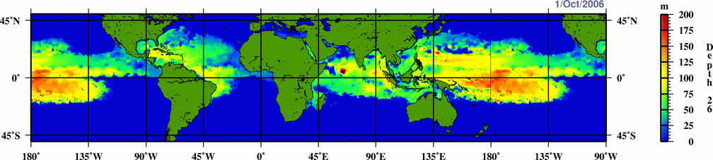
, enough Coriolis force to develop a low pressure center, a pre-existing low level focus or disturbance, and low vertical wind shear. While these conditions are necessary for tropical cyclone formation, they do not guarantee that a tropical cyclone will form. Normally, an ocean temperature of 26.5 °C (79.7 °F]) spanning through a depth of at least 50 metres (164 ft) is considered the minimum to maintain the special mesocyclone
that is the tropical cyclone. These warm waters are needed to maintain the warm core that fuels tropical systems. A minimum distance of 500 km (300 mi) from the equator
is normally needed for tropical cyclogenesis.
Whether it be a depression in the intertropical covergence zone (ITCZ)
or monsoon trough
, a broad surface front
, or an outflow boundary
, a low level feature with sufficient vorticity and convergence is required to begin tropical cyclogenesis. About 85 to 90 percent of Pacific typhoons form within the monsoon trough. Even with perfect upper level conditions and the required atmospheric instability, the lack of a surface focus will prevent the development of organized convection and a surface low. Vertical wind shear of less than 10 m/s (20 kn, 33 ft/s) between the ocean surface and the tropopause
is required for tropical cyclone development. Typically with Pacific typhoons, there are two outflow
jets
: one to the north ahead of an upper trough in the Westerlies
, and a second towards the equator.
In general, westerly wind increases associated with the Madden-Julian Oscillation
lead to increased tropical cyclogenesis in all tropical cyclone basins
. As the oscillation propagates from west to east, it leads to an eastward march in tropical cyclogenesis with time during that hemisphere's summer
season. On average, twice per year twin tropical cyclones will form in the western Pacific ocean, near the 5th parallel north
and the 5th parallel south
, along the same meridian, or line of longitude. There is an inverse relationship between tropical cyclone activity in the western Pacific basin and the north Atlantic basin, however. When one basin is active, the other is normally quiet, and vice versa. The main reason for this appears to be the phase of the Madden-Julian oscillation
, or MJO, which is normally in opposite modes between the two basins at any given time.
Nearly one-third of the world's tropical cyclones form within the western Pacific. This makes this basin the most active on Earth. Pacific typhoons have formed year round, with peak months from August to October. The peak months correspond to that of the Atlantic hurricane season
s. Along with a high storm frequency, this basin also features the most globally intense storms on record. One of the most recent busy seasons was 2004
. Tropical cyclones form in any month of the year across the northwest Pacific ocean, and concentrate around June and November in the northern Indian ocean. The area just northeast of the Philippines is the most active place on Earth for tropical cyclones to exist. Across the Philippines themselves, activity reaches a minimum in February, before increasing steadily through June, and spiking from July through October, with September being the most active month for tropical cyclones across the archipelago
. Activity falls off significantly in November. The most frequently impacted areas of the Philippines by tropical cyclones are northern Luzon
and eastern Visayas
. A ten year average of satellite determined precipitation showed that at least 30 percent of the annual rainfall in the northern Philippines could be traced to tropical cyclones, while the southern islands receive less than 10 percent of their annual rainfall from tropical cyclones.
 Most tropical cyclones form on the side of the subtropical ridge closer to the equator, then move poleward past the ridge axis before recurving north and northeast into the main belt of the Westerlies
. When the subtropical ridge position shifts due to El Niño
, so will the preferred tropical cyclone tracks. Areas west of Japan and Korea
tend to experience much fewer September–November tropical cyclone impacts during El Niño and neutral years. During El Niño years, the break in the subtropical ridge tends to lie near 130°E
which would favor the Japanese archipelago. During La Niña years, the formation of tropical cyclones, along with the subtropical ridge position, shifts westward across the western Pacific ocean, which increases the landfall threat to China. Those that form near the Marshall Islands
find their way to Jeju Island
, Korea.
Typhoon paths follow three general directions.
A rare few storms, like Hurricane John
, were redesignated as typhoons as its track originated from the Eastern/Central Pacific and moved its way into the western Pacific.
, part of the Japan Meteorological Agency
has had the official warning responsibility for the whole of the Western Pacific since 1989, and the naming responsibility for systems of tropical storm strength or greater since 2000. However each National Meteorological and Hydrological Service within the western Pacific has the responsibility for issuing warnings for land areas about tropical cyclones affecting their country, such as the Joint Typhoon Warning Center for United States agencies, the Philippine Atmospheric, Geophysical and Astronomical Services Administration
(PAGASA) for interests in the island archipelago nation, and the Hong Kong Observatory
for storms which come close enough to cause the issuance of warning signals
.
The most active Western Pacific typhoon season was in 1964, when 39 storms of tropical storm strength formed. The least activity seen in the northwest Pacific ocean was during the 2010 Pacific typhoon season
, when only 14 tropical storms and seven typhoons formed. In the Philippines, the most active season, since 1945, for tropical cyclone strikes was 1993
when nineteen tropical cyclones moved through the country. There was only one tropical cyclone which moved through the Philippines in 1958
. The 2004 Pacific typhoon season
was the busiest for Okinawa since 1957. Within Guangdong
in southern China, during the past thousand years, the most active decades for typhoon strikes were the 1660s and 1670s.
The most intense storm on record was Typhoon Tip
in the northwestern Pacific Ocean in 1979, which reached a minimum pressure of 870 hectopascals (25.7 inHg) and maximum sustained wind speeds of 165 knots (85 m/s, 190 mph, 310 km/h). The deadliest typhoon of the 20th century was Typhoon Nina
killed nearly 100,000 in China in 1975 due to a flood that caused 12 reservoirs to fail. After Typhoon Morakot landed in Taiwan at midnight on August 8, 2009, almost the entire southern region of Taiwan (Chiayi County
/Chiayi City, Tainan County
/Tainan City (now merged as Tainan), Kaohsiung County
/Kaohsiung City (now merged as Kaohsiung), and Pingtung County
) and parts of Taitung County
and Nantou County
were flooded by record-breaking heavy rain. The rainfall in Pingtung County
reached 2327 millimetres (91.6 in), breaking all rainfall records of any single place in Taiwan induced by a single typhoon, and making the cyclone the wettest known typhoon.
Tropical cyclone
A tropical cyclone is a storm system characterized by a large low-pressure center and numerous thunderstorms that produce strong winds and heavy rain. Tropical cyclones strengthen when water evaporated from the ocean is released as the saturated air rises, resulting in condensation of water vapor...
that develops in the northwestern part of the Pacific Ocean
Pacific Ocean
The Pacific Ocean is the largest of the Earth's oceanic divisions. It extends from the Arctic in the north to the Southern Ocean in the south, bounded by Asia and Australia in the west, and the Americas in the east.At 165.2 million square kilometres in area, this largest division of the World...
between 180°
180th meridian
The 180th meridian or antimeridian is the meridian which is 180° east or west of the Prime Meridian passing through the Royal Observatory, Greenwich. It is common to both east longitude and west longitude. It is used as the basis for the International Date Line because it for the most part passes...
and 100°E
100th meridian east
The meridian 100° east of Greenwich is a line of longitude that extends from the North Pole across the Arctic Ocean, Asia, the Indian Ocean, the Southern Ocean, and Antarctica to the South Pole....
. This region is referred to as the northwest Pacific basin. For organizational purposes, the northern Pacific Ocean is divided into three regions: the eastern (North America to 140°W
140th meridian west
The meridian 140° west of Greenwich is a line of longitude that extends from the North Pole across the Arctic Ocean, North America, the Pacific Ocean, the Southern Ocean, and Antarctica to the South Pole....
), central (140°W to 180°), and western (180° to 100°E). Identical phenomena in the eastern north Pacific are called hurricanes, with tropical cyclones moving into the western Pacific re-designated as typhoons. The Regional Specialized Meteorological Center
Regional Specialized Meteorological Center
A Regional Specialized Meteorological Centre is responsible for the distribution of information, advisories, and warnings regarding the specific program they have a part of, agreed by consensus at the World Meteorological Organization as part of the World Weather Watch.-Tropical...
(RSMC) for tropical cyclone forecasts is in Japan
Japan
Japan is an island nation in East Asia. Located in the Pacific Ocean, it lies to the east of the Sea of Japan, China, North Korea, South Korea and Russia, stretching from the Sea of Okhotsk in the north to the East China Sea and Taiwan in the south...
, with other tropical cyclone warning centers for the northwest Pacific in Honolulu (the Joint Typhoon Warning Center
Joint Typhoon Warning Center
The Joint Typhoon Warning Center is a joint United States Navy – United States Air Force task force located at the Naval Maritime Forecast Center in Pearl Harbor, Hawaii...
), the Philippines
Philippines
The Philippines , officially known as the Republic of the Philippines , is a country in Southeast Asia in the western Pacific Ocean. To its north across the Luzon Strait lies Taiwan. West across the South China Sea sits Vietnam...
, and Hong Kong
Hong Kong
Hong Kong is one of two Special Administrative Regions of the People's Republic of China , the other being Macau. A city-state situated on China's south coast and enclosed by the Pearl River Delta and South China Sea, it is renowned for its expansive skyline and deep natural harbour...
. While the RSMC names each system, the main name list itself is coordinated amongst 18 countries, including the United States, who have territories threatened by typhoons each year. The Philippines uses their own naming list for systems which approach the country.
Within the northwestern Pacific there are no official typhoon seasons as tropical cyclones form throughout the year. Like any tropical cyclone, there are six main requirements for typhoon formation and development: sufficiently warm sea surface temperature
Sea surface temperature
Sea surface temperature is the water temperature close to the oceans surface. The exact meaning of surface varies according to the measurement method used, but it is between and below the sea surface. Air masses in the Earth's atmosphere are highly modified by sea surface temperatures within a...
s, atmospheric instability, high humidity
Relative humidity
Relative humidity is a term used to describe the amount of water vapor in a mixture of air and water vapor. It is defined as the partial pressure of water vapor in the air-water mixture, given as a percentage of the saturated vapor pressure under those conditions...
in the lower to middle levels of the troposphere, enough Coriolis force
Coriolis effect
In physics, the Coriolis effect is a deflection of moving objects when they are viewed in a rotating reference frame. In a reference frame with clockwise rotation, the deflection is to the left of the motion of the object; in one with counter-clockwise rotation, the deflection is to the right...
to develop a low pressure center, a pre-existing low level focus or disturbance, and low vertical wind shear
Wind shear
Wind shear, sometimes referred to as windshear or wind gradient, is a difference in wind speed and direction over a relatively short distance in the atmosphere...
. The majority of storms form between June and November whilst tropical cyclone formation is at a minimum between December and May. On average, the northwestern Pacific features the most numerous and intense tropical cyclones globally. Like other basins, they are steered by the subtropical ridge
Subtropical ridge
The subtropical ridge is a significant belt of high pressure situated around the latitudes of 30°N in the Northern Hemisphere and 30°S in the Southern Hemisphere. It is characterized by mostly calm winds, which acts to reduce air quality under its axis by causing fog overnight, and haze during...
towards the west or northwest, with some systems recurving near and east of Japan. The Philippines receive a brunt of the landfalls, with China
China
Chinese civilization may refer to:* China for more general discussion of the country.* Chinese culture* Greater China, the transnational community of ethnic Chinese.* History of China* Sinosphere, the area historically affected by Chinese culture...
and Japan being impacted slightly less. Some of the deadliest typhoons in history have struck China. Southern China has the longest record of typhoon impacts for the region, with a thousand year sample via documents within their archives. Taiwan
Taiwan
Taiwan , also known, especially in the past, as Formosa , is the largest island of the same-named island group of East Asia in the western Pacific Ocean and located off the southeastern coast of mainland China. The island forms over 99% of the current territory of the Republic of China following...
has received the wettest known typhoon on record for the northwest Pacific tropical cyclone basin
Tropical cyclone basins
Traditionally, areas of tropical cyclone formation are divided into seven basins. These include the north Atlantic Ocean, the eastern and western parts of the northern Pacific Ocean, the southwestern Pacific, the southwestern and southeastern Indian Oceans, and the northern Indian Ocean. The...
.
Etymology
The English term typhoon appears to be related to Chinese southern dialects such as HakkaHakka
The Hakka , sometimes Hakka Han, are Han Chinese who speak the Hakka language and have links to the provincial areas of Guangdong, Jiangxi, Guangxi, Sichuan, Hunan and Fujian in China....
and Cantonese
Cantonese
Cantonese is a dialect spoken primarily in south China.Cantonese may also refer to:* Yue Chinese, the Chinese language that includes Cantonese* Cantonese cuisine, the cuisine of Guangdong province...
, where the pronunciation for 大風
(Dai-fung, Great Wind) sounds exactly like the English word. (The more modern term for Typhoon in Chinese
Chinese language
The Chinese language is a language or language family consisting of varieties which are mutually intelligible to varying degrees. Originally the indigenous languages spoken by the Han Chinese in China, it forms one of the branches of Sino-Tibetan family of languages...
, having the literal meaning of "Wind from Taiwan", or in Japanese
Japanese language
is a language spoken by over 130 million people in Japan and in Japanese emigrant communities. It is a member of the Japonic language family, which has a number of proposed relationships with other languages, none of which has gained wide acceptance among historical linguists .Japanese is an...
台風 (tai-fū), may have been re-imported from English.) In plural, one can add an "s" at the end in English
English language
English is a West Germanic language that arose in the Anglo-Saxon kingdoms of England and spread into what was to become south-east Scotland under the influence of the Anglian medieval kingdom of Northumbria...
although in Chinese, "Táifēng", as with "Taifu" in Japanese, is always pronounced the same for both singular and plural. Another possible origin for the etymology of typhoon could be from the Greek
Greek language
Greek is an independent branch of the Indo-European family of languages. Native to the southern Balkans, it has the longest documented history of any Indo-European language, spanning 34 centuries of written records. Its writing system has been the Greek alphabet for the majority of its history;...
τύφειν (typhein), to smoke, which later made its way into the Arabic
Arabic language
Arabic is a name applied to the descendants of the Classical Arabic language of the 6th century AD, used most prominently in the Quran, the Islamic Holy Book...
language (as طوفان Tufân) to describe the cyclonic
Cyclone
In meteorology, a cyclone is an area of closed, circular fluid motion rotating in the same direction as the Earth. This is usually characterized by inward spiraling winds that rotate anticlockwise in the Northern Hemisphere and clockwise in the Southern Hemisphere of the Earth. Most large-scale...
storms of the Indian Ocean
Indian Ocean
The Indian Ocean is the third largest of the world's oceanic divisions, covering approximately 20% of the water on the Earth's surface. It is bounded on the north by the Indian Subcontinent and Arabian Peninsula ; on the west by eastern Africa; on the east by Indochina, the Sunda Islands, and...
. Typhoon is the regional name in the northwest Pacific for a severe (or mature) tropical cyclone, whereas hurricane is the regional term for the northeast Pacific, northern Atlantic. Elsewhere, storms of similar strength are termed tropical cyclone, severe tropical cyclone, or severe cyclonic storm.
Intensity classifications
A tropical depression is the lowest category that the Japan Meteorological AgencyJapan Meteorological Agency
The or JMA, is the Japanese government's weather service. Charged with gathering and reporting weather data and forecasts in Japan, it is a semi-autonomous part of the Ministry of Land, Infrastructure and Transport...
uses and is the term used for a tropical system that has wind speeds not exceeding 33 kn (40.2 mph; 64.7 km/h). A tropical depression is upgraded to a tropical storm should its sustained wind speeds
Maximum sustained wind
The maximum sustained winds associated with a tropical cyclone are a common indicator of the intensity of the storm. Within a mature tropical cyclone, they are found within the eyewall at a distance defined as the radius of maximum wind, or RMW. Unlike gusts, the value of these winds are...
exceed 34 kn (41.4 mph; 66.6 km/h). Tropical storms also receive official names from RSMC Tokyo. Should the storm intensify further and reach sustained wind speeds of 48 kn (58.5 mph; 94.1 km/h) then it will be classified as a severe tropical storm. Once the system's maximum sustained winds reach wind speeds of 64 kn (77.9 mph; 125.4 km/h), the JMA will designate the tropical cyclone as a typhoon—the highest category on its scale.
From 2009 the Hong Kong Observatory
Hong Kong Observatory
Hong Kong Observatory is a department of the Hong Kong government. The Observatory forecasts weather and issues warnings on weather-related hazards...
started to further divide typhoon into two further classifications severe typhoon and super typhoon. A severe typhoon has winds of at least 80 kn (97.4 mph; 156.8 km/h) whilst a super typhoon has winds of at least 100 kn (121.8 mph; 196 km/h). The United States
United States
The United States of America is a federal constitutional republic comprising fifty states and a federal district...
' Joint Typhoon Warning Center
Joint Typhoon Warning Center
The Joint Typhoon Warning Center is a joint United States Navy – United States Air Force task force located at the Naval Maritime Forecast Center in Pearl Harbor, Hawaii...
(JTWC) unofficially classifies typhoons with wind speeds of at least 130 knots (67 m/s; 150 mph; 241 km/h)—the equivalent of a strong Category 4 storm in the Saffir-Simpson scale
Saffir-Simpson Hurricane Scale
The Saffir–Simpson Hurricane Scale , or the Saffir–Simpson Hurricane Wind Scale , classifies hurricanes — Western Hemisphere tropical cyclones that exceed the intensities of tropical depressions and tropical storms — into five categories distinguished by the intensities of their sustained winds...
—as super typhoons. However, the maximum sustained wind speed measurements that the JTWC uses are based on a 1-minute averaging period, akin to the U.S.' National Hurricane Center
National Hurricane Center
The National Hurricane Center , located at Florida International University in Miami, Florida, is the division of the National Weather Service responsible for tracking and predicting weather systems within the tropics between the Prime Meridian and the 140th meridian west poleward to the 30th...
and Central Pacific Hurricane Center
Central Pacific Hurricane Center
The Central Pacific Hurricane Center of the United States National Weather Service is the official body responsible for tracking and issuing tropical cyclone warnings, watches, advisories, discussions, and statements for the Central North Pacific Basin...
. As a result, the JTWC's wind reports are higher than JMA's measurements, as the latter are based on a 10-minute averaging interval.
Genesis
There are six main requirements for tropical cyclogenesis: sufficiently warm sea surface temperatures, atmospheric instability, high humidity
Humidity
Humidity is a term for the amount of water vapor in the air, and can refer to any one of several measurements of humidity. Formally, humid air is not "moist air" but a mixture of water vapor and other constituents of air, and humidity is defined in terms of the water content of this mixture,...
in the lower to middle levels of the troposphere
Troposphere
The troposphere is the lowest portion of Earth's atmosphere. It contains approximately 80% of the atmosphere's mass and 99% of its water vapor and aerosols....
, enough Coriolis force to develop a low pressure center, a pre-existing low level focus or disturbance, and low vertical wind shear. While these conditions are necessary for tropical cyclone formation, they do not guarantee that a tropical cyclone will form. Normally, an ocean temperature of 26.5 °C (79.7 °F]) spanning through a depth of at least 50 metres (164 ft) is considered the minimum to maintain the special mesocyclone
Mesocyclone
A mesocyclone is a vortex of air, approximately 2 to 10 miles in diameter , within a convective storm....
that is the tropical cyclone. These warm waters are needed to maintain the warm core that fuels tropical systems. A minimum distance of 500 km (300 mi) from the equator
Equator
An equator is the intersection of a sphere's surface with the plane perpendicular to the sphere's axis of rotation and containing the sphere's center of mass....
is normally needed for tropical cyclogenesis.
Whether it be a depression in the intertropical covergence zone (ITCZ)
Intertropical Convergence Zone
The Intertropical Convergence Zone , known by sailors as The Doldrums, is the area encircling the earth near the equator where winds originating in the northern and southern hemispheres come together....
or monsoon trough
Monsoon trough
The monsoon trough is that portion of the Intertropical Convergence Zone which extends into or through a monsoon circulation, as depicted by a line on a weather map showing the locations of minimum sea level pressure, and as such, is a convergence zone between the wind patterns of the southern and...
, a broad surface front
Surface weather analysis
Surface weather analysis is a special type of weather map that provides a view of weather elements over a geographical area at a specified time based on information from ground-based weather stations...
, or an outflow boundary
Outflow boundary
An outflow boundary, also known as a gust front, is a storm-scale or mesoscale boundary separating thunderstorm-cooled air from the surrounding air; similar in effect to a cold front, with passage marked by a wind shift and usually a drop in temperature and a related pressure jump...
, a low level feature with sufficient vorticity and convergence is required to begin tropical cyclogenesis. About 85 to 90 percent of Pacific typhoons form within the monsoon trough. Even with perfect upper level conditions and the required atmospheric instability, the lack of a surface focus will prevent the development of organized convection and a surface low. Vertical wind shear of less than 10 m/s (20 kn, 33 ft/s) between the ocean surface and the tropopause
Tropopause
The tropopause is the atmospheric boundary between the troposphere and the stratosphere.-Definition:Going upward from the surface, it is the point where air ceases to cool with height, and becomes almost completely dry...
is required for tropical cyclone development. Typically with Pacific typhoons, there are two outflow
Outflow (meteorology)
Outflow, in meteorology, is air that flows outwards from a storm system. It is associated with ridging, or anticyclonic flow. In the low levels of the troposphere, outflow radiates from thunderstorms in the form of a wedge of rain-cooled air, which is visible as a thin rope-like cloud on weather...
jets
Jet stream
Jet streams are fast flowing, narrow air currents found in the atmospheres of some planets, including Earth. The main jet streams are located near the tropopause, the transition between the troposphere and the stratosphere . The major jet streams on Earth are westerly winds...
: one to the north ahead of an upper trough in the Westerlies
Westerlies
The Westerlies, anti-trades, or Prevailing Westerlies, are the prevailing winds in the middle latitudes between 30 and 60 degrees latitude, blowing from the high pressure area in the horse latitudes towards the poles. These prevailing winds blow from the west to the east, and steer extratropical...
, and a second towards the equator.
In general, westerly wind increases associated with the Madden-Julian Oscillation
Madden-Julian oscillation
The Madden–Julian oscillation ' is the largest element of the intraseasonal variability in the tropical atmosphere. It is a large-scale coupling between atmospheric circulation and tropical deep convection...
lead to increased tropical cyclogenesis in all tropical cyclone basins
Tropical cyclone basins
Traditionally, areas of tropical cyclone formation are divided into seven basins. These include the north Atlantic Ocean, the eastern and western parts of the northern Pacific Ocean, the southwestern Pacific, the southwestern and southeastern Indian Oceans, and the northern Indian Ocean. The...
. As the oscillation propagates from west to east, it leads to an eastward march in tropical cyclogenesis with time during that hemisphere's summer
Summer
Summer is the warmest of the four temperate seasons, between spring and autumn. At the summer solstice, the days are longest and the nights are shortest, with day-length decreasing as the season progresses after the solstice...
season. On average, twice per year twin tropical cyclones will form in the western Pacific ocean, near the 5th parallel north
5th parallel north
The 5th parallel north is a circle of latitude that is 5 degrees north of the Earth's equatorial plane. It crosses the Atlantic Ocean, Africa, the Indian Ocean, Southeast Asia, the Pacific Ocean and South America....
and the 5th parallel south
5th parallel south
The 5th parallel south is a circle of latitude that is 5 degrees south of the Earth's equatorial plane. It crosses the Atlantic Ocean, Africa, the Indian Ocean, Southeast Asia, Australasia, the Pacific Ocean and South America....
, along the same meridian, or line of longitude. There is an inverse relationship between tropical cyclone activity in the western Pacific basin and the north Atlantic basin, however. When one basin is active, the other is normally quiet, and vice versa. The main reason for this appears to be the phase of the Madden-Julian oscillation
Madden-Julian oscillation
The Madden–Julian oscillation ' is the largest element of the intraseasonal variability in the tropical atmosphere. It is a large-scale coupling between atmospheric circulation and tropical deep convection...
, or MJO, which is normally in opposite modes between the two basins at any given time.
Frequency
| Month | Count | Average |
|---|---|---|
| Jan | 28 | 0.6 |
| Feb | 15 | 0.3 |
| Mar | 26 | 0.6 |
| Apr | 39 | 0.8 |
| May | 64 | 1.4 |
| Jun | 96 | 2.0 |
| Jul | 215 | 4.6 |
| Aug | 312 | 6.6 |
| Sep | 262 | 5.6 |
| Oct | 219 | 4.7 |
| Nov | 134 | 2.9 |
| Dec | 75 | 1.6 |
| Annual | 1485 | 31.7 |
| Source: JTWC | ||
Nearly one-third of the world's tropical cyclones form within the western Pacific. This makes this basin the most active on Earth. Pacific typhoons have formed year round, with peak months from August to October. The peak months correspond to that of the Atlantic hurricane season
Atlantic hurricane season
The Atlantic hurricane season is the period in a year when hurricanes usually form in the Atlantic Ocean. Tropical cyclones in the North Atlantic are called hurricanes, tropical storms, or tropical depressions. In addition, there have been several storms over the years that have not been fully...
s. Along with a high storm frequency, this basin also features the most globally intense storms on record. One of the most recent busy seasons was 2004
2004 Pacific typhoon season
The 2004 Pacific typhoon season has no official bounds; it ran year-round in 2004, but most tropical cyclones tend to form in the northwestern Pacific Ocean between May and November...
. Tropical cyclones form in any month of the year across the northwest Pacific ocean, and concentrate around June and November in the northern Indian ocean. The area just northeast of the Philippines is the most active place on Earth for tropical cyclones to exist. Across the Philippines themselves, activity reaches a minimum in February, before increasing steadily through June, and spiking from July through October, with September being the most active month for tropical cyclones across the archipelago
Archipelago
An archipelago , sometimes called an island group, is a chain or cluster of islands. The word archipelago is derived from the Greek ἄρχι- – arkhi- and πέλαγος – pélagos through the Italian arcipelago...
. Activity falls off significantly in November. The most frequently impacted areas of the Philippines by tropical cyclones are northern Luzon
Luzon
Luzon is the largest island in the Philippines. It is located in the northernmost region of the archipelago, and is also the name for one of the three primary island groups in the country centered on the Island of Luzon...
and eastern Visayas
Visayas
The Visayas or Visayan Islands and locally known as Kabisay-an gid, is one of the three principal geographical divisions of the Philippines, along with Mindanao and Luzon. It consists of several islands, primarily surrounding the Visayan Sea, although the Visayas are considered the northeast...
. A ten year average of satellite determined precipitation showed that at least 30 percent of the annual rainfall in the northern Philippines could be traced to tropical cyclones, while the southern islands receive less than 10 percent of their annual rainfall from tropical cyclones.
Paths
Westerlies
The Westerlies, anti-trades, or Prevailing Westerlies, are the prevailing winds in the middle latitudes between 30 and 60 degrees latitude, blowing from the high pressure area in the horse latitudes towards the poles. These prevailing winds blow from the west to the east, and steer extratropical...
. When the subtropical ridge position shifts due to El Niño
El Niño-Southern Oscillation
El Niño/La Niña-Southern Oscillation, or ENSO, is a quasiperiodic climate pattern that occurs across the tropical Pacific Ocean roughly every five years...
, so will the preferred tropical cyclone tracks. Areas west of Japan and Korea
Korea
Korea ) is an East Asian geographic region that is currently divided into two separate sovereign states — North Korea and South Korea. Located on the Korean Peninsula, Korea is bordered by the People's Republic of China to the northwest, Russia to the northeast, and is separated from Japan to the...
tend to experience much fewer September–November tropical cyclone impacts during El Niño and neutral years. During El Niño years, the break in the subtropical ridge tends to lie near 130°E
130th meridian east
The meridian 130° east of Greenwich is a line of longitude that extends from the North Pole across the Arctic Ocean, Asia, Australia, the Indian Ocean, the Southern Ocean, and Antarctica to the South Pole....
which would favor the Japanese archipelago. During La Niña years, the formation of tropical cyclones, along with the subtropical ridge position, shifts westward across the western Pacific ocean, which increases the landfall threat to China. Those that form near the Marshall Islands
Marshall Islands
The Republic of the Marshall Islands , , is a Micronesian nation of atolls and islands in the middle of the Pacific Ocean, just west of the International Date Line and just north of the Equator. As of July 2011 the population was 67,182...
find their way to Jeju Island
Jeju-do
Jeju-do is the only special autonomous province of South Korea, situated on and coterminous with the country's largest island. Jeju-do lies in the Korea Strait, southwest of Jeollanam-do Province, of which it was a part before it became a separate province in 1946...
, Korea.
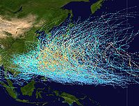
Typhoon paths follow three general directions.
- Straight track (or straight runner). A general westward path affects the PhilippinesPhilippinesThe Philippines , officially known as the Republic of the Philippines , is a country in Southeast Asia in the western Pacific Ocean. To its north across the Luzon Strait lies Taiwan. West across the South China Sea sits Vietnam...
, southern China, Taiwan, and VietnamVietnamVietnam – sometimes spelled Viet Nam , officially the Socialist Republic of Vietnam – is the easternmost country on the Indochina Peninsula in Southeast Asia. It is bordered by China to the north, Laos to the northwest, Cambodia to the southwest, and the South China Sea –...
. - A parabolic, recurving track. Storms recurving affect eastern China, Taiwan, Korea, and Japan.
- Northward track. From point of origin, the storm follows a northerly direction, only affecting small islands.
A rare few storms, like Hurricane John
Hurricane John (1994)
Hurricane John formed during the 1994 Pacific hurricane season and became both the longest-lasting and the farthest-traveling tropical cyclone ever observed...
, were redesignated as typhoons as its track originated from the Eastern/Central Pacific and moved its way into the western Pacific.
Basin monitoring
Within the Western Pacific, RSMC Tokyo-Typhoon CenterRegional Specialized Meteorological Center
A Regional Specialized Meteorological Centre is responsible for the distribution of information, advisories, and warnings regarding the specific program they have a part of, agreed by consensus at the World Meteorological Organization as part of the World Weather Watch.-Tropical...
, part of the Japan Meteorological Agency
Japan Meteorological Agency
The or JMA, is the Japanese government's weather service. Charged with gathering and reporting weather data and forecasts in Japan, it is a semi-autonomous part of the Ministry of Land, Infrastructure and Transport...
has had the official warning responsibility for the whole of the Western Pacific since 1989, and the naming responsibility for systems of tropical storm strength or greater since 2000. However each National Meteorological and Hydrological Service within the western Pacific has the responsibility for issuing warnings for land areas about tropical cyclones affecting their country, such as the Joint Typhoon Warning Center for United States agencies, the Philippine Atmospheric, Geophysical and Astronomical Services Administration
Philippine Atmospheric, Geophysical and Astronomical Services Administration
The Philippine Atmospheric, Geophysical and Astronomical Services Administration is a Philippine national institution dedicated to provide flood and typhoon warnings, public weather forecasts and advisories, meteorological, astronomical, climatological, and other specialized information and...
(PAGASA) for interests in the island archipelago nation, and the Hong Kong Observatory
Hong Kong Observatory
Hong Kong Observatory is a department of the Hong Kong government. The Observatory forecasts weather and issues warnings on weather-related hazards...
for storms which come close enough to cause the issuance of warning signals
Hong Kong Tropical Cyclone Warning Signals
The Hong Kong tropical cyclone warning signals or informally typhoon signals are a set of signals used to indicate the threat or effects of a tropical cyclone. The Hong Kong Observatory issues the warning signal if a tropical cyclone is centred within of Hong Kong and may affect Hong Kong later...
.
Name sources
The list of names consists of entries from 17 East Asian nations and the United States who have territories directly affected by typhoons. The submitted names are arranged into five lists; and each list is cycled with each year. Unlike tropical cyclones in other parts of the world, typhoons are not named after people. Instead, they generally refer to animals, flowers, astrological signs, and a few personal names. However, PAGASA retains its own naming list, which does consist of human names. Therefore, a typhoon can possibly have two names. Storms that cross the date line from the central Pacific retain their original name, but the designation of hurricane becomes typhoon. In Japan, typhoons are also given a numerical designation according to the sequence of their occurrence in the calendar year.Records
| Total Storms |
Year | Tropical Storms |
Typhoons | Super Typhoons |
|---|---|---|---|---|
| 39 | 1964 1964 Pacific typhoon season The 1964 Pacific typhoon season has no official bounds; it ran year-round in 1964, but most tropical cyclones tend to form in the northwestern Pacific Ocean between June and December... |
13 | 19 | 7 |
| 35 | 1965 1965 Pacific typhoon season The 1965 Pacific typhoon season has no official bounds; it ran year-round in 1965, but most tropical cyclones tend to form in the northwestern Pacific Ocean between June and December... 1967 1967 Pacific typhoon season The 1967 Pacific typhoon season has no official bounds; it ran year-round in 1967, but most tropical cyclones tend to form in the northwestern Pacific Ocean between June and December... 1971 1971 Pacific typhoon season The 1971 Pacific typhoon season has no official bounds; it ran year-round in 1971, but most tropical cyclones tend to form in the northwestern Pacific Ocean between June and December... |
14 15 11 |
10 16 16 |
11 4 4 |
| 34 | 1994 1994 Pacific typhoon season The 1994 Pacific typhoon season was an active season in the annual cycle of tropical cyclone formation in the Western North Pacific, with a total of 41 tropical cyclones during the course of the season. The season had no official bounds and it ran year-round in 1994, but most tropical cyclones tend... |
14 | 14 | 6 |
| 33 | 1996 1996 Pacific typhoon season The 1996 Pacific typhoon season has no official bounds; it ran year-round in 1996, but most tropical cyclones tend to form in the northwestern Pacific Ocean between May and November... |
12 | 15 | 6 |
| 32 | 1974 1974 Pacific typhoon season The 1974 Pacific typhoon season has no official bounds; it ran year-round in 1974, but most tropical cyclones tend to form in the northwestern Pacific Ocean between June and December... |
16 | 16 | 0 |
| 31 | 1989 1989 Pacific typhoon season The 1989 Pacific typhoon season has no official bounds; it ran year-round in 1989, but most tropical cyclones tend to form in the northwestern Pacific Ocean between May and November. These dates conventionally delimit the period of each year when most tropical cyclones form in the northwestern... 1992 1992 Pacific typhoon season One person was killed and eight others were reported missing when the storm moved through the Philippines. Extensive damage took place in China with losses amounting to $235 million.-Typhoon Gary :At least 48 people were killed by Typhoon Gary... |
10 9 |
15 17 |
6 5 |
| 30 | 1962 1962 Pacific typhoon season The 1962 Pacific typhoon season had no official bounds; there was activity in every month but January, March, and June, but most tropical cyclones tend to form in the northwestern Pacific Ocean between May and November. Most tropical cyclones tend to form in the northwestern Pacific Ocean between... 1966 1966 Pacific typhoon season The 1966 Pacific typhoon season has no official bounds, but most tropical cyclones tend to form in the northwestern Pacific Ocean between June and December... 1972 1972 Pacific typhoon season The 1972 Pacific typhoon season has no official bounds; it ran year-round in 1972, but most tropical cyclones tend to form in the northwestern Pacific Ocean between June and December... 1990 1990 Pacific typhoon season Tropical Storm Lewis was a minimal tropical storm that only held said intensity for 2 days.-Severe Tropical Storm Nathan :A tropical disturbance trekked across the Philippines in mid June, upon entering the South China Sea a depression formed. The depression was upgraded to Tropical Storm Nathan... 2004 2004 Pacific typhoon season The 2004 Pacific typhoon season has no official bounds; it ran year-round in 2004, but most tropical cyclones tend to form in the northwestern Pacific Ocean between May and November... |
7 10 8 9 10 |
17 17 20 17 13 |
6 3 2 4 7 |
The most active Western Pacific typhoon season was in 1964, when 39 storms of tropical storm strength formed. The least activity seen in the northwest Pacific ocean was during the 2010 Pacific typhoon season
2010 Pacific typhoon season
The 2010 Pacific typhoon season was the least active Pacific typhoon season, in terms of the number of named storms and typhoons, on record, due to a moderate La Niña event...
, when only 14 tropical storms and seven typhoons formed. In the Philippines, the most active season, since 1945, for tropical cyclone strikes was 1993
1993 Pacific typhoon season
On July 29, PAGASA initiated advisories on a poorly organised tropical depression. The depression moved slowly towards the north-west before it dissipated during the next day.-Typhoon Robyn :...
when nineteen tropical cyclones moved through the country. There was only one tropical cyclone which moved through the Philippines in 1958
1958 Pacific typhoon season
The scope of this article is limited to the Pacific Ocean, north of the equator and west of the international date line. Storms that form east of the date line and north of the equator are called hurricanes; see 1958 Pacific hurricane season...
. The 2004 Pacific typhoon season
2004 Pacific typhoon season
The 2004 Pacific typhoon season has no official bounds; it ran year-round in 2004, but most tropical cyclones tend to form in the northwestern Pacific Ocean between May and November...
was the busiest for Okinawa since 1957. Within Guangdong
Guangdong
Guangdong is a province on the South China Sea coast of the People's Republic of China. The province was previously often written with the alternative English name Kwangtung Province...
in southern China, during the past thousand years, the most active decades for typhoon strikes were the 1660s and 1670s.
The most intense storm on record was Typhoon Tip
Typhoon Tip
Typhoon Tip was the largest and most intense tropical cyclone on record. The nineteenth tropical storm and twelfth typhoon of the 1979 Pacific typhoon season, Tip developed out of a disturbance in the monsoon trough on October 4 near Pohnpei...
in the northwestern Pacific Ocean in 1979, which reached a minimum pressure of 870 hectopascals (25.7 inHg) and maximum sustained wind speeds of 165 knots (85 m/s, 190 mph, 310 km/h). The deadliest typhoon of the 20th century was Typhoon Nina
Typhoon Nina (1975)
Super Typhoon Nina was a short-lived but intense super typhoon that caused catastrophic damage and loss of life in China after causing the Banqiao Dam to collapse...
killed nearly 100,000 in China in 1975 due to a flood that caused 12 reservoirs to fail. After Typhoon Morakot landed in Taiwan at midnight on August 8, 2009, almost the entire southern region of Taiwan (Chiayi County
Chiayi County
Chiayi County is a county in southwestern Taiwan surrounding but not including Chiayi City. Its historical name in Taiwanese Hokkien derives from Tsirosen in the Formosan languages...
/Chiayi City, Tainan County
Tainan County
Tainan County was located in southern Taiwan. The name "Tainan" means "Southern Taiwan". Formerly a county of the Republic of China , Tainan County was merged with Tainan City at the end of 2010 to form a single special municipality....
/Tainan City (now merged as Tainan), Kaohsiung County
Kaohsiung County
Kaohsiung County was a county in southern Taiwan that enclosed but did not include Kaohsiung City. On December 25, 2010, the county merged with Kaohsiung City to form a single special municipality.- Administration :-External links:*...
/Kaohsiung City (now merged as Kaohsiung), and Pingtung County
Pingtung County
Pingtung County is a county in Southern Taiwan. Pingtung County is officially administered as a county of the Republic of China . The oldest national park in Taiwan, Kenting National Park, was established in Pingtung County in 1984...
) and parts of Taitung County
Taitung County
Taitung County is a county in eastern Taiwan. The name means "Eastern Taiwan". Taitung County is also known as 後山 by many of the locals, meaning behind the mountains or the back mountains. Taitung is officially administered as a county of Taiwan, Republic of China.Taitung runs along the south east...
and Nantou County
Nantou County
Nantou County is the second largest county of Taiwan. It is also the only landlocked county in Taiwan. Its name derives from the Hoanya Taiwanese aboriginal word Ramtau. Nantou County is officially administered as a county of Taiwan....
were flooded by record-breaking heavy rain. The rainfall in Pingtung County
Pingtung County
Pingtung County is a county in Southern Taiwan. Pingtung County is officially administered as a county of the Republic of China . The oldest national park in Taiwan, Kenting National Park, was established in Pingtung County in 1984...
reached 2327 millimetres (91.6 in), breaking all rainfall records of any single place in Taiwan induced by a single typhoon, and making the cyclone the wettest known typhoon.
See also
- China tropical cyclone rainfall climatologyChina tropical cyclone rainfall climatologyChina is a mountainous country, which leads to rapid dissipation of cyclones that move inland as well as significant amounts of rain from those dissipating cyclones. Typhoon Nina caused the collapse of two huge reservoirs and ten smaller dams when 1062 mm/41.81 inches fell in Henan...
- Effects of tropical cyclonesEffects of tropical cyclonesThe main effects of tropical cyclones include heavy rain, strong wind, large storm surges at landfall, and tornadoes. The destruction from a tropical cyclone depends mainly on its intensity, its size, and its location...
- Tropical cycloneTropical cycloneA tropical cyclone is a storm system characterized by a large low-pressure center and numerous thunderstorms that produce strong winds and heavy rain. Tropical cyclones strengthen when water evaporated from the ocean is released as the saturated air rises, resulting in condensation of water vapor...
- Typhoons in the PhilippinesTyphoons in the PhilippinesTyphoons in the Philippines refer in general to tropical cyclones that enter the Philippine area of responsibility and affect the Philippines. Locally they are called bagyo...
External links
- Japan Meteorological Agency
- China Meteorological Agency
- National Weather Service Guam
- Hong Kong Observatory
- Korea Meteorological Administration
- Philippine Atmospheric, Geophysical and Astronomical Services Administration
- Taiwan Central Weather Bureau
- Taiwan Typhoon Information Center
- TCWC Jakarta
- Thai Meteorological Department
- Vietnam's National Hydro-Meterological Service
- Joint Typhoon Warning Center