
Ouiatenon
Encyclopedia
Ouiatenon is a name that refers to a dwelling place of members of the Wea
tribe of Native Americans
. The name Ouiatenon, also variously given as Ouiatanon, Oujatanon, Ouiatano or other similar forms, is a French rendering of a term from the Wea dialect of the Miami-Illinois language which means "place of the people of the whirpool", an ethnonym
for the Wea. Ouiatenon can be said to refer generally to any settlement of Wea or to their tribal lands as a whole, though the name is most frequently used to refer to a group of extinct settlements situated together along the Wabash River
in what is now western Tippecanoe County
, Indiana
.
, of which the Wea were a part, had begun to return to their homelands in the Wabash River Valley, an area they had earlier been driven from by the eastern Iroquois
. The several tribal bands of Miami separated as they settled the valley, with the Wea occupying the middle Wabash Valley between the Eel River in the north and the Vermilion River
in the south. Of the Wea's five major settlements, Ouiatenon was the largest concentration; it was described in August 1791 by U.S. General Wilkinson as "the chief town of the Ouiatenon Nation."
The Ouiatenon site was favorably located for trade and habitation, being situated on a fertile plain near what was considered to be the head of deep water navigation on the Wabash River. It was also well supplied with fish, plentiful near the mouth of Wea Creek, and with wild game in the surrounding prairie and woodlands. Ouiatenon consisted of two large villages and two or three smaller ones located along or near the Wabash River between the mouth of Wea Creek in the east and mouth of Riviere de Bois Rouge (later Indian Creek) in the west, a distance of between four and five miles (8 km). One village, located on the north bank of the river opposite the main Ouiatenon town, was chiefly inhabited by Kickapoo.
. European settlement in the area surrounding the fort was sparse because the post's commandants did not make grants of land to settlers as was done elsewhere; however, it did become one of the most successful trading posts in the region. In 1760 the French agreed to withdraw from the valley and ceded the area to British control.
 On 9 March 1791, U.S. Secretary of War Henry Knox
issued orders from President George Washington
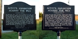
to Brigadier General Charles Scott
of Kentucky to lead a punitive expedition against the Wea settlements in the Wabash Valley. Just after noon on 1 June 1791, Scott with a force of 33 officers and 760 mounted Kentucky volunteers crested High Gap Hill and entered the Wea Plains. Perceiving two villages to the northwest, at two miles (3 km) and four miles (6 km) out, Scott sent a small detachment under Colonel John Hardin
to destroy them while he and the bulk of his force continued north toward the main Ouiatenon village near the mouth of Wea Creek, where the smoke of cooking fires could be seen.
Rounding the fringe of trees at the bend in Wea Creek, Scott's forces found the Ouiatenon town in the bottom land near the Wabash and descended upon it, causing panic amongst the inhabitants. Some in canoes tried to escape to the Kickapoo village opposite, but were killed by riflemen before reaching the opposite shore; 41 women and children were taken prisoner; the remainder were killed, dispersed or escaped. Scott burned the town and several hundred acres of growing corn.
or Weaton was founded in 1834 near the site of the westernmost Ouiatenon village and prospered from the presence of the Wabash and Erie Canal
, built through the area in the 1840s. Both the canal and town declined in the 1850s and were defunct by the 1870s.
The towns of Glen Hall
and Shadeland
remain on the southern and eastern periphery of the plain. Lilly Tippecanoe Labs, a large Eli Lilly and Company
laboratory and manufacturing complex, stands just east of the mouth of Wea Creek; the site of the main Ouiatenon town and surrounding area is owned by Lilly and is partly contained within the Tippecanoe Labs Wildlife Habitat.
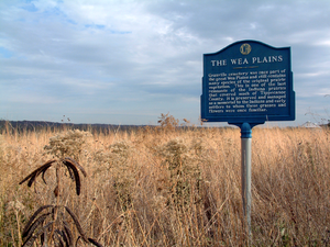 The villages of Ouiatenon occupied a fertile area known as the Wea Plains, a roughly 25 square miles (64.7 km²) area in what is now northern Wayne
and Union
townships.
Lost Creek, a small waterway with no distinct end, flows west-northwest through the Wea Plains.
Wea
The Wea were a Miami-Illinois-speaking tribe originally located in western Indiana, closely related to the Miami. The name Wea is used today as the a shortened version of their many recorded names...
tribe of Native Americans
Native Americans in the United States
Native Americans in the United States are the indigenous peoples in North America within the boundaries of the present-day continental United States, parts of Alaska, and the island state of Hawaii. They are composed of numerous, distinct tribes, states, and ethnic groups, many of which survive as...
. The name Ouiatenon, also variously given as Ouiatanon, Oujatanon, Ouiatano or other similar forms, is a French rendering of a term from the Wea dialect of the Miami-Illinois language which means "place of the people of the whirpool", an ethnonym
Ethnonym
An ethnonym is the name applied to a given ethnic group. Ethnonyms can be divided into two categories: exonyms and autonyms or endonyms .As an example, the ethnonym for...
for the Wea. Ouiatenon can be said to refer generally to any settlement of Wea or to their tribal lands as a whole, though the name is most frequently used to refer to a group of extinct settlements situated together along the Wabash River
Wabash River
The Wabash River is a river in the Midwestern United States that flows southwest from northwest Ohio near Fort Recovery across northern Indiana to southern Illinois, where it forms the Illinois-Indiana border before draining into the Ohio River, of which it is the largest northern tributary...
in what is now western Tippecanoe County
Tippecanoe County, Indiana
Tippecanoe County is a county located in the northwest quadrant of the U.S. state of Indiana. It was created in 1826 from Wabash County. It is part of the Lafayette, Indiana, Metropolitan Statistical Area....
, Indiana
Indiana
Indiana is a US state, admitted to the United States as the 19th on December 11, 1816. It is located in the Midwestern United States and Great Lakes Region. With 6,483,802 residents, the state is ranked 15th in population and 16th in population density. Indiana is ranked 38th in land area and is...
.
Establishment
By the late 17th century the Miami speaking peoplesMiami tribe
The Miami are a Native American nation originally found in what is now Indiana, southwest Michigan, and western Ohio. The Miami Tribe of Oklahoma is the only federally recognized tribe of Miami Indians in the United States...
, of which the Wea were a part, had begun to return to their homelands in the Wabash River Valley, an area they had earlier been driven from by the eastern Iroquois
Iroquois
The Iroquois , also known as the Haudenosaunee or the "People of the Longhouse", are an association of several tribes of indigenous people of North America...
. The several tribal bands of Miami separated as they settled the valley, with the Wea occupying the middle Wabash Valley between the Eel River in the north and the Vermilion River
Vermilion River (Wabash River tributary)
The Vermilion River is a tributary of the Wabash River in the states of Illinois and Indiana, United States.There are two "Vermilion Rivers" in Illinois. The Wabash tributary flows south, while the other Vermilion River flows north to the Illinois River...
in the south. Of the Wea's five major settlements, Ouiatenon was the largest concentration; it was described in August 1791 by U.S. General Wilkinson as "the chief town of the Ouiatenon Nation."
The Ouiatenon site was favorably located for trade and habitation, being situated on a fertile plain near what was considered to be the head of deep water navigation on the Wabash River. It was also well supplied with fish, plentiful near the mouth of Wea Creek, and with wild game in the surrounding prairie and woodlands. Ouiatenon consisted of two large villages and two or three smaller ones located along or near the Wabash River between the mouth of Wea Creek in the east and mouth of Riviere de Bois Rouge (later Indian Creek) in the west, a distance of between four and five miles (8 km). One village, located on the north bank of the river opposite the main Ouiatenon town, was chiefly inhabited by Kickapoo.
French period
The French, in an effort to counter British influence over the area, established a military post on the north bank of the Wabash opposite Ouiatenon in 1717, a site now known as Fort OuiatenonFort Ouiatenon
Fort Ouiatenon was the first fortified European settlement in what is now called Indiana. It was a French trading post at the joining of the Tippecanoe River and the Wabash River located approximately three miles southwest of modern-day West Lafayette...
. European settlement in the area surrounding the fort was sparse because the post's commandants did not make grants of land to settlers as was done elsewhere; however, it did become one of the most successful trading posts in the region. In 1760 the French agreed to withdraw from the valley and ceded the area to British control.
Destruction
Henry Knox
Henry Knox was a military officer of the Continental Army and later the United States Army, and also served as the first United States Secretary of War....
issued orders from President George Washington
George Washington
George Washington was the dominant military and political leader of the new United States of America from 1775 to 1799. He led the American victory over Great Britain in the American Revolutionary War as commander-in-chief of the Continental Army from 1775 to 1783, and presided over the writing of...
to Brigadier General Charles Scott
Charles Scott
Charles Scott may refer to:* Charles Scott , American Revolutionary War soldier and fourth governor of Kentucky* Charles Frederick Scott , U.S. Representative from Kansas...
of Kentucky to lead a punitive expedition against the Wea settlements in the Wabash Valley. Just after noon on 1 June 1791, Scott with a force of 33 officers and 760 mounted Kentucky volunteers crested High Gap Hill and entered the Wea Plains. Perceiving two villages to the northwest, at two miles (3 km) and four miles (6 km) out, Scott sent a small detachment under Colonel John Hardin
John Hardin
John J. Hardin was a soldier, farmer, rancher, noted marksman and hunter. He was wounded fighting in Lord Dunmore's War; served as a Continental Army officer in the American Revolutionary War and as a Kentucky Co., Virginia militia commander in the Northwest Indian War...
to destroy them while he and the bulk of his force continued north toward the main Ouiatenon village near the mouth of Wea Creek, where the smoke of cooking fires could be seen.
Rounding the fringe of trees at the bend in Wea Creek, Scott's forces found the Ouiatenon town in the bottom land near the Wabash and descended upon it, causing panic amongst the inhabitants. Some in canoes tried to escape to the Kickapoo village opposite, but were killed by riflemen before reaching the opposite shore; 41 women and children were taken prisoner; the remainder were killed, dispersed or escaped. Scott burned the town and several hundred acres of growing corn.
Post-destruction
Vestiges of Ouiatenon remained visible for many years after its destruction, and artifacts could be easily found after the grass had been burned off in the autumn. A small town named GranvilleGranville, Indiana
Granville is an extinct town in Wayne Township, Tippecanoe County, Indiana. It was founded in 1834 by Thomas W. Treckett and Thomas Concannon on the south side of the Wabash and Erie Canal, just south of the Wabash River. The town was platted to contain 153 lots, a public square and several...
or Weaton was founded in 1834 near the site of the westernmost Ouiatenon village and prospered from the presence of the Wabash and Erie Canal
Wabash and Erie Canal
The Wabash and Erie Canal was a shipping canal that linked the Great Lakes to the Ohio River via an artificial waterway. The canal provided traders with access from the Great Lakes all the way to the Gulf of Mexico...
, built through the area in the 1840s. Both the canal and town declined in the 1850s and were defunct by the 1870s.
The towns of Glen Hall
Glen Hall, Indiana
Glen Hall is a small settlement in Wayne Township, Tippecanoe County, Indiana. The site is often considered part of the adjoining town of West Point.- Geography :...
and Shadeland
Shadeland, Indiana
Shadeland is a town in Tippecanoe County, Indiana, United States. The population was 1,610 at the 2010 census. It is part of the Lafayette, Indiana Metropolitan Statistical Area.-Geography:...
remain on the southern and eastern periphery of the plain. Lilly Tippecanoe Labs, a large Eli Lilly and Company
Eli Lilly and Company
Eli Lilly and Company is a global pharmaceutical company. Eli Lilly's global headquarters is located in Indianapolis, Indiana, in the United States...
laboratory and manufacturing complex, stands just east of the mouth of Wea Creek; the site of the main Ouiatenon town and surrounding area is owned by Lilly and is partly contained within the Tippecanoe Labs Wildlife Habitat.
Geography
Wayne Township, Tippecanoe County, Indiana
Wayne Township is one of thirteen townships in Tippecanoe County, Indiana, USA. As of the 2000 census, its population was 1,306.-Geography:According to the United States Census Bureau, Wayne Township covers an area of ; of this, or 1.02 percent is water....
and Union
Union Township, Tippecanoe County, Indiana
Union Township is one of thirteen townships in Tippecanoe County, Indiana, USA. As of the 2000 census, its population was 1,682.-Geography:According to the United States Census Bureau, Union Township covers an area of ; of this, or 0.85 percent is water...
townships.
To the north lies the long range of the Indian Hills, crowned with forest trees, and scarped with many a sharp ravine. At the southern edge of these hills flows the Wabash, winding in and out with graceful curves, and marked in its courses by a narrow fringe of woodland. To the east lies Wea creek, jutting out into the plain with a sharp turn, and then gliding on again to the river. Within this enclosure of wood and stream lie the meadows of the Ouiatenons...
Lost Creek, a small waterway with no distinct end, flows west-northwest through the Wea Plains.